South Africa
- Country Flag
- Capital City
- Most Helpful
- Google Car
- Rare Car
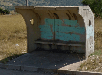
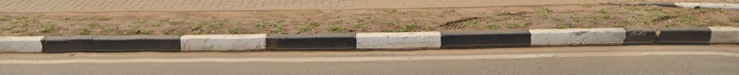
- Bollards
- Google Coverage
- Unique Vehicle
- Camera Generation
- Road Lines
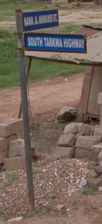
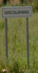
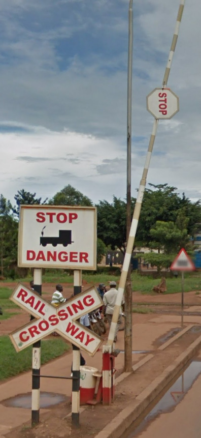
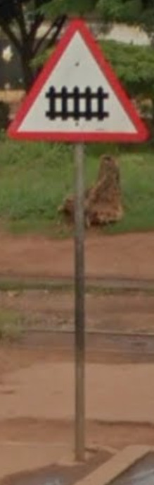
- Road Signs
- Road Numbering System
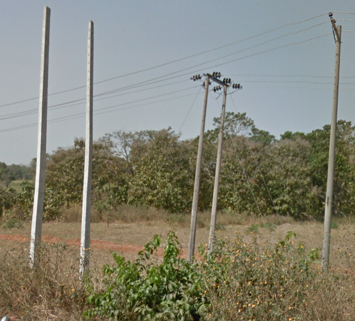
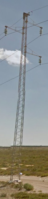
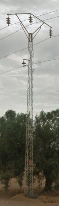
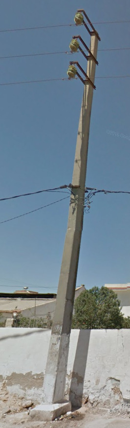
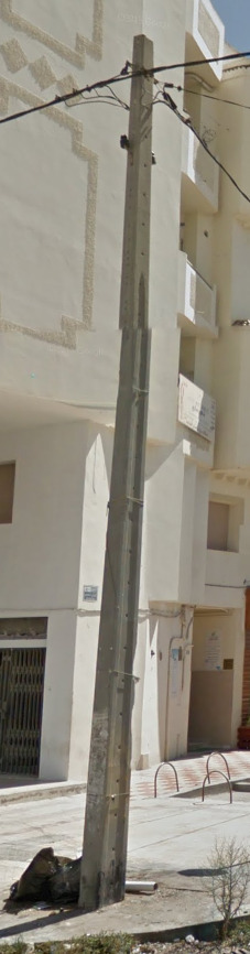
- Electricity Poles
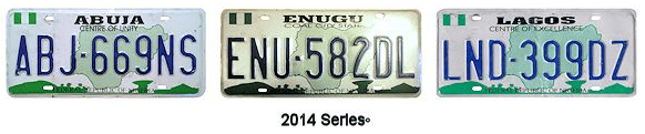
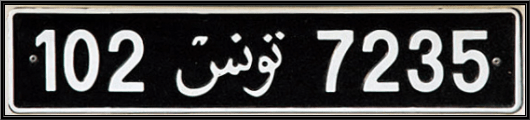
- License Plates
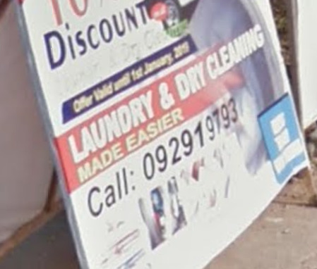
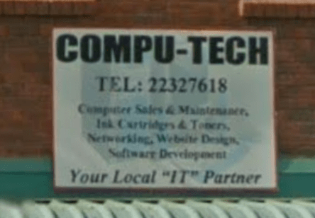
- Phone Number
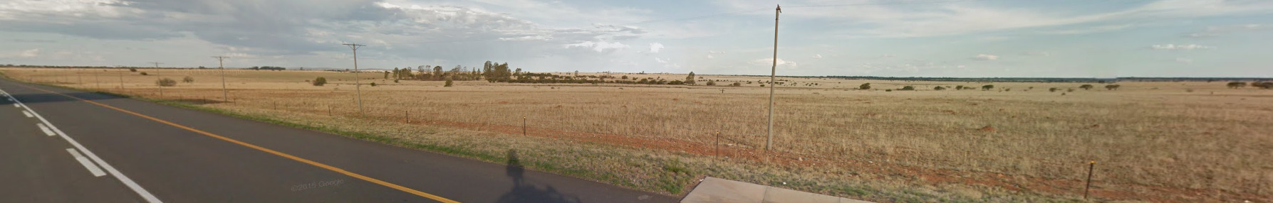
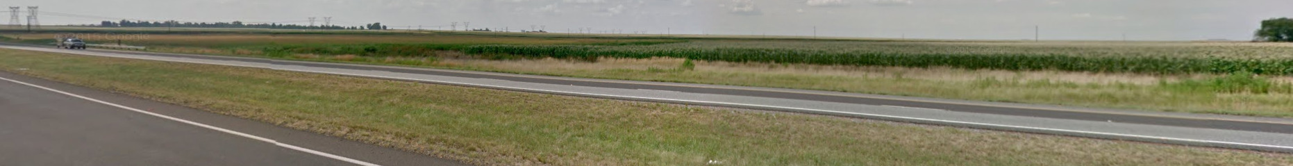
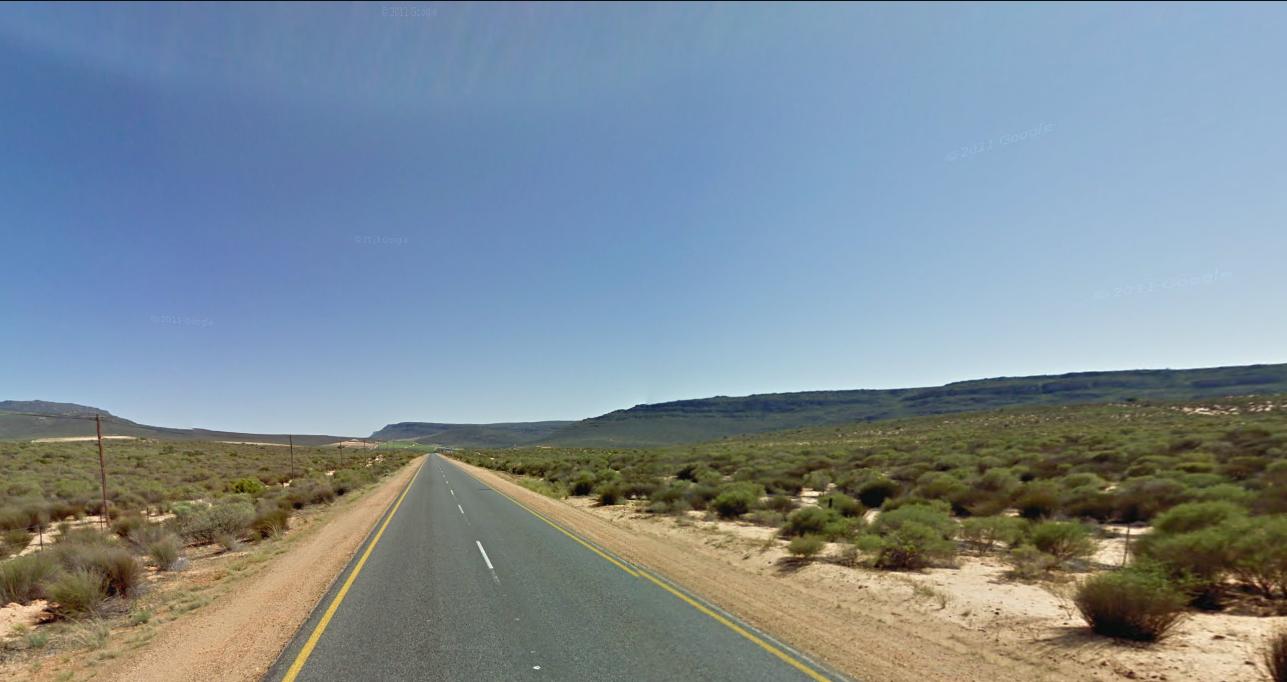
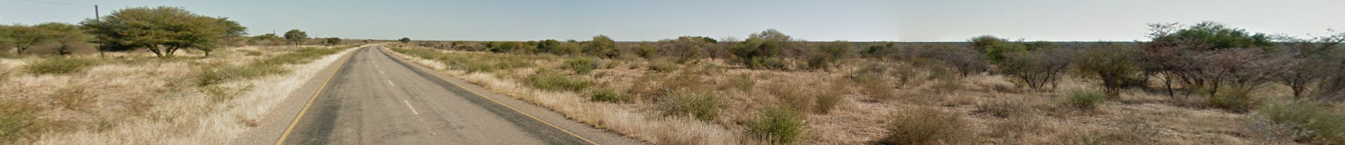
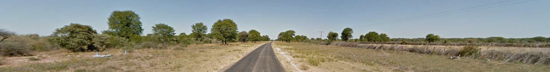
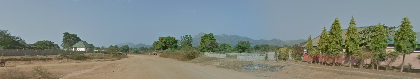
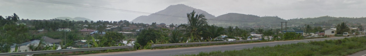
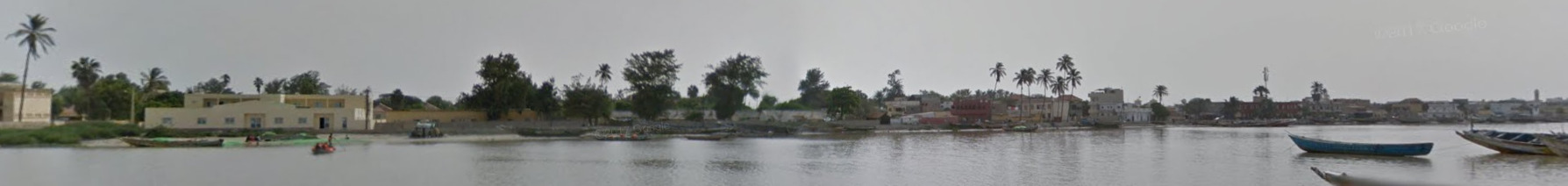
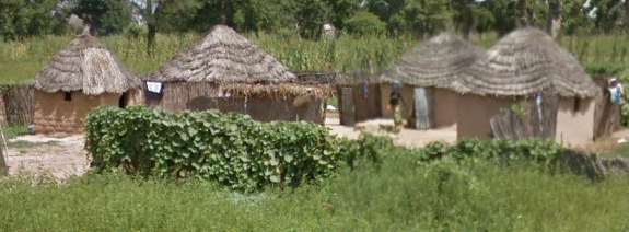
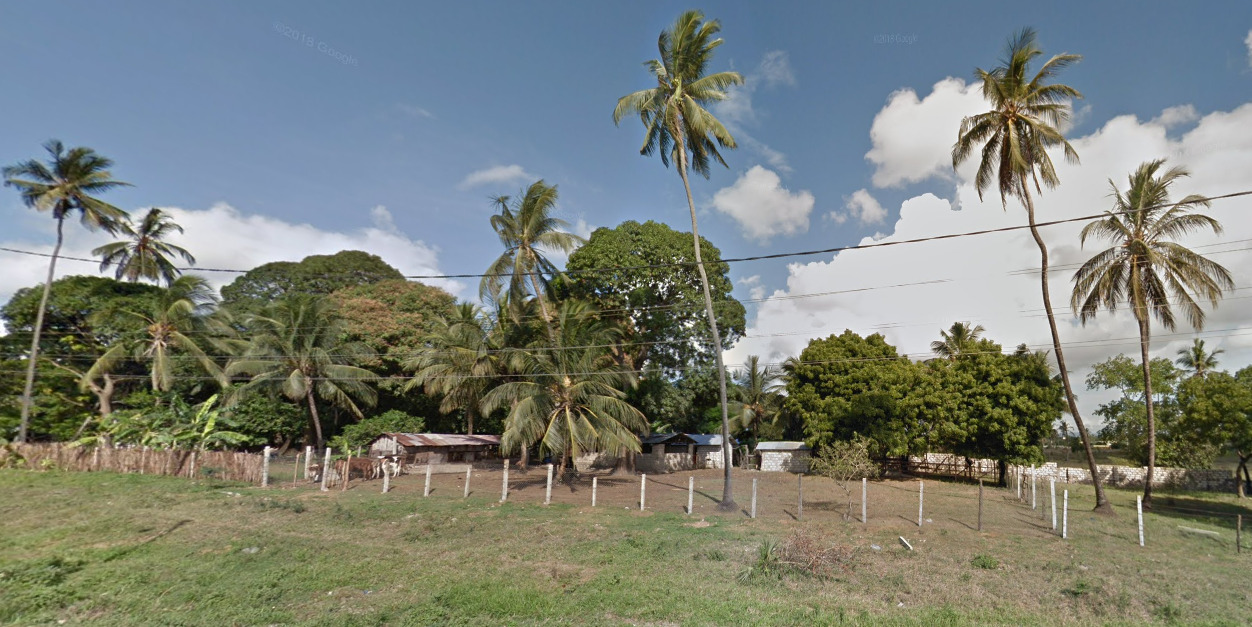
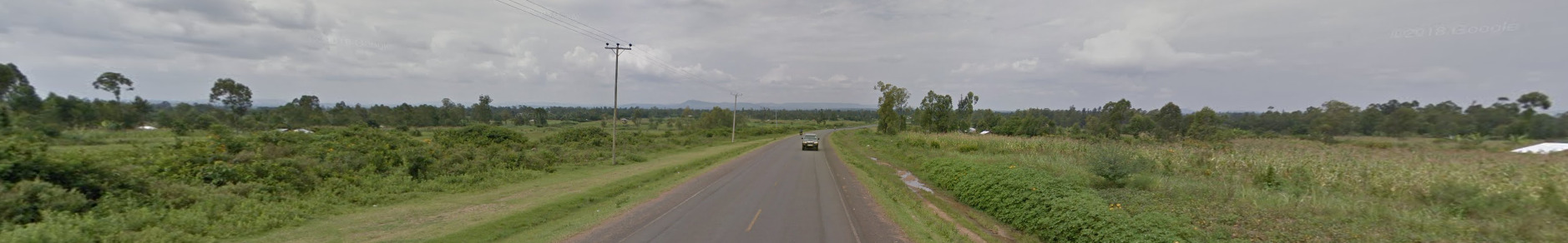
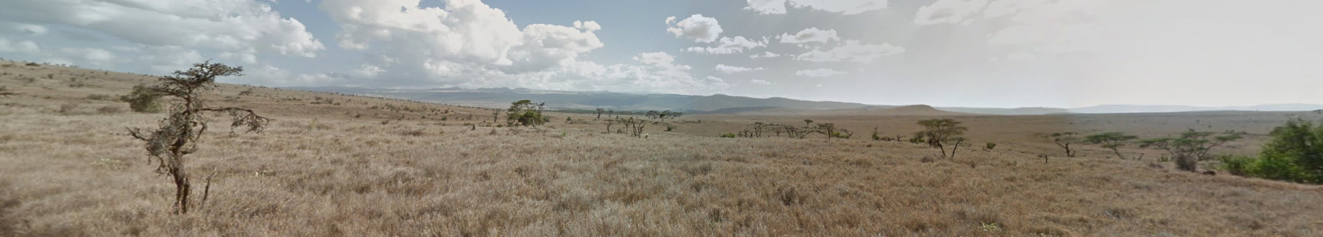
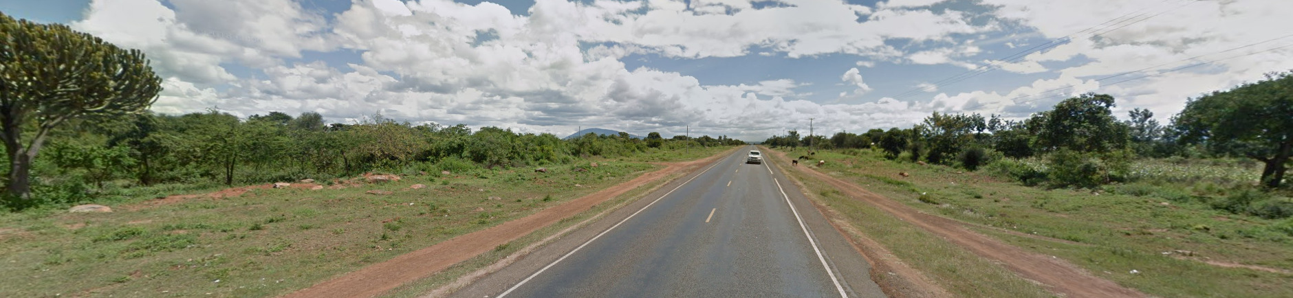
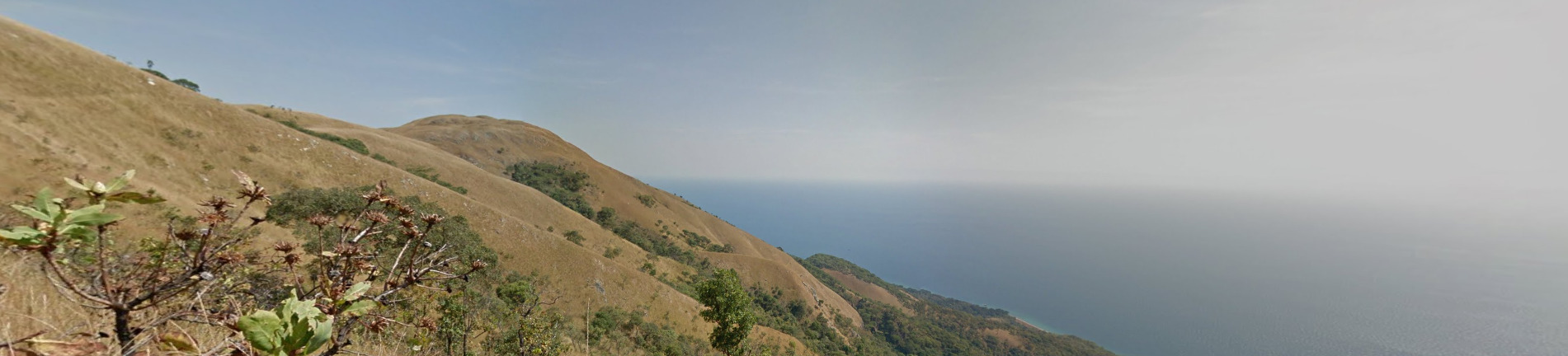
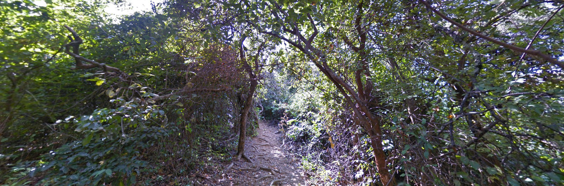
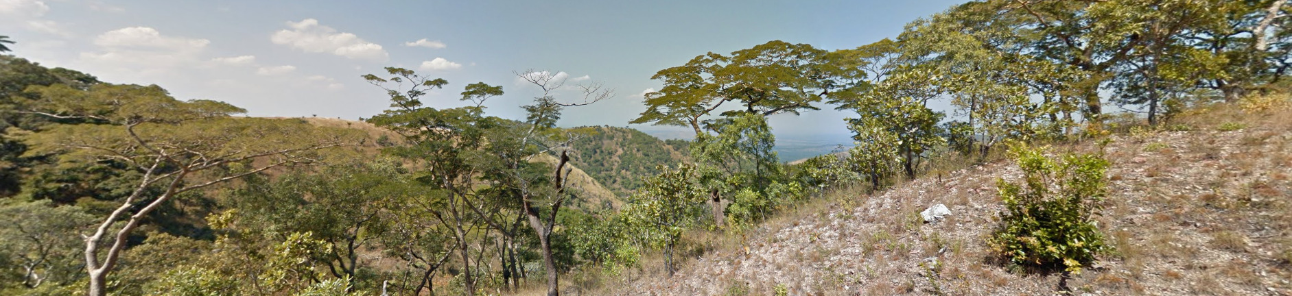
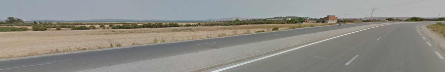
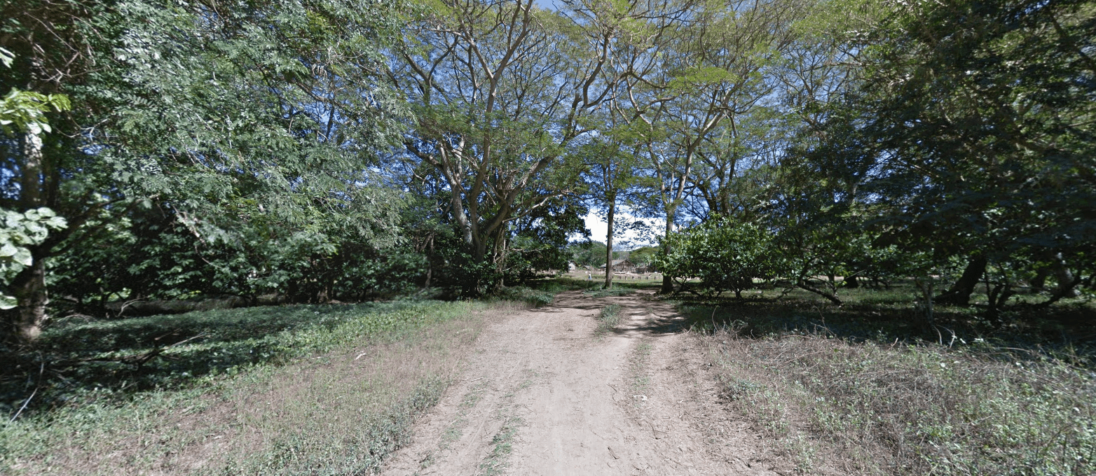
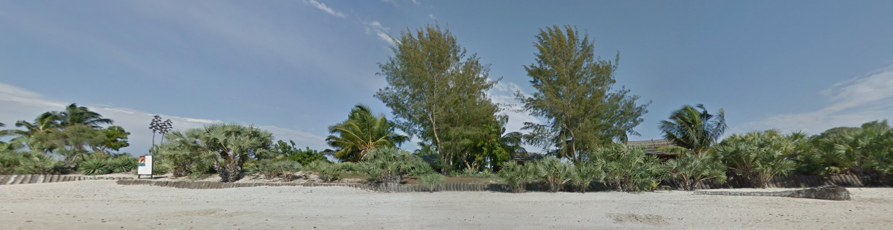
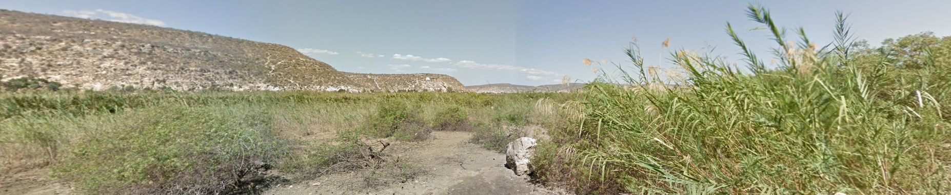
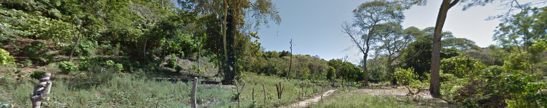
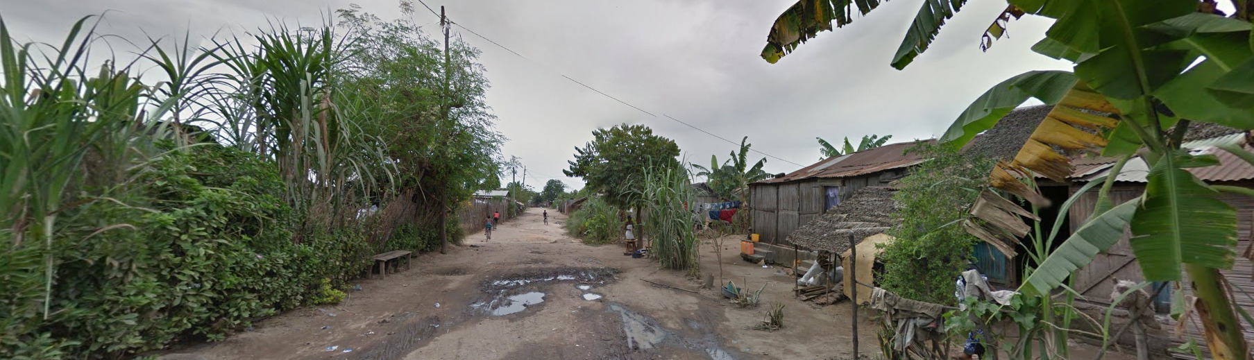
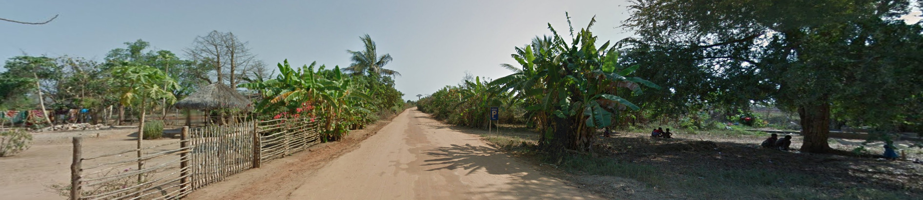
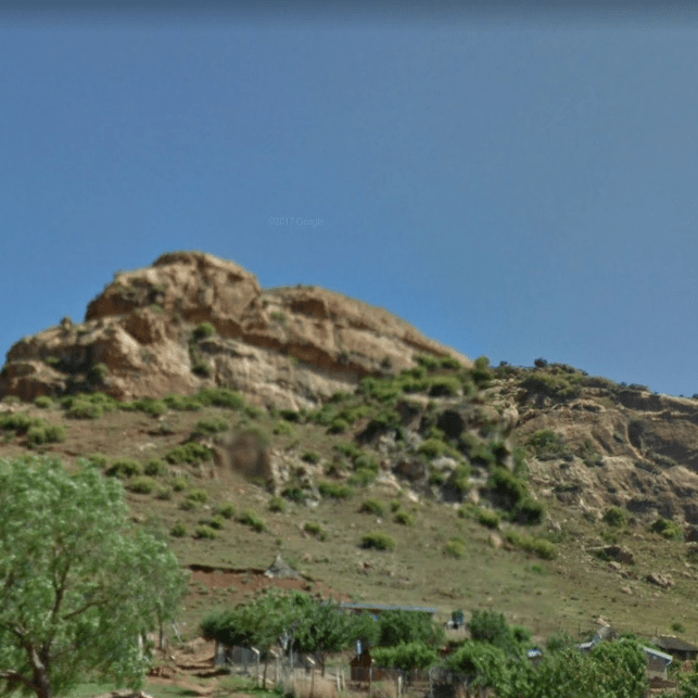
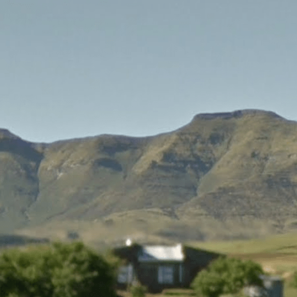
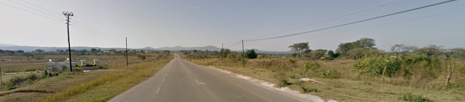
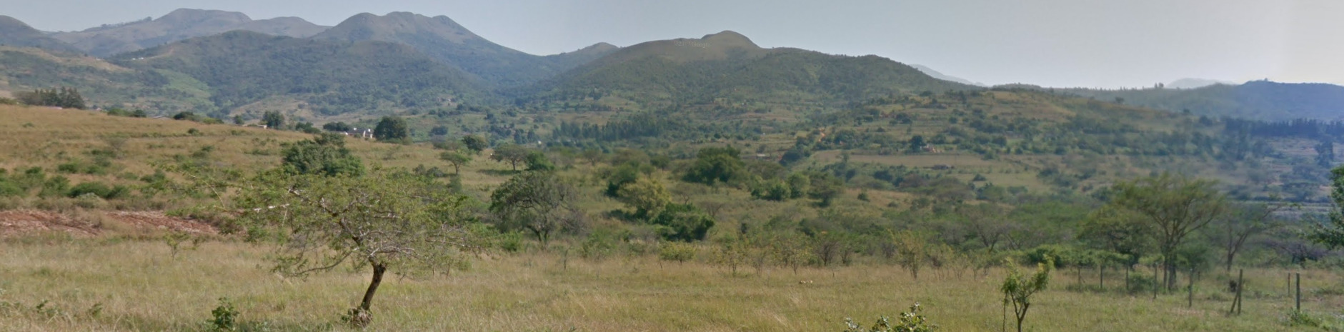
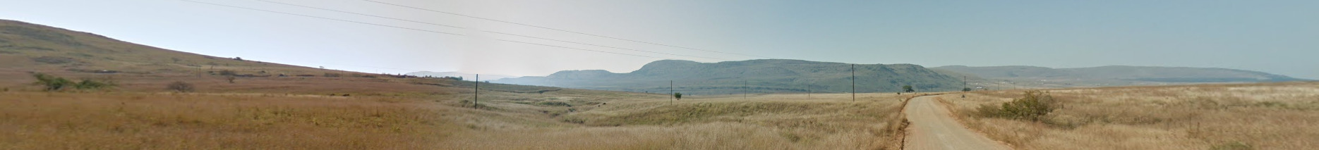
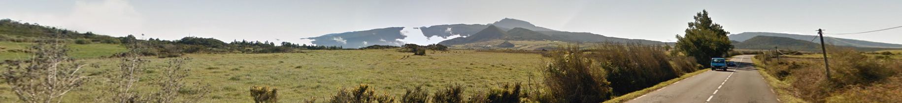
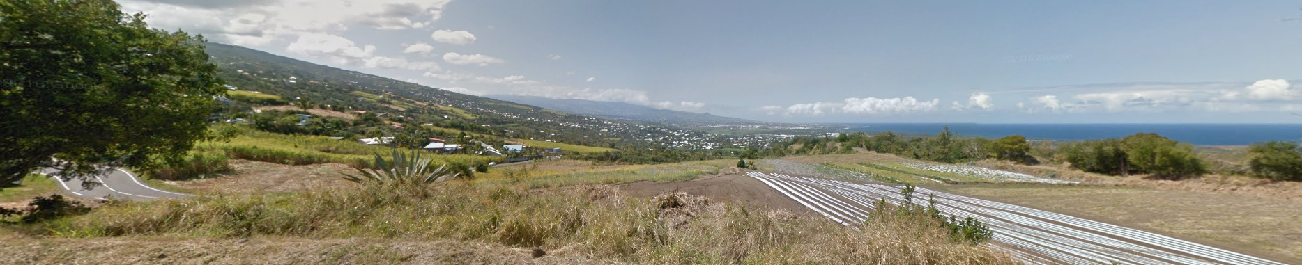
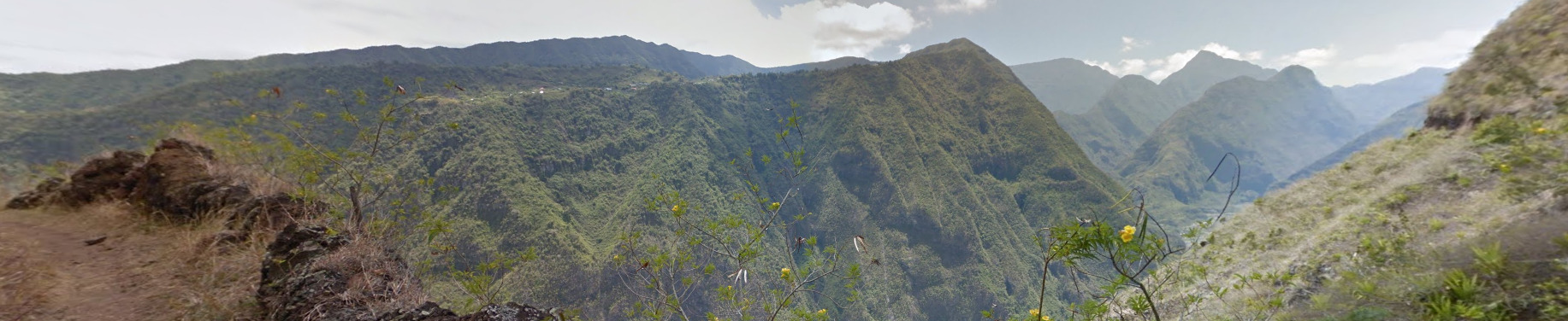
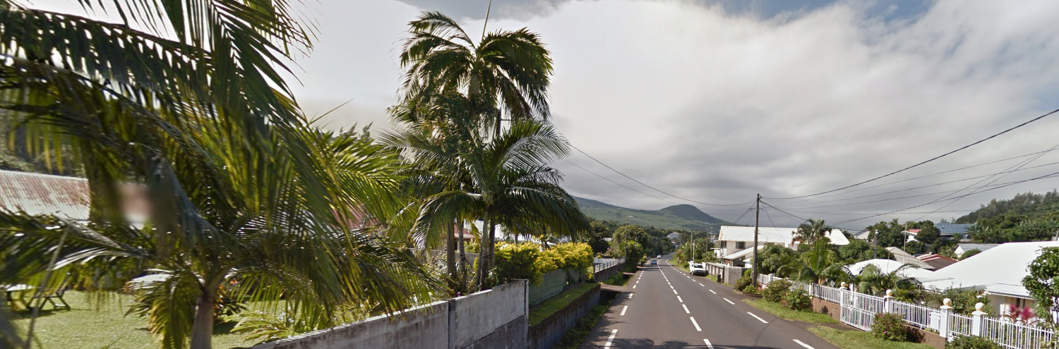
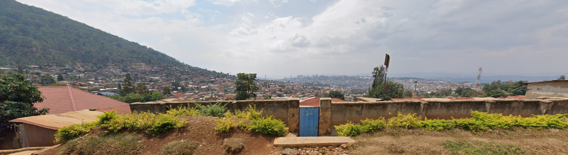
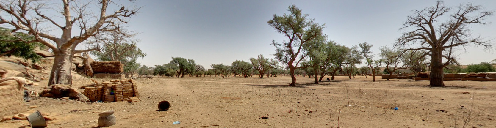
- Vegetation / Landscape
- Currency
- Architecture
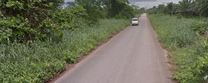
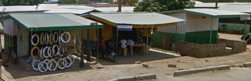
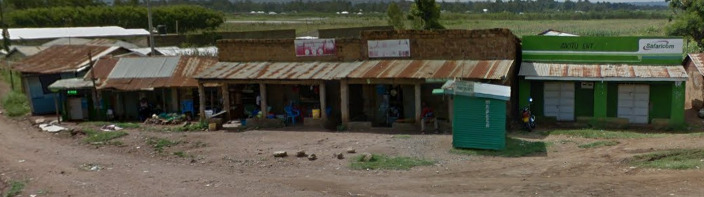
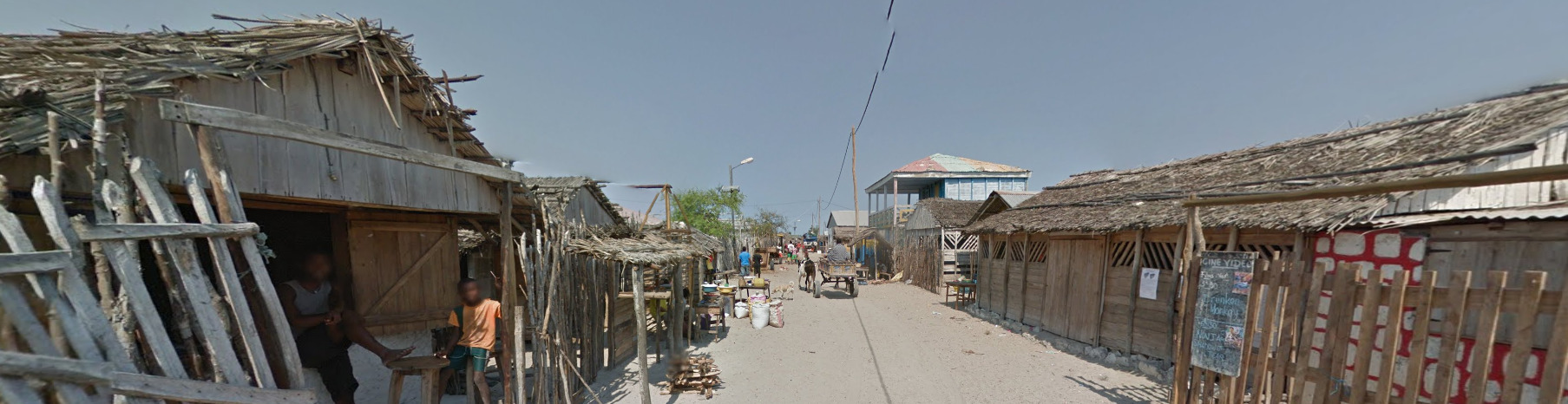
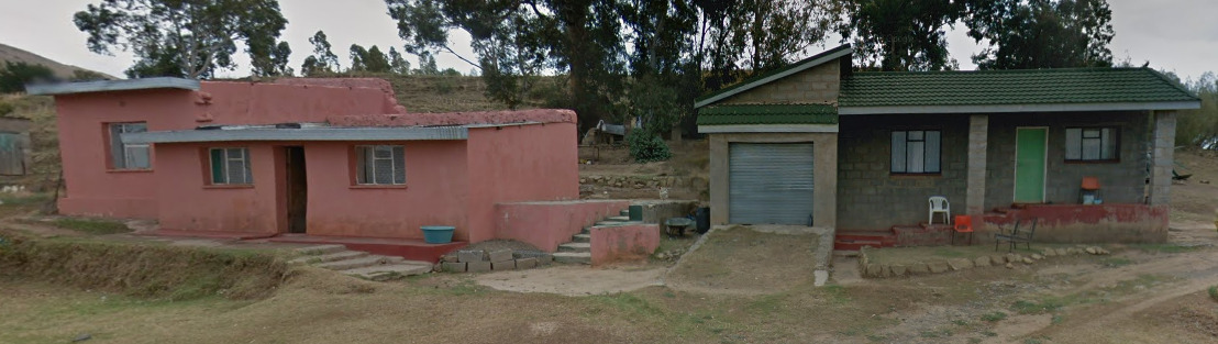
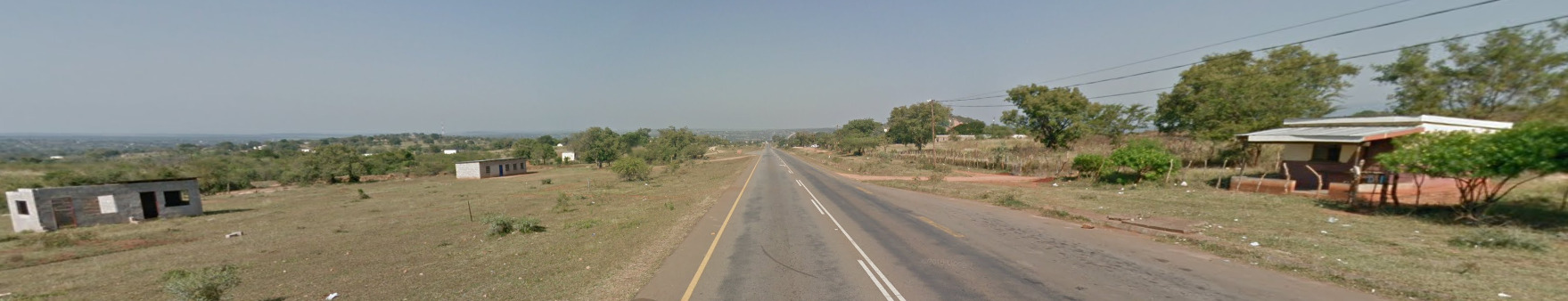
- General Look
- Language
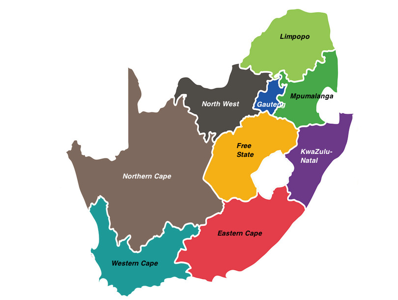
- Subdivisions
- Domain
Country Flag:
Capital City:
Bloemfontein/Cape Town/Pretoria
Most Helpful:
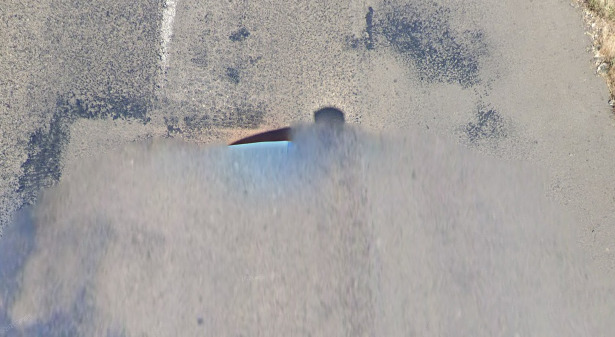
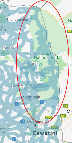
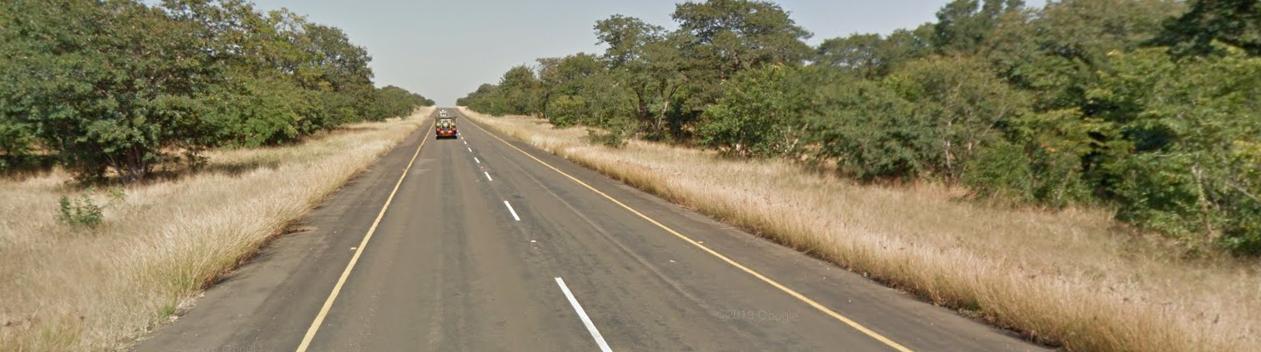
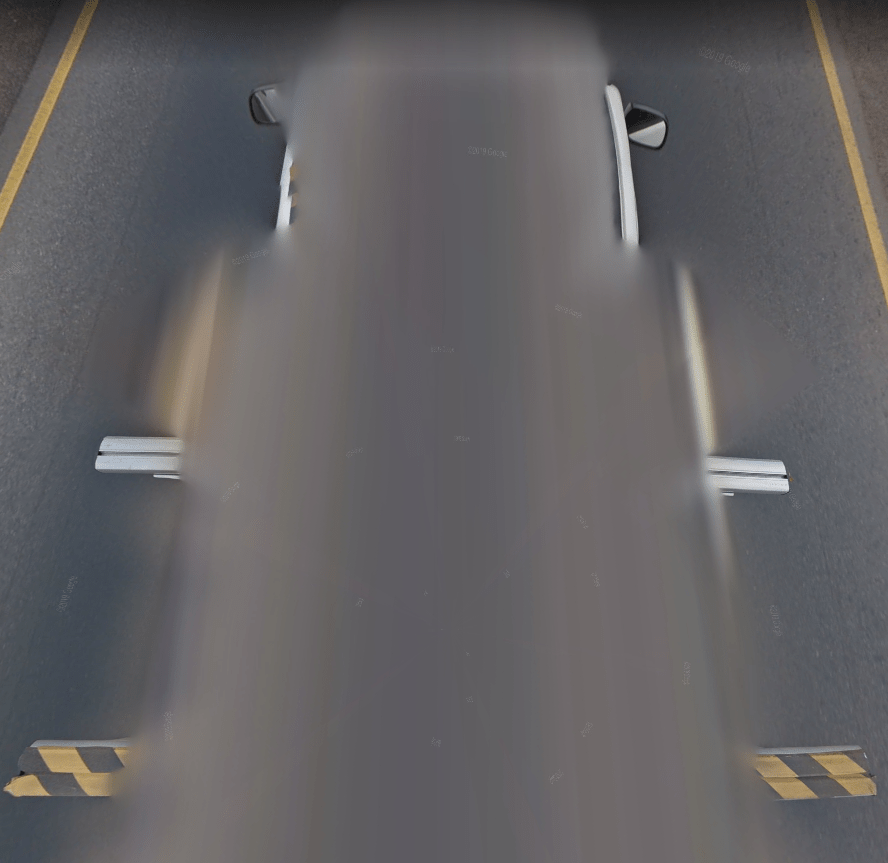
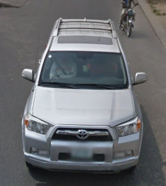
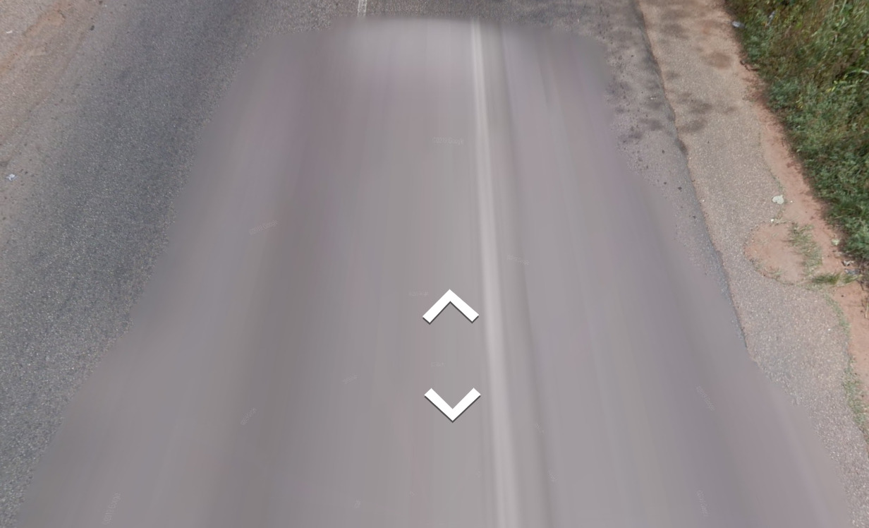
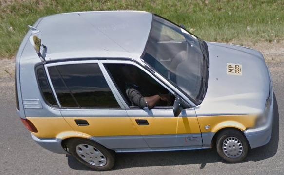
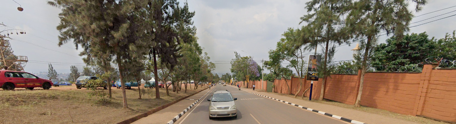
South Africa is the first country on the southern tip of Africa to get Gen 4 coverage. You will see a lovely sky blue car. There can sometimes be a short black antenna off the back.
Not all places in South Africa have Gen 2 coverage, but if you know youre in the Southern Africa region and you end up with Gen 2 coverage, it has to be South Africa.
Google Car:
South Africa is the first country on the southern tip of Africa to get Gen 4 coverage. You will see a lovely sky blue car. There can sometimes be a short black antenna off the back.
When you’re in the Gen 3 coverage, you can see the back of the car. Its the same general car seen in the Southern Africa region.
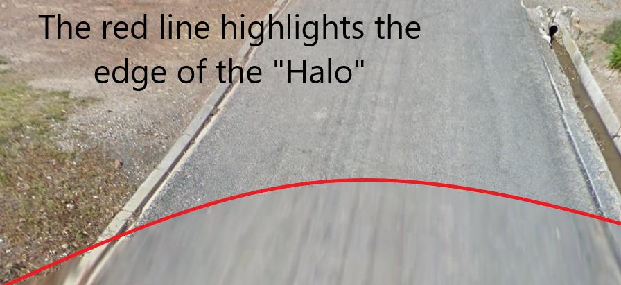
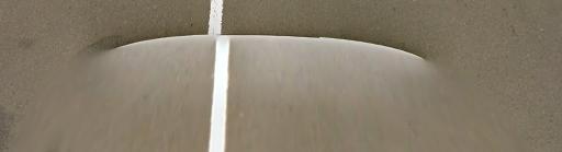
However, when it is Gen 2 coverage, you get the typical “halo” associated with that camera.
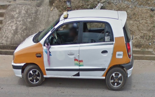
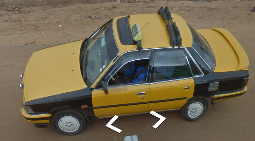
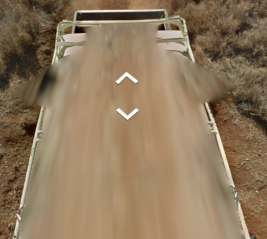
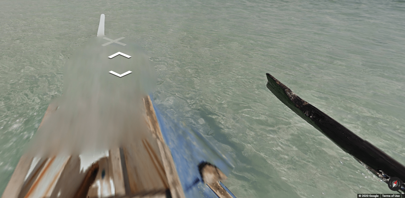
Rare Car:
This rare car is found in the Kruger National Park. Its located on the North Eastern edge of the country, and is the only place in the world where you can find a camo pattern to the vehicle.
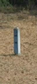
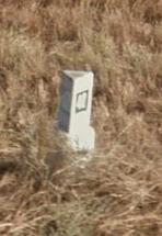
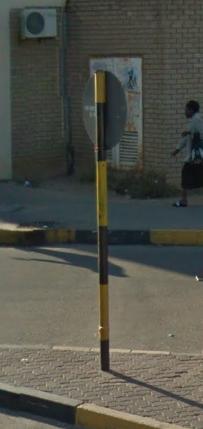
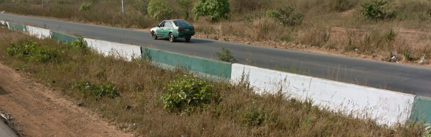
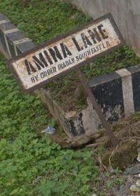
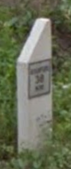
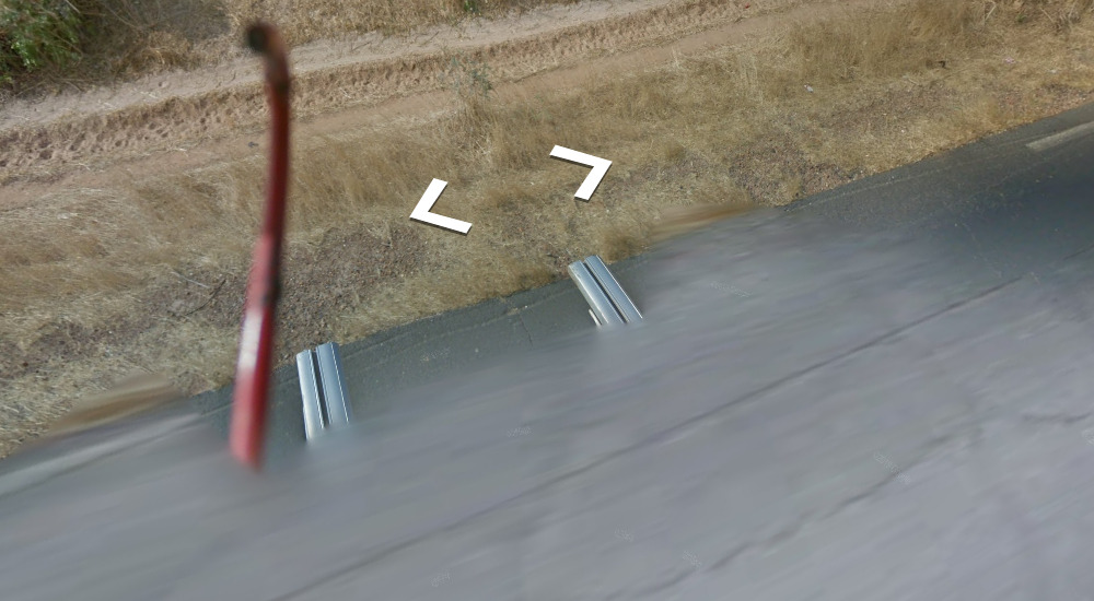
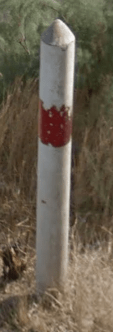
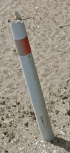
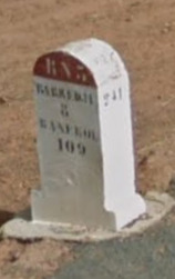
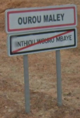
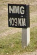
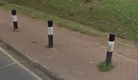
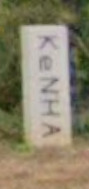
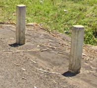
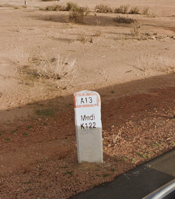
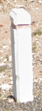
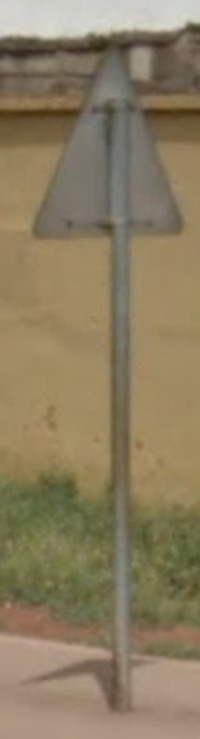
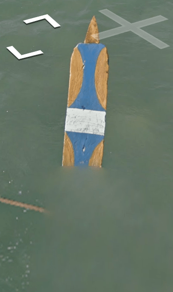
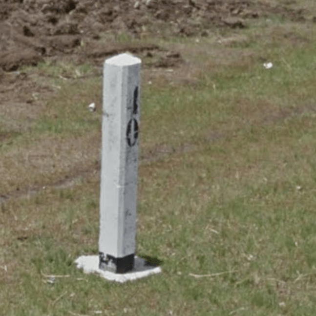
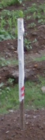
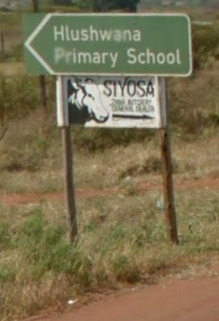
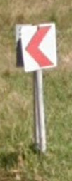
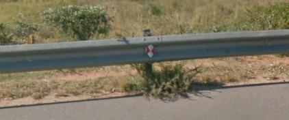
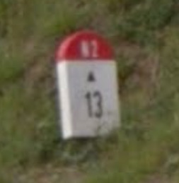
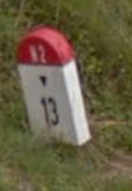
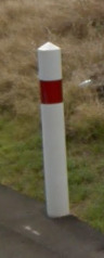
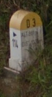
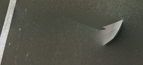
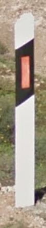
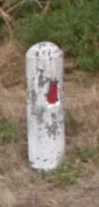
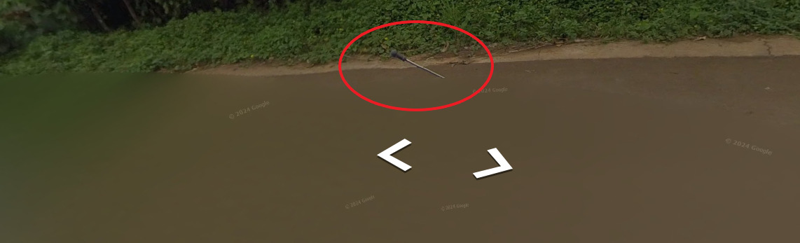
Bollards:
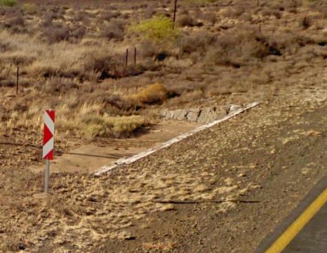
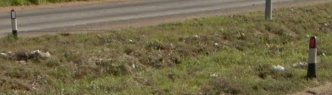
Like Botswana, these signs are located near the sides of Drainage ditches. However, there appears to only be one sign, not two like Botswana.
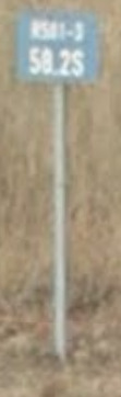
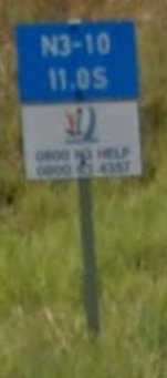
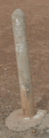
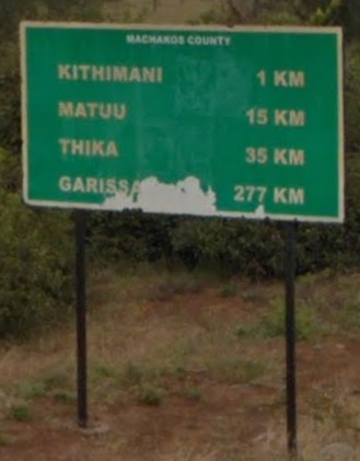
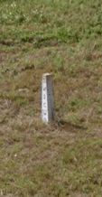
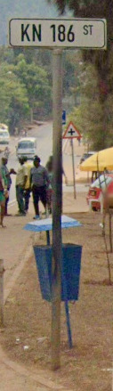
These KM markers seem to be found on the major roads. They tell you which road you are on, and how far along it you are.
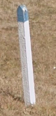
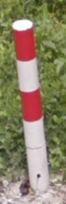
This bollard seems to be super rare. Its found near major cities.
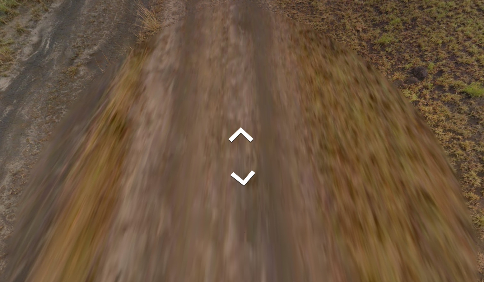
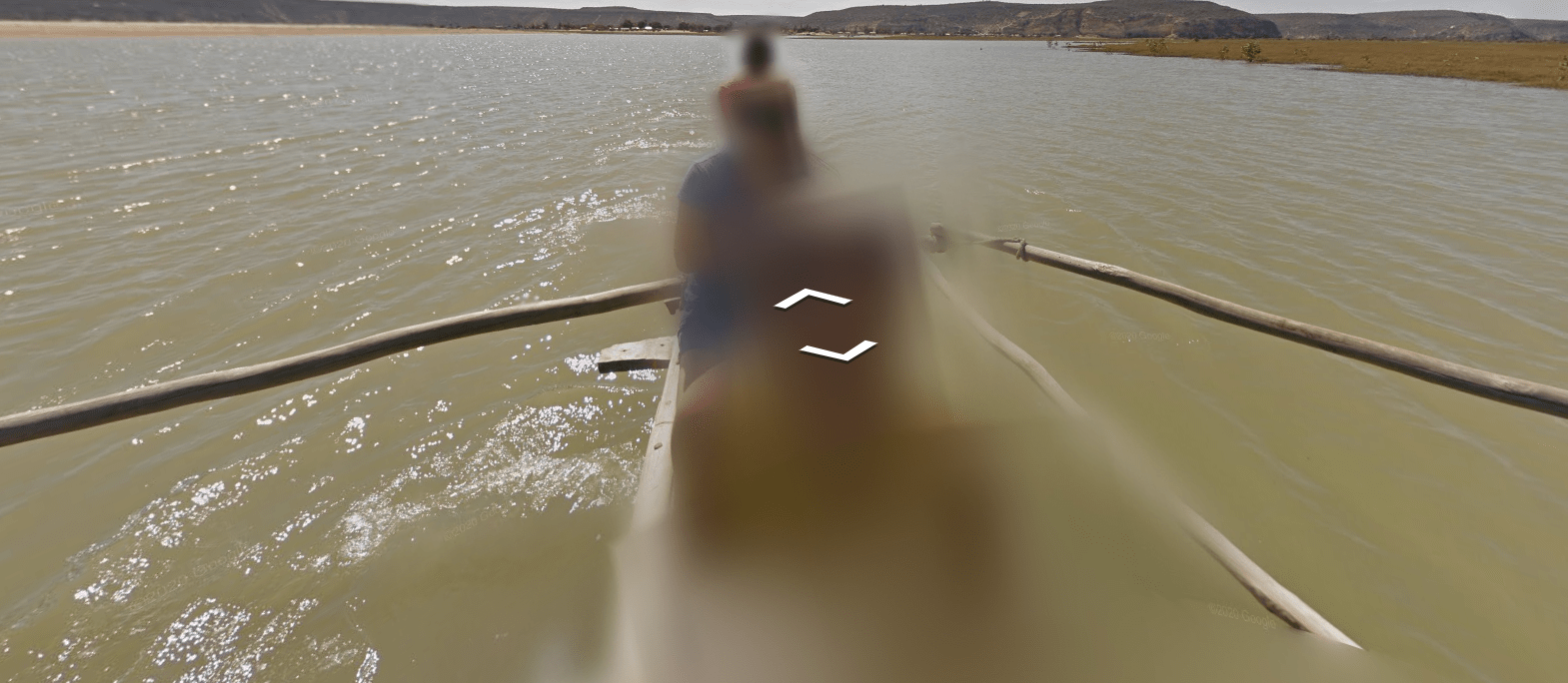
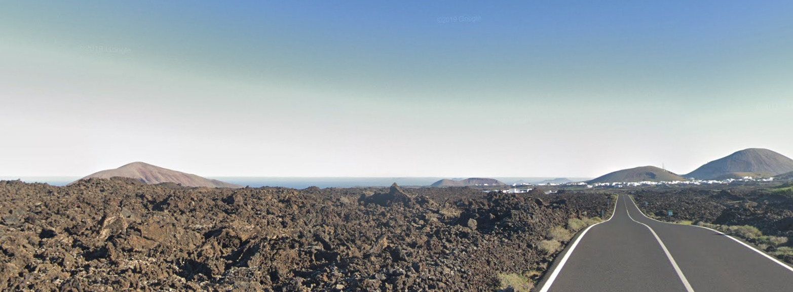
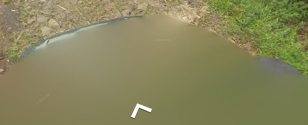
Google Coverage:
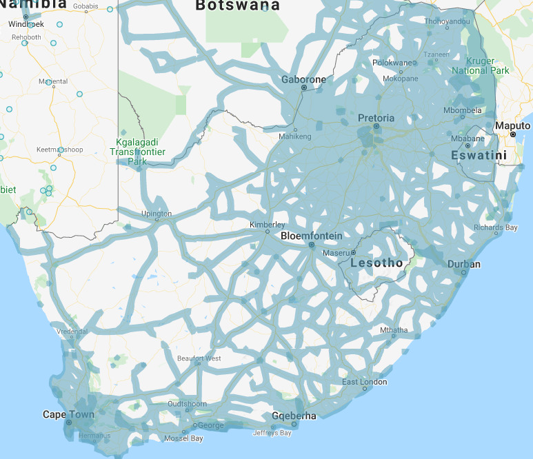
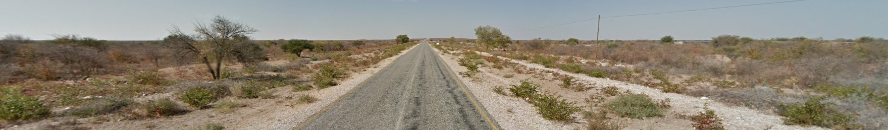
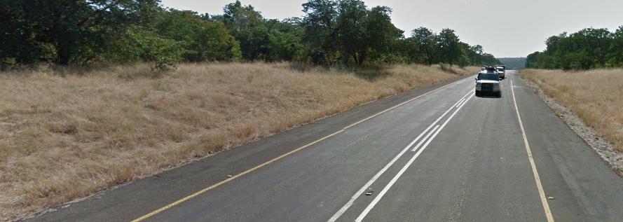
There are some large sections that do not contain street view, especially in the west of the country. Its always worth guessing in a place that has coverage.
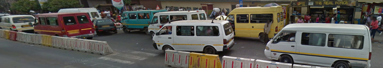
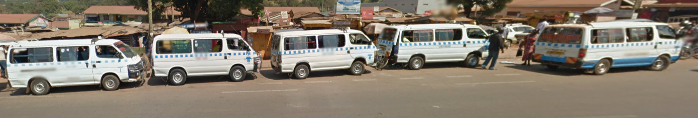
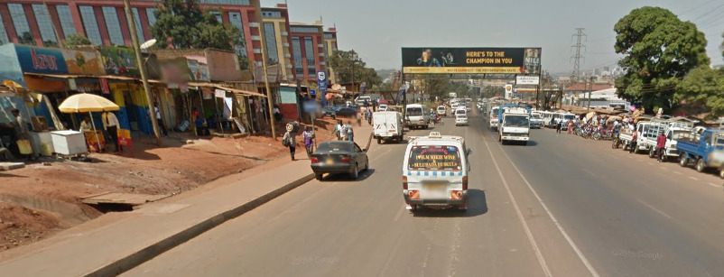
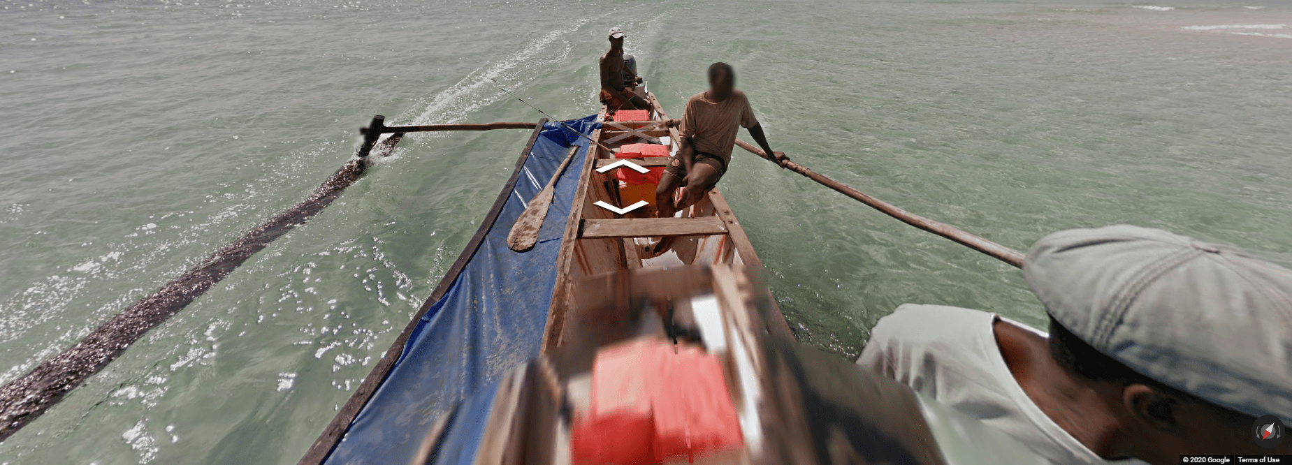
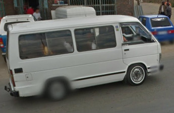
Unique Vehicle:
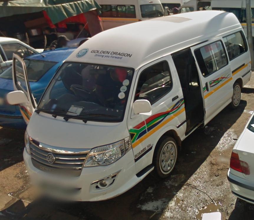
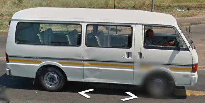
You will see these vans everywhere. They have a South African flag on the side with a nice design. They are in every city, and I believe they are like Taxi’s.
Camera Generation:
Gen 2, 3 and 4
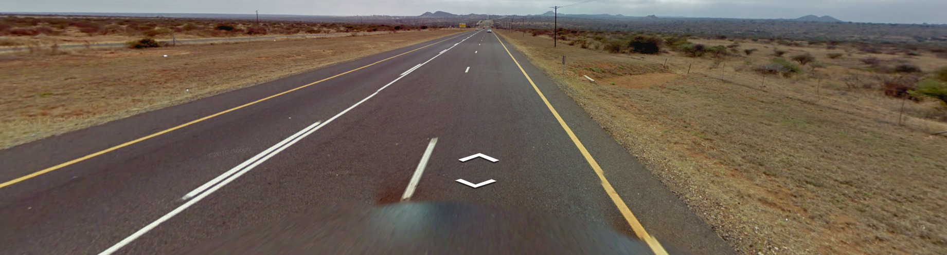
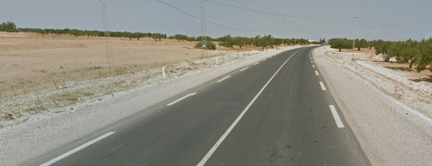
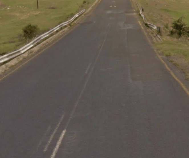
Road Lines:
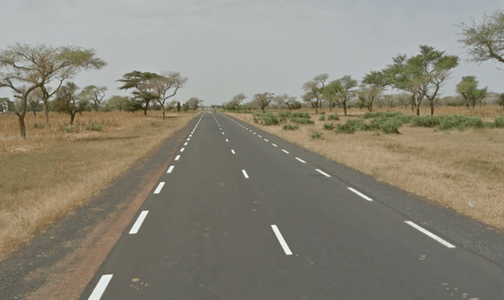
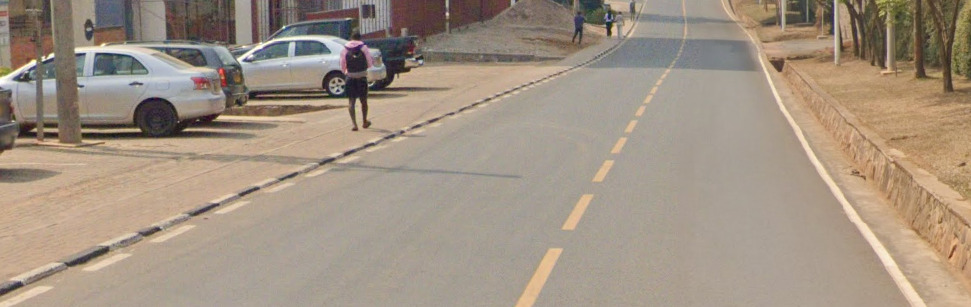
Much like the rest of this geographical region, you will see yellow shoulder lines and a white center divider line. Similarly to the other areas, you can also see the triple white line.
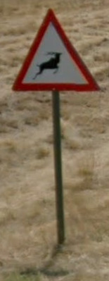
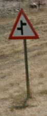
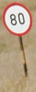
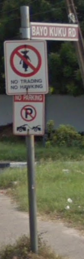
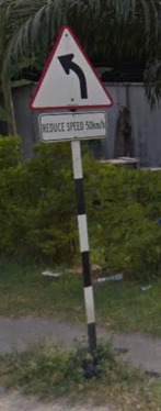
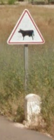
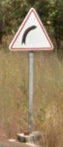
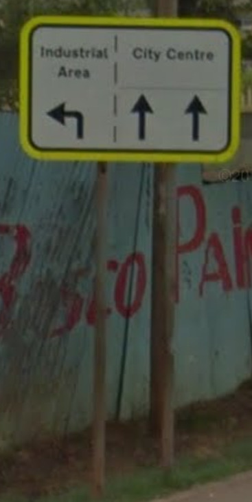
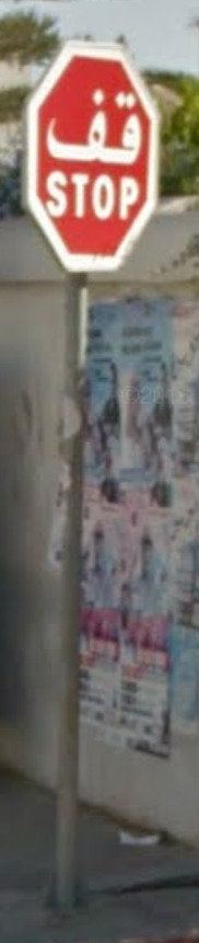
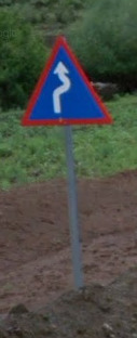
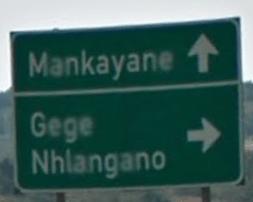
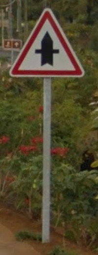
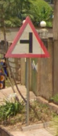
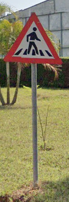
Road Signs:
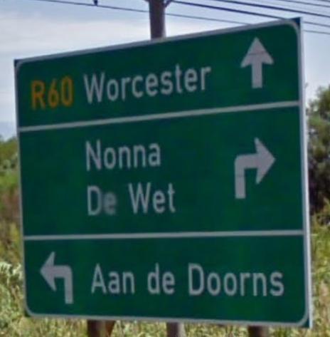
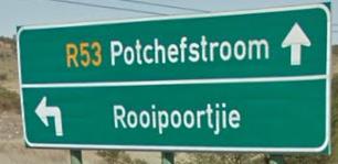
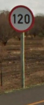
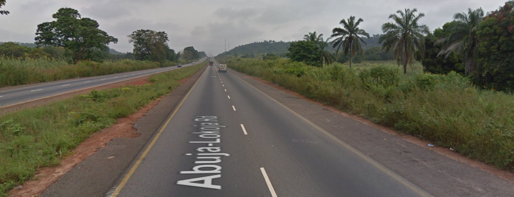
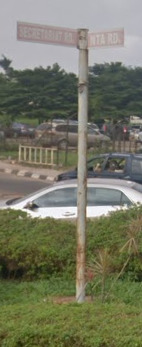
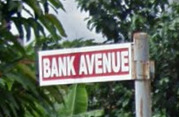
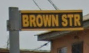
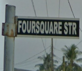
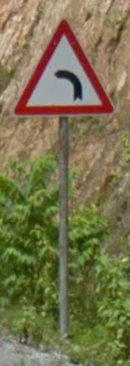
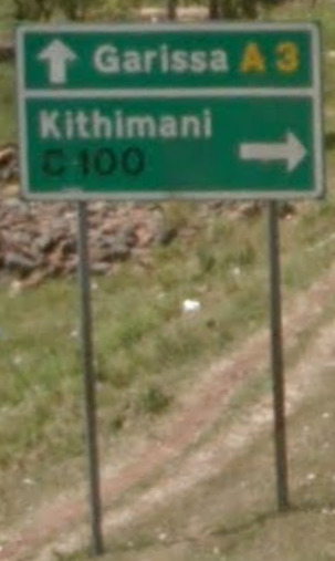
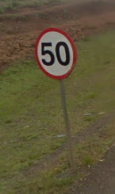
South Africa uses several different letters with their roads, however R and M are some of the most common.
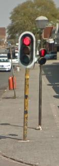
All traffic lights in South Africa appear to be on Yellow poles. Or at least all the major cities have them like this. They have varying degrees of paint ware.
Road numbering system:
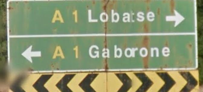
South Africa has national (N1 to N20), provincial (R21 to R99) and regional (R300 to R799) numbered routes. The regional route numbers follow a pattern depending on the province they are in. For more information see: Numbered routes in South Africa
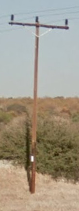
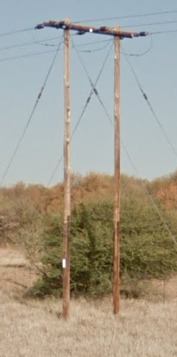
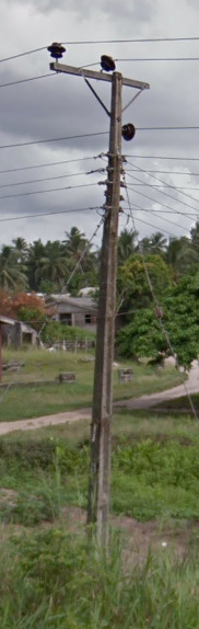
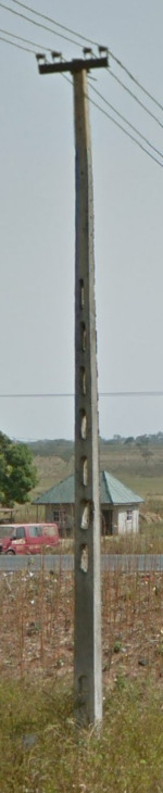
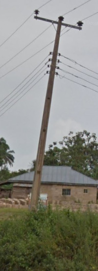
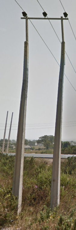
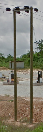
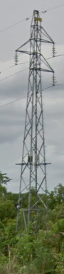
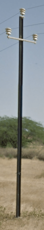
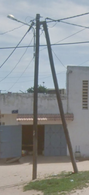
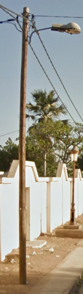
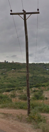
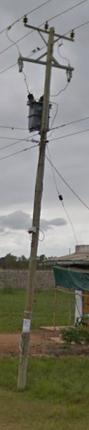
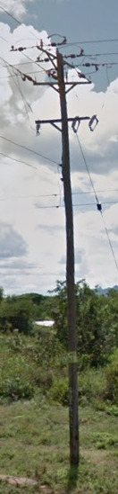
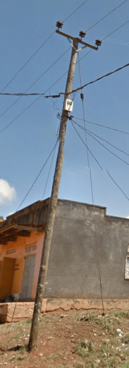
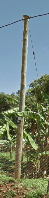
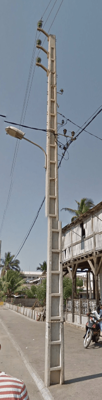
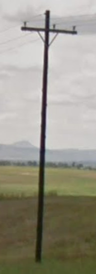
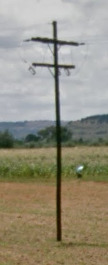
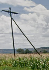
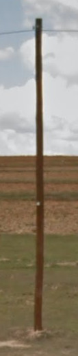
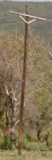
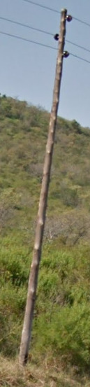
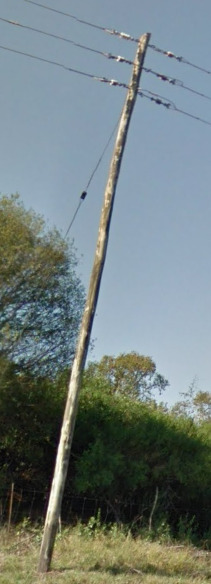
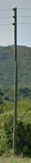
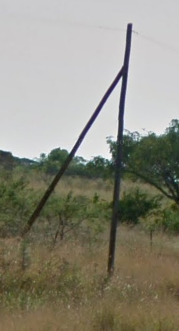
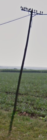
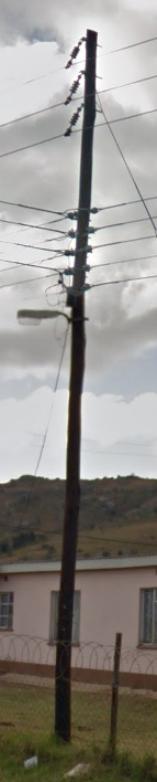
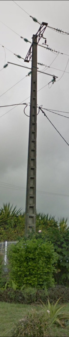
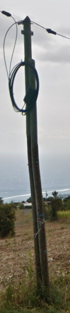
Electricity poles:
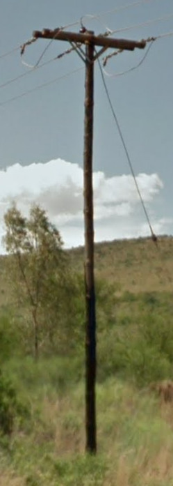
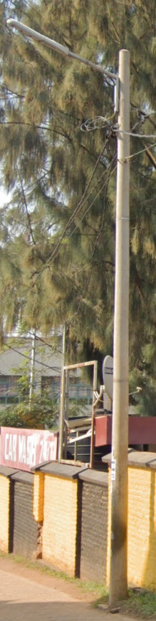
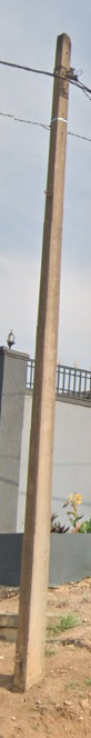
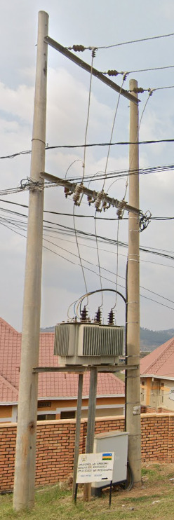
South Africa uses wooden poles in multiple styles. They can often be found around the Rural and developed areas.
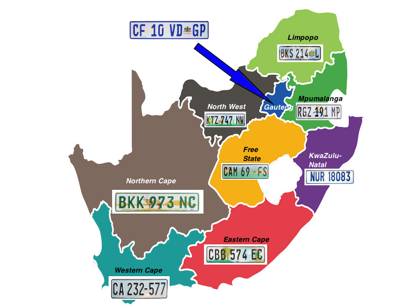
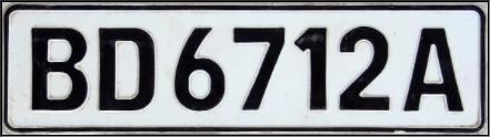
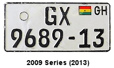
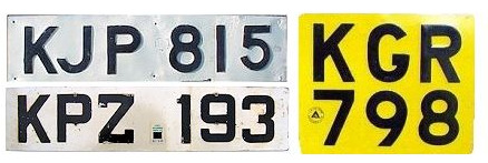
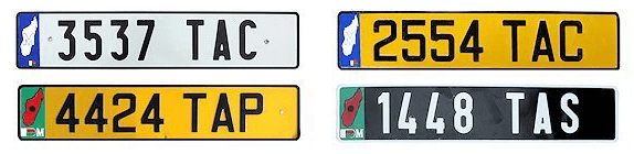
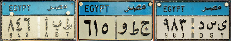
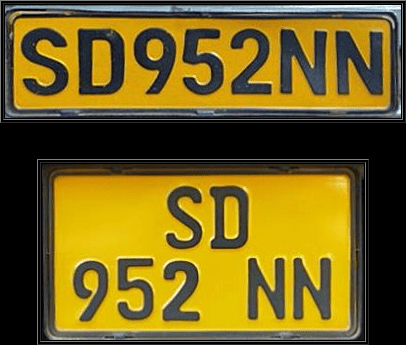
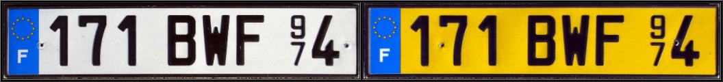
License plates:
Each individual region in South Africa has their own license plate. However, its not the easiest to tell through the blur of GeoGuessr. For the sake of this website, each regional license plate will be listed, but just be aware that it may be tough to tell the difference in the game itself.
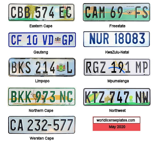
Most seem to have a two letter province code at the end, however the blur will make it tough to spot those letters.
The plates shown on the map (made by zi8gzag):
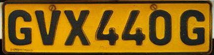
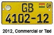
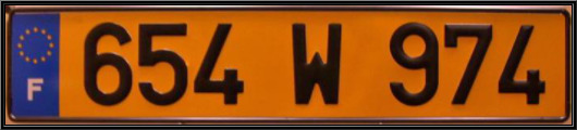
The public service vehicle license plates are yellow:
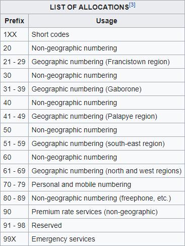
Phone numbers:
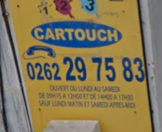
The 015 indicated the region, while the 082 indicates that it is a mobile number. The image below explains all of that more clearly.
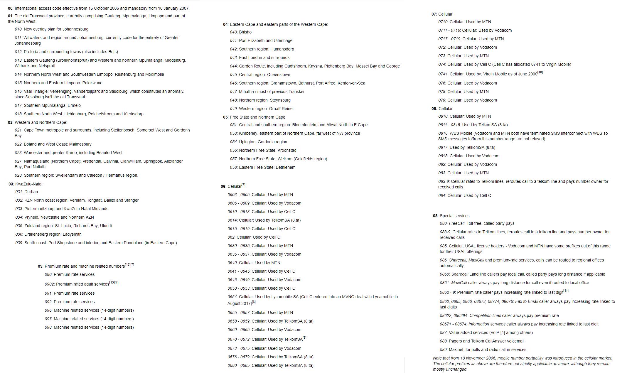
Wikipedia gave us a wonderful list of where each number in South Africa goes. It may be important to learn this list.
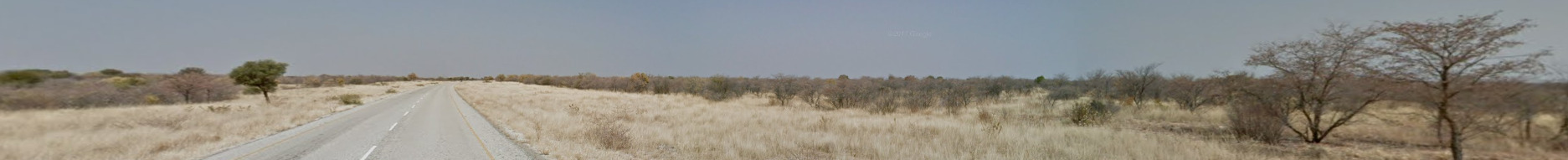
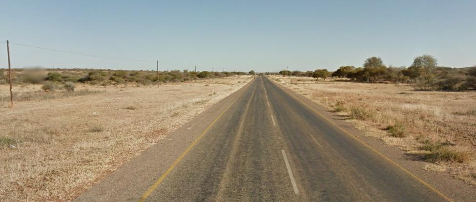
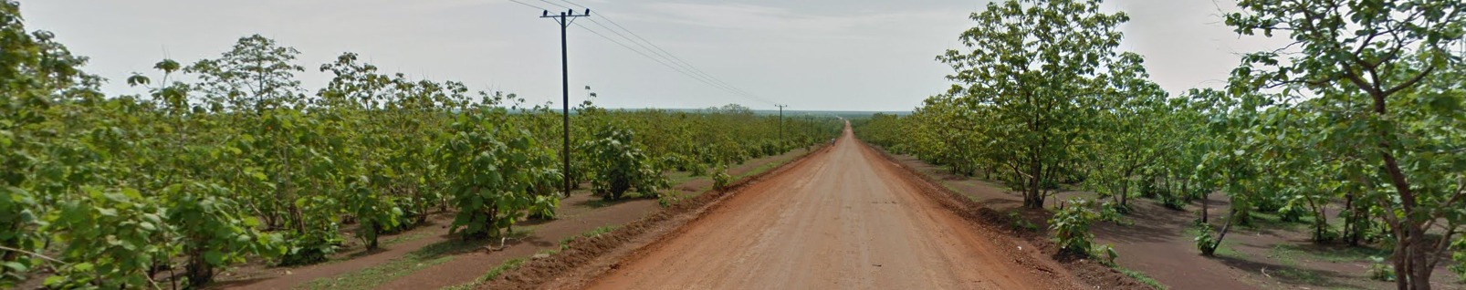
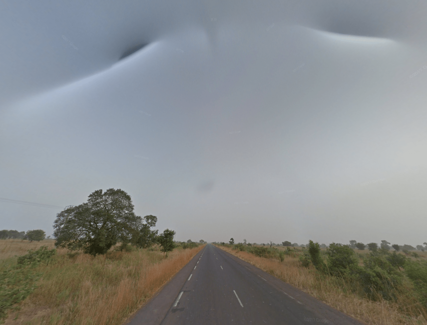
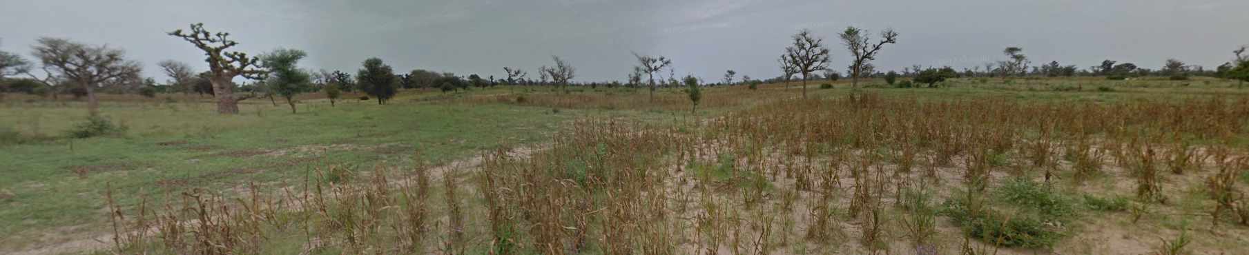
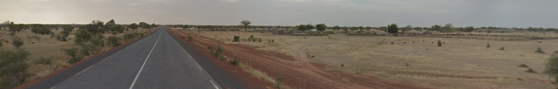
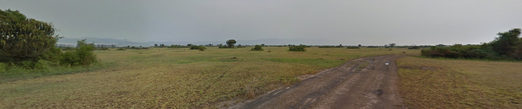
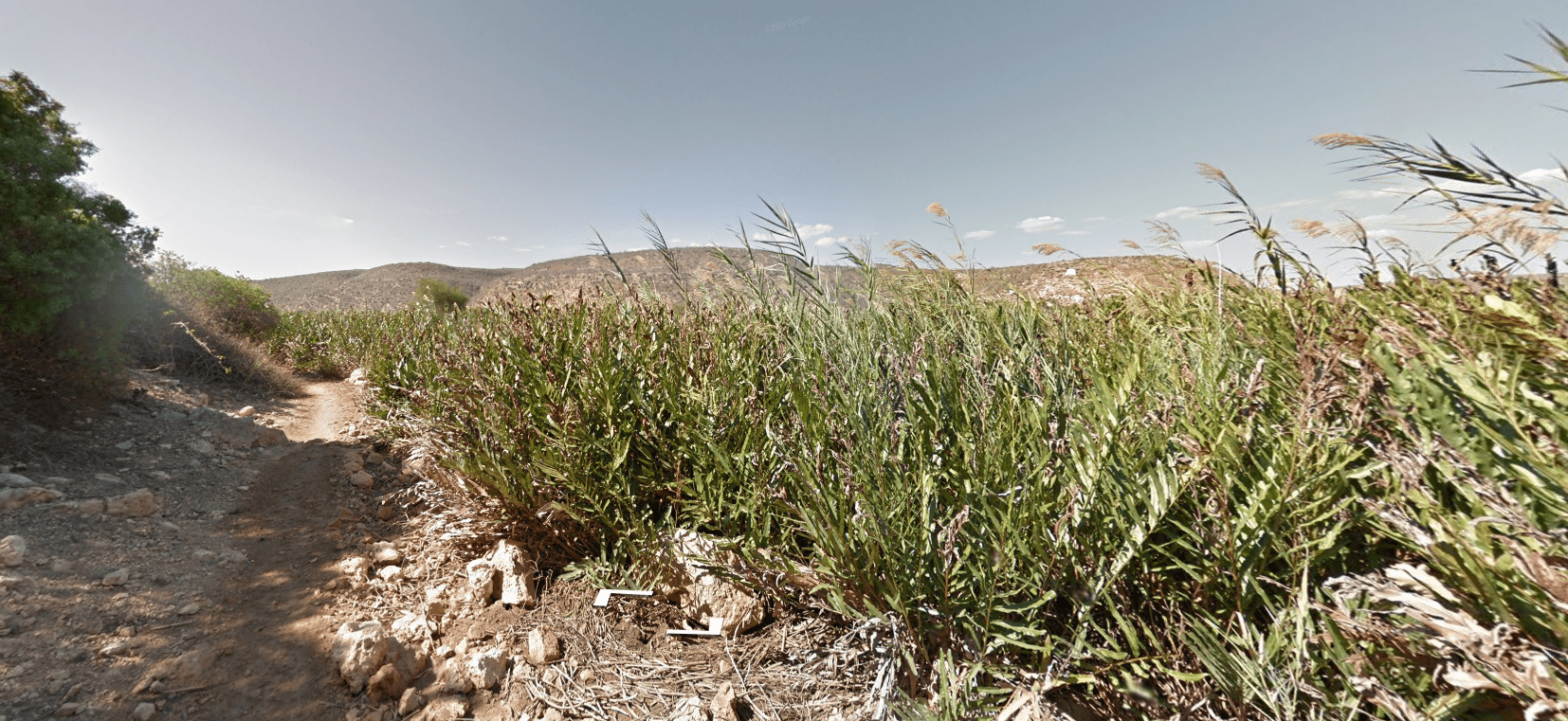
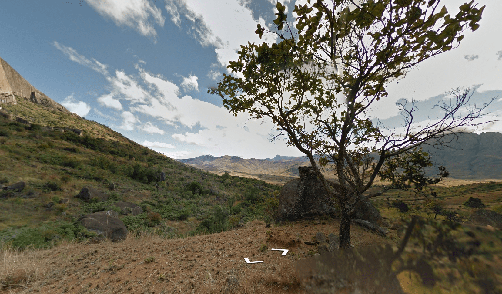
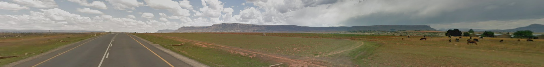
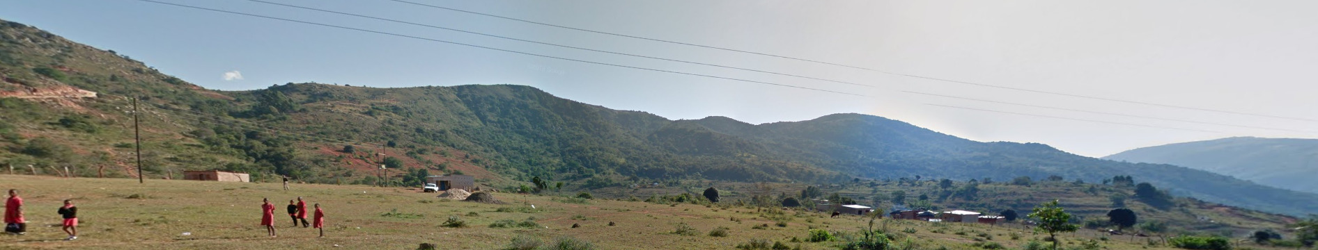
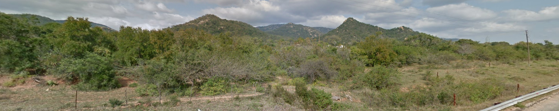
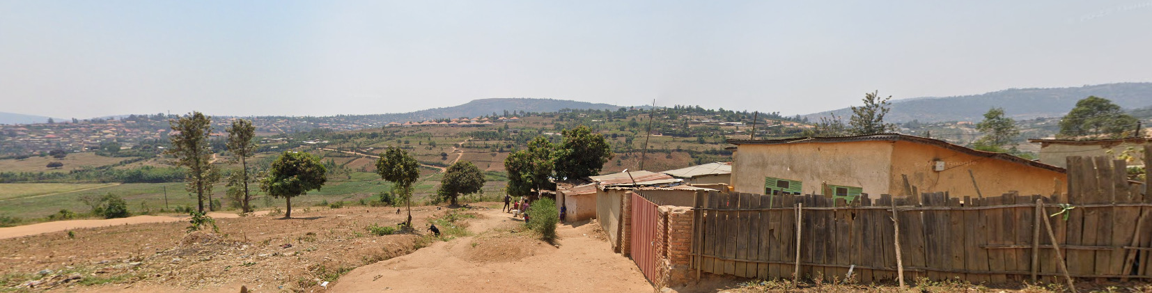
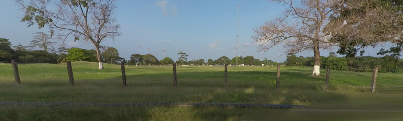
Vegetation / Landscape:

Currency:
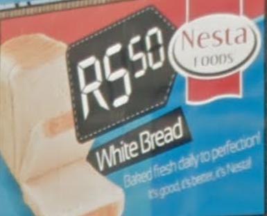
South Africa uses the Rand. Its usually marked by the letter R.
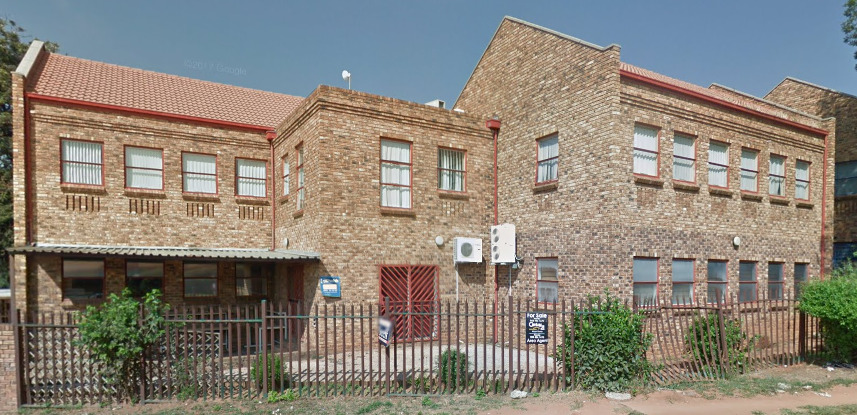
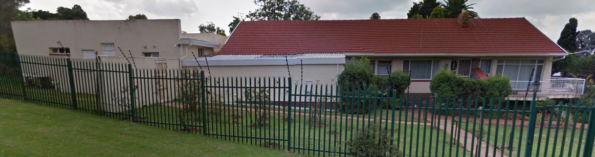
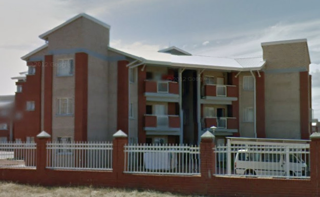
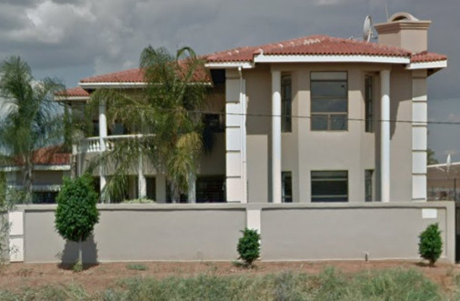
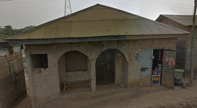
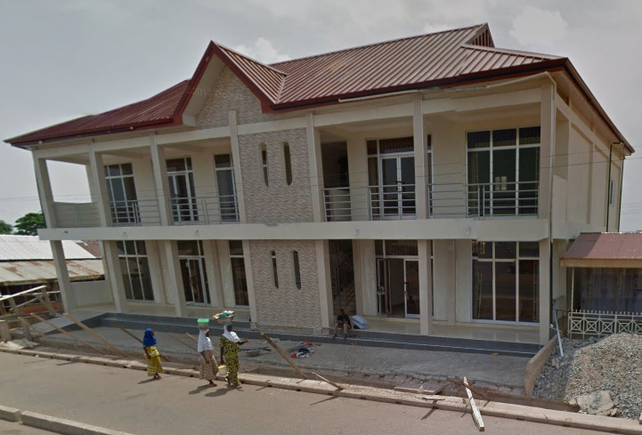
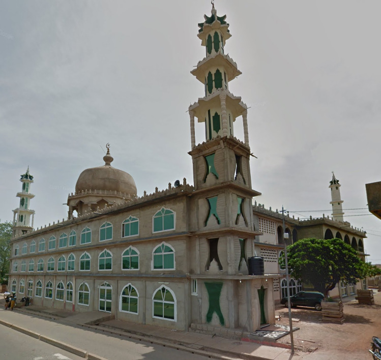
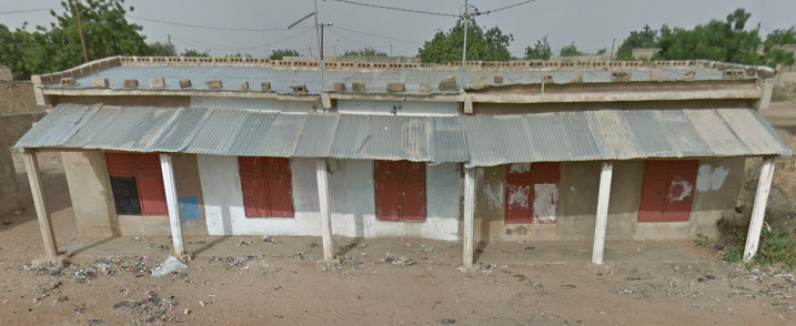
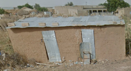
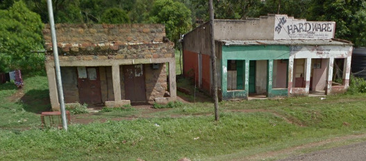
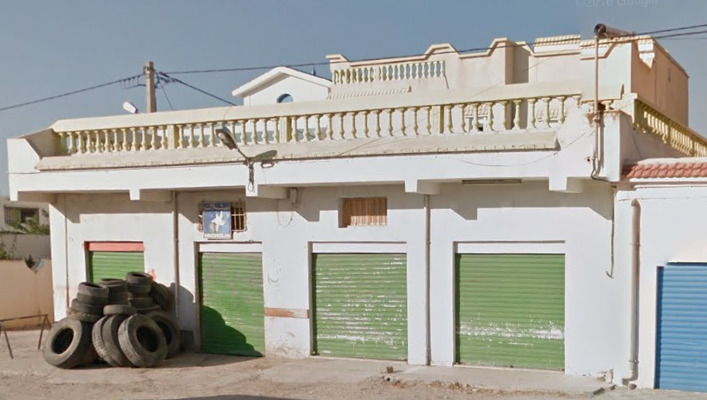
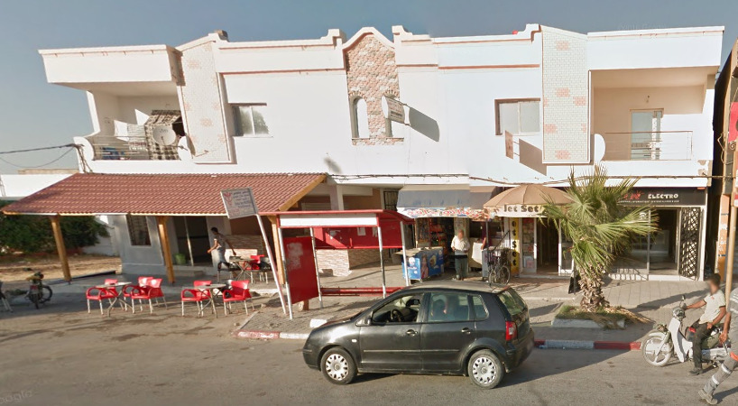
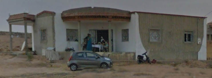
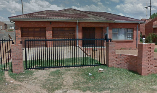
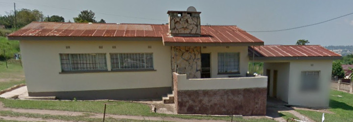
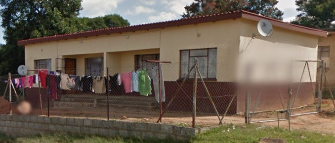
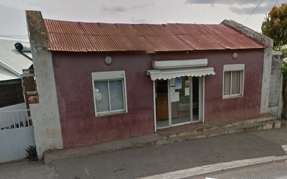
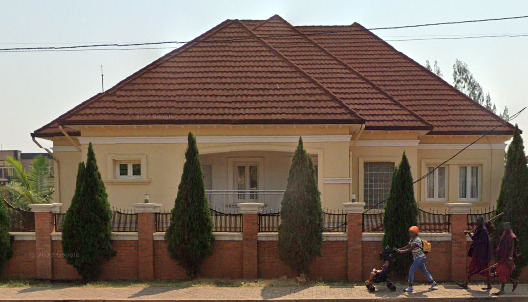
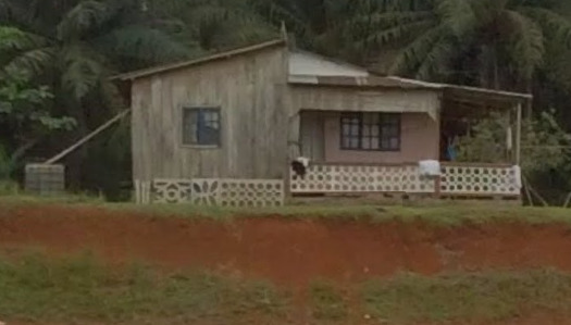
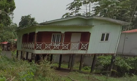
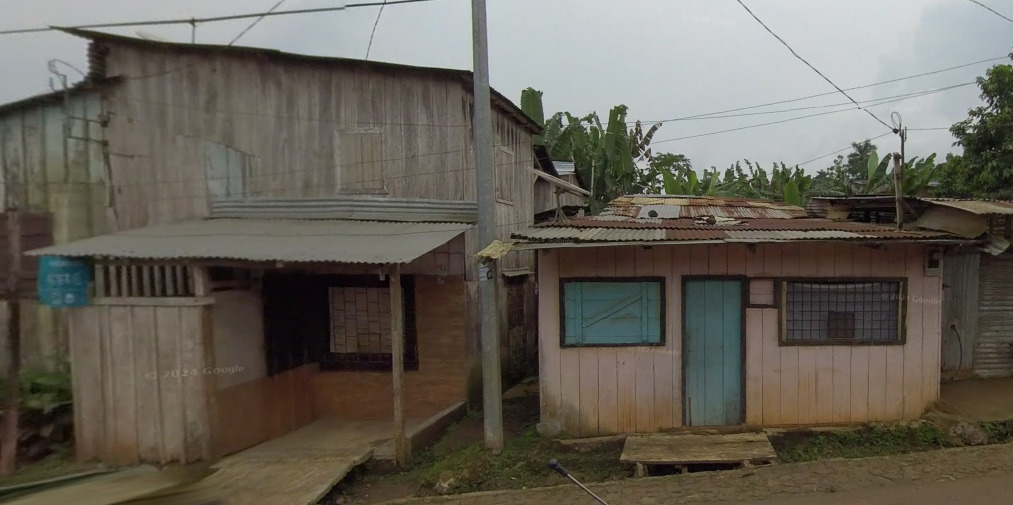
Architecture:
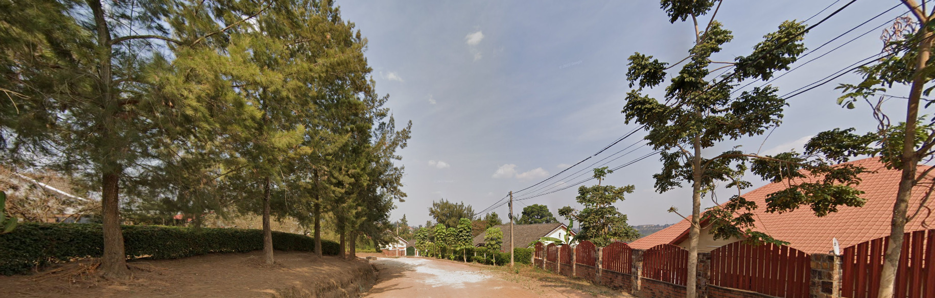
The Architecture is heavily inspired by the British. However, nearly all residential buildings are protected by fences. This can help you distinguish between similar looking places in Australia or New Zealand.
General look:
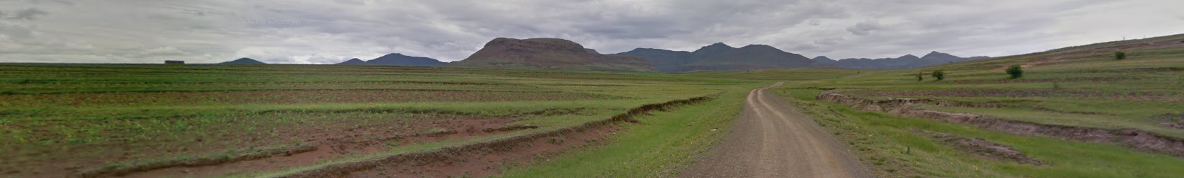
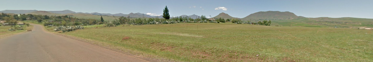
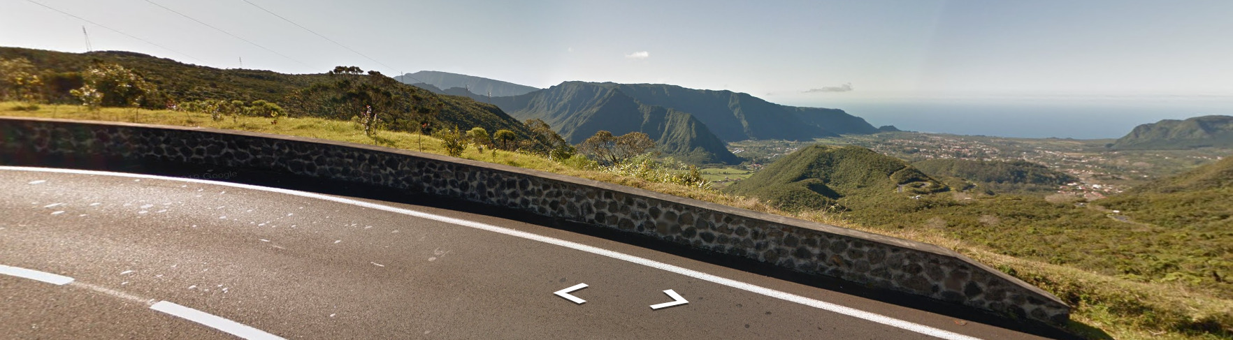
The general feel to South Africa is very close to Botswana. A good rule of thumb is that Gen 2 is South Africa, Gen 3 needs something else. You can usually find something relatively fast that will help determine the distance. Also, South Africa has more hills than Botswana, as well as more overall coverage. With South Africa now being the only country with Gen 4, you have a solid guess if you can recognize the camera.

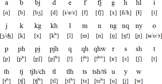
Alphabet/script:
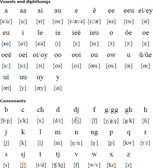
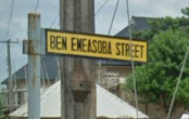
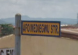
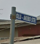
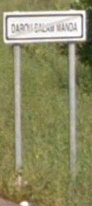
South Africa uses the English and Afrikaans language. Afrikaans is very similar to the Dutch language. You’ll notice the Afrikaans when it comes to some names of towns / villages (Like the picture above)
Subdivisions:
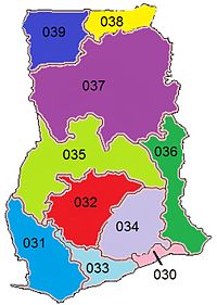
South Africa is divided into 9 provinces:
Domain:
.za (Zuid-Afrika)
Botswana
- Country Flag
- Capital City
- Most Helpful
- Google Car
- Bollards
- Google Coverage
- Unique Vehicle
- Camera Generation
- Road Lines
- Road Signs
- Electricity Poles
- License Plates
- Phone Number
- Vegetation / Landscape
- Architecture
- General Look
- Language
- Domain
Country Flag:

Capital City:
Gaborone
Most Helpful:
Botswana is incredibly remote and rural. Even their capital city of Gaborone feels empty. The combination of Gen 3 coverage and rural locations that are flat are a good sign you’re in Botswana.
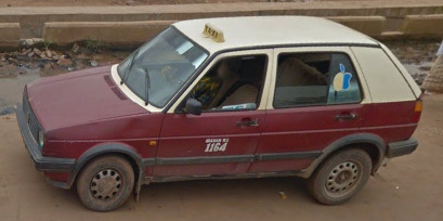
Google car:
Botswana, like most of the Southern Africa region, has the back of the vehicle visible. It is important to note that you will not always see the car, but that it is still visible from time to time!
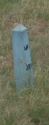
Bollard:
This bollard is pretty rare, and its usually located about 10 meters off the road.
This bollard is a triangle shape and is about 5 meters from the road. It usually has the KM located on the side. Its found closer to the major cities.
This blueish bollard was found in the city of Gabane, south west of Gaborone.
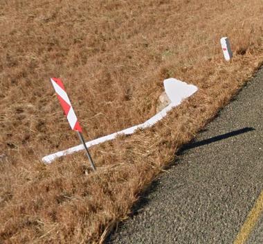
You find these reflectors and bollards near drainage ditches across the country. Sometimes its two signs (the red and white arrow).
Google Coverage:
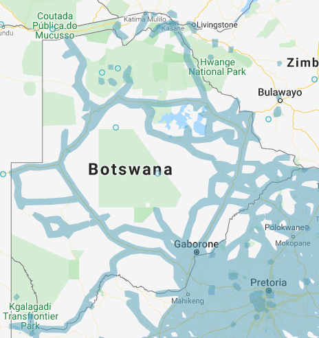
There is a lot of open space in Botswana. If you keep to the main roads (A1, A2 and A3) you should be fine. There is coverage off of these roads, however.
Unique Vehicle:
Like most of the African Continent, we have these vans. They don’t seem to have a pattern, but some have a yellow stripe on the bottom portion of the sides.
Camera Generation:
Gen 3
Road Lines:
Like most of the Southern Africa region, Botswana has yellow shoulder lines and a white middle line. There is also the chance for the triple white middle line (Like seen in Eswatini).
Road Signs:
These road signs look very similar to other countries in this area. The important thing to look for is the letter that is before the number. Botswana uses the letter A, which separates it from South Africa and Eswatini (But not Lesotho). However, The color Green with the letter A is entirely unique!
There are also plenty of signs that have a yellow and black pattern. These are located in / near the major cities. You can also find the curbs following a similar pattern across the country.
Electricity poles:
License plates:
Phone number:
These numbers are pretty unique, with the first 2 digits being super important. You can find out why by looking at the image below.
This was taken directly from Wikipedia, but displays why the first two numbers are really important. +267 is the international calling code into Botswana, so keep an eye out for that as well.
Vegetation/Landscape:
Architecture:
There seems to be a lot of Brick houses, as well as these plaster houses.
General look:
Alphabet/script:
There are two official languages of Botswana. English and Tswana. However, English is the official written language, meaning all signs will be English.
Domain:
.bw
Nigeria
- Country Flag
- Capital City
- Most Helpful
- Google Car
- Follow Car
- Google Coverage
- Unique Vehicle
- Unique Taxi Color’s
- Camera Generation
- Road Lines
- Road Signs
- Street Sign Meta
- Electricity Poles
- License Plates
- Phone Number
- Vegetation / Landscape
- Architecture
- General Look
- Domain
- Language
Country flag:

Capital City:
Abuja
Most Helpful:
The Google car or the follow car is the most useful. Learning the Meta here is very useful.
There is a chance to not get a car with bars.
This tan car seems to be found near the Lagos area, and the surrounding suburbs. It can also be found East of Benin City.
This Black follow car seems to be in the Benin City area. It has been spotted in Lagos however.
You can find a red follow car in Benin City as well as some parts of Lagos.
The Silver car is found in and around Lagos.
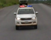
(Red on the left)
When the Red on the Police light is on the left of the image, it tends to be South in Nigeria.
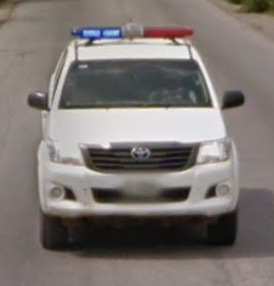
(Red on the Right)
When the Red on the Police light is on the right of the image, it tends to be North around Abuja.
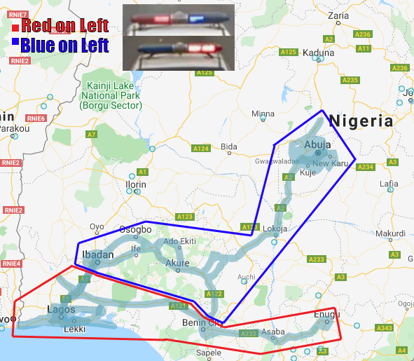
The police car can be found pretty much everywhere. However, the police lights on the top can change based on region.
Google Car:
Nigeria has a google car which has bars, with different variants:
There is also a chance you can find no bars on the car in Nigeria. Your best bet would be to look for a follow car and the roof rack.
(Front)
(Back)
Follow Car:
What makes it very easily recognizable, is that you are almost always escorted by a Toyota SUV or Police car behind the google car.
This tan car seems to be found near the Lagos area, and the surrounding suburbs. It can also be found East of Benin City.
This Black follow car seems to be in the Benin City area. It has been spotted in Lagos however.
You can find a red follow car in Benin City as well as some parts of Lagos.
The Silver car is found in and around Lagos.
(Red on the left)
When the Red on the Police light is on the left of the image, it tends to be South in Nigeria.
(Red on the Right)
When the Red on the Police light is on the right of the image, it tends to be North around Abuja.
The police car can be found pretty much everywhere. However, the police lights on the top can change based on region.
Google Coverage:
There is extremely limited coverage in Nigeria. Its mostly on some major roads or in some of the major cities.
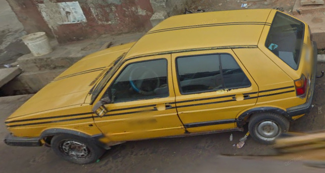
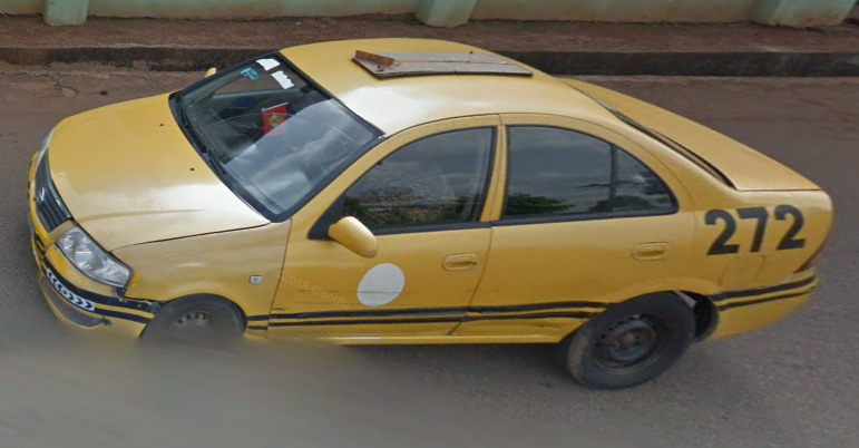
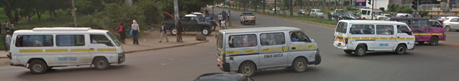
Unique Vehicle:
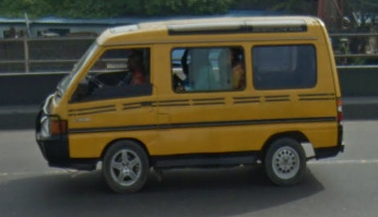
These Taxi’s look like the other ones in Central Africa, but there is no pattern on the side like Uganda or Kenya.
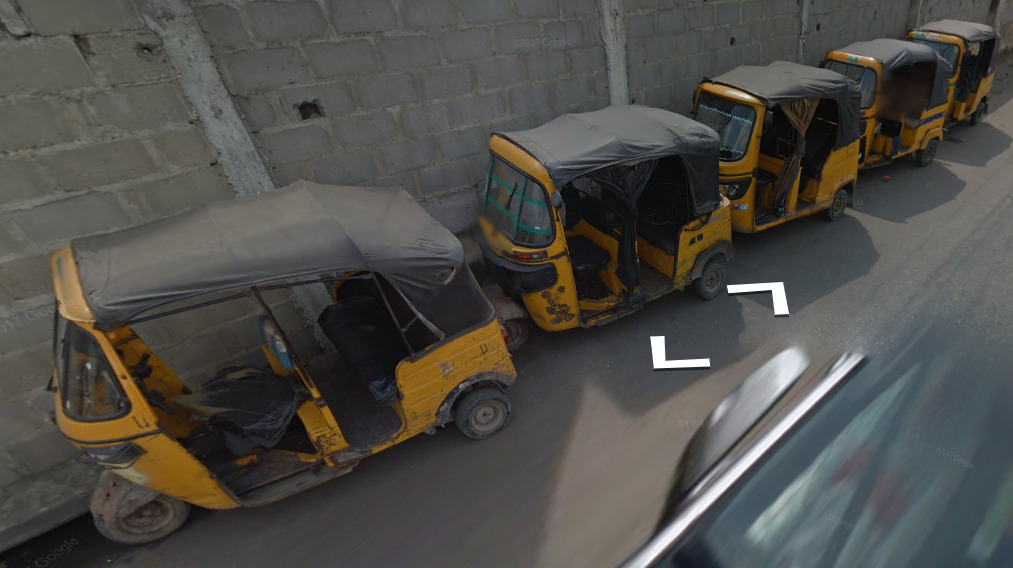
You can also find these rickshaw’s nearly everywhere in major cities.
Unique Taxi Color’s:
You can tell which city you’re in based on the colors and patterns of the taxi. They are generally unique in the coverage here.
Lagos uses a yellow car with two black stripes on the sides. The black stripes tend to be closer towards the windows here, unlike, Enugu.
Abuja uses a Green taxi that sometimes will have white stripes along the sides. Most of the time, however, they do not have a stripe.
Asaba uses a Blue and white taxi. There is no coverage of the town, but you do pass through the area and can see the taxis while nearby.
Enugu uses a yellow car with two black stripes. The stripes appear to be lower than in Lagos, and are closer to the wheel wells than other places.
Ibadan uses a Burnt red / brown and yellow taxi. The bottom half is the burnt red / brown while the top half is yellow.
Camera Generation:
Gen 3
Road Lines:
Nigeria mostly uses all white road lines, sometimes with a solid divider and sometimes with a dashed divider.
There is also a chance to find yellow shoulders, although it is definitely rare.
Road Signs:
These arrow like signs are unique and can only be found in Abuja.
While these are not signs, some of their concrete dividers are painted Green and White like their flag. This is not all of the concrete barriers however.
Street Sign Meta:
The newest Meta discovered in Nigeria involves the SHAPE and COLOR of the street signs. I do want to state that Street Signs are not that common in Nigeria, but that it can be used when you do find a sign. Also, this should be used in combination with the follow car meta. That can help you pinpoint a generic region before starting to guess.
![]()
Abuja uses an arrow that has a border around it. While other arrows have been seen, they are not as common as the ones found in Abjua (See Benin City). There are multiple colors of arrows in Abuja, but there doesn’t seem to be any reasoning behind it.
Ibadan uses a squared sign, often near the bottom of the ground. There are different colors, but no method to which color is found where. If you do find a street sign on a post, it will be a red rectangle with some white letters. Its not that common, but you can definitely find examples of it in the town.
Enugu uses multiple colors, with no real method to the madness. There are more colors than listed above, and the sides of the signs seem to have a border as well, something not really found in the other towns. These are only a small sample of the colors that can be found in the town and surrounding suburbs. The best thing to do is recognize the follow car and then look for the street signs here. Nearly every color can be found.
![]()
![]()
Benin City is a bit of an outlier. You can find some arrows like the ones in Abuja, but they mostly appear to be rusted. You can also find some rectangular signs, also super rusty or with some darkish brown/black color to them. There are lighter options of these signs as well, including Yellow, Green, White and Blue.
The Lagos Area has a few different versions, with the city of Lagos containing nearly every color.
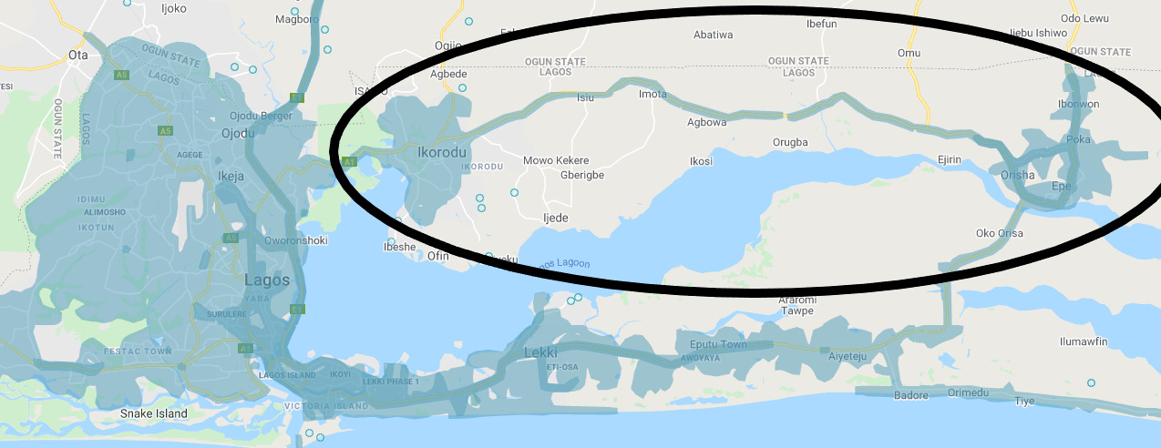
Epe and Ikorodu use a Black sign with white lettering.
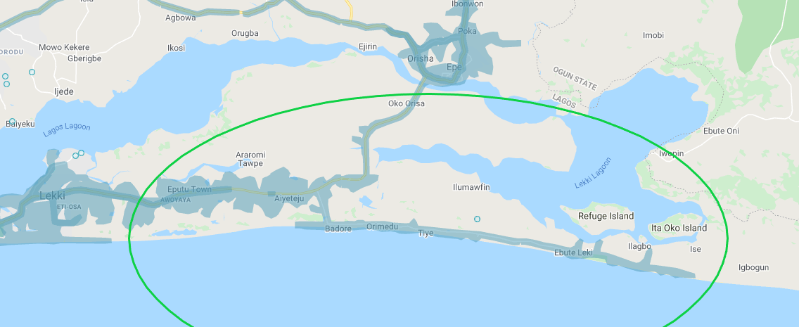
Eputu Town, Ebute Leki and Aiyeteju (and a little town east of Aiyeteju) use a Green sign with white text.
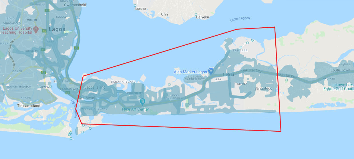
Lekki, Ikoyi and Victoria Island Uses a Red sign with white text.
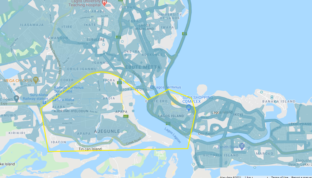
Lagos Island uses a Greenish black sign with yellow text. This also extends to Ajegunle.
Badagry and Magbon use a blue sign with white text.
The Town east of Morogbo, Ikeji, Oba Akran, Idi Mangoro, Magbon (The Suburb of Lagos, not the town itself), Volkswagen and Ojo use a Green Sign with White text. There are no maps here as the suburbs are not all near each other. Just know that you can find the suburbs if you zoom in on the map while looking.
Festac Town, Yaba, Olowora, Ikosi Ketu, Ketu and Satellite Town use the red sign with the white text.
Ijora, Badia and Ajegunle-Ifelodun use a black sign with Yellow lettering.
Orile-Iganmu, Itare, Ikate, Iganmu, Ijegun, Ikotun, Alimosho, Idimu, Ayobo, Ipaja, Alagbado, Alakuko, Egbeda, Shasha, Iyana and Idi Araba use a Blue sign white White text.
Somolu and Akoka, Ojokoro, Ifako-Ijaiye and Aguda use a black sign with white text.
Electricity poles:
You can find these “broken” poles quite frequently in Nigeria.

License plates:
There seems to be a nice green blur when seeing the license plates in Geoguessr.
Phone number:
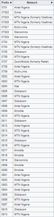
You can find mobile numbers nearly everywhere. They are not region specific however.
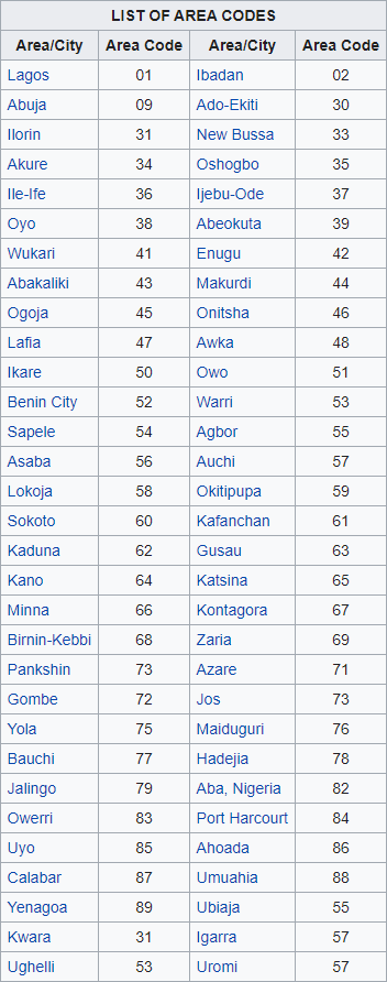
Finding an area code is extremely rare, but it might be worth knowing the cities that have coverage just in case.
This is a shot from Abuja. The 09 area code doesn’t really look much different from the 09xx mobile area codes. Its just the length of the phone number itself that gives it away.
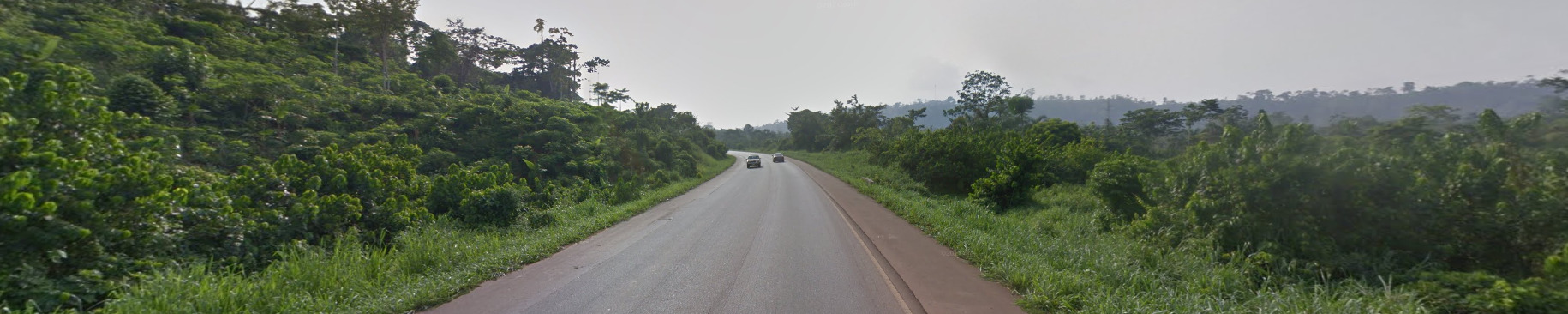
Vegetation/Landscape:
Nigeria is generally flat, however you can find hills around the Abuja area. Its the only place that has a real elevation change in Googles current street view.
Architecture:
Nigeria has a lot of Gas Stations. Ibadan has so many, it’s almost become a meme.
General Look:
This is the north of the country. Its rather dry and open. You can also find some hills around the Abuja area.
The middle of the country has this damper feel
The South of the country is generally more tropical. It tends to have palm trees and other tropical foliage.
Domain:
.ng
Language:
Nigeria uses the English Language for most of its official signs. There are other native languages, but you wont see them on street view
Ghana
- Country Flag
- Capital City
- Most Helpful
- Google Car
- Rare Car
- Bollards
- Google Coverage
- Unique Vehicle
- Camera Generation
- Road Lines
- Road Signs
- Electricity Poles
- License Plates
- Phone Number
- Vegetation / Landscape
- Architecture
- General Look
- Domain
- Language
Country flag:
Capital City:
Accra
Most Helpful:
The Front Right roof-rack bar has black duct tape on it. There is only one other country / territory that has tape on the bar. Learning the tape meta can help you figure out that you’re in Ghana.
Google car:
Ghana is extremely easy to recognize because on the Google car which has bars on the roof, one of the four bars has a black duct tape:
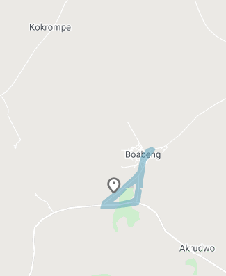
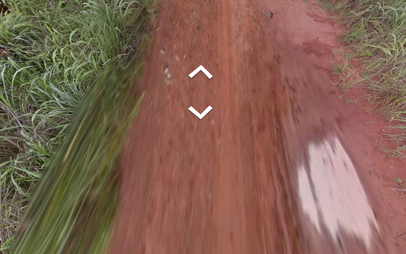
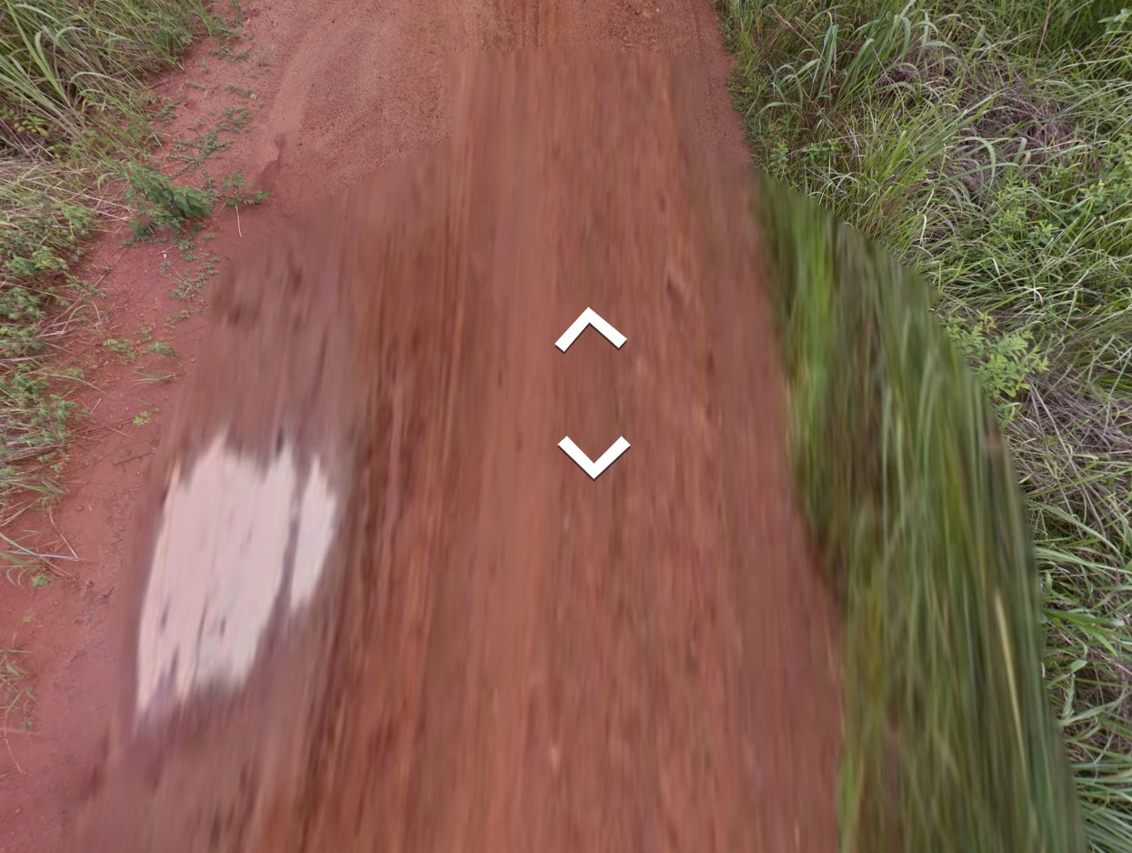
Rare Car:
(Front)
(Back)
There is a rare “tape-less” Ghana. It can only be found in the town of Boabeng. Its located near the middle of the country. You can sometimes see a small piece of their side mirror on the right hand side.
Bollard:
These KM markers can sometimes be found around Ghana. They will point to some town names, but the text is too small for you to be able to realistically read.
You can also sometimes find these red and white stripped poles around. They are not common, but can be seen occasionally
There is also a chance you can find bollards straight out of the UK.
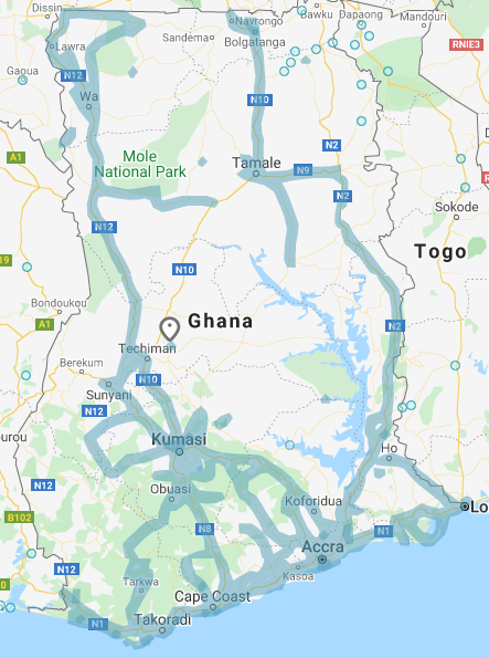
Google Coverage:
There are not a lot of roads covered in Ghana. Stick to the main roads and you should be fine.
Unique Vehicles:
You can find the same vans as most of Central Africa. However, the first taxi seems to be a bit more common.
Camera Generation:
Gen 3
Road Lines:
Most of Ghana uses a white divider, whether dashed or solid. There is a chance to find white shoulder lines, but these are usually closer to cities and towns, and not as common out in the rural areas.
There is also a chance that there will be no visible road markings at all, or that you will end up on a dirt road.
Road Signs:
Electricity poles:
License plates:
Ghana uses white and yellow plates. They’re short plates, so its often easy to use to your advantage.
Phone number:
You can find both Mobile and regular phone numbers. The area codes have changed within the past 20 years, so there is a chance you can find a number that doesn’t fit this setup.
Vegetation/Landscape:
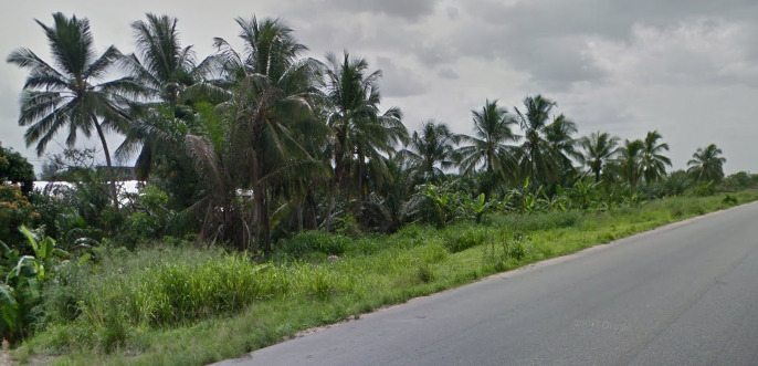
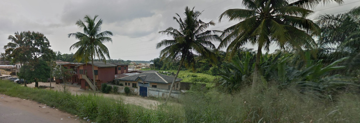
Ghana has some tropical sections to it, with the south having more palm trees than the north.
There is a chance for you to see mountains as well, mostly towards the middle of the country.
Architecture:
The architecture in Ghana is similar to most of the other Central African countries. You can find some interesting religious sites, and those seem to be a bit different.
General Look:
You can find this reddish soil to the middle / east of Ghana. Its close to the border of Togo.
You can find this near the south of Ghana. It feels very green and can be a good sign.
This is the North of the Country. It is definitely a bit more dry than the others.
Domain:
.gh
Language:
Ghana uses the English Language on all of their signs.
Senegal
- Country Flag
- Capital City
- Most Helpful
- Google Car
- Rare Car
- Bollards
- Google Coverage
- Unique Vehicle
- Camera Generation
- Road Lines
- Road Signs
- Electricity Poles
- License Plates
- Phone Number
- Vegetation / Landscape
- Architecture
- General Look
- Language
- Domain
Country Flag:
Capital City:
Dakar
Most Helpful:
Senegal has what the community calls “Rifts” located all around. They are clearly visible in the majority of the locations, but “rift less” locations are possible, mostly in Dakar. Try moving to see if you can find some rifts to confirm it is Senegal.
The new update has introduced a few new cars located around Senegal. This has also removed some of the “rifts” that were common in Senegal, but can still sometimes be found.
Google Car:
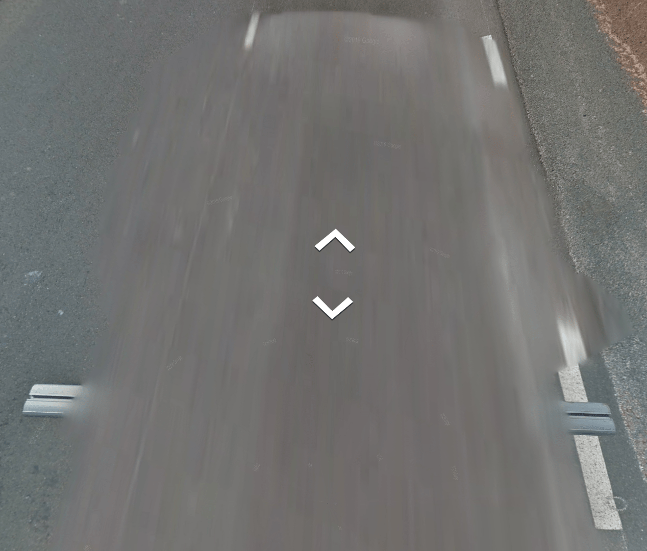
(Front)
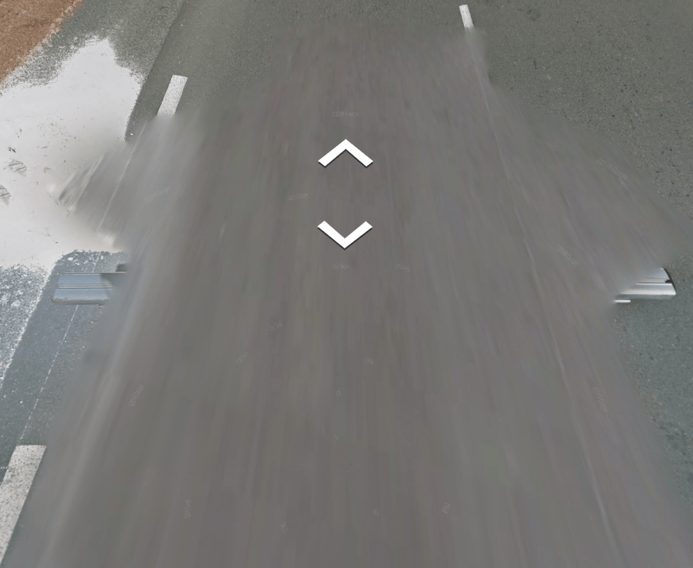
(Back)
The car has a roof rack, but with no distinguishing features directly located on the rack itself. You are more likely to see the front of the car (The hood or bonnet) in Dakar than anywhere else.
The new update has introduced a few new cars located around Senegal. This has also removed some of the “rifts” that were common in Senegal, but can still sometimes be found.
Rare Car:
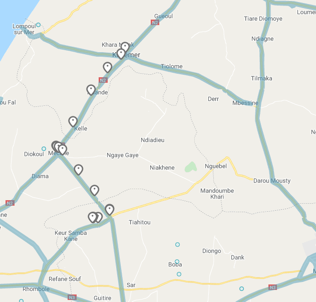
The rare car found in Senegal has a red stick on one side of the vehicle. It follows N2 from Kebemer down to the town of Meckhe. It then takes R32 south to Baba Garage. From there, it heads south west and ends on a curve along the road.
Bollards:
Bollards are rare in Senegal, and due to that there are a few varieties. While there may be a pattern, I couldn’t figure it out. Ill post what road these bollards were found on in case that helps.
Found off of R-1
Found off of R-2
Most of these bollards are located near drainage areas or curves. They’re not marked on the sides of the roads anywhere else, unlike the marker below.
These bollards seem to be around some curves in the South East of the Country.
These have towns located, as well as distances. They may be tough to see, but they are extremely helpful.
Google Coverage:
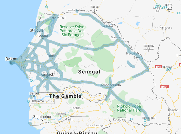
Most of the coverage in Senegal exists along major roads and in the towns along those roads. There is no coverage directly south of The Gambia, but there are a few roads directly east and south east of The Gambia.
There are a few cities worth learning. Mostly because of their size and because not a lot of places have street view. These are:
Dakar
St. Louis
Thies
Diourbel
Touba
Tambacounda
Unique Vehicle:
These taxis seem to have a unique paintjob. It is alternating black and yellow, with orange sometimes being used. There are a few rare examples of the car not having this paintjob, but more often than not, it has a paint job similar to the image.
Touba on the other hand, doesn’t use this paint job. It often features taxis with a solid paint job, often white, black or blue.
>br>
Camera Generation:
Gen 3 and 4
Road Lines:
Pretty typical country road, with dashed white lines marking the center divider as well as the shoulders. There are roads that don’t fit this look, but this is very common.
There are also places where a solid white line can be found, as well as spots that have a double white divider line.
Road Signs:
Electricity poles:
This is the most common, often found along major roads and the smaller roads that have power.
This is the second most common, sometimes found alongside the first pole mentioned above.
License plates:
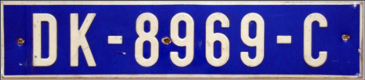
These have been the same license plates for over 20 years. It is a blue plate with white lettering, and the only blue plate in Africa. The DK stands for Dakar and the KD stands for Kolda.
Phone number:
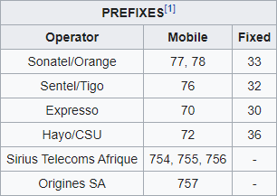
All mobile numbers start with a 7x, while landlines start with a 3x. You will see the numbers like XX – XXX – XX XX. In the image above, the 33 indicates that it is a landline, while the first 8 after that indicates it is in Dakar.
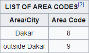
Its also important to note that there are two area codes. The number 8 Exists within Dakar, while 9 is used everywhere else.
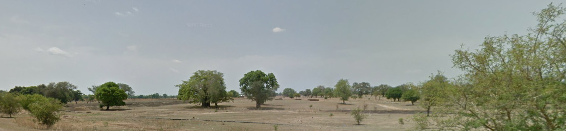
Vegetation/Landscape:
Architecture:
General look:
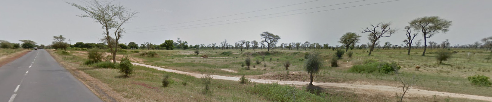
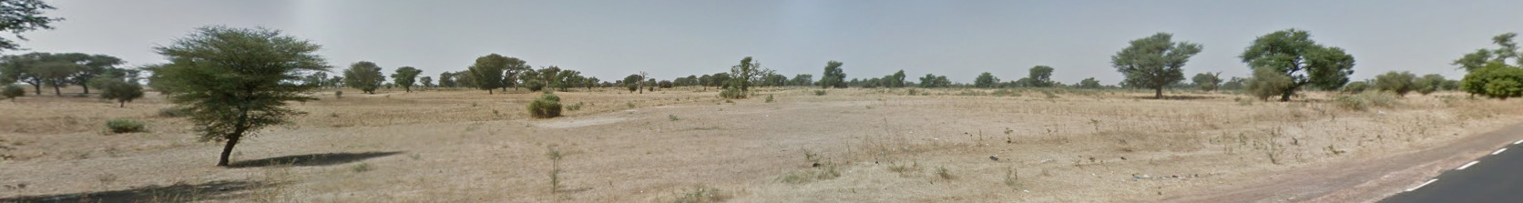
Notice the Rifts and the road markings. If you don’t end up in a town or a city, this is a good general look of Senegal.
Alphabet/script:

Senegal uses your typical French alphabet for the majority of all road signs. There are 36 languages in Senegal, but these languages are not represented well on street view.
Domain:
.sn
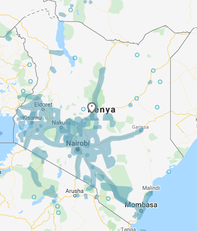
Kenya
- Country Flag
- Capital City
- Most Helpful
- Google Car
- Follow Car
- Rare Car
- Bollards
- Google Coverage
- Camera Generation
- Road Lines
- Road Signs
- Electricity Poles
- License Plates
- Phone Number
- Vegetation / Landscape
- Unique Vehicle
- Architecture
- General Look
- Language
- Domain
Country Flag:
Capital City:
Nairobi
Most Helpful:
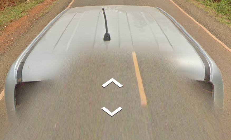
With the late Autumn 2022 update, Kenya received new coverage. There is a SLIGHT chance you can still find the old cars around Kenya, but most of the coverage is now Gen 4 and the cars you can see here.
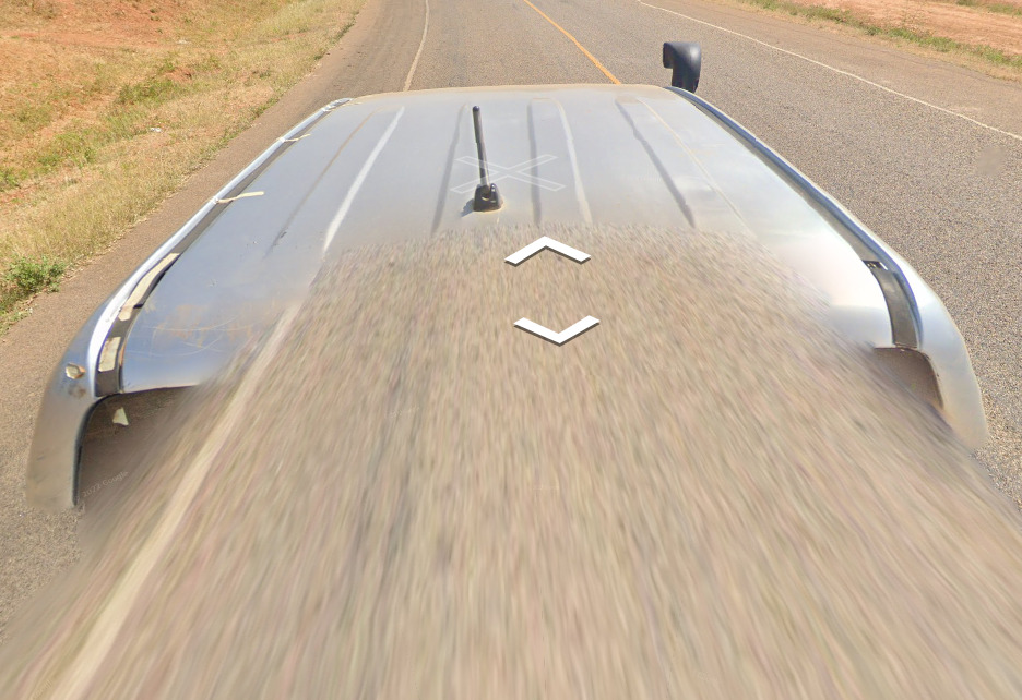
It appears the mirror car didn’t make an appearance during the new update, but the Snorkel car did.
Google Car:
NEW GOOGLE COVERAGE / CAR
With the late Autumn 2022 update, Kenya received new coverage. There is a SLIGHT chance you can still find the old cars around Kenya, but most of the coverage is now Gen 4 and the cars you can see here.
It appears the mirror car didn’t make an appearance during the new update, but the Snorkel car did.
OLD GOOGLE COVERAGE / CAR
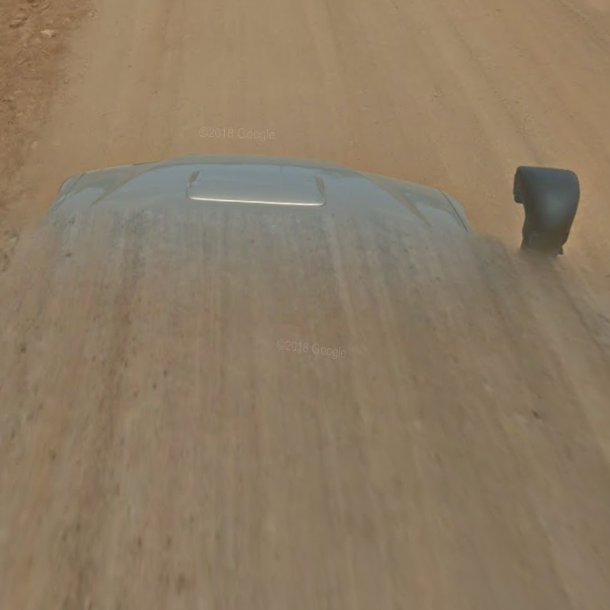
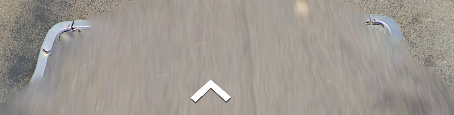
This is the snorkel car. It is very easy to distinguish from other cars.
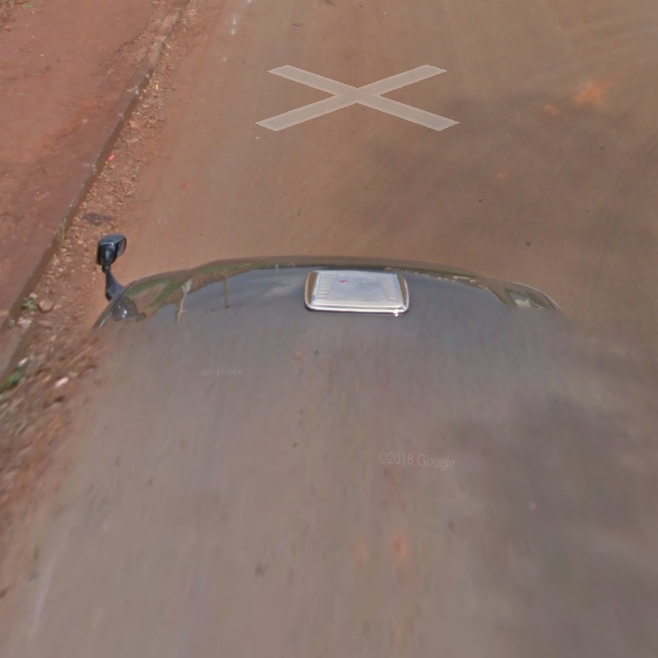
This is the mirror car. It is a black car with a mirror on the front left of the car.
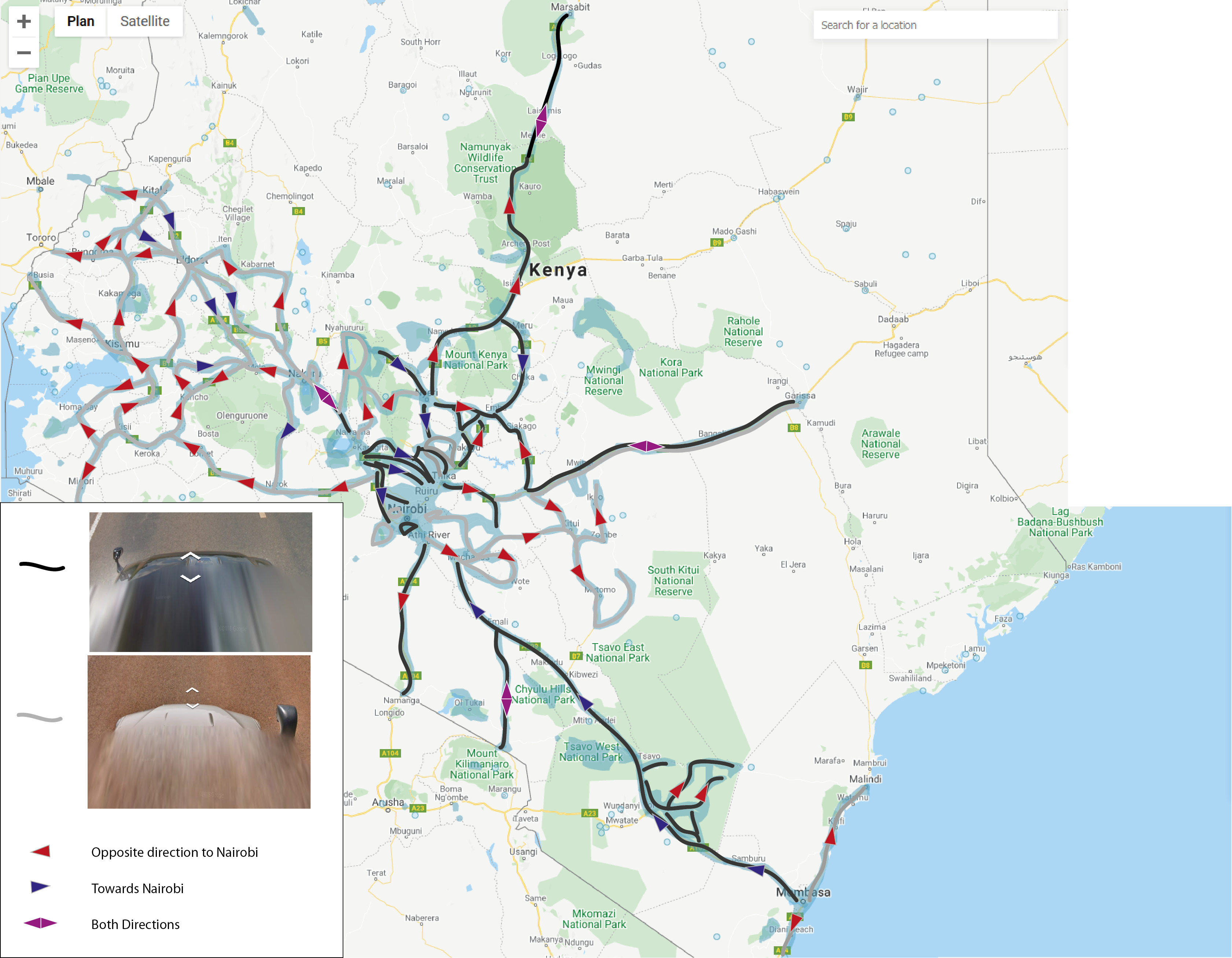
This map shows the direction and the location each car went and traveled.
Follow Car:
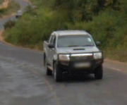
There is a toyota that follows you in most of Kenya. However, there are plenty of other clues that can help you find out its Kenya.
With the Autumn update, it seems the follow car is still active, but can be missing in some more urban areas.
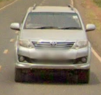
Rare Car:
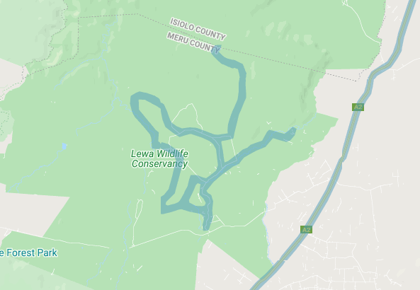
There is a rare car in the Lewa Wildlife Conservancy. This is the first official coverage Kenya ever got.
(Front)
(Back)
The car itself feels very square, almost like a safari vehicle. It has an off-white / eggshell colored roof rack and it sits on the bed of a truck.
Bollards:
This is a KM marker.
These bollards were found in Nairobi. They seem to be near intersections and have a black and white striped pattern. They did not seem to exist outside of large cities / towns.
These bollards were found in Mombassa. There were also some black and white bollards around, although not as common.
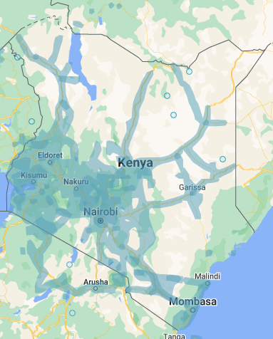
Google Coverage:
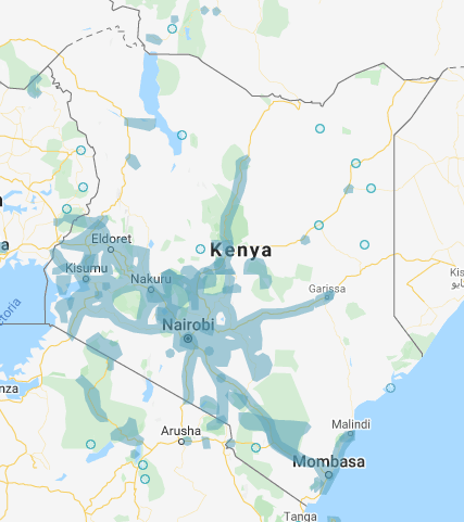
^OLD COVERAGE ^
^NEW COVERAGE ^
Most of the coverage in Kenya is located near the South of the Country.
Camera Generation:
Gen 3 and 4
Road Lines:
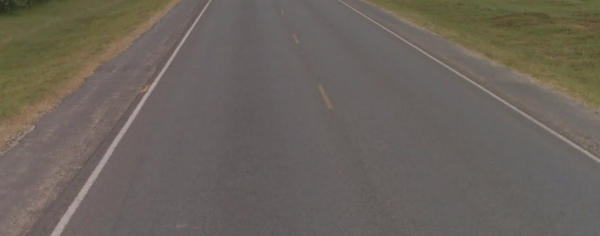
Kenya uses a yellow center divider line, often times dashed or solid.
Road Signs:
(Front)
(Back)
Electricity poles:
License plates:
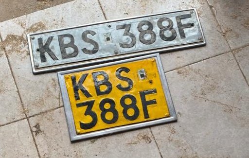
Kenya uses a long white plate in the front, and a short stubby yellow plate in the back. The Image used is of old plates, the newer white plates contain 3 letters followed by 3 numbers and then another letter at the end.
Phone number:
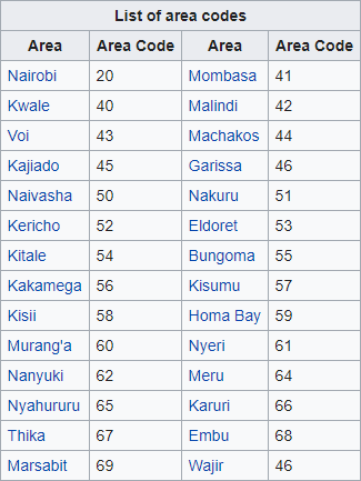
Area codes in Kenya can sometimes be useful, however you will mostly find cell phone area codes. They start with either 10x, 11x, or 7xx.
This shows both the area code from Nairobi and a cell phone number.
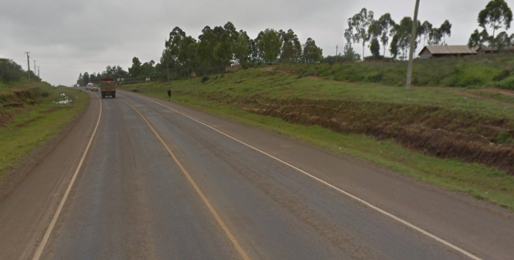
Vegetation/Landscape:
You can find a lot of palm trees in the south of Kenya near the coast.
Unique Vehicles:
These vans look very similar to the ones in Uganda, however the pattern on the sides is different. You can find the same style of van, and generally the same pattern on the sides. The colors can be anything and everything.
Architecture:
Kenya uses a lot of metal for their roofs. A lot of them are rusty and stand out from a distance.
You can find a lot of these plaster / brick looking buildings around. They look like a style used in the old west USA.
General look:
This is the general feel of most of Kenya. The orangish soil is a good sign, mixed in with the car (which isnt in the shot).
This is the general feel of the Mombassa region. You can see the palm trees and the sandy soil on the sides of the road.
This is the western area of Kenya. There is a lake in this area, and it feels pretty hilly.
Alphabet/script:
Kenya has two official languages, English and Swahili. You will find English most commonly on signs and buildings.
Domain:
.ke
Uganda
- Country Flag
- Capital City
- Most Helpful
- Google Car
- Rare Car
- Google Coverage
- Unique Vehicle
- Camera Generation
- Road Lines
- Road / Street Signs
- Electricity Poles
- License Plates
- Phone Number
- Vegetation / Landscape
- Architecture
- Domain
Country flag:
Capital City:
Kampala
Most Helpful:
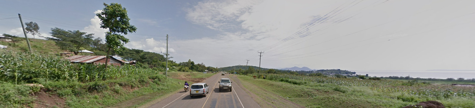
The most useful piece of information in Uganda is the Google Car. This is the most common car, and can only be found between Kampala and Entebee. There are some Rare cars worth learning too.
Where there is coverage in Uganda should also allow you to get 4000+ points every time you end up in Uganda.
Google car:
This is one of the easiest places to recognize based only on the car. Its one of the few countries where you can see the front of the car!
Rare Google cars:
On most images, you can see the front of the car. It has a black bull / push bar, and varying amounts of it can be seen.
You can also find carless Uganda, and the blur of the vehicle looks like Gen 2, even though it is Gen 3 and you don’t have the top halo.
This is the front of the car. It has a square section near the middle of the image.
The back of this car comes to a point in the middle.
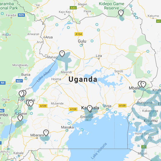
Google Coverage:
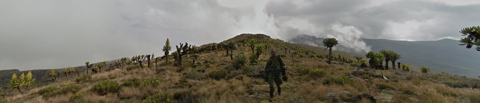
Uganda has a lot of limited coverage. Most of it is near the capital of Kampala. There are some scattered places with either car coverage or trekker coverage. The reddit famous “Guy with an AK-47” is a trekker location in Uganda.
If there is a pin, there is official coverage. There is one pin per area. A lot of the coverage is national parks or nature reserves.
Unique Vehicle:
Uganda has these vans that they use as taxi’s. They can be different colors, but the white and the light blue seem to be the most common. Regardless, the pattern that appears midway through the car can be found on nearly all of them, and can be seen on busses around the city. There are other companies that appear to use these vans without the pattern.
Camera Generation:
Gen 3
Road Lines:
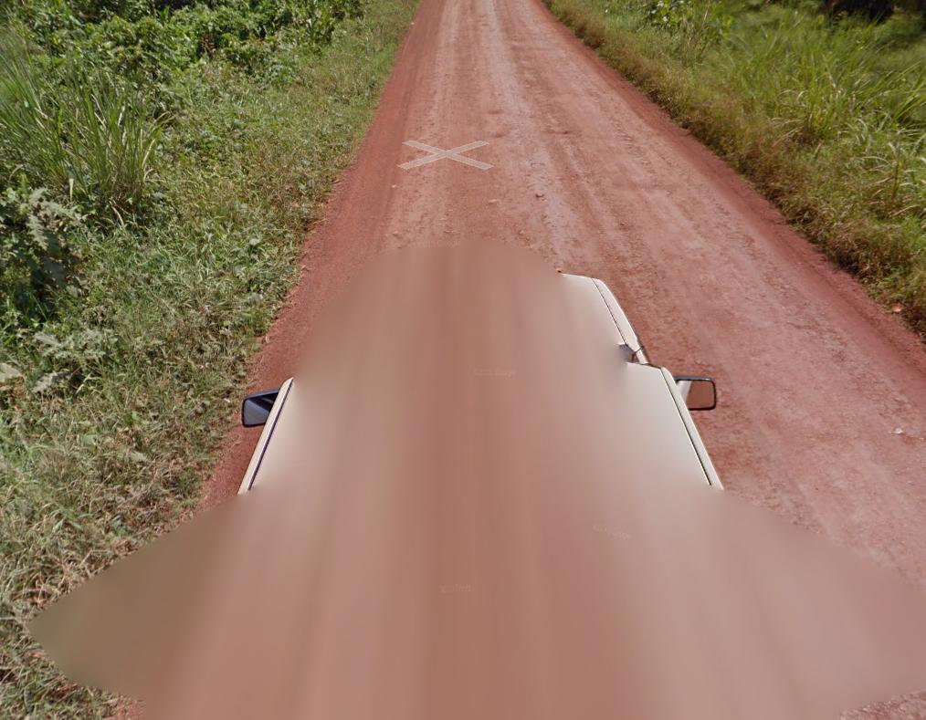
Road lines are not common in Uganda, but will be all white if you do find them. The only paved roads in Uganda are in the Kampala – Entebee region.
Road / Street Signs:
Some of the colors in Uganda are definitely unique, and most signs can only be found in the Kampala – Entebee region.
Backs of the street signs have plenty of fasteners and two bars to connect the fasteners too.
There are a few rail lines in Uganda, and their signage indicating it is very easy to spot.
Electricity poles:
There are two varieties of poles in Uganda. They’re both wooden poles, but contain slight differences. One pole has a strip with 3 voltage relays, while the other pole has a metal circle near the top. You can generally find both in Kampala and the surrounding area.
You can also find this Double pole. It is found near the main roads of Kampala.
There seem to be a lot of ads on Light poles near major intersections. A lot of them have to do with Sexuality and health care.
You can sometimes find traffic lights in Uganda. Most of the time, there will be a Traffic Police officer nearby as well.
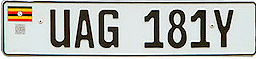
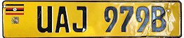
License plates:
Uganda uses white front and yellow rear plates.
Phone number:
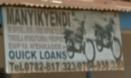
This is how the numbers generally look in Uganda.
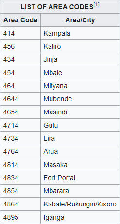
These are the area codes for Uganda, but not all of them are important. Try and focus on Kampala mainly.
Vegetation/Landscape:
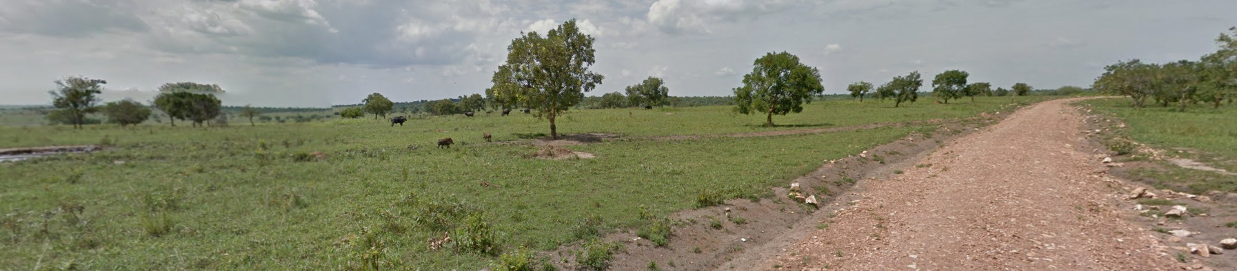
Uganda has very reddish / orange soil, however there are places where it can be darker. There are also plenty of regions that are picturesque safari locations. The car in Uganda is incredibly useful.
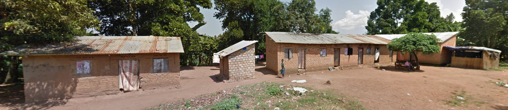
Architecture:
There are a variety of houses all around Uganda, and these are just some examples of them. Check back to the Most Useful section at the top for the most important tips and tricks.
Domain:
.ug
Tanzania
- Country Flag
- Capital City
- Most Helpful
- Google Car
- Google Coverage
- Camera Generation
- Vegetation / Landscape
- General Look
- Domain
Country Flag:
Capital City:
Dodoma
Most Helpful:
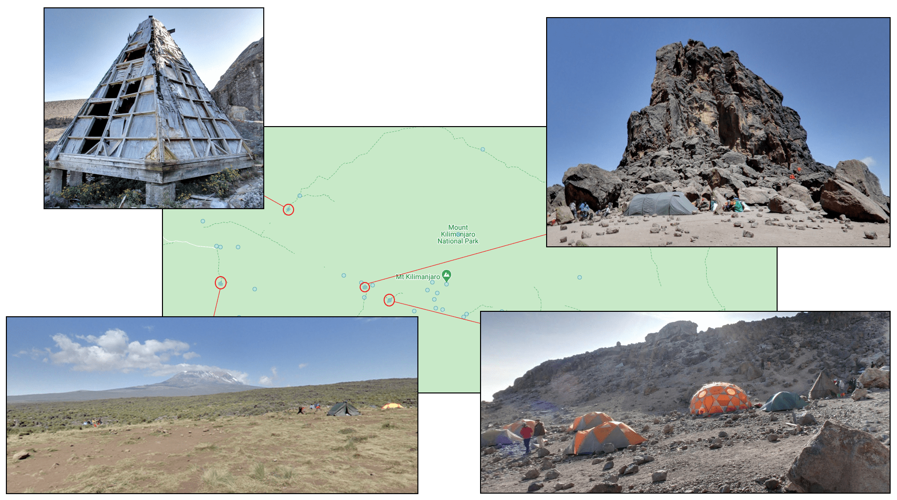
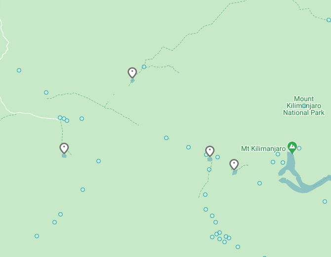
As the other areas in Tanzania are impossible to pinpoint, knowing the Mt. Kilimanjaro area is important. There is a chance to find places around this mountain as it is a noticeable feature.
Google Car:
Tanzania has trekker coverage and doesn’t have a vehicle. You may occasionally see their shadow, but you are clearly places where cars cant go. There also is really limited coverage. You can see those examples below.
Google Coverage:
(North East Coverage)
(West Coverage)
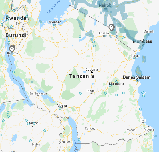
There isnt much coverage in Tanzania. Recognizing Mt. Kilimanjaro is essential. However, most map creators tend to stay away from Trekkers in their maps.
Camera Generation:
Gen 3 Trekker
Vegetation/Landscape:
General look:
This is Mount Kilimanjaro. There are a few surrounding areas (Pictured above) that have official coverage. All locations will have Kilimanjaro in the background. Only the areas circled in red have official coverage. The other circles are photospheres!
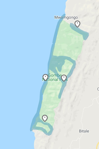
The only other official coverage that exists in Tanzania is the Gombe National Park. It’s near the borders of Burundi along Lake Tanganyika.
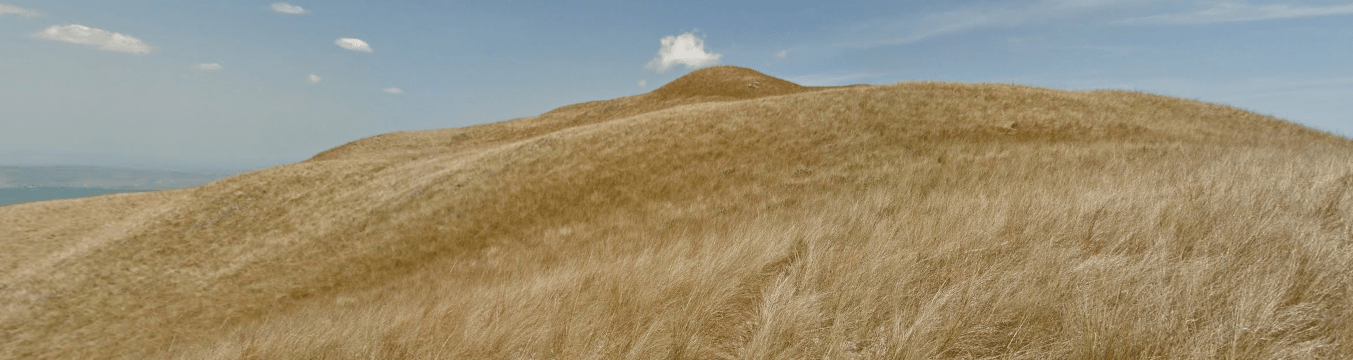
It’s very hilly, and you are usually surrounded by dense foliage. However, there are times where you’re on top of the hills with nothing but beautiful sights or by the coast. An example of one of these is located under the Landscape section!
There is also boat coverage, going the length of the national park listed above. It’s clear you’re on a boat even if you can’t see the boat.
Domain:
.tz
Tunisia
- Country Flag
- Capital City
- Most Helpful
- Google Car
- Follow Car
- Bollards
- Google Coverage
- Camera Generation
- Road Lines
- Road Signs
- Electricity Poles
- License Plates
- Phone Number
- Vegetation / Landscape
- Architecture
- General Look
- Language
- Domain
Country Flag:
Capital City:
Tunis
Most Helpful:
Tunisia has a follow car (and is almost always seen). There are a few of these cars and they have a clear divider between North and South at Hammamet Sud. That general area has both cars, often one car going north and the other going south.
This lighter colored car is often found North of Hammamet Sud, and will be found on the North Bound lanes towards Tunis
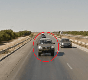
The darker colored car can be found South of Hammamet Sud. It often is found on the South Bound lanes towards Sfax.
Please be aware that the car CAN BE in front of the google car. It will still look like the pictures above.
The Island of Djerba is unique in that it doesnt have an official follow car, however you may run into a cop car (although it is a sedan). The cop car itself is not that common, but it does exist and can often be seen with its lights on.
Tunisia uses very French road markings. That includes a white divider, often dashed or solid, with white dashed shoulder lines.
There is a rare chance to find a double yellow line. They seem to mainly be in some of the major cities.
Tunisia uses a red and white curb in most of their major cities. Its either freshly painted or faded.
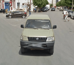
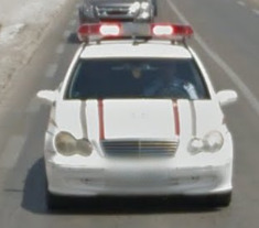
Google Car:
There is a short and stubby antenna on the back of the Tunisian car.
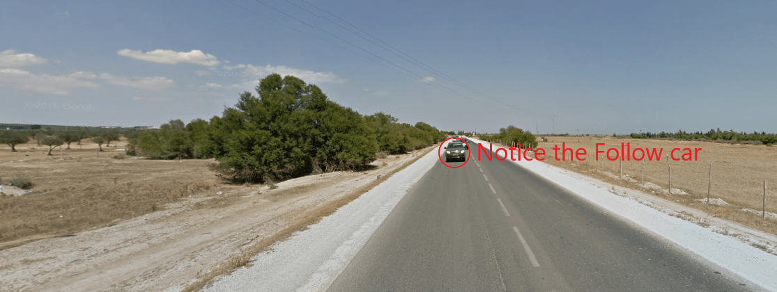
Follow Car:
Tunisia has a follow car (and is almost always seen). There are a few of these cars and they have a clear divider between North and South at Hammamet Sud. That general area has both cars, often one car going north and the other going south.
This lighter colored car is often found North of Hammamet Sud, and will be found on the North Bound lanes towards Tunis
The darker colored car can be found South of Hammamet Sud. It often is found on the South Bound lanes towards Sfax.
Please be aware that the car CAN BE in front of the google car. It will still look like the pictures above.
The Island of Djerba is unique in that it doesnt have an official follow car, however you may run into a cop car (although it is a sedan). The cop car itself is not that common, but it does exist and can often be seen with its lights on.
Bollard:
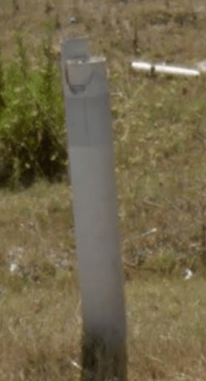
You dont see bollards too often, but they are around some corners and some drainage areas. They look super French.
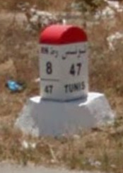
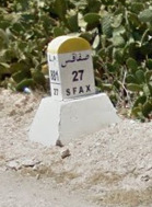
These KM markers can be found on the sides of the major roads. They often point to large cities, and will have the road number on the sides. They can also be found in Red or Yellow.
Google Coverage:
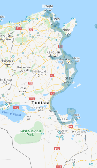
A super important detail is that ALL of the official coverage exists on the eastern coast between Bizerte and Djerba. The only place that isnt on the coast is Kairouan along P12.
Camera Generation:
Gen 3
Road Lines:
Tunisia uses very French road markings. That includes a white divider, often dashed or solid, with white dashed shoulder lines.
There is a rare chance to find a double yellow line. They seem to mainly be in some of the major cities.
Tunisia uses a red and white curb in most of their major cities. Its either freshly painted or faded.
Road Signs:
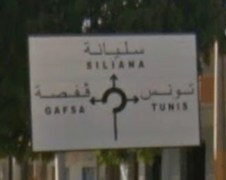
You will always find signs in both French and Arabic. Almost every sign points to Tunis.
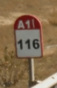
You can also find these road markers along most of the major roads. the 116 is the KM you are currently at, while A1 is the road you are on.
![]()
Electricity poles:
This is the general electricity pole. There is also the single side version of this were only one of the top lights is on the pole.
License plates:
Tunisian plates are black. The follow car usually has a red strip on the left side of the plate (Can be seen on the second image of the car above). The red indicates that the vehicle is used by the police. It is not standard on any civilian vehicle.
Phone number:
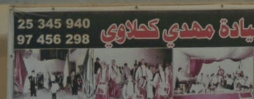
Both numbers shown are mobile numbers. All numbers look like XX-xxx-xxx with the first two being the area code.
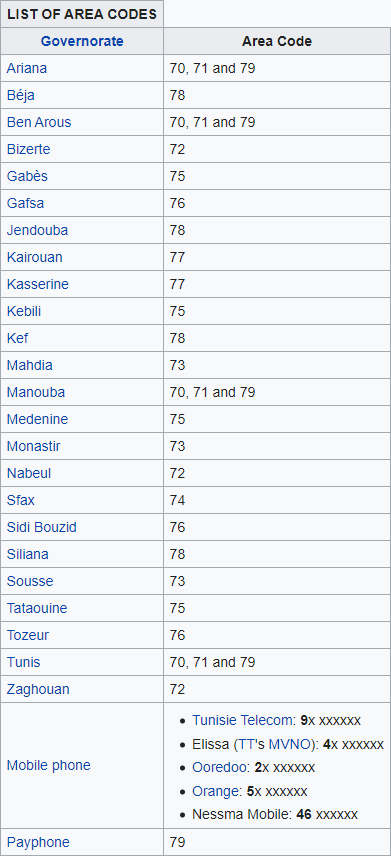
These area codes were taken from Wikipedia, but give a good idea of the numbers to look for.
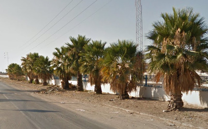
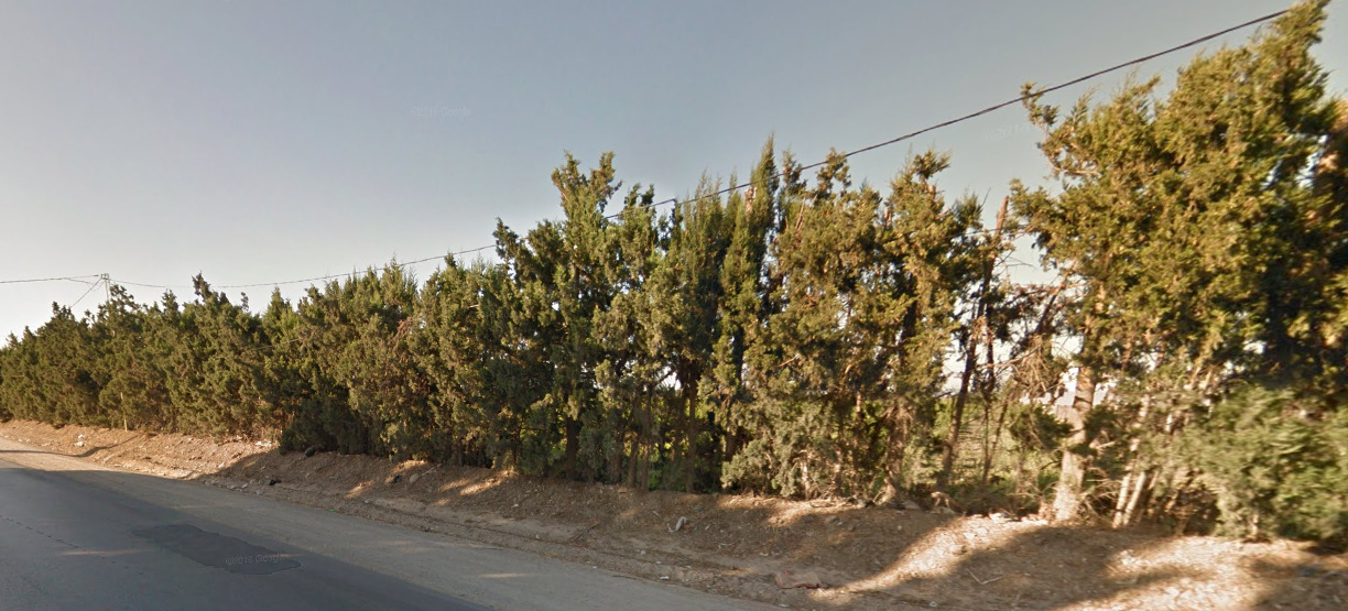
Vegetation/Landscape:
Architecture:
General look:
Alphabet/script:
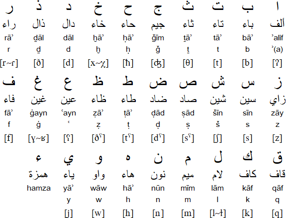
Tunisia uses a typical French alphabet, as well as arabic.
Domain:
.tn
Madagascar
- Country Flag
- Capital City
- Most Helpful
- Google Car
- Rare Car
- Camera Generation
- Electricity Poles
- License Plates
- Phone Number
- Vegetation / Landscape
- Specific Tree
- Architecture
- General Look
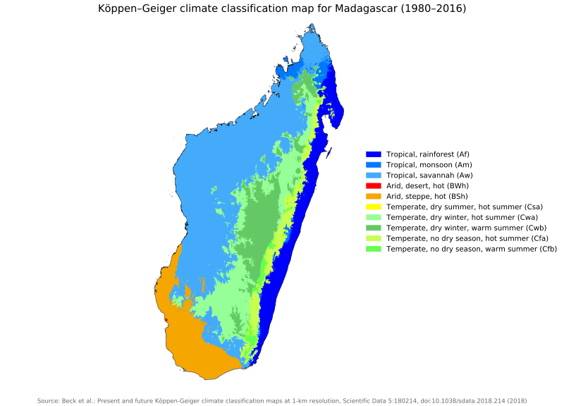
- Climate
- Language
- Domain
Country Flag:
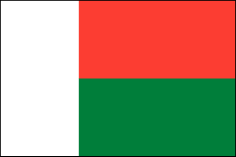
The black border is only on this image to make it easier to see the white section of the flag.
Capital City:
Antananarivo
Most Helpful:
Most map creators don’t like adding Boat or Trekker views into their maps. If you are playing Official maps, you will need to know the boats shown below. If you are playing player made maps, learning the rare cars is more than enough 95% of the time.
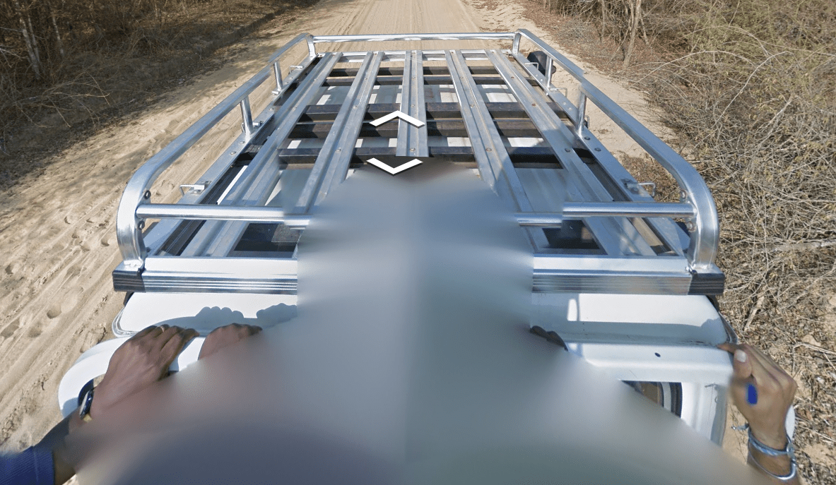
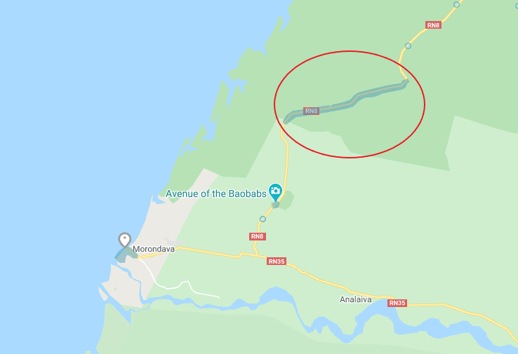
This vehicle is only located on a small stretch of the RN8 road. Its located in the circled image. The first part of the road (The Western Half), the man sitting on the side is wearing a white shirt. It changes about 20% down the road to a guy in a blue shirt.
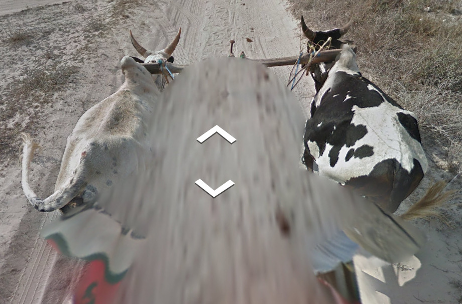
This Ox cart can only be found on a small stretch of land. Its only in the circled section.
Google car (Or other Vehicle):
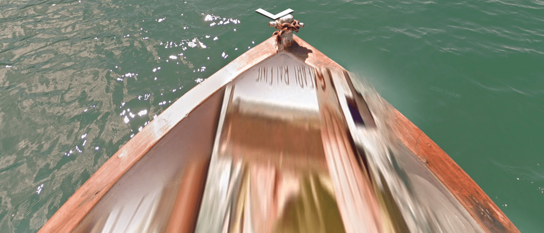
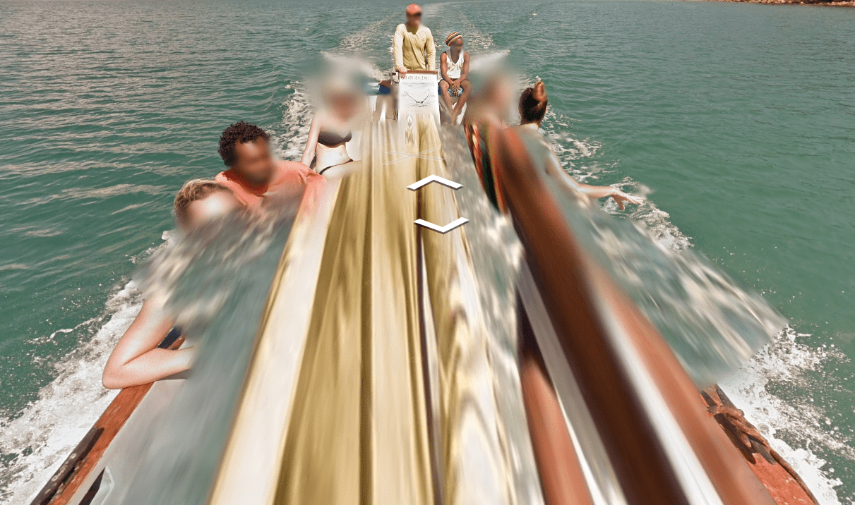
Madagascar uses a Google Trekker, Boats and other vehicles. Each vehicle is unique to a certain area of Madagascar and is mentioned below the pictures.
(Front)
(Back)
This boat is located around the island of Nosy Ambariovato in the North of the country as well as the coast directly to the south of the island.
(Front)
(Back)
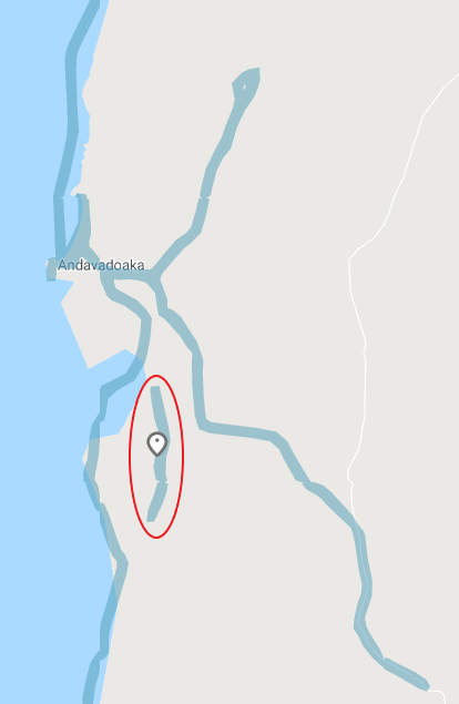
This boat is located around the city of Andavadoaka on the West Coast.
(Front)
(Back)
This boat is located on the Sambirano river, located between Ambolohazo and Ambanja.
(Front)
(Back)
This boat is located off the west coast and covers some unmapped islands. These islands don’t show up on Google Maps. Here is where they are located in the Geoguessr Map Creator.
(Front)
(Back)
This boat is located south of St. Augustin. Its very limited coverage.
Trekker View is located in the towns of Ambanja, Centre-Ville, a path east of St. Augustin, the Reserve du Tsaranoro, the Avenue of the Baobabs, the town of Ambiky and a small area north of Bemaneviky. Some of these areas look different than the others.
This is the view of the path covered west of St. Augustin. It all looks very similar to this picture.
This is the view from the Reserve du Tsaranoro. It has a beautiful view and some mountains around the park.
This is the most common feel to Madagascar. This specific example is from the small coverage north of Bemaneviky.
Rare Car:
This vehicle is only located on a small stretch of the RN8 road. Its located in the circled image. The first part of the road (The Western Half), the man sitting on the side is wearing a white shirt. It changes about 20% down the road to a guy in a blue shirt.
This Ox cart can only be found on a small stretch of land. Its only in the circled section.
Camera Generation:
Gen 3 Trekker, Boat and Car
Electricity poles:
These are located in the larger cities covered by Trekkers. You will not find them in most of the locations covered on Street view.
License plates:
Phone number:
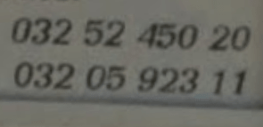
Here are two different mobile numbers, showcasing the format.
This telephone is a landline, however it doesn’t showcase the “020”.
Landline numbers start with 020 while mobile numbers start with 032, 033 or 034. They all follow the format of XXX XX XXX XX.
Vegetation/Landscape:
Specific tree:
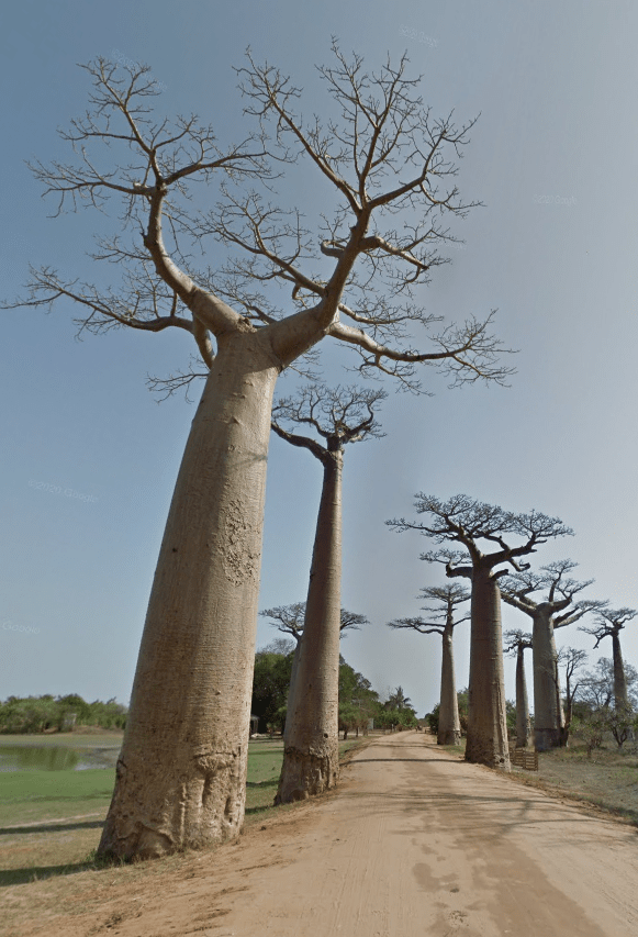
These are called Baobabs, and are unique to a single area of Madagascar.
You can find them on the West Coast east of Morondava on RN8 (Near the place the car coverage is).
Architecture:
General look:
Climate:
Alphabet/script:
Madagascar uses your typical French alphabet as well as the native language Malagasy. However, there were no good examples of the later on street view .
Domain:
.mg
Egypt
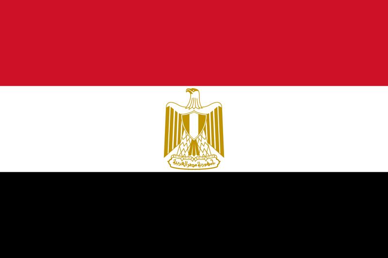
- Country Flag
- Capital City
- Most Helpful
- Google Car
- Google Coverage
- Follow Person
- Camera Generation
- Electricity / Light Poles
- License Plates
- Phone Number
- General Look
- Language
- Domain
Country Flag:
Capital City:
Cairo
Most Helpful:
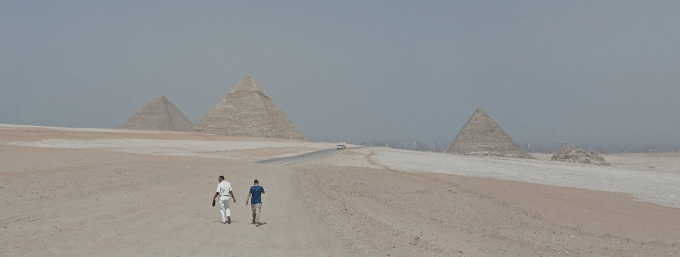
Egypt is really easy to figure out. Nearly all of the maps will have the Pyramids somewhere in the background. A lot of World maps dont use Trekker coverage, so its mostly Battle Royale or Official maps that will contain the coverage.
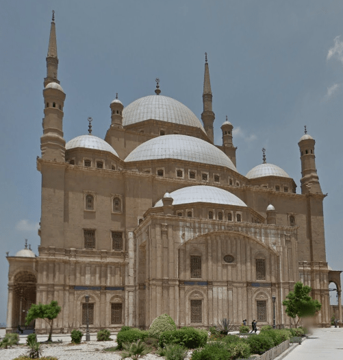
This is the general feel of the Mosque of Mohammad Ali. Its located South East of the word Cairo on the map. You can also generally see this mosque from every spot of the official coverage.
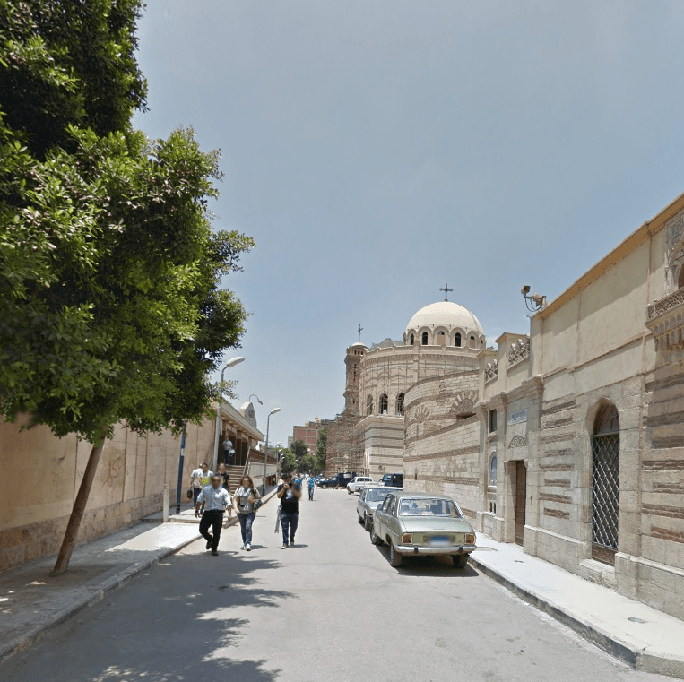
This street all this coverage on is called “Mari Gerges” and covers a bunch of Churches. It is due east of the word Giza on the map. Its also the only place you will end up on a road that has churches.
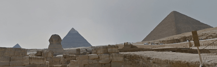
A lot of the coverage is on the Giza Plateau. Its kind of obvious that you’re near the pyramids as they’re very prominent.
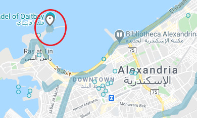
There is, however, a chance to end up in Alexandria. The official coverage in Alexandria only exists at the Citadel of Qaitbay along the north western coast.
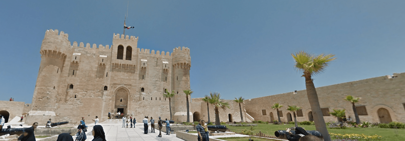
Its clearly different from the other coverage. Its also the only coverage near a large body of water.
Google Car:
Egypt does not use a car, instead relying on Trekker coverage. There are only one or two roads covered in Giza, and you can tell you are walking down the street.
As Egypt is Trekker coverage, you will see mostly Historical or Religious sites. That includes the Pyramids of Giza as well as
Google Coverage:
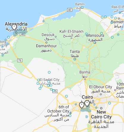
Egypt doesn’t have a lot of coverage. These pins show the 4 places that official coverage exists.
Follow Person:
This guy in the skull shirt can be found at two of the locations in Giza. The one he cannot be seen in is the Pyramids.
You also seem to have a police escort in most of the areas, including at the Pyramids.
Camera Generation:
Gen 3 Trekker
Electricity / Light Poles:
License plates:
License plates are super rare due to the limited coverage. However, these are the private vehicle plates. They can be found on the one road that has coverage over to the East of Giza on the Coverage picture above.
Phone number:
While there is super limited coverage, it still exists. You can find examples of (02) and (03) which represent Cairo and Alexandria.
All numbers are set up as either 02-xxxxxxxx or +20-2-xxxxxxxx. The +20 is the international calling code of Egypt.
The picture above doesn’t have either an Area code or an International code and instead shows a 011 and a 012x. These indicate mobile numbers.
General look:
This is the general feel of the Mosque of Mohammad Ali. Its located South East of the word Cairo on the map. You can also generally see this mosque from every spot of the official coverage.
This street all this coverage on is called “Mari Gerges” and covers a bunch of Churches. It is due east of the word Giza on the map. Its also the only place you will end up on a road that has churches.
A lot of the coverage is on the Giza Plateau. Its kind of obvious that you’re near the pyramids as they’re very prominent.
There is, however, a chance to end up in Alexandria. The official coverage in Alexandria only exists at the Citadel of Qaitbay along the north western coast.
Its clearly different from the other coverage. Its also the only coverage near a large body of water.
Alphabet/script:
As there is limited coverage and its mostly near prominent locations, you will see some signs with Arabic and English.
Domain:
.eg
Lesotho
- Country Flag
- Capital City
- Most Helpful
- Google Car
- Google Coverage
- Unique Vehicle
- Bollards
- Camera Generation
- Road Lines
- Road Signs
- Electricity Poles
- License Plates
- Phone Number
- Vegetation / Landscape
- Architecture
- General Look
- Domain
- Language
Country Flag:
Capital City:
Maseru
Most Helpful:
Lesotho usually has mountains/hills which rarely have trees on them, and they seem to be dry, often times with the rock showing.
Google Car:

Lesotho is mostly covered by a white google car. Its the same car that can be found in the region of Southern Africa.
Google Coverage:
Lesotho is a small country, and much like Eswatini, only the major roads are covered. There are vast portions of the country that are left uncovered. Stick to the roads and the towns and you should be fine with your guesses.
Unique Vehicle:
You can find these taxis occasionally around. They generally have the same pattern, with a yellow strip around the side and what looks like a license (or a permit) on the front of their vehicles.
You can also find these vans which appear around most of the African Continent.
Bollard:
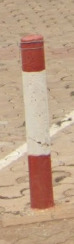
Bollards are extremely rare in Lesotho but they are these white rectangular poles with a black strip on their base. They also use black numbers on the sides facing the roads.
These sticks are also found around a lot of the dirt roads / construction sites.
Camera Generation:
Gen 3
Road Lines:
Lesotho has yellow lines on the sides and white in the middle, much like the entire southern Africa region.
Road Signs:
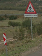
This signs color patterns was found no where else. Most of the other signs contain the red and white color scheme, but it seemed to interesting to not share.
Electricity poles:
License plates:
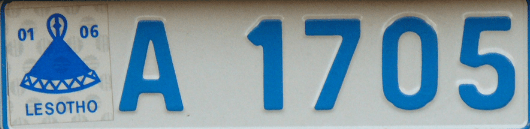
License plates in Lesotho have blue on white for private vehicles and red on white for government vehicles. The format is one or two letters followed by four numbers.
Phone number:
Lesotho has the following area codes which are simple to remember:
22,28 Maseru Reserved for fixed
57,58,59 Reserved for cellular use
6x Reserved for cellular use
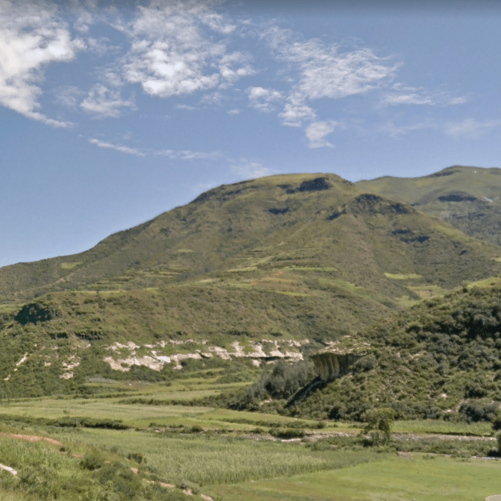
Vegetation/Landscape:
Lesotho usually has mountains/hills which rarely have trees on them, and they seem to be dry, often times with the rock showing.
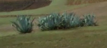
These plants are called American Aloe, even though they are an Agave plant. They’re found throughout Southern Africa, but they definitely stand out more in Lesotho and can be seen quite often in the rural areas and near the rocky outcrops on the hills / mountains.
Architecture:
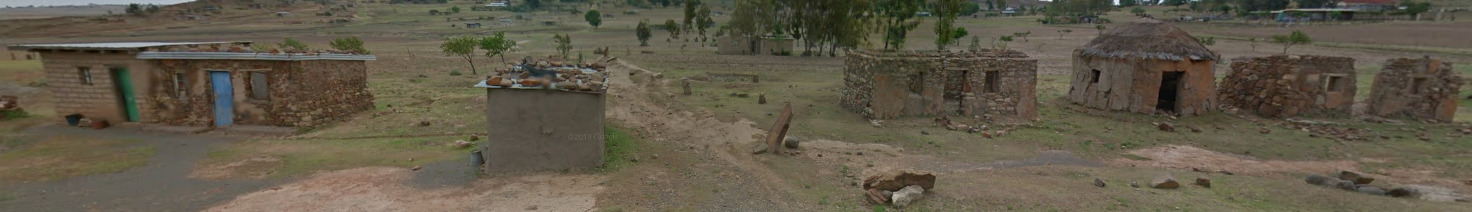
Major cities seem to have a lot of buildings that are made out of Brick. There isn’t really a pattern, but red brick architecture does exist in a lot of the larger towns.
General look:
Alphabet/script:
The two official languages of Lesotho are Sesotho and English. All Major signs contain English, and it is rare to see Sesotho anywhere. Sesotho uses the Latin alphabet, but the image above shows the pronunciation.
Domain:
.ls
You will occasionally see the South Africa domain, .ZA, while in Lesotho.
Eswatini
- Country Flag
- Capital City
- Disclaimer
- Most Helpful
- Google Car
- Bollards
- Google Coverage
- Unique Vehicle
- Camera Generation
- Road Lines
- Road Signs
- Electricity Poles
- License Plates
- Phone Number
- Vegetation / Landscape
- Architecture
- General Look
- Language
- Domain
Country Flag:

Capital City:
Mbabane/Lobamba
Disclaimer:
Eswatini changed their name from Swaziland to Eswatini in 2018. There are still plenty of signs around that still say Swaziland around the country. Their domain is based on when the country was called Swaziland.
Most Helpful:
The Landscape is incredibly helpful in Eswatini. Finding these green mountains are key, as Lesotho often has rocky mountains and Botswana is incredibly flat. South Africa can have some green hills near the Eswatini region, but its always safe to guess in that area.
Google car:
You will see the back of the car, and its clearly a white vehicle. This is the same vehicle that did all of Southern Africa.
Bollard:
These bollards are rare, but are located about 10 meters or so off the road itself.
Google Coverage:
There isnt a lot of coverage in Eswatini. Most of the major roads as well as most of the towns are covered. There are large sections of the country that doesn’t have any coverage.
Unique Vehicles:
Like most of Africa, Eswatini uses these vans for their taxis. Unlike most other countries, there really isn’t a method to the pattern on the sides.
Camera Generation:
Gen 3
Road Lines:
There are some pretty unique lines in Eswatini. Its the same general lines you’d see in the general region of Southern Africa.
You can also find the triple white lines across the country.
Road Signs:
These road signs are common in the area of Southern Africa.
(Back)
There are guard rails through most of the country. You can find these white and red reflectors in the guard rails.
Electricity poles:
License plates:
The top plate is for the rear, while the bottom plate is for the front of the vehicles.
Phone number:
Phone numbers are generally only 6 numbers. You can also get a two digit prefix that states region. Most are set up as XX – xx – xxxx.
22 is the Shiselweni region
23 is the Lubombo region
24 is the Hhohho region
and 25 is the Manzini region
76,77 and 78 are all Mobile numbers.
Any number leading with a +268 is the international calling code into Eswatini.
Vegetation/Landscape:
Architecture:
You see these cement bus stops nearly everywhere in Eswatini.
General look:
Eswatini feels like South Africa, but has a lot of hills/mountains. Its usually pretty obvious when looking at the camera generation and the hills that you are not in South Africa.
Alphabet/script:
Eswatini uses the Swazi language, as well as English. Swazi is a little different and has different dialects in the four major regions.
Domain:
.sz
Reunion (Island)
- Country Flag
- Capital City
- Most Helpful
- Google Car
- Bollards
- Google Coverage
- Towns Worth Knowing
- Camera Generation
- Road Lines
- Road Signs
- Electricity Poles
- License Plates
- Phone Number
- Vegetation / Landscape
- Architecture
- General Look
- Language
- Domain
Country Flag:
Because Reunion is a French Territory, you will find a French Flag almost everywhere. However, they have their own flag as well.
Capital City:
Saint Denis
Most Helpful:
(Front)
(Back)
The car is the most helpful piece in Reunion. Its also clear that the tape is in a different spot than Ghana.
Google Car:
(Front)
(Back)
The Car in Reunion is very unique and has tape on the rear passenger bar. The only other country with tape is Ghana, and its really obvious that you’re not in Ghana.
Bollard:
These road markers are often found off of the roads. Sometimes you can find them on the median if its a large enough road.
You can also find your typical French Bollard, although it isn’t very common.
You can also find these yellow capped KM markers. They were also seen in Senegal.
Google Coverage:
Reunion is a very mountainous island. Because of that, there are large portions of land that do not have coverage. Some roads leading up the mountain are also not covered. The safe bet is to keep to the coast. If you are in the mountains, N3 is your best bet.
Towns Worth Knowing:
Realistically, there are a few towns that will appear on signs more than others. Those towns are:
Saint-Denis (The Capital)
Saint Pierre
Le Tampon
Cilaos
This is not saying that all of the other towns are not important. Just that these are the larger cities (or the unique ones in the hills).
Camera Generation:
Gen 3
Road Lines:
Reunion uses white dashed lines for the middle and shoulders.
Road Signs:
Like Mainland France, Reunion uses D roads (except they’re actually helpful here). There are also N roads, but these are much more limited across the island.
![]()
Reunion also uses Blue and White arrows for corners. They stick out like sore thumbs.
Electricity poles:
Much like mainland France, you will find poles with this pattern across the island.
License plates:
These are license plates from before 2009. The numbers at the end mean the most with 97 indicating an overseas territory and the 4 indicating that the territory exists in the Indian Ocean.
This is the more recent (and less common it seems) license plate from 2009 – today. Its not as orange as this picture makes it out (and actually is more like the yellow above), but you can still notice the same numbers (97 and 4). It would make sense if there was a white version of this as well, but I could not find any images that prove that.
Phone number:
All phone numbers in Reunion consist of 10 digits, with a 4 digit area code and its meaning listed below.
0262 – Landline
0692 – Mobile
0693 – Mobile
Vegetation/Landscape:
Architecture:
General look:
Reunion feels like a tropical France. It has the palm trees and feelings of an Island, but with some Mountains and other clear indicators that it isn’t mainland France.
Alphabet/script:
Reunion, being a territory of France, uses a typical French Alphabet.
Domain:
.re
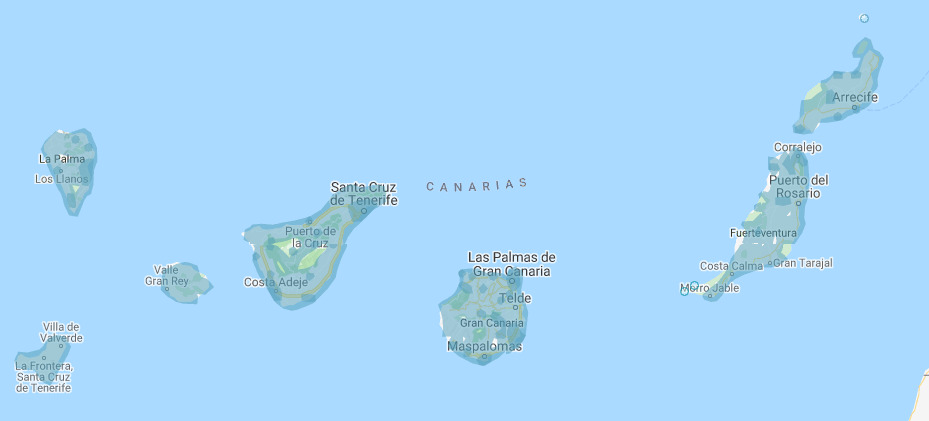
Canary Islands
- Country Flag
- Capital City
- Most Helpful
- Google Car
- Bollards
- Google Coverage
- Unique Trash Cans
- Camera Generation
- Road Lines
- Road Signs
- Electricity Poles
- License Plates
- Phone Number
- Vegetation / Landscape
- Architecture
- General Look
- Language
- Domain
Country Flag:
The Canary islands are owned by Spain. Therefore, you will see a Spain flag nearly everywhere.
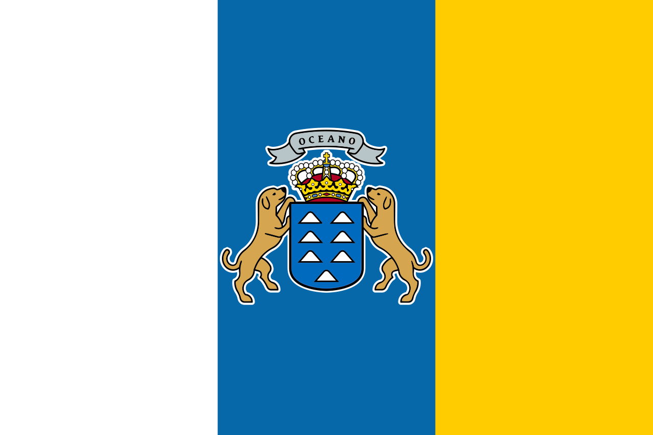
There is a flag specifically for the Canary Islands however.
Capital City:
Municipality of Las Palmas/Santa Cruz de Tenerife
Most Helpful:

The most useful thing here is the landscape and the general feel of the Canaries. The trash cans are a good thing to look for, but they are not everywhere.
Google car:
The Canary Islands use a white car for their coverage. It can sometimes be seen. There are also times where there are short antennas visible.
Bollards:
(Front)
(Back)
These bollards can be found around the islands. They have an orange rectangle instead of Yellow like in Spain.
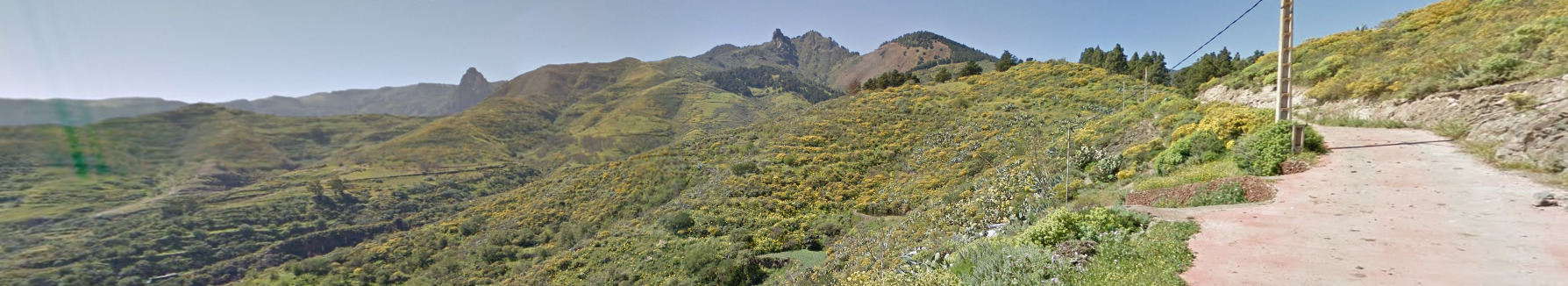
Google Coverage:
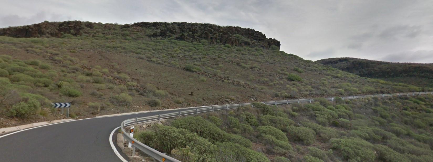
While it may look like everything has coverage, the Canary Islands only have the roads covered. If there are no roads in an area, there is no reason to guess there.
Unique Trash Can:
Like most of Spain, the trash and recycle cans are unique. They usually have a city crest or something similar on most of their cans. You can actually see a crest that says Las Palma on the blue bin.
Camera Generation:
Gen 2, 3, and 4.
Road Lines:
The Canary Islands use all white road markings. There are some cases where there may be a yellow line near curbs, but that seems to be more rare than the white lines.
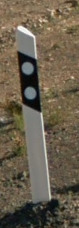
Road Signs:
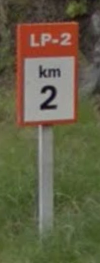
You can sometimes find these orange KM markers on the sides of roads. The road itself is LP-2. They show up on the map as Green roads.
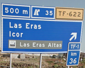
There are also these blue signs that tell you exits, and you can also see a blue KM marker in front of the sign. This tells us we are on the road TF-1, 36 KM in.
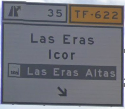
There are also some white signs for the exits themselves.
Electricity poles:
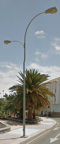
You can find these double lights near / in main cities. The smaller light is for the sidewalk.
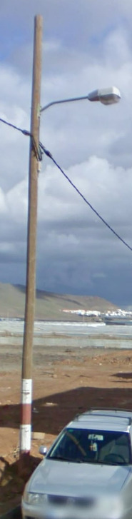
You can also find the typical poles from Spain, including the wooden ones.
License plates:
Much like Spain, The Canary Islands use the typical EU plates. The set up of the letters and numbers may be a bit different.
Phone number:
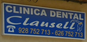
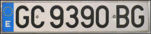
The Canary Islands use the country code of +34 and its international prefix is 00. There are only 4 area codes in the Canaries. 922 and 822 will call Santa Cruz de Tenerife. 928 and 828 will call Las Palmas.
Vegetation/Landscape:
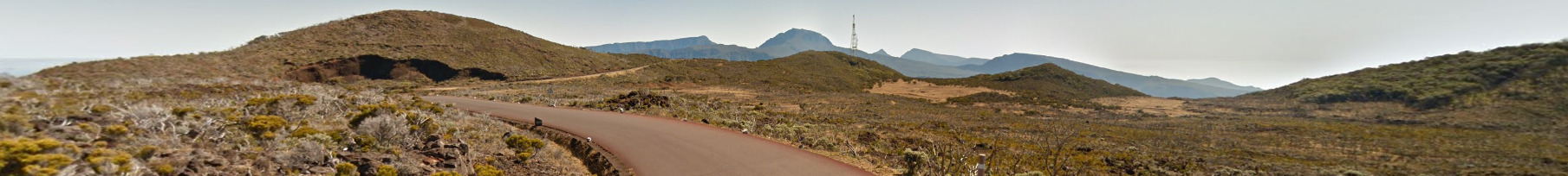
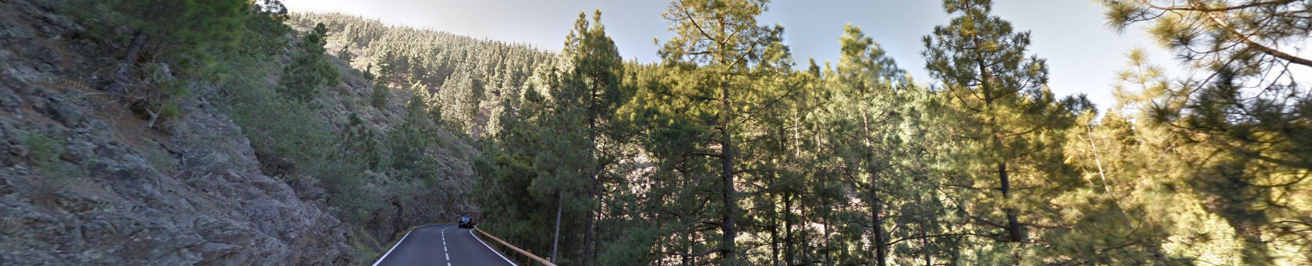
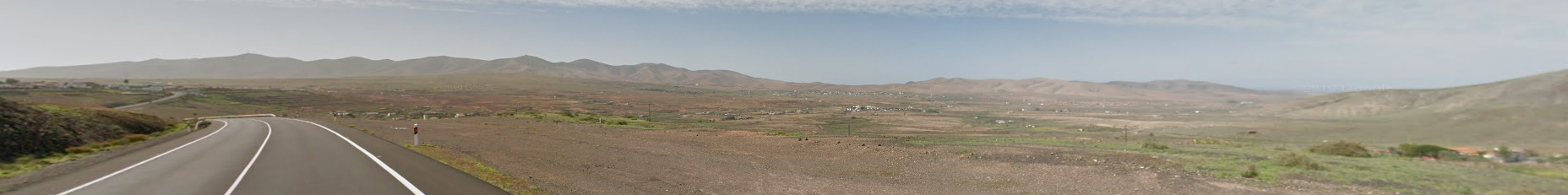
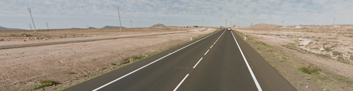
There are Seven islands that have coverage in the Canaries, and they all kind of feel similar. Some are more dry than others, and some more Developed. Either way, you can normally tell when you are in the Canary Islands.
Architecture:
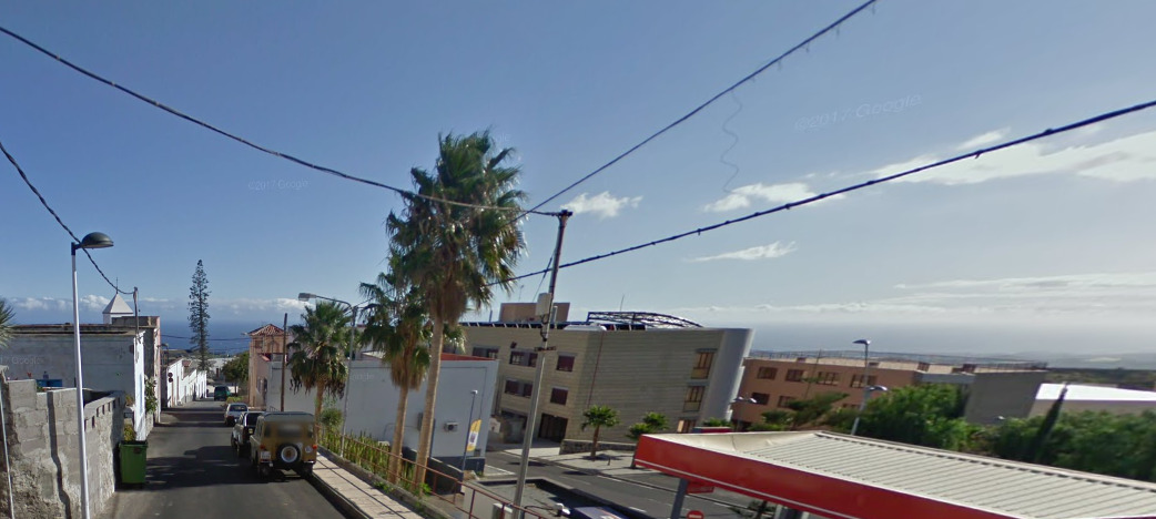
It seems like there are a lot more modern houses on the Canaries.
But you can still find your typical plaster house with the orange / red tiled roof.
General look:
You can clearly tell you’re on an island for most of the Canaries. You can often feel the difference, seeing palm trees and other tropical vegetation.
Alphabet/script:
The Canary Islands, a territory of Spain, use the Spanish language.
Domain:
.ic & .es
Madeira
- Country Flag
- Capital City
- Most Helpful
- Google Car
- Bollards
- Google Coverage
- Towns Worth Knowing
- Camera Generation
- Road Lines
- Road Signs
- Electricity Poles
- License Plates
- Phone Number
- Vegetation / Landscape
- Architecture
- General Look
- Language
- Domain
Country Flag:
Madeira is an Island that is owned by Portugal. While they do have their own flag, you should also be on the lookout for the Portuguese flag.
Capital City:
Funchal
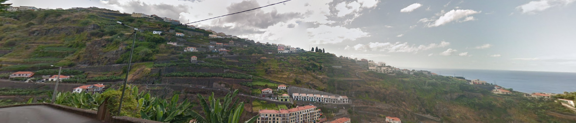
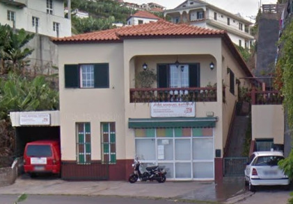
Most Helpful:
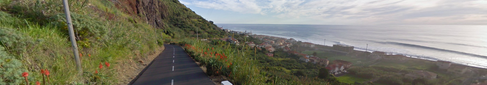
The West coast feels very green and lush.
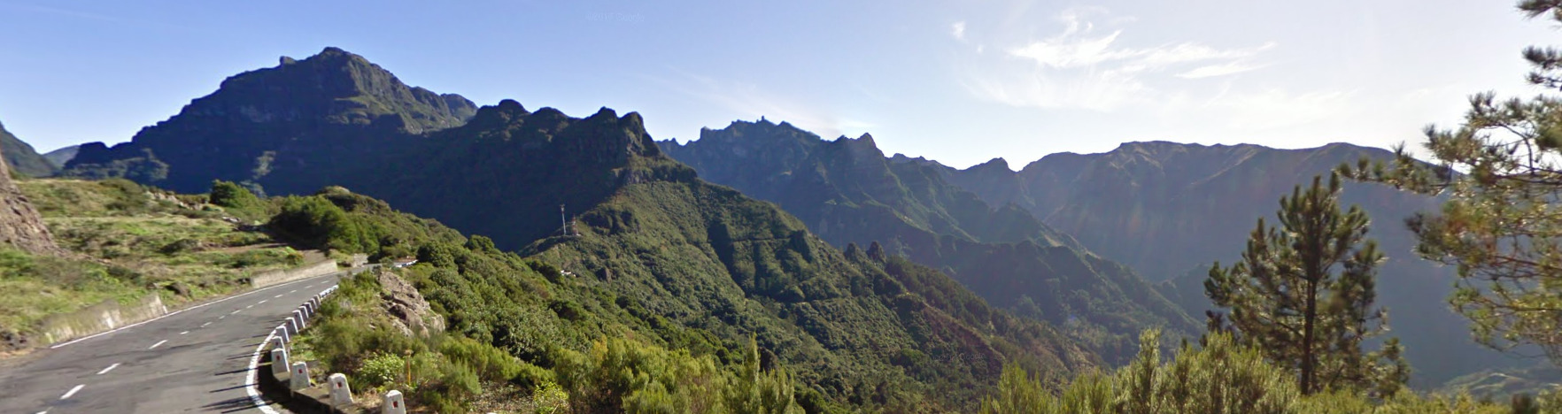
The middle of the island is incredibly mountainous.
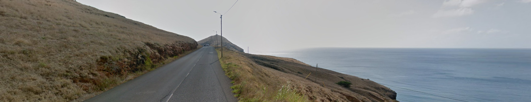
The East coast feels a bit more dry and not as lush as other parts of the island.
Google car:
When you can see the car, there is a small antenna coming off the back.
Bollards:
These bollards are weird. They seem to be either wood or concrete and only have a reflector on one side.
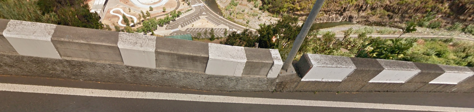
You can also find these protection walls along side the cliffs of Madeira. They remind me a bit of Bhutan.
Google Coverage:
Not everywhere on the island will have coverage, with vast sections around the middle being empty. Try and stick to the coast when it comes to Madeira.
Towns Worth Knowing:
Madeira is rather small, and knowing some of the larger towns can help you to orient yourself on the island.
Funchal (The Capital)
Ponta Do Pargo
Porto Moniz
Sao Jorge
Santa Cruz
Sao Vicente
Machico
Canico
Estreito da Calheta
Knowing these towns and where they exist on the island can help you decide between the East or the West. Most signs will contain Funchal.
Camera Generation:
Gen 2, 3 and 4
Road Lines:
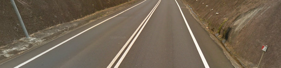
Madeira, much like Portugal, uses white lines in the middle and on the sides. There doesn’t have to be a double white line, with some places having a single white line or a dashed line.
Road Signs:
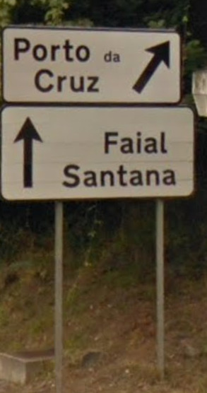
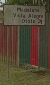
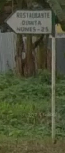
For some reason, almost every sign points towards Funchal (The Capital). I know the Island isn’t the biggest, but you can be nowhere near Funchal and find signs pointing towards it.
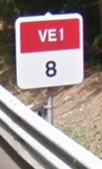
These KM Markers have the Road numbers up top. The VE1 is the road and the 8 marks the KM into that road.
You can also find signs like these on the major roads. The go over the road and point you towards destinations.
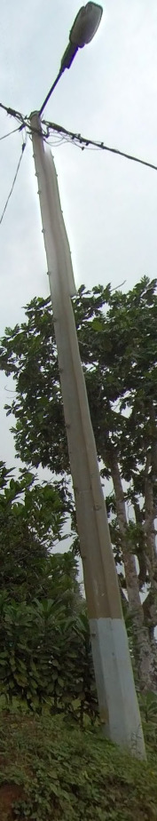
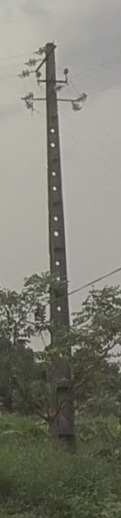
Electricity poles:
Much like mainland Portugal, you can find these telephone poles.
There are some variants however, and those should be noted.
You can also find these octagon metal light poles around, but they seem to be on the outskirts of main cities.
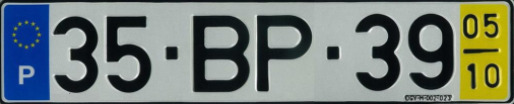
License plates:
Much like regular Portugal, there is a yellow section on the license plates here.
Small disclaimer. Portugal has retired that plate with the yellow on it. It will be showing up a lot less as time goes on and new places get updated coverage. We will update the plate list when that time comes.
Phone number:
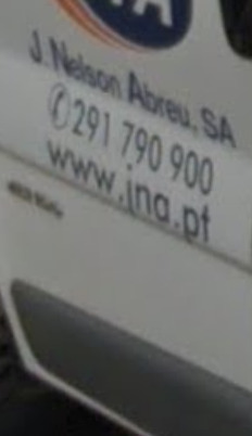
There is one Area code in Madeira, that being 291. This number is ONLY for landlines. You can, however, find phone numbers that call Mainland Portugal or Mobile numbers in Madeira everywhere.
Vegetation/Landscape:
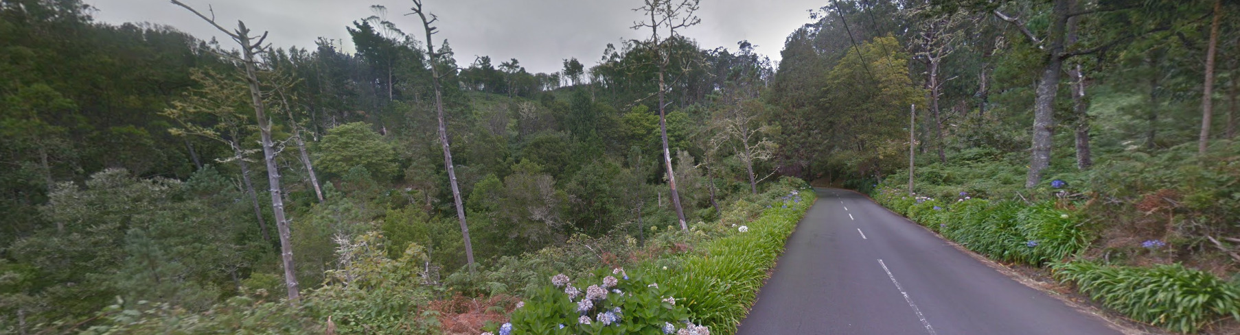
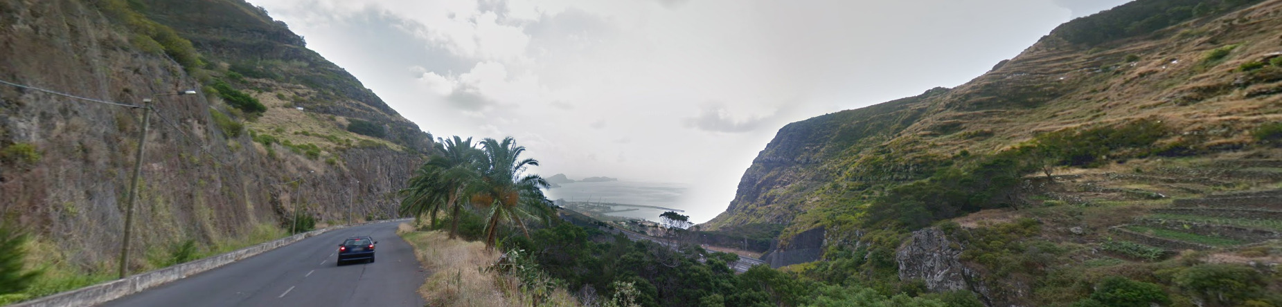
Madeira is an island in the middle of an ocean. Therefore, it has to be mountainous. You can see clear examples of the steep cliffs and hills throughout most of the island.
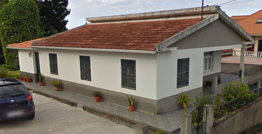
Architecture:
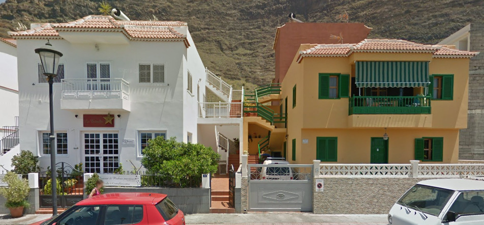
It feels like your typical Mediterranean architecture. You get the plaster houses with the red / orange tiled roof. It seems to be the most common house in Madeira.
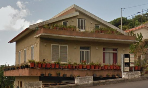
General look:
The West coast feels very green and lush.
The middle of the island is incredibly mountainous.
The East coast feels a bit more dry and not as lush as other parts of the island.
Alphabet/script:
Madeira uses the Portuguese language.
Domain:
.pt
Rwanda
- Country Flag
- Capital City
- Most Helpful
- Google Car
- Bollards
- Google Coverage
- Unique Vehicle
- Camera Generation
- Road Lines
- Road Signs
- Electricity Poles
- License Plates
- Phone Number
- Vegetation / Landscape
- Architecture
- General Look
- Language
- Domain
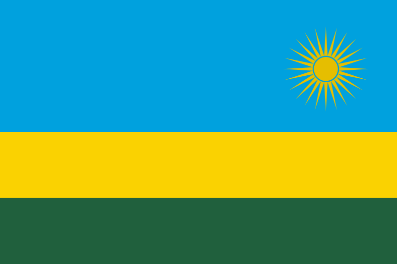
Country Flag:
Capital City:
Kigali
Most Helpful:
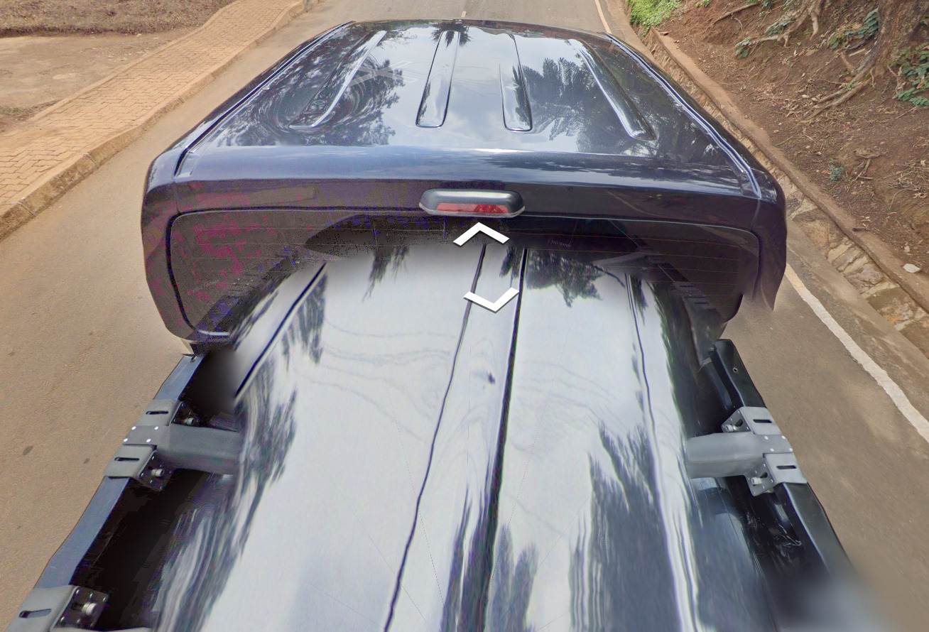
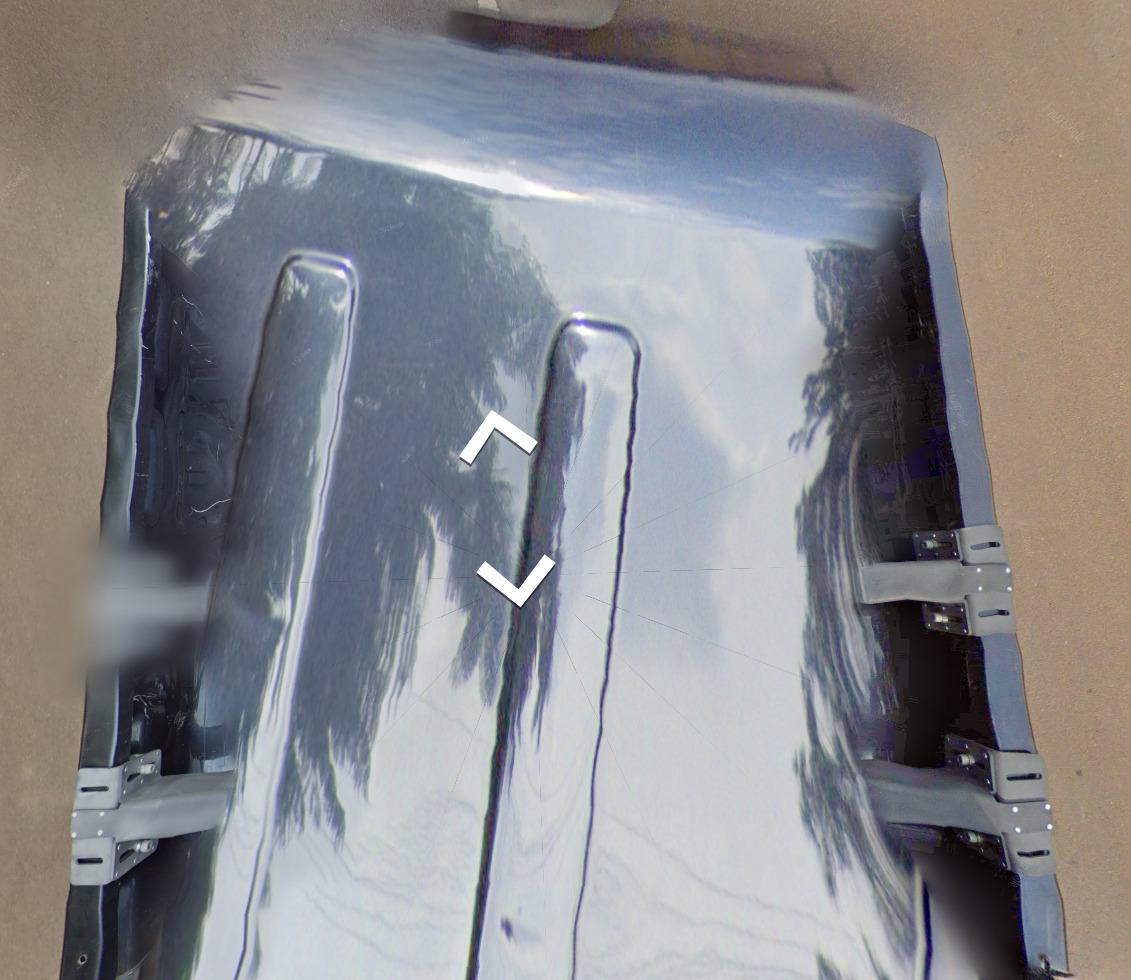
Google Car:
The Google car is super easy to recognize. You have a low camera with a black truck and some bad blurring. There is a VERY small chance you can get a location with a completely blurred truck, but you can definitely tell you’re in Rwanda.
Bollard:
Google Coverage:
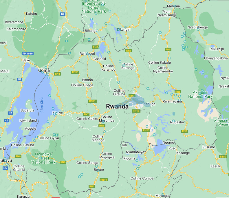
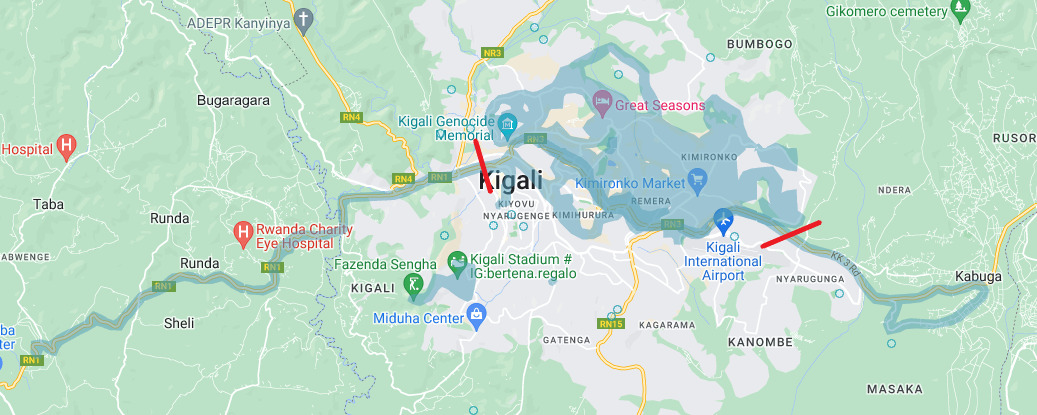
Rwanda has extremely limited coverage which should make it easy to get a decent score here. Just drop your pin somewhere around Kigali and you should be okay. A lot of the coverage on RN1 (marked by the red lines) is done by an Ari and isn’t official coverage. The small area to the south near the golf course IS official though.
Unique Vehicle:
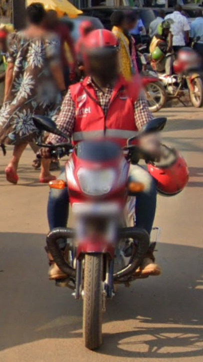
Its not necessarily unique or rare, but it seems like the majority of people riding motorcycles has this red vest (and occasionally a helmet). It logo says Airtel and what looks like Money.
Camera Generation:
Gen 4
Road Lines:
Rwanda uses a single yellow center line and white side lines. The center line can be solid or dashed depending on how popular a certain road is.
Road Signs:
Street signs are very common in Rwanda. Most houses will also have something informing you of the road you are on.
Electricity Poles:
The poles are either rounded that taper or squared that taper. You can also find these junction poles that are used to convert wattage.
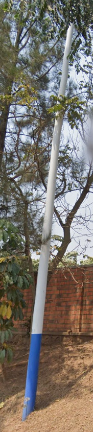
Some light poles have a blue bottom. It doesn’t seem too common, probably happening on major roads.
License Plates:
Rwanda uses a white plate with black letters / numbers on the front, and a yellow plate with black letters / numbers on the back.
Phone number:
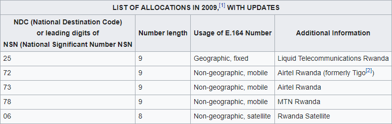
+250 is Rwanda’s country code, and it can occasionally be seen. If you find a number, you will probably also find a sign that says Rwanda as well.
Vegetation/Landscape:
The Curb is definitely unique enough to be seen all over.
Architecture:
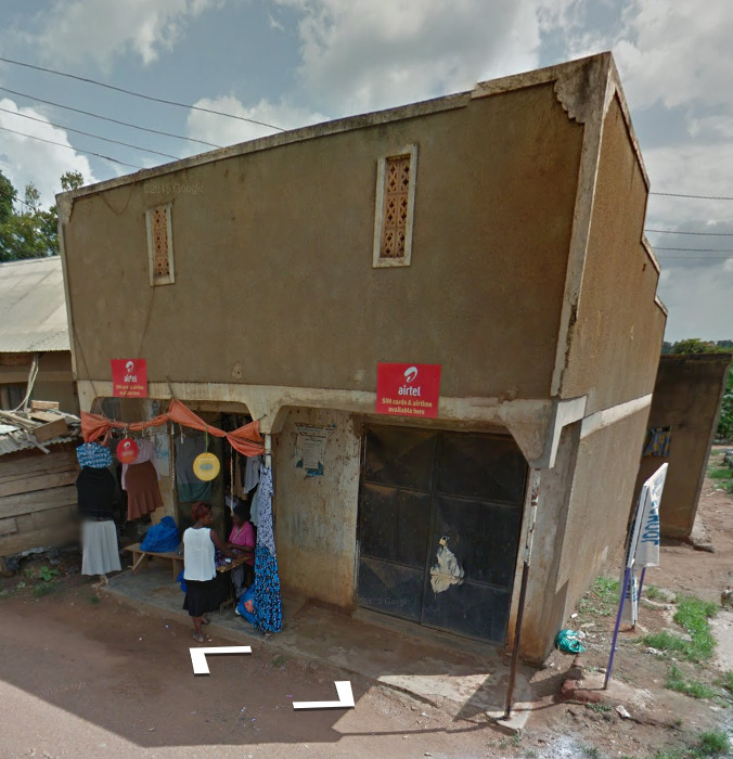
You can find these black drums lifted high above some of the fences. I believe they’re used for water treatment, but they are common enough around Rwanda.
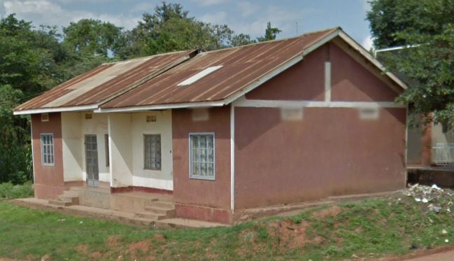
There are a lot of red clay roof’s around Rwanda. You can find other color clay roofs, but this red one seems to be the most common.
General look:
Alphabet/script:
There are FOUR official languages of Rwanda (Kinyarwanda, English, French and Swahili). There are realistically two important ones. Kinyarwanda (shown above) can be found on a bunch of signs, as well as English which can also be found sparingly around Rwanda. French is being reduced across the country, while Swahili is being brought in after a 2019 decision to bring the country closer to its historical roots.
Domain:
.rw
São Tomé and Príncipe
- Country Flag
- Capital City
- Most Helpful
- Google Car
- Google Coverage
- Camera Generation
- Road Lines
- Road Signs
- Electricity Poles
- License Plates
- Phone Number
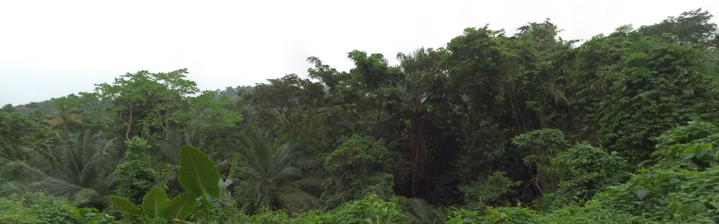
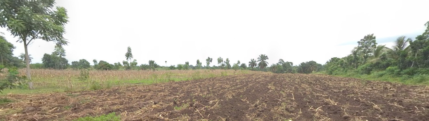
- Vegetation / Landscape
- Architecture
- General Look
- Language
- Domain
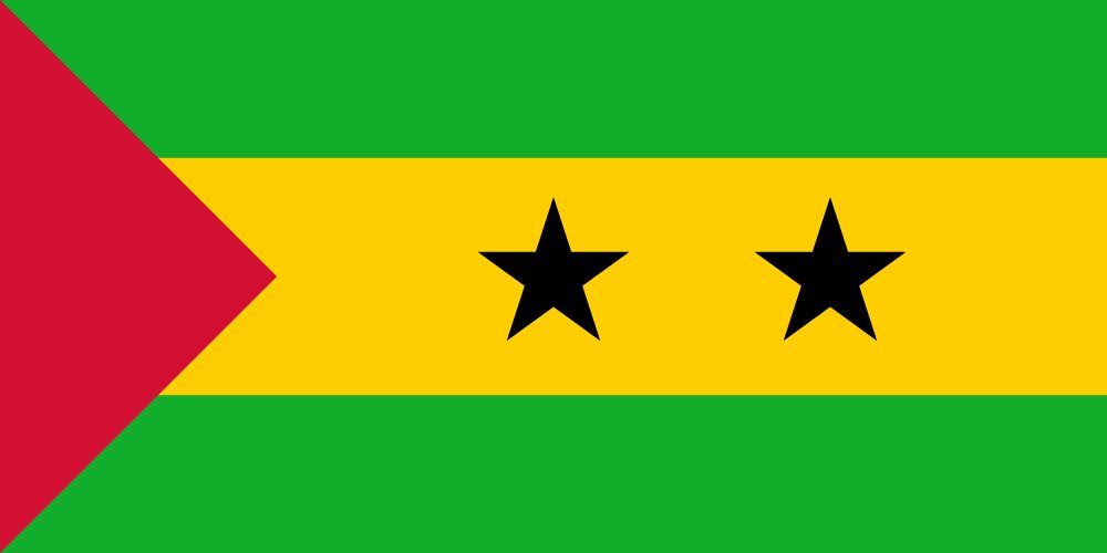
Country Flag:
Capital City:
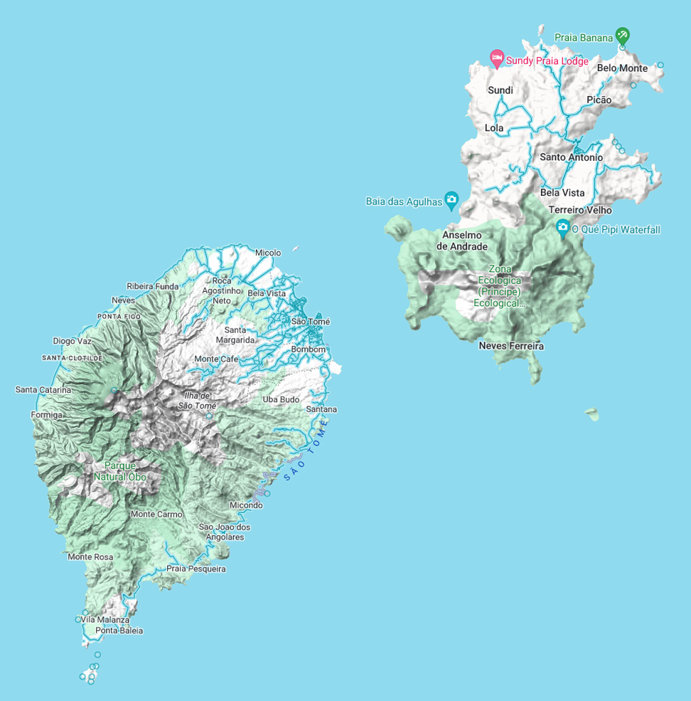
São Tomé
Most Helpful:
Google Car:
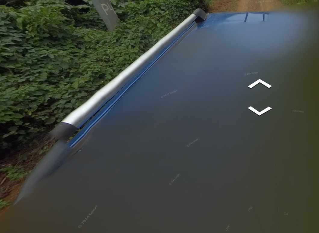
The car on São Tomé is mostly blurred, however there will be some parts of a black / green truck that stick out.
There is a section on Príncipe where you can see this black antenna sticking off the side. Its apart of the blue truck that can also be seen on that island. The two pictures above are of the same truck.
Google Coverage:
There is a limited amount of roads covered on both islands, with an Ari who has done about 30% of what the map shows.
Camera Generation:
Generation Badcam
Road Lines:
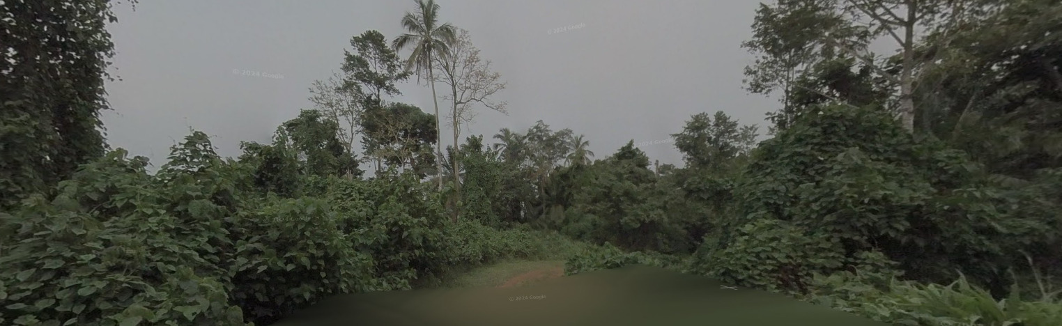
There are only road lines on the main island, which will be white. You can find a mix of roads elsewhere, but this cobblestone road will be the most memorable.
Road Signs:
Electricity poles:
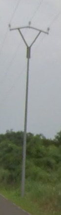
There does not appear to be a real method to the poles. The more things on the pole itself, the more likely you’re on the main island.
License plates:
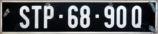
São Tomé and Príncipe use a black plate with white lettering.
Phone number:
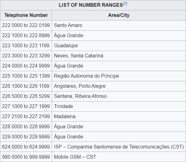
There are not many phone numbers here. The other tips will be more beneficial to your learning.
Vegetation/Landscape:
Architecture:
General look:
Alphabet/script:

São Tomé and Príncipe has Portuguese as its official language.
Domain:
.st
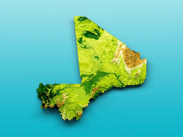
Republic of Mali
- Country Flag
- Capital City
- Most Helpful
- Google Coverage
- Trekkers and their Locations
- Camera Generation
- Road Lines
- Electricity Poles
- License Plates
- Phone Number
- Vegetation / Landscape
- Language
- Domain
Country Flag:
Capital City:
Bamako
Most Helpful:
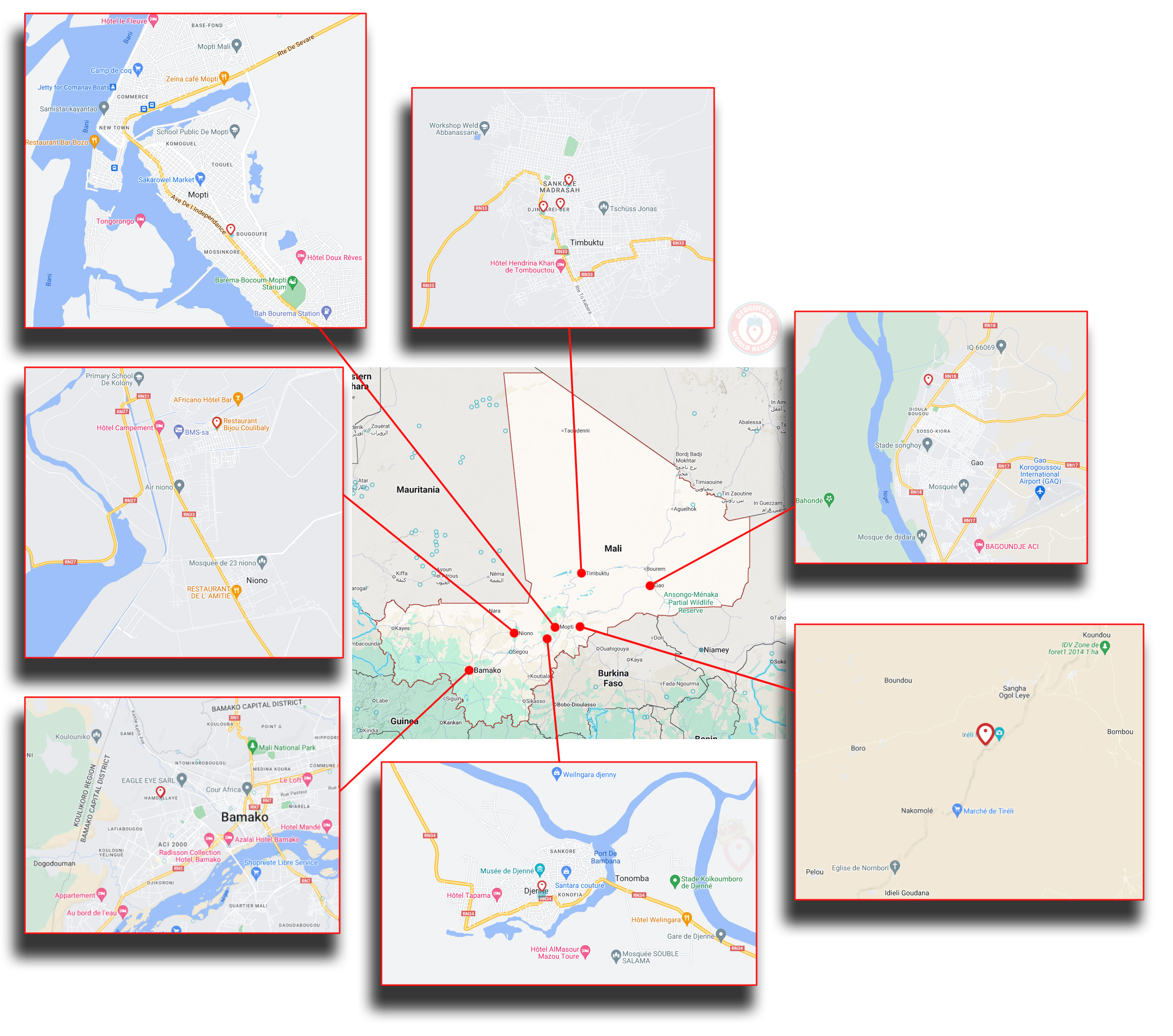
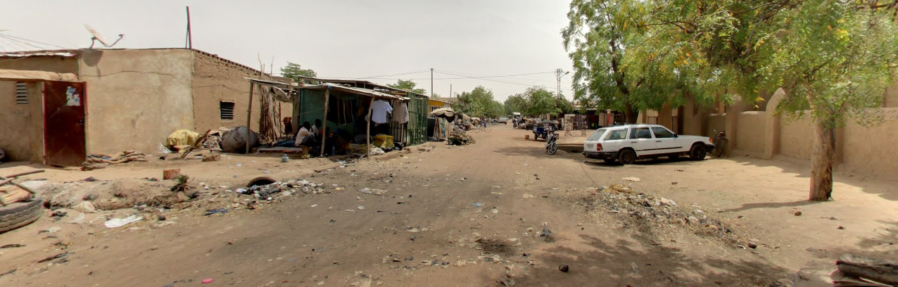
Google Coverage:
There is VERY limited coverage in Mali, done by a couple of trekkers. It is probably easier to memorize the trekkers and where they exist over the other clues listed here.
Trekkers and their Locations:
Bamako (This coverage is misplaced and does not actually exist in Bamako)
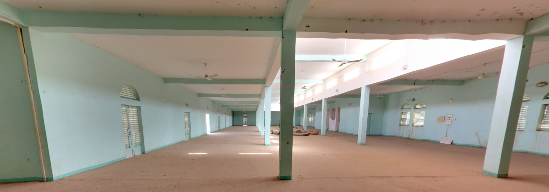
Niono has its Grand Mosque covered. You can actually walk around on the streets outside of the mosque and see “normal” life happening.
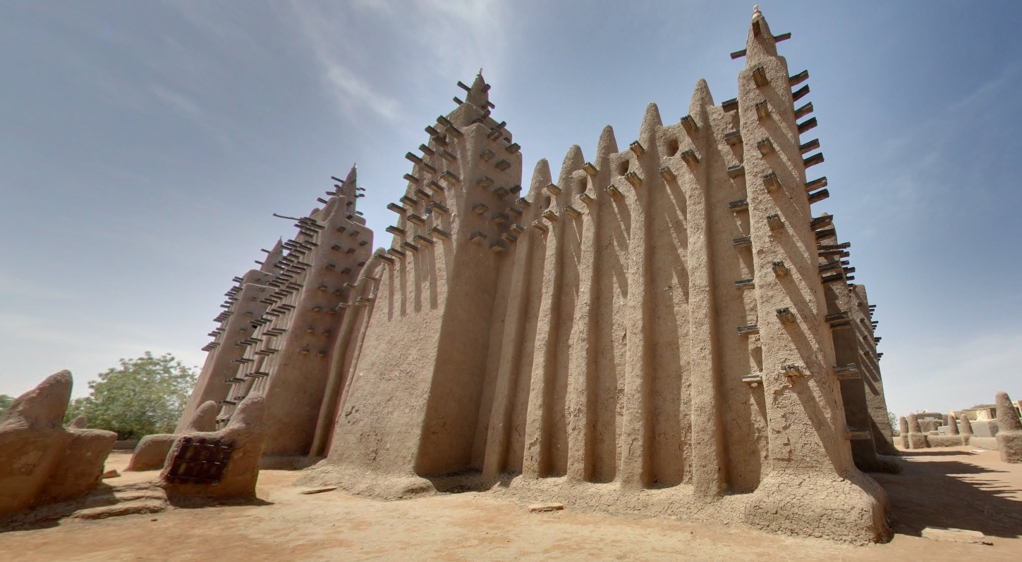

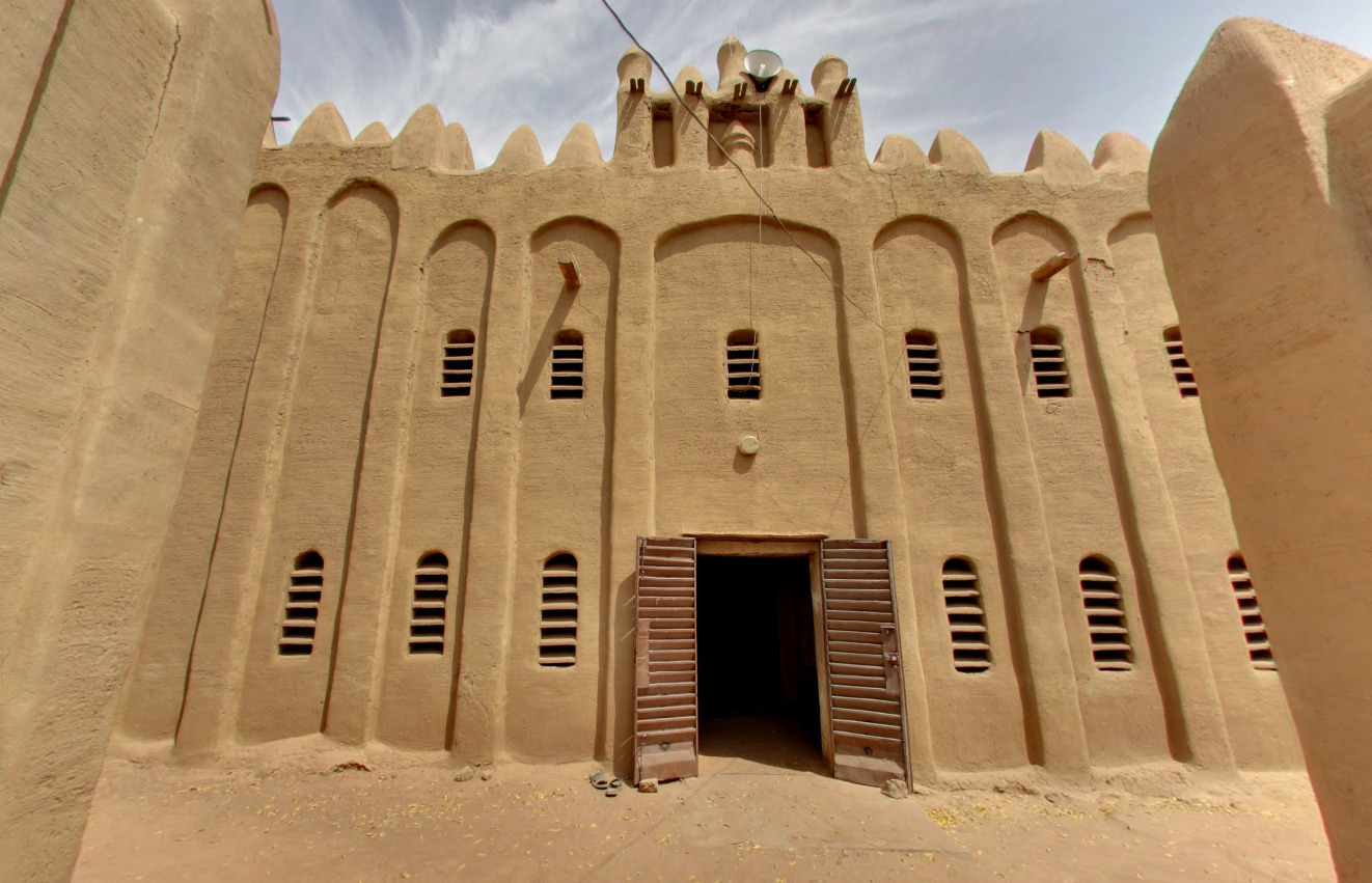
Djenne has its Grand Mosque covered. It is rather large and contains colorful prayer maps inside. The outside appears to be straight out of an Assassins Creed game.
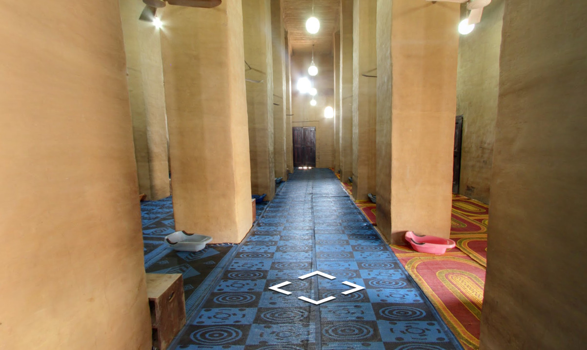
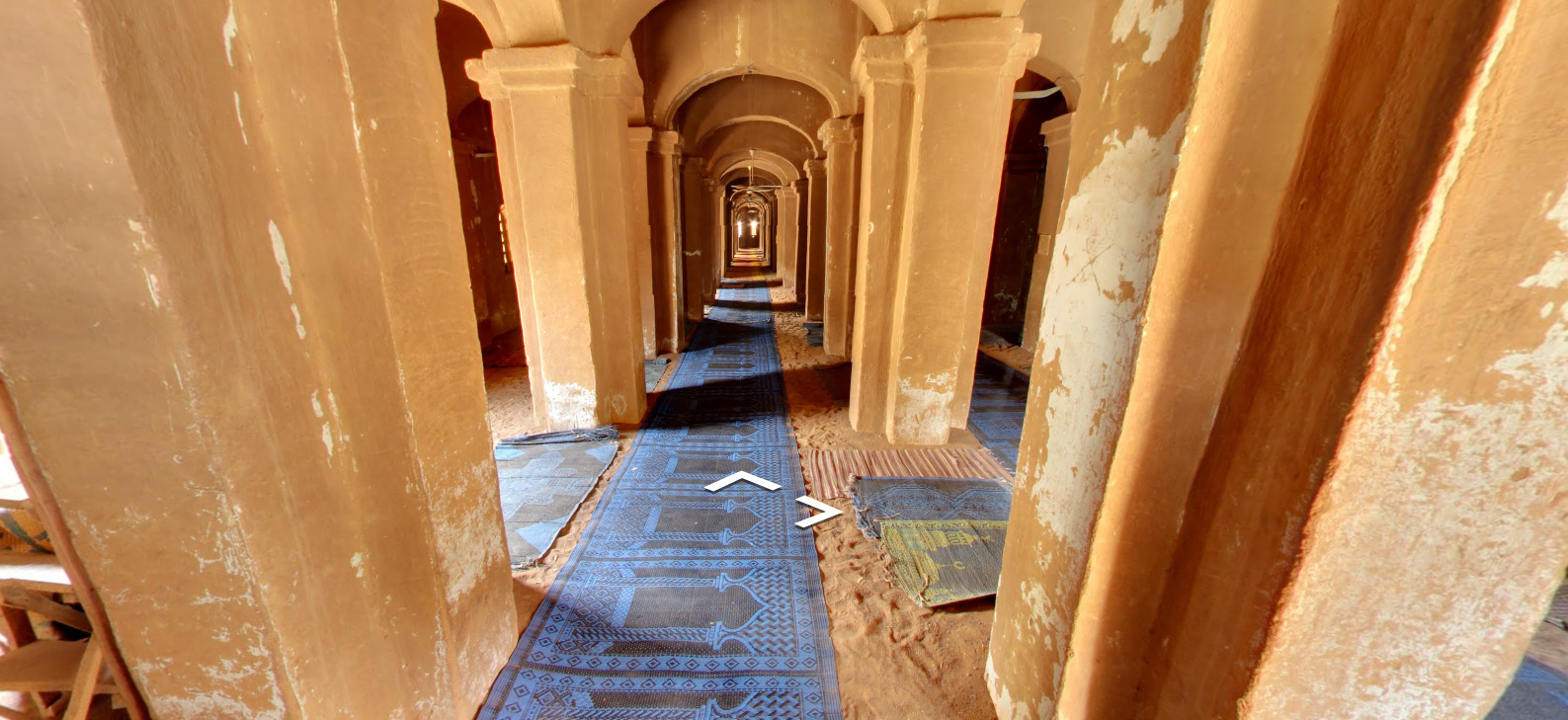
Mopti has its Grand Mosque covered. It has these colorful prayer mats inside. The outside is walled in and appears to be made of dried mud and wooden posts.
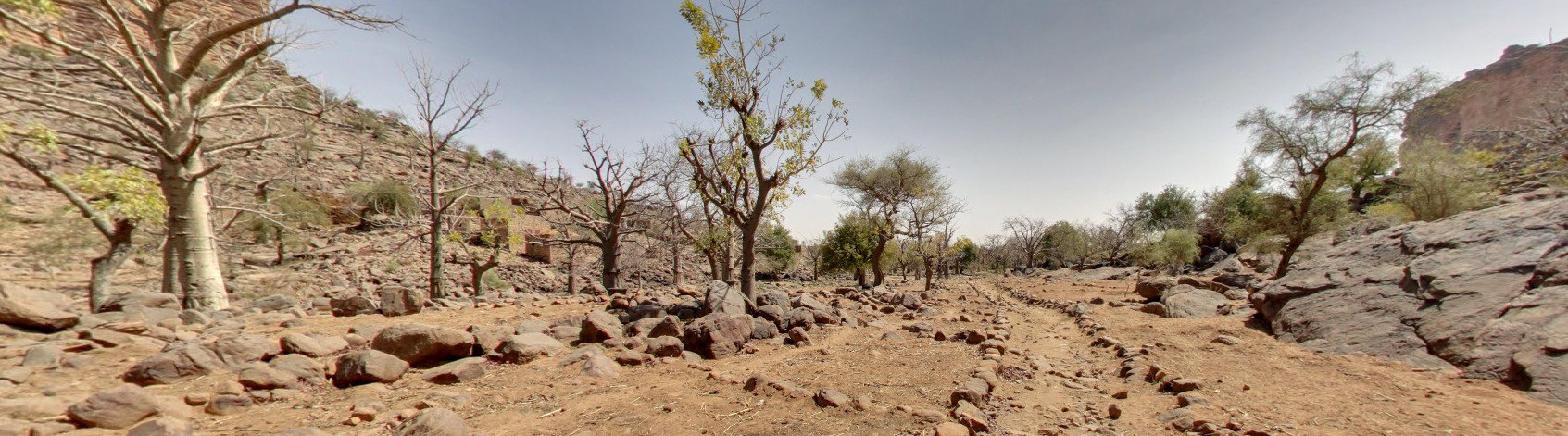
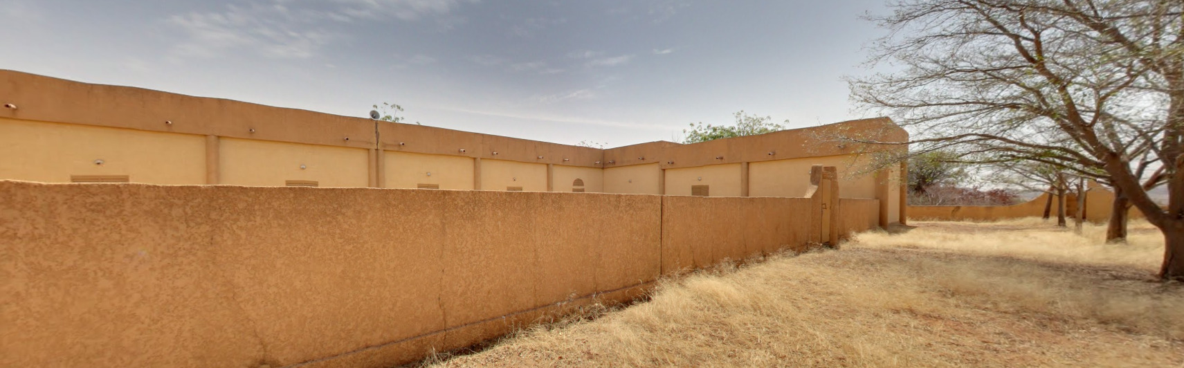
There is a random valley east of Mopti that has a little bit of coverage. It actually follows Iréli Niéné, a tourist attraction famous for its cave dwellings. While it is hard to make out some of these dwellings, you can catch a glimpse of them between some of the trees. The valley itself is very recognizable once you see it.
Timbuktu has three locations covered. The Sankore Mosque, The Sidi Yahiya Mosque and the Djingareyber Mosque.
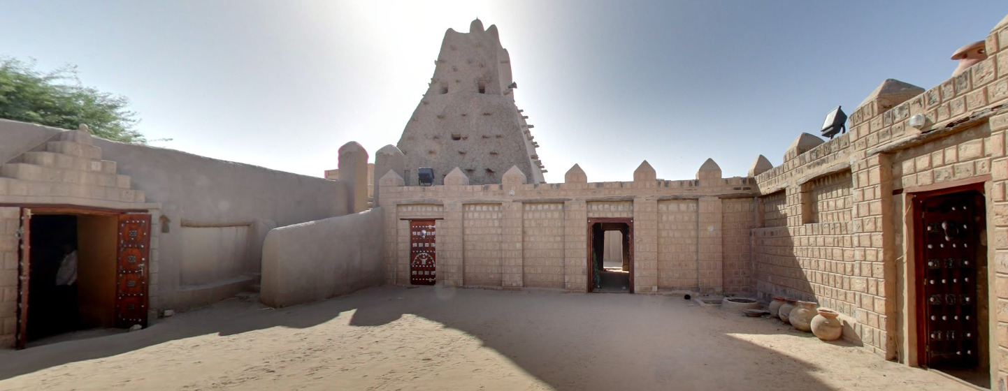
Gao contains the tomb of Askia. The tomb itself appears to be a giant pile of dried mud with a bunch of logs sticking out of it. Legend has it that all of the material came from Mecca. The rest of the site contains a building that almost resembles a labyrinth. The inside is very squared by design.
Camera Generation:
Gen 3 Trekker
Road Lines:
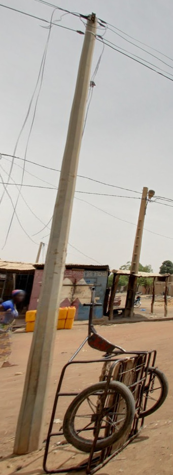
Electricity poles:
License plates:
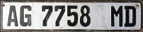
License plates in Mali are all white with black text. Only Niono and Timbuktu will have cars with a visible license plate.
Phone number:
You wont really find any numbers that will attach to the above diagram. If you find a number, its most likely a mobile number. This diagram is left in case Mali gets full coverage in the future.
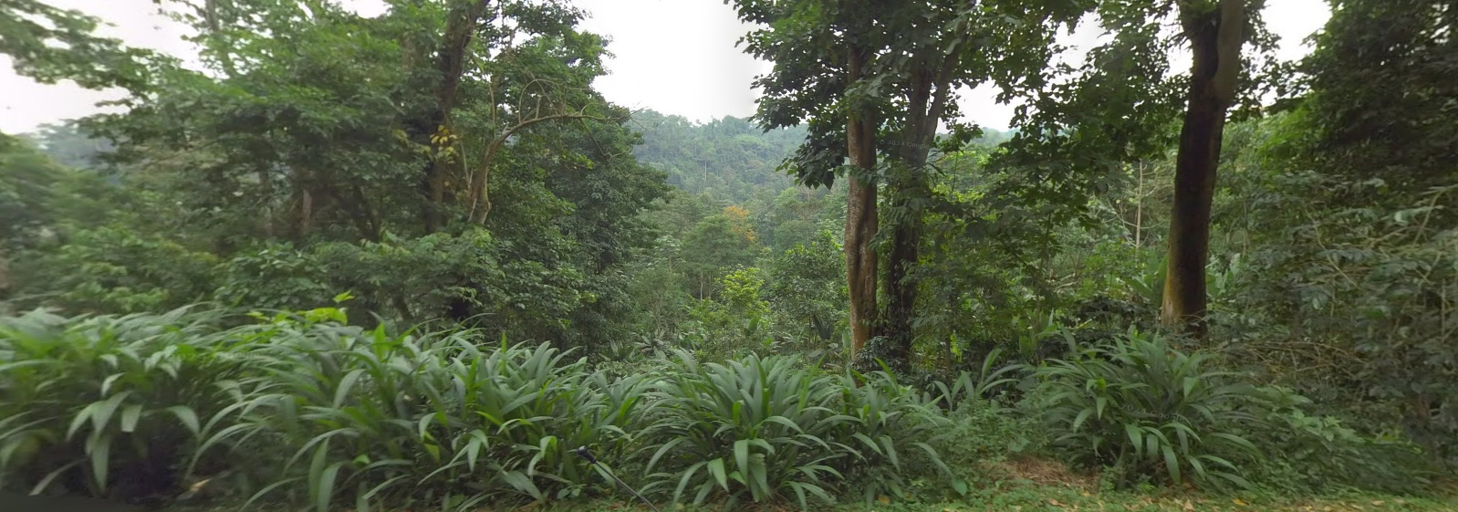
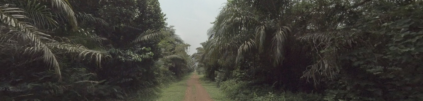
Vegetation/Landscape:
Alphabet/script:

There are over 80 languages in Mali, with the official ones including Bambara, Bobo, Bozo, Dogon, Fula, Hassaniya, Kassonke, Maninke, Minyanka, Senufo, Songhay languages, Soninke, and Tamasheq. French is the working language and therefore will be the most commonly found.
Domain:
.ML
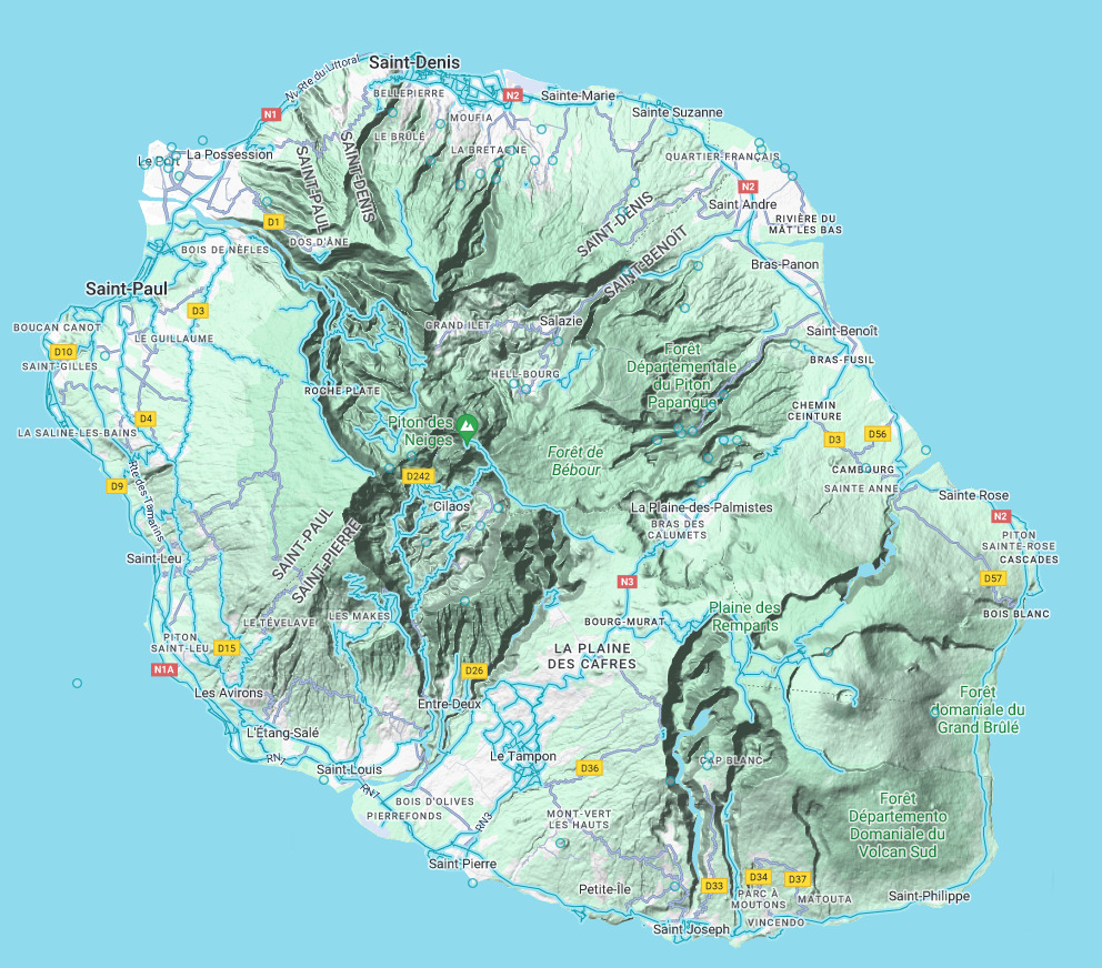
Reunion (Island)
- Country Flag
- Capital City
- Most Helpful
- Google Car
- Bollards
- Google Coverage
- Towns Worth Knowing
- Camera Generation
- Road Lines
- Road Signs
- Electricity Poles
- License Plates
- Phone Number
- Vegetation / Landscape
- Architecture
- General Look
- Language
- Domain
Country Flag:
Because Reunion is a French Territory, you will find a French Flag almost everywhere. However, they have their own flag as well.
Capital City:
Saint Denis
Most Helpful:
(Front)
(Back)
The car is the most helpful piece in Reunion. Its also clear that the tape is in a different spot than Ghana.
Google Car:
(Front)
(Back)
The Car in Reunion is very unique and has tape on the rear passenger bar. The only other country with tape is Ghana, and its really obvious that you’re not in Ghana.
Bollard:
These road markers are often found off of the roads. Sometimes you can find them on the median if its a large enough road.
You can also find your typical French Bollard, although it isn’t very common.
You can also find these yellow capped KM markers. They were also seen in Senegal.
Google Coverage:
Reunion is a very mountainous island. Because of that, there are large portions of land that do not have coverage. Some roads leading up the mountain are also not covered. The safe bet is to keep to the coast. If you are in the mountains, N3 is your best bet.
Towns Worth Knowing:
Realistically, there are a few towns that will appear on signs more than others. Those towns are:
Saint-Denis (The Capital)
Saint Pierre
Le Tampon
Cilaos
This is not saying that all of the other towns are not important. Just that these are the larger cities (or the unique ones in the hills).
Camera Generation:
Gen 3
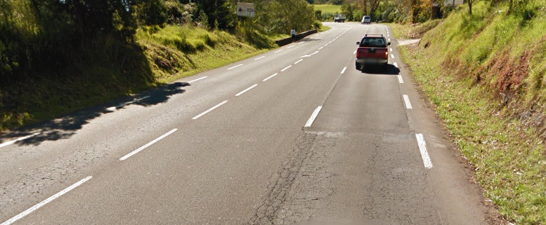
Road Lines:
Reunion uses white dashed lines for the middle and shoulders.
Road Signs:
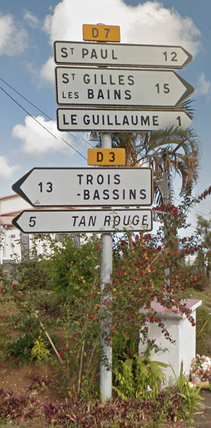
Like Mainland France, Reunion uses D roads (except they’re actually helpful here). There are also N roads, but these are much more limited across the island.
![]()
Reunion also uses Blue and White arrows for corners. They stick out like sore thumbs.
Electricity poles:
Much like mainland France, you will find poles with this pattern across the island.
License plates:
These are license plates from before 2009. The numbers at the end mean the most with 97 indicating an overseas territory and the 4 indicating that the territory exists in the Indian Ocean.
This is the more recent (and less common it seems) license plate from 2009 – today. Its not as orange as this picture makes it out (and actually is more like the yellow above), but you can still notice the same numbers (97 and 4). It would make sense if there was a white version of this as well, but I could not find any images that prove that.
Phone number:
All phone numbers in Reunion consist of 10 digits, with a 4 digit area code and its meaning listed below.
0262 – Landline
0692 – Mobile
0693 – Mobile
Vegetation/Landscape:
Architecture:
General look:
Reunion feels like a tropical France. It has the palm trees and feelings of an Island, but with some Mountains and other clear indicators that it isn’t mainland France.
Alphabet/script:
Reunion, being a territory of France, uses a typical French Alphabet.
Domain:
.re
Canary Islands
- Country Flag
- Capital City
- Most Helpful
- Google Car
- Bollards
- Google Coverage
- Unique Trash Cans
- Camera Generation
- Road Lines
- Road Signs
- Electricity Poles
- License Plates
- Phone Number
- Vegetation / Landscape
- Architecture
- General Look
- Language
- Domain
Country Flag:
The Canary islands are owned by Spain. Therefore, you will see a Spain flag nearly everywhere.
There is a flag specifically for the Canary Islands however.
Capital City:
Municipality of Las Palmas/Santa Cruz de Tenerife
Most Helpful:
The most useful thing here is the landscape and the general feel of the Canaries. The trash cans are a good thing to look for, but they are not everywhere.
Google car:
The Canary Islands use a white car for their coverage. It can sometimes be seen. There are also times where there are short antennas visible.
Bollards:
(Front)
(Back)
These bollards can be found around the islands. They have an orange rectangle instead of Yellow like in Spain.
Google Coverage:
While it may look like everything has coverage, the Canary Islands only have the roads covered. If there are no roads in an area, there is no reason to guess there.
Unique Trash Can:
Like most of Spain, the trash and recycle cans are unique. They usually have a city crest or something similar on most of their cans. You can actually see a crest that says Las Palma on the blue bin.
Camera Generation:
Gen 2, 3, and 4.
Road Lines:
The Canary Islands use all white road markings. There are some cases where there may be a yellow line near curbs, but that seems to be more rare than the white lines.
Road Signs:
You can sometimes find these orange KM markers on the sides of roads. The road itself is LP-2. They show up on the map as Green roads.
There are also these blue signs that tell you exits, and you can also see a blue KM marker in front of the sign. This tells us we are on the road TF-1, 36 KM in.
There are also some white signs for the exits themselves.
Electricity poles:
You can find these double lights near / in main cities. The smaller light is for the sidewalk.
You can also find the typical poles from Spain, including the wooden ones.
License plates:
Much like Spain, The Canary Islands use the typical EU plates. The set up of the letters and numbers may be a bit different.
Phone number:
The Canary Islands use the country code of +34 and its international prefix is 00. There are only 4 area codes in the Canaries. 922 and 822 will call Santa Cruz de Tenerife. 928 and 828 will call Las Palmas.
Vegetation/Landscape:
There are Seven islands that have coverage in the Canaries, and they all kind of feel similar. Some are more dry than others, and some more Developed. Either way, you can normally tell when you are in the Canary Islands.
Architecture:
It seems like there are a lot more modern houses on the Canaries.
But you can still find your typical plaster house with the orange / red tiled roof.
General look:
You can clearly tell you’re on an island for most of the Canaries. You can often feel the difference, seeing palm trees and other tropical vegetation.
Alphabet/script:
The Canary Islands, a territory of Spain, use the Spanish language.
Domain:
.ic & .es
Madeira
- Country Flag
- Capital City
- Most Helpful
- Google Car
- Bollards
- Google Coverage
- Towns Worth Knowing
- Camera Generation
- Road Lines
- Road Signs
- Electricity Poles
- License Plates
- Phone Number
- Vegetation / Landscape
- Architecture
- General Look
- Language
- Domain
Country Flag:
Madeira is an Island that is owned by Portugal. While they do have their own flag, you should also be on the lookout for the Portuguese flag.
Capital City:
Funchal
Most Helpful:
The West coast feels very green and lush.
The middle of the island is incredibly mountainous.
The East coast feels a bit more dry and not as lush as other parts of the island.
Google car:
When you can see the car, there is a small antenna coming off the back.
Bollards:
These bollards are weird. They seem to be either wood or concrete and only have a reflector on one side.
You can also find these protection walls along side the cliffs of Madeira. They remind me a bit of Bhutan.
Google Coverage:
Not everywhere on the island will have coverage, with vast sections around the middle being empty. Try and stick to the coast when it comes to Madeira.
Towns Worth Knowing:
Madeira is rather small, and knowing some of the larger towns can help you to orient yourself on the island.
Funchal (The Capital)
Ponta Do Pargo
Porto Moniz
Sao Jorge
Santa Cruz
Sao Vicente
Machico
Canico
Estreito da Calheta
Knowing these towns and where they exist on the island can help you decide between the East or the West. Most signs will contain Funchal.
Camera Generation:
Gen 2, 3 and 4
Road Lines:
Madeira, much like Portugal, uses white lines in the middle and on the sides. There doesn’t have to be a double white line, with some places having a single white line or a dashed line.
Road Signs:
For some reason, almost every sign points towards Funchal (The Capital). I know the Island isn’t the biggest, but you can be nowhere near Funchal and find signs pointing towards it.
These KM Markers have the Road numbers up top. The VE1 is the road and the 8 marks the KM into that road.
You can also find signs like these on the major roads. The go over the road and point you towards destinations.
Electricity poles:
Much like mainland Portugal, you can find these telephone poles.
There are some variants however, and those should be noted.
You can also find these octagon metal light poles around, but they seem to be on the outskirts of main cities.
License plates:
Much like regular Portugal, there is a yellow section on the license plates here.
Small disclaimer. Portugal has retired that plate with the yellow on it. It will be showing up a lot less as time goes on and new places get updated coverage. We will update the plate list when that time comes.
Phone number:
There is one Area code in Madeira, that being 291. This number is ONLY for landlines. You can, however, find phone numbers that call Mainland Portugal or Mobile numbers in Madeira everywhere.
Vegetation/Landscape:
Madeira is an island in the middle of an ocean. Therefore, it has to be mountainous. You can see clear examples of the steep cliffs and hills throughout most of the island.
Architecture:
It feels like your typical Mediterranean architecture. You get the plaster houses with the red / orange tiled roof. It seems to be the most common house in Madeira.
General look:
The West coast feels very green and lush.
The middle of the island is incredibly mountainous.
The East coast feels a bit more dry and not as lush as other parts of the island.
Alphabet/script:
Madeira uses the Portuguese language.
Domain:
.pt
São Tomé and Príncipe
- Country Flag
- Capital City
- Most Helpful
- Google Car
- Google Coverage
- Camera Generation
- Road Lines
- Road Signs
- Electricity Poles
- License Plates
- Phone Number
- Vegetation / Landscape
- Architecture
- General Look
- Language
- Domain
Country Flag:
Capital City:
São Tomé
Most Helpful:
Google Car:
The car on São Tomé is mostly blurred, however there will be some parts of a black / green truck that stick out.
There is a section on Príncipe where you can see this black antenna sticking off the side. Its apart of the blue truck that can also be seen on that island. The two pictures above are of the same truck.
Google Coverage:
There is a limited amount of roads covered on both islands, with an Ari who has done about 30% of what the map shows.
Camera Generation:
Generation Badcam
Road Lines:
There are only road lines on the main island, which will be white. You can find a mix of roads elsewhere, but this cobblestone road will be the most memorable.
Road Signs:
Electricity poles:
There does not appear to be a real method to the poles. The more things on the pole itself, the more likely you’re on the main island.
License plates:
São Tomé and Príncipe use a black plate with white lettering.
Phone number:
There are not many phone numbers here. The other tips will be more beneficial to your learning.
Vegetation/Landscape:
Architecture:
General look:
Alphabet/script:
São Tomé and Príncipe has Portuguese as its official language.