Australia
- Country Flag
- Capital City
- Largest Cities by Population
- Most Helpful
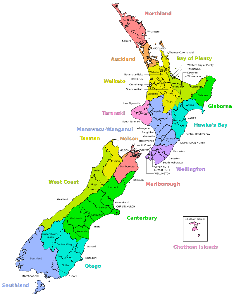
- Subdivisions
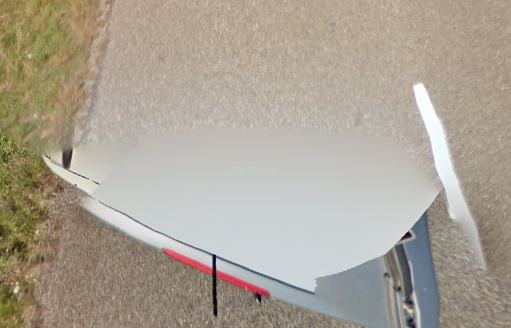
- Google Car
- Unique Vehicles
- Bollards
- Google Coverage
- Camera Generation
- Road Lines
- Road Signs
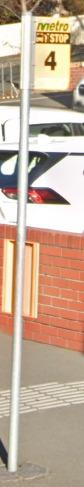
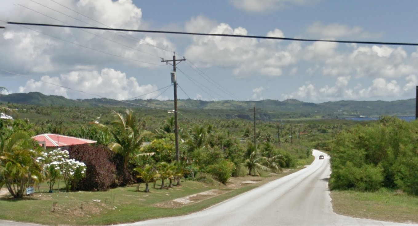
- Electricity Poles
- License Plates
- Phone Number
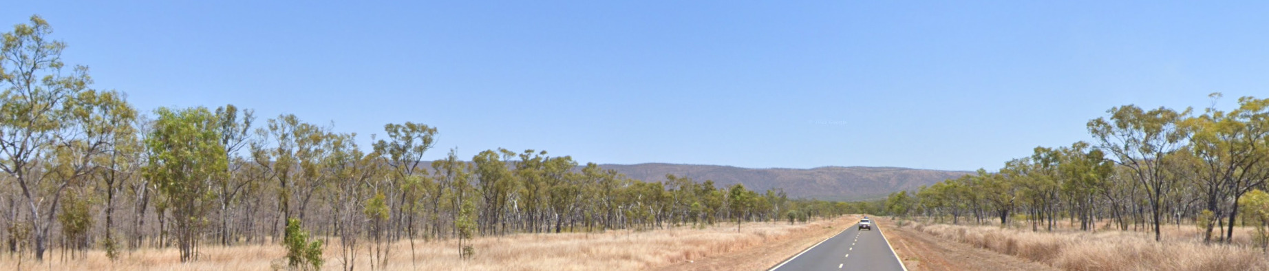
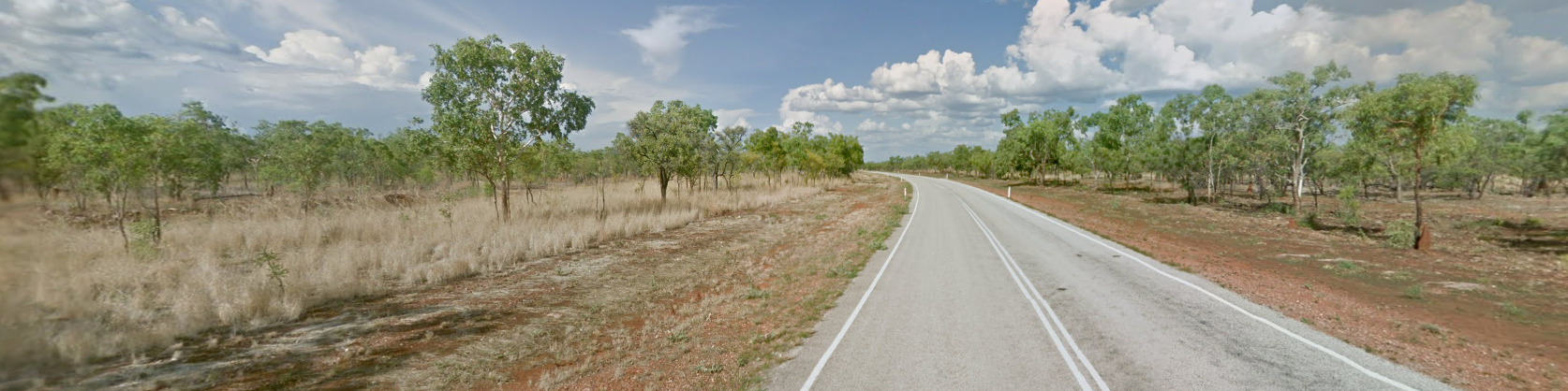
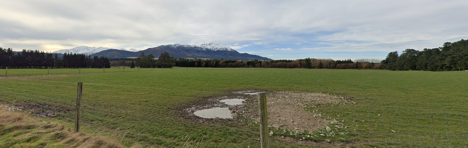
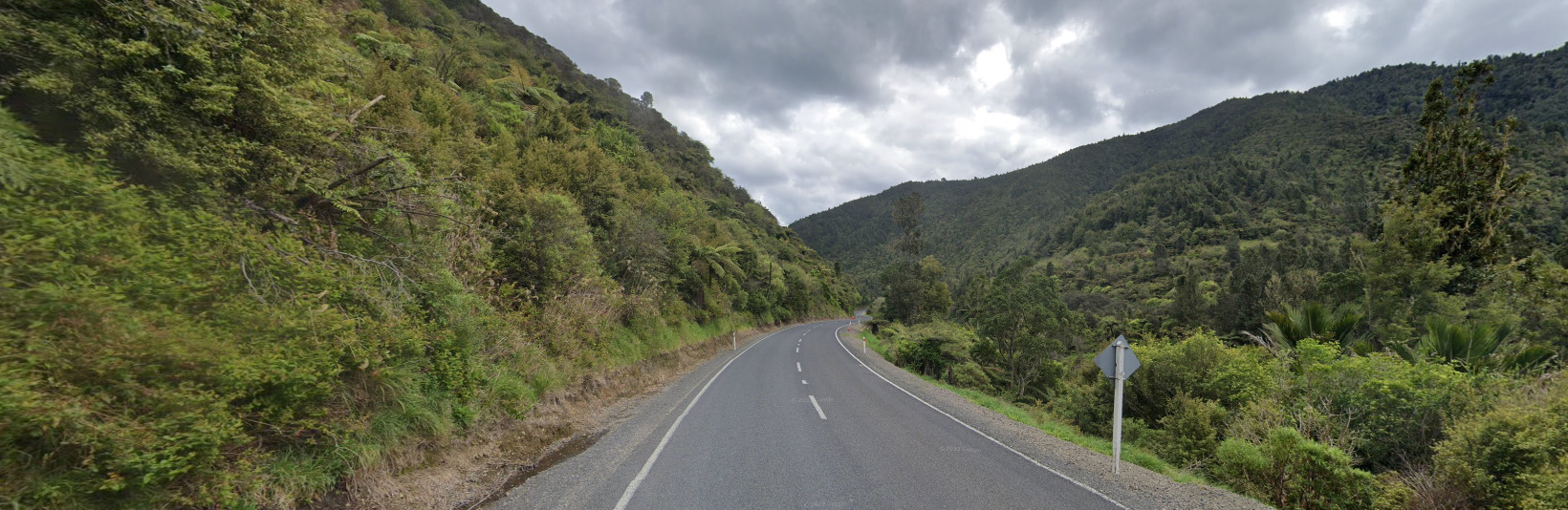
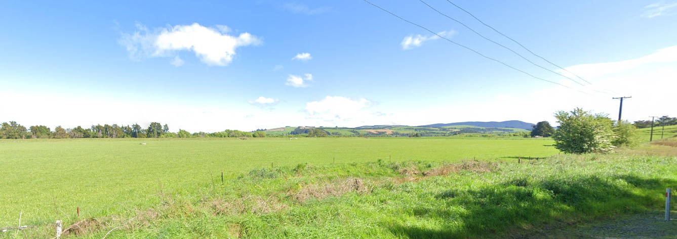
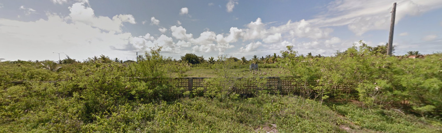
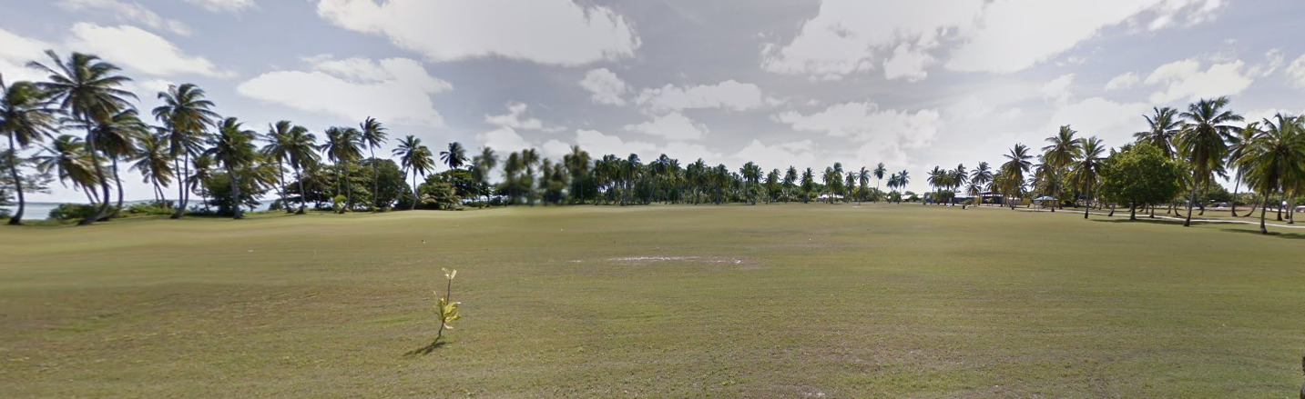
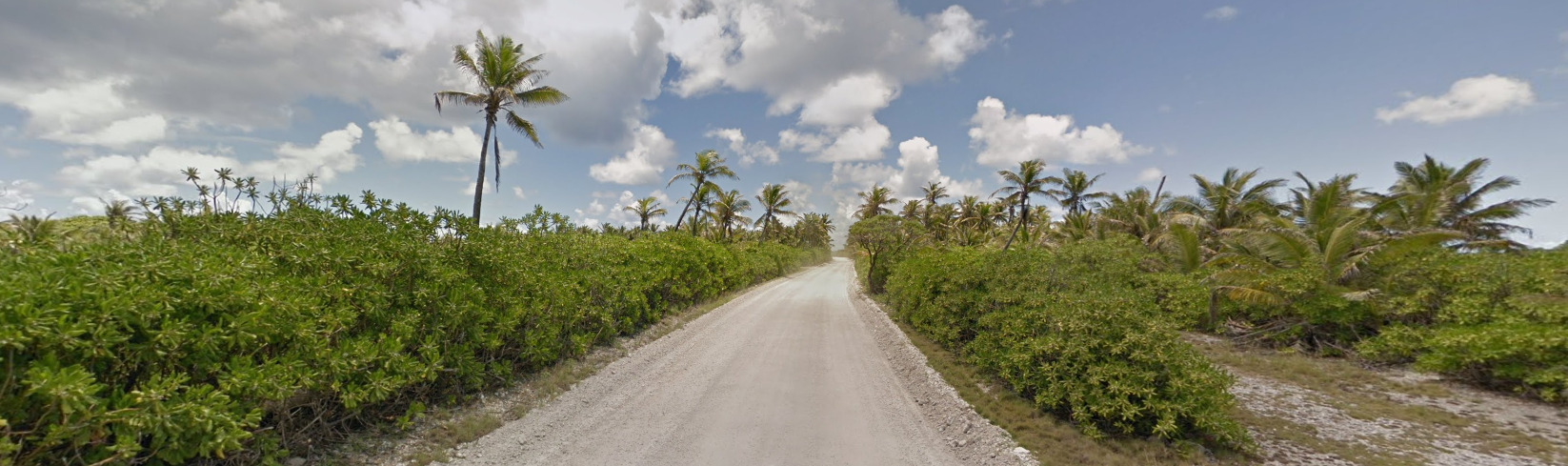
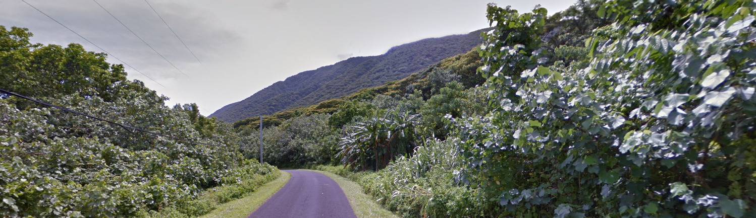
- Vegetation / Landscape
- Topography
- Specific Tree
- Architecture
- General Look
- Language
- Domain
Country Flag:
Capital City:
Canberra
Largest Cities by Population:
1. Greater Sydney – 5,361,466
2. Greater Melbourne – 5,096,298
3. Greater Brisbane – 2,582,007
4. Greater Perth – 2,141,834
5. Greater Adelaide – 1,378,413
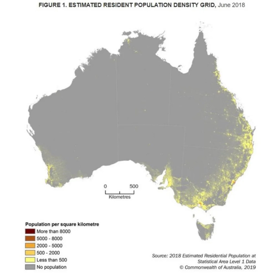
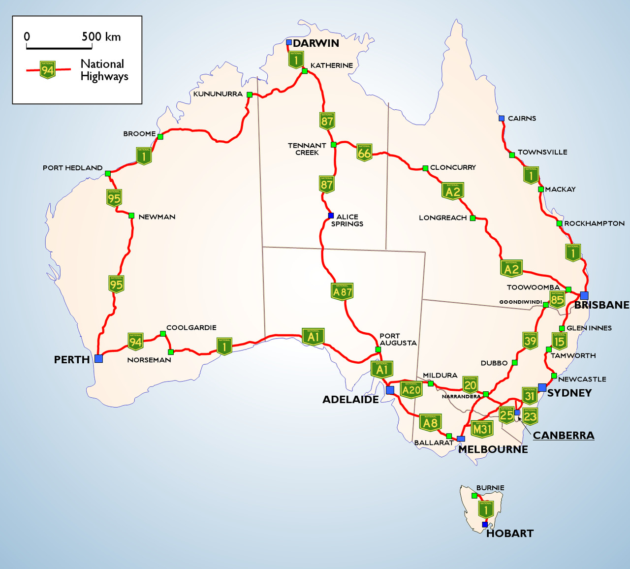
These five cities have one thing in common, they are all on the coast. The middle of Australia seems to be mostly empty, with roads and settlements being few and far between.
Most Helpful:
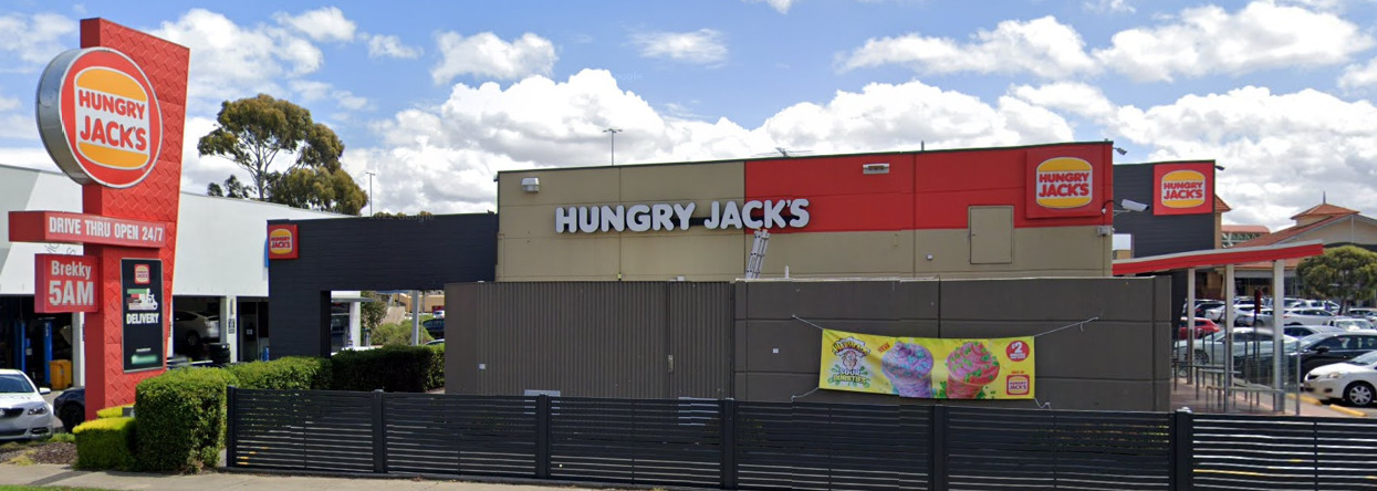
Funny enough, seeing a Hungry Jacks is an instant Giveaway that you are in Australia. When Burger King first sought to establish itself in Australia in 1971, it discovered that there was already a local food chain called “Burger King”. Thus, after several failed attempts to buy the Burger King trademark, the name Hungry Jacks stuck. It is the only place in the world where Burger King is called “Hungry Jacks”

Subdivisions:
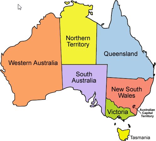
Australia Has 8 states which are as follows, New South Wales, Queensland, South Australia, Tasmania, Victoria, Western Australia, Northern Territory, and Australian Capital Territory.
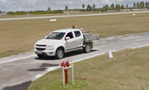
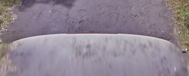
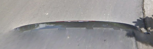
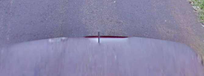
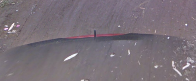
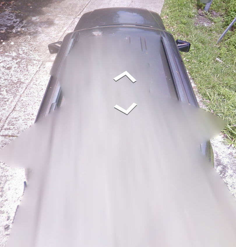
Google car:
It appears that the Gen 1 and 3 cars have an antenna, while you cant tell with the Gen 2 car.
The Gen 4 car definitely doesn’t have any remarkable features to it. Its hard to tell there is a car at all sometimes.
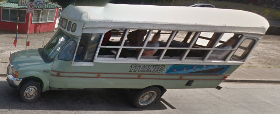
Unique Vehicles:
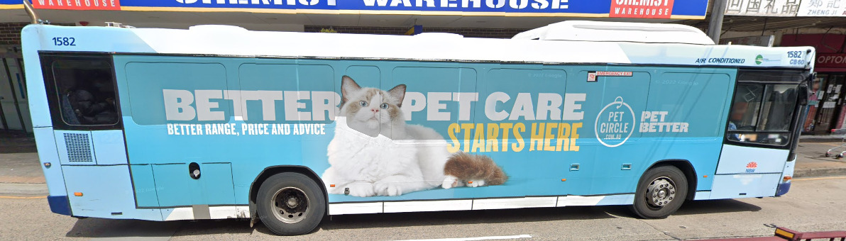
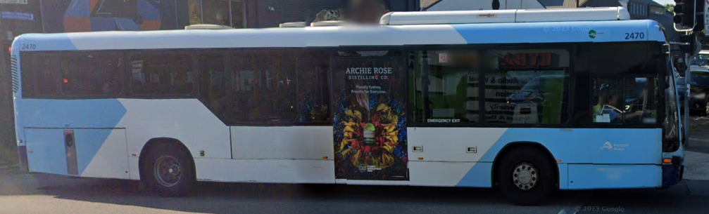
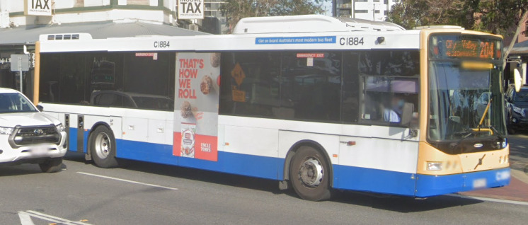
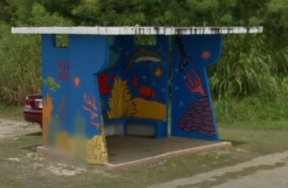
Buses in New South Wales will generally have dark blue at the bottom, and may also have light blue designs painted above them.
The Queensland buses have the same blue design at the bottom of the NSW ones, but they also have yellow at the front and rear.
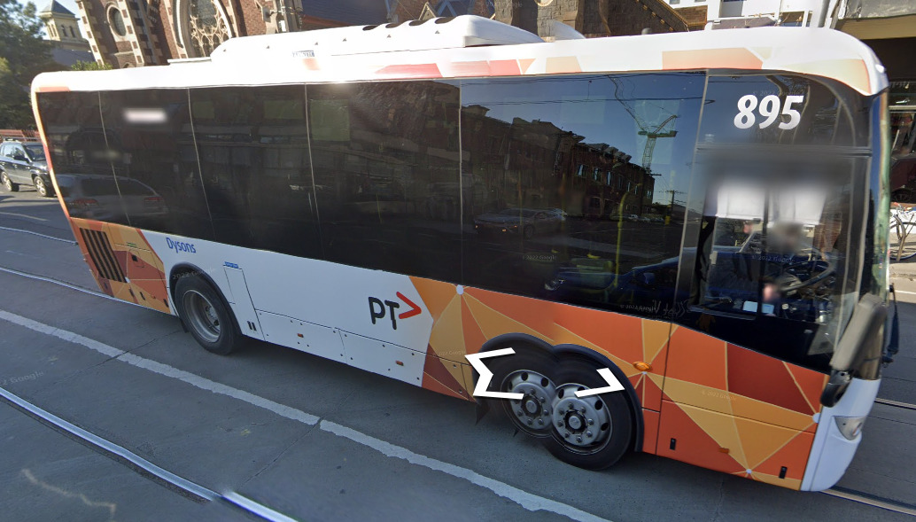
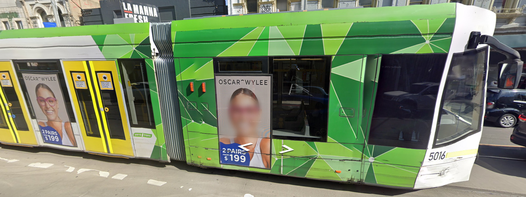
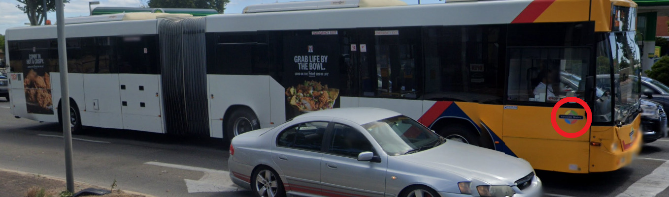
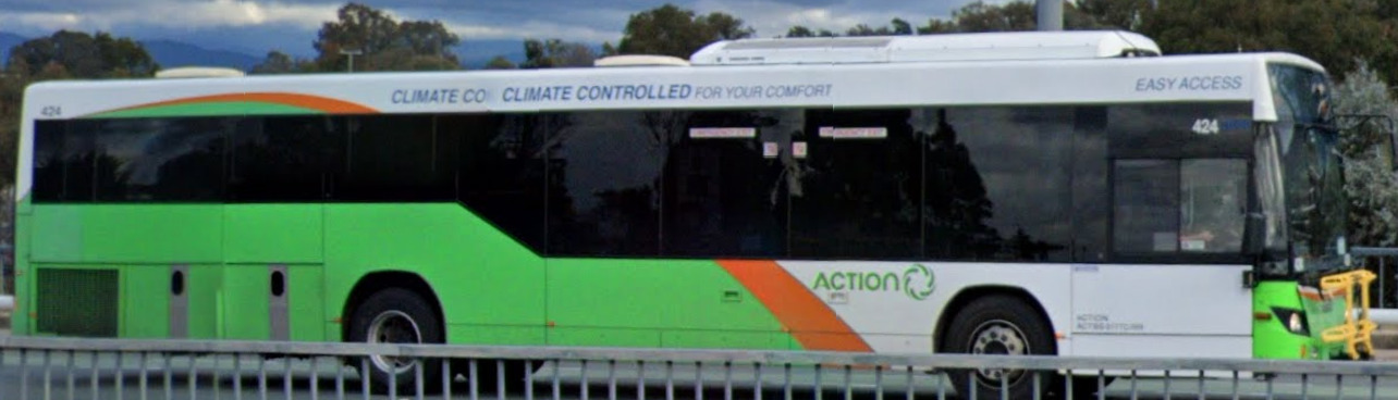
Most buses in Victoria have this orange-triangle design all around them. You will also find green triangular designs on the trams.
South Australian buses come in several designs of red, blue and yellow. However, they will always have the “Adelaide Metro” logo on them, and these logos are found on the trains and trams also.
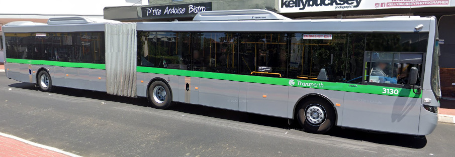
Western Australian buses have a grey design with green stripes, and also the word “Transperth” written on them.
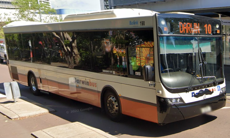
There are several bus designs in the Northern Territory, but many seem to have this orange design at the bottom, especially closer / in Darwin.
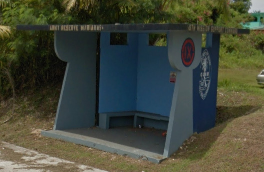
Tasmania has several bus companies, but most of them have the yellow at the front. There are several bus stop designs.
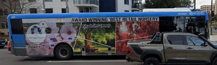
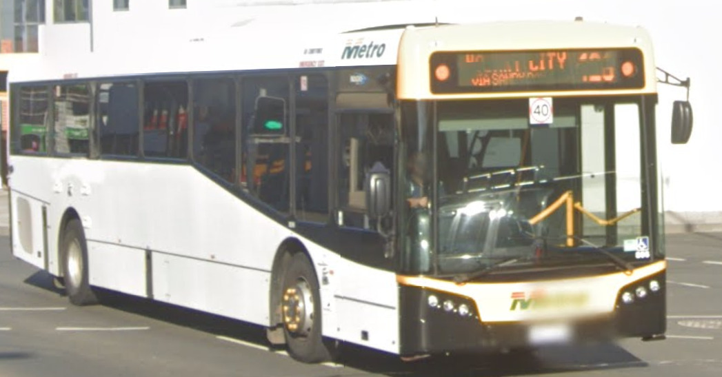
Finally, the Australian Capital Territory has a lot of bus designs. They can have blue, green or yellow on them.
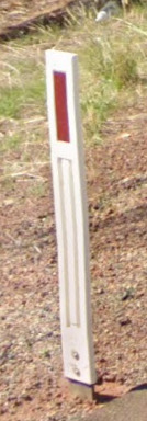
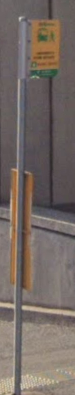
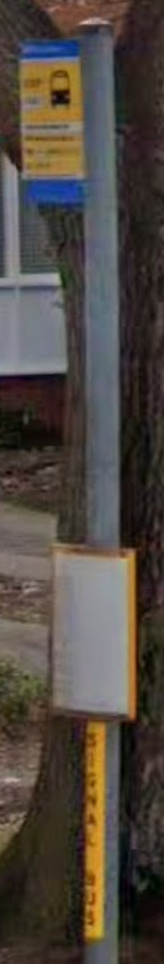
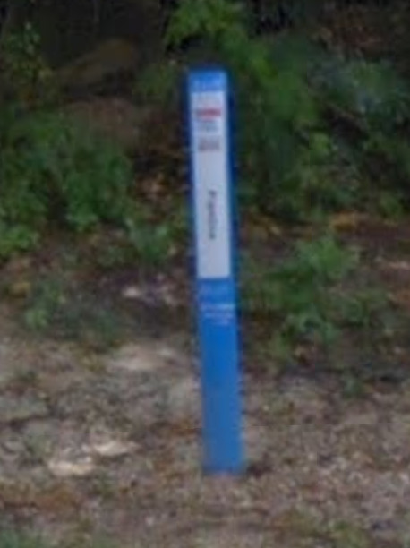
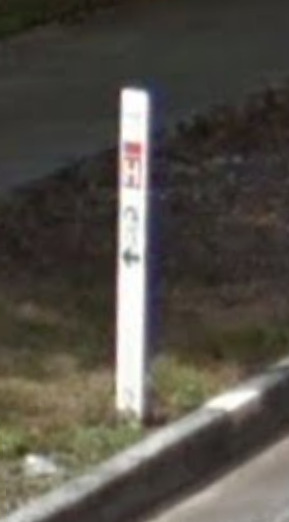
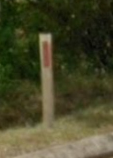
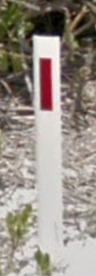
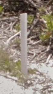
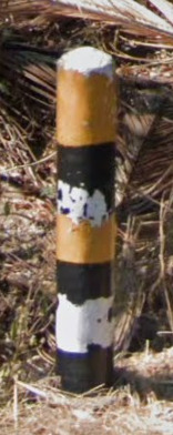
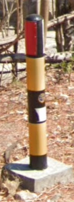
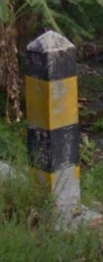
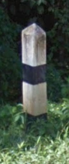
Bollard:
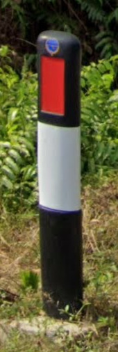
The most common Bollard is flat, and white apart from a red rectangle towards the top.
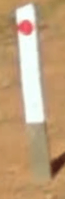
There are variations on these but they all maintain the color theme.
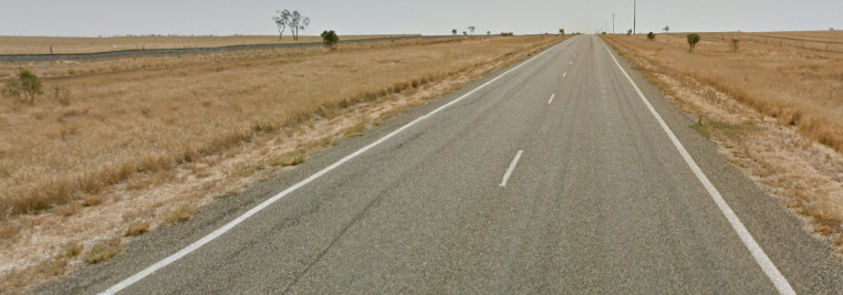
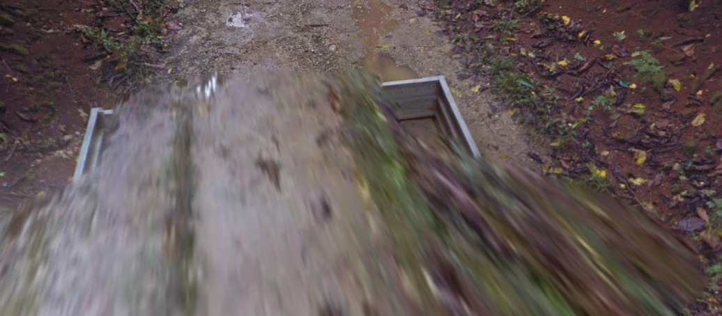
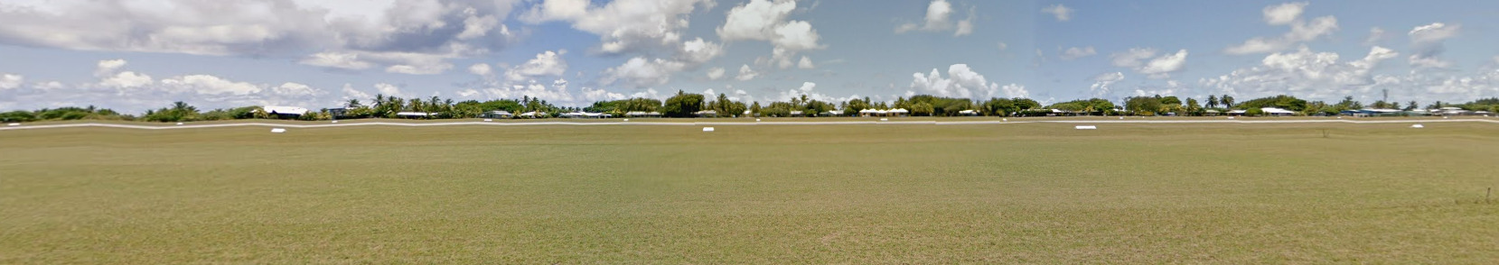
Google Coverage:
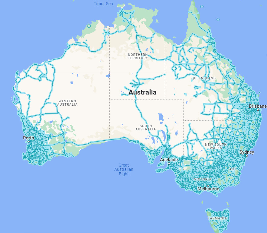
Australia has incredibly limited coverage away from the coast lines. This makes it difficult to get a good score, as most of the middle is filler. Guessing the wrong side of the country could be devastating.
Camera Generation:
Gen 1, 2, 3, and 4
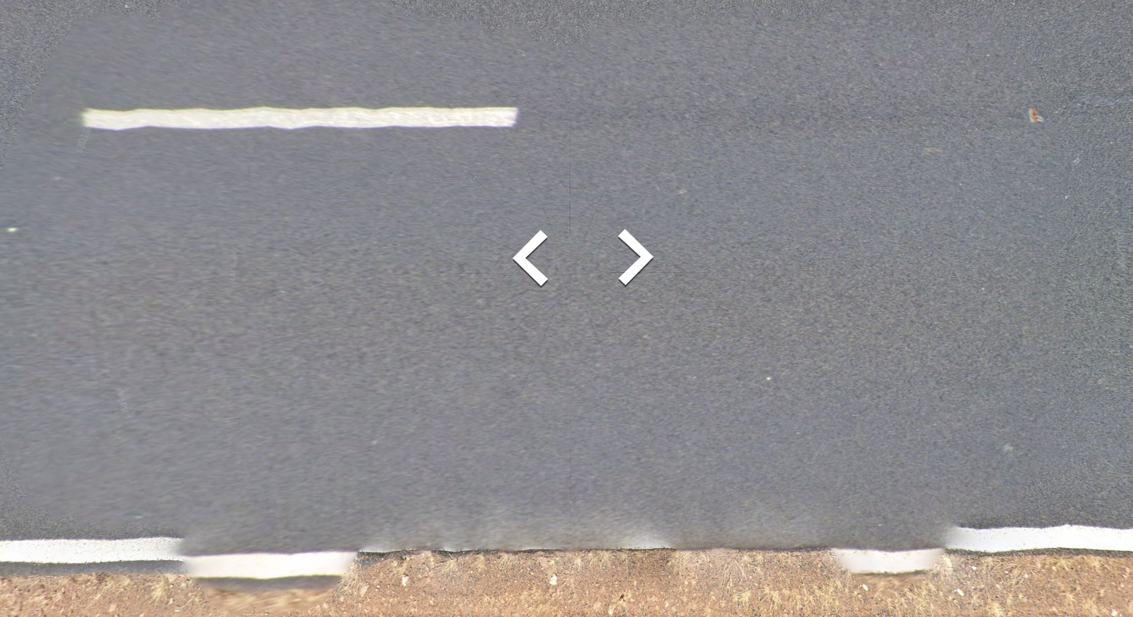
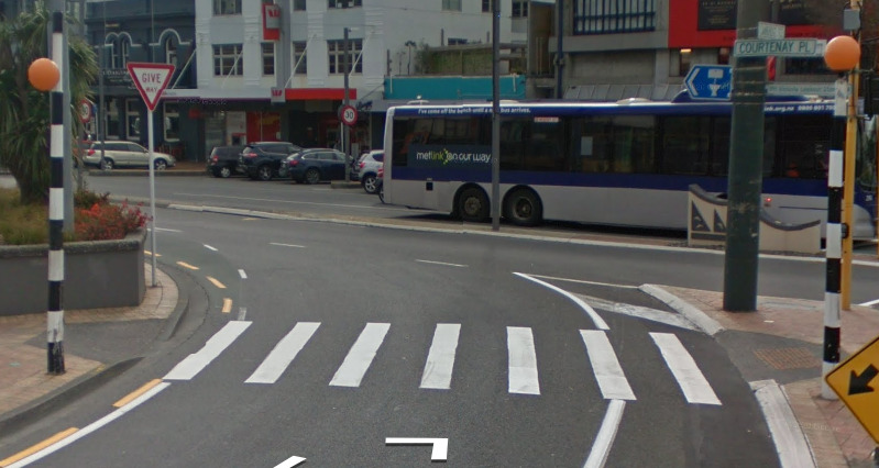
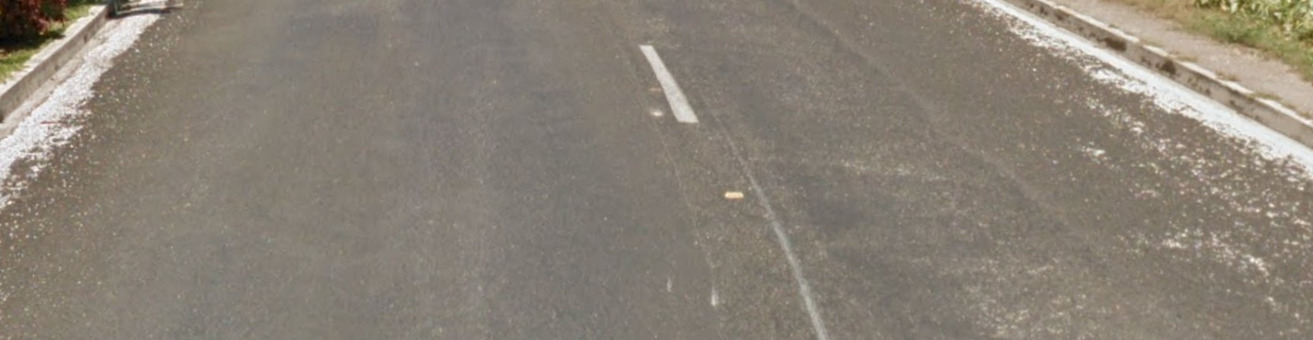
Road Lines:
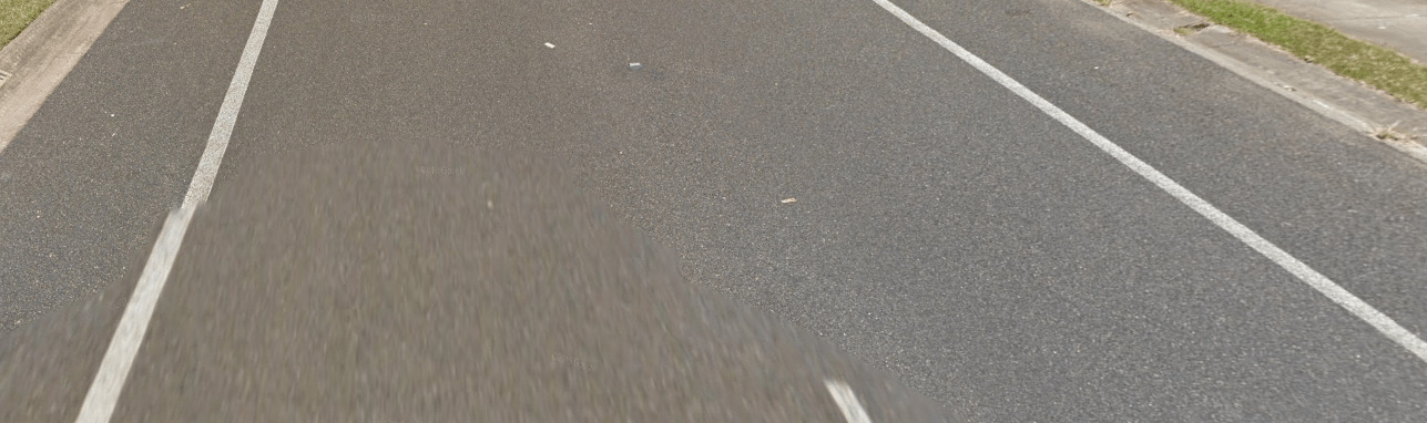
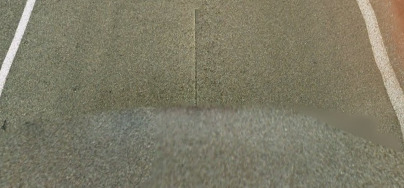
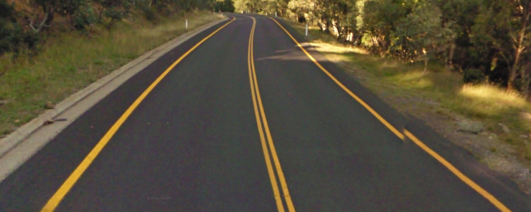
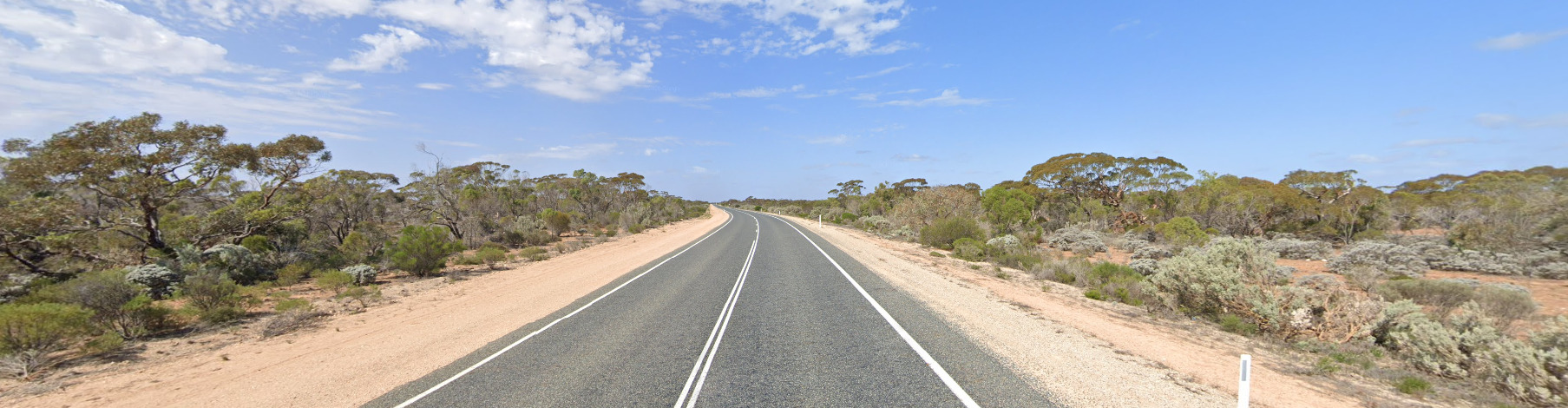
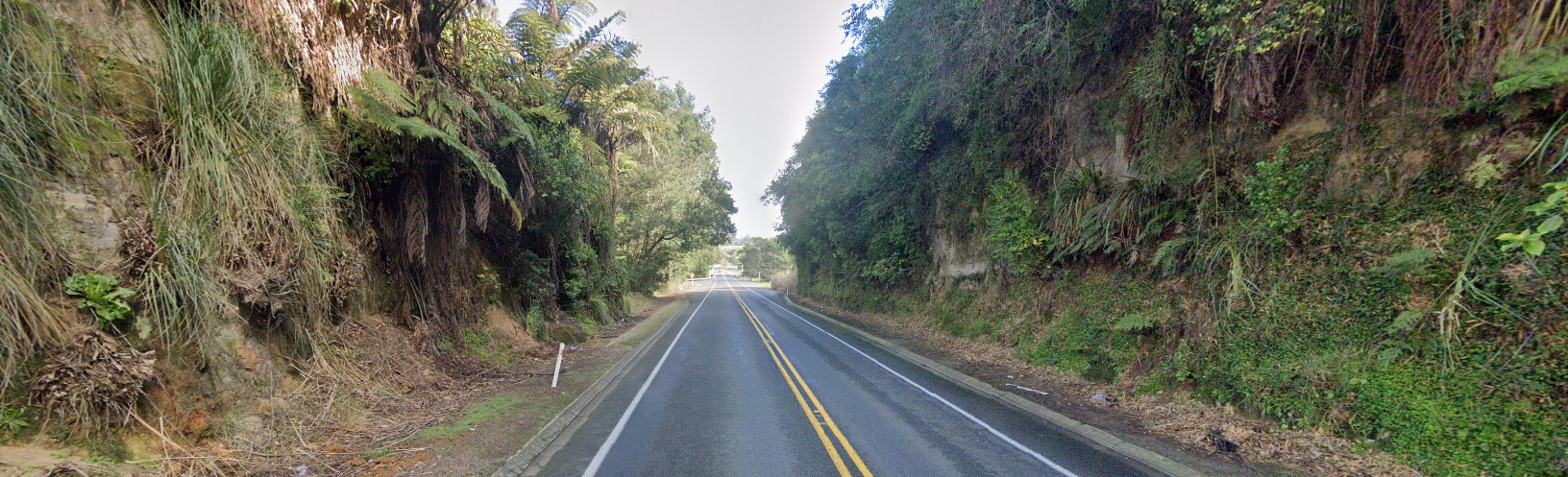
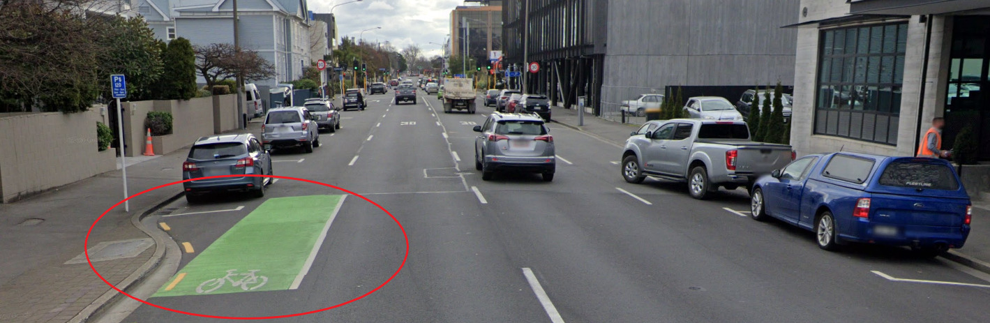
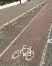
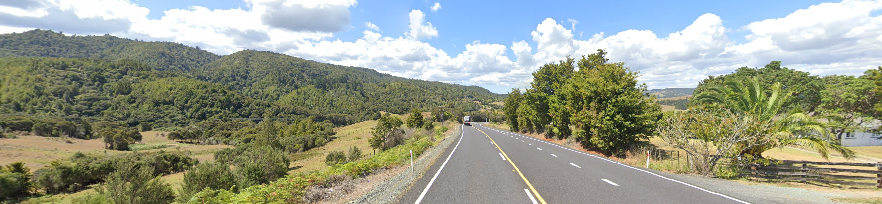
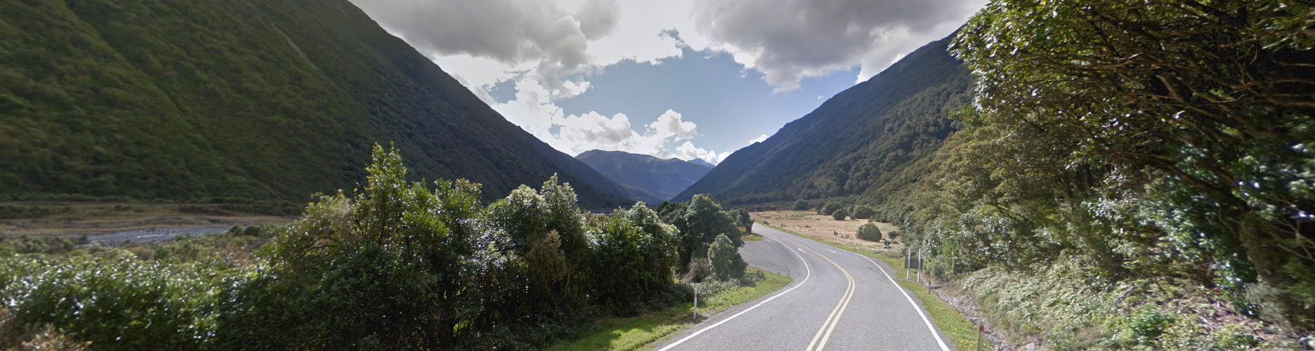
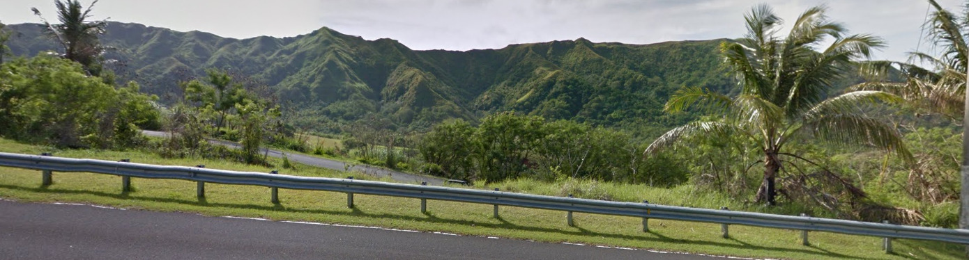
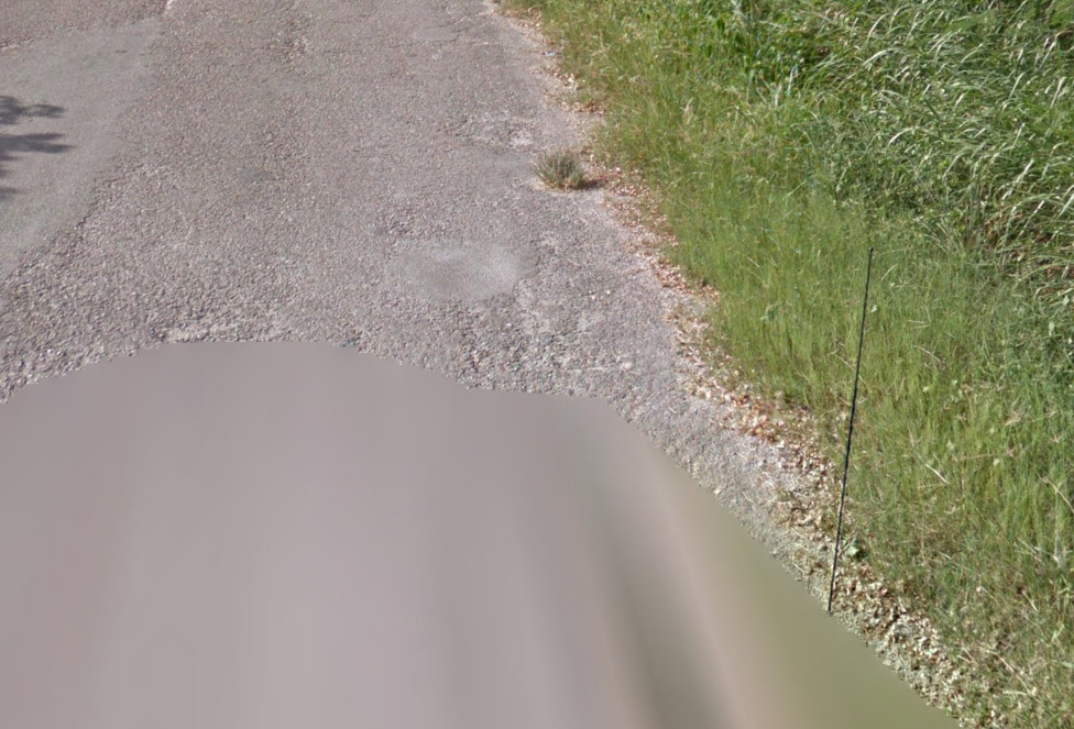
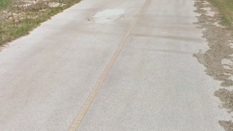
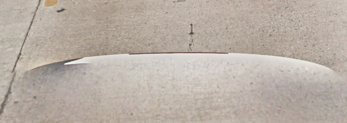
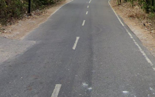
Australia normally uses all white lines. You can find rare instances of all yellow lines, typically in the mountains of New South Wales. You can see an example of this below.
Australia also will use the color yellow to inform it’s licensed drivers that you cannot park. While not a helpful tip, it can help with the confusion you may experience while seeing the yellow lines in Australia.

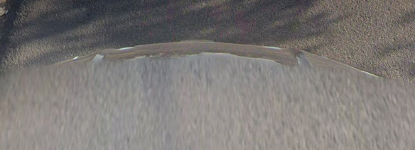
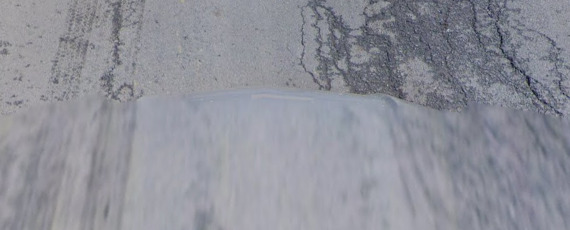
You can occasionally find these rumble strips in desolate areas. You tend to be very far away from any civilization.
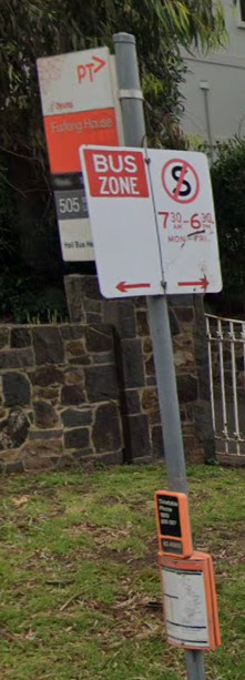
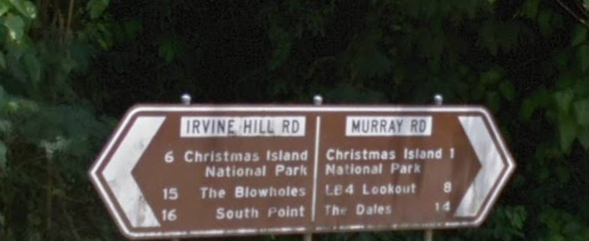
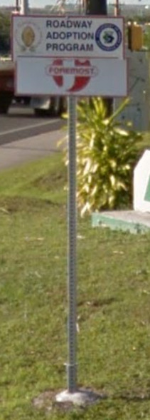
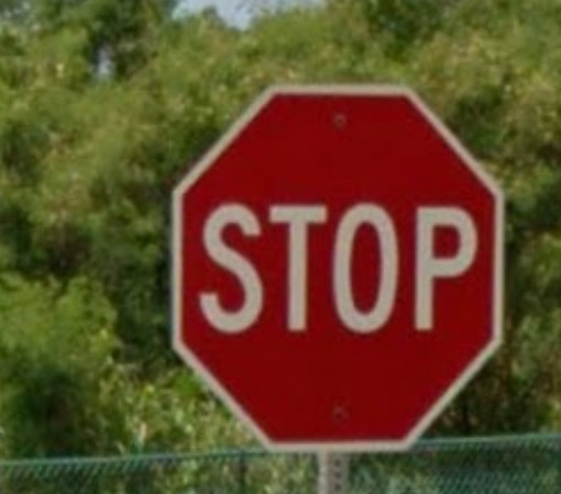
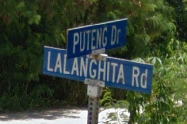
Road Signs:
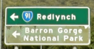
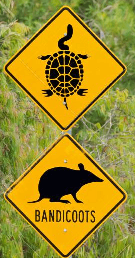
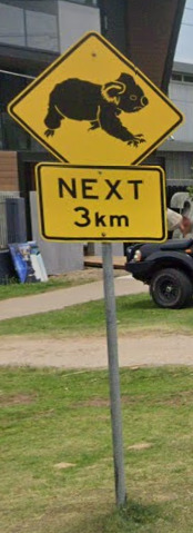
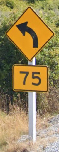
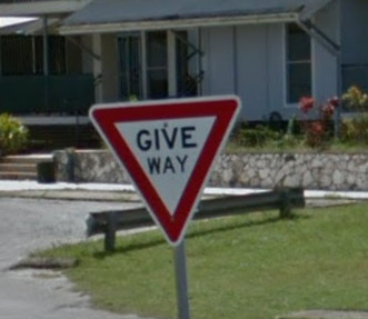
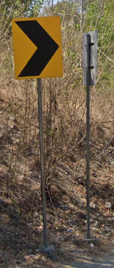
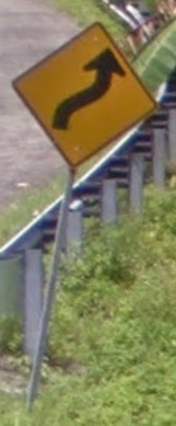
Australia uses yellow diamond-shaped warning signs often featuring the local fauna.
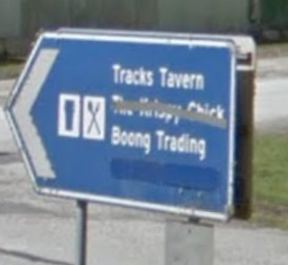
Australia has a wide range of signs, most look similar to signs you could find in the USA or Canada.
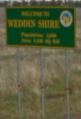
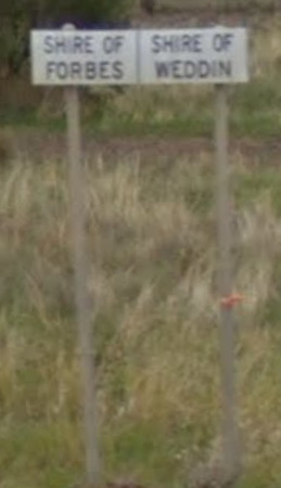
“Shire” essentially means County. You can find these signs near all “Shire” borders, with some indicating a population or showing a crest of arms.
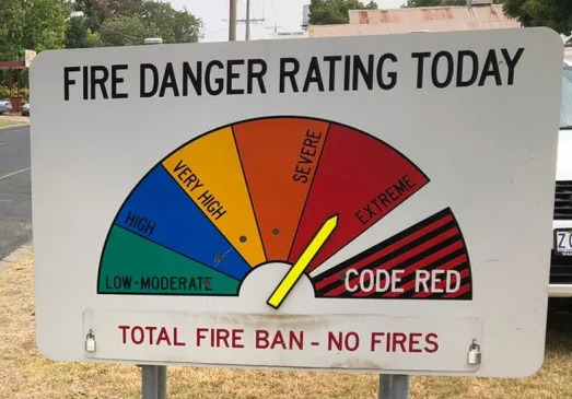
You can occasionally find these wild fire signs. They will sometimes indicate the area you are on up top, and Code Red can sometimes be Catastrophic. However, they share a very similar design and can be found on the outskirts of most large towns.
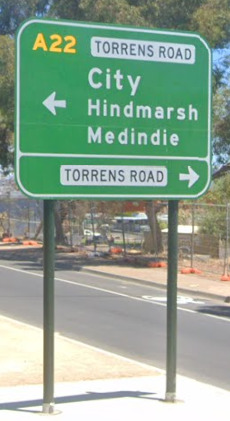
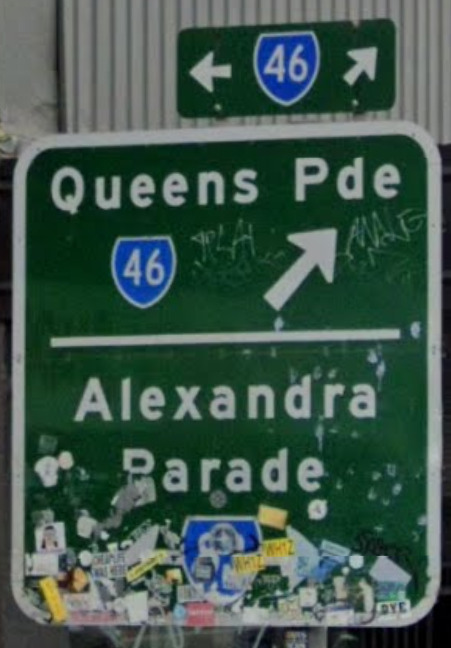
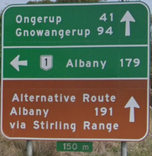
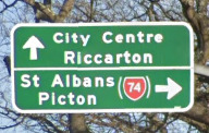
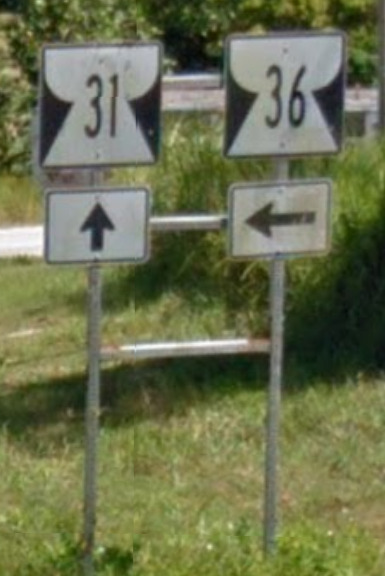
Australia typically uses a green sign with a blue shield as their state road symbol. Its important to note that New Zealand uses a RED shield while the USA has their typical Black and White / Red and Blue shields.
Roads are often alphanumeric or on blue shields. The national highways begin with the letter A and a number, most state highways begin with B and a number (although Queensland and Western Australia use blue shields), and some will use C.
You can even use a few quick tips for State-Specific metas.
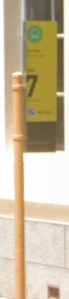
Some Western Australia road signs will be on yellow poles.
Some bollards in Western Australia will be painted brown at the bottom.
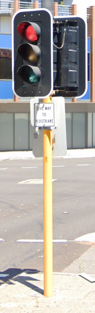
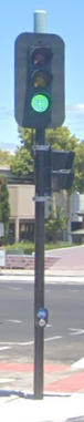
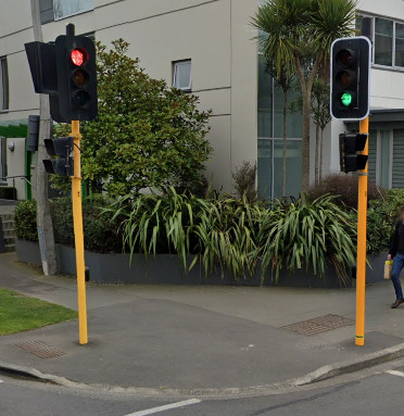
Western Australia, New South Wales, Queensland, Tasmania and the Australian Capital Territory have white borders around their traffic lights, while Victoria, South Australia and the Northern Territory do not.
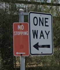
No Stopping sings in New South Wales are red, unlike anywhere else in the country.
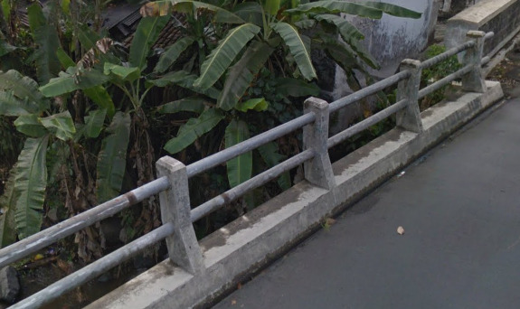
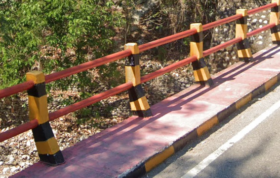
![]()
![]()
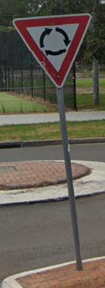
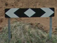
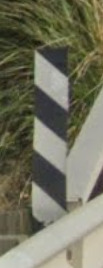
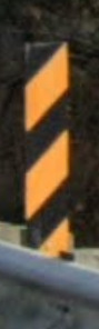
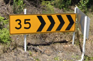
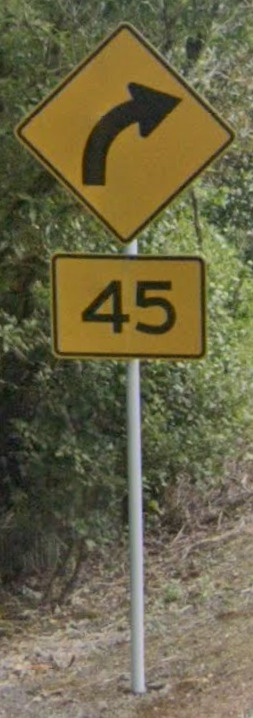
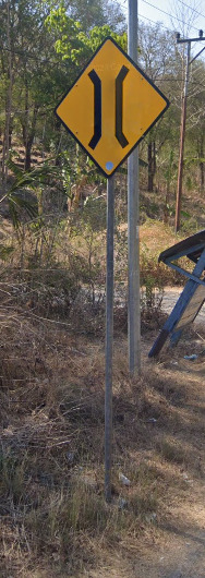
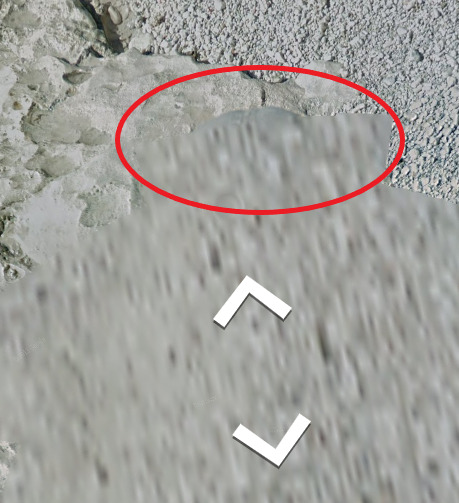
Chevrons seem a bit rare. You can find the Black and White ones occasionally near traffic circles. As for the Yellow and Black ones, these are located in Forested hilly areas, and are quite hard to find.
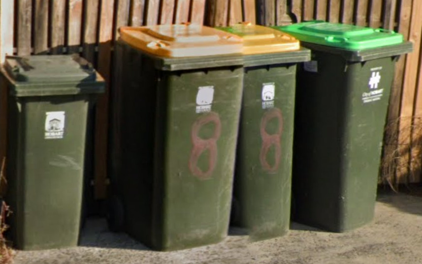
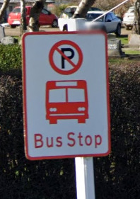
Like other countries in the world, you can find the City name as well as their logo on most trash bins located around. As these are often smaller, its often difficult to make out the name or logo. Shown here is the City of Hobart on Tasmania.
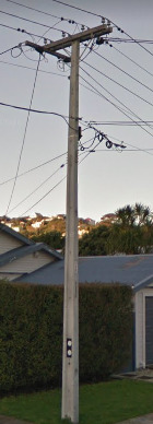
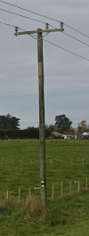
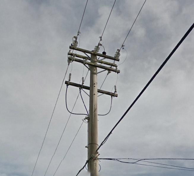
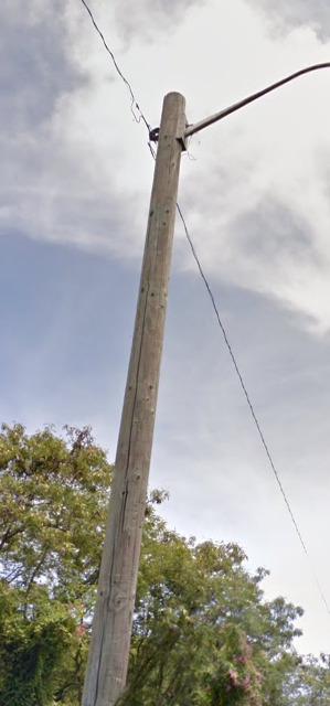
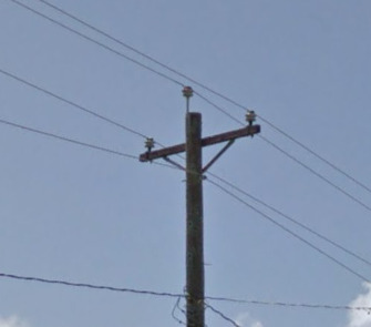
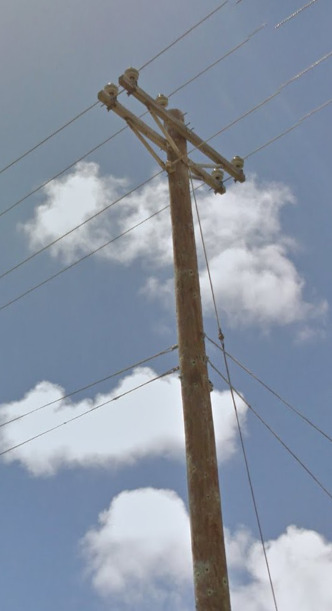
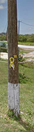
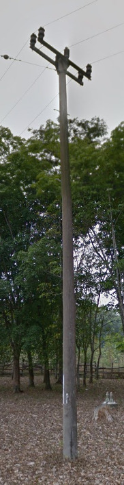
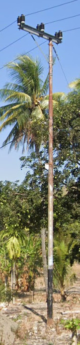
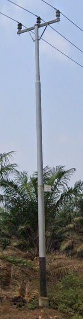
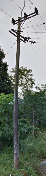
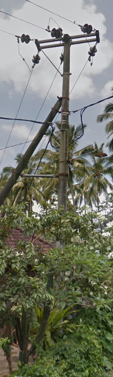
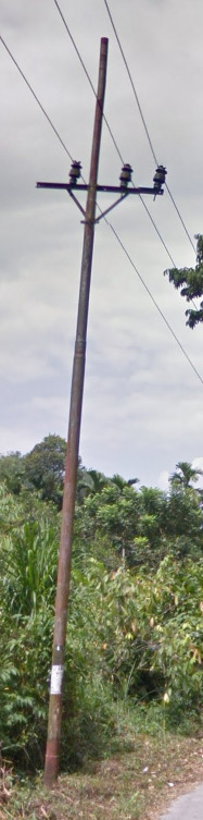
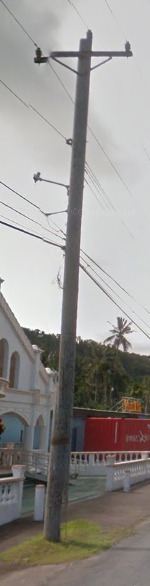
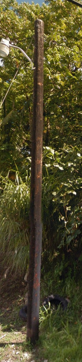
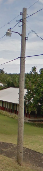
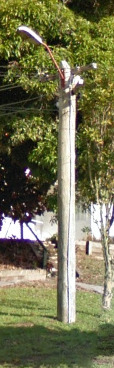
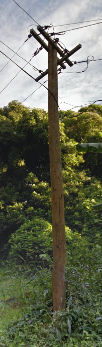
Electricity poles:
Australia uses wooden poles for most things, but an occasional metal one may pop up.
There are state specific poles, with some being a bit more helpful than others.
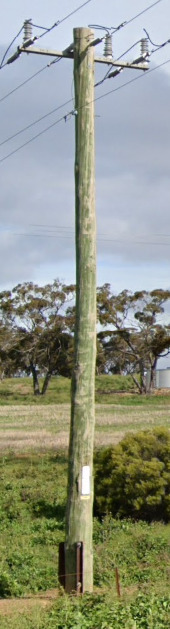
This is a timber pole. You’ll find them in Western Australia, Tasmania, Victoria, New South Wales, and Queensland. They’re often green, but they can be any color.
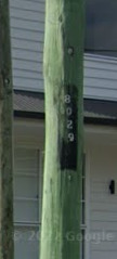
You can often find this black square with numbers in it. Each number is designed to a unique pole to make utility work easier. What is nice about this square is that it can only be found in Queensland.
You can find these metal poles with holes in the Northern Territory and the northern parts of Western Australia.
Finally, you can find the “Stobie” pole in South Australia. A Stobie pole is two metal beams joined by tie bolts and held apart by a slab of concrete. It often has artwork towards the bottom and can be used as bus stops if painted Yellow.
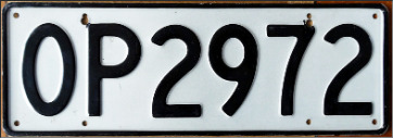
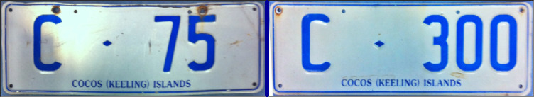
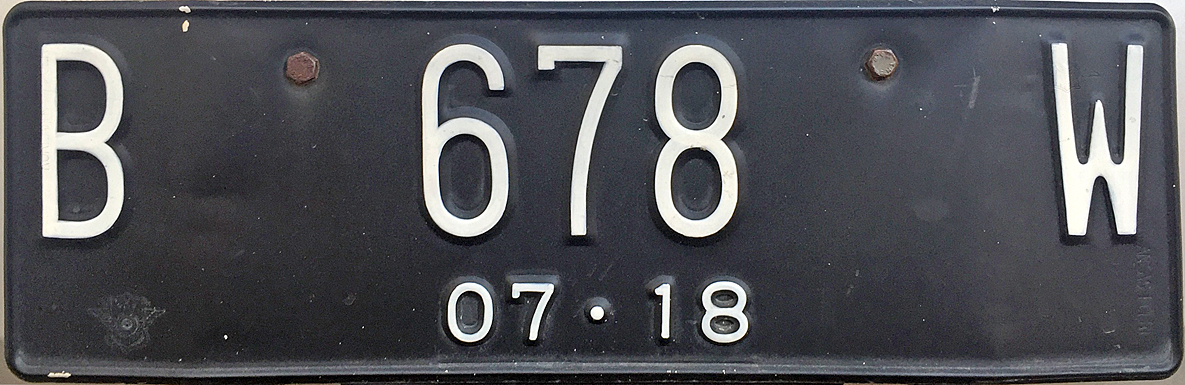
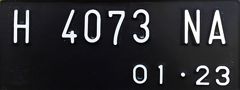
License plates:
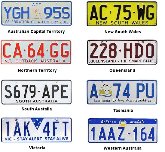
All plates are white except for New south wales where they are yellow.
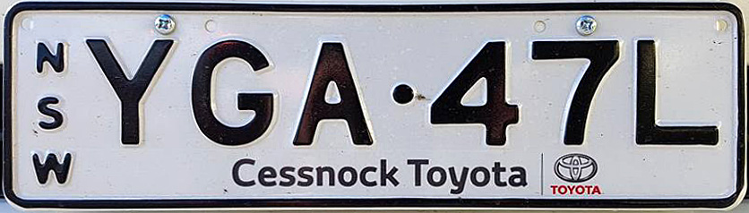
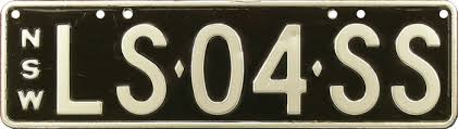
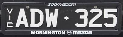
Both New South Wales and Victoria use lots of thin license plates, and these can come in white and black for both states.
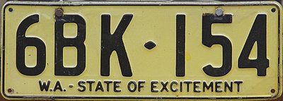
Western Australia used to use yellow license plates similar to those of NSW, but not since 1997. Very few farm vehicles and old cars will still have them in the google coverage.
Like most countries, you can often customize the license plate on your car. While its not worth showing all variations, its important to note that you may come across these on your travels.
Phone number:
Australian states each use a different first two digits with a couple overlaps.
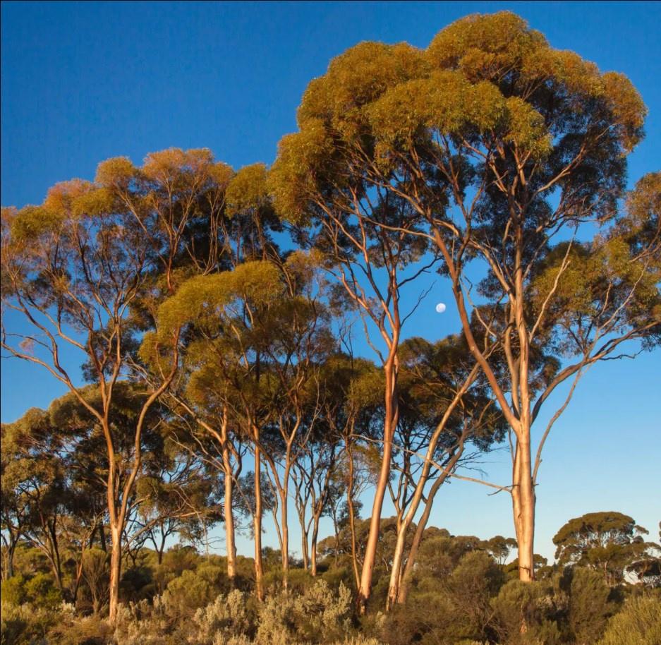
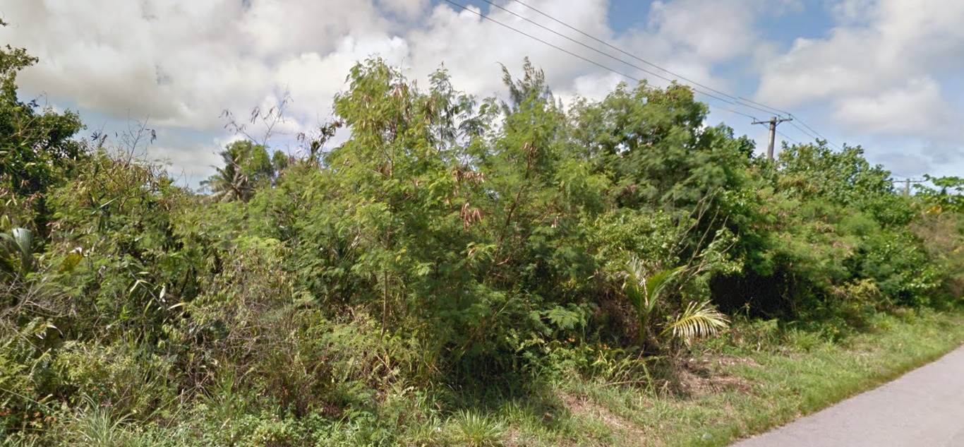
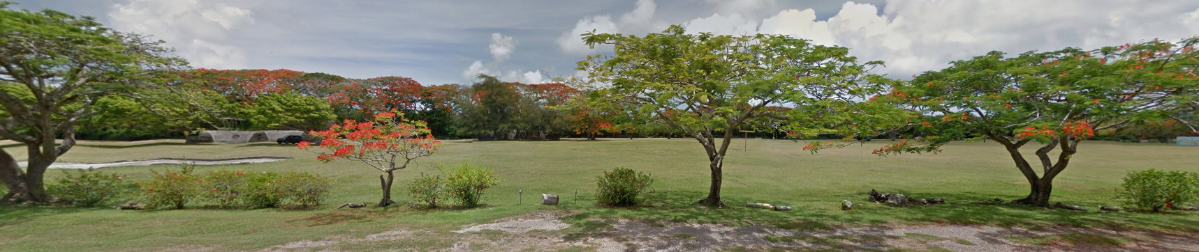
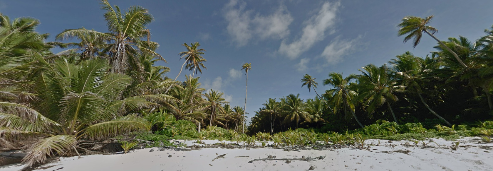
Vegetation/Landscape:
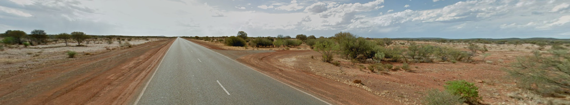
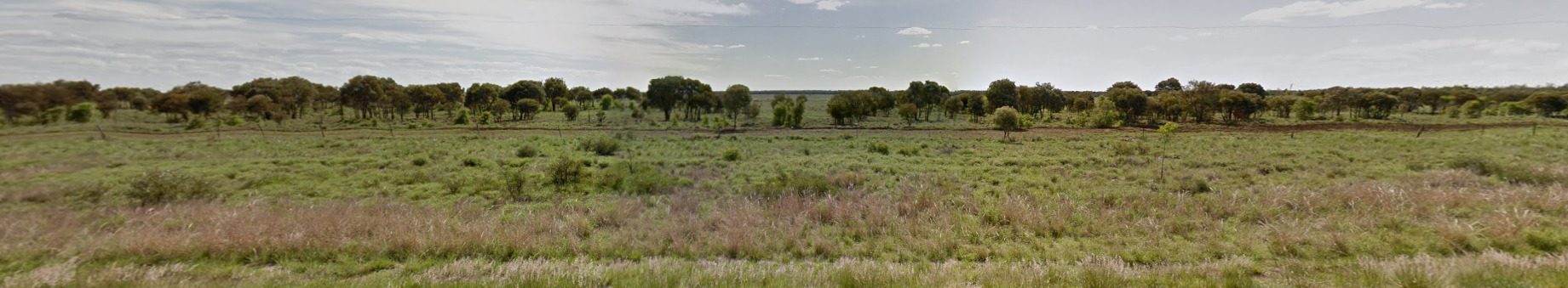
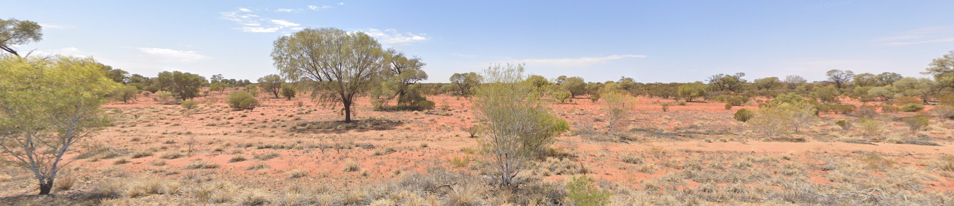
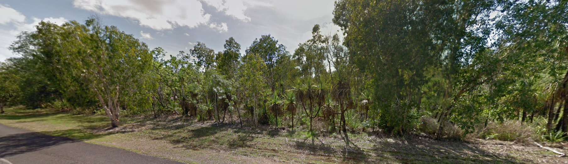
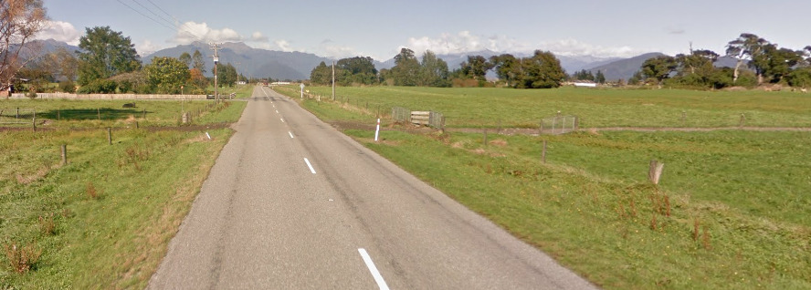
Australia has a wide variety of landscapes, ranging from desert in the center, grasslands in the south, and tropics in the north.
Topography:
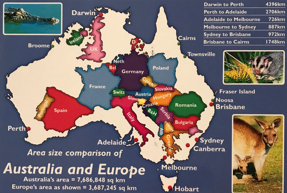
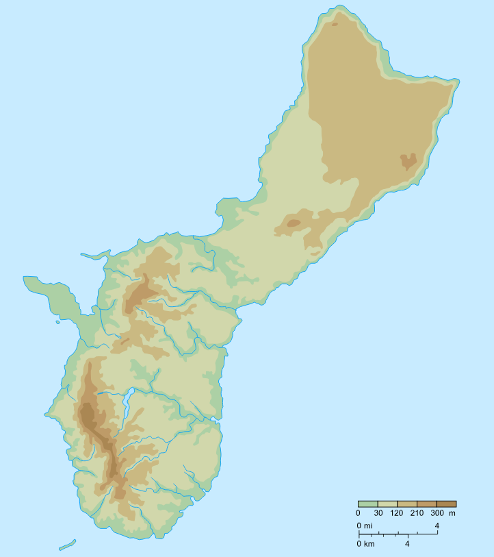
The continent of Australia is divided into four general topographic regions: (1) a low, sandy eastern coastal plain; (2) the eastern highlands, ranging from 300 to more than 2,100 m (1,000–7,000 ft) in altitude and extending from Cape York Peninsula in northern Queensland southward to Tasmania; (3) the central plains, consisting largely of a north-south series of drainage basins, including the Great Artesian Basin, which underlies about 1,751,480 sq km (676,250 sq mi) of territory and is the most extensive area of internal drainage in the world; and (4) the western plateau, covered with great deserts and “bigger plains” (regularly spaced sand ridges and rocky wastes), rising 300 to 600 m (1,000–2,000 ft) high and constituting most of the western half of the continent.
Australian mountains have eroded over recent geological periods, and only about 6% of the continent is above 600 m (2,000 ft); the average elevation is less than 300 m (1,000 ft). The highest point is Mt. Kosciusko, 2,228 m (7,310 ft), in the Australian Alps of the southeastern corner of New South Wales; the lowest point is Lake Eyre in South Australia, 15 m (49 ft) below sea level. In 1983, grains of rock from Western Australia were dated at 4.1–4.2 billion years old, making them the oldest ever found on earth.
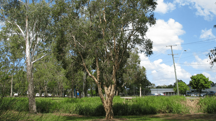
Specific tree:
Australia has a wide variety of unique Flora/Fauna to be found there, here are just 3 examples out of hundreds:
Eucalyptus.
Paperbark.
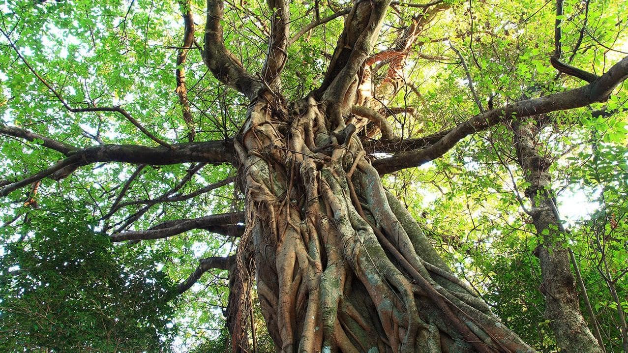
Strangler Fig.
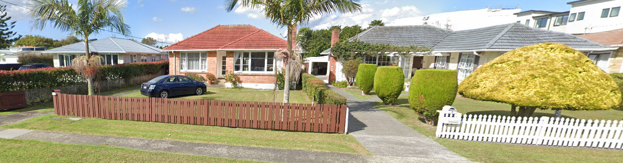
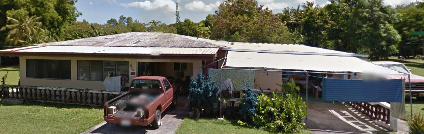
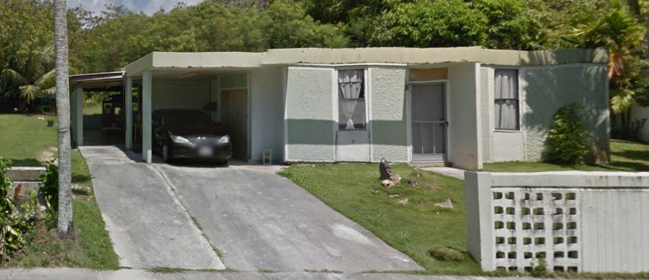
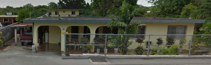
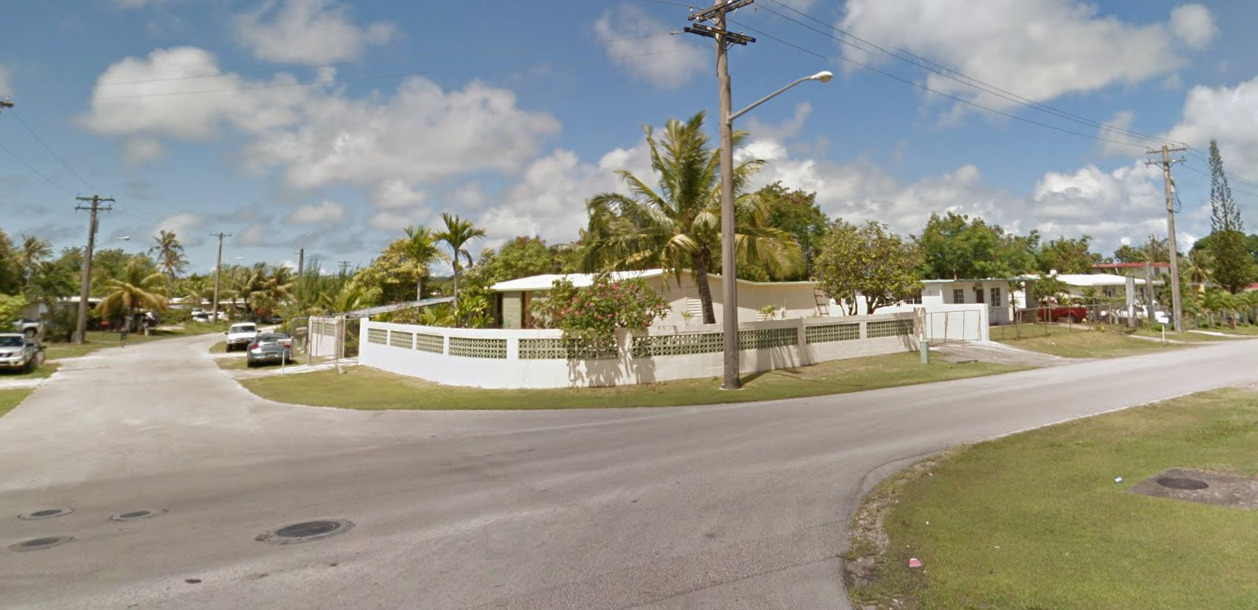
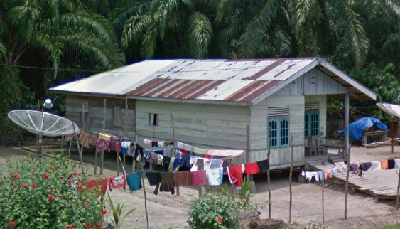
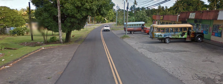
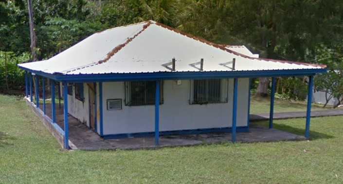
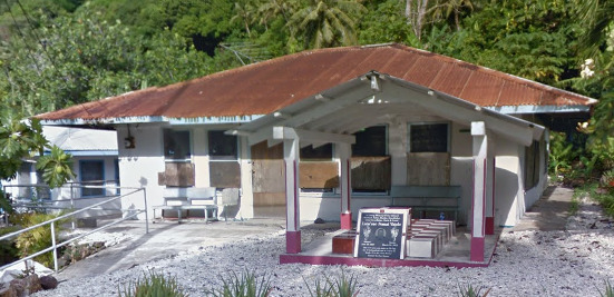
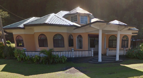
Architecture:
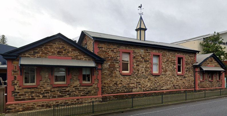
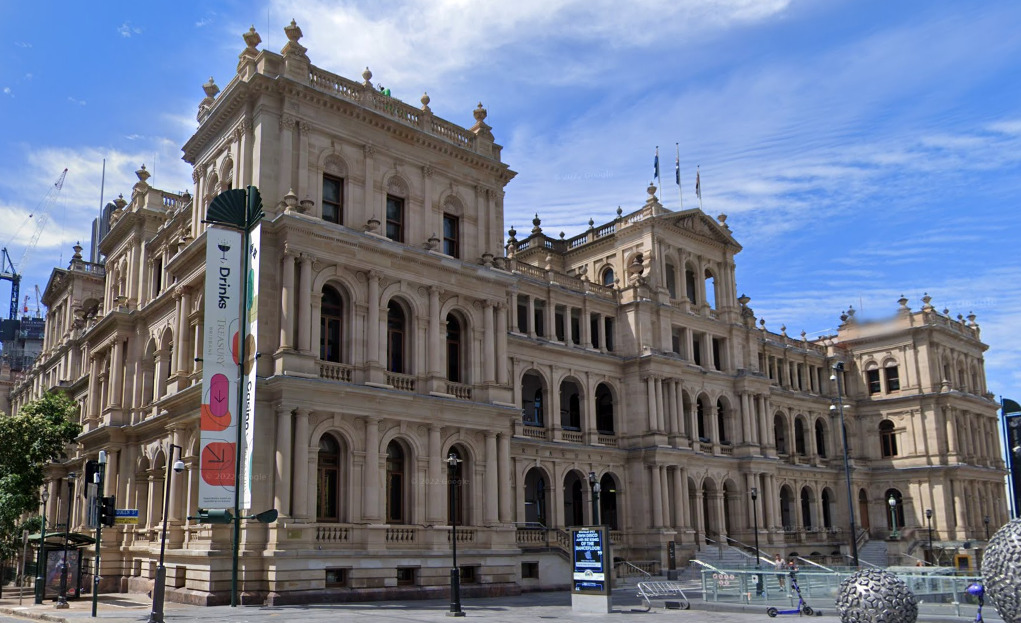
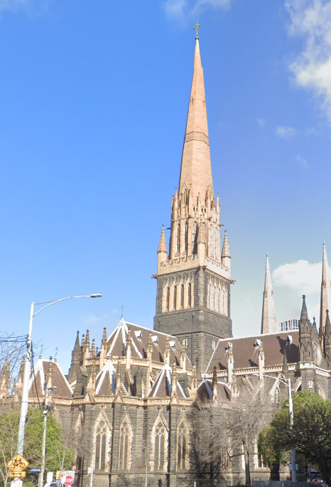
Most large cities in Australia do not have massive skyscrapers. There are some exceptions like Sydney Melbourne and Brisbane, but it looks like most cities have shorter buildings.
There is also a clear western influence on the buildings, with a lot of English architecture common throughout the country.
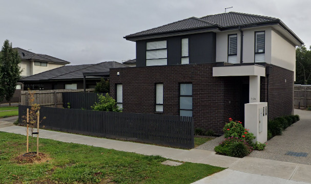
General look:
Alphabet/script:
Australia uses a typical English alphabet.
However, you can often find signs that include names that come from the Aboriginal Language.
Internet domain:
.Au
New Zealand
- Country Flag
- Capital City
- Most Helpful
- Subdivisions
- Google Car
- Bollards
- Google Coverage
- Camera Generation
- Road Lines
- Road Signs
- Electricity Poles
- License Plates
- Phone Number
- Vegetation / Landscape
- Specific Tree
- Architecture
- General Look
- Language
- Domain
Country Flag:
Capital City:
Wellington
Most Helpful:
(Front)
(Back)
Subdivisions:
Google car:
When it is Gen 4, you can see a bit of the blue car. However, the other Gens were covered by a white car. However, you will only see pieces of it if the coverage is slightly glitched.
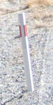
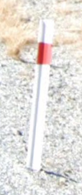
Bollard:
(Front)
(Back)
New Zealand has some unique bollards, so it is worth learning them. If you don’t, you may often confused New Zealand with Australia.
(Front)
(Back)
You can also find these near bridges.
Camera Generation:
Gen 1, 2, 3 and 4
Road Lines:
New Zealand uses a yellow divider line and white shoulder lines.
There are some cases where you can find just white dashed lines. This means that you can pass other drivers.
You can also find these in cities. They tell you that there is no parking in this spot.
You can also find Green bus lanes and red or green bicycle lanes in urban areas.
Road Signs:
New Zealand has these green signs that are on most major roads. That red shield is important as it is the New Zealand State road system.
New Zealand uses Diagonal warning signs, and they appear on White wooden poles. The exception is pedestrian crossings, which have black and white striped poles.
These are the pedestrian crossing signs mentioned above
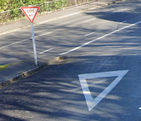
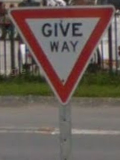
New Zealand’s Yield signs are white and red. They also have a white painted triangle on the road. This is a unique combination.
![]()
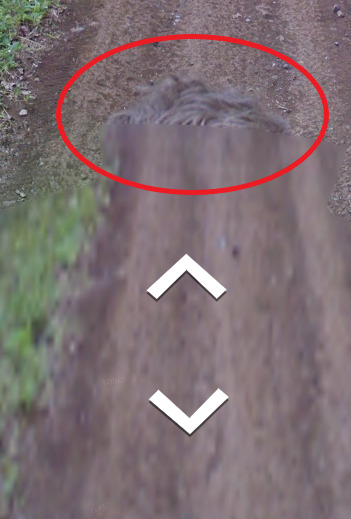
The Chevron in New Zealand is yellow and black, however it has this unique thin black border around the edge.
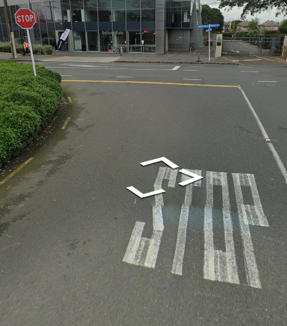
New Zealand uses a solid yellow line for its stop line.
New Zealand’s speed limit signs do not have a KM/H under the number. They just make the assumption that the drivers know better.
Electricity poles:
These concrete poles are mostly found in Suburbs and urban areas.
The wooden poles are mostly found in rural areas, but they can also be found closer to urban areas. There are some areas of the country that are replacing these poles with the concrete ones above.
These metal poles are found mostly on large highways and near some major cities.
New Zealand uses Yellow poles for their traffic lights. There were found in major cities quite frequently.
License plates:
Phone number:
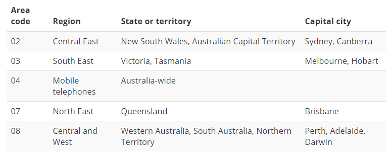
Area codes in New Zealand can be incredibly useful.
02 = Cellphone
03 = Entire South Island
04 = Wellington area
06 = East side of North Island
07 = Central and west side of North Island
09 = North end of North Island (from Auckland northwards)
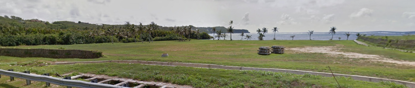
Vegetation / Landscape:
Architecture:
Some cities will have some taller skyscrapers, but they’re not too common of a sight.
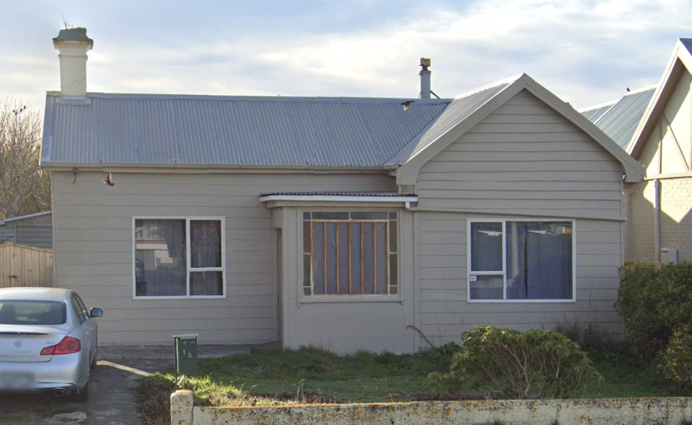
New Zealand has quite a few houses with this metal roof. Some are in better condition, while others are rusty.
General look:
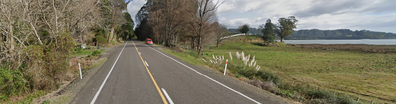
This is the General feel of the North Island. While New Zealand is really diverse, its a generic feel.
This is the General feel of the South Island.
The best thing to do is imagine the Lord of the Rings movies. If it looks like Middle Earth, its New Zealand.
Alphabet/script:
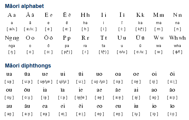
New Zealand uses English and Māori. Most of the North Island contains both languages.
Māori words have the unique letters with a horizontal line above them.
A key way to know if a place is a Māori word is if it ends in common vowel pairs, like ‘ui’, ‘ea’, or ‘oa’.
Domain:
.nz
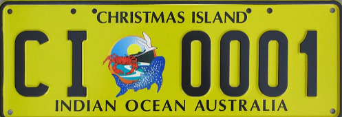
Christmas Island
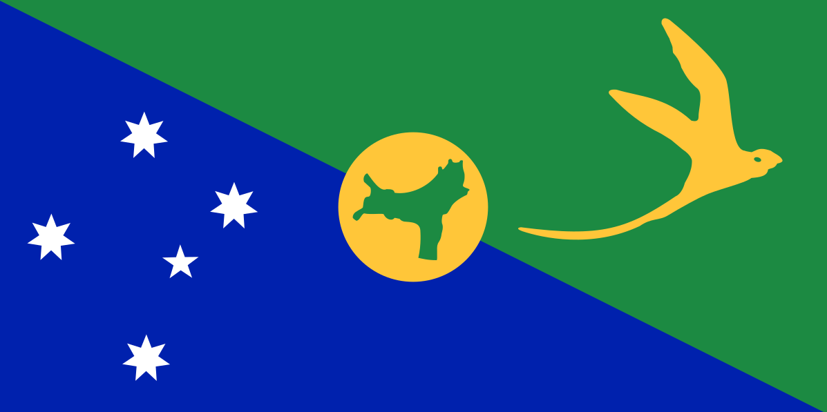
Country Flag:
Google car:
You can see the edges of the tray on the back of the google car.
There is also boat coverage on the north coast.
There is also trekker coverage.
Bollard:
Christmas island has a few different bollards, including the same bollard as mainland Australia.
Camera Generation:
3
Road Lines:
Christmas island uses white lines though most are faded.
Road Signs:
Street names are on yellow signs.
Electricity poles:
–
License plates:
Christmas islands use yellow backed plates.
Phone number:
–
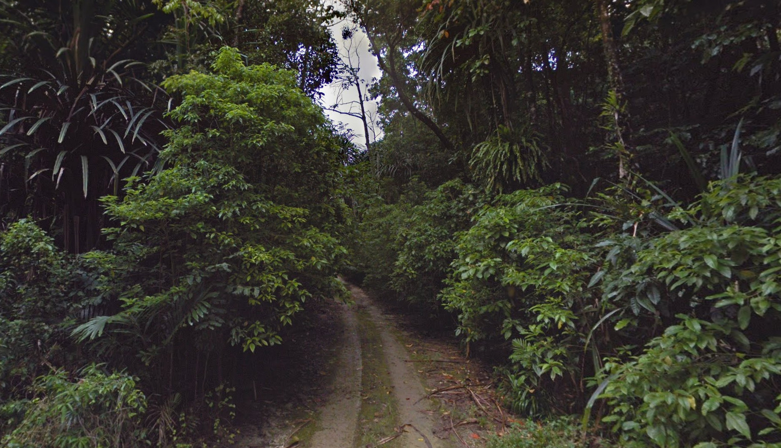
Vegetation/Landscape:
Christmas island is a tropical island containing dense rainforest.
Specific tree:
–
Architecture:
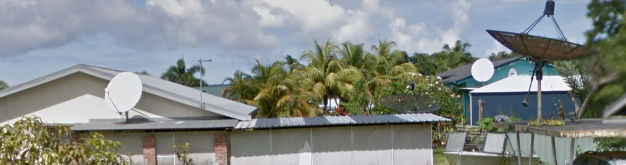
Many of the houses feature satellite dishes.
General look:
Alphabet/script:
Christmas island uses English.
Domain:
.cx
Guam
- Country Flag
- Capital City
- Most Helpful
- Google Car
- Bollards
- Google Coverage
- Camera Generation
- Road Lines
- Road Signs
- Electricity Poles
- License Plates
- Phone Number
- Vegetation / Landscape
- Architecture
- General Look
- Language
- Domain
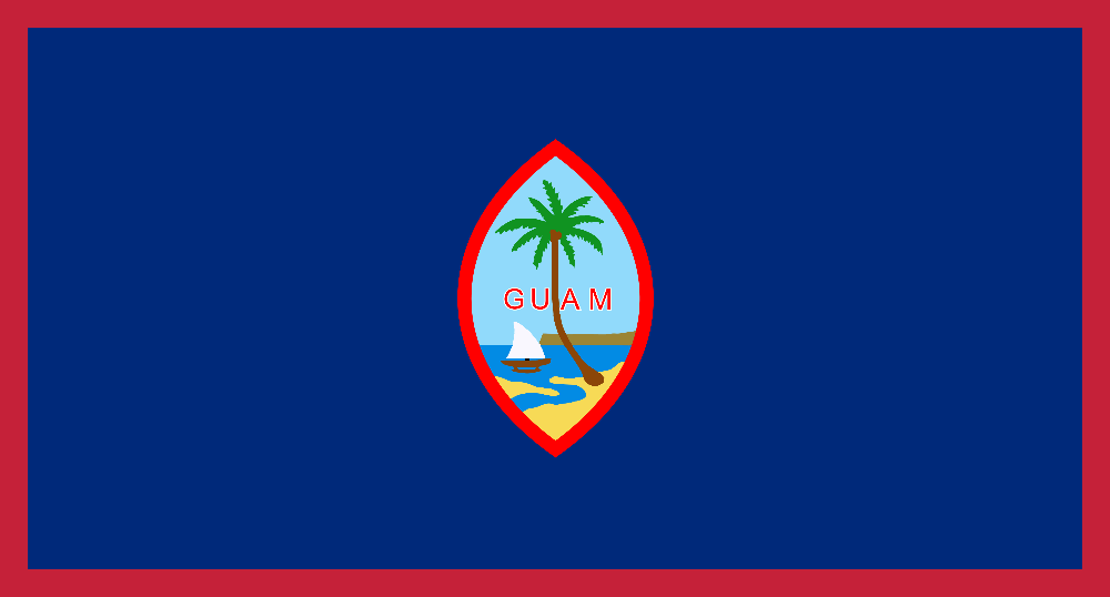
Country Flag:
Capital City:
Hagåtña
Most Helpful:
Google car:
Guams google car features a long antenna on the front right of the vehicle.
Bollard:
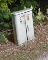
While not exactly a bollard, these electrical access panels can be found often throughout Guam. They will be in most residential areas near stop signs, and then scattered across the island on most roads. They will either be the one shown above, or one that is half the size but with a similar design.
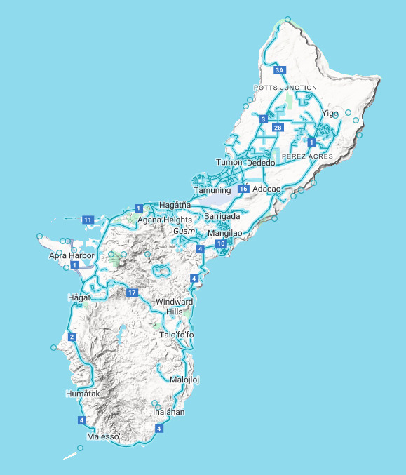
Google Coverage:
Most of the coverage of Guam will be the northern half of the island. There is a lot of open space available for guesses to miss their mark. There is also a lot of ari coverage for the size of the island.
Camera Generation:
Gen 3
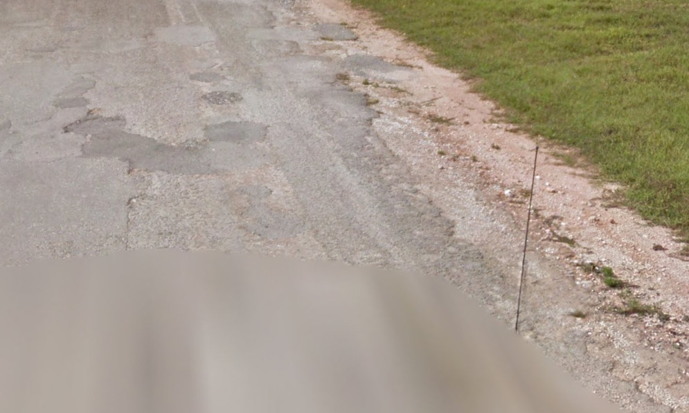
Road Lines:
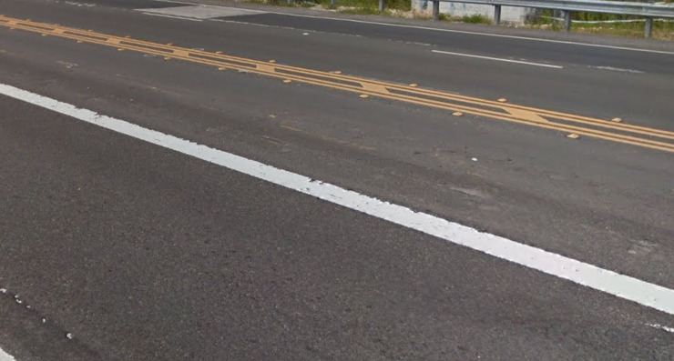
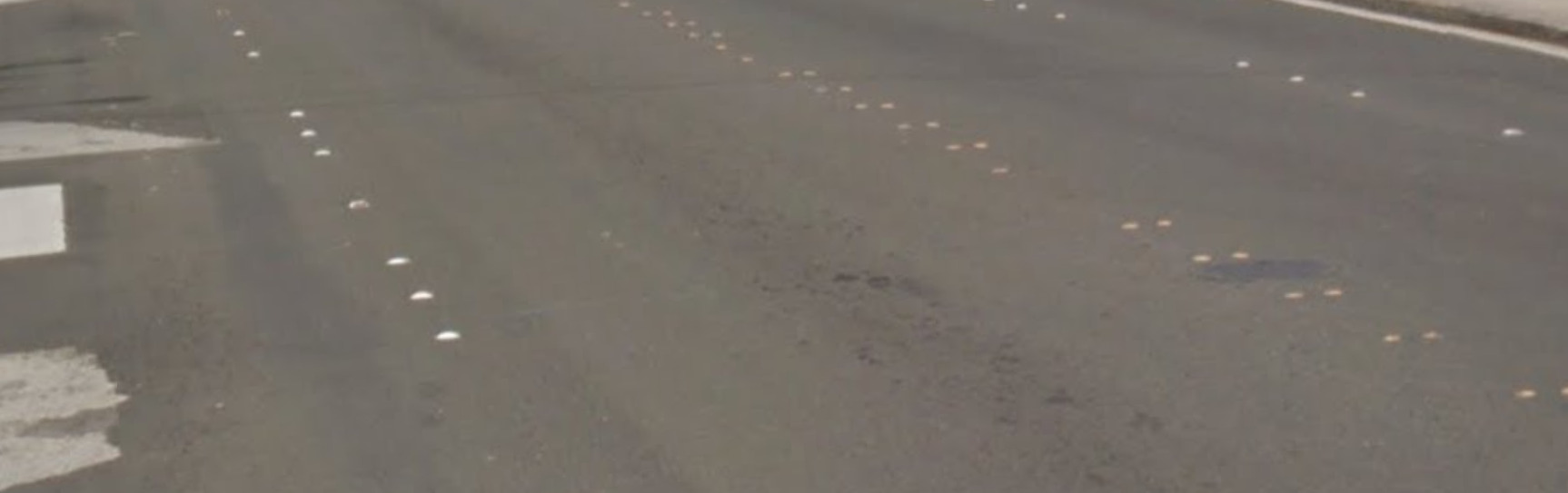
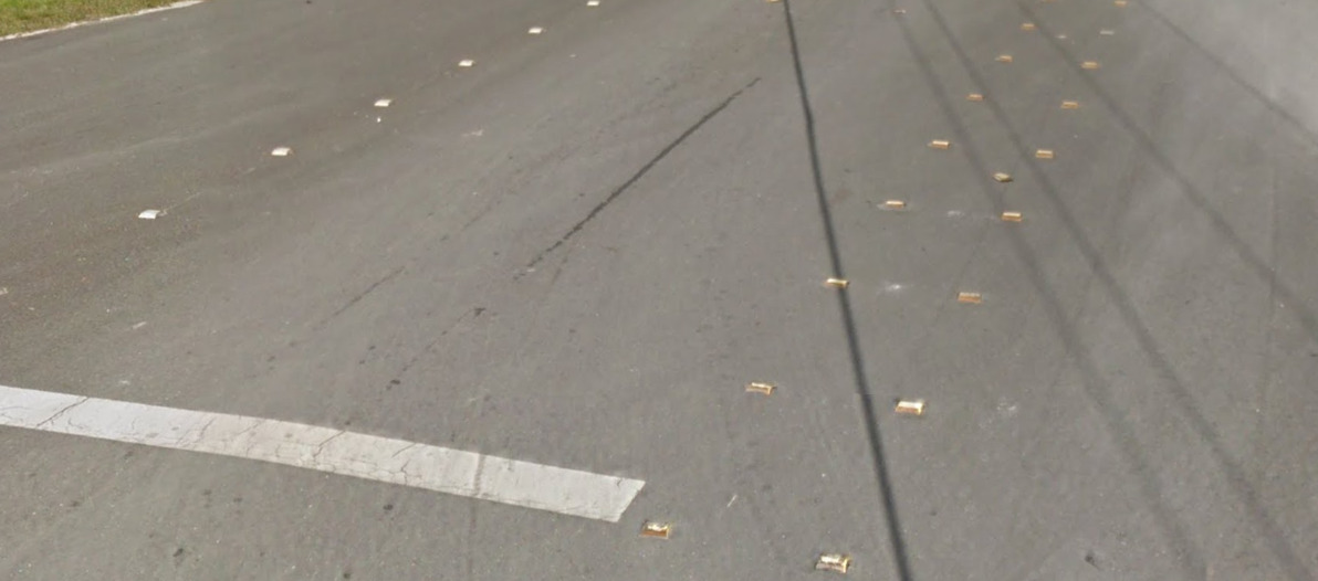
Guam uses white shoulder and yellow center lines, however interestingly it is more common to find studded roads rather than lined.
Road Signs:
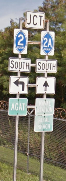
Guam uses US style signs.
While not a sign, Guam has painted bus stops. All of them have different designs with most having some words / imagery tied to the island.
Electricity poles:
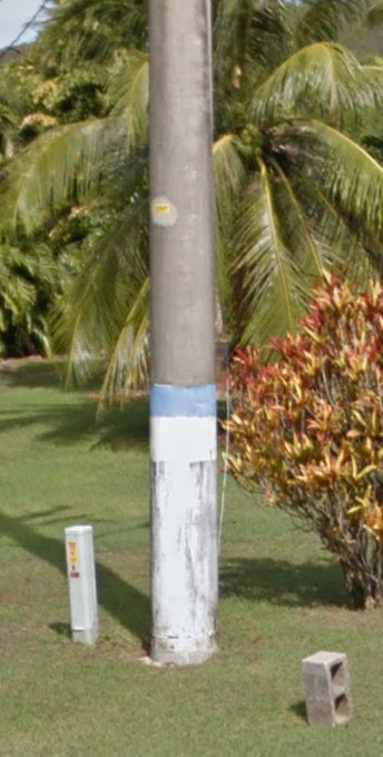
Guam uses wooden and concrete poles, with the bases of many being painted with a white and blue stripe. They appear to be larger than most poles on the mainland, probably done intentionally due to the weather in the pacific.
License plates:
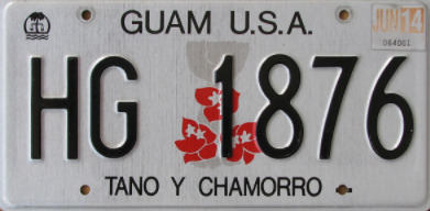
Guam uses a US style white plate.
Phone number:
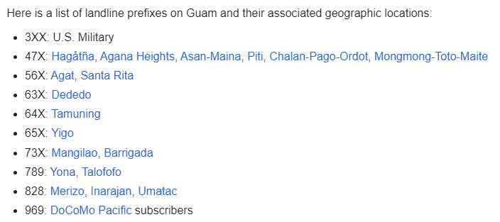
Guam has a small enough population where not even 25% of available numbers are in use. There are no real area codes on signs (which would be 671 for Guam), so the diagram is talking about the first three digits of the number itself.
Vegetation/Landscape:
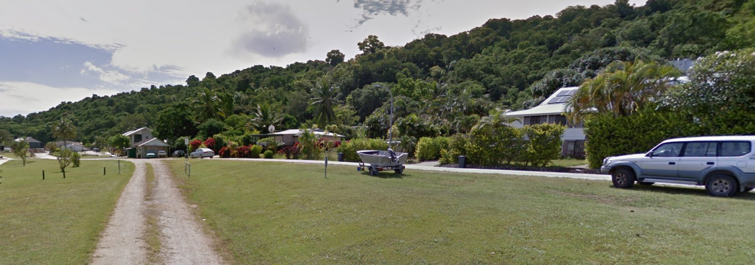
Guam is a rather flat tropical island. There are some hills / peaks towards the southern end of the island.
Architecture:
Guam features lots of bungalow style housing.
General look:
Alphabet/script:
Guam has 2 official languages in Chamorro and English, however everything is signed only in English.
Domain:
.gu
Northern Mariana Islands
- Country Flag
- Capital City
- Most Helpful
- Google Car
- Bollards
- Google Coverage
- Camera Generation
- Road Lines
- Road Signs
- Electricity Poles
- License Plates
- Phone Number
- Vegetation / Landscape
- Architecture
- General Look
- Language
- Domain
Country Flag:
Capital City:
Saipan
Most Helpful:
Google car:
The Mariana islands car has an antenna on the front right of the vehicle.
Bollard:
The mile markers here have fractions on them instead of a decimal.
Google Coverage:
Only the Northern most Island of Saipan is Covered.
Camera Generation:
Gen 3
Road Lines:
Lines are quite rare on the Mariana island roads, however they will have yellow center lines.
Road Signs:
The Mariana Islands use US style signs.
Mariana street names are on blue signs.
The National sign used for the routes is this interesting cup shape. You will also see this shape on other signs.
While not a sign, these squared trash receptacles can be found across the island. They usually have a the name and number of the trash service listed. There are at least two different types.
Electricity poles:
The Mariana Islands use wooden poles.
The bottoms of the poles can be plain, painted white, or even have these yellow identifiers on them. Not all poles will have these, while some will have a combination of multiple versions.
License plates:

The Mariana Islands use US style plates. When they are blurred out, they sometimes resemble the blurred Douglas Fir on the license plate of Oregon.
Phone number:
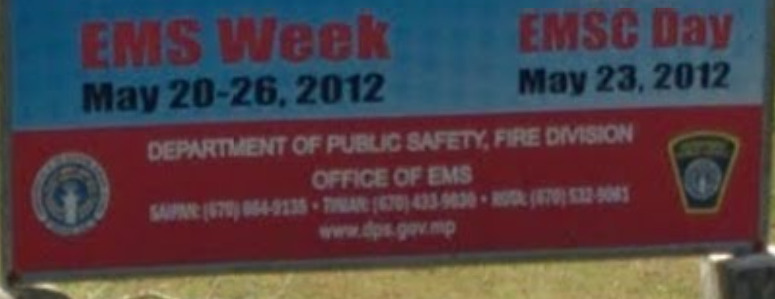
Officially, the area code to the Northern Mariana Islands is 670. You will only find it on the occasional government sign, and there is no method to the madness when it comes to the numbers allocation.
Vegetation/Landscape:
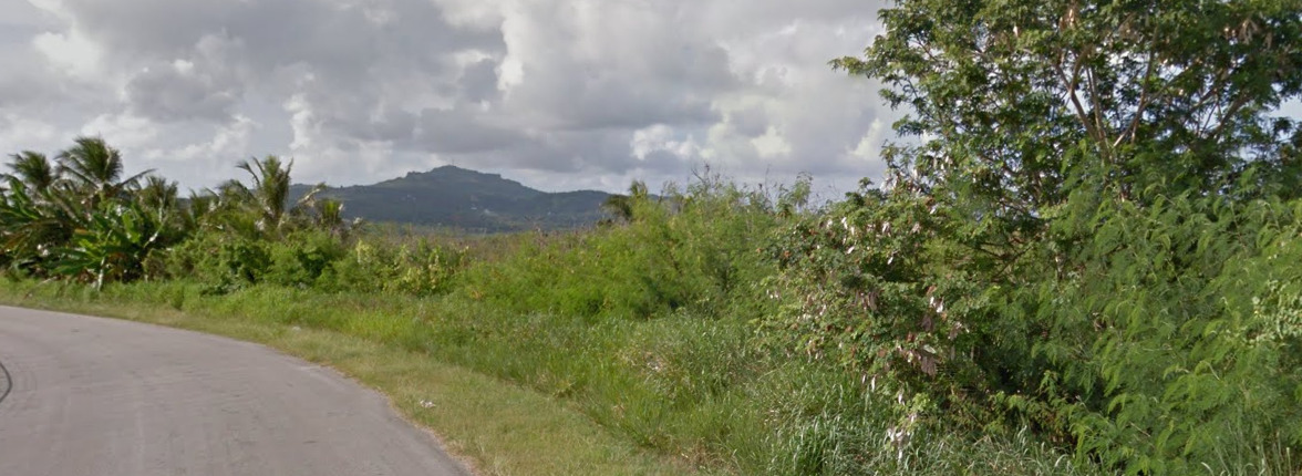
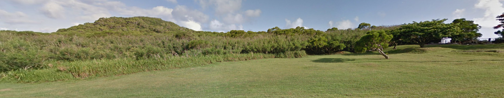
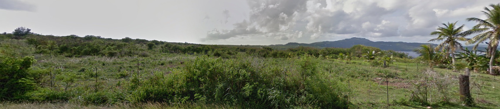
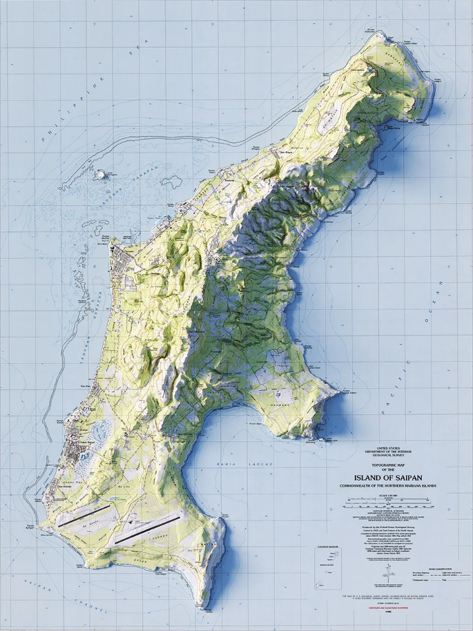
The Marianas are mountainous tropical islands.
Architecture:
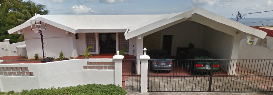
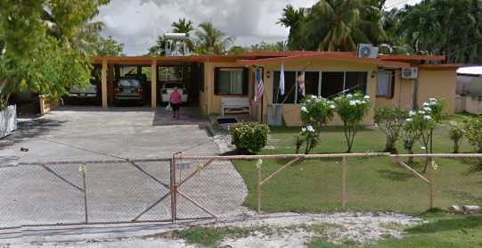
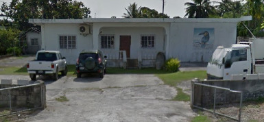
General look:
It appears that an election was coming up to decide the legality of gambling on the island. You can find political posters against this everywhere. You will see signs with the shape of the island, as well as the shape used on their “national” road signs.
Alphabet/script:
Northern Mariana Islands use English as their official language.
Domain:
.mp
Cocos (Keeling) Islands
- Country Flag
- Capital City
- Most Helpful
- Google Car
- Follow Car
- Bollards
- Google Coverage
- Camera Generation
- Road Lines
- Road Signs
- License Plates
- Phone Number
- Vegetation / Landscape
- Architecture
- General Look
- Language
- Domain
Country Flag:
Capital City:
West Island
Most Helpful:
There are actually two different vehicles. One of these can be found on the eastern half. It has a weird air filter on the passenger side of the car. It is a snorkel much like Kenya’s, but its a cone filter instead.
This truck can be found on the western half (Mostly on Home Island). All that is visible is the bed of the truck.
Google car:
There are actually two different vehicles. One of these can be found on the eastern half. It has a weird air filter on the passenger side of the car. It is a snorkel much like Kenya’s, but its a cone filter instead.
This truck can be found on the western half (Mostly on Home Island). All that is visible is the bed of the truck.
This Ferry can be found between West island and Home Island. It is in the middle of the lagoon.
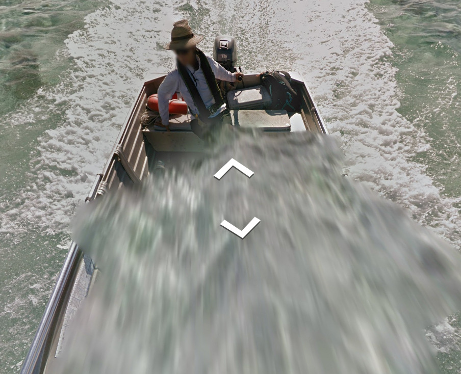
This boat is found along the south, connecting the West Island with the other end. There is plenty of boat coverage down here.
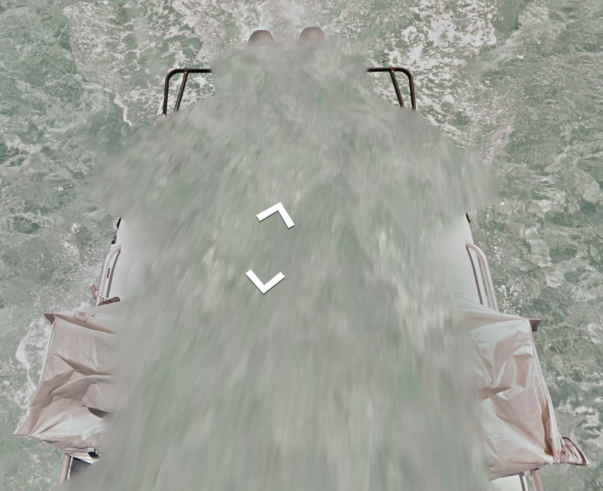
This boat with the brown tarp is found in the north, Connecting Pulau Luar and Direction Island.
Follow Car:
There is a car that follows you ONLY when you are near the Cocos airport. It looks like a security car.
Bollard:
(Front)
(Back)
The Cocos Islands use Australian Bollards, although they are tough to find.
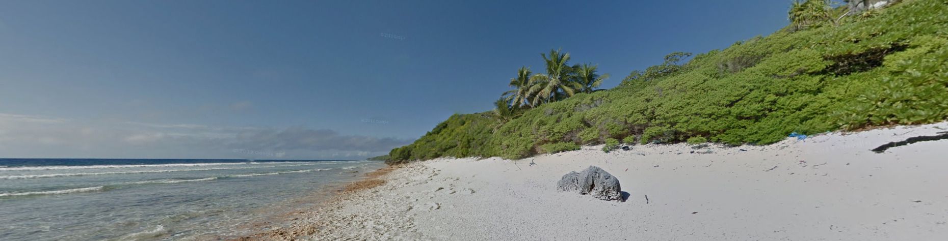
Google Coverage:
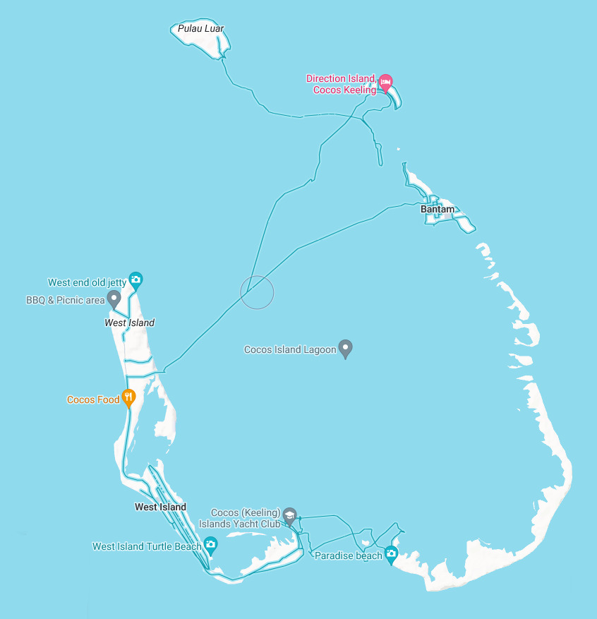
The Cocos Islands are an atoll in the middle of the Pacific ocean. There are not many roads, and that can be seen from the image above.
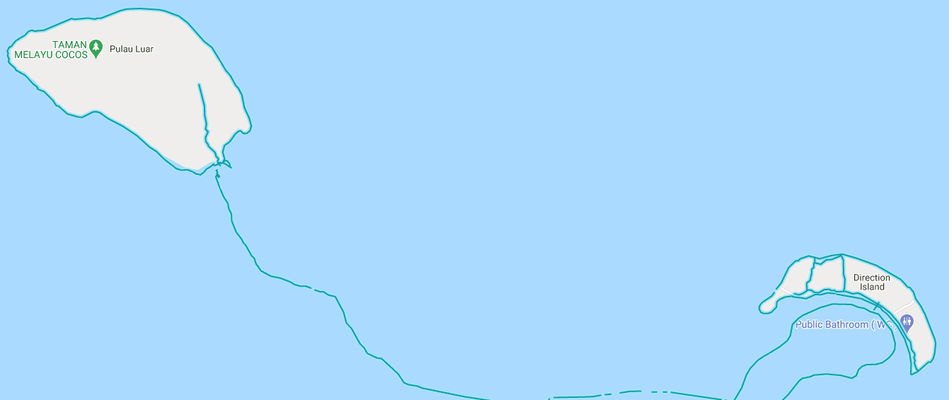
The northern most island, Pulau Luar, as well as Direction Island, are only covered by a trekker. You get some wonderful shots of beaches, as well as a small interior pathways.
Camera Generation:
Gen 3
Road Lines:
There are no road lines in the Cocos Islands. However, you can find either gravel roads, dirt paths, or this cobble stone road. The only paved road is on West island near the airport.
Road Signs:
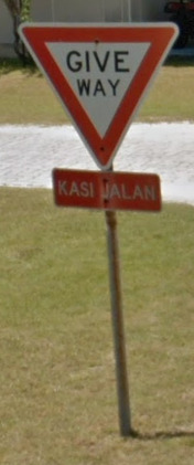
You can often find Bilingual signs on Home Island.
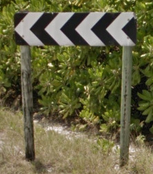
These black and white arrows can be found in a few places, but they are almost always on these thick wooden poles.
License plates:
There are so few cars in the Cocos Islands, however they do exist.
Phone number:
The Cocos Islands use the same number format as Australia. There are not many numbers listed, but they are typically 8 digits long.
Vegetation/Landscape:
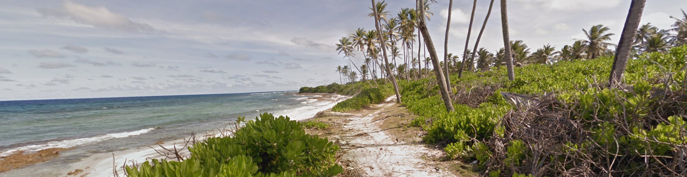
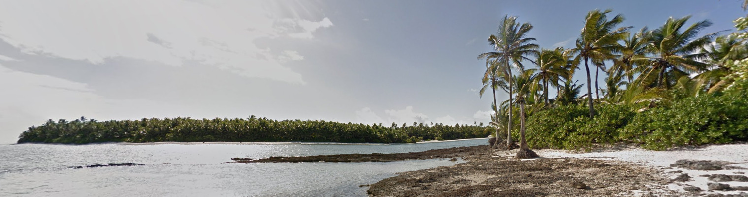
The Cocos are rather flat, and you’re often treated with wonderful views of Palm trees and other tropical flora.
Architecture:
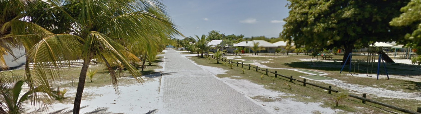
A lot of the houses feel the same, and even look the same. Some people may have a different trim color, but houses in towns generally all look similar.
General look:
Alphabet/script:

You can often find Bilingual signs with both English and Malay in the East, with mostly English signs on West Island.
Domain:
.cc
Vanuatu
- Country Flag
- Capital City
- Most Helpful
- Google Car
- Google Coverage
- Volcano
- Camera Generation
- Vegetation / Landscape
- Architecture
- General Look
- Language
- Domain
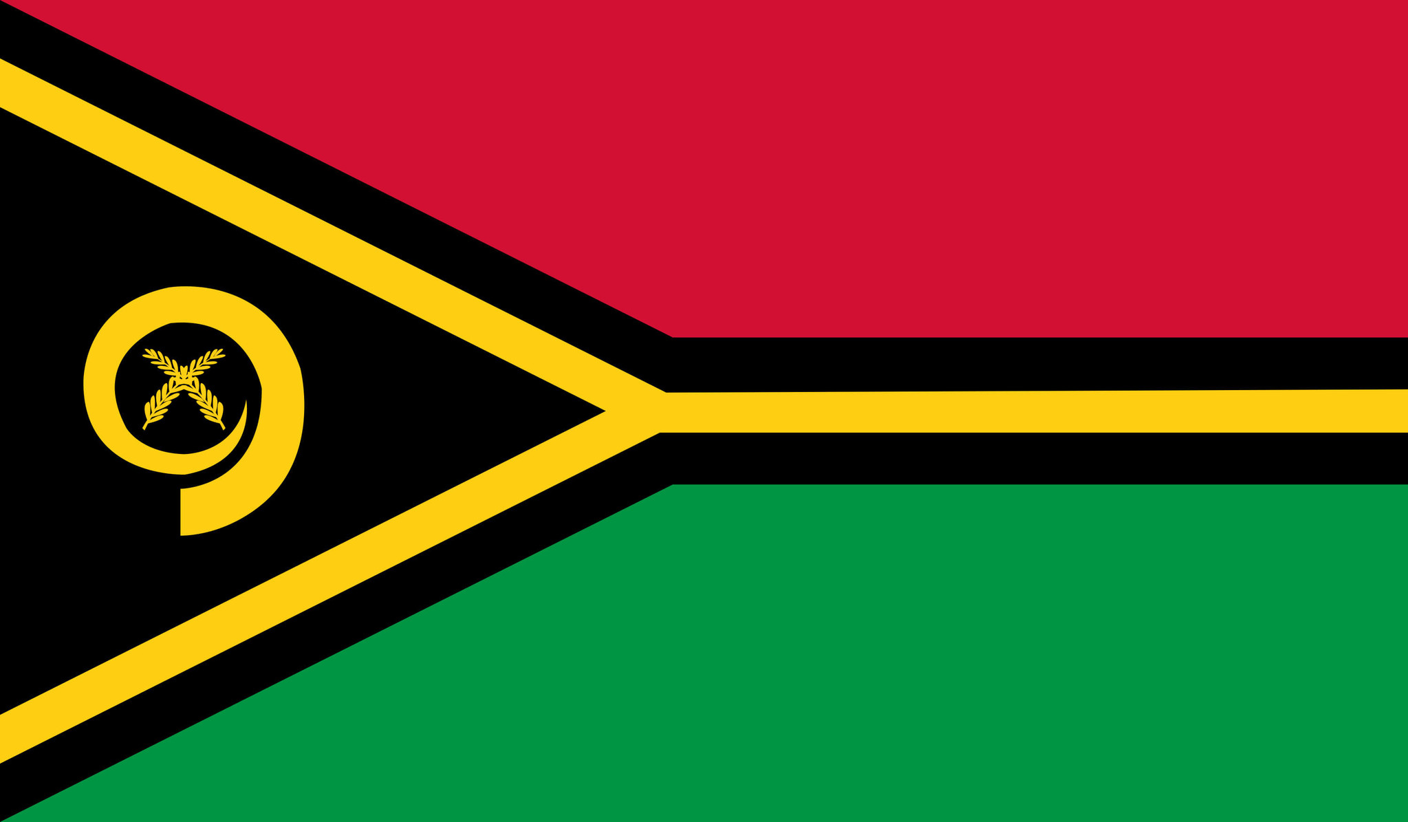
Country Flag:
Capital City:
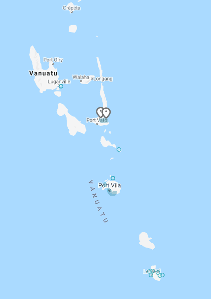
Port Villa
Most Helpful:
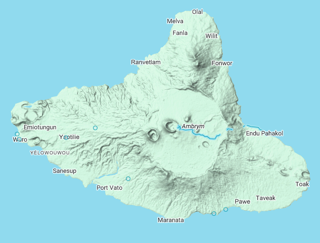
Vanuatu only has a single island covered. This island is Ambrym, located south of the main island. There is also only one town covered, on the eastern end of the island called Endu Pahakol.
Google car:
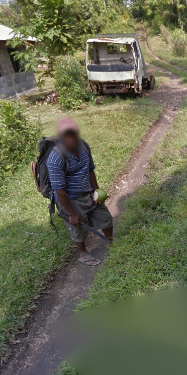
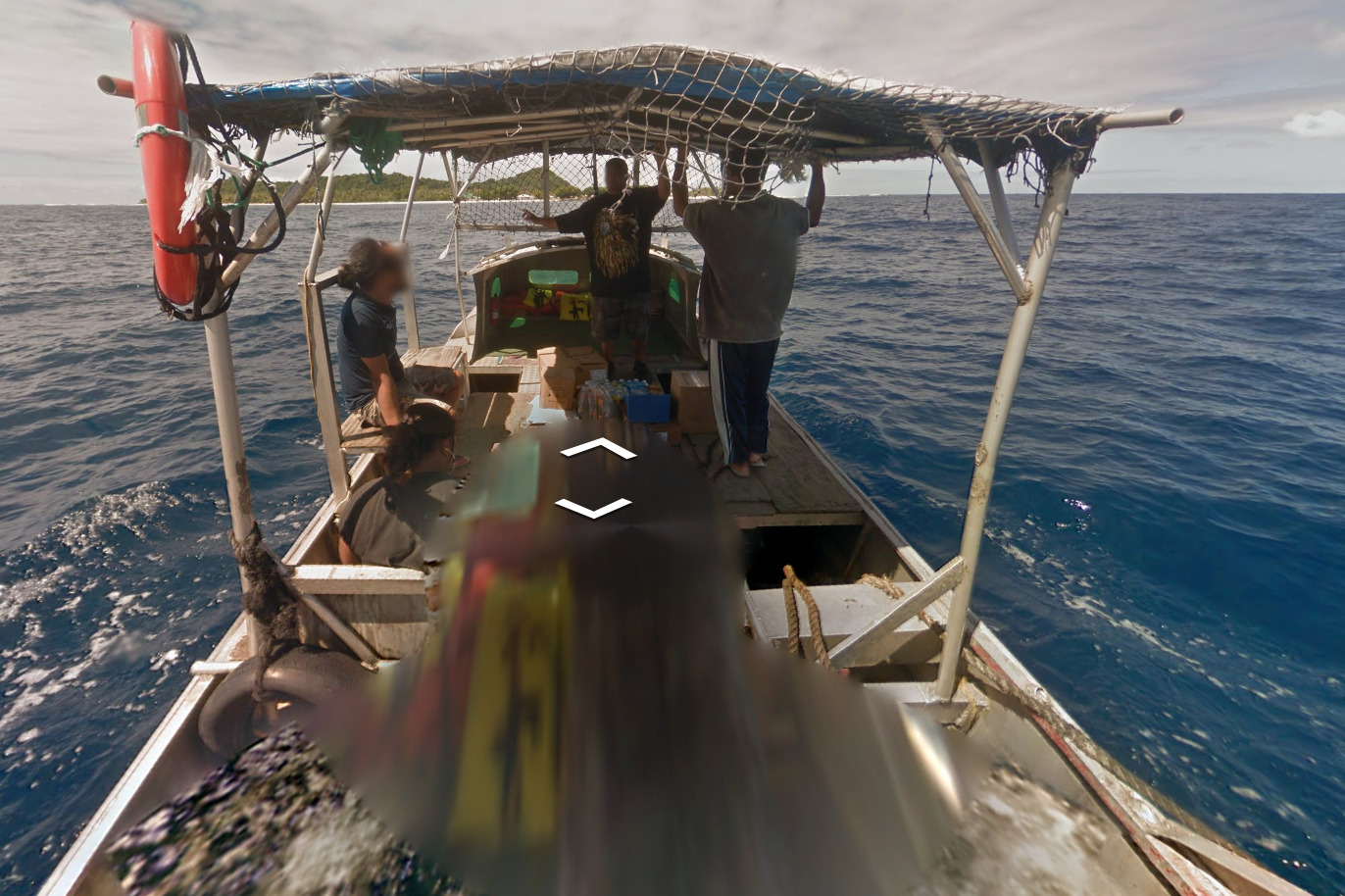
Vanuatu is covered by a trekker. It appears he has a guide along most of the village. The guide carries a machete and a coconut.
Google Coverage:
Vanuatu only has a single island covered. This island is Ambrym, located south of the main island. There is also only one town covered, on the eastern end of the island called Endu Pahakol.
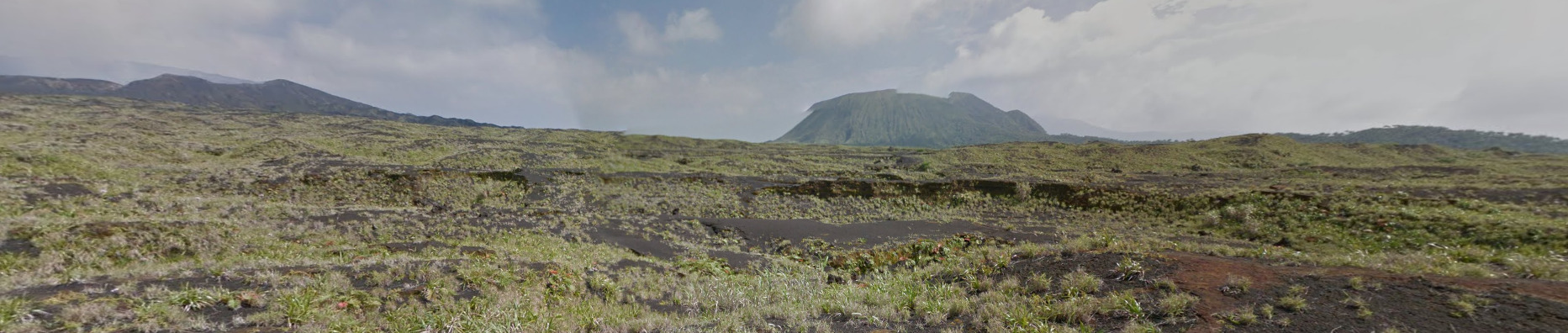
Volcano:
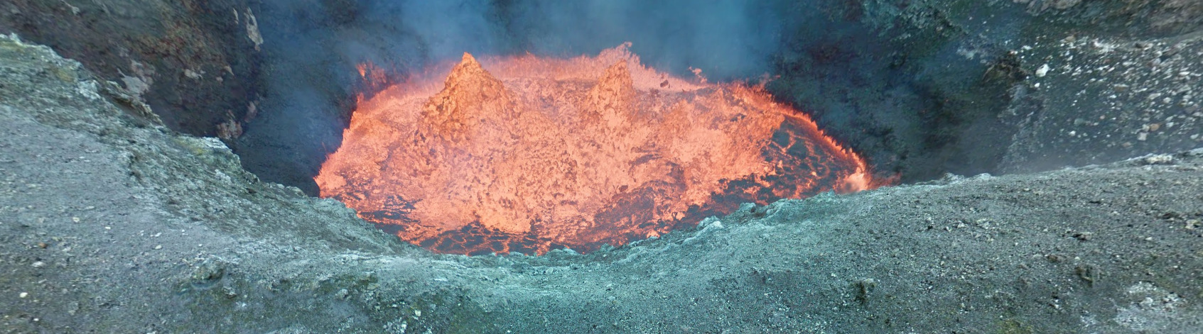
Vanuatu has an active volcano, aptly titled the Ambrym Volcano, and you can actually find images of the volcano and the lava that is boiling.
Camera Generation:
Gen 3 Trekker
Vegetation/Landscape:
The island generally is flat and rises to a peak towards the volcano (which is west of the only town coverage). The trees are very tropical, and it feels like you are on an island.
Architecture:
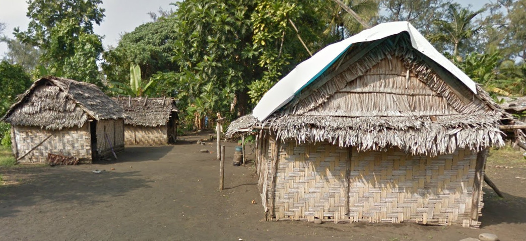
These thatched huts are the most common houses. The pattern of the weaving can be helpful and should tell you that you are in Vanuatu.
You can also occasionally find these cinderblock and sheet metal houses. They are more rare, but they do exist.
General look:
The town of Endu Pahakol has a dirt road. There don’t appear to be any vehicles around, so it’s most likely a footpath.
Leading up to the volcano, you get this really dark soil mixed with some vegetation. It looks beautiful.
Alphabet/script:
Vanuatu uses the English Language. There appears to be a general store and a towel that contains some text.
Domain:
.vu
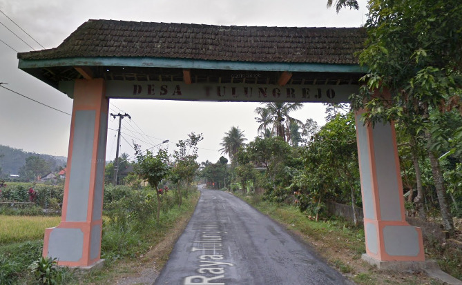
Indonesia
Country Flag:
Capital City:
Jakarta
Google car:
White, black car, with or without the antenna, no car, or scraped paint car:
White car with an antenna can be found in eastern Java.
Indonesia is the only country which has this “scraped paint” car.
The Gen 4 cars in Indonesia are unique – they are black or grey, and not blue like in other countries:
The front of the car is seen on Gen 4 coverage in Indonesia.
Bollard:
Camera Generation:
Gen 3 and 4
Road Lines:
Usually all-white:
However they are changing to orange centreline, which can be seen on newer, mostly Gen 4 coverage:
The double centreline in Indonesia is found only on highways, unlike Malaysia which often uses it on 2-lane roads.
Road Signs:
Directional road signs in Indonesia are usually found only at important crossroads:
Indonesia uses the yellow diamond-shaped warning signs, like the rest of Southeast Asia:
The turn arrows are black with a yellow background:
Guardrails:
Bridge railings:
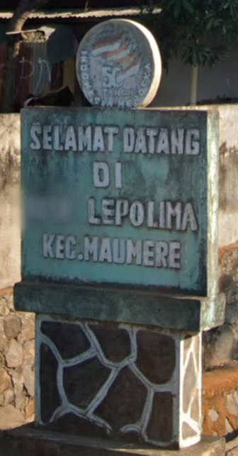
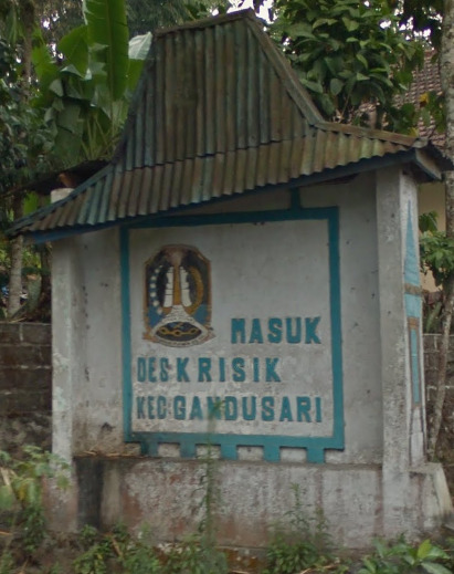
Settlements can often have these welcome and goodbye signs stating the name of the settlement and the subdivision(s) it is in:
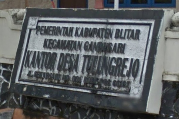
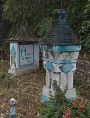
These boards containing information can usually be found in front of important buildings in a settlement:
Location information can be found in many places in Indonesia (boards, billboards, shop fronts, etc.). The meaning of certain important words found on these boards and other places can be found below in the “Alphabet/language” section.
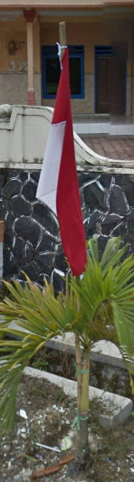
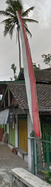
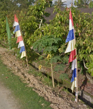
Indonesian flags can be found everywhere, and in many forms:
Prayer flags on the side of the road are very common too, each colour carrying a meaning:
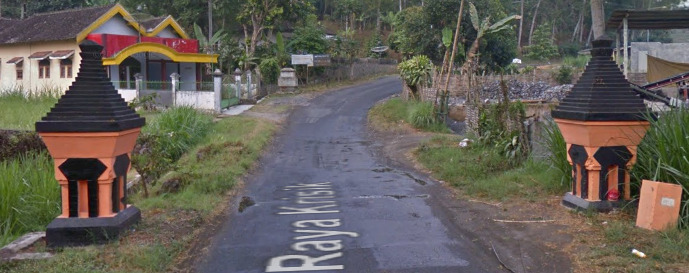
Sometimes there are these ornamented structures by the side of the road, usually when entering or exiting a settlement:
Road numbering system:
Usually you won’t see any road numbers on signs nor on the map:
Indonesia Road Numbering System
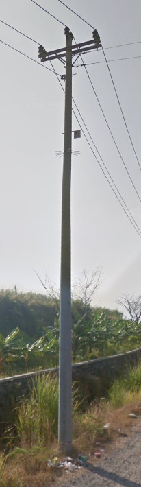
Electricity poles:
License plates:
The plates in Indonesia have 3 parts, while those in Malaysia have 2, and that can be sometimes seen through the blur.
Motorcycle plates:
Indonesia has front motorcycle plates too, in contrast with Malaysia.
Ads:
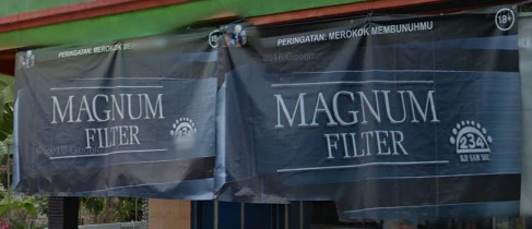
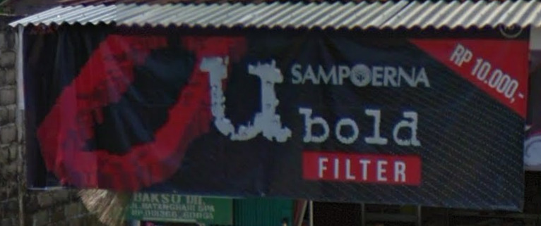
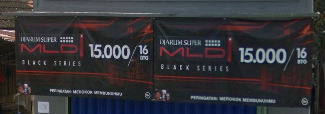
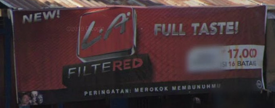
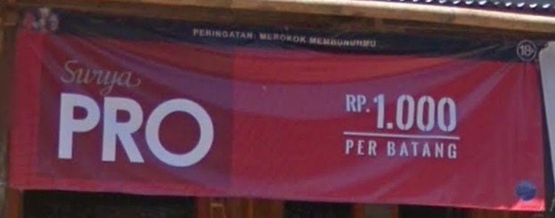
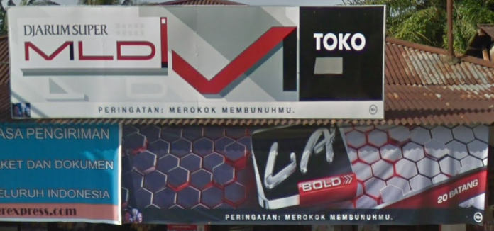
Cigarette ad banners and boards are everywhere in Indonesia:
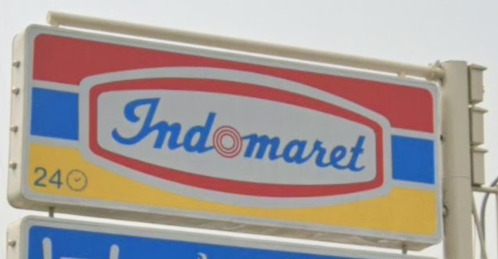
Indomaret is one of the most popular convenience store chains in Indonesia:
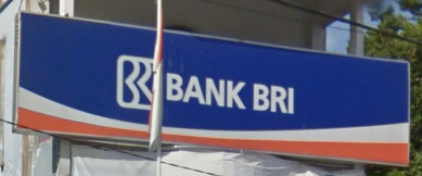
Bank BRI is one of the largest banks in Indonesia:
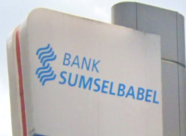
If you find a Sumsel Babel bank, you know you are in the provinces of South Sumatra (Sumatera Selatan) or Bangka Belitung:
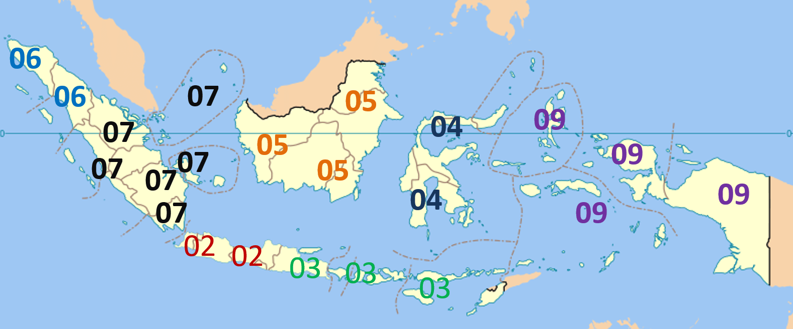
Phone area codes:
Vegetation/Landscape:
–
Specific tree:
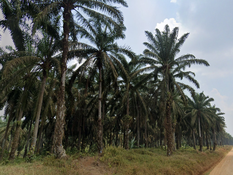
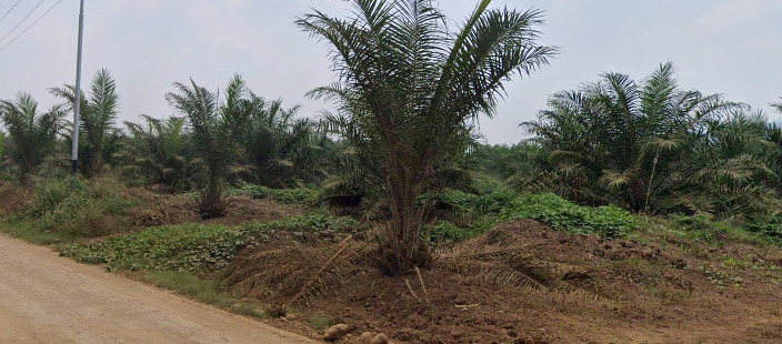
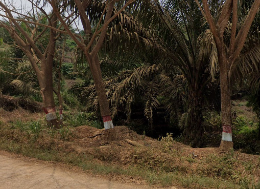
Oil palms are very specific agricultural planted trees which are mostly found on the islands of Sumatra and Borneo in Indonesia:
Another agriculturally planted tree species is the rubber tree, which can be found here and there all over Indonesia:
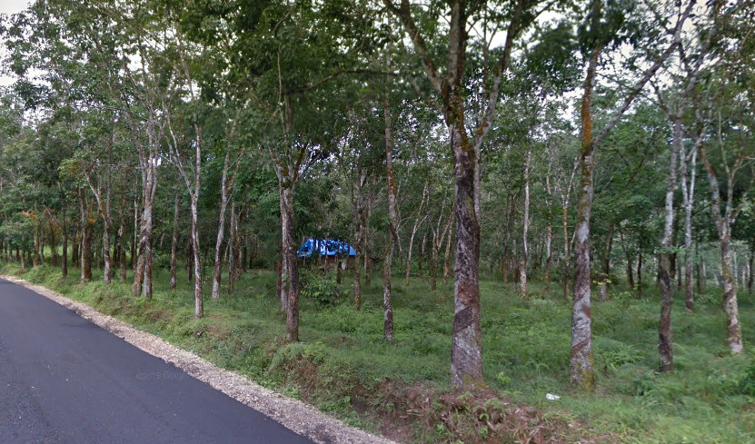
It is characterised by thin whitish bark trunks and is planted in an arranged pattern, just like oil palms.
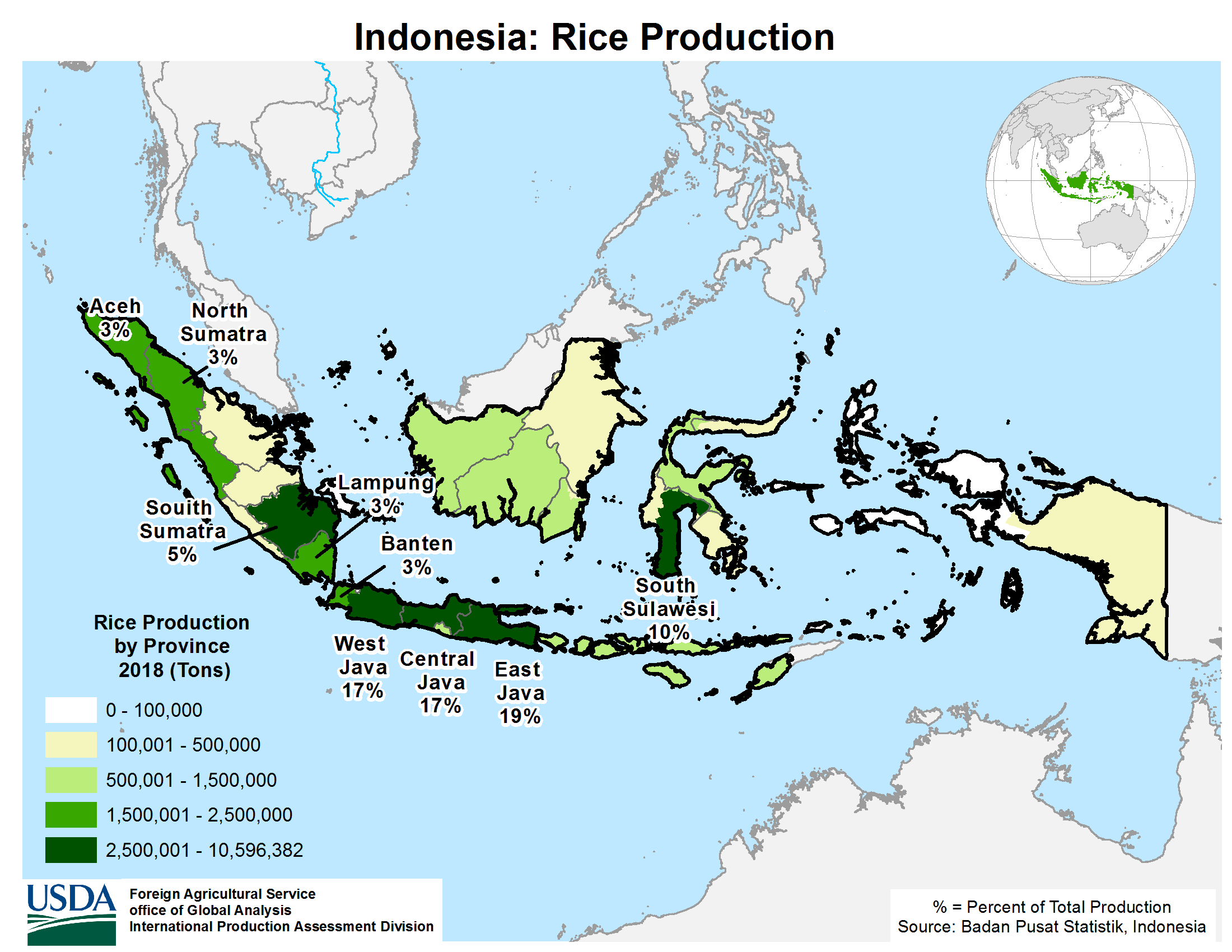
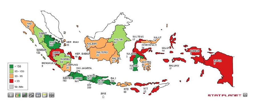
Rice is also grown all around Indonesia:
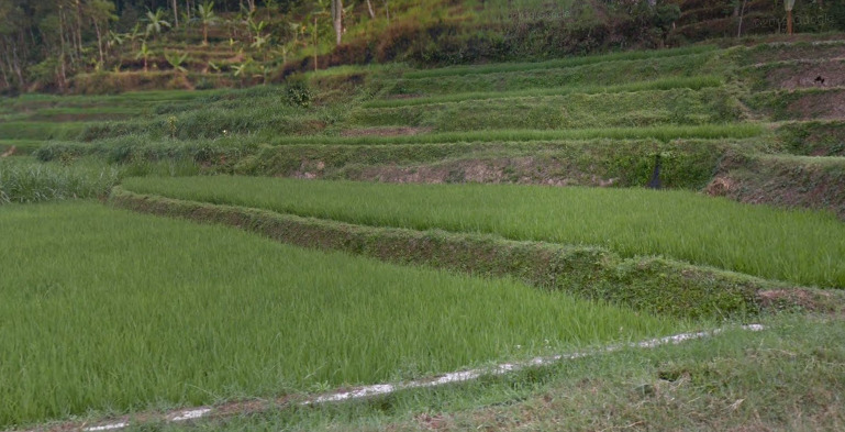
Rice growing map of Indonesia:
Trees in Indonesia can sometimes be painted with the flag colours on the trunks:
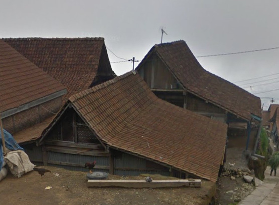
Architecture:
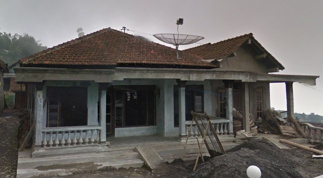
Classic Indonesian houses:
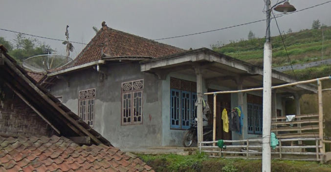
Houses with brick tile roofs can most frequently be found on the main islands (e.g. Java, Bali), while the metal roof ones are more frequent on the other, less populated islands (Sumatra, Borneo, Sulawesi, Nusa Tenggaras). However, this is not always fool-proof and both house types can be found on all the islands.
This type of roof is very specific to Indonesia:
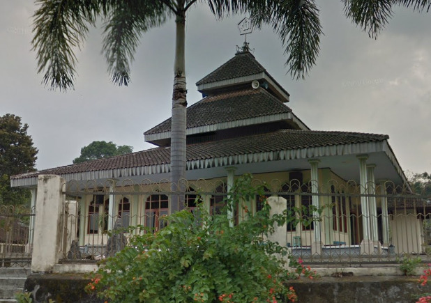
Mosque:
Religion:
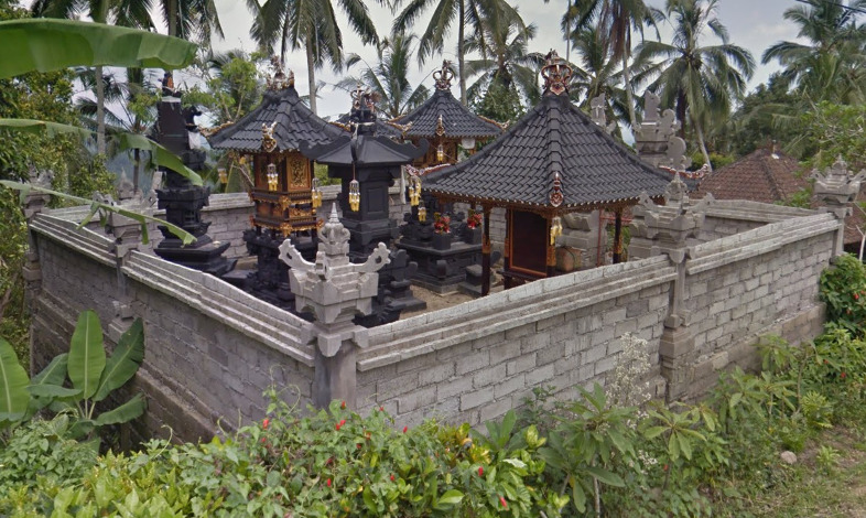
Indonesia is predominantly a Muslim country, although some parts of it are Christian, Hindu or Buddhist:

So, by finding a church or a Hindu/Buddhist temple you can usually tell in which part of the country you are.
A Hindu shrine on Bali:
General look:
–
Alphabet/language:
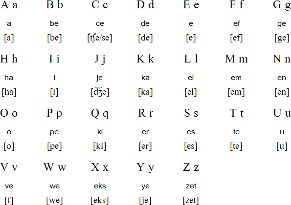
Indonesian uses the Latin alphabet:
Useful vocabulary:
North – Utara
East – Timur
West – Barat
South – Selatan
Central – Tengah
Southeast – Tenggara
Kota – City
Desa – Village
Street/road – Jalan (abbreviated as Jl.)
Province – Provinsi
Regency – Kabupaten (abbreviated as Kab.)
District – Kecamatan (abbreviated as Kec.)
Selamat datang – Welcome
Selamat jalan – Goodbye (bon voyage)
Peringatan: Merokok membunuhmu – Warning: Smoking kills you
Additional language notes:
If the place names start with Ci-, like for example in Cirebon, that is a place name of Sundanese origin. The part ci- means “river” and Sundanese is the language spoken in the provinces of West Java and Banten. You can also find some of these languages – Sundanese, Javanese, Balinese, etc. around but it is still unknown to us how to distinguish them (Sundanese, for example, has more consonant clusters than Indonesian) as they are not written in their native script, but in the Latin script, and Indonesian (Malay) is still the most widespread language.
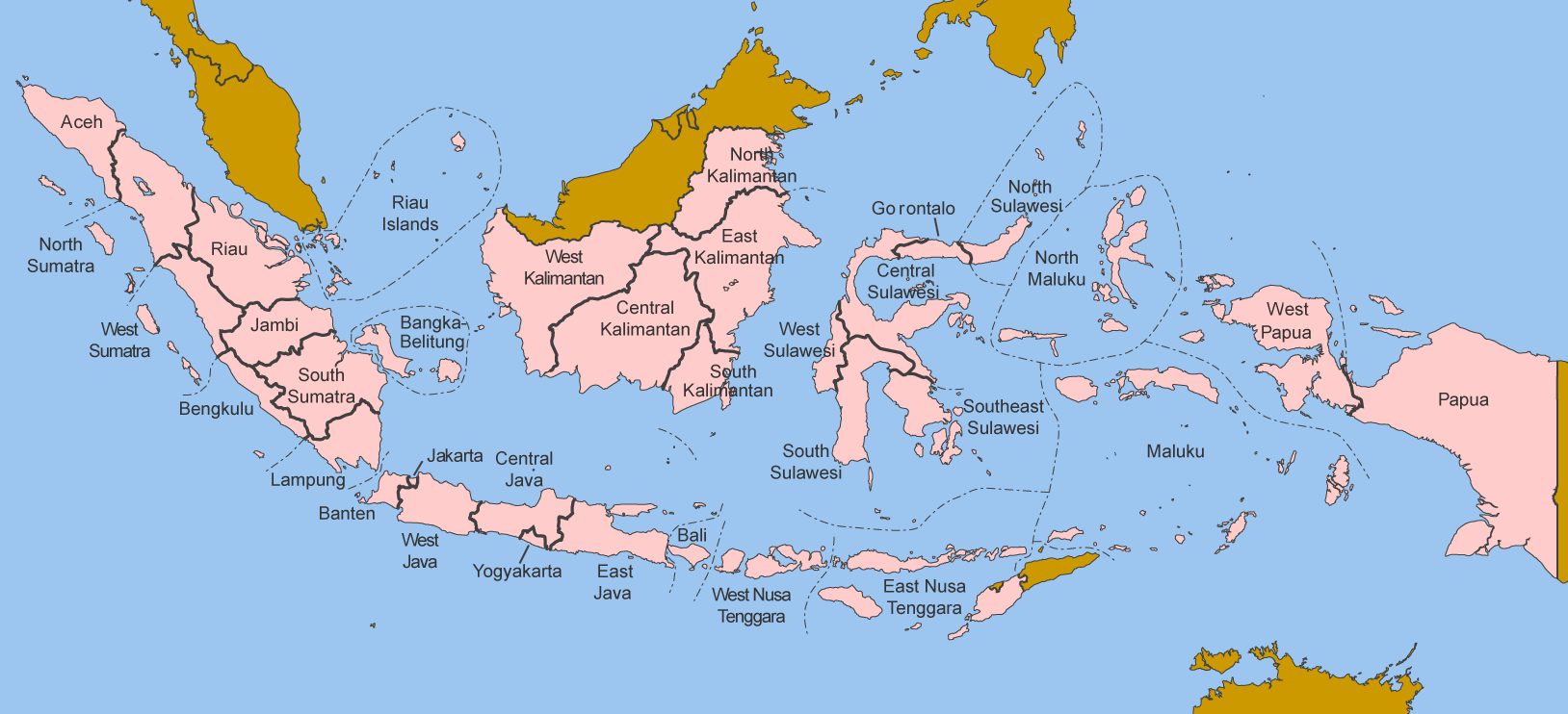
Subdivisions:
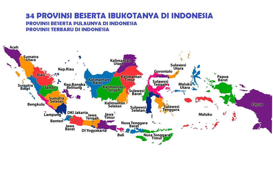
1st level – Provinces (provinsi). Indonesia is composed of 34 provinces:
Province names in Indonesian:
Sometimes the province names are abbreviated:
2nd level – Regencies (kabupaten) and cities (kota). Indonesia has 514 regencies/cities:
List of regencies and cities of Indonesia
3rd level – Districts (kecamatan). There are a total of 7024 districts in Indonesia:
Districts of Indonesia
Internet domain:
.id (.in = India)
Christmas Island
Country Flag:
Google car:
You can see the edges of the tray on the back of the google car.
There is also boat coverage on the north coast.
There is also trekker coverage.
Bollard:
Christmas island has a few different bollards, including the same bollard as mainland Australia.
Camera Generation:
3
Road Lines:
Christmas island uses white lines though most are faded.
Road Signs:
Street names are on yellow signs.
Electricity poles:
–
License plates:
Christmas islands use yellow backed plates.
Phone number:
–
Vegetation/Landscape:
Christmas island is a tropical island containing dense rainforest.
Specific tree:
–
Architecture:
Many of the houses feature satellite dishes.
General look:
Alphabet/script:
Christmas island uses English.
Domain:
.cx
Guam
- Country Flag
- Capital City
- Most Helpful
- Google Car
- Bollards
- Google Coverage
- Camera Generation
- Road Lines
- Road Signs
- Electricity Poles
- License Plates
- Phone Number
- Vegetation / Landscape
- Architecture
- General Look
- Language
- Domain
Country Flag:
Capital City:
Hagåtña
Most Helpful:
Google car:
Guams google car features a long antenna on the front right of the vehicle.
Bollard:
While not exactly a bollard, these electrical access panels can be found often throughout Guam. They will be in most residential areas near stop signs, and then scattered across the island on most roads. They will either be the one shown above, or one that is half the size but with a similar design.
Google Coverage:
Most of the coverage of Guam will be the northern half of the island. There is a lot of open space available for guesses to miss their mark. There is also a lot of ari coverage for the size of the island.
Camera Generation:
Gen 3
Road Lines:
Guam uses white shoulder and yellow center lines, however interestingly it is more common to find studded roads rather than lined.
Road Signs:
Guam uses US style signs.
While not a sign, Guam has painted bus stops. All of them have different designs with most having some words / imagery tied to the island.
Electricity poles:
Guam uses wooden and concrete poles, with the bases of many being painted with a white and blue stripe. They appear to be larger than most poles on the mainland, probably done intentionally due to the weather in the pacific.
License plates:
Guam uses a US style white plate.
Phone number:
Guam has a small enough population where not even 25% of available numbers are in use. There are no real area codes on signs (which would be 671 for Guam), so the diagram is talking about the first three digits of the number itself.
Vegetation/Landscape:
Guam is a rather flat tropical island. There are some hills / peaks towards the southern end of the island.
Architecture:
Guam features lots of bungalow style housing.
General look:
Alphabet/script:
Guam has 2 official languages in Chamorro and English, however everything is signed only in English.
Domain:
.gu
Northern Mariana Islands
- Country Flag
- Capital City
- Most Helpful
- Google Car
- Bollards
- Google Coverage
- Camera Generation
- Road Lines
- Road Signs
- Electricity Poles
- License Plates
- Phone Number
- Vegetation / Landscape
- Architecture
- General Look
- Language
- Domain
Country Flag:
Capital City:
Saipan
Most Helpful:
Google car:
The Mariana islands car has an antenna on the front right of the vehicle.
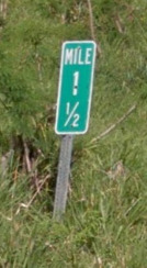
Bollard:
The mile markers here have fractions on them instead of a decimal.
Google Coverage:
Only the Northern most Island of Saipan is Covered.
Camera Generation:
Gen 3
Road Lines:
Lines are quite rare on the Mariana island roads, however they will have yellow center lines.
Road Signs:
The Mariana Islands use US style signs.
Mariana street names are on blue signs.
The National sign used for the routes is this interesting cup shape. You will also see this shape on other signs.
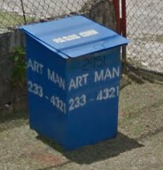
While not a sign, these squared trash receptacles can be found across the island. They usually have a the name and number of the trash service listed. There are at least two different types.
Electricity poles:
The Mariana Islands use wooden poles.
The bottoms of the poles can be plain, painted white, or even have these yellow identifiers on them. Not all poles will have these, while some will have a combination of multiple versions.
License plates:
The Mariana Islands use US style plates. When they are blurred out, they sometimes resemble the blurred Douglas Fir on the license plate of Oregon.
Phone number:
Officially, the area code to the Northern Mariana Islands is 670. You will only find it on the occasional government sign, and there is no method to the madness when it comes to the numbers allocation.
Vegetation/Landscape:
The Marianas are mountainous tropical islands.
Architecture:
General look:
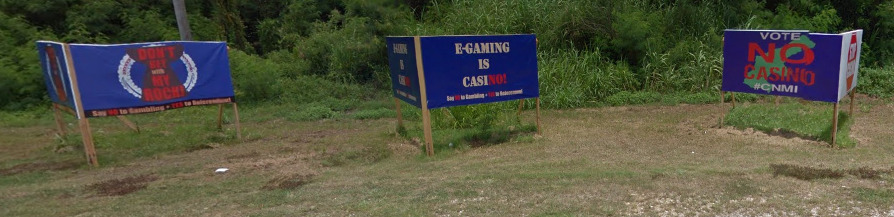
It appears that an election was coming up to decide the legality of gambling on the island. You can find political posters against this everywhere. You will see signs with the shape of the island, as well as the shape used on their “national” road signs.
Alphabet/script:
Northern Mariana Islands use English as their official language.
Domain:
.mp
Cocos (Keeling) Islands
- Country Flag
- Capital City
- Most Helpful
- Google Car
- Follow Car
- Bollards
- Google Coverage
- Camera Generation
- Road Lines
- Road Signs
- License Plates
- Phone Number
- Vegetation / Landscape
- Architecture
- General Look
- Language
- Domain
Country Flag:
Capital City:
West Island
Most Helpful:
There are actually two different vehicles. One of these can be found on the eastern half. It has a weird air filter on the passenger side of the car. It is a snorkel much like Kenya’s, but its a cone filter instead.
This truck can be found on the western half (Mostly on Home Island). All that is visible is the bed of the truck.
Google car:
There are actually two different vehicles. One of these can be found on the eastern half. It has a weird air filter on the passenger side of the car. It is a snorkel much like Kenya’s, but its a cone filter instead.
This truck can be found on the western half (Mostly on Home Island). All that is visible is the bed of the truck.
This Ferry can be found between West island and Home Island. It is in the middle of the lagoon.
This boat is found along the south, connecting the West Island with the other end. There is plenty of boat coverage down here.
This boat with the brown tarp is found in the north, Connecting Pulau Luar and Direction Island.
Follow Car:
There is a car that follows you ONLY when you are near the Cocos airport. It looks like a security car.
Bollard:
(Front)
(Back)
The Cocos Islands use Australian Bollards, although they are tough to find.
Google Coverage:
The Cocos Islands are an atoll in the middle of the Pacific ocean. There are not many roads, and that can be seen from the image above.
The northern most island, Pulau Luar, as well as Direction Island, are only covered by a trekker. You get some wonderful shots of beaches, as well as a small interior pathways.
Camera Generation:
Gen 3
Road Lines:
There are no road lines in the Cocos Islands. However, you can find either gravel roads, dirt paths, or this cobble stone road. The only paved road is on West island near the airport.
Road Signs:
You can often find Bilingual signs on Home Island.
These black and white arrows can be found in a few places, but they are almost always on these thick wooden poles.
License plates:
There are so few cars in the Cocos Islands, however they do exist.
Phone number:
The Cocos Islands use the same number format as Australia. There are not many numbers listed, but they are typically 8 digits long.
Vegetation/Landscape:
The Cocos are rather flat, and you’re often treated with wonderful views of Palm trees and other tropical flora.
Architecture:
A lot of the houses feel the same, and even look the same. Some people may have a different trim color, but houses in towns generally all look similar.
General look:
Alphabet/script:
You can often find Bilingual signs with both English and Malay in the East, with mostly English signs on West Island.
Domain:
.cc
Vanuatu
- Country Flag
- Capital City
- Most Helpful
- Google Car
- Google Coverage
- Volcano
- Camera Generation
- Vegetation / Landscape
- Architecture
- General Look
- Language
- Domain
Country Flag:
Capital City:
Port Villa
Most Helpful:
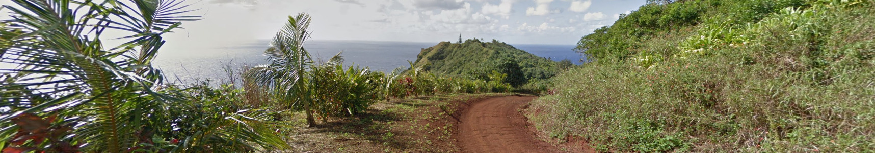
Vanuatu only has a single island covered. This island is Ambrym, located south of the main island. There is also only one town covered, on the eastern end of the island called Endu Pahakol.
Google car:
Vanuatu is covered by a trekker. It appears he has a guide along most of the village. The guide carries a machete and a coconut.
Google Coverage:
Vanuatu only has a single island covered. This island is Ambrym, located south of the main island. There is also only one town covered, on the eastern end of the island called Endu Pahakol.
Volcano:
Vanuatu has an active volcano, aptly titled the Ambrym Volcano, and you can actually find images of the volcano and the lava that is boiling.
Camera Generation:
Gen 3 Trekker
Vegetation/Landscape:
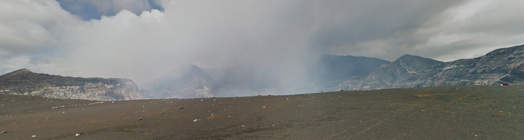
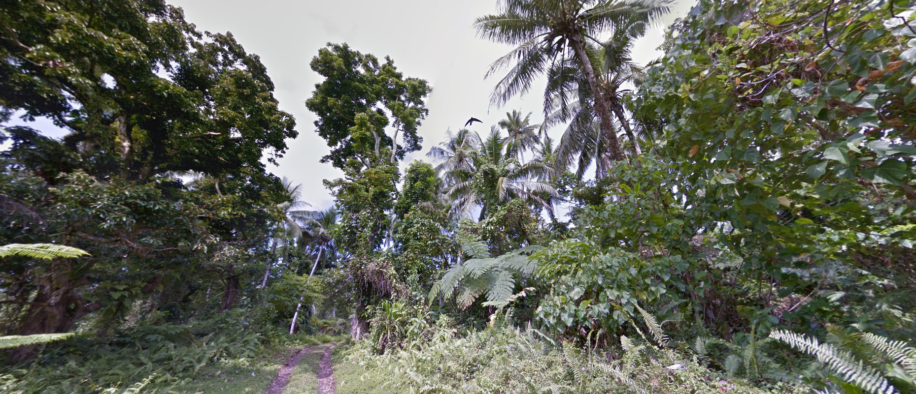
The island generally is flat and rises to a peak towards the volcano (which is west of the only town coverage). The trees are very tropical, and it feels like you are on an island.
Architecture:
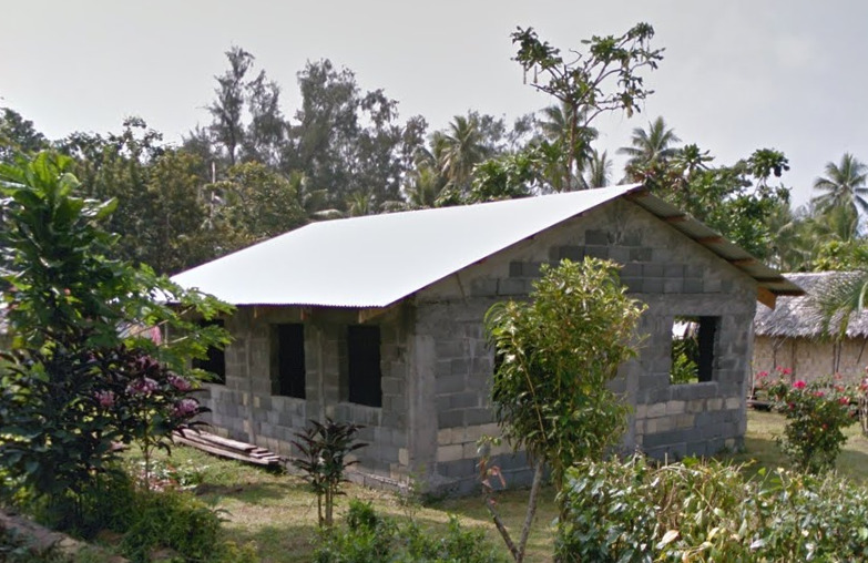
These thatched huts are the most common houses. The pattern of the weaving can be helpful and should tell you that you are in Vanuatu.
You can also occasionally find these cinderblock and sheet metal houses. They are more rare, but they do exist.
General look:
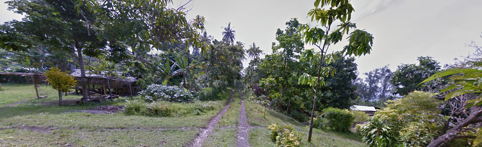
The town of Endu Pahakol has a dirt road. There don’t appear to be any vehicles around, so it’s most likely a footpath.
Leading up to the volcano, you get this really dark soil mixed with some vegetation. It looks beautiful.
Alphabet/script:
Vanuatu uses the English Language. There appears to be a general store and a towel that contains some text.
Domain:
.vu
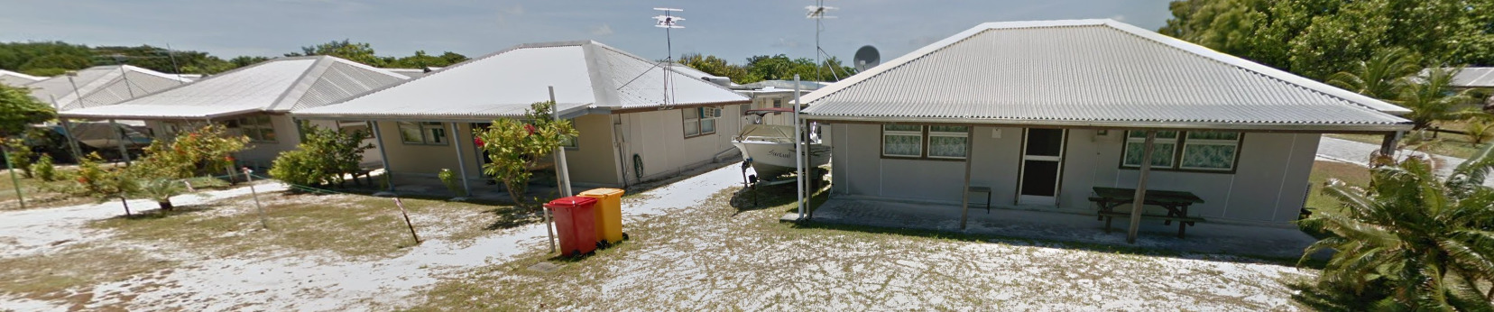
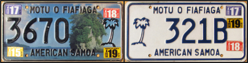
American Samoa
- Country Flag
- Capital City
- Capital City
- Most Helpful
- Google Car
- Bollards
- Google Coverage
- Unique Vehicle
- Camera Generation
- Road Lines
- Road Signs
- Electricity Poles
- License Plates
- Phone Number
- Vegetation / Landscape
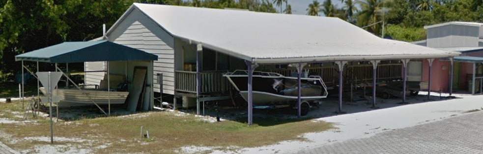
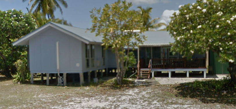
- Architecture
- General Look
- Topography
- Language
- Domain
- Rose Atoll
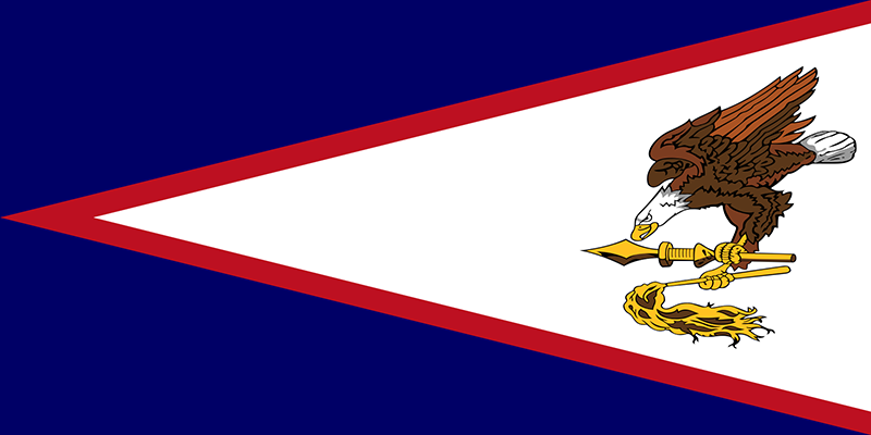
Country Flag:
As this is a territory of the USA, you can also find that flag here as well.
Capital City:
Pago Pago
Most Populated Cities:
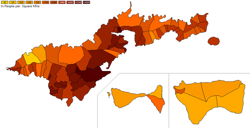
There are not really enough “cities” to be featured on this list, but by checking out this population density map, you can see that if its flat enough for a town, most likely that’s where one was built.
Most Helpful:
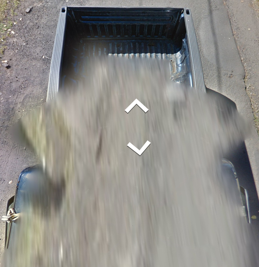
(Tutuila) The truck here is blue. Its definitely blue, and not a dark grey / black or a similar color. The front of the truck is mostly blurred, and its the back of the truck that matters here.
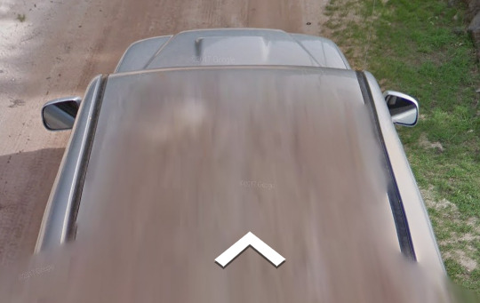
(Ofu and Olosega) The truck here is a silver. Its the only silver car used for coverage in American Samoa.
(Tau) The truck here is a dark grey. It can occasionally look black under the right lighting.
Each island in American Samoa has a different vehicle, check out the coverage map below for the island names.
Google Car:
(Tutuila) The truck here is blue. Its definitely blue, and not a dark grey / black or a similar color. The front of the truck is mostly blurred, and its the back of the truck that matters here.
(Ofu and Olosega) The truck here is a silver. Its the only silver car used for coverage in American Samoa.
(Tau) The truck here is a dark grey. It can occasionally look black under the right lighting.
Each island in American Samoa has a different vehicle, check out the coverage map below for the island names.
(Tutuila Common Boat)
(Tutuila Rare Boat)
Bollard:
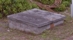
While these are technically not bollards, these concrete squares can be found off the side of the road in most locations.
Google Coverage:
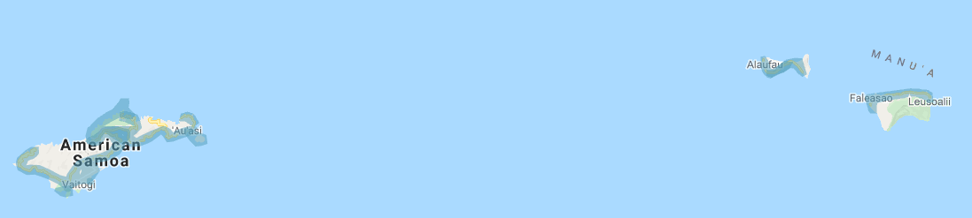
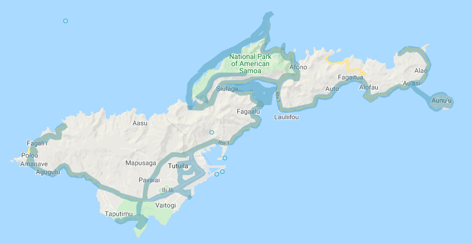
The island of Tutuila is the largest of the American Samoan islands. It is also the one with the most coverage. There is some boat coverage in the bay, just south of the National Park of American Samoa as well as on the Northern coast of the park. The boat is the same in both locations.
You can also find a boat going to the island of Aunu’u just off the coast of Tutuila. Its different from the other boats here. Aunu’u is trekker only.
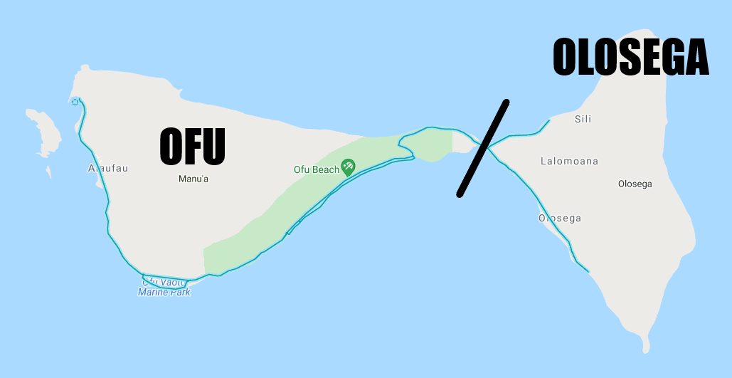
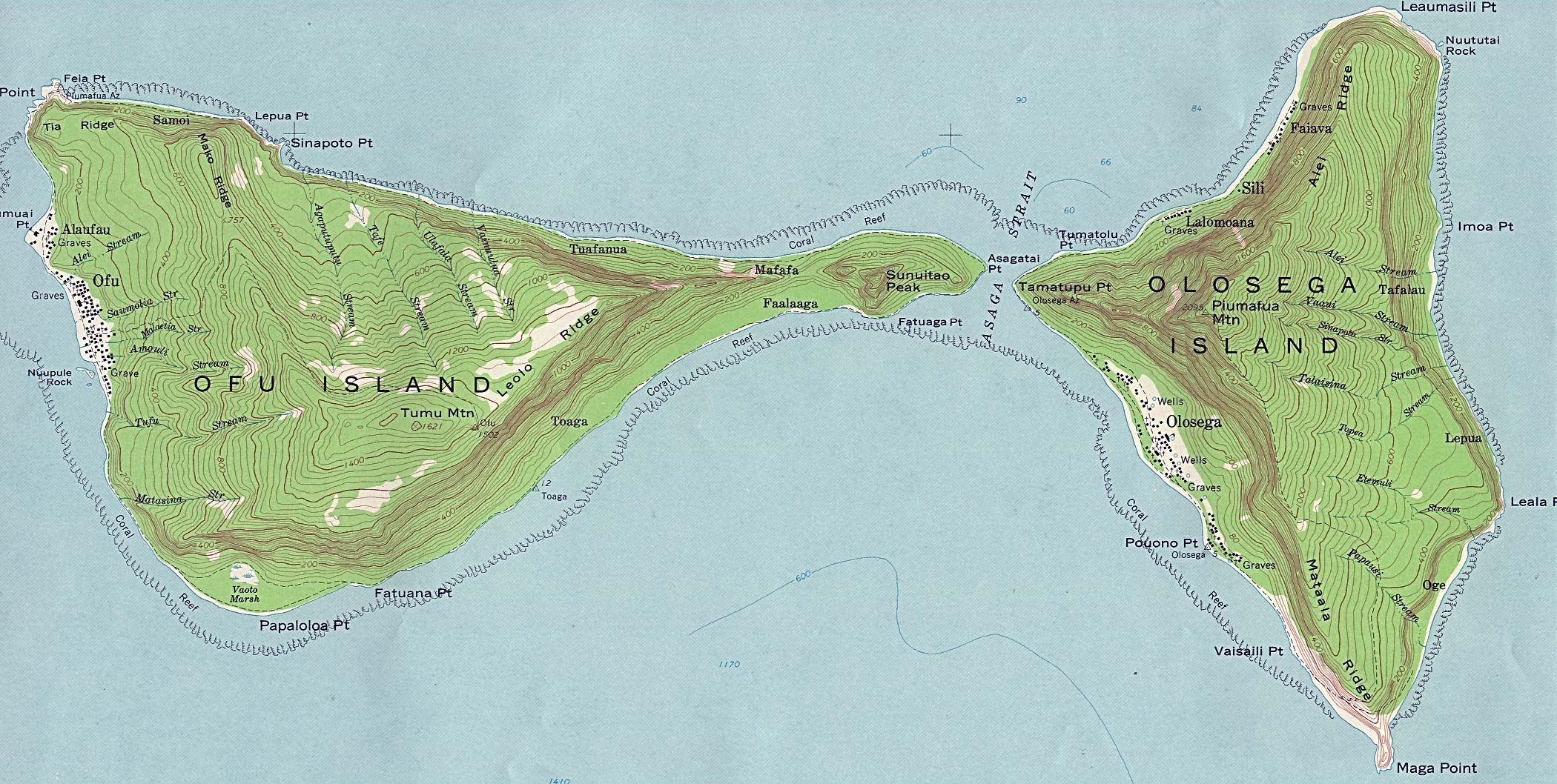
The islands of Ofu and Olosega are connected by a bridge. Technically they are two different islands, but you might not be able to tell the difference.
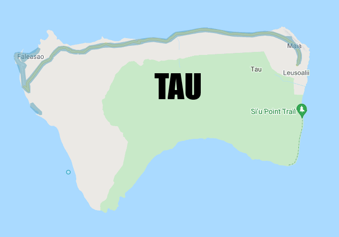
The island of Tau has limited coverage as well.
Unique Vehicle:
These busses are more common than taxis in American Samoa. They can be painted different colors and patterns. They will be mostly on the main island of Tutuila.
Camera Generation:
Gen 3
Road Lines:
Only the island of Tutuila will have yellow lines painted. All other islands have concrete roads without markings. There is a small chance to end up on a dirt road, but you can use the car in these situations.
Road Signs:
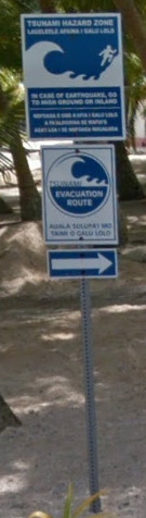
The most common sign in American Samoa is this Tsunami warning sign. It makes up nearly 50%, if not more, of all the signs you will see on American Samoa.
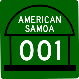
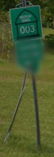
American Samoa has 3 numbered highways: American Samoa (AS) 001, AS005 and AS006, all of which are on the main island. AS001 goes east-west along the southern shore of the main island. AS005 also runs east to west but is much shorter (only 5 mi or 8 km) and cuts across the southern part of skinny strip that moves northeast. AS006 also cuts across the strip but does so going north-south and is further east than AS005.

American Samoa uses a traditional guardrail with a white reflector.
Electricity poles:
The poles can be painted, with blue seeming to be the color of choice.
License plates:
The white plates are reserved for taxis, but you can occasionally see them on the island.
Phone number:
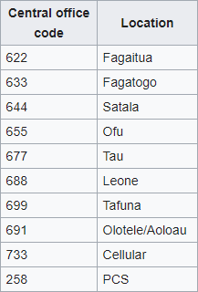
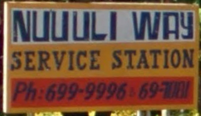
There are a few area codes in American Samoa, however you wont really find those in front of the telephone numbers.
Nice
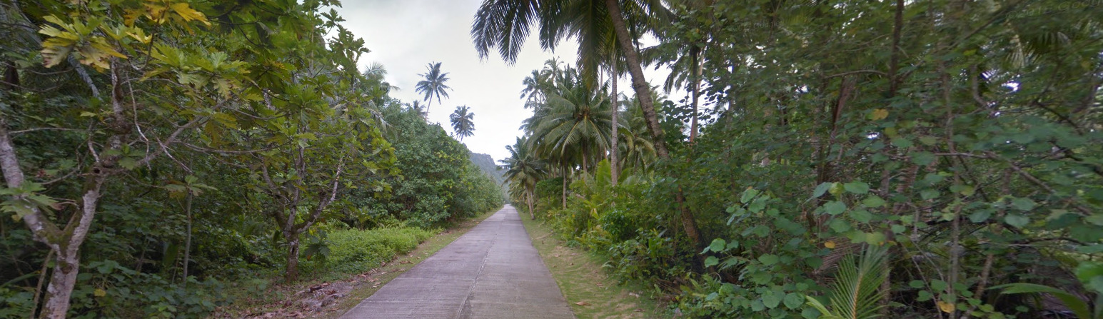
Vegetation/Landscape:
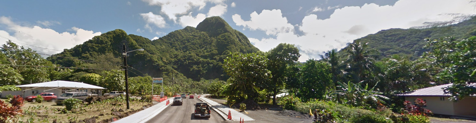
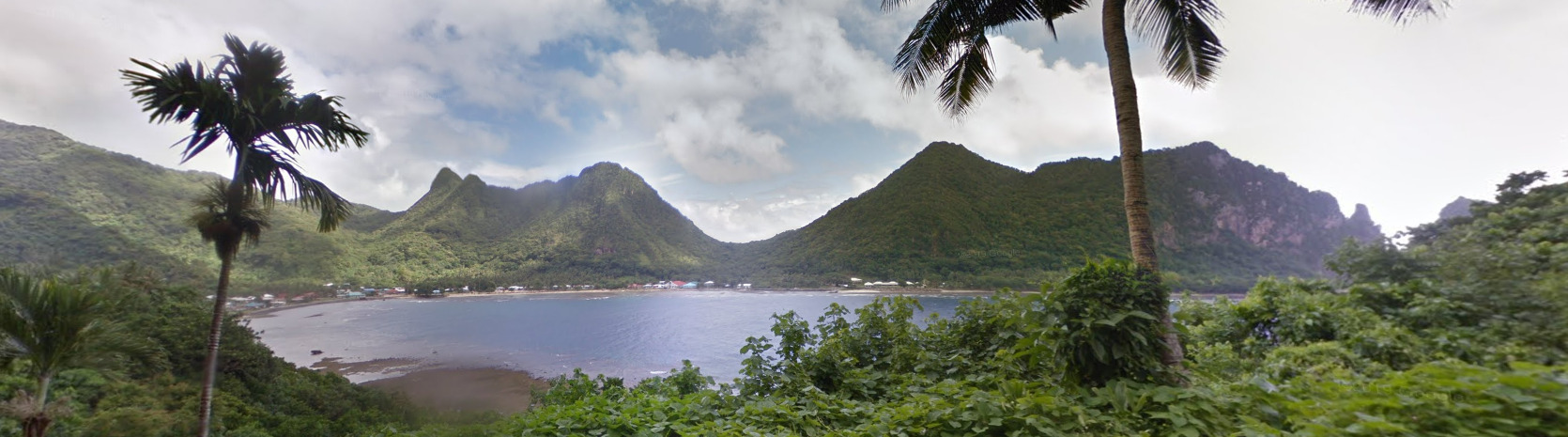
American Samoa is a very mountainous region. Some sharp peaks exist, and it makes the area feel like Jurassic Park / Kong island.
Architecture:
There seems to be a lot of buildings that have pillars.
General look:
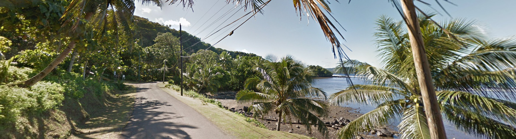

Topography:
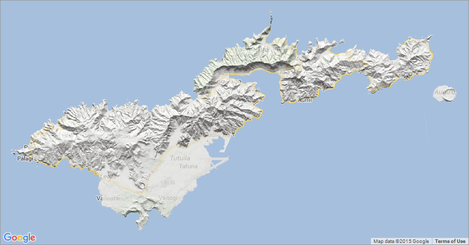
American Samoa is a volcanic island chain in the middle of the Pacific Ocean. There are a lot of peaks and not too many flat areas. Humans will always find a way, and you can see the flat points of the islands tend to be where the majority of the humans live.
Alphabet/script:
American Samoa has two official Languages. Samoan and English.
Domain:
.as
Rose Atoll:
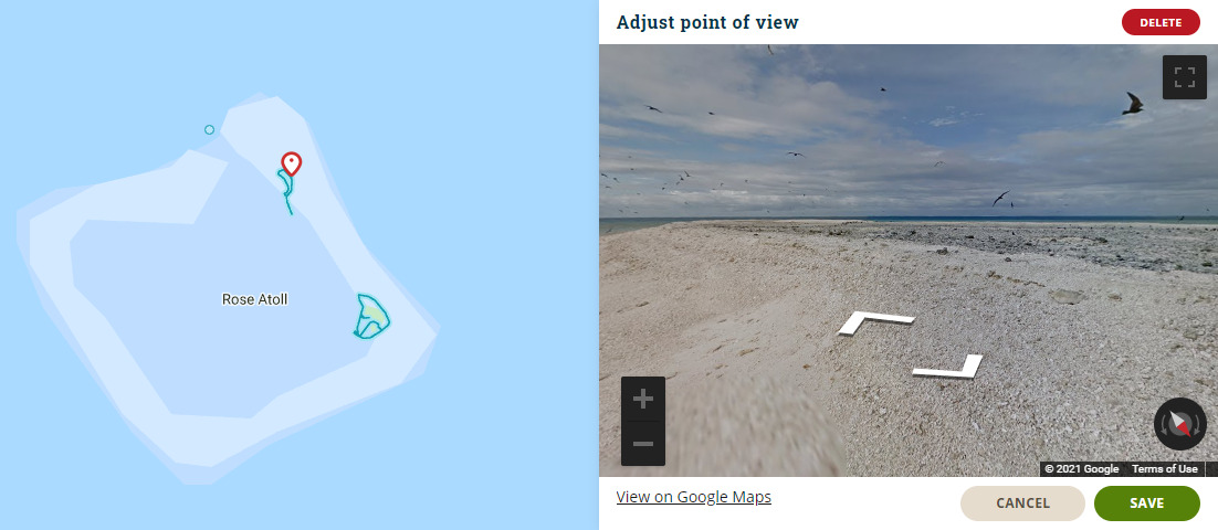
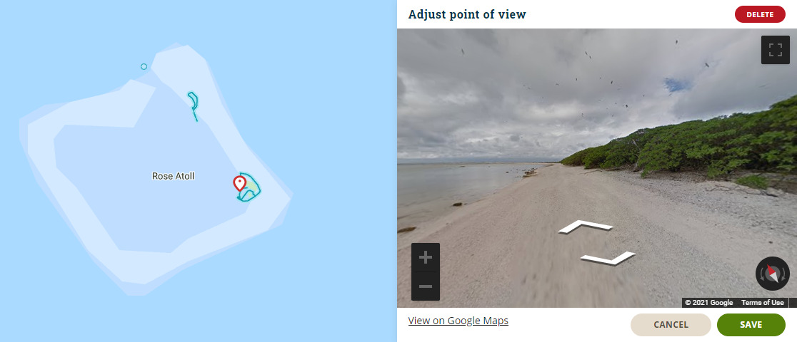
Rose Atoll is technically apart of American Samoa. However, its extremely limited coverage. It is trekker only and most map makers tend to stay away from adding this coverage. Both spots are uninhabited island, and you will mostly find birds here.
Pitcairn
Disclaimer
Pitcairn is not actually located where you clicked. In fact, its another 40 degrees Longitude to the east (Its about 2100 miles). The issue is, if we were to put Pitcairn where it actually was, it would be on the South America map. We also tried to get this marker further east, but due to the positioning of the map, we were unable to do so.
- Country Flag
- Capital City
- Most Helpful
- Google Car
- Google Coverage
- Camera Generation
- Road Signs
- Electricity Poles
- Vegetation / Landscape
- Architecture
- General Look
- Language
- Domain
Country Flag:
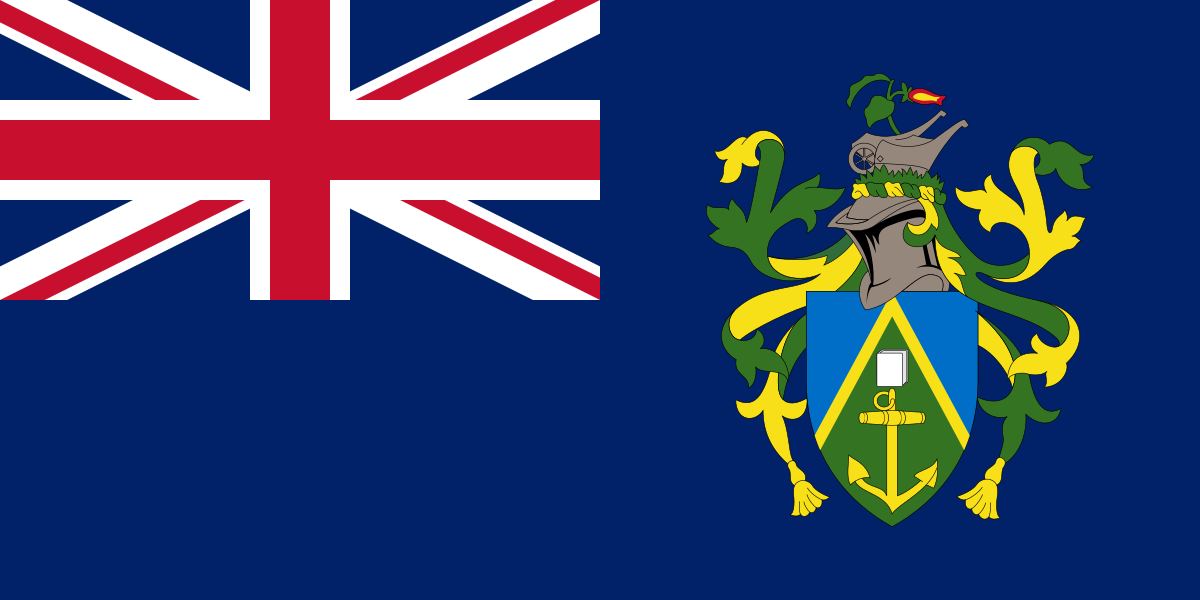
Pitcairn is an overseas territory of the UK. You can tell because of the Union Jack on the flag.
Capital City:
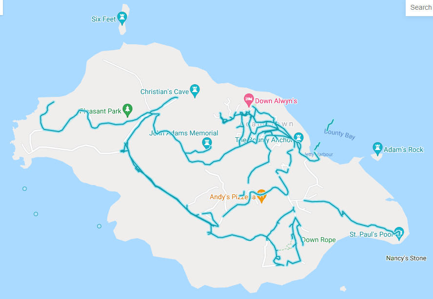
Adamstown
Most Helpful:
Henderson Island has a trekker with a light grey / tan hat. It almost blends into the sandy soil you see everywhere.
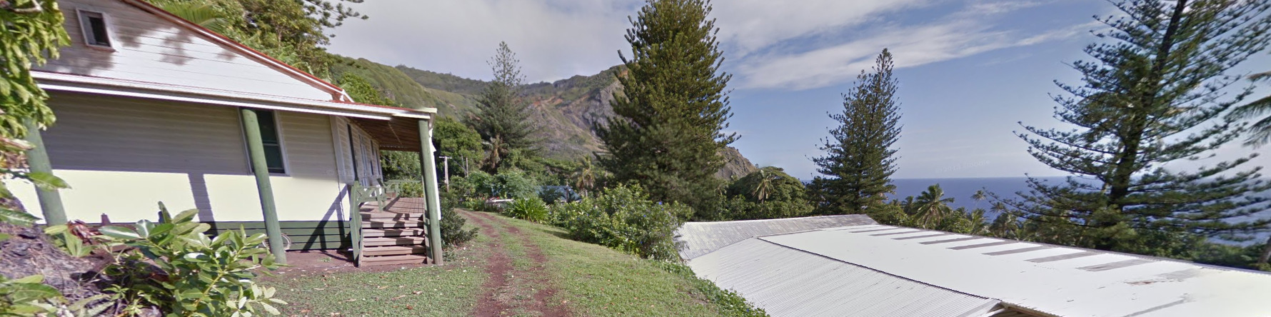
The Adamstown hair. Its a classic meta for the town / city of Adamstown on the island of Pitcairn.
Also on the island of Pitcairn, you can find this tan hat or no hat / hair at all.
Google Car:
Henderson Island has a trekker with a light grey / tan hat. It almost blends into the sandy soil you see everywhere.
The Adamstown hair. Its a classic meta for the town / city of Adamstown on the island of Pitcairn.
Also on the island of Pitcairn, you can find this tan hat or no hat / hair at all.
Google Coverage:
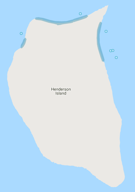
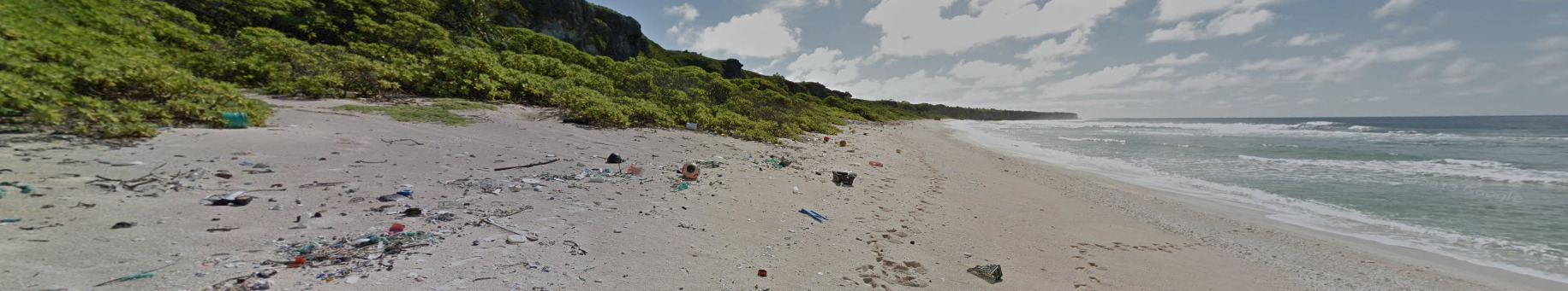
Henderson Island has incredibly limited coverage. There is a bit of interior, but its mostly beach coverage.
Pitcairn has a lot more interior coverage. There is also some third party here, so its not as much coverage as you think.
Camera Generation:
Gen 3
Road Signs:
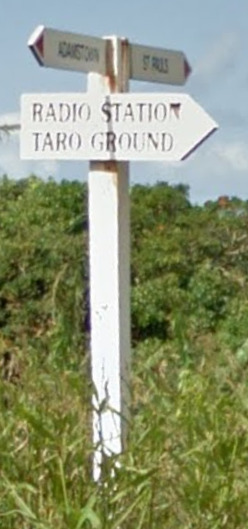
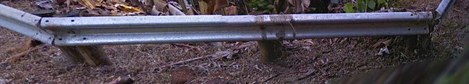
There are not many road signs in Pitcairn. You can find these signs that point to different landmarks, as well as a standard guardrail.
Electricity poles:
Electricity poles on Pitcairn are smaller than your traditional pole. You can find both concrete and wooden poles.
Vegetation/Landscape:
(Henderson Island)
Architecture:
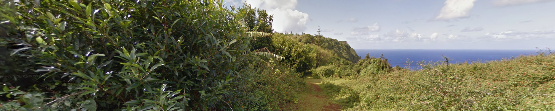
The only island with infrastructure that is covered is Pitcairn, where Adamstown is located.
General look:
(Henderson Island)
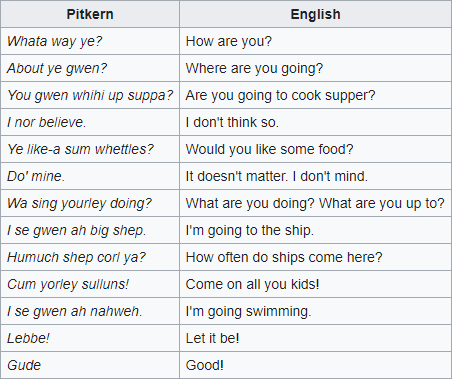
Alphabet / Script:
Pitcairn uses English and Pitkern. Pitkern is only spoken luckily.