The United States of America
Disclaimer:
This is a GENERIC USA map. For a more detailed explanation on certain areas or states, check out the USA map designed to get more in depth (Currently under construction).
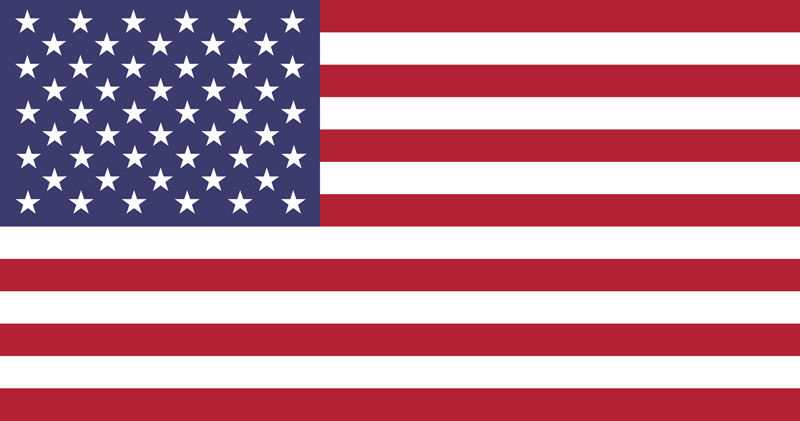
Country Flag:
There are also 50 individual state flags to learn (Woohoo!). However, we will have a map for each individual state for those wanting to learn each state.
Capital City:
Washington D.C.
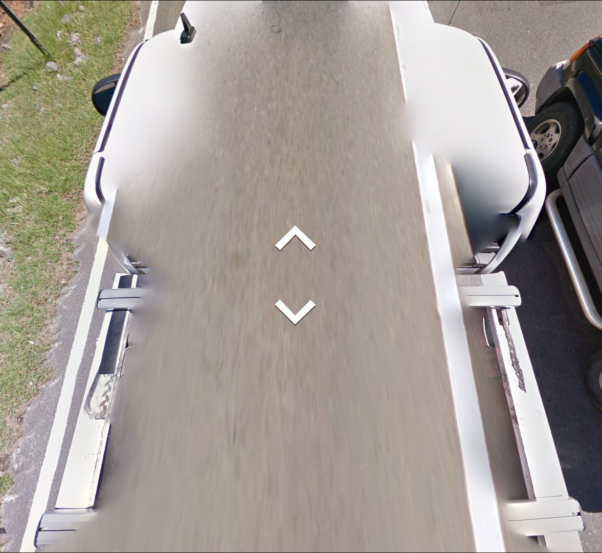
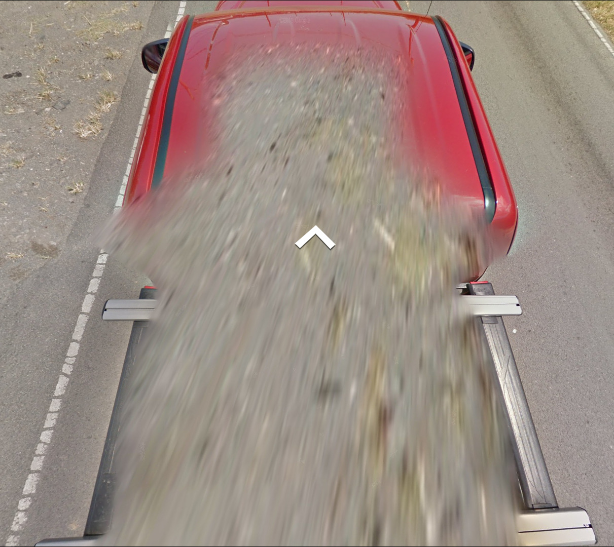
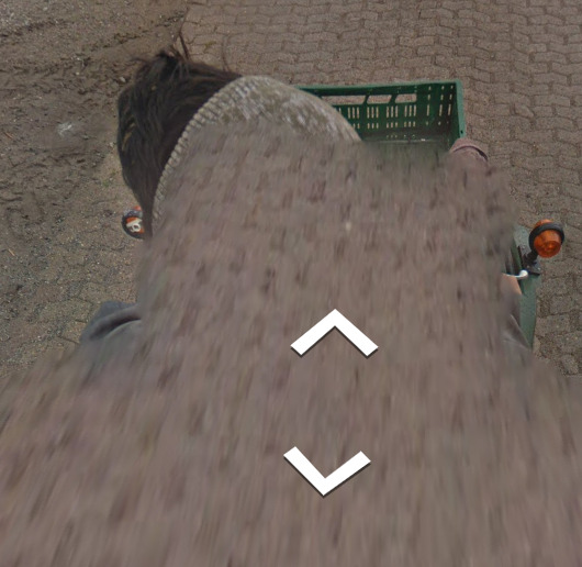
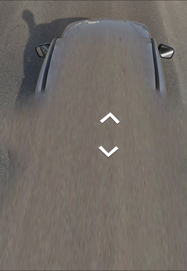
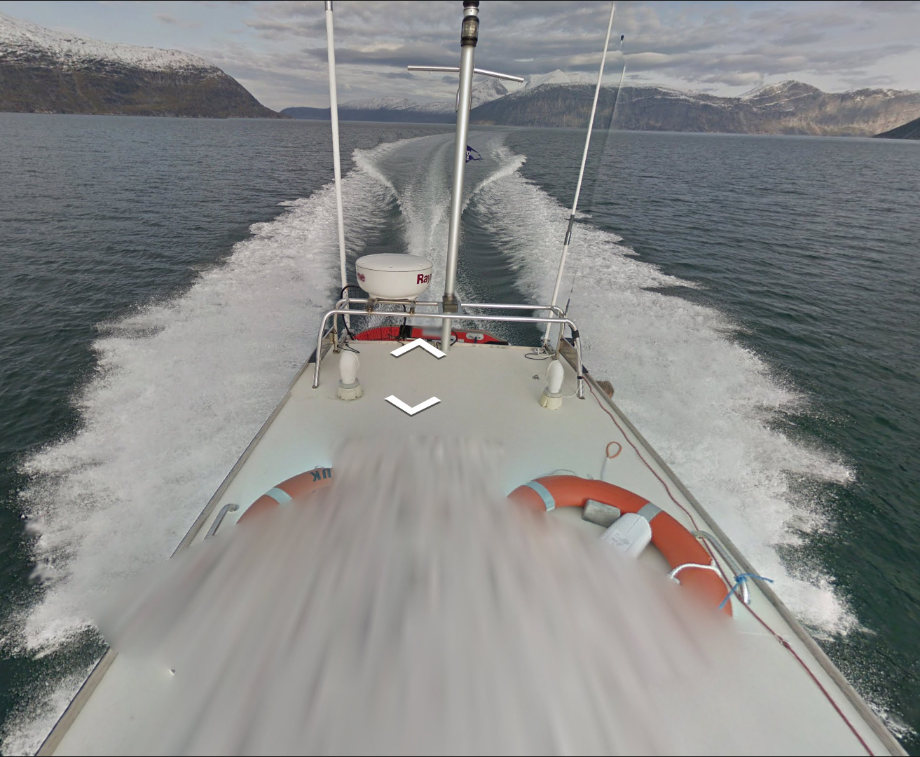
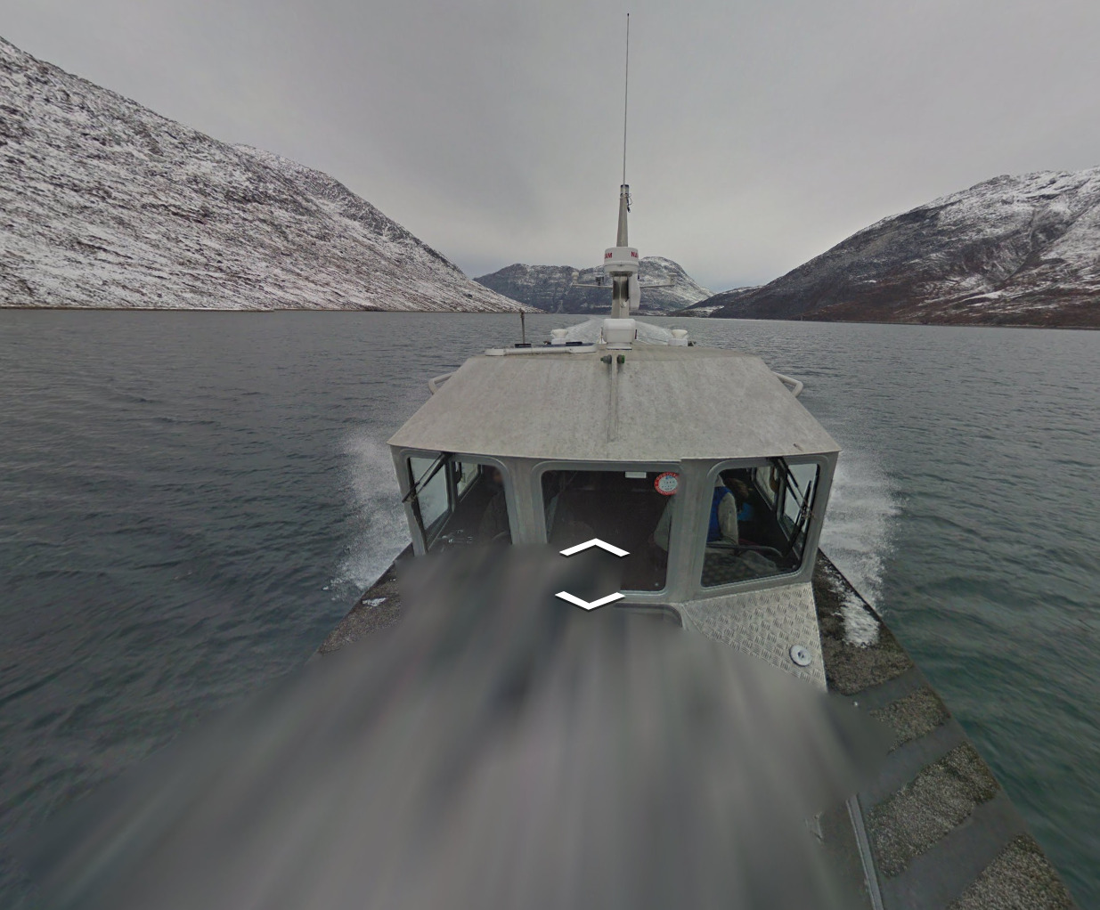
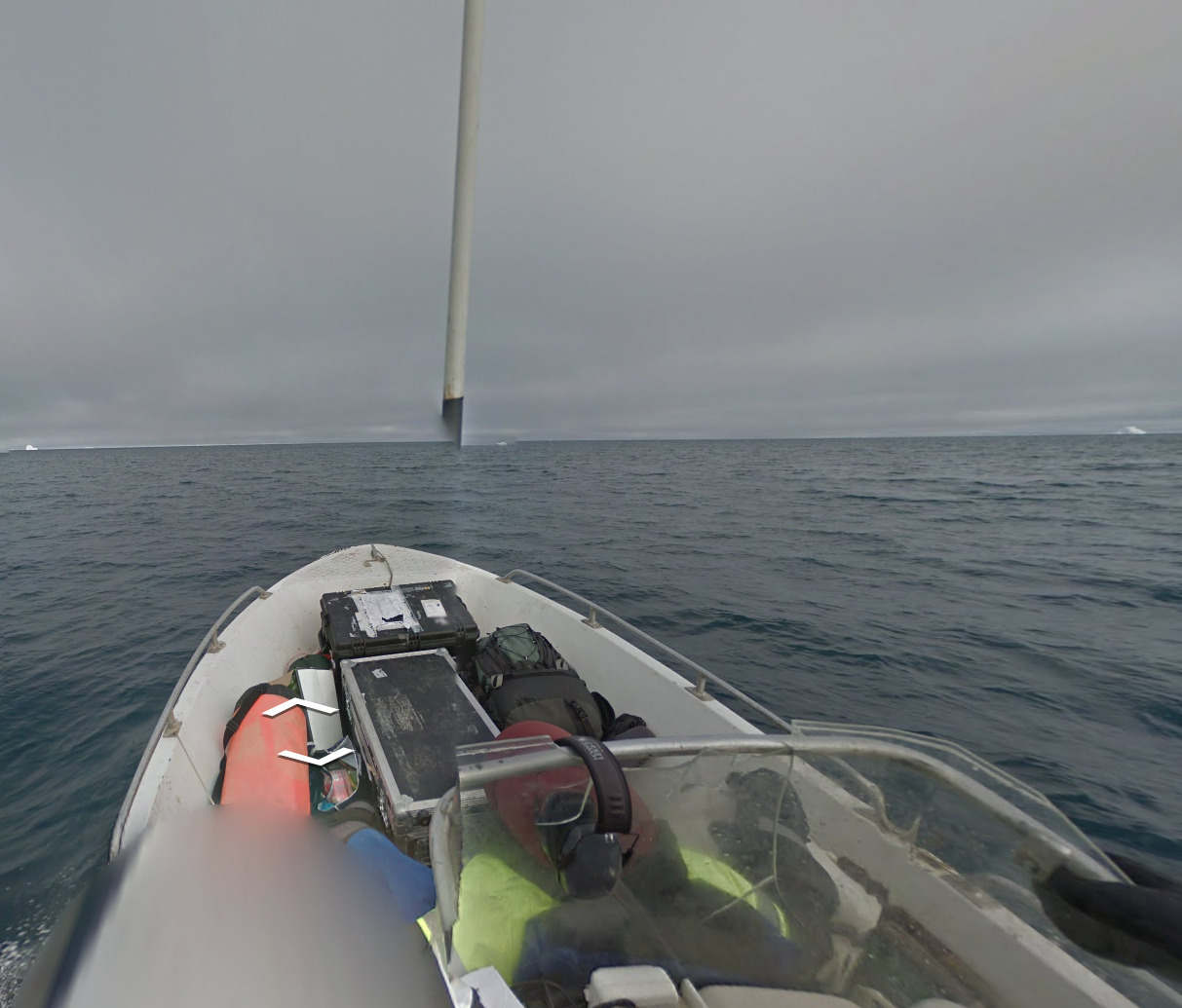
Google car:
Due to the USA being covered by all Generations of Cameras, you will only see a blue car when in Gen 4 coverage. This is limited and not always the case as well.
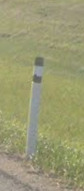
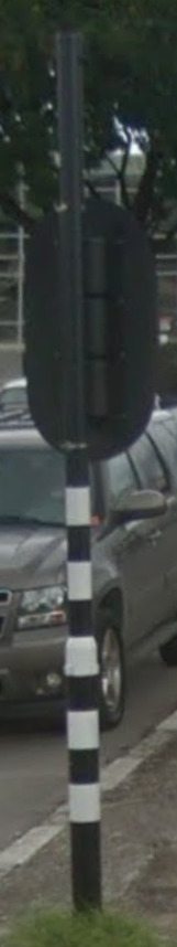
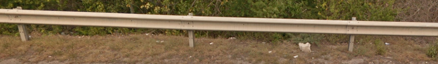
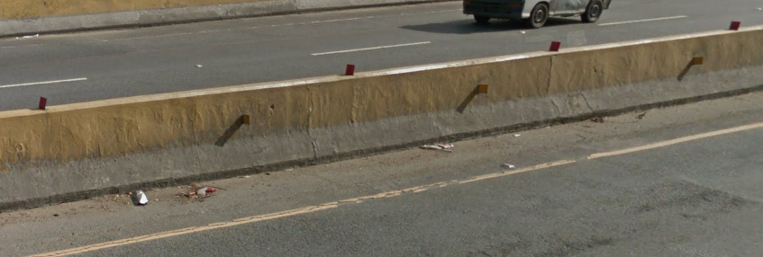
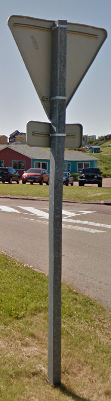
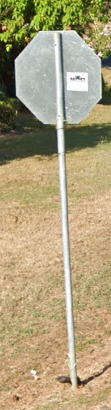
Bollard:
The USA doesn’t have a generic bollard, however there are countless examples of a reflector on guard rails across major highways. Some state may have something like a bollard (Check out Washington State).
Camera Generation:
ALL Camera Gens
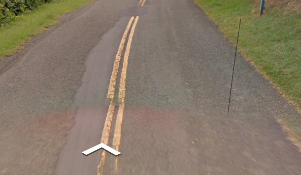
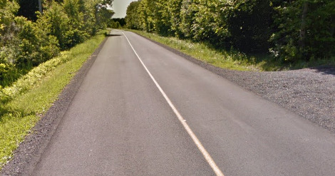
Road Lines:
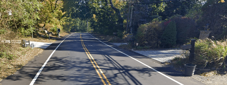
The USA uses a yellow divider line and a white shoulder line. This yellow center will nearly always be a double yellow (Unlike Canada).
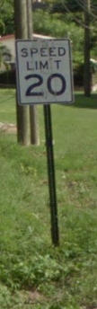
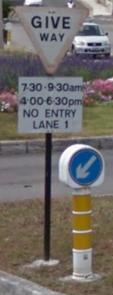
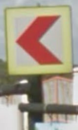
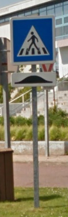
Road Signs:
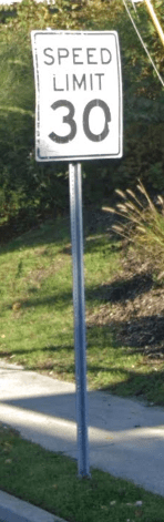
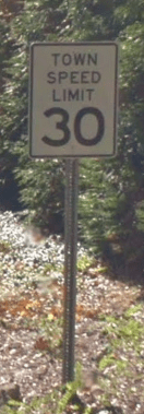
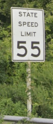
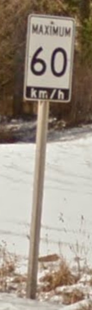
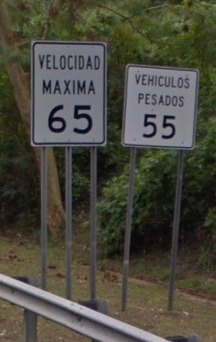
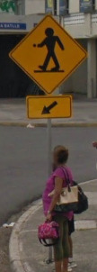
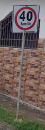
There are hundreds of different signs in the USA. The most important one being the speed limit sign. This speed limit sign can save you from guessing Canada. There are multiple varieties, with the most common being shown above.
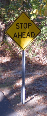
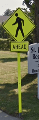
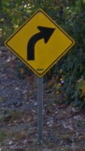
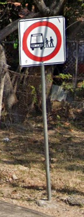
You can also see countless other examples of signs, with some of them being a yellow base sign with black text / imagery, others being a neon yellow, or even a white and black sign. The color seems to matter as to what will appear on the sign. You wont see a white and black pedestrian crossing for example. There is also nothing important about the back of the signs.
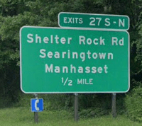
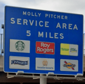
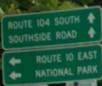
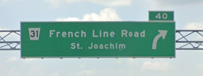
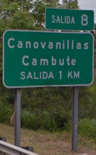
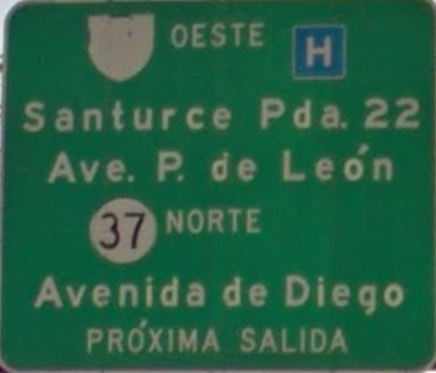
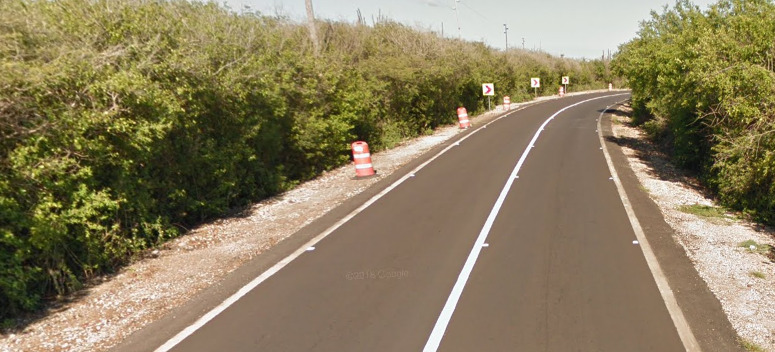
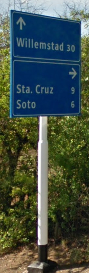
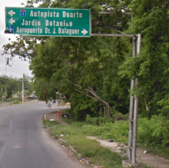
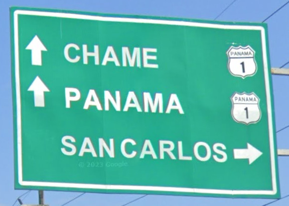
Then you get your highway signs. The Green signs will point to towns and destinations, while the blue sign will point to gas stations, hotels or places to eat.
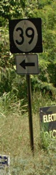
Highways:
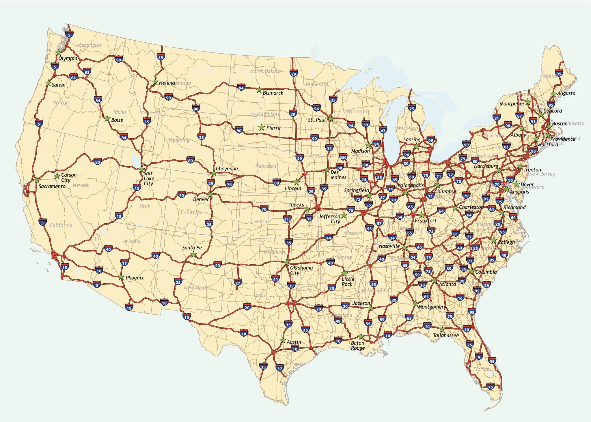
The USA uses multiple highway roads. You have the Interstate which travels between states. Odd numbered interstates generally travel from North to South, while Even numbers go East to West. Some notable Interstates are I95 (East coast from Miami Florida up to the Canada border at New Brunswick), I80 (Eastern New Jersey to San Francisco California), I5 goes from the Mexico border to the Canada border on the West Coast (California, Oregon and Washington State).

There are also the USA Route numbers (Not to be confused with individual state roads). Which look like a Shield. These roads almost imitate interstates.

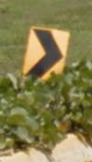
State highways are mostly unique. The most common one of these is a circle sign. You can find this sign in Delaware, Iowa, Kentucky, Mississippi and New Jersey.

There are then Secondary highways, often used to supplement the state highways. Texas has a good example (as shown above).

There are then County Highways. Counties are small districts, not to be mistaken with the word Country.
Please note, there are varieties between states. These are the most common (Often called the Standard). The USA map will be more detailed with road signs.
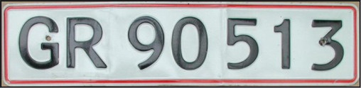
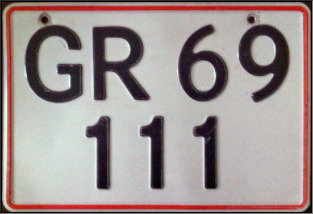
License plates:
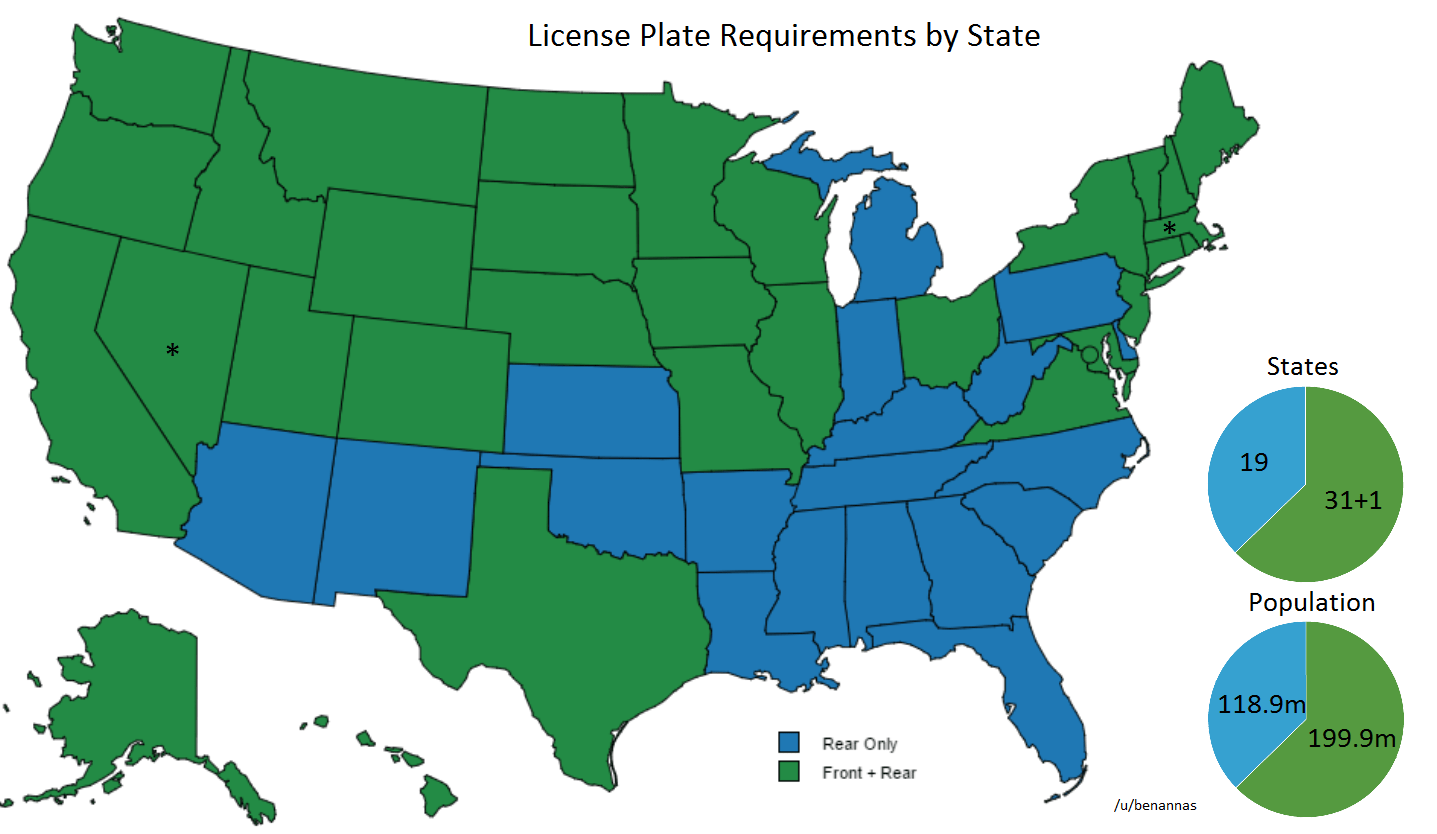

There are MORE THAN 50 unique plates on Street view. Some state have multiple varieties, but its worth knowing which states don’t have a Front license plate, as there are only 17 states that don’t require it!
For a more in depth look at how the license plates look, check out the USA map!
Phone number:
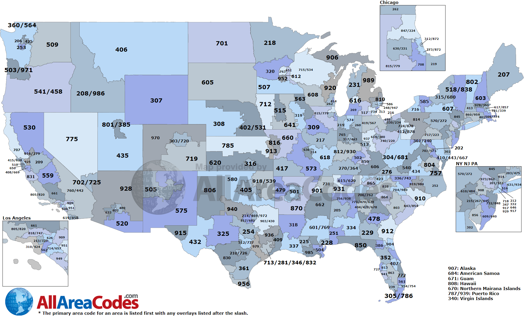
There are 335 area codes in the United States. There is NO difference between a mobile number or a landline. All phone numbers will be 10 digits, set up like (xxx) xxx – xxxx.
Vegetation/Landscape:
There are many differences, and its best to look towards the “General Look” section to get a good feel.
Domain:
.us
While this may be the domain for the USA, you will almost never see it. You’re more likely to see .com, .org, .net or .gov.
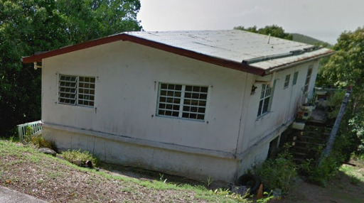
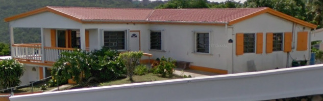
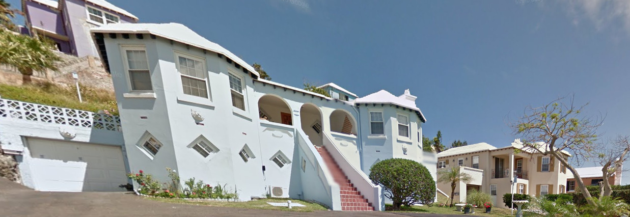
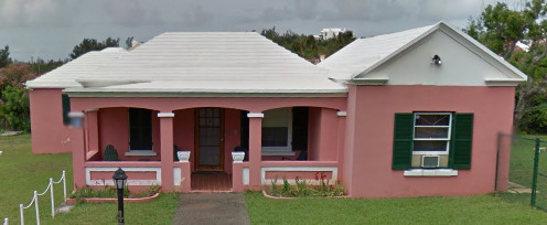
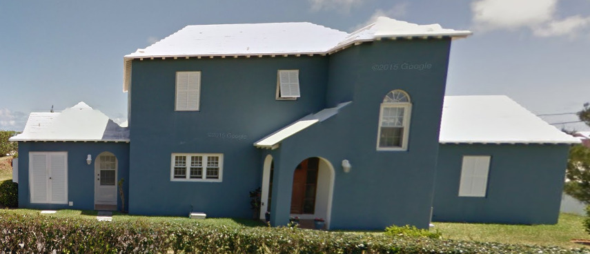
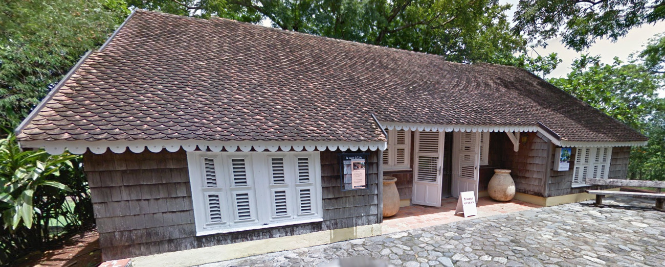
Architecture:
The USA has massive cities with large skyscrapers. These are pretty important as you wont find tall skyscrapers in Europe.
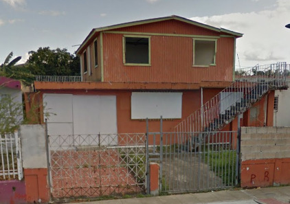
There are some building styles, but these can vary based on the builders preference.
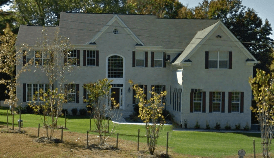
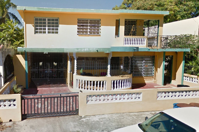
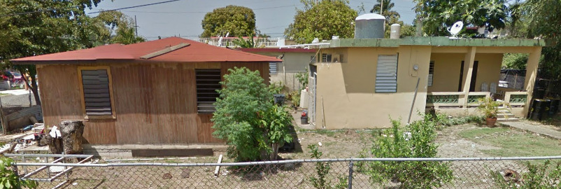
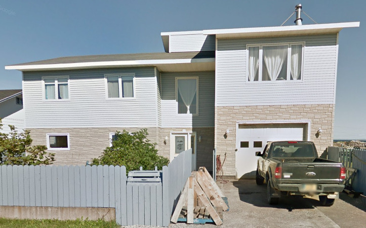
These kind of houses are often found in the North East. Its often pretty obvious and feels “Rich”.
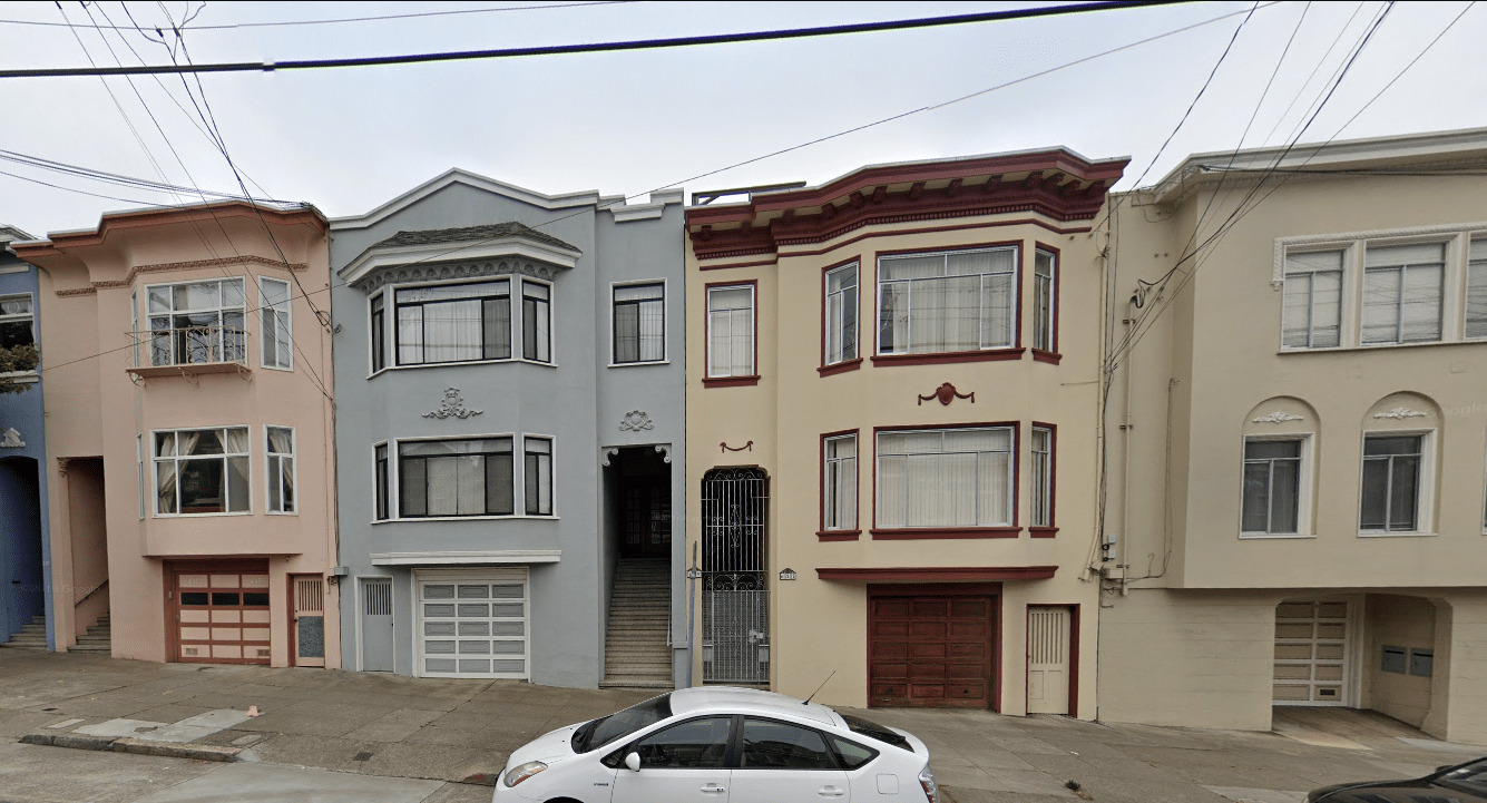
These houses, often called “Row Houses” are found in Suburbs outside of large cities. This example is taken from San Francisco. San Francisco is almost known for these houses.
We’ll get into more detail with architecture in the USA specific map.
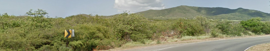
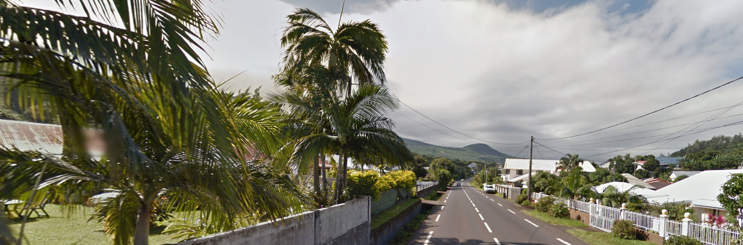
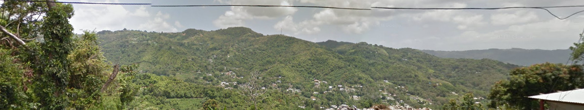
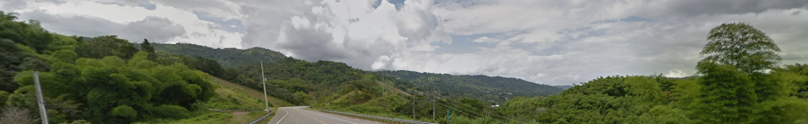
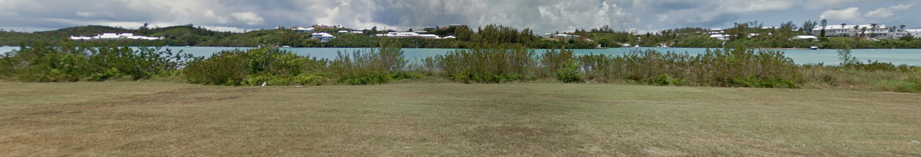
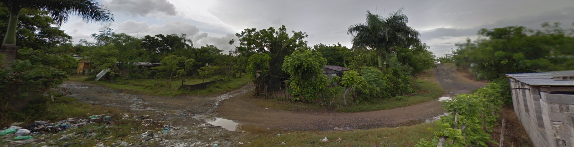
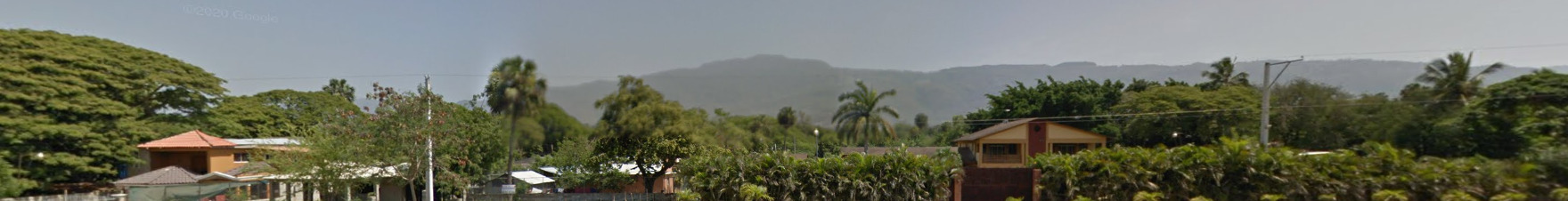
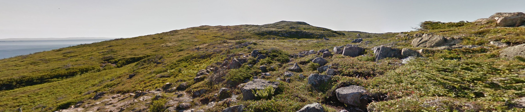
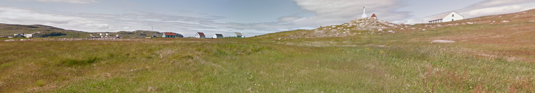
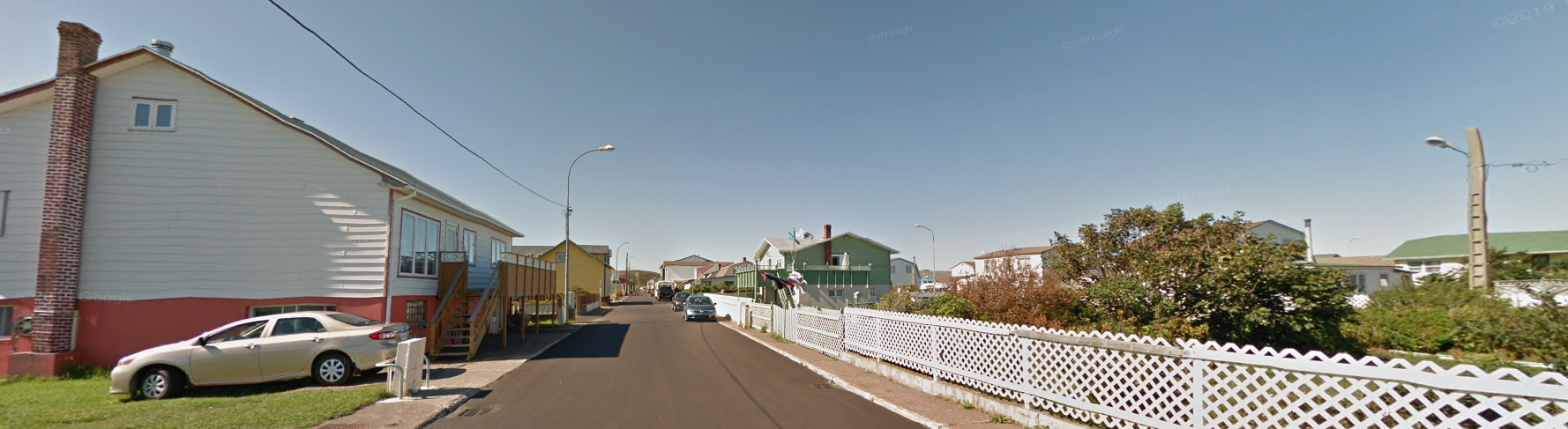
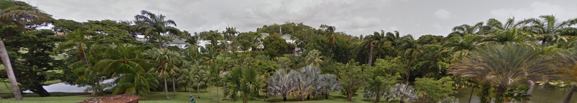
General look:
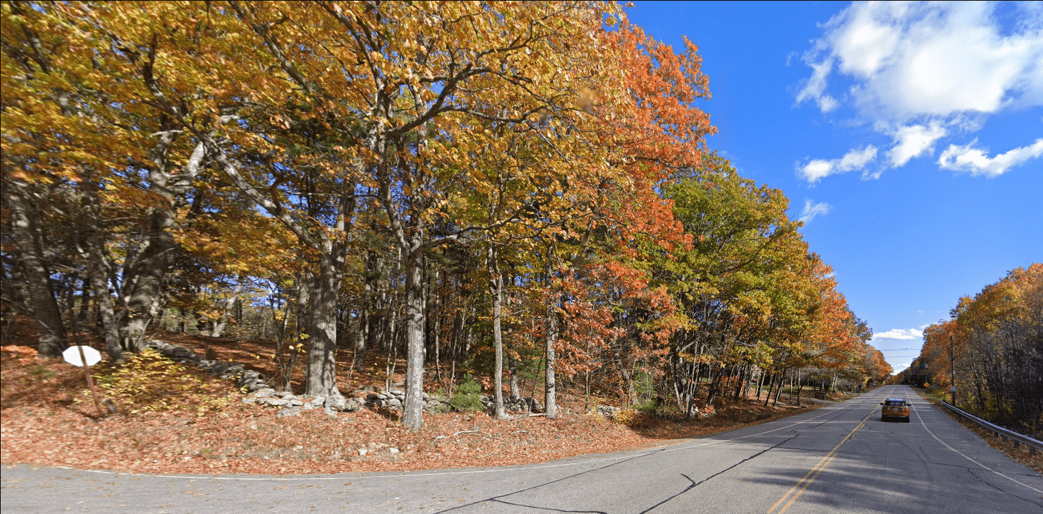
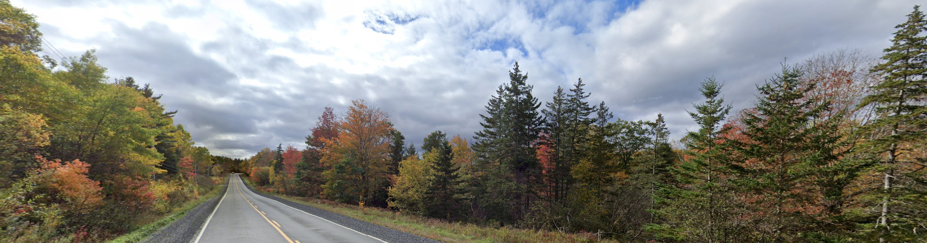
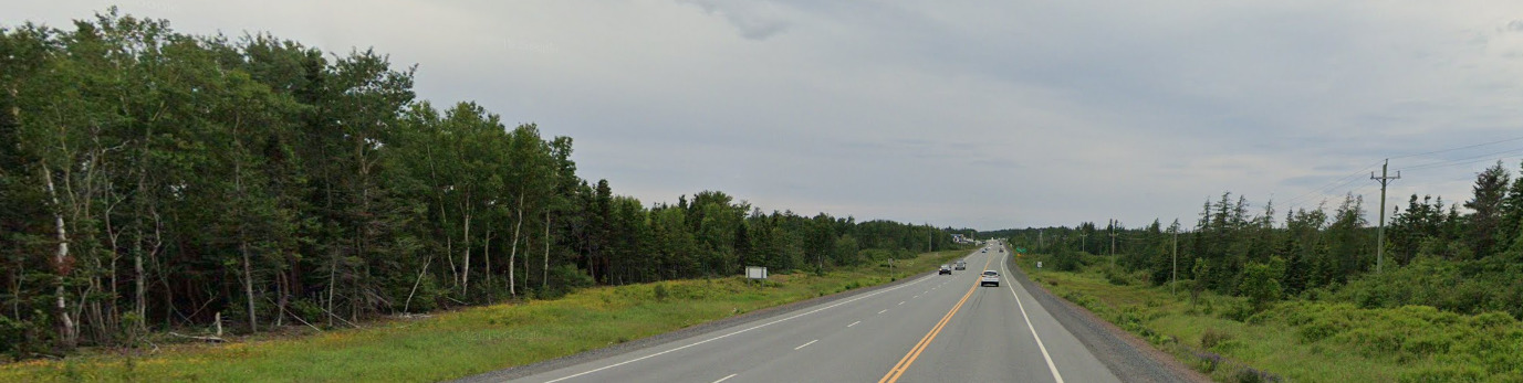
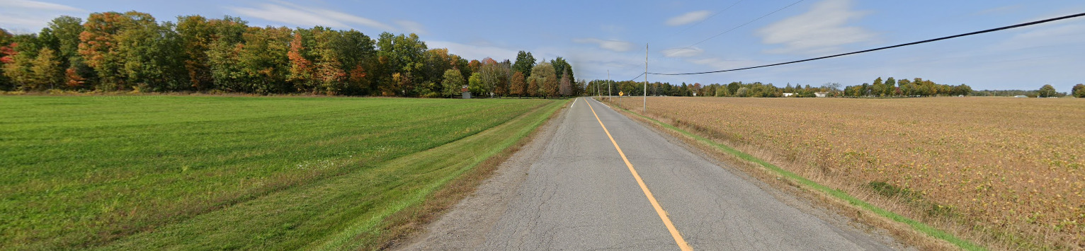
This is the general feel of the North East. You get the fall coverage and the changing leaves up here.
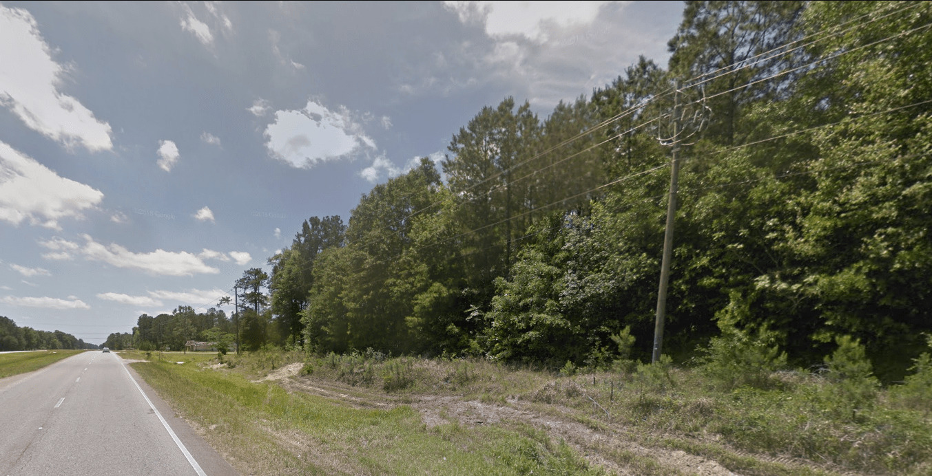
This is the South East. You can see the sandy soil on the side of the road.

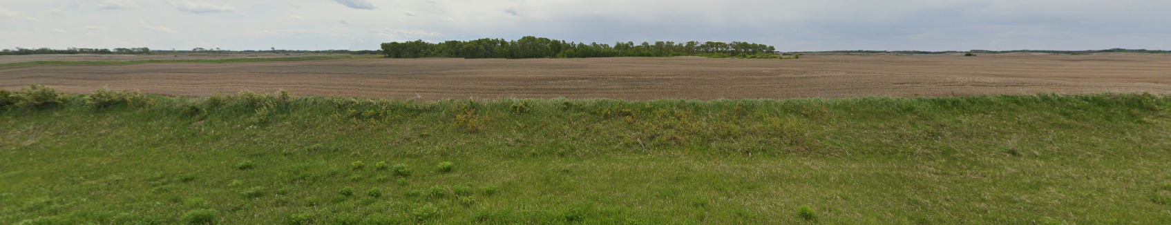
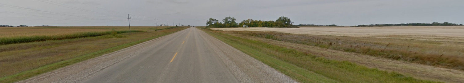
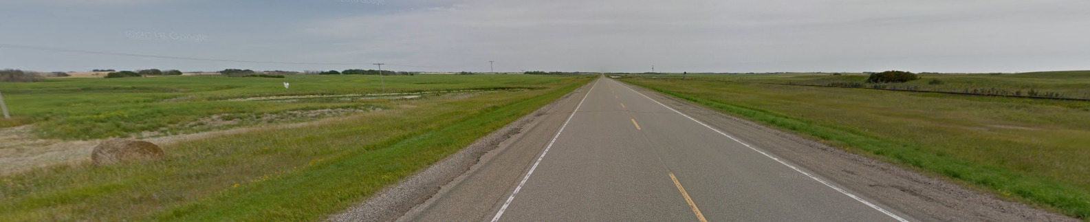
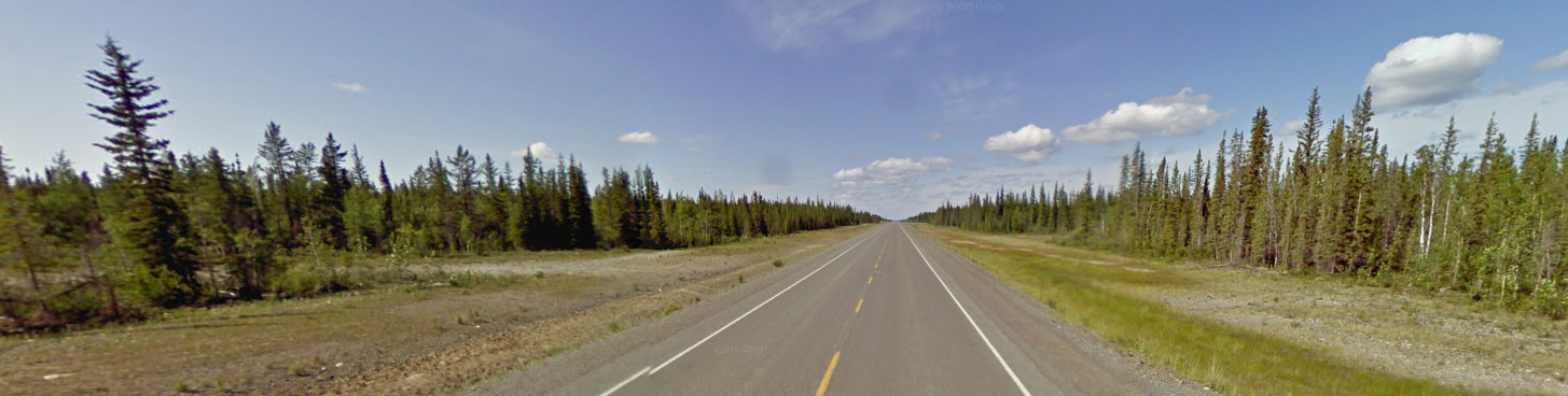
This is the Central North, and its rather flat and green. You can also find a surprising lack of trees.
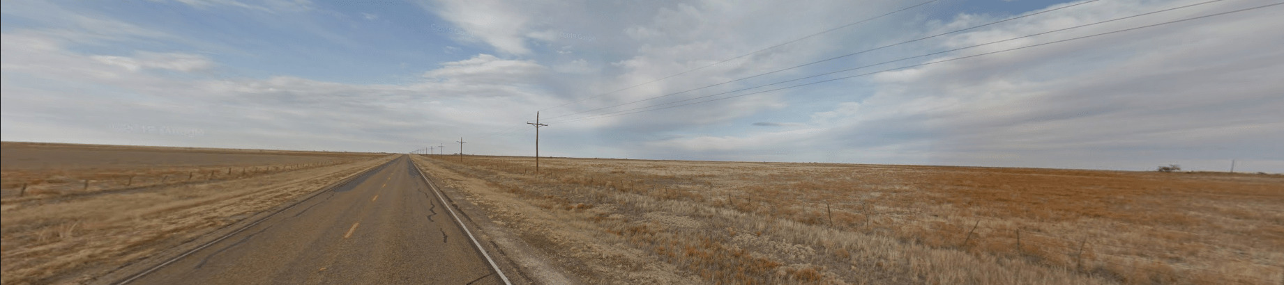
This is the Central South, and its just as flat as the north. However, this area is a lot more dry than the north.
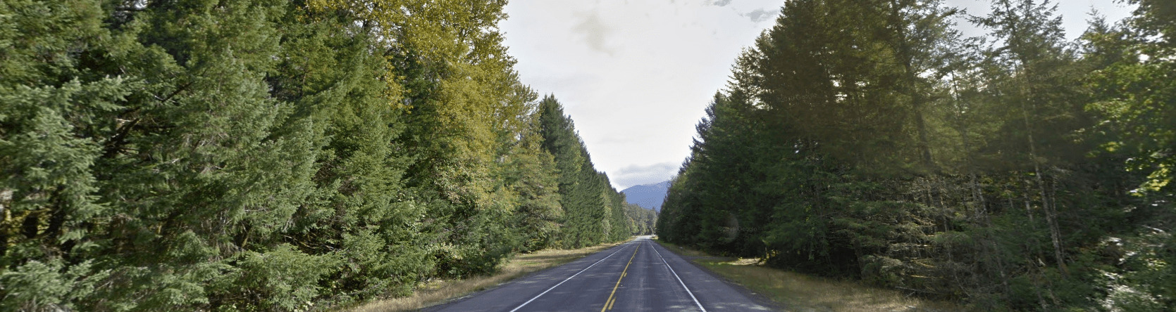
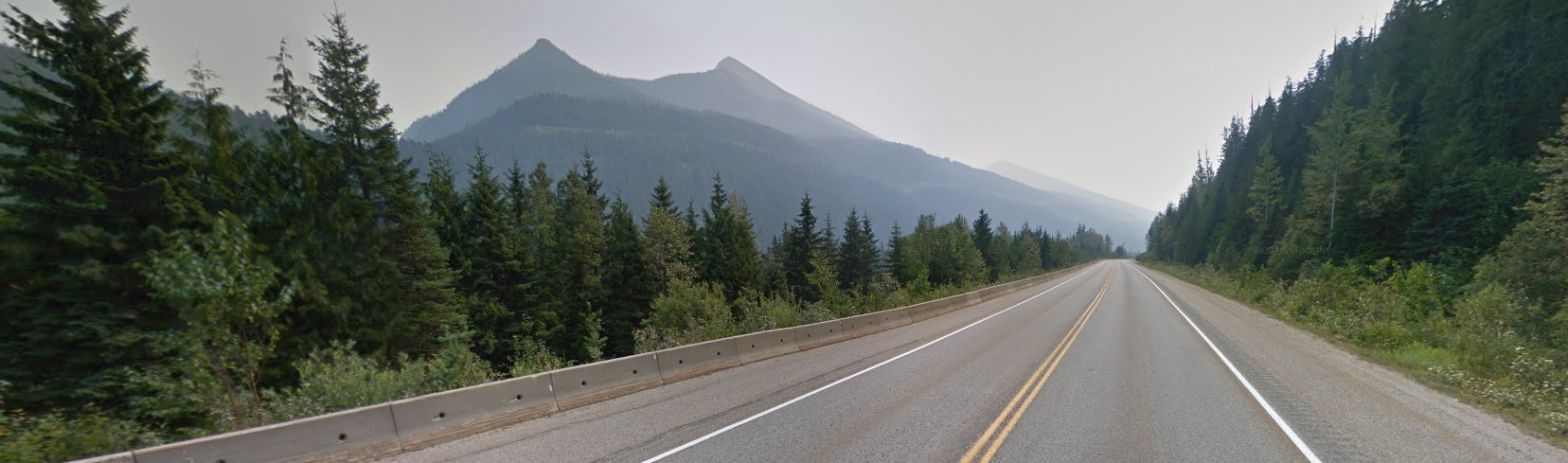
This is the North West, also called the Pacific North West. You will notice the mountains and the tall pines.
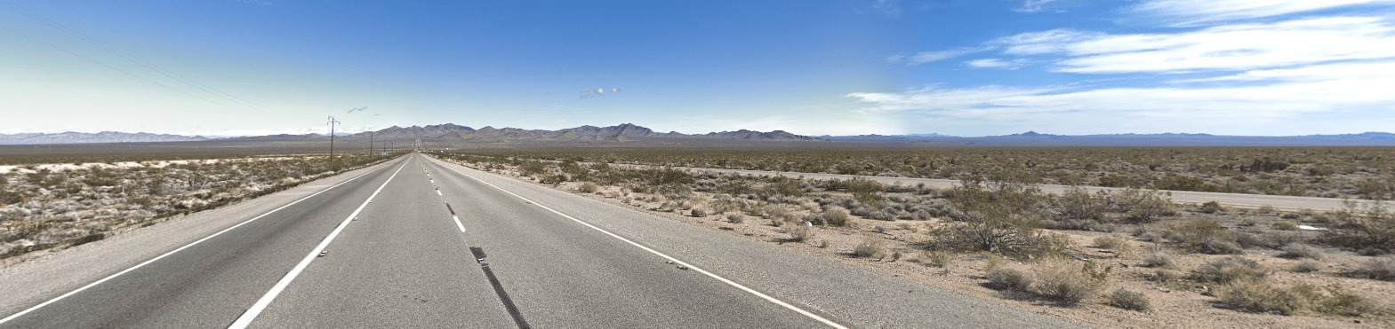
This is the South West, and looks much like the Central South. The only difference seems to be the hills/mountains that you see in the distance.
Unique Vehicle:
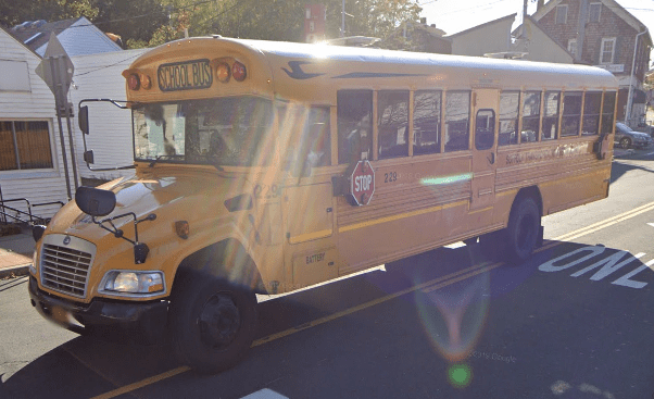
The USA uses a yellow school bus. You can find them often around town.

You can also find Postal trucks around. There are different varieties, but they all contain the same logo on the side / back. All post offices will also tell you the name of the town and give you a zip code. The zip code may not be useful for Geoguessr.
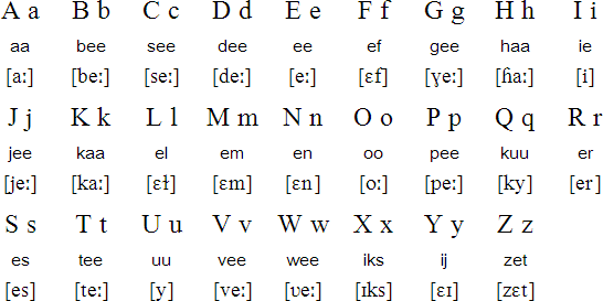
Alphabet/script:
The USA uses English, however you will find signs across the country with a multitude of different languages. You will find more Spanish in the south, and other diverse languages near major cities. For example, you can find Chinese signs in parts of Queens, NY.
Mexico
- Country Flag
- Capital City
- Most Helpful
- Google Car
- Bollards
- Google Coverage
- Unique Vehicle
- Camera Generation
- Road Lines
- Road Signs
- Electricity Poles
- Traditional Clothing
- License Plates
- Phone Number
- Vegetation / Landscape
- Architecture
- General Look
- Subdivisons
- Language
- Domain
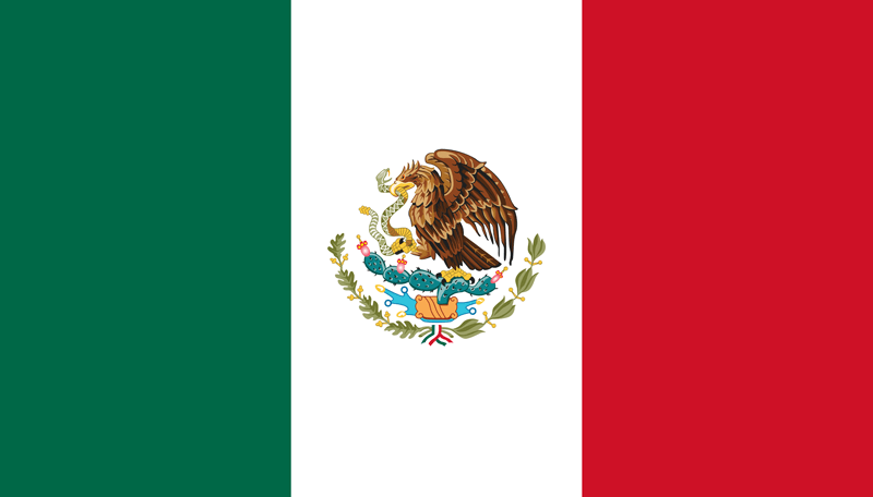
Country Flag:
Capital City:
Mexico City
Most Helpful:

Google car:

The google car in Mexico is a white vehicle, except when the coverage is Gen 4. It has a short stubby antenna. If its Gen 4, the car is blue.
Bollard:


This bollard is common in the south. All bollards tend to have the pattern of a white reflector on the top section and a black base.

This is an example of a bollard from the North. Notice the same color pattern.
Google Coverage:
Unique Vehicle:
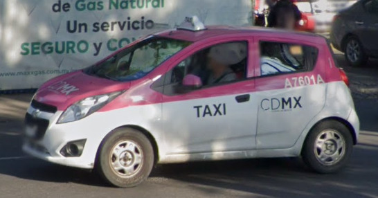
Mexico City uses a pink and white taxi. While you can find taxi’s in other places of the country, the one above can only be found in Mexico City.
Camera Generation:
Gen 2, 3 and 4
There is a chance to see Rifts in Mexico. If you do, it is Gen 3 coverage in the Oaxaca state 99% of the time.
Road Lines:


Mexico, like the rest of North America, uses a Yellow divider and white shoulder lines. The yellow divider will be a double line on major roads, and a single line on smaller roads.
A good thing to notice is that the white shoulder lines are dashed on most major highways in a passing zone. Outside of passing zones and side roads often use a solid white line.
Road Signs:

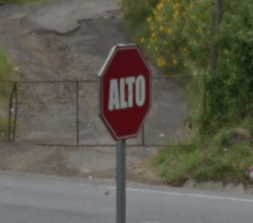
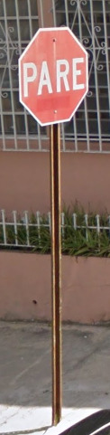
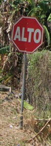
Mexico uses Alto on their stop sign. This is super important and can be a really good deciding factor in Central and South America.

Mexico also uses a variety of colored signs like the USA, but the Green ones are the ones you want to look for.

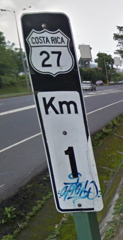
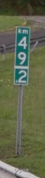
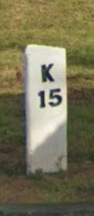
Mexico also uses KM, which can help you figure out whether its Mexico or the South West USA.

Mexico uses the North American Yellow warning signs. They seem to have large “bolded” images on them.

This is the highway map of Mexico. It can be really useful to know where the numbers lead to (ex. Baja California having highway 1).
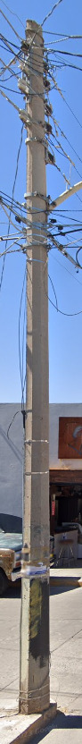
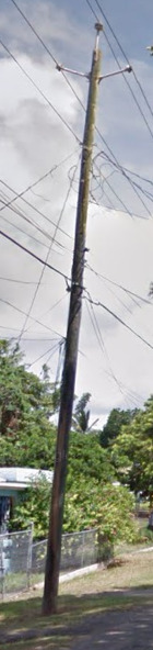
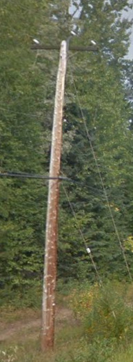
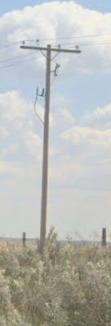
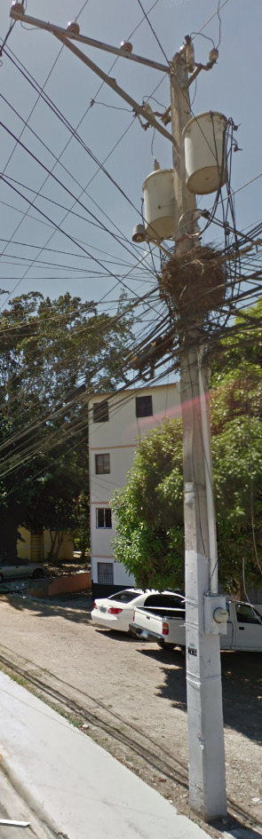
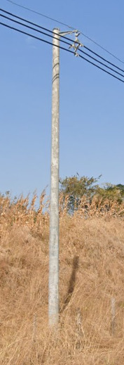
Electricity Poles:
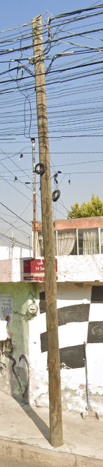
There is an established meta with poles in Mexico. The majority of poles use this octagonal shape. It is a good clue to use.
This doesn’t mean that it is the only pole, with wooden poles still being used occasionally.
Traditional Clothing:
Mexico has a rich history. Pre-colonialism, it was a thriving empire. Even today, some of these indigenous people live on. They dress in a similar fashion to what would have been worn hundreds of years ago. Its possible to see people on streetview wearing this traditional garb. Here’s an article to read about the different types of clothing and styles.
Traditional Dress
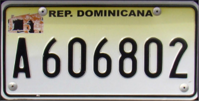
License plates:

Licesne Plates are a problem in Mexico. There are 32 states, with each state having their own plate. They also update the plates with a new deisgn every 4-5 years. That means, from Gen 2 coverage to modern day, there are over 100 license plate variations in Mexico.
Because of this, instead of being able to show you a picture of everything, its better to link you to a website that will show you the differences.
The picture above is just an example of one of the newer plates. It was eye catching and I hope it got you interested!
Mexico Plates 1
Mexico Plates 2
Mexico Plates 3
Mexico Plates 4
Mexico Plates 5
Phone number:


All phone numbers in Mexico consist of 10 digits. Introduced in 2018, a new plan exists. The FIRST digit will assign a region for the country.
The following numbers attribute to the regions.
2 – East
3 – West
4 – North
5 – Central
6 – Northwest
7 – South
8 – Northeast
9 – Southeast
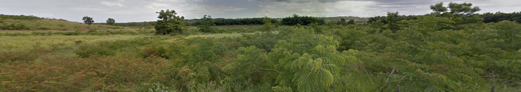
Vegetation/Landscape:
Mexico boasts the highest number of pine and oak species in the world. Other notable trees include mahogany, zapote and ceiba (also known as pochote), the sacred tree of the Maya.

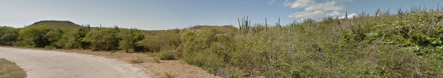
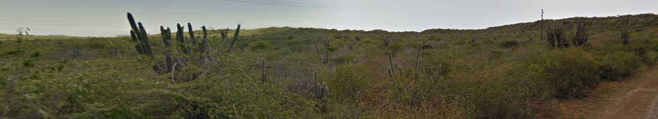
There are also a lot of Cacti, with this being a good sign you’re near or in Mexico.
Architecture:
General look:

Because of the size of Mexico, there are a few general feels. Above is the Yucatan Peninsula. Its pretty distinct from any other region. Its also one of the heaviest tourist destinations in Mexico (Cancun).

The South of Mexico generally has this sandy / dirt feel on the sides. You can see it near the grassy areas on the sides of this image.

The North of Mexico is basically a giant desert. That being said, there are parts that are less desert-y than others.

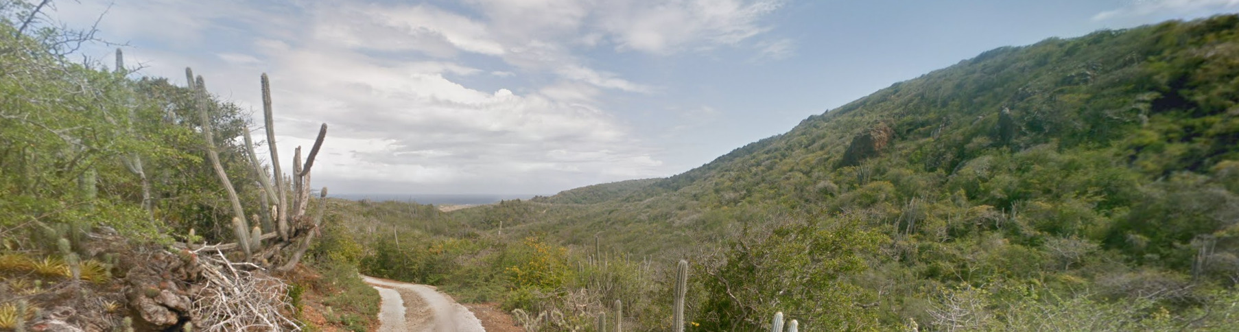
This is the Central Mexican feel. It feels like the South West USA but with some mountains and hills.
Subdivisions:

Mexico has 32 states. This is a map of them as well as their names.
Alphabet/script:
Mexico uses a traditional Spanish alphabet.
Domain:
.mx
Guatemala
Country Flag:

Capital City:
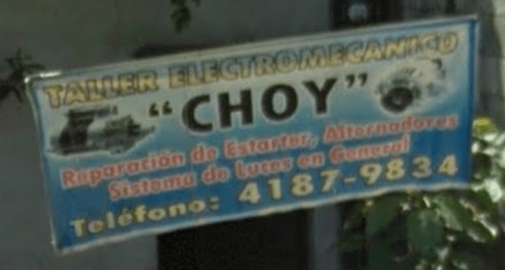
Guatemala City
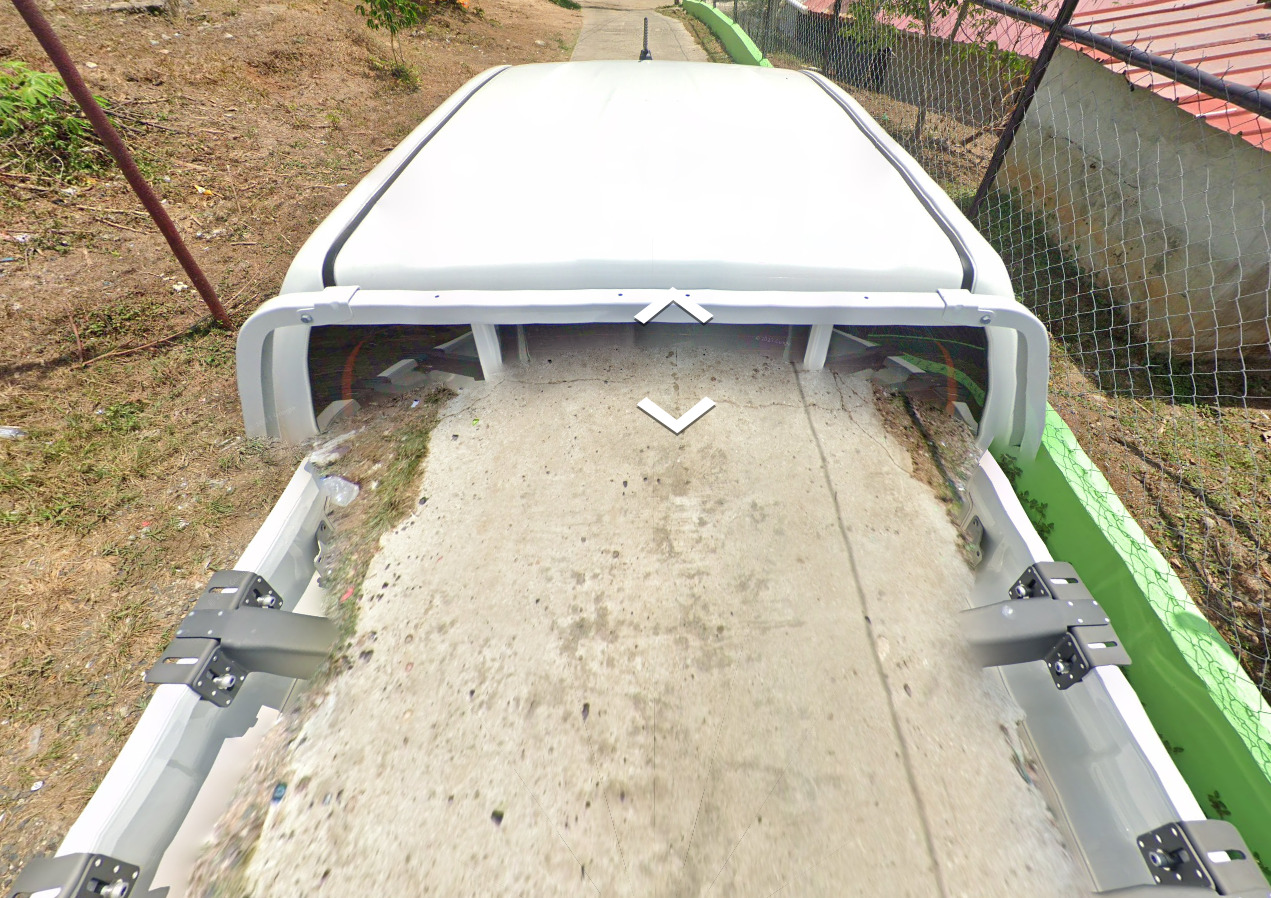
Google car:
Guatemala is very easy to recognize as it uses a car with a roof rack across the entire country.
Bollard:
Bollards do exist in Guatemala but they are extremely rare to find:

Camera Generation:
Gen 3
Road Lines:
Yellow line in the middle, white on the sides:
Road Signs:
Guatemala uses ALTO for stop signs:
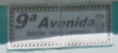
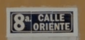
If you are in a city, the street names usually look like this:

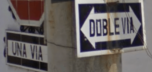
Another thing worth noting is most of the cities are grid type, with many one way roads. They are marked with “Una Via” (one way) or “Doble via” (two way):
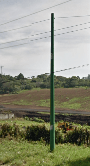
Electricity poles:
Utility poles most of the time are painted with red on the bottom:
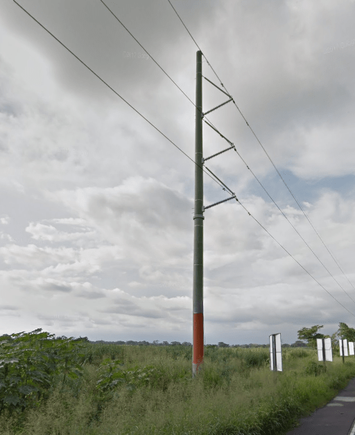
Sometimes you will also see a medium-sized utility pole, all painted green from top to bottom. Probably used for internet or TV lines:
License plates:
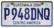
Guatemala uses small license plate sizes (15cmx30cm), so they don’t take the entire space of the car area:
Phone number:
In Guatemala, phone numbers are 8 digit. The first digit indicates the type of phone:
2 – Guatemala city
3/4/5 – Mobile
6 – Guatemala Department
7 – Rest of the country/rural
Vegetation/Landscape:
–
Specific tree:
–
Architecture:
–
General look:
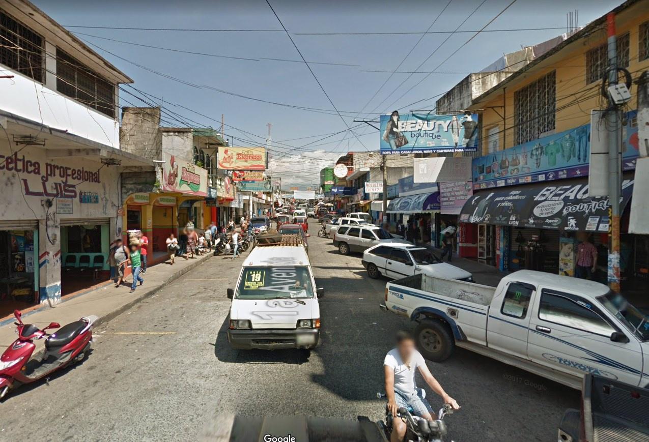
In cities, it generally looks like this:
Alphabet/script:
Guatemala uses spanish alphabet.
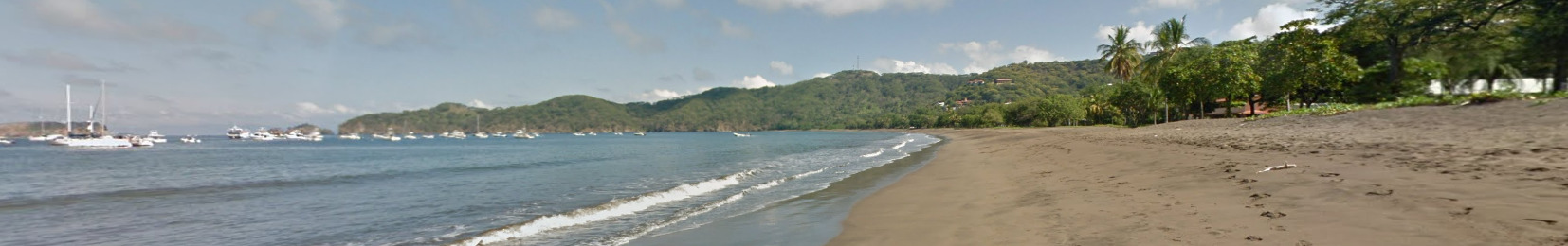
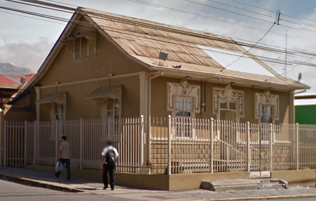
Costa Rica
- Country Flag
- Capital City
- Most Helpful
- Google Car
- Rare Google Car
- Google Coverage
- Unique Vehicle
- Camera Generation
- Road Lines
- Road Signs
- Electricity Poles
- License Plates
- Phone Number
- Vegetation / Landscape
- Architecture
- General Look
- Language
- Domain
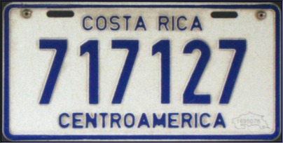
Country Flag:

Capital City:
San José
Most Helpful:
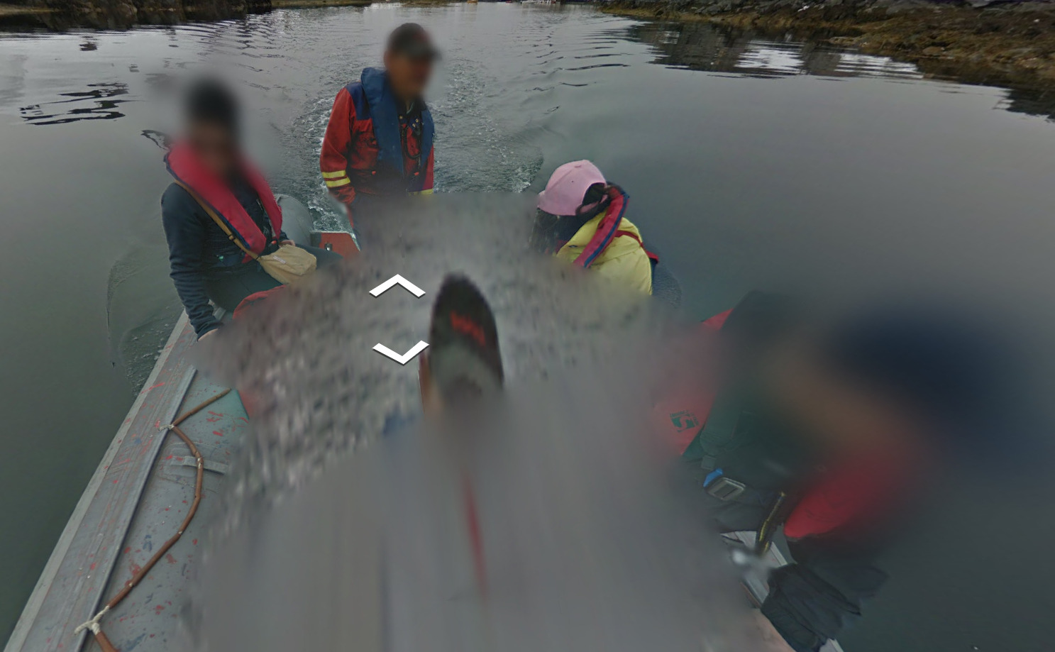
Trekkers in South American countries are not common. Finding one with a decent amount of coverage is a good sign you are in Costa Rica.
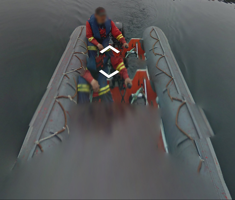
Google Car:
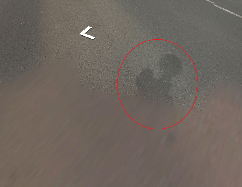
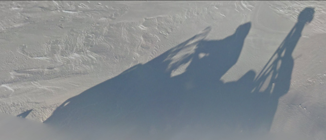
Costa Rica uses a Google Trekker and therefore doesn’t have a car. However, you will still see the shadow of the individual.
Rare Google “Car”:

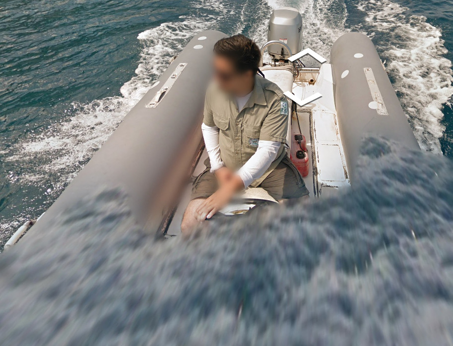
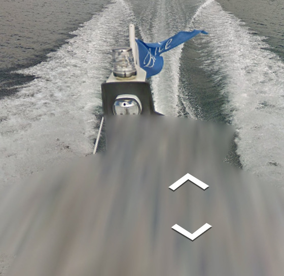
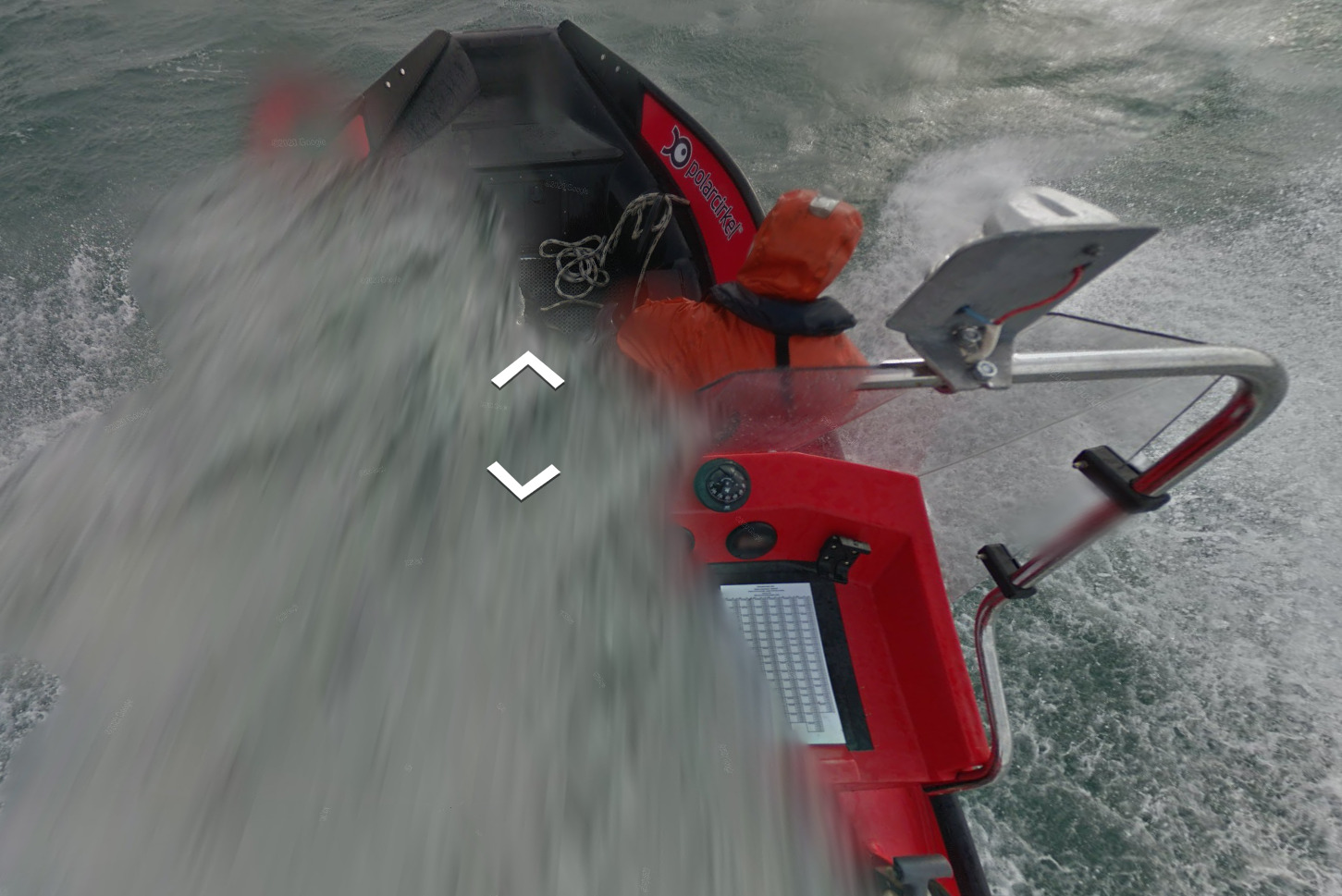
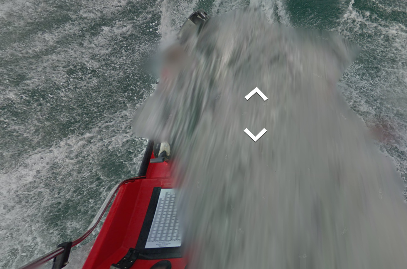
(Caño Island). The Captain removes his shirt at the top left of the boat coverage around the island.
(Cocos)
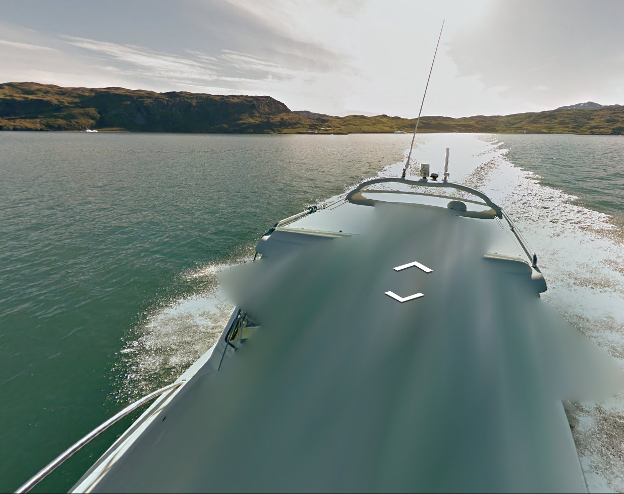
Costa Rica uses two different boats for their two different islands that have coverage. Both boats are unique, and cant be found elsewhere.
Google Coverage:
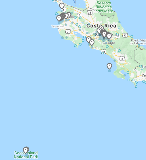
(North West)
(The City of San José)
Most of the coverage in Costa Rica is on the Beach or in historically / culturally significant places. The trekker will have taken all of these images. A lot of the images don’t have any clues, so memorizing where you could end up is not a bad idea.
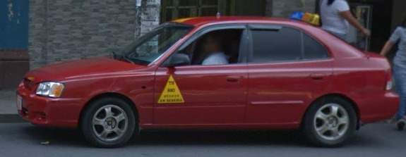
Unique Vehicle:
Costa Rica uses a red taxi. The yellow taxi sign is often found on the back of the vehicle and can be seen at most locations currently covered on Google Maps. Taxis will have a Green Plate as well.
Camera Generation:
Gen 3 Trekker
Road Lines:
Most of the coverage of Costa Rica is located away from the road system. However, you will find roads that look like the image above in a few scenarios. They use a single yellow divider.
Road Signs:
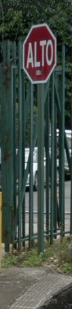
Costa Rica uses “Alto” instead of “Pare” on their stop signs.
Electricity poles:
License plates:
Phone number:
Any Number that starts with a 2 or 4 is a landline, while 5, 6, 7, and 8 are Mobile numbers. 3 is currently reserved for mobile numbers, but not in use.
They all follow the same format of XXXX-XXXX.
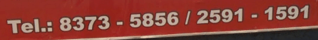
There is also the chance to spot the Domain on many of the billboards that also house phone numbers.

Vegetation/Landscape:
Architecture:
General look:
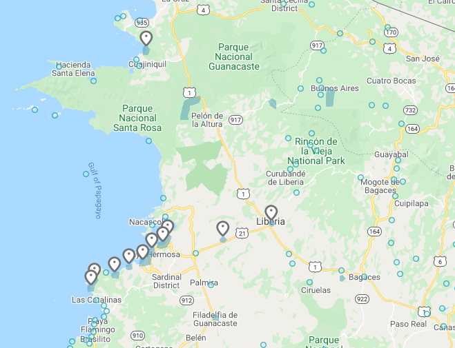
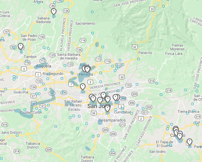
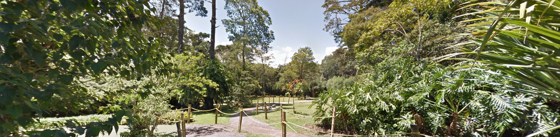
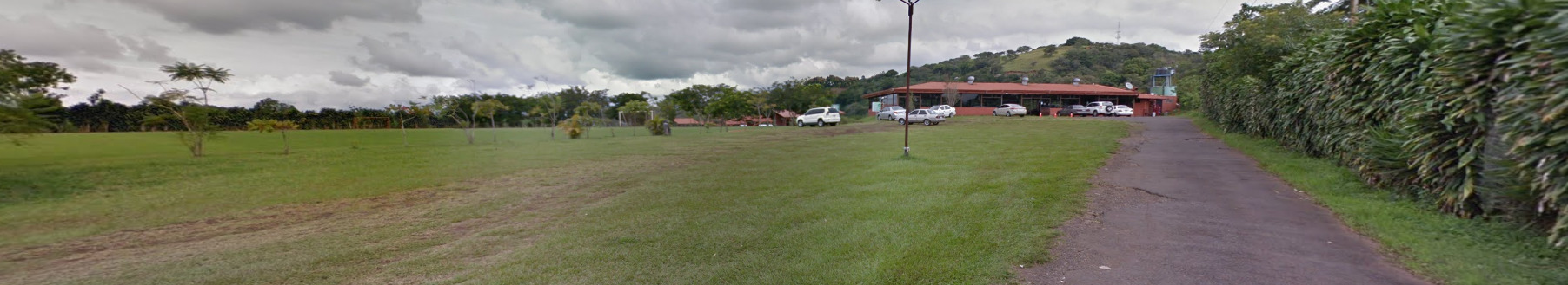
Due to Costa Rica having limited Coverage, there are few places that are covered. Most of it is in the capital city of San José. You are more likely to end up in a park or outside of the airport. There is also some coverage at the University of Costa Rica, some beaches along the west coast and the Palacio de los Deportes (Located in the town of Heredia).
The airport is pretty easy to recognize. You also have access to the main road in front of it.
The parks all feel the same, but its clear that it is a park. The paths feel like they’re designed for foot traffic.
You find these signs everywhere on the University of Costa Rica, and its clear when you are on the campus.
Alphabet/script:

Costa Rica uses your typical Spanish alphabet.
Domain:
.cr
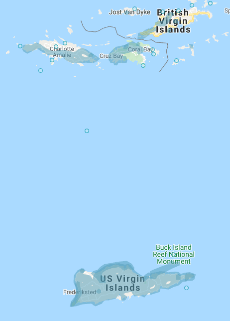
The US Virgin Islands
- Country Flag
- Capital City
- Most Helpful
- Google Car
- Rare Car
- Google Coverage
- Unique Vehicle
- Camera Generation
- Road Lines
- Road Signs
- Electricity Poles
- License Plates
- Phone Number
- Vegetation / Landscape
- Architecture
- General Look
- Language
- Domain
Country Flag:
If you find this flag anywhere, it will be directly next to the USA flag.
Capital City:
Charlotte Amalie
Most Helpful:
The US Virgin Islands drive on the left hand side of the road.
The US Virgin Islands are SUPER easy to recognize because of this car. Just be aware that the color CAN tell you which island you are on.
The White Truck can be found on the North Islands St. Thomas and St. John while the red truck and a white truck are found on St. Croix.
The white truck on the south island is missing the black antenna that is found on the top of the truck near the front left on the north island.
Google car:
The US Virgin Islands are SUPER easy to recognize because of this car. Just be aware that the color CAN tell you which island you are on.
The White Truck can be found on the North Islands St. Thomas and St. John while the red truck and a white truck are found on St. Croix.
The white truck on the south island is missing the black antenna that is found on the top of the truck near the front left on the north island.
There is also a chance to end up on some boat coverage, but most map makers don’t include that. You cannot see anything from the boat itself.
Rare Car:
The Carambola Golf club features at least three (3) different rare cars.
You can see a red blur with an antenna.
You can see a roof rack with no visible vehicle.
The last is just a regular blurred out vehicle. The only thing you can see is a large antenna.
You can tell you are on a golf course for all of these vehicles. Even the road that leads up to the golf course is marked as such.
Google Coverage:
Most of the towns on the islands are covered. Stick to the towns and the surrounding roads and you should be fine.
Unique Vehicle:
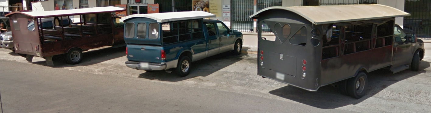
Taxis in the US Virgin Islands are a bit different. They tend to be trucks that have open backs to fit large groups. They can be different colored trucks, with smaller and larger variants existing. The patterns on the sides also seem to be different.
Camera Generation:
Gen 3
Road Lines:
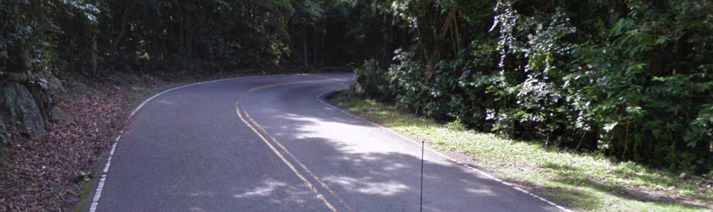
The US Virgin Islands use a double yellow center line with white shoulders. However, they drive on the left hand side of the road and its clear you’re not in the USA.
Road Signs:
The road signs are very similar to the signs from the USA.

The guardrails in the US Virgin Islands are painted yellow in dangerous areas to alert the driver.
Electricity poles:
License plates:
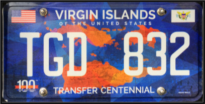
There are plenty of variations, but this is the most common plate for the US Virgin Islands.
Phone number:
Like the USA, the Virgin Islands have a phone 10 digit phone number set up like (xxx) xxx – xxxx.
There is only one area code for ALL of the US Virgin Islands, that being 340.
Vegetation/Landscape:
Architecture:
General look:
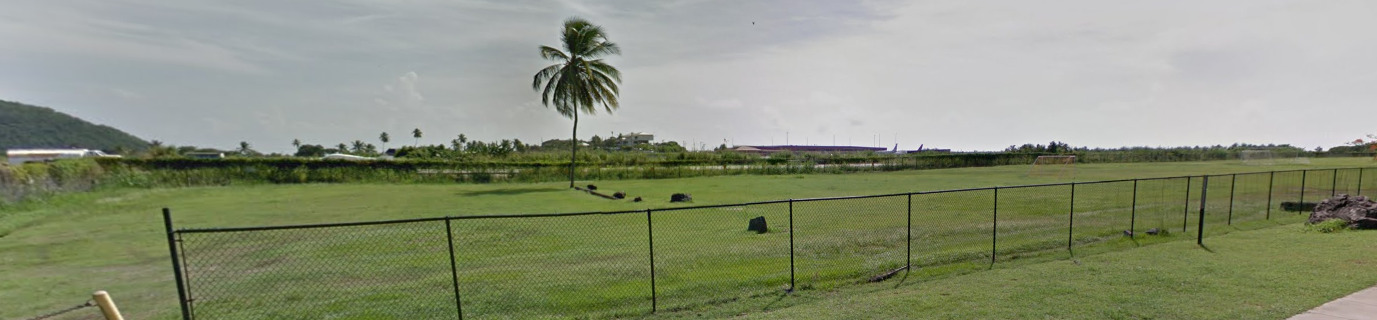
This is the general feel of the Northern Islands. It seems to be a bit more hilly than the south.
This is the general feel of the Southern Island. It seems rather flat.
Alphabet/script:
The US Virgin Islands use a typical English alphabet.
Domain:
.vi
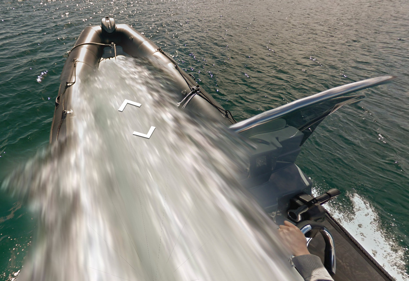
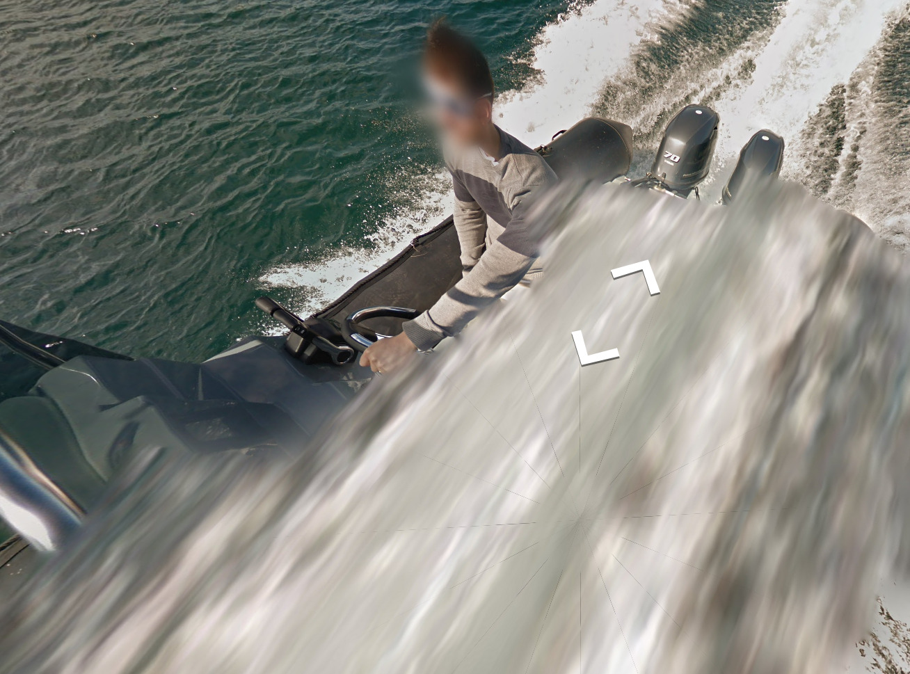
Canada
Disclaimer:
This is a Generic Canada, we have plans to do a more in-depth map to talk about the diversity in Canadas Province’s. Attempting to get this done 2024.
- Country Flag
- Capital City
- Most Helpful
- Google Car
- Bollards
- Google Coverage
- Camera Generation
- Road Lines
- Highway Signs
- Road Signs
- Electricity Poles
- License Plates
- Phone Number
- Vegetation / Landscape
- Architecture
- General Look
- Language
- Domain
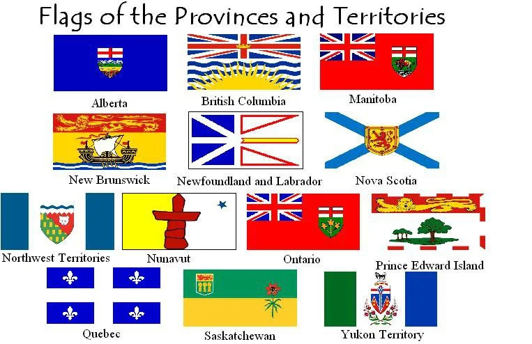
Country Flag:
While this is the main flag of Canada, there are also individual flags for each province.
Capital City:
Ottawa
Most Helpful:
Google car:
When there is a car visible, its either Blue (for Gen 4 coverage), or white.
There are regions where there is not a car. You can find snowmobile coverage as an example.
The snowmobile coverage is in the Hudson Bay on those islands.
Bollard:
These are not all of the examples available. A more in-depth guide will be created soon with specifics.
Google Coverage:
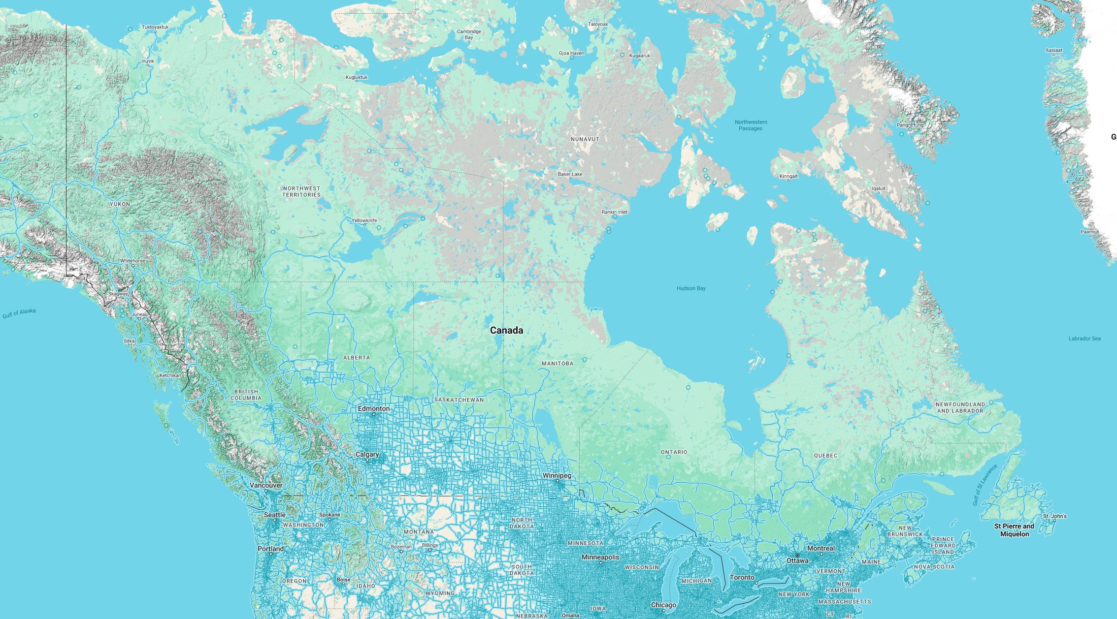
While it may not be the entirety of Canada shown here, there are large portions with no coverage. The closer you are to the USA, the more likely there is coverage. It also follows the population map closely.
Camera Generation:
Gen 2, 3 and 4
Road Lines:
Canada uses a yellow divider line with white shoulder lines. While Canada does use a lot of double yellow lines, you also find a bunch of single yellow dividers. These are more common in Canada than the USA, so its a good tell. However, a single yellow DOES NOT mean that it can only be Canada.
Highway Signs:
Like the USA, Canada uses Green signs for locations, Brown for National Parks and blue for “hospitalities”.
Road Signs:
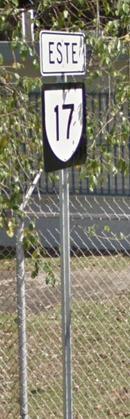
This Route number sign has a unique shield for each Province. The example shown is from Ontario.
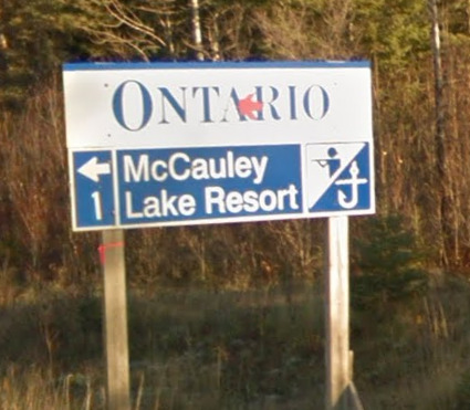
You can find signs like this on most major highways. They will let you know what province you are in 99% of the time.
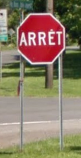
Road signs are very similar to the USA. A few big differences comes from the KM sign (Each province has its own unique KM sign) and the stop sign from Quebec (You will only find the French stop sign in Quebec!).
Electricity poles:
These are not all of the examples available. A more in-depth guide will be created soon with specifics.
License plates:
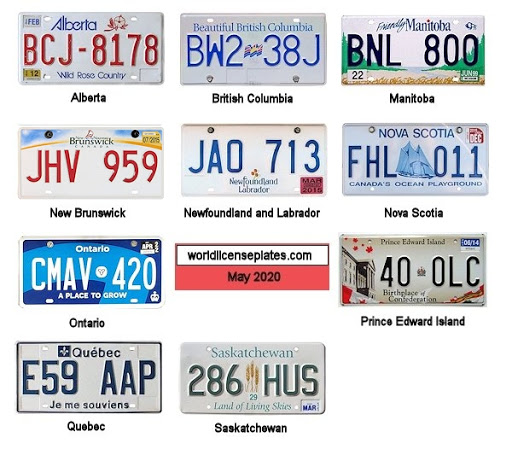
Each Province has its own Unique License Plate. It’s important to remember that most of these license plates are going to look identical when blurred. You can however make out the Green of the Saskatchewan plate (most of the time)
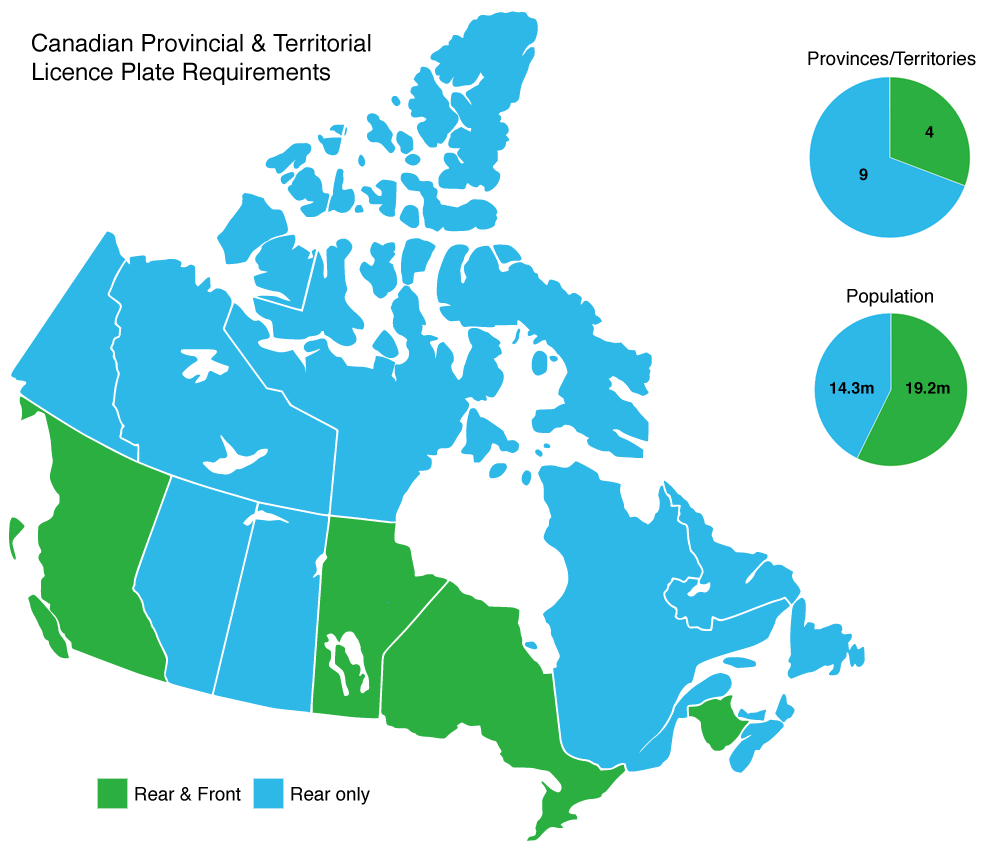
What we can mention is that 4 Provinces require the use of a Front Plate. The other 9 do not require it!.
Phone number:
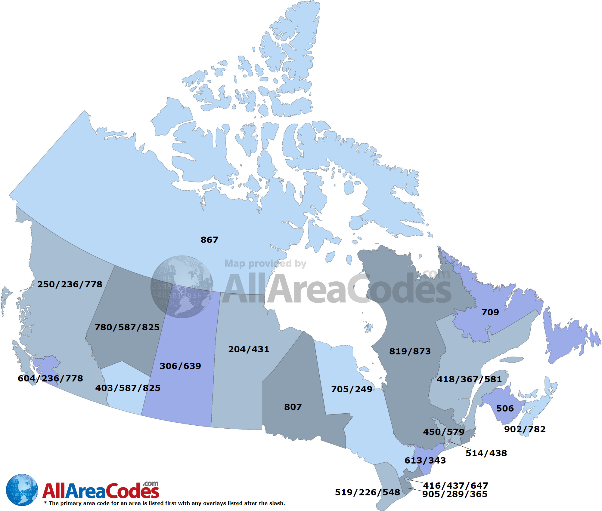
Canada uses a 10 digit phone number, set up in the same way as the USA. You will see a 3 digit area code followed by the 7 digit phone number. It will be set up like (xxx) xxx – xxxx.
Its Estimated that by 2042, Canada will run out of phone numbers to assign. When there is a plan to expand these area codes, we will let you know.
Vegetation/Landscape:
Architecture:
General look:
Each Province can have its own feel, but due to other factors we wont talk about too many different areas.
This is the general feel of the East. That includes Prince Edward Island, Nova Scotia, Newfoundland and New Brunswick.
This is the General feel of Ontario and Quebec.
Manitoba has its own feel.
You can tell its Saskatchewan or Eastern Alberta because they don’t have many trees.
This is the West. It covers the Western part of Alberta and British Columbia.
This is the general feel of the North. That included Yukon, the Northwest Territories and Nunavut. If you do end up in Nunavut, you will be in a town with Trekker coverage!
Alphabet/script:

Canada uses English as well as French. The French is a little more prominent in the East and can draw a line from Quebec. From Quebec east is Both French and English, and Ontario west is more English heavy.
Domain:
.ca
Puerto Rico
- Country Flag
- Capital City
- Most Helpful
- Google Car
- Google Coverage
- Unique Vehicle
- Camera Generation
- Road Lines
- Road Signs
- Electricity Poles
- License Plates
- Phone Number
- Vegetation / Landscape
- Architecture
- General Look
- Language
- Domain
Country Flag:
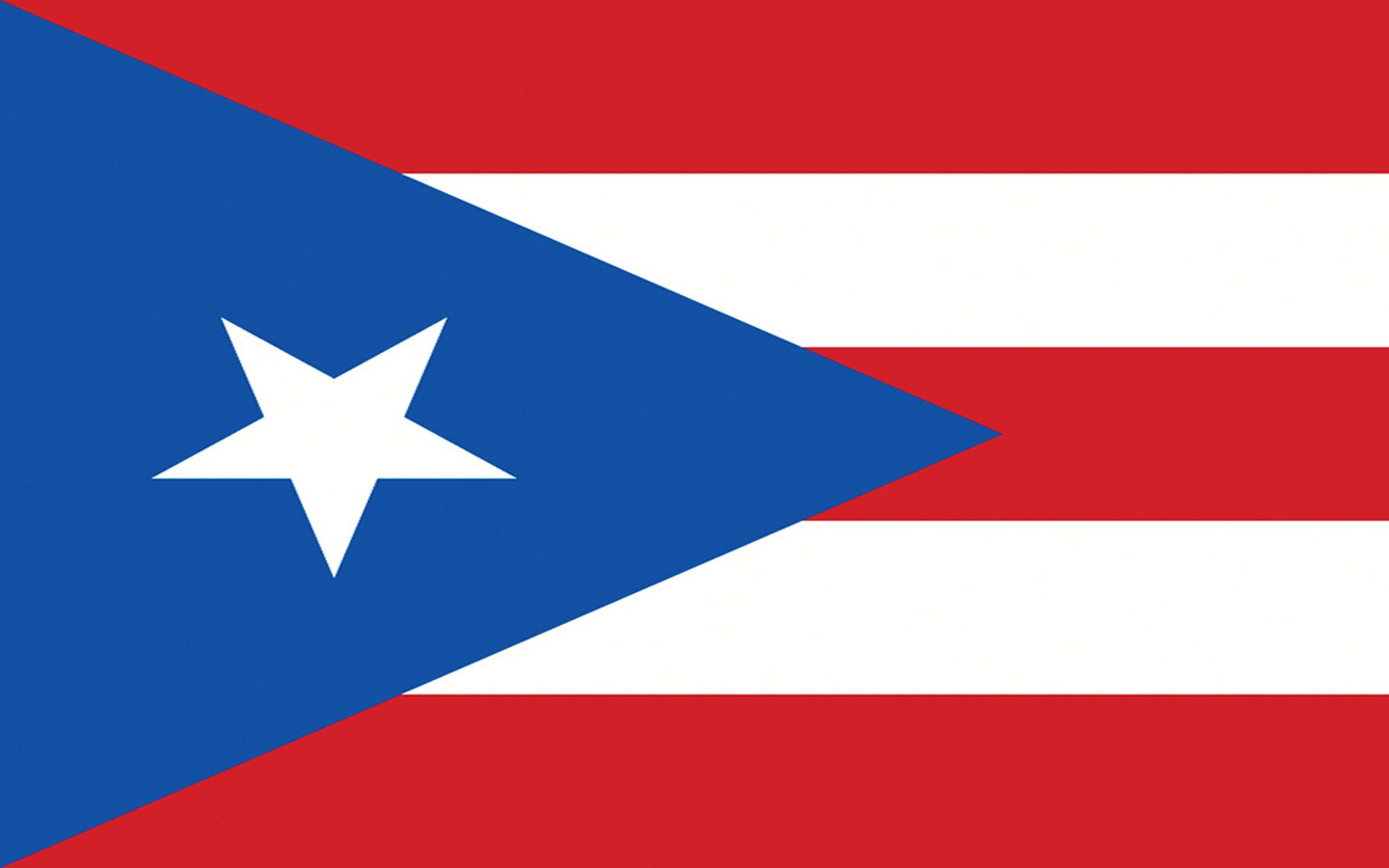
Puerto Rico is a United States territory, so you can also find the flag of the USA. However, the Puerto Rico flag is definitely the most prominent.
Capital City:
San Juan
Most Helpful:
The easiest thing about Puerto Rico is the vehicle. Recognizing the Antenna here, as well as the Spanish is a good sign. Mix this in with the limited coverage, and you should improve your guesses.
Google car:
The Google car here is white, but you probably wont get a clear view of it. What you will see is this antenna that comes off the front passenger side of the vehicle.
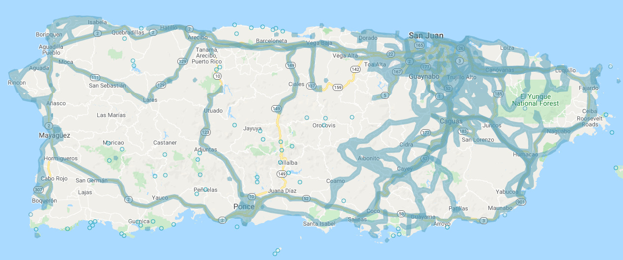
Google Coverage:
A lot of Puerto Rico is missing coverage. Stick to the West Coast around San Juan and you should be fine. That is where the majority of coverage is located.
Unique Vehicle:
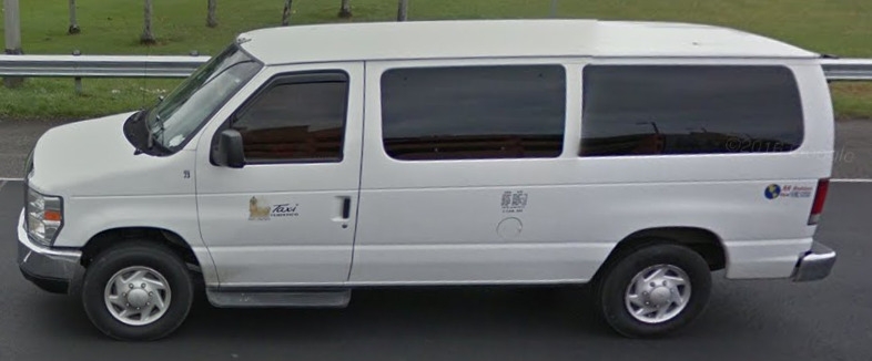
Taxis in Puerto Rico are all vans. Its tough to tell that they are taxis, besides having a small logo on the sides.
Camera Generation:
Gen 3
Road Lines:
Much like the Western Hemisphere, you can find Yellow divider lines with White Shoulders.
Road Signs:
Much like the United States and Canada, Puerto Rico uses different colors to represent different things. Green signs indicate destinations.
Blue signs represent rest areas / hospitality places.
Yellow signs represent warnings to drivers.
Speed Limit signs are in MPH.
However, they use KM to track distance.
Also, their stop signs say “Pare”.
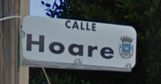
They use “Calle” on most of their street signs.
There are also two highway signs. A circle (like from New Jersey) and a Shield. There are also different signs to represent counties like the USA.
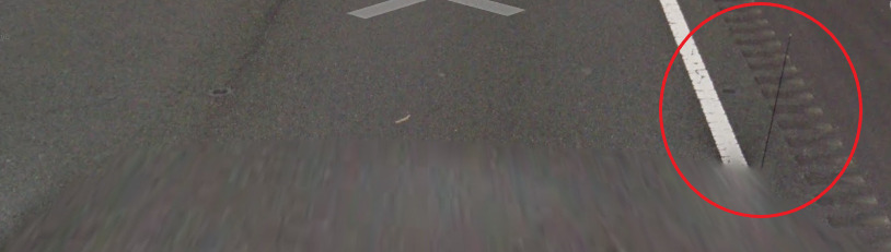
Electricity poles:
You can find these poles on major highways, and they’re definitely unique.
You can also find the Mexican Octagon poles scattered around as well.
There are also these large square poles that tend to
License plates:

There are three major license plates, and the easiest one to see is the middle one (due to the yellow). However, its not always easy to tell any of these plates exist.
Puerto Rico also does not require the use of a front plate!
Phone number:
Puerto Rico has 10 digits, shown as (xxx) xxx – xxxx. There are only two area codes for Puerto Rico, those being 787 and 939.
Vegetation/Landscape:
Architecture:
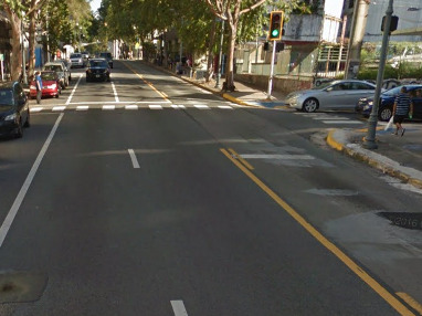
General look:
Alphabet/script:
Puerto Rico uses both Spanish and English, although the Spanish seems to be more prominent.
Domain:
.pr
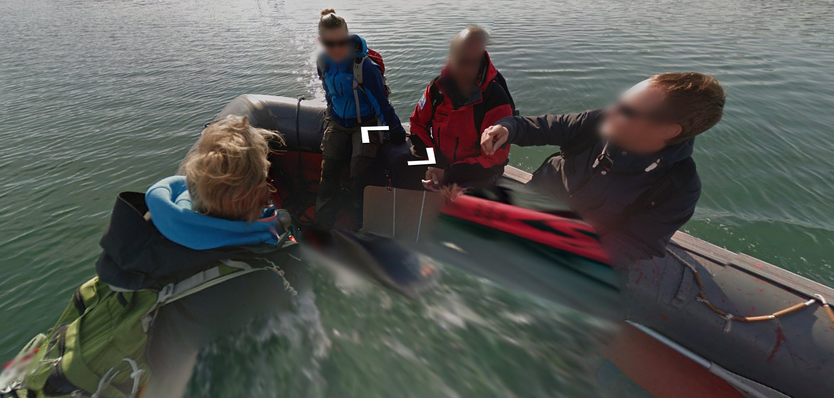
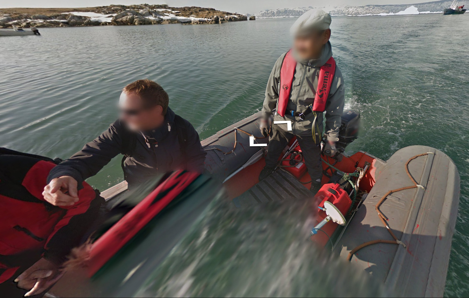
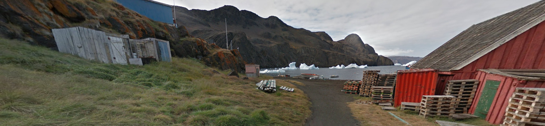
Greenland
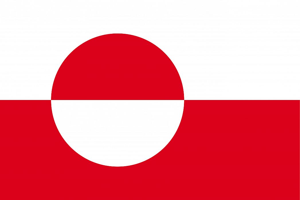
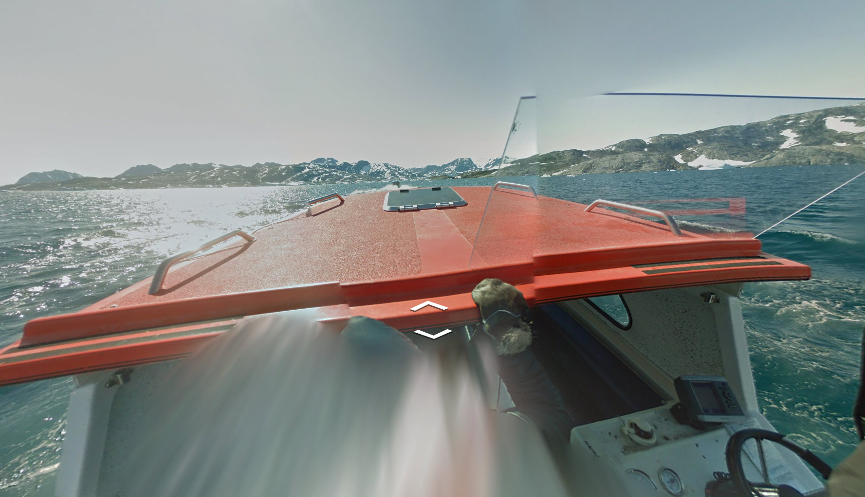
Country Flag:
Capital City:
Nuuk
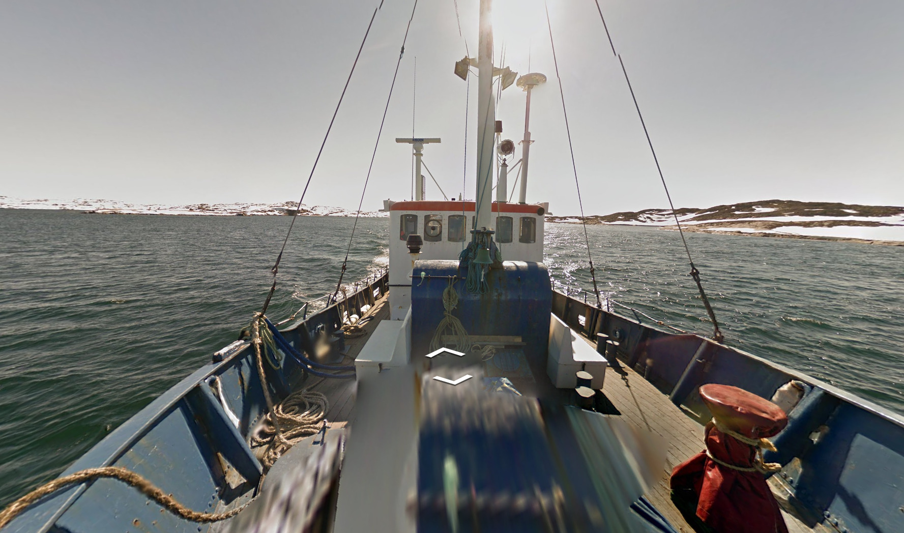
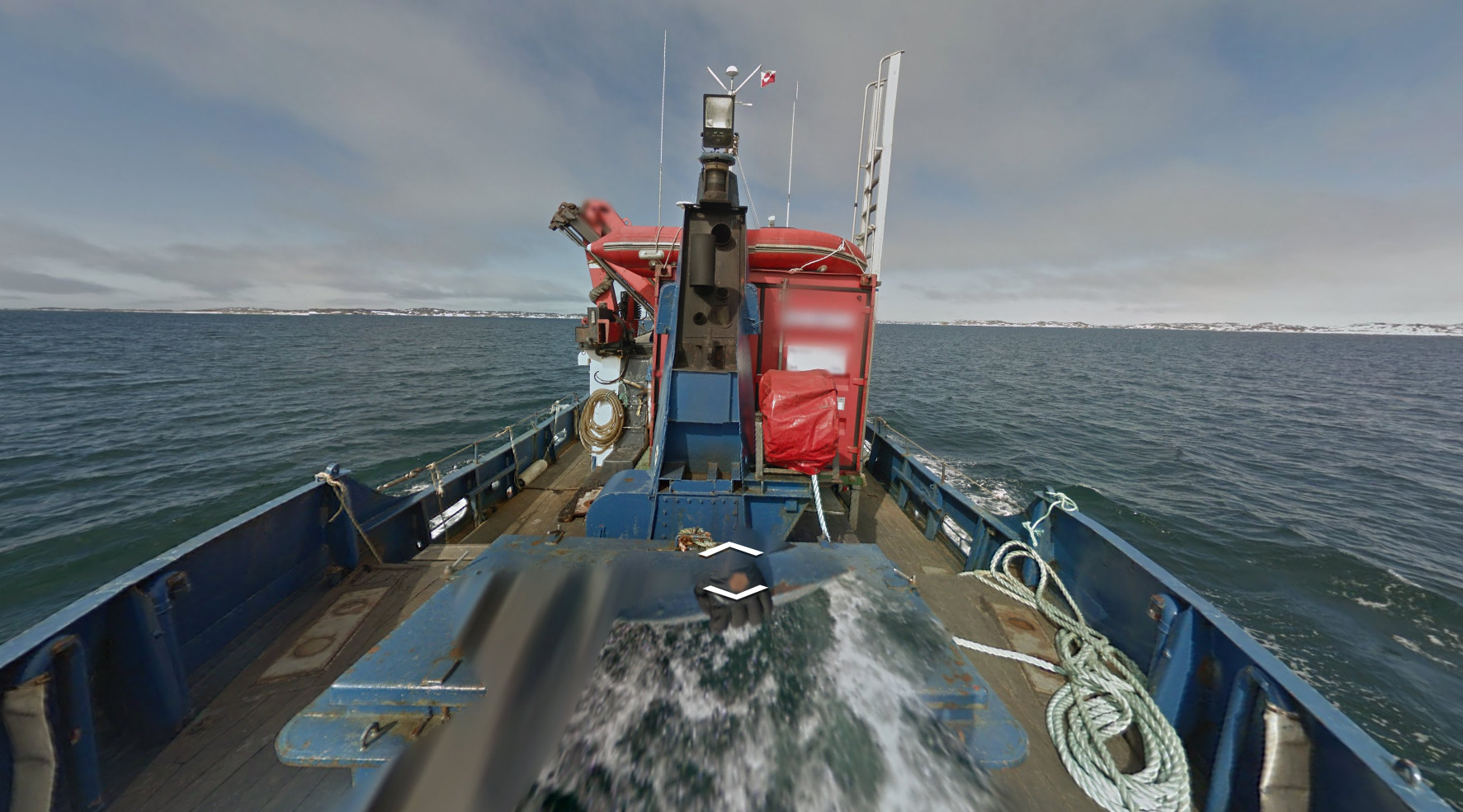
Google Car / Coverage:
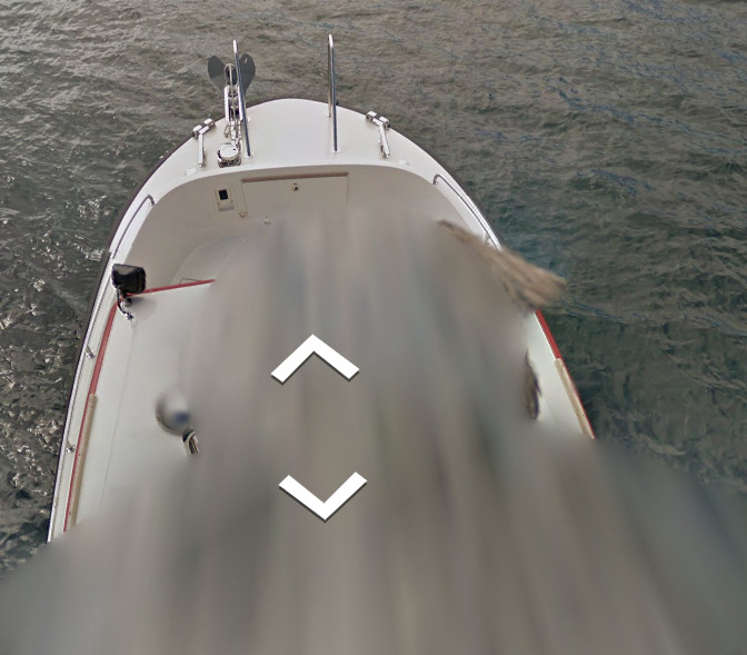
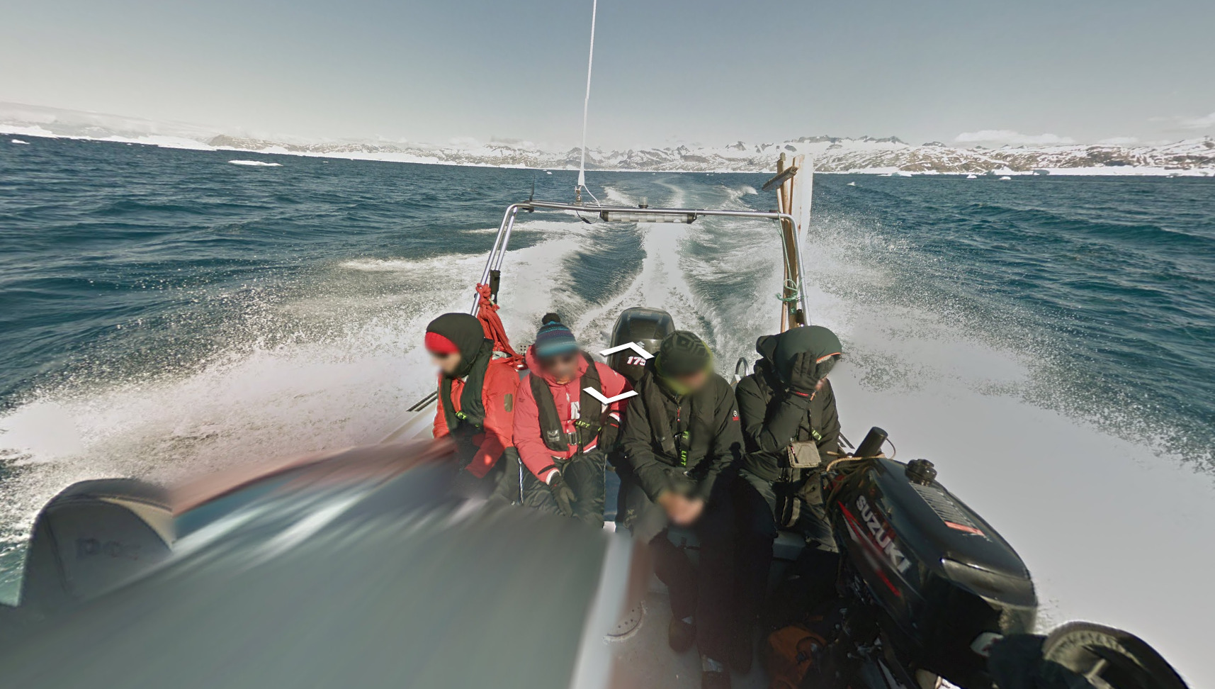
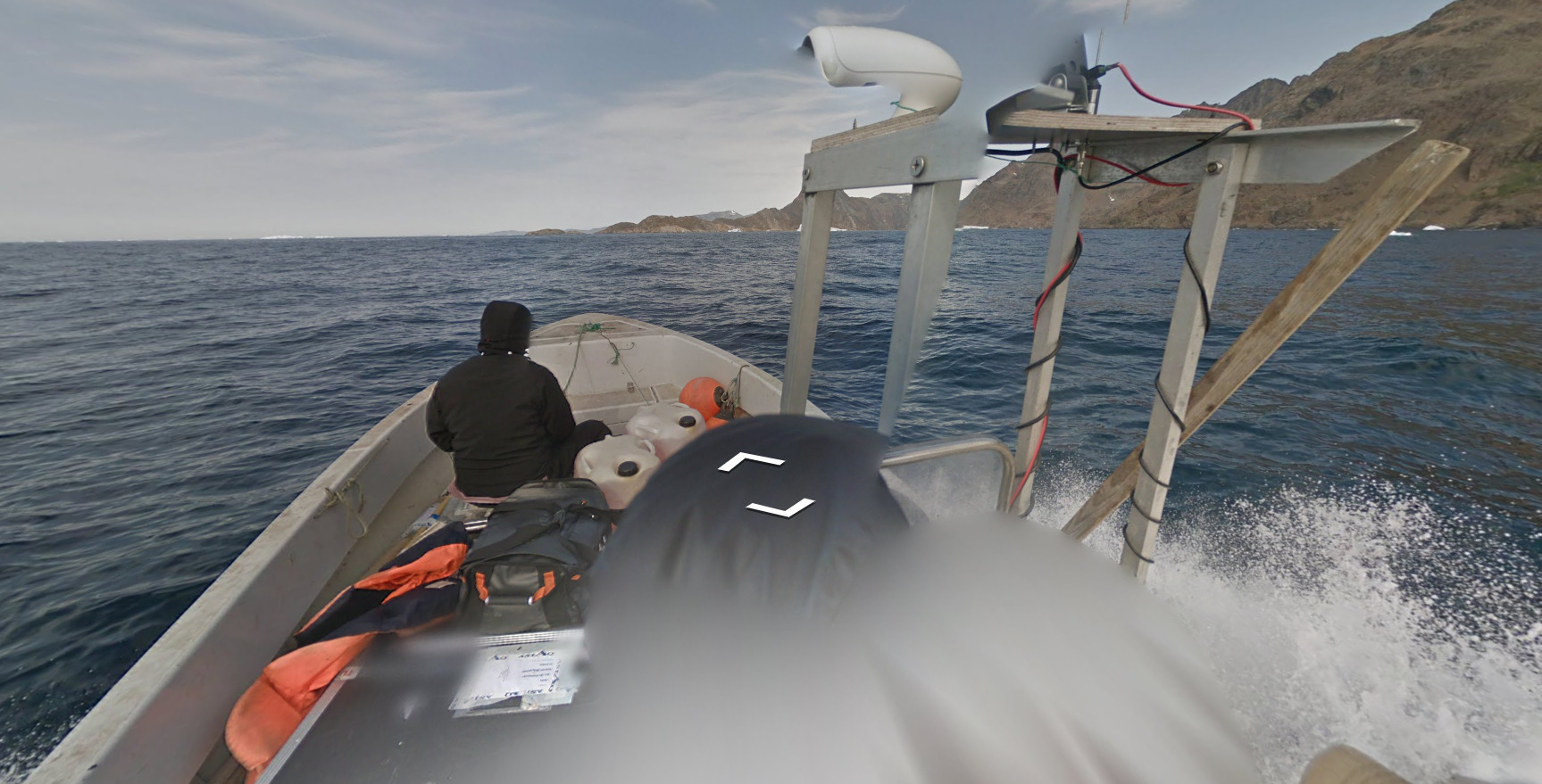
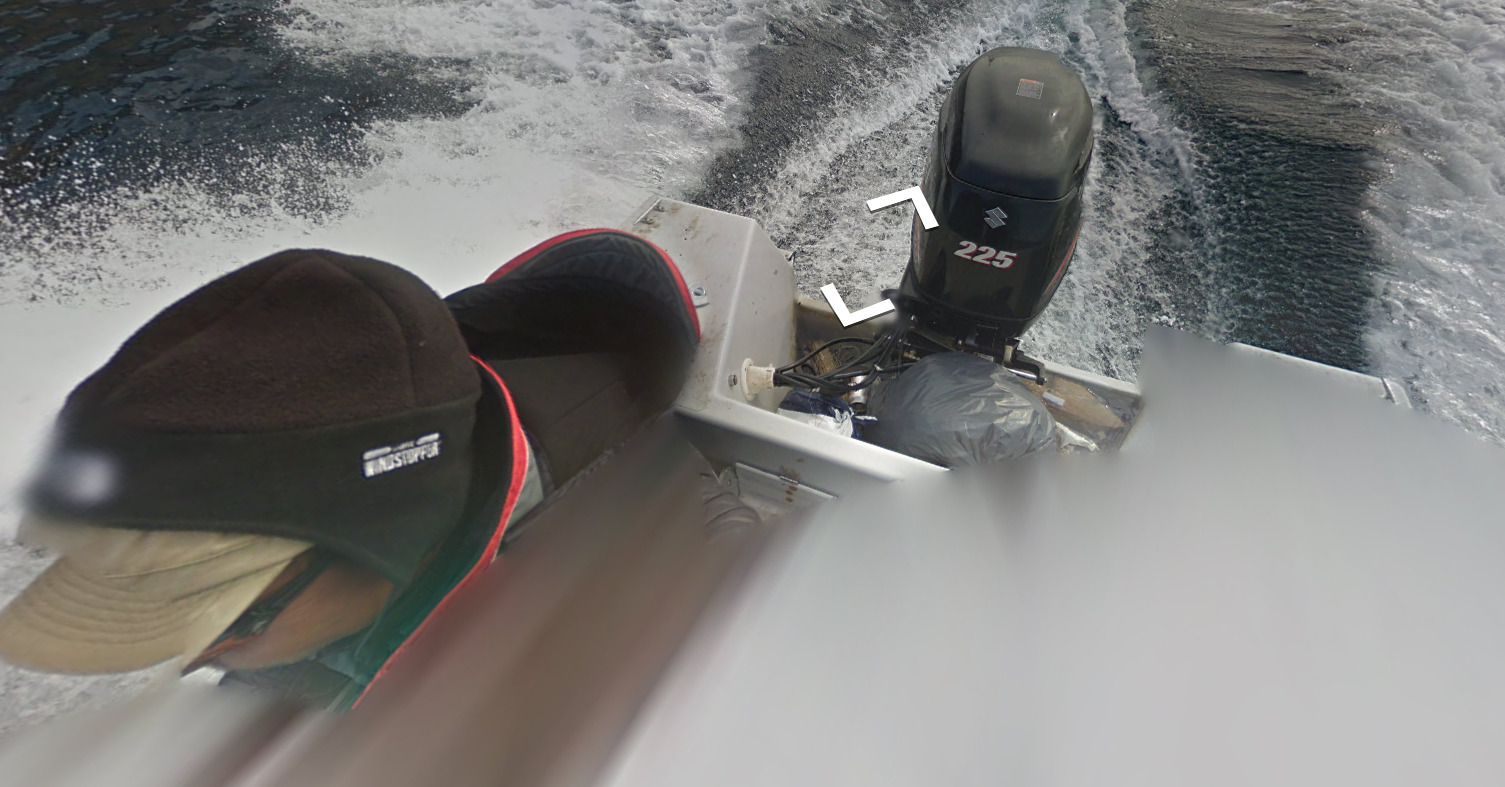
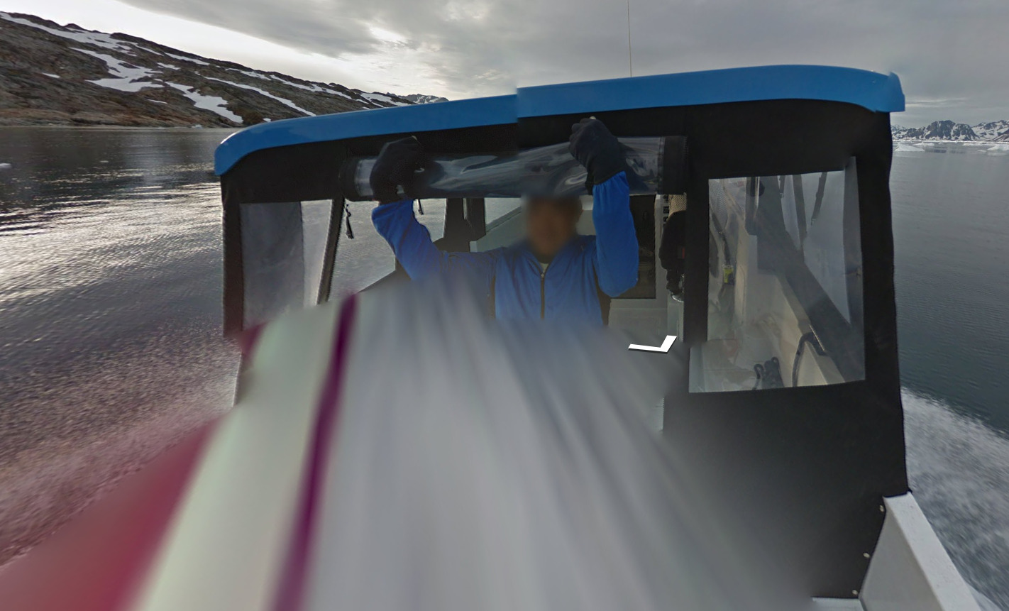
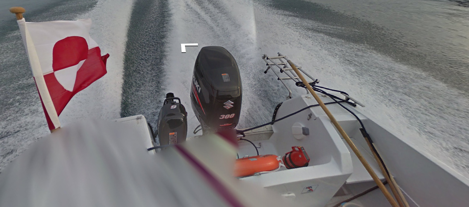
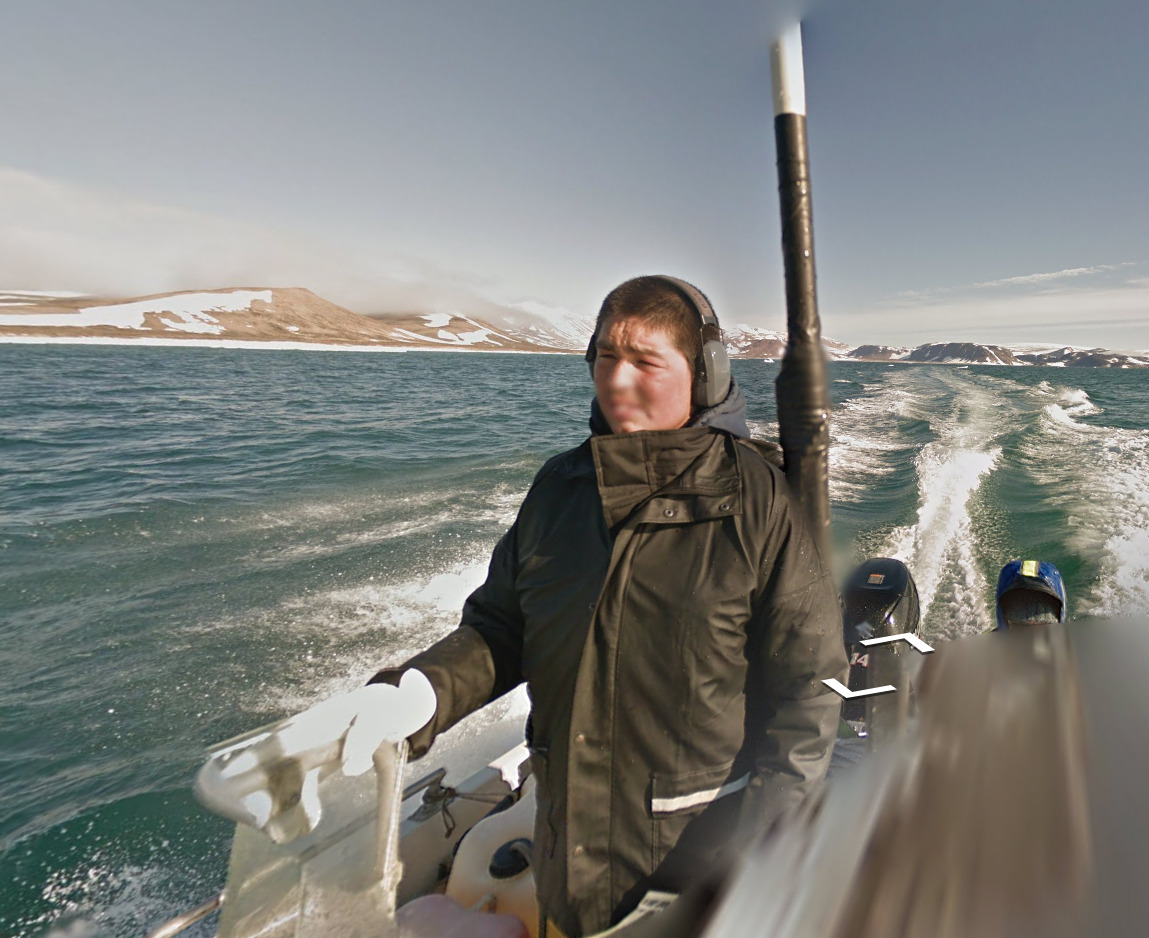
The most important thing to determine where you are in Greenland is the type of vehicle and its style. You can find trekker views, boat views, ATV’s and Cars. Each is unique to a certain area.
The towns start from the bottom of Greenland and work up the western coast and then the eastern coast. There are duplicates when it comes to boats, but you shouldn’t have to worry too much about that.
There will be a list of towns that contain rifts at the bottom of this section.
(Back)
There are TWO common boats. One of them contains a ships bell on the front. Its listed here and will be mentioned for the towns.
(Back)
The other common boat is a blue hall and a red cabin. It looks weird, but it’s seen pretty often.
We start with the Hotsprings near Uunartoq. Its covered by a Trekker. There is no boat coverage here, and it looks kinda dry and open.
We then move onto a small town south of Eqalugaarsuit. It really is the definition of a small town, only having 15-20 houses. There is also a graveyard.
(Front)
(Back)
(Front)
(Back)
This red van is found in the town of Qaqortoq, towards the southern point of Greenland. There is also boat coverage here.
(Front)
(Back)
Narsaq uses an SUV for their coverage, and its clear from the shadow and the front that it is an SUV. There are these really thin bars (The roof rack) on the side.
(Front)
(Back)
There is also boat coverage around Narsaq, and its one of the few unique boats in Greenland.
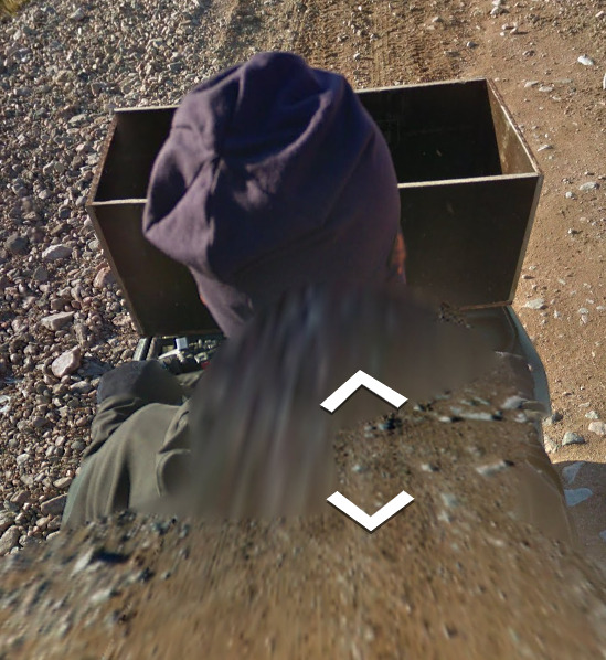
Narsarsuaq uses an ATV, and its tough to tell if the person is wearing a hood or a hat.
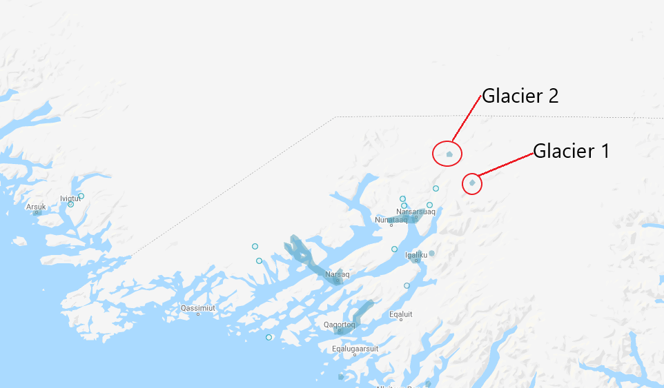
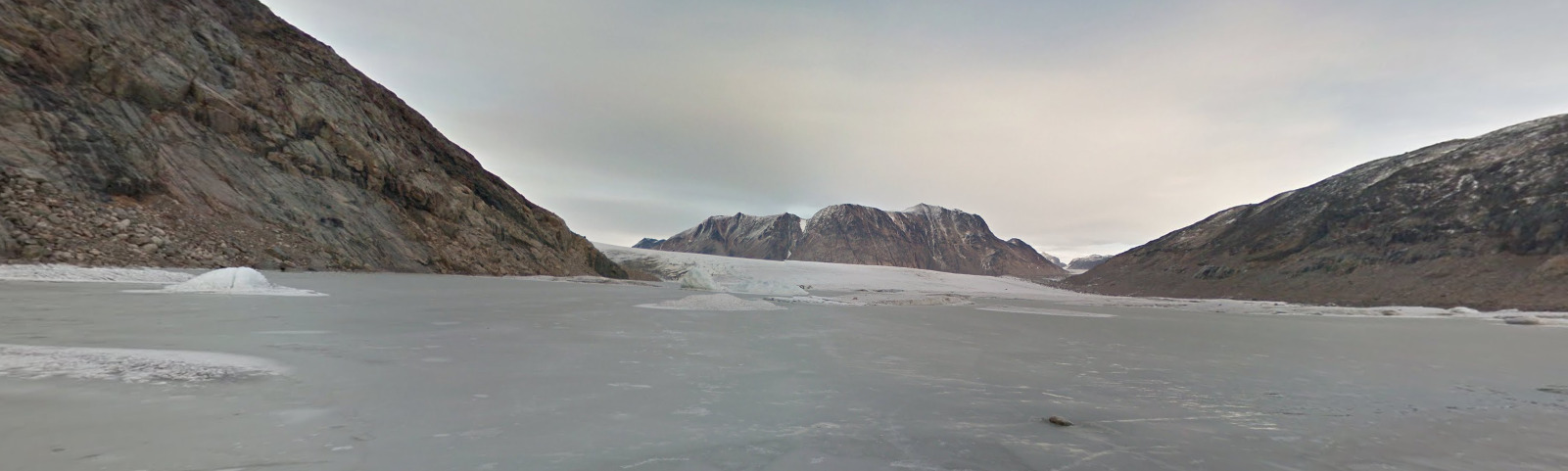
(Glacier 1)
(Glacier 2)
There is also coverage of Glaciers northeast on Narsarsuaq.
Qassiarsuk has ATV coverage, and the person who took it is wearing a purple bandana.
(Front)
(Back)
Qassiarsuk has boat coverage between Qassiarsuk and Narsarsuaq. Its a unique boat in Greenland.
Arsuk uses an ATV for most of their coverage. There appears to be a green basket on the front, and the person who took the coverage is definitely wearing a hat.
Paamiut uses what looks like a grey or tan sedan to complete their coverage.
Nuuk uses a white pickup truck for their coverage.
(Front)
(Back)
Nuuk has two different boats. The one shown above is located North of the city.
(Front)
(Back)
This is the Nuuk boat located south of the city.
Kapisillit uses a red ATV. You can only see small pieces of it.
Maniitsoq has the most unique coverage, with the vehicle being used looking like a cherry picker or something from an airport.
There is also boat coverage in Maniitsoq. Its the common one with the ships bell visible.
Kangaamiut uses a Trekker for their land coverage, the guy wears a hat with an orange trim, but they also have a boat, or rather a dingy.
Part of Kangerlussuaq has trekker, part of it has an ATV (that isn’t visible) and part of it is a white pickup truck.
This is the Sisimiut ATV, It is a black front and both side mirrors can be seen. There is also a chance to see more or less of the front of the ATV, but there is no pattern to that.
Sarfannguit uses a trekker, but there is also a bit of the bell boat coverage North and West of the town.
Attu uses a trekker in the town, but has a boat with the cabin the goes north of the town.
Ikerasaarsuk uses a trekker in the town and has a boat that goes south and east of the town. It is the boat with the bell on it.
Niaqornaarsuk Uses a trekker in the town and has a boat similar to the one above (The bell boat). That coverage goes out from the south and the west.
There are two boats for the area of Kangaatsiaq. The boat North of the town is the bell, while the southern boat is the one with the cabin.
Aasiaat has what looks like an ATV, you can really only see the side mirrors and the persons blue coat.
Aasiaat also contains the common boat with the bell.
The two most common boats are both found near Akunnaaq, one being north of the town (The bell boat) and one being south of the town (The cabin boat).
(Front)
(Back)
Kitsissuarsuit has trekker coverage and also contains boat coverage like most of the area. Its a bit different from the other boats, so this may help you with an area.
There are trekker views in Qasigiaanguit. The boat in Qasigiaanguit is a weird angle however. It is, however, the boat with the cabin.
Ilulissat has ATV coverage. It was done by someone with blonde hair OR someone with a grey / tan hat, and both are prominent.
There is also boat coverage west of Ilulissat, and the boat looks like it came out of the 1930’s.
Oqaatsut has some of the red cabin boat coverage.
Qeqertarsuaq has ATV coverage, and you can see the red jacket of the individual doing the coverage. The ATV itself appears blue. Qeqertarsuaq also uses the ship with the bell for its water coverage.
There is a small town east of Diskofjord. It isn’t named, but has some trekker coverage. There might be 10-15 structures here.
There is also boat coverage south of this town, and its the second common boat, the one with the red cabin.
(Front)
(Back)
Saqqaq has trekker coverage, and they have a dingy for their boat coverage.
Qeqertaq has Trekker coverage and no boat coverage. There’s nothing special about the trekker to show it here.
Ikerasak has Trekker coverage and no boat coverage. There seems to be an oil pipeline that runs through the town.
Uummannaq has ATV coverage, and you can sometimes see their glove. That green glove is unique to this town.
Qaarsut has Trekker coverage. Its cloudy coverage and you cant see any unique marker for this area.
Niaqornat has Trekker coverage and its on this black soil.
Saattut has Trekker coverage and its very muddy.
Ukkusissat has Trekker coverage and it feels like you’re walking in a river.
The town of Prøven has Trekker coverage. There isn’t anything unique about it. The town has switched its name and is now called Kangersuatsiaq, but it has not updated on google streetview yet.
Upernavik has Trekker coverage. Its actually a decent sized town, but nothing here is unique.
Innaarsuit has Trekker coverage. Its pretty hilly, but nothing really stands out.
The Majestic Bay Settlement has Trekker coverage. There is a bit of a brown pipe that runs through the town. There also seems to be a small stream that runs along the path at one point.
Nuussuaq has some Trekker coverage. Like the Majestic Bay Settlement, this is a pipe that runs through the town. However, it seems to be black and not brown.
Kullorsuaq has some Trekker coverage. Its built on the side of a hill. There isn’t anything unique here.
Qaanaaq has some Trekker coverage even though there are some actual roads here. You can see some cars, which hasn’t happened in a few towns.
Siorapaluk has some Trekker coverage, but there are no roads. It has some oil or gas tanks on a beach.
Moving onto the east coast now
Isortoq has trekker coverage, but nothing notable about it.
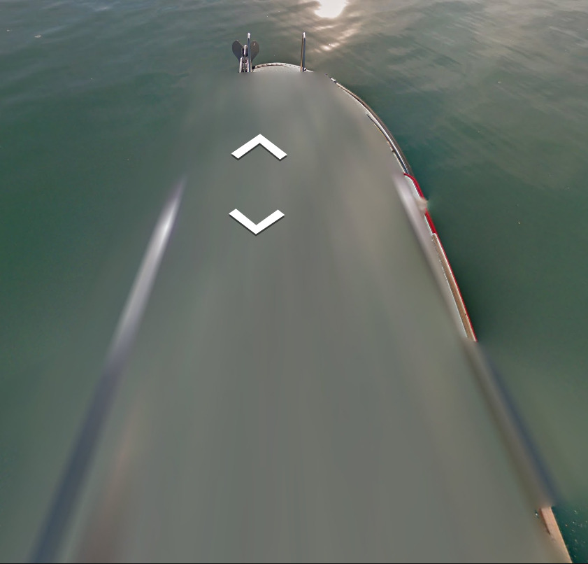
Tasiilaq has Trekker coverage. There are also 3 different boats that came out of Tasiilaq and spread both north, south and east. The orange boat that is North West is also found North East.
(Front)
(Back)
Northwest (And Northeast) of Tasiilaq has this Orange boat. There are 4 people sitting at the back when its Northwest and nobody sitting in the back when its Northeast.
(Front)
(Back)
This boat is located South of Tasiilaq. Its the smallest boat and has some wires and other equipment on it.
(Front)
(Back)
This boat is located East of Tasiilaq, and a bit north as well. It has a massive blue cabin in the front and you spawn next to a flag of Greenland.
Most of the town of Kulusuk is covered by a trekker, yet there is coverage from a red ATV that covers most of the island.
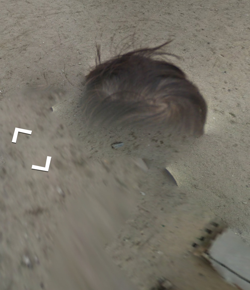
Sermiligaaq has Trekker coverage and you can see the hair of the individual who took the photos.
(Front)
(Back)
This boat is located about 100 KM west of Ittoqqortoormiit. It has this pole sticking out of the middle, even though it isnt a sail boat.
The same boat is used a lot closer to Ittoqqortoormiit, except you are in front of the pole this time.
Ittoqqortoormiit has ATV coverage. The person driving the ATV has a purple beanie and there is a wooden basket on the front of the ATV.
There is some coverage north of Daneborg, but there isn’t much here.
(Front)
(Back)
There is some boat coverage Northwest of Daneborg, and its definitely a unique boat. It feels smaller than most other boats.
Towns with Rifts:
Like the coverage, the towns will start from the south of Greenland and work their way up the west coast, followed then by the east coast.
Aasiaat
Akunnaaq
Kitsissuarsuit
Qasigiannguit
Ilimanaq
Oqaatsut (Slight rifts, but they are there)
Qeqertarsuaq
Small town east of Diskofjord
Town in the North of Disko Island
Saqqaq
Qeqertaq
Isortoq (East Coast)
Daneborg (East Coast)
Bollard:
–
Camera Generation:
Gen 3
Road Lines:
There are not always road lines, and that can be seen in this first picture. You can see what would represent the middle lines.
Where there are road lines, it appears that everything is white. That includes the center divider, which makes it one of the only countries in the western hemisphere to not contain a yellow divider (Most of Chile being the other).
Road Signs:
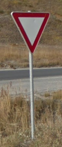
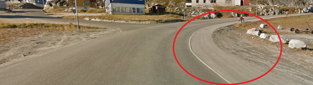
For some reason, stop signs don’t exist in Greenland. You will instead find Yield signs everywhere.
Electricity poles:
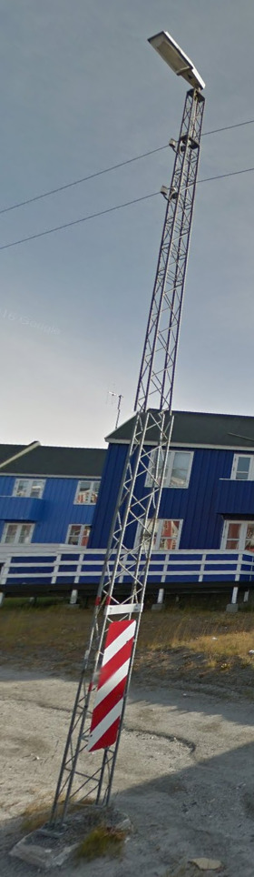
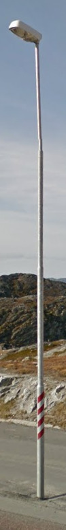
There are two styles of poles, both are found pretty much everywhere, even remote towns.
License plates:
License plates here can be either or, but mostly the long plates. They have been the same style for over 30 years.
Phone number:
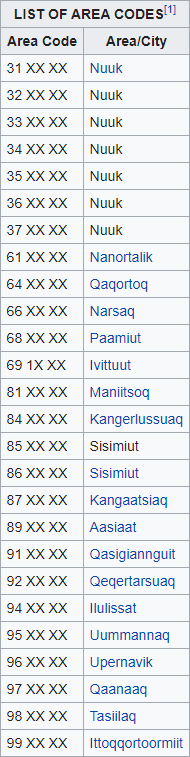
Greenland uses only 6 digits for their phone numbers. 21 – 29, 42 – 49 and 51 – 59 are all saved for mobile numbers. The country calling code is +299.
Based on the starting digit, you can generally figure out where you are.
3’s are around Nuuk, and are probably the only numbers you will find.
6 includes South Greenland
8 covers the West of the country
9 covers the North and the East
Vegetation/Landscape:
–
Specific tree:
–
Architecture:
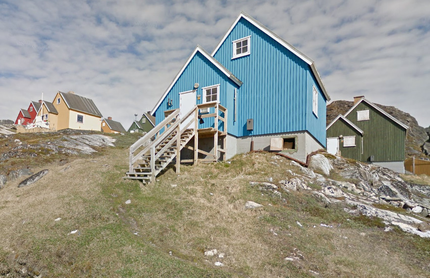
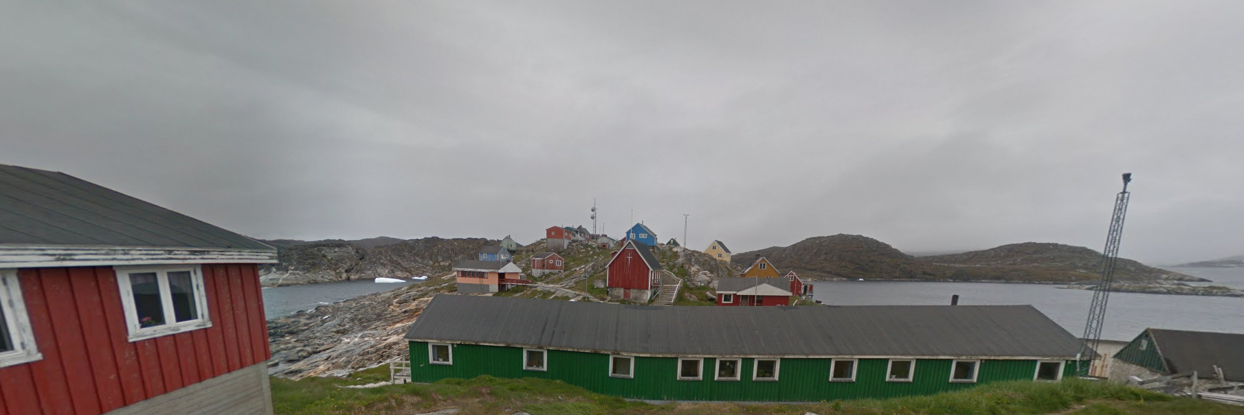
The colors of the houses in Greenland are a really good tell. These houses and the styles are found in most areas in Greenland.
General look:
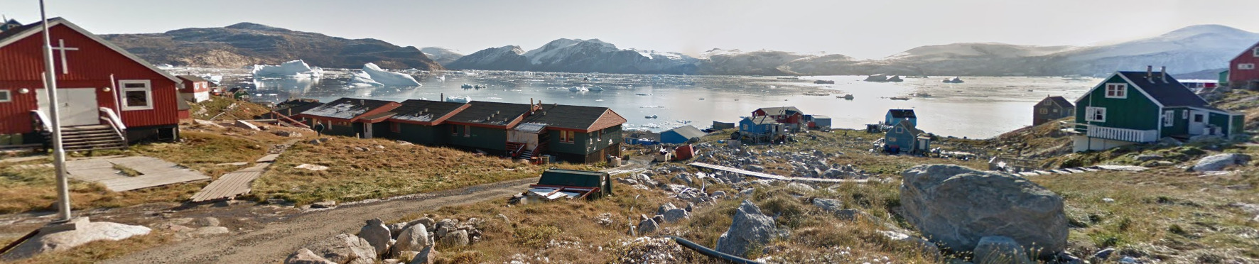
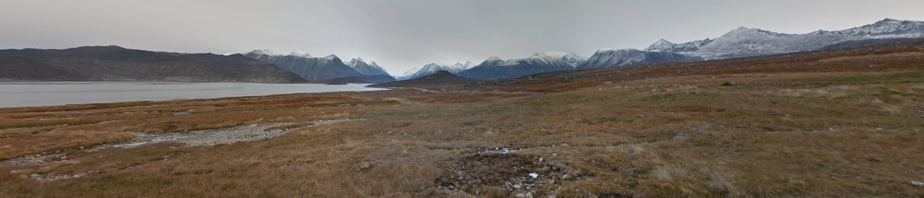
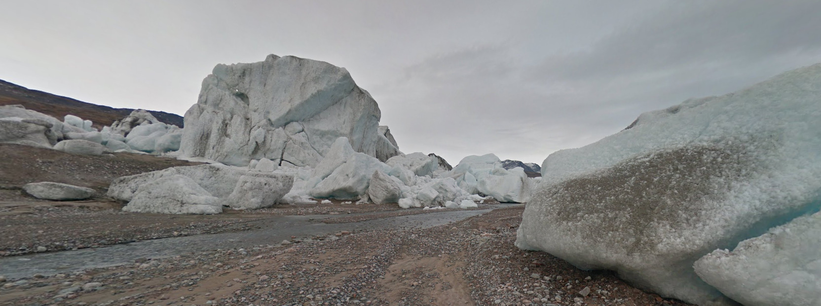
You can find a lot of icebergs around Greenland. The further north you go, the more of them you will find.
Alphabet/script:
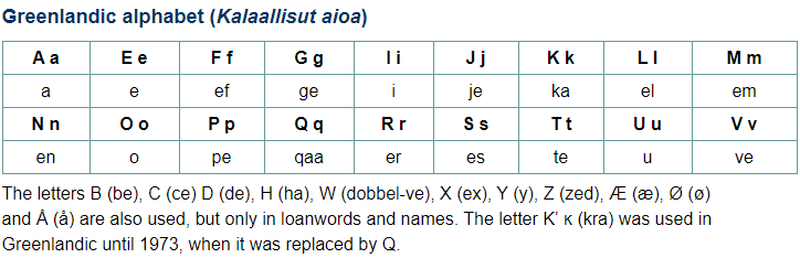
Greenland is technically a province of Denmark. Their language is Greenlandic, which has four different dialects. They also use Danish and English. Most signs will be in Greenlandic.
Domain:
.gl
Bermuda
- Country Flag
- Capital City
- Most Helpful
- Google Car
- Third Party Coverage
- Google Coverage
- Unique Vehicle
- Camera Generation
- Road Lines
- Road Signs
- Electricity Poles
- License Plates
- Phone Number
- Vegetation / Landscape
- Architecture
- General Look
- Language
- Domain
Country Flag:
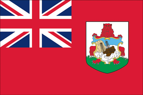
Being a territory of the UK, they have the Union Jack on their flag. However, a red flag is rare in British territories, and can be a good indicator if you find one.
You can find the flag of the UK as well as the flag of the USA next to the flag of Bermuda. This happens a few times in the official coverage.
Capital City:
Hamilton
Most Helpful:
When you do find a car, it is a black truck. You can see the front of it clearly.
Google car:
When you do find a car, it is a black truck. You can see the front of it clearly.
There is also some boat / jet-ski coverage. Its one of the few places where you cant really see the boat.
Third Party Coverage:
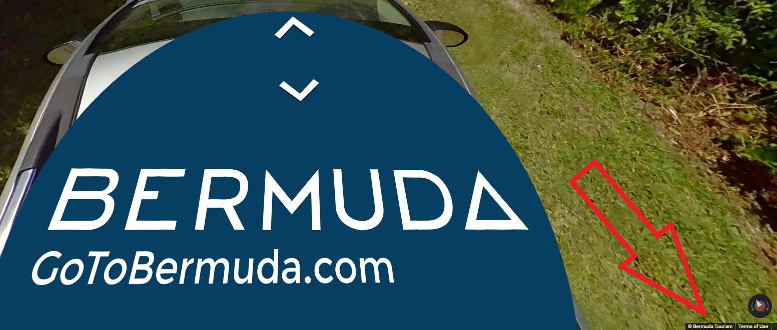
Third party coverage, often called “Ari’s”, are ruining official coverage with their terrible images that they upload over official coverage. Some countries have it worse than others. You can find out whether or not you are in official coverage by looking at the copyright in the bottom right of the image. If it says Google, its official coverage. If it says something else, like in the example above, its third party. Bermuda has an Ari called Bermuda Tourism. You can often tell you are in third party coverage as the quality is a lot worse than google, as well as movement being incredibly slow. In most cases, third party coverage is not included in maps, but they can sneak their way in, especially when these Aris keep ruining street view.
Google Coverage:
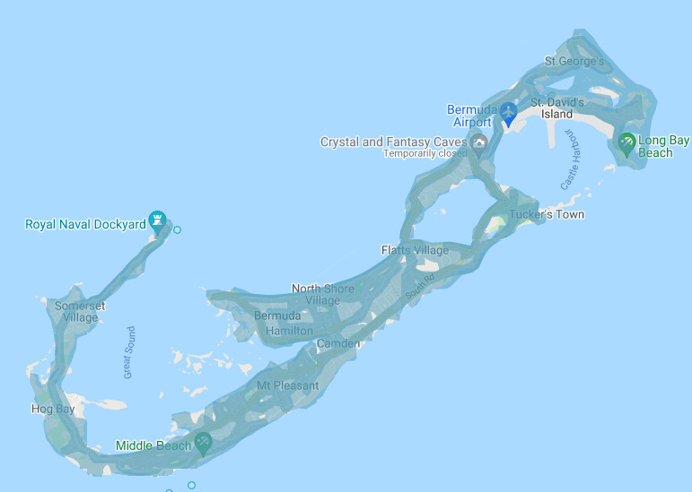
Stick to the roads in Bermuda and there shouldn’t be a problem. The darker blue areas are places that have third party coverage. Those are best to avoid. Most of the residential areas are covered by the third party ari
Unique Vehicle:
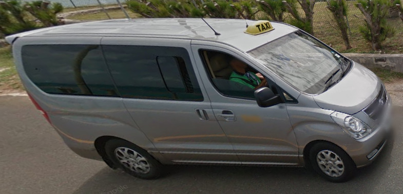
Taxis are quite common in Bermuda. They are generally vans with a taxi sign on top. The color can change, and Blue, White and Grey have been spotted.
Camera Generation:
Gen 3
Road Lines:
Bermuda uses a single yellow divider line, and occasionally uses a white shoulder line. There occasionally can be a white divider in the middle, however this is more rare than the yellow. Sometimes the yellow divider is extremely faded, but its definitely there.
Road Signs:
Bermuda uses a mix of Western Hemisphere and Eastern Hemisphere signs. There is not a white rim around most of their signs (excluding stop signs) and the signs feel a bit British.

You can also find these street signs everywhere. They seem to share a design across the island. They can be found on the sides of buildings, so keep an eye out for them.
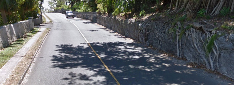
Bermuda uses either a wooden fence or a stone wall to keep cars on the roads. It is their version of a guard rail. Both can be seen in the image above.
Electricity poles:
These poles can be found across the island. They’re all wooden and all have some nice designs. The bigger ones are found near the larger towns, while the smaller ones are found in the suburbs.
License plates:
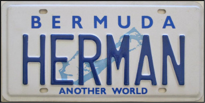
Bermuda truck plates have a chance to start with either HC, IN, or L. These each mean different things. There are some unblurred license plates on trucks in Bermuda.
HC Stands for Heavy Truck
IN Stands for Intermediate Truck
L Stands for Light Truck
Phone number:
Bermuda only has one area code, that being 441. However, you really don’t see the area code often in Bermuda. The phone number is set up like most of the North American numbers, being 7 digits long and are set up as xxx-xxxx.
Vegetation/Landscape:
Architecture:
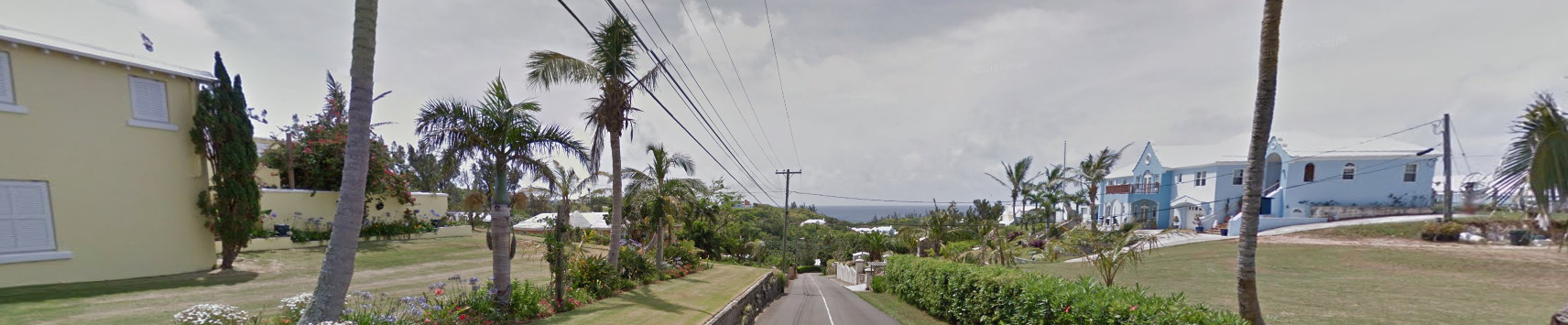
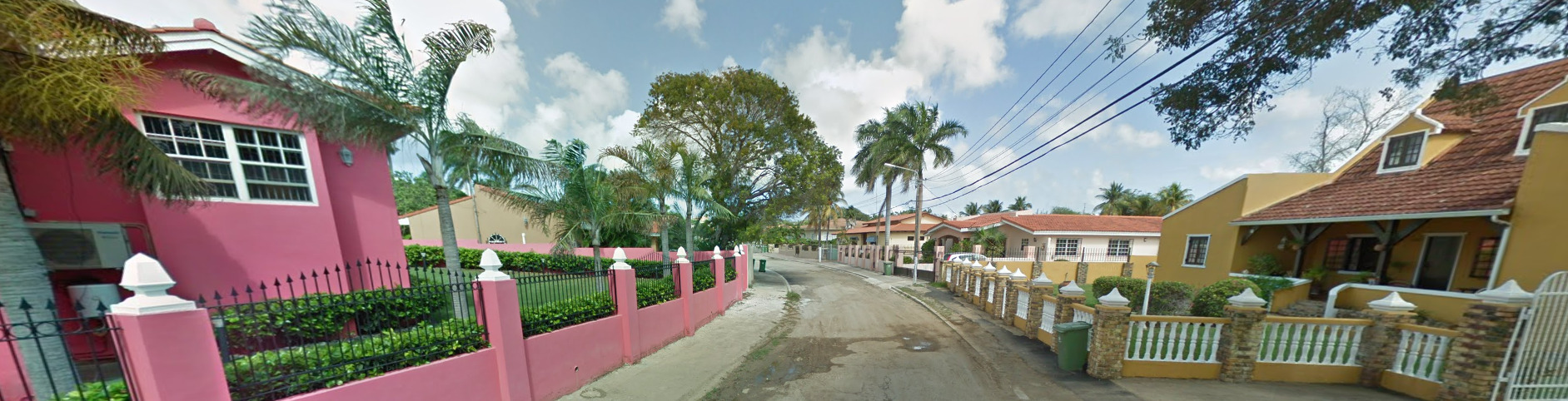
Bermuda has a very colorful palette when it comes to their buildings. Almost every building is painted a bright color, with blue, red and pink being some of the more common colors. It feels very island-ish, almost somewhat colonial.
Most of the time, the houses are very squared. This house above is almost an oddity.
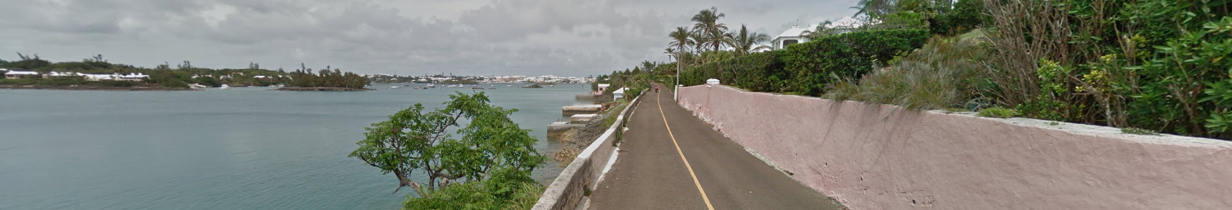
General look:
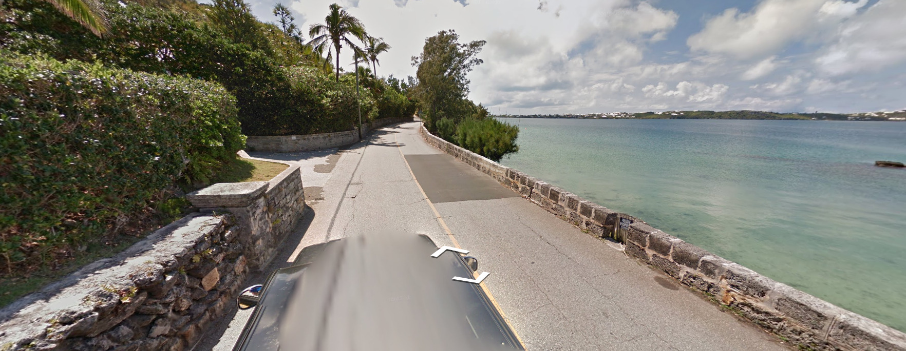
Bermuda feels very tropical. There’s something about this place that just feels warm. The palm trees on the sides of the road and the crystal blue water are good tells. Keep an eye out for the car, its the most obvious tell there is that this is Bermuda.
Alphabet/script:
Bermuda uses English, being a British Territory.
Domain:
.bm
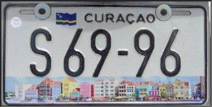
Curaçao
- Country Flag
- Capital City
- Most Helpful
- Google Car
- Third Party Coverage
- Google Coverage
- Camera Generation
- Road Lines
- Road Signs
- Electricity Poles
- License Plates
- Phone Number
- Vegetation / Landscape
- Architecture
- General Look
- Language
- Domain
Country Flag:
Capital City:
Willemstad
Most Helpful:
In Curaçao, you can find bars (a roof rack) and the front of a black vehicle. This combination is unique to Curaçao.
Google Car:
In Curaçao, you can find bars (a roof rack) and the front of a black vehicle. This combination is unique to Curaçao.
Third Party Coverage:
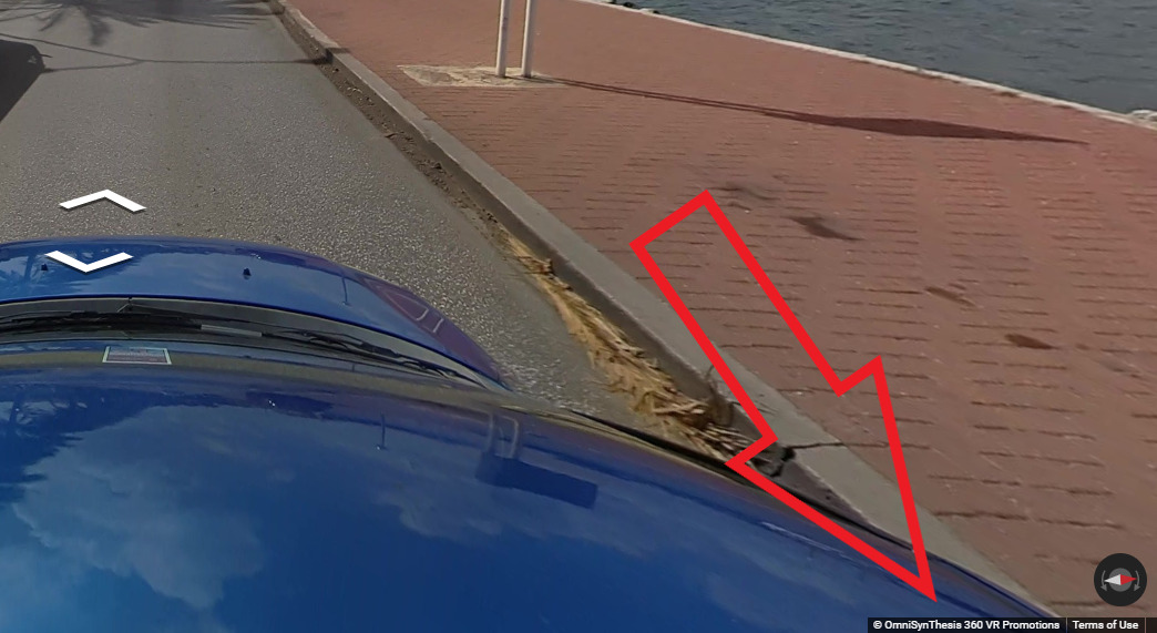
Third party coverage, often called “Ari’s”, are ruining official coverage with their terrible images that they upload over official coverage. Some countries have it worse than others. You can find out whether or not you are in official coverage by looking at the copyright in the bottom right of the image. If it says Google, its official coverage. If it says something else, like in the example above, its third party. Curaçao has an Ari called OmniSynThesis 360 VR Promotions. You can often tell you are in third party coverage as the quality is a lot worse than google, as well as movement being incredibly slow. In most cases, third party coverage is not included in maps, but they can sneak their way in, especially when these Aris keep ruining street view.
Google Coverage:
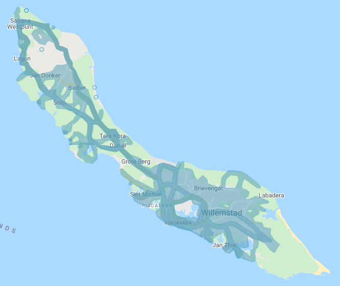
The darker blue that you see actually tells you where the third party coverage is located. Not all of the island is covered, stick to the roads and the capital.
Camera Generation:
Gen 3
Road Lines:
Curaçao uses all white lines.
Road Signs:
You can find these blue signs all over Curaçao that point to destinations. There isn’t really a major highway system here, so you will find them on smaller roads.
Curaçao has these bright yellow poles for their street signs in the big towns. They really stand out and can be a good clue.
There can also be these red and white striped poles on some street corners.
Curaçao has their traffic lights painted with black and white stripes.
Some of their signs will also have black and white stripes, but only signs found near larger intersections will be painted like that.
The rest of the signs will be on a typical metal pole.
Curaçao uses a traditional guardrail. However, they seem to be painted a tan color. There are examples of newer sections not being painted, and older sections being a bit faded and missing some paint.
Electricity poles:
Most of the poles seem to have about 2 meters or 6 feet on white paint at the bottom. Not every pole has this, but its common across the island.br>
License plates:
Phone number:
Curaçao uses the Country code of +599. They use the area code of 9 and have a 7 digit local number that follows. It is set up to look like xxx-xxxx. It’s unlikely that you will see the area code here as 9 covers the whole island.
Vegetation/Landscape:
Architecture:
These houses feel very island like. There also seems to be a pattern where the fence or an accent piece on the fence is painted the same color as the house.
General look:
Curaçao is a flat island. It feels a bit more dry than your typical island and you can find spots that really capture this. Above is an example of that.
Alphabet/script:
Curaçao uses Dutch, English and Papiamento. Most of the signs will be in Dutch or English however.
Domain:
.cw
Dominican Republic
- Country Flag
- Capital City
- Most Helpful
- Google Car
- Google Coverage
- Unique Vehicle
- Camera Generation
- Road Lines
- Road Signs
- Electricity Poles
- License Plates
- Phone Number
- Vegetation / Landscape
- Architecture
- General Look
- Language
- Domain
Country Flag:
Capital City:
Santo Domingo
Most Helpful:
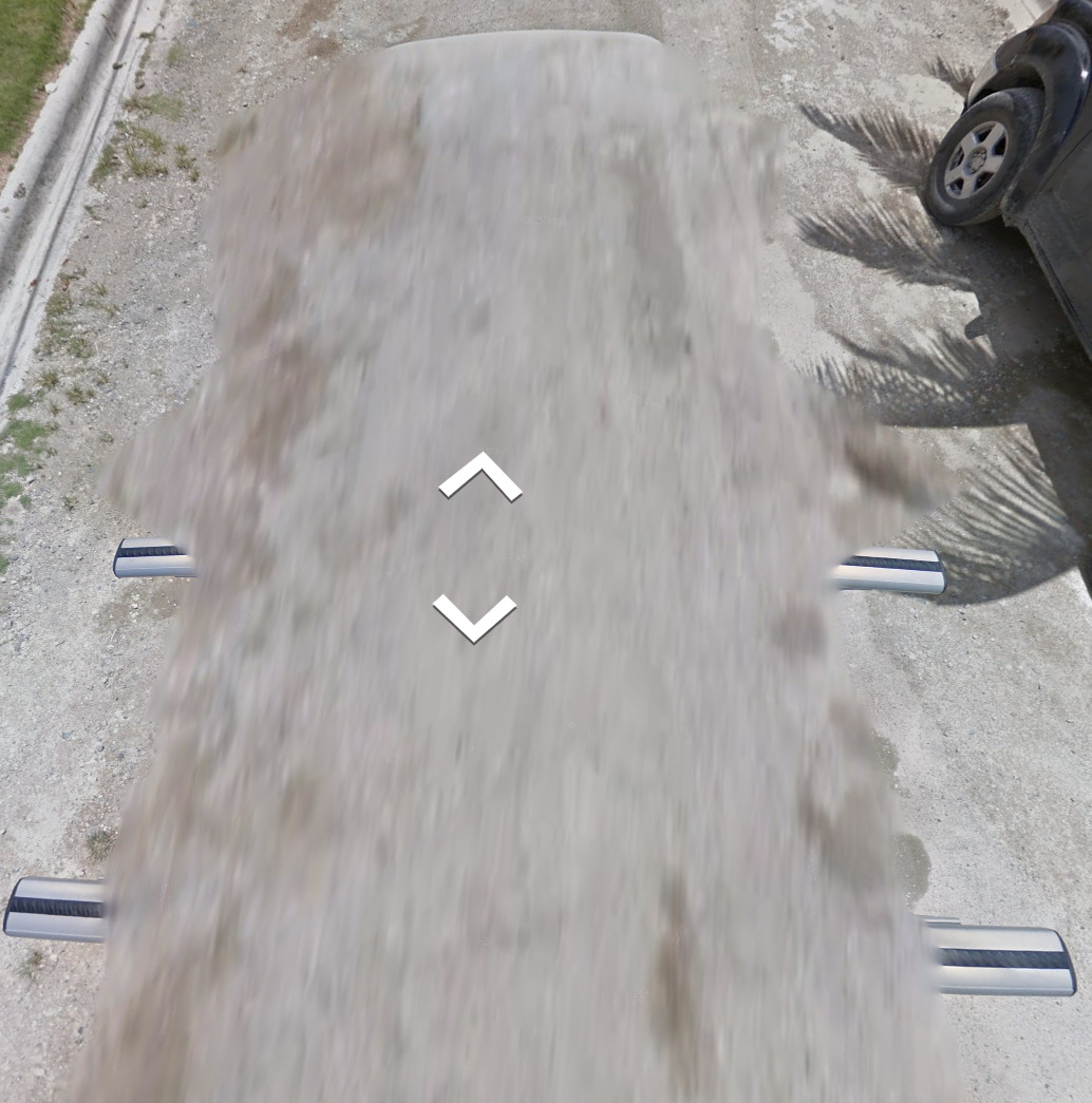
The Dominican Republic has bars with a black rubber inlay. The only other place that has this inlay is in Ulaanbaatar in Mongolia. You can also see the front of the car which is white.
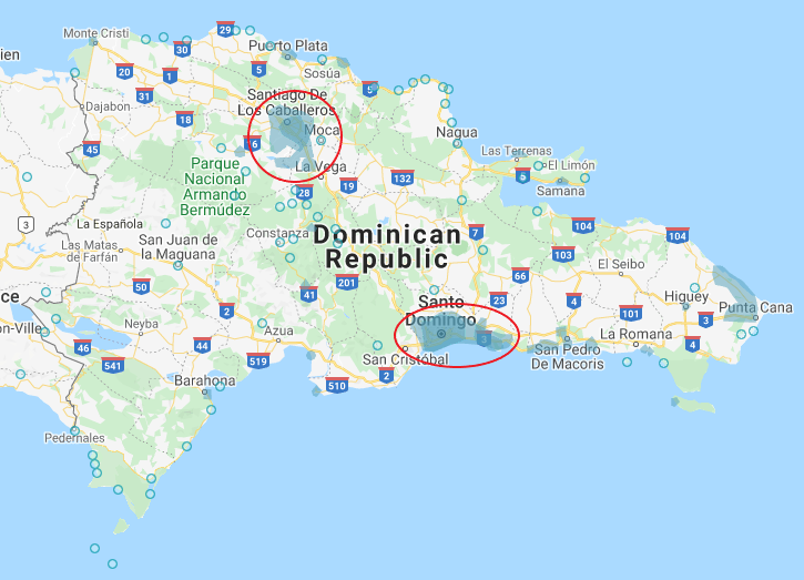
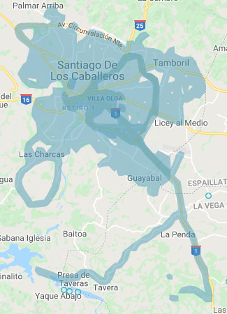
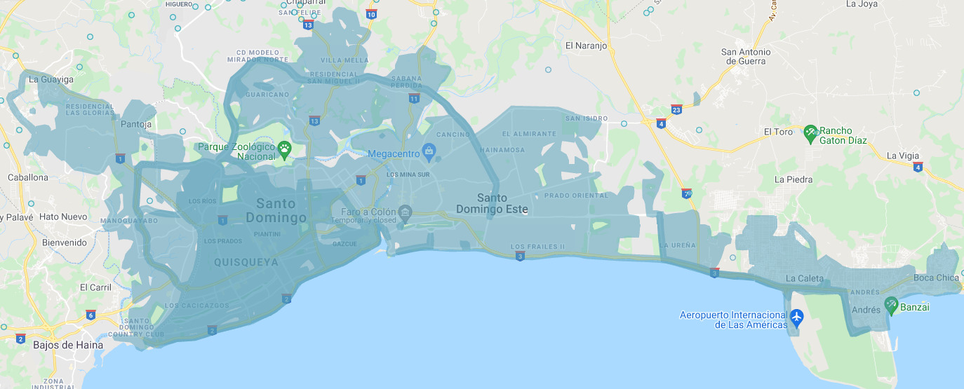
The Dominican Republic currently only has two cities covered. These two cities are its capital Santo Domingo and Santiago De Los Caballeros.
Google Car:
The Dominican Republic has bars with a black rubber inlay. The only other place that has this inlay is in Ulaanbaatar in Mongolia. You can also see the front of the car which is white.
Google Coverage:
The Dominican Republic currently only has two cities covered. These two cities are its capital Santo Domingo and Santiago De Los Caballeros.
The coverage does cover some of the suburbs as well. The coverage over by Punta Cana is third party and will not be on maps.
The darker blue coverage is third party. While official coverage does exist there, there is a chance that map creators have stayed away from these areas.
Unique Vehicle:
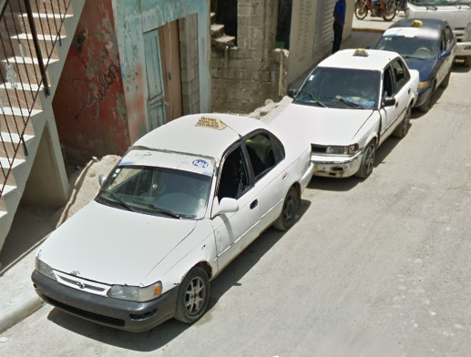
Taxis in the Dominican Republic are a bit different. Each car is different, as well as each color. The only real defining feature of the Taxis is a yellow sign on the top of the vehicle. They are a bit more common in Santo Domingo.
Camera Generation:
Gen 3
Road Lines:
Much like most of North America, the Dominican Republic uses a yellow divider line and white shoulder lines.
The yellow divider can be solid or dashed.
Road Signs:
These over head signs can be found on smaller roads as well as larger roads. They point you towards destinations.
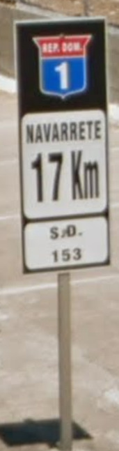
You can also find these KM markers on the major highways. The top part which says Rep. Dom stands for La República Dominicana.
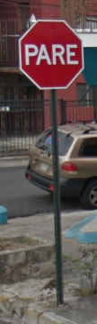
The Dominican Republic also uses Pare for their stop signs.
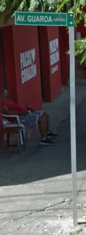
The Dominican Republic has Green street signs with a white border. They’re also on top of a metal pole.
The Cross walk sign in the DR is unique to all of Latin America. The shape of the guy on the sign, as well as the direction he is facing is important.
On the major highways, you can find these cement dividers. They have a red reflector on top and yellow reflectors on the sides. They are only found on the major highways.
Electricity poles:
These poles are square and made of concrete. They also have the bottom portion painted. If the paint is Yellow, you are in Santo Domingo. If the pole is painted grey, you are in Santiago De Los Caballeros. Not every pole will be painted however, and some businesses paint the poles outside of their stores the same color as their stores.
You can find some grey poles in Santo Domingo, but it doesn’t appear that there are yellow poles in Santiago De Los Caballeros. The patterns on the poles may be useful, as it seems *(But isn’t confirmed) that each region has a different pattern along side the typical grey / yellow pole.
You can also find these octagon poles in the suburbs, with different patterns based on the suburb you are in.
License plates:
The license plates here are half yellow and half white. The blur makes the license plates look pretty yellow.
Phone number:

There are three area codes in the Dominican Republic. All of them can be found in the two cities covered. 809 is the original, while 829 and 849 were added in 2005 and 2009.
All of the numbers are set up like North America, looking like (xxx) xxx – xxxx.
Vegetation/Landscape:
Architecture:
Like most of the islands in the Caribbean, there are very square concrete buildings. They are painted very bright colors.
General look:
Notice the grey on the poles, as well as the short buildings. This is very generic, but is a good feel for Santiago De Los Caballeros.
Its easy to tell the cities apart. Santo Domingo has more cars and taller buildings. Santiago De Los Caballeros, while still a large city, seems more residential. There also seem to be less cars, but it could just be when the Google coverage was taken.
Alphabet/script:
The Dominican Republic uses Spanish as their official language.
Domain:
.do
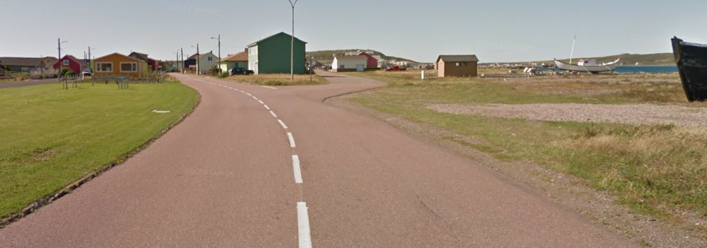
Saint Pierre and Miquelon
- Country Flag
- Capital City
- Most Helpful
- Google Car
- Bollards
- Google Coverage
- Camera Generation
- Road Lines
- Road Signs
- Electricity Poles
- License Plates
- Phone Number
- Vegetation / Landscape
- Architecture
- General Look
- Language
- Domain
Country Flag:

Saint Pierre and Miquelon is an overseas, self governing body, of the French. Therefore, they use the French Flag.
Capital City:
Saint-Pierre
Most Helpful:
(Front)
(Back)
(Side)
Saint Pierre and Miquelon uses an ATV for their coverage on roads. There are only a few roads covered on the North Island, Grand Miquelon.

This is the North Island, Grand Miquelon and Langlade. The only coverage here is on the tip over by Miquelon-Langlade.
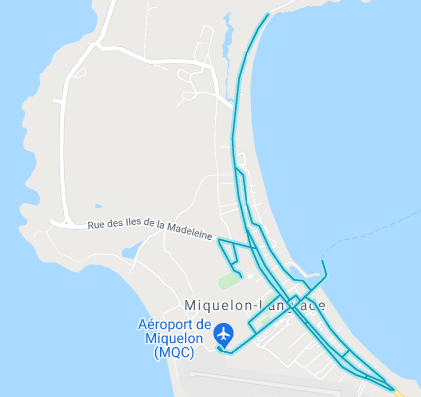
There is limited coverage on the roads here. These are the only roads covered.
There is also this piece north of the city. The coverage in this park is done by a Trekker.
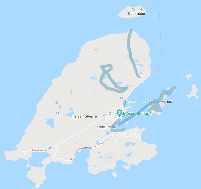
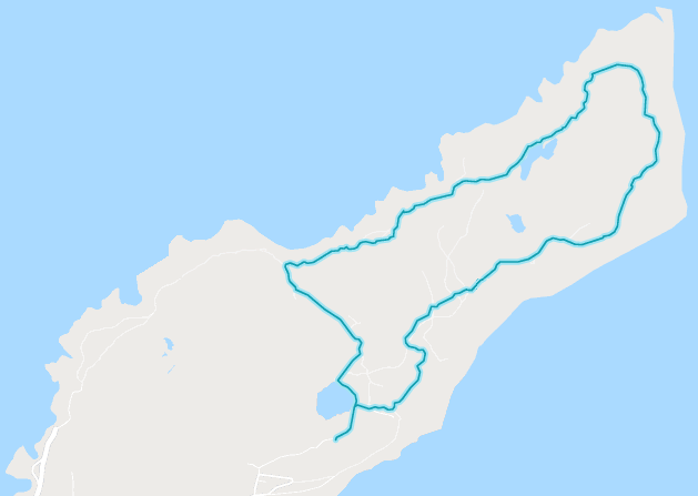
This is the Southern Island, called Saint Pierre.
Google car:
(Front)
(Back)
(Side)
Saint Pierre and Miquelon uses an ATV for their coverage on roads. There are only a few roads covered on the North Island, Grand Miquelon.
The shadow is also unique in Geoguessr. If you find this shadow, it has to be Saint Pierre and Miquelon.
Bollard:
Because its France, you can find French bollards VERY RARELY. In fact, I believe these might be the only two bollards in the coverage. They’re at the southern tip of the town on the Northern Island.
You can also find these weird boxes. They seem to only be on corners or in front of houses.
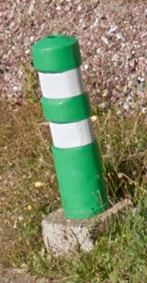
There was only one case of this green bollard that was above. Its on the Northern Island.
Google Coverage:
This is the North Island, Grand Miquelon and Langlade. The only coverage here is on the tip over by Miquelon-Langlade.
There is limited coverage on the roads here. These are the only roads covered.
There is also this piece north of the city. The coverage in this park is done by a Trekker.
This is the Southern Island, called Saint Pierre.
(Front)
(Back)
There is some boat coverage, however its on the South Island.
There is also plenty of trekker coverage on the southern island, including the entire eastern island. You can find a look of it below.
There is a bit of coverage in one of the towns, however it is only covered by a trekker. There is also a view of it below.
Camera Generation:
Gen 3
Road Lines:
Most of Saint Pierre and Miquelon doesn’t have clear road lines. Where there are road lines, however, they’re white dashed lines.
There also seems to be a red tint to most of the roads in the area.
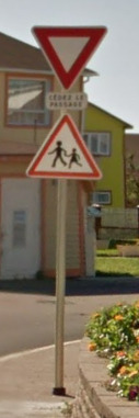
Road Signs:

Even though this is a French Territory, they use “Stop” for their stop signs. The white border around the stop sign is also thicker than normal.
The back of the signs also have these strips on them. Definitely something you don’t see everywhere.
Electricity poles:
These telephone poles are very similar to ones you can find in Europe.
These light poles have a unique design to them.
License plates:
Much like the UK, Saint Pierre and Miquelon use White plates in the front and Yellow plates in the back. It can either be the short stubby plates or the typical EU plates.
Phone number:
You will only find the phone numbers on the Trekker coverage on the Southern Island.
Saint Pierre and Miquelon have a country code of +509, and are only 6 digits long. 41, 42, 43 and 50 are landlines, while 40,42,43,44,50 and 55 are mobile (42 and 50 can be both). The numbers are set up like xx-xx-xx.
Vegetation/Landscape:
Architecture:
The houses and architecture feel very similar to a hybrid of Canada and Greenland. In combination with the ATV, its possible to mistake where you are.
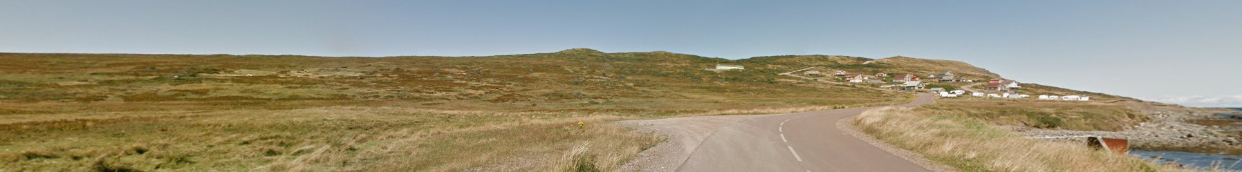
General look:
This is the North Island
This is the South Island
This is the East Island
Alphabet/script:

Saint Pierre and Miquelon uses a typical French Alphabet.
Domain:
.pm
You will not find an example of this domain in the current coverage these islands have.
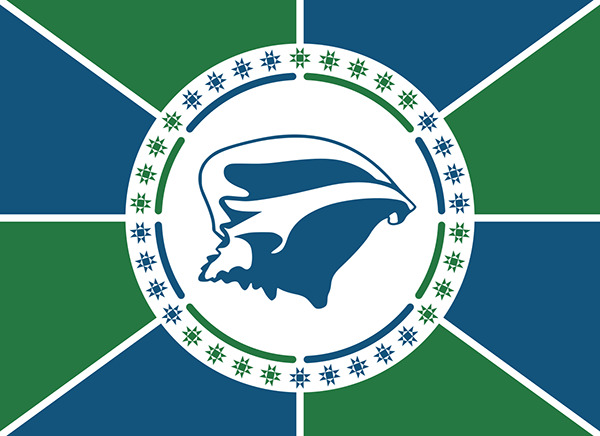
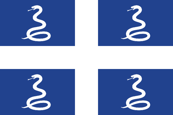
Martinique
- Country Flag
- Capital City
- Most Helpful
- Google Car
- Google Coverage
- Camera Generation
- License Plates
- Vegetation / Landscape
- Architecture
- General Look
- Language
- Domain
Country Flag:
Martinique is a French Department, but they do have their own flag.
Capital City:
Fort-de-France
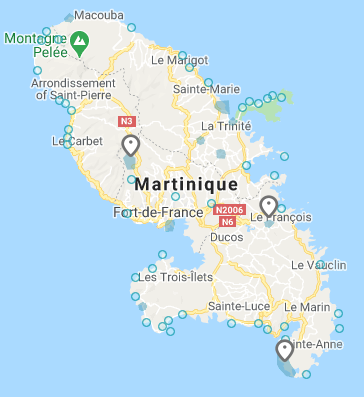
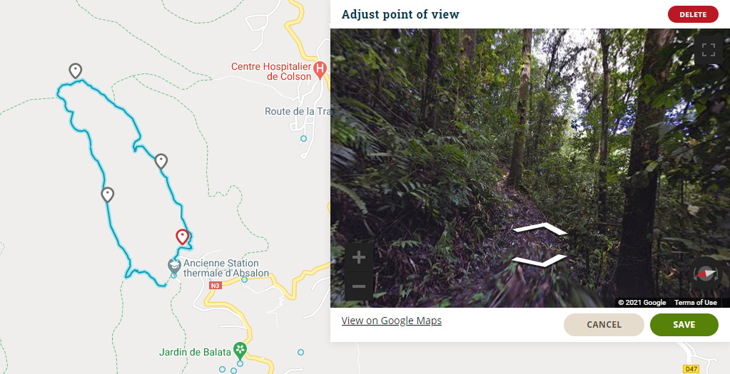
Most Helpful:
(North West)
(Central)
(South Central)
There are only three places covered in Martinique. All three are covered by a Trekker. You can see what the area looks like on the right hand side.
Google Car:
The island of Martinique was covered by a Trekker. However, there is no distinguishing feature to the trekker.
Google Coverage:
(North West)
(Central)
(South Central)
There are only three places covered in Martinique. All three are covered by a Trekker. You can see what the area looks like on the right hand side.
Camera Generation:
Gen 3
License plates:
Martinique has a white plate, much like the rest of France. The only image we could find on the plates was the old yellow style that is extremely weathered. The same plates that are used in France today are used here, just with different letters and numbers.
Vegetation/Landscape:
With the limited coverage, its tough to get good images of landscape. However, you can often find these trees, indicating you are in a tropical area.
Architecture:
The coverage on the island is extremely limited, The amount of buildings you can find are limited. However, they most certainly feel colonial.
General look:
Martinique is an island, and one of the locations with official coverage is on the coast. Seeing the ocean with these plants is a good indicator.
Alphabet/script:

The Official Language of Martinique is French.
Domain:
.mq
Panama
- Country Flag
- Capital City
- Most Helpful
- Google Car
- Bollards
- Google Coverage
- Unique Vehicle
- Camera Generation
- Road Lines
- Road Signs
- Satellite Dish
- Electricity Poles
- License Plates
- Phone Number
- Vegetation / Landscape
- Architecture
- General Look
- Language
- Domain
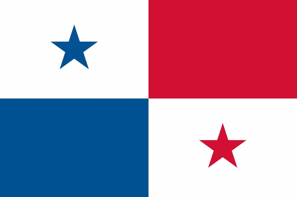
Country Flag:
Capital City:
Panama City
Most Helpful:

Google Car:
You can find variations of the same truck. Some have more blur, some almost no blur. It seems to be generally random. However, you can almost always see the antenna near the front center of the truck.
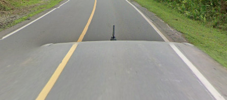
Bollard:
There is no official bollard, however you can find these KM markers on more rural roads.
Google Coverage:
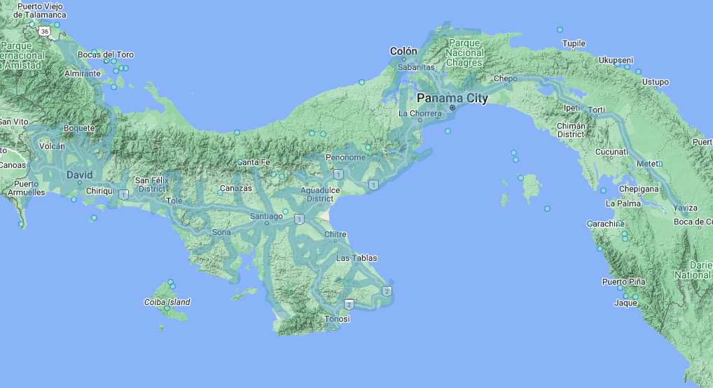
Please note that a portion of Panama is covered by third party coverage. There is a chance you will come across it in your journey. It also means that this map is not accurate as third party coverage extends much further than official. Try and keep your guesses near the major cities.
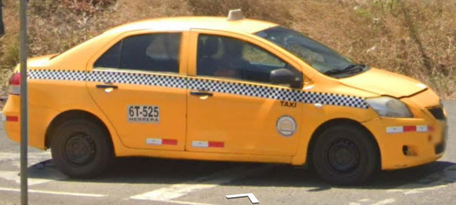
Unique Vehicle:
Panama has a similar situation with Columbia. They have taxi’s that display the plate on the side door. The plate will tell you the region that taxi is registered to drive in.
Camera Generation:
Gen 4
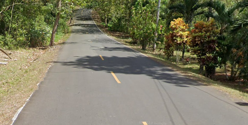
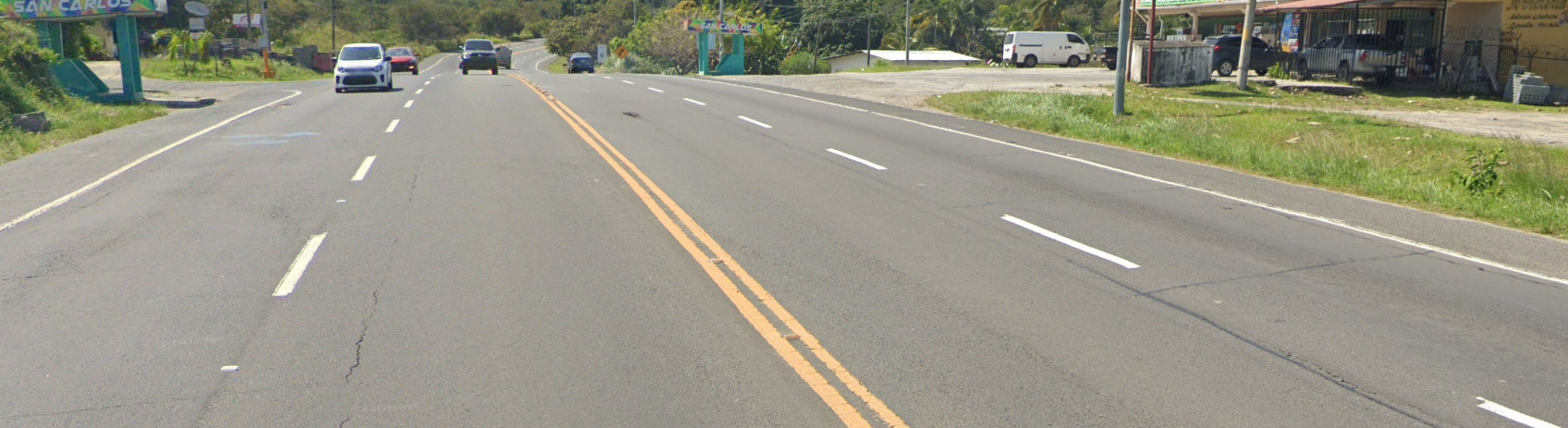
Road Lines:
Panama uses a yellow center lines with white lines on the sides. You can find various forms of the yellow center line, with a single yellow being the most common and double yellow being used in rare occasions.
Road Signs:
The back of almost all signs in Panama look very similar. Its a rounded metal pole with the fasteners being in the pole itself. This is uncommon in the Americas.
Satellite Dish:
Panama has quite a few different types of Satellite dishes that could be useful. The ones shown here are only here because they’re colorful and easy to spot. There are other brands that can be found in panama.
Electricity poles:
License plates:
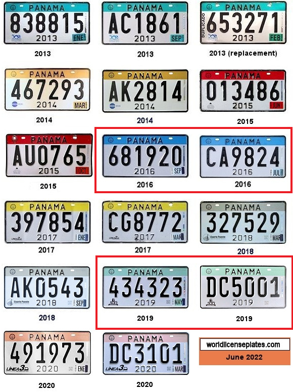
The two sets in the red rectangle seem to be the most common in the coverage. You can often see the white plate with the blue or green streak.
Phone number:
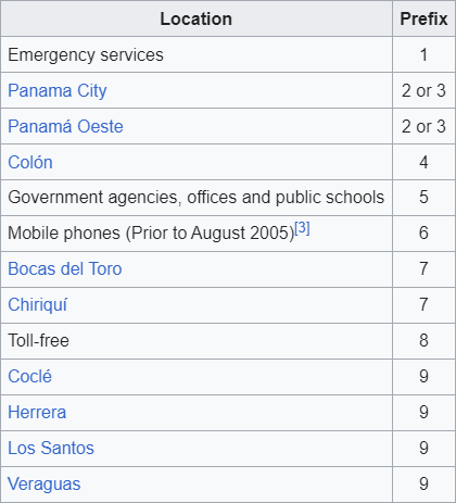
Panama’s country code is +507 and they do not have an area code. All mobile numbers are 8 digits long and will start with the number 6. All numbers 7 digits long are landlines and the first number can be used for a general location.
Vegetation/Landscape:
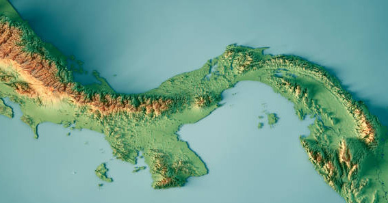
Panama has quite a few mountains and countless flatlands. This topography map showcases that.
Architecture:
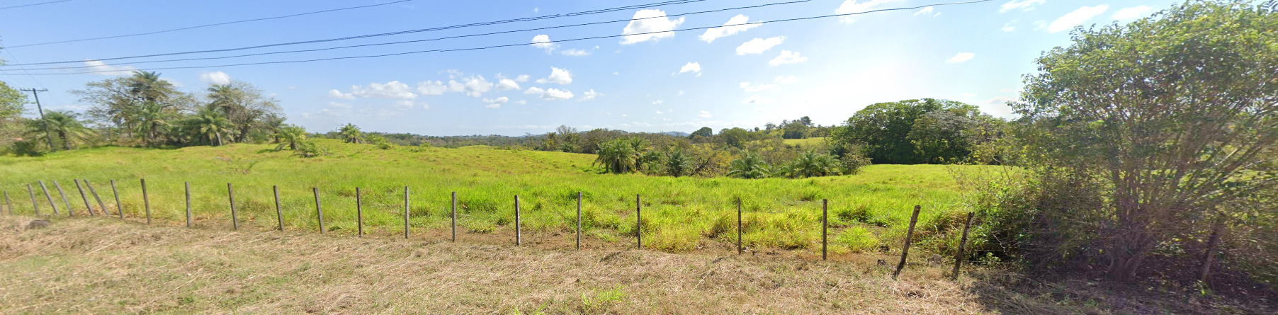
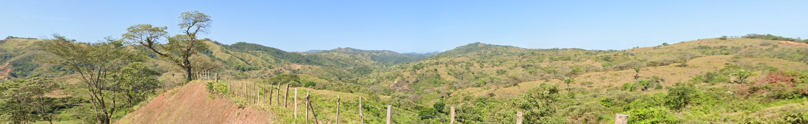
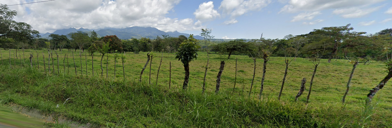
General look:

Alphabet/script:
Panama uses a traditional Spanish alphabet.
Domain:
.pa
Curaçao
- Country Flag
- Capital City
- Most Helpful
- Google Car
- Third Party Coverage
- Google Coverage
- Camera Generation
- Road Lines
- Road Signs
- Electricity Poles
- License Plates
- Phone Number
- Vegetation / Landscape
- Architecture
- General Look
- Language
- Domain
Country Flag:
Capital City:
Willemstad
Most Helpful:
In Curaçao, you can find bars (a roof rack) and the front of a black vehicle. This combination is unique to Curaçao.
Google Car:
In Curaçao, you can find bars (a roof rack) and the front of a black vehicle. This combination is unique to Curaçao.
Third Party Coverage:
Third party coverage, often called “Ari’s”, are ruining official coverage with their terrible images that they upload over official coverage. Some countries have it worse than others. You can find out whether or not you are in official coverage by looking at the copyright in the bottom right of the image. If it says Google, its official coverage. If it says something else, like in the example above, its third party. Curaçao has an Ari called OmniSynThesis 360 VR Promotions. You can often tell you are in third party coverage as the quality is a lot worse than google, as well as movement being incredibly slow. In most cases, third party coverage is not included in maps, but they can sneak their way in, especially when these Aris keep ruining street view.
Google Coverage:
The darker blue that you see actually tells you where the third party coverage is located. Not all of the island is covered, stick to the roads and the capital.
Camera Generation:
Gen 3
Road Lines:
Curaçao uses all white lines.
Road Signs:
You can find these blue signs all over Curaçao that point to destinations. There isn’t really a major highway system here, so you will find them on smaller roads.
Curaçao has these bright yellow poles for their street signs in the big towns. They really stand out and can be a good clue.
There can also be these red and white striped poles on some street corners.
Curaçao has their traffic lights painted with black and white stripes.
Some of their signs will also have black and white stripes, but only signs found near larger intersections will be painted like that.
The rest of the signs will be on a typical metal pole.
Curaçao uses a traditional guardrail. However, they seem to be painted a tan color. There are examples of newer sections not being painted, and older sections being a bit faded and missing some paint.
Electricity poles:
Most of the poles seem to have about 2 meters or 6 feet on white paint at the bottom. Not every pole has this, but its common across the island.br>
License plates:
Phone number:
Curaçao uses the Country code of +599. They use the area code of 9 and have a 7 digit local number that follows. It is set up to look like xxx-xxxx. It’s unlikely that you will see the area code here as 9 covers the whole island.
Vegetation/Landscape:
Architecture:
These houses feel very island like. There also seems to be a pattern where the fence or an accent piece on the fence is painted the same color as the house.
General look:
Curaçao is a flat island. It feels a bit more dry than your typical island and you can find spots that really capture this. Above is an example of that.
Alphabet/script:
Curaçao uses Dutch, English and Papiamento. Most of the signs will be in Dutch or English however.
Domain:
.cw
Saint Pierre and Miquelon
- Country Flag
- Capital City
- Most Helpful
- Google Car
- Bollards
- Google Coverage
- Camera Generation
- Road Lines
- Road Signs
- Electricity Poles
- License Plates
- Phone Number
- Vegetation / Landscape
- Architecture
- General Look
- Language
- Domain
Country Flag:
Saint Pierre and Miquelon is an overseas, self governing body, of the French. Therefore, they use the French Flag.
Capital City:
Saint-Pierre
Most Helpful:
(Front)
(Back)
(Side)
Saint Pierre and Miquelon uses an ATV for their coverage on roads. There are only a few roads covered on the North Island, Grand Miquelon.
This is the North Island, Grand Miquelon and Langlade. The only coverage here is on the tip over by Miquelon-Langlade.
There is limited coverage on the roads here. These are the only roads covered.
There is also this piece north of the city. The coverage in this park is done by a Trekker.
This is the Southern Island, called Saint Pierre.
Google car:
(Front)
(Back)
(Side)
Saint Pierre and Miquelon uses an ATV for their coverage on roads. There are only a few roads covered on the North Island, Grand Miquelon.
The shadow is also unique in Geoguessr. If you find this shadow, it has to be Saint Pierre and Miquelon.
Bollard:
Because its France, you can find French bollards VERY RARELY. In fact, I believe these might be the only two bollards in the coverage. They’re at the southern tip of the town on the Northern Island.
You can also find these weird boxes. They seem to only be on corners or in front of houses.
There was only one case of this green bollard that was above. Its on the Northern Island.
Google Coverage:
This is the North Island, Grand Miquelon and Langlade. The only coverage here is on the tip over by Miquelon-Langlade.
There is limited coverage on the roads here. These are the only roads covered.
There is also this piece north of the city. The coverage in this park is done by a Trekker.
This is the Southern Island, called Saint Pierre.
(Front)
(Back)
There is some boat coverage, however its on the South Island.
There is also plenty of trekker coverage on the southern island, including the entire eastern island. You can find a look of it below.
There is a bit of coverage in one of the towns, however it is only covered by a trekker. There is also a view of it below.
Camera Generation:
Gen 3
Road Lines:
Most of Saint Pierre and Miquelon doesn’t have clear road lines. Where there are road lines, however, they’re white dashed lines.
There also seems to be a red tint to most of the roads in the area.
Road Signs:
Even though this is a French Territory, they use “Stop” for their stop signs. The white border around the stop sign is also thicker than normal.
The back of the signs also have these strips on them. Definitely something you don’t see everywhere.
Electricity poles:
These telephone poles are very similar to ones you can find in Europe.
These light poles have a unique design to them.
License plates:
Much like the UK, Saint Pierre and Miquelon use White plates in the front and Yellow plates in the back. It can either be the short stubby plates or the typical EU plates.
Phone number:
You will only find the phone numbers on the Trekker coverage on the Southern Island.
Saint Pierre and Miquelon have a country code of +509, and are only 6 digits long. 41, 42, 43 and 50 are landlines, while 40,42,43,44,50 and 55 are mobile (42 and 50 can be both). The numbers are set up like xx-xx-xx.
Vegetation/Landscape:
Architecture:
The houses and architecture feel very similar to a hybrid of Canada and Greenland. In combination with the ATV, its possible to mistake where you are.
General look:
This is the North Island
This is the South Island
This is the East Island
Alphabet/script:
Saint Pierre and Miquelon uses a typical French Alphabet.
Domain:
.pm
You will not find an example of this domain in the current coverage these islands have.
The US Virgin Islands
- Country Flag
- Capital City
- Most Helpful
- Google Car
- Rare Car
- Google Coverage
- Unique Vehicle
- Camera Generation
- Road Lines
- Road Signs
- Electricity Poles
- License Plates
- Phone Number
- Vegetation / Landscape
- Architecture
- General Look
- Language
- Domain
Country Flag:
If you find this flag anywhere, it will be directly next to the USA flag.
Capital City:
Charlotte Amalie
Most Helpful:
The US Virgin Islands drive on the left hand side of the road.
The US Virgin Islands are SUPER easy to recognize because of this car. Just be aware that the color CAN tell you which island you are on.
The White Truck can be found on the North Islands St. Thomas and St. John while the red truck and a white truck are found on St. Croix.
The white truck on the south island is missing the black antenna that is found on the top of the truck near the front left on the north island.
Google car:
The US Virgin Islands are SUPER easy to recognize because of this car. Just be aware that the color CAN tell you which island you are on.
The White Truck can be found on the North Islands St. Thomas and St. John while the red truck and a white truck are found on St. Croix.
The white truck on the south island is missing the black antenna that is found on the top of the truck near the front left on the north island.
There is also a chance to end up on some boat coverage, but most map makers don’t include that. You cannot see anything from the boat itself.
Rare Car:
The Carambola Golf club features at least three (3) different rare cars.
You can see a red blur with an antenna.
You can see a roof rack with no visible vehicle.
The last is just a regular blurred out vehicle. The only thing you can see is a large antenna.
You can tell you are on a golf course for all of these vehicles. Even the road that leads up to the golf course is marked as such.
Google Coverage:
Most of the towns on the islands are covered. Stick to the towns and the surrounding roads and you should be fine.
Unique Vehicle:
Taxis in the US Virgin Islands are a bit different. They tend to be trucks that have open backs to fit large groups. They can be different colored trucks, with smaller and larger variants existing. The patterns on the sides also seem to be different.
Camera Generation:
Gen 3
Road Lines:
The US Virgin Islands use a double yellow center line with white shoulders. However, they drive on the left hand side of the road and its clear you’re not in the USA.
Road Signs:
The road signs are very similar to the signs from the USA.
The guardrails in the US Virgin Islands are painted yellow in dangerous areas to alert the driver.
Electricity poles:
License plates:
There are plenty of variations, but this is the most common plate for the US Virgin Islands.
Phone number:
Like the USA, the Virgin Islands have a phone 10 digit phone number set up like (xxx) xxx – xxxx.
There is only one area code for ALL of the US Virgin Islands, that being 340.
Vegetation/Landscape:
Architecture:
General look:
This is the general feel of the Northern Islands. It seems to be a bit more hilly than the south.
This is the general feel of the Southern Island. It seems rather flat.
Alphabet/script:
The US Virgin Islands use a typical English alphabet.
Domain:
.vi
Bermuda
- Country Flag
- Capital City
- Most Helpful
- Google Car
- Third Party Coverage
- Google Coverage
- Unique Vehicle
- Camera Generation
- Road Lines
- Road Signs
- Electricity Poles
- License Plates
- Phone Number
- Vegetation / Landscape
- Architecture
- General Look
- Language
- Domain
Country Flag:
Being a territory of the UK, they have the Union Jack on their flag. However, a red flag is rare in British territories, and can be a good indicator if you find one.
You can find the flag of the UK as well as the flag of the USA next to the flag of Bermuda. This happens a few times in the official coverage.
Capital City:
Hamilton
Most Helpful:
When you do find a car, it is a black truck. You can see the front of it clearly.
Google car:
When you do find a car, it is a black truck. You can see the front of it clearly.
There is also some boat / jet-ski coverage. Its one of the few places where you cant really see the boat.
Third Party Coverage:
Third party coverage, often called “Ari’s”, are ruining official coverage with their terrible images that they upload over official coverage. Some countries have it worse than others. You can find out whether or not you are in official coverage by looking at the copyright in the bottom right of the image. If it says Google, its official coverage. If it says something else, like in the example above, its third party. Bermuda has an Ari called Bermuda Tourism. You can often tell you are in third party coverage as the quality is a lot worse than google, as well as movement being incredibly slow. In most cases, third party coverage is not included in maps, but they can sneak their way in, especially when these Aris keep ruining street view.
Google Coverage:
Stick to the roads in Bermuda and there shouldn’t be a problem. The darker blue areas are places that have third party coverage. Those are best to avoid. Most of the residential areas are covered by the third party ari
Unique Vehicle:
Taxis are quite common in Bermuda. They are generally vans with a taxi sign on top. The color can change, and Blue, White and Grey have been spotted.
Camera Generation:
Gen 3
Road Lines:
Bermuda uses a single yellow divider line, and occasionally uses a white shoulder line. There occasionally can be a white divider in the middle, however this is more rare than the yellow. Sometimes the yellow divider is extremely faded, but its definitely there.
Road Signs:
Bermuda uses a mix of Western Hemisphere and Eastern Hemisphere signs. There is not a white rim around most of their signs (excluding stop signs) and the signs feel a bit British.
You can also find these street signs everywhere. They seem to share a design across the island. They can be found on the sides of buildings, so keep an eye out for them.
Bermuda uses either a wooden fence or a stone wall to keep cars on the roads. It is their version of a guard rail. Both can be seen in the image above.
Electricity poles:
These poles can be found across the island. They’re all wooden and all have some nice designs. The bigger ones are found near the larger towns, while the smaller ones are found in the suburbs.
License plates:
Bermuda truck plates have a chance to start with either HC, IN, or L. These each mean different things. There are some unblurred license plates on trucks in Bermuda.
HC Stands for Heavy Truck
IN Stands for Intermediate Truck
L Stands for Light Truck
Phone number:
Bermuda only has one area code, that being 441. However, you really don’t see the area code often in Bermuda. The phone number is set up like most of the North American numbers, being 7 digits long and are set up as xxx-xxxx.
Vegetation/Landscape:
Architecture:
Bermuda has a very colorful palette when it comes to their buildings. Almost every building is painted a bright color, with blue, red and pink being some of the more common colors. It feels very island-ish, almost somewhat colonial.
Most of the time, the houses are very squared. This house above is almost an oddity.
General look:
Bermuda feels very tropical. There’s something about this place that just feels warm. The palm trees on the sides of the road and the crystal blue water are good tells. Keep an eye out for the car, its the most obvious tell there is that this is Bermuda.
Alphabet/script:
Bermuda uses English, being a British Territory.
Domain:
.bm
Martinique
- Country Flag
- Capital City
- Most Helpful
- Google Car
- Google Coverage
- Camera Generation
- License Plates
- Vegetation / Landscape
- Architecture
- General Look
- Language
- Domain
Country Flag:
Martinique is a French Department, but they do have their own flag.
Capital City:
Fort-de-France
Most Helpful:
(North West)
(Central)
(South Central)
There are only three places covered in Martinique. All three are covered by a Trekker. You can see what the area looks like on the right hand side.
Google Car:
The island of Martinique was covered by a Trekker. However, there is no distinguishing feature to the trekker.
Google Coverage:
(North West)
(Central)
(South Central)
There are only three places covered in Martinique. All three are covered by a Trekker. You can see what the area looks like on the right hand side.
Camera Generation:
Gen 3
License plates:
Martinique has a white plate, much like the rest of France. The only image we could find on the plates was the old yellow style that is extremely weathered. The same plates that are used in France today are used here, just with different letters and numbers.
Vegetation/Landscape:
With the limited coverage, its tough to get good images of landscape. However, you can often find these trees, indicating you are in a tropical area.
Architecture:
The coverage on the island is extremely limited, The amount of buildings you can find are limited. However, they most certainly feel colonial.
General look:
Martinique is an island, and one of the locations with official coverage is on the coast. Seeing the ocean with these plants is a good indicator.
Alphabet/script:
The Official Language of Martinique is French.
Domain:
.mq
Midway Atoll
- Country Flag
- Most Helpful
- Google Trekker
- Google Coverage
- Camera Generation
- Vegetation / Landscape
- General Look
- Language
- Domain
Country Flag:
This flag is an unofficial flag of Midway Atoll. It was designed in the year 2000.
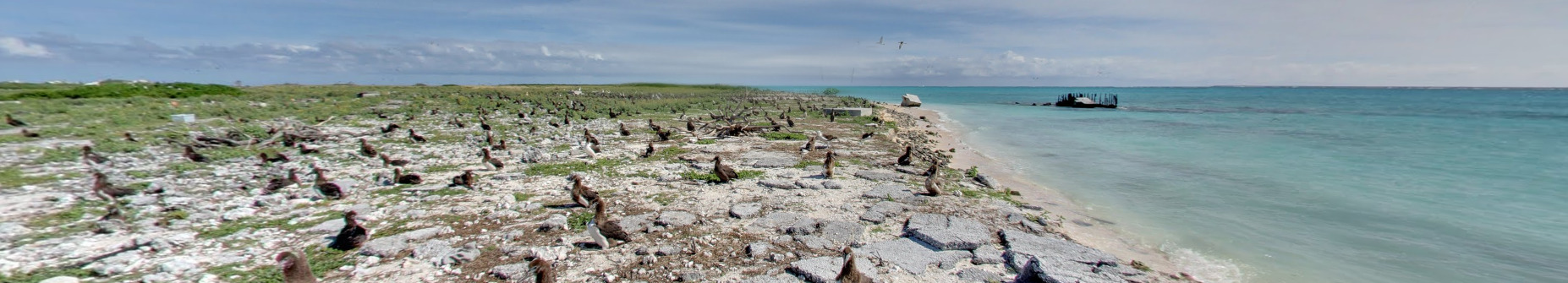
Most Helpful:
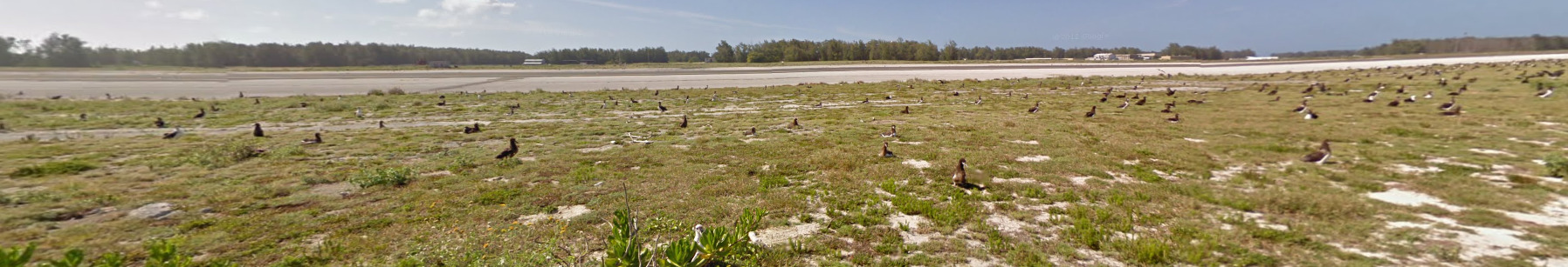
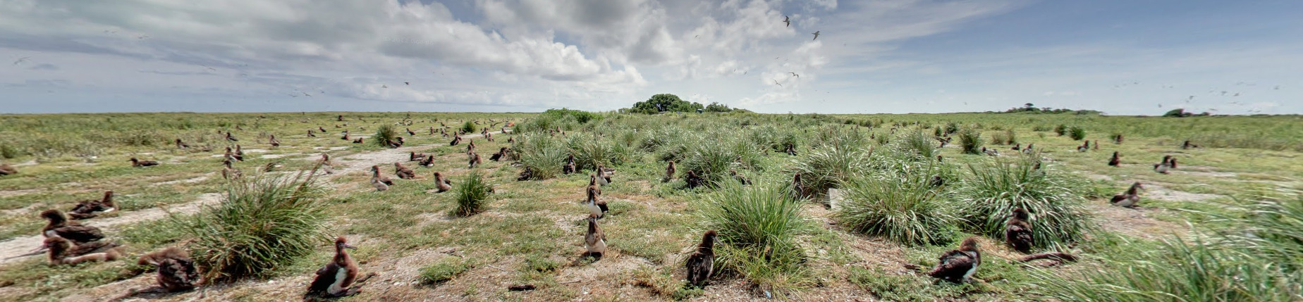
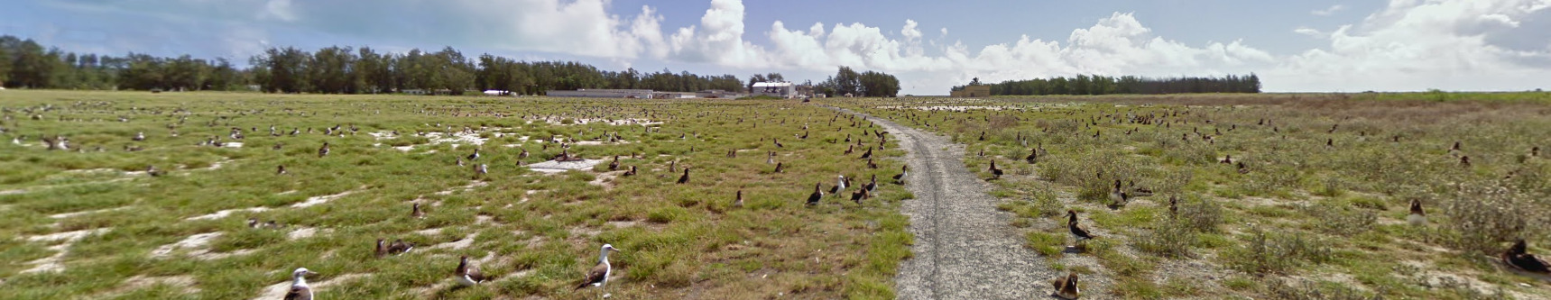
Nearly everywhere you look on Midway Atoll, you can see these birds. A combination of the trekkers with the birds is a good clue you are in Midway.
DISCLAIMER: You need to guess KURE ATOLL (To the North West) in Country Battle Royale currently for Midway Atoll. When this gets patched, we will remove this line.
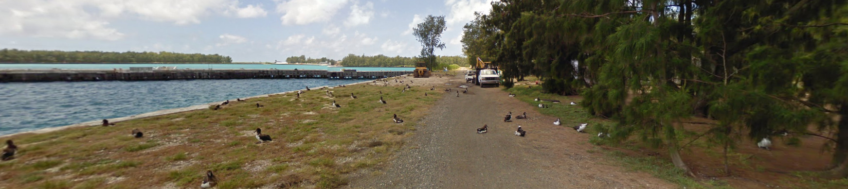
Google Trekker:
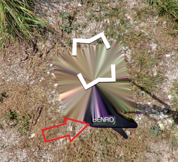
Eastern island has a tripod with the word “BENRO” visible. Sand island has Gen 2 coverage. There is one small spot on Sand Island that has the Benro tripod and gen 3 coverage, but its broken coverage (it doesn’t connect to anything) and most map makers don’t like coverage like that. That location is an old, run down building. Eastern Island doesn’t have anything like that.
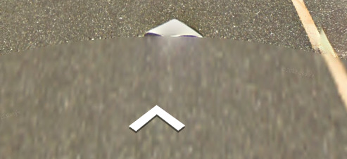
Sand Island, while it has Gen 2 coverage, does have a few places where a piece of the trekker is shown. Its looks like someone’s hat is shown, and it can be see to varying degrees. From the Image shown to not there at all. You are more likely to find hatless than to find the hat.
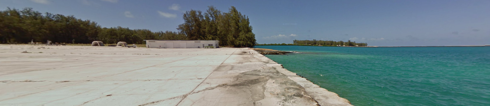
Google Coverage:
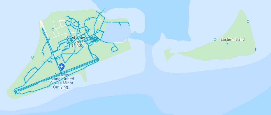
Midway Atoll has two separate islands, Sand Island and Eastern Island. Sand Island has infrastructure, while Eastern Island has a war memorial. Sand Island is the most common of the two islands to end up on.
Camera Generation:
Gen 2 & 3
Vegetation/Landscape:
.
General look:
Alphabet/script:
Midway Atoll uses your typical English language.
Domain:
.um
The .UM domain is used for all US Outlying Minor Islands. It is not unique to Midway Atoll.
Northwestern Hawaiian Islands
- Country Flag
- Capital City
- Most Helpful
- Google Car
- Google Coverage
- Camera Generation
- Vegetation / Landscape
- General Look
- Subdivisions
- Language
- Domain
Country Flag:
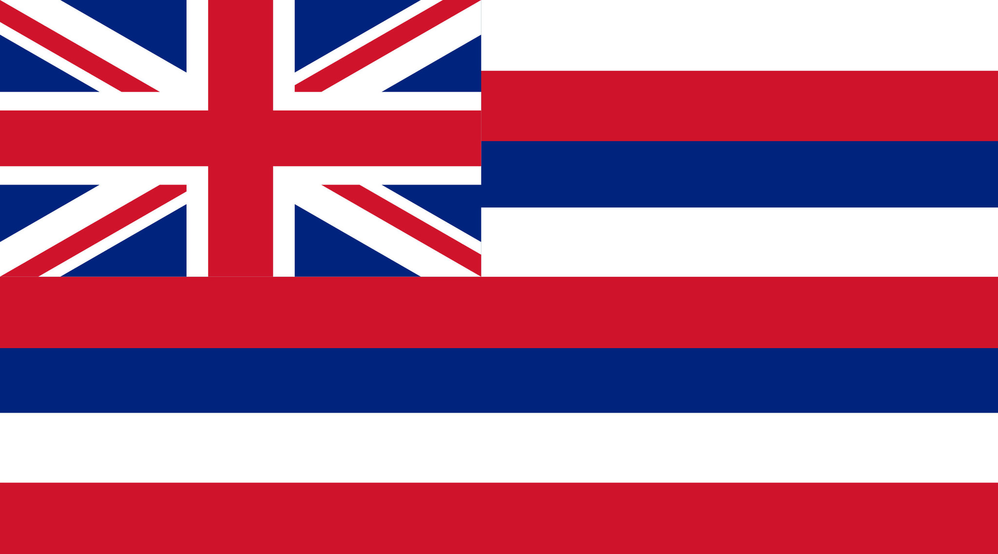
These islands are technically part of Hawaii, a United States State. The flag shown is the flag of Hawaii.
Most Helpful:
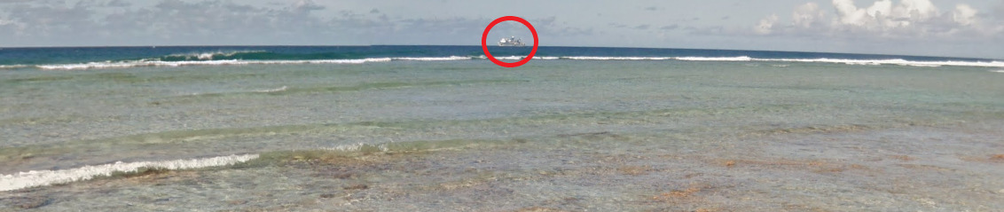
(Southeast Island) There is a visible fishing boat off the Southern coast. It can be seen from pretty much everywhere on the island. Its a good sign that you are on the Southeast island. This boat does make its appearance around the other islands, although not off the south coast.
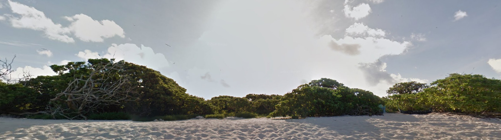
(Lisianski Island) Half of the island was shot during the morning, when the sun is very low in the sky.
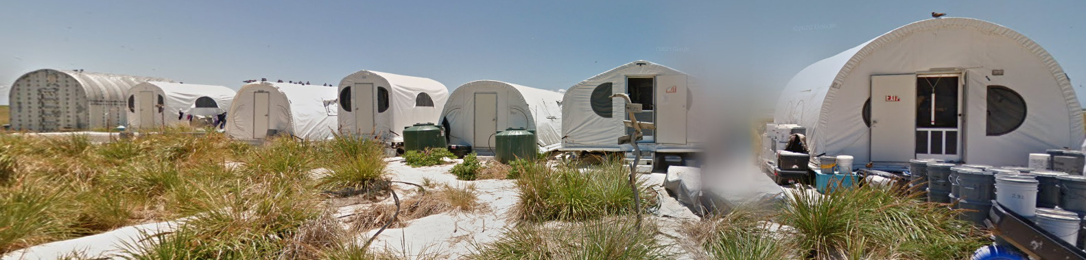
(Kauō / Laysan) Kauō / Laysan have what appears to be a research station. You can find what appear to be temporary structures set up on the western part of the island, but because the island is so flat, you can generally see them from the entire area that has coverage.
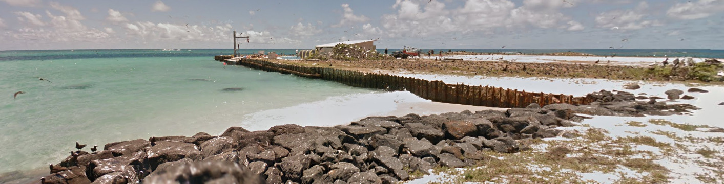
(French Frigate Shoals / Tern Island) You can find both of these man made retaining walls around the island. The black rock one makes up a smaller percentage of the cover, while the metal wall can be nearly gone due to rust in some places.
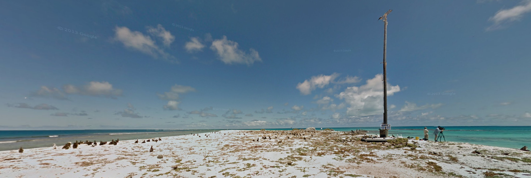
(East Island) East island is rather small. You can find what appears to be some scientific relay pole on the islands northern end. You can also find some sea turtles on the beaches of this island.
Google Trekker:
You can occasionally see the shadow of the trekker, but there doesn’t seem to be anything unique between the islands.
Google Coverage:
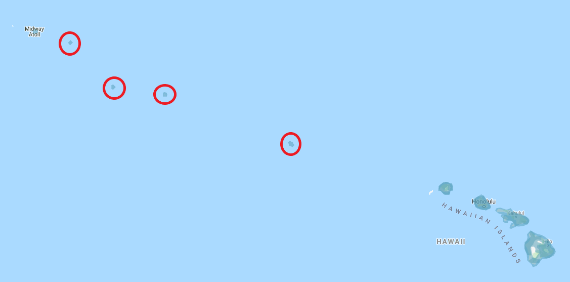
The closeups of the islands will work from the top left down to the bottom right.
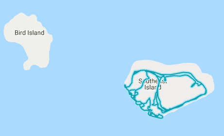
Southeast Island has plenty of trekker coverage. Nearby Bird Island doesn’t have any coverage.
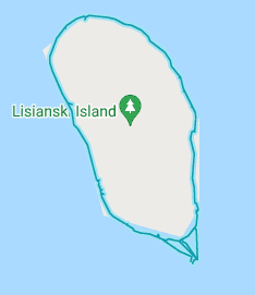
Lisianski Island has a lot of perimeter coverage. The guy walks around the island, but not really through it.
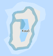
Kauō, also called Laysan, has perimeter and interior coverage.
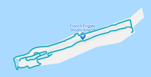
French Frigate Shoals, also called Tern Island, has some infrastructure but not really anything else.
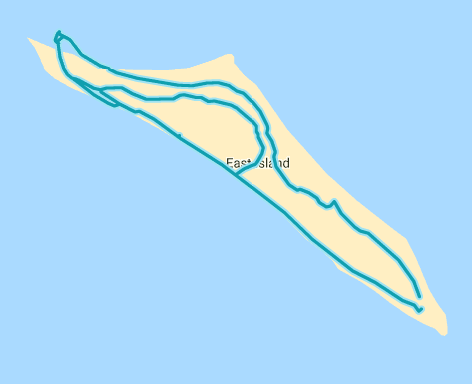
East Island is rather small, and doesn’t have much there to show for it.
Camera Generation:
Gen 3
Vegetation/Landscape:
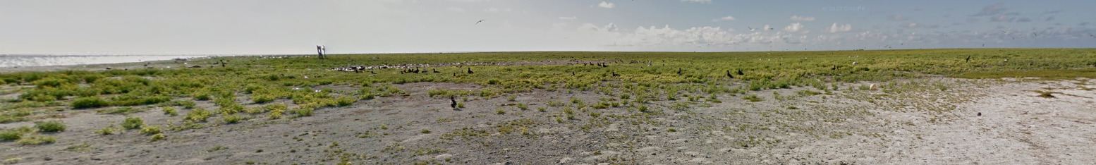
(Southeast Island)
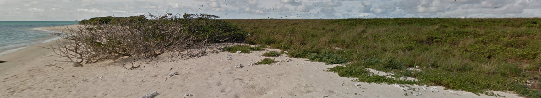
(Lisianski Island)
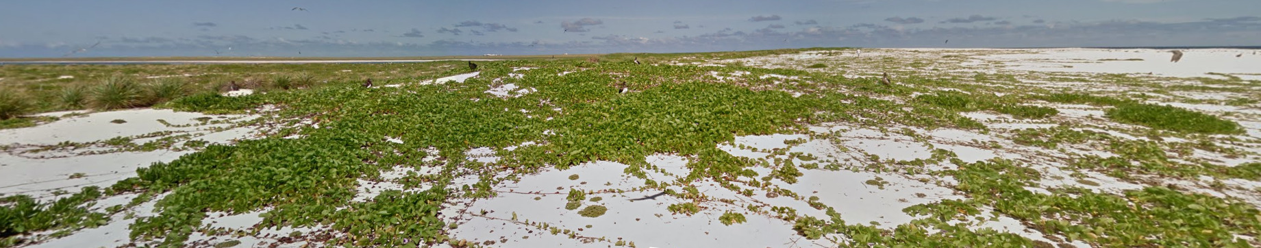
(Kauō / Laysan)
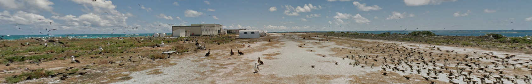
(French Frigate Shoals / Tern Island)
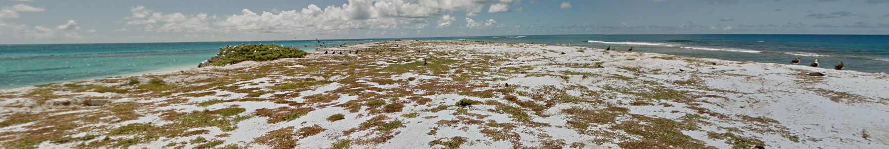
(East Island)
General look:
(Southeast Island) There is a visible fishing boat off the Southern coast. It can be seen from pretty much everywhere on the island. Its a good sign that you are on the Southeast island. This boat does make its appearance around the other islands, although not off the south coast.
(Lisianski Island) Half of the island was shot during the morning, when the sun is very low in the sky.
(Kauō / Laysan) Kauō / Laysan have what appears to be a research station. You can find what appear to be temporary structures set up on the western part of the island, but because the island is so flat, you can generally see them from the entire area that has coverage.
(French Frigate Shoals / Tern Island) You can find both of these man made retaining walls around the island. The black rock one makes up a smaller percentage of the cover, while the metal wall can be nearly gone due to rust in some places.
(East Island) East island is rather small. You can find what appears to be some scientific relay pole on the islands northern end. You can also find some sea turtles on the beaches of this island.
Subdivisions:
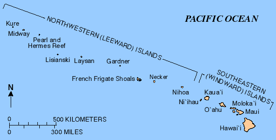
While these are the islands in the Northwestern Hawaii Island chain, not all of them are covered. Midway Atoll, while mentioned here, is not a part of Hawaii like the rest of the islands.
Alphabet/script:
These islands all use English.
Domain:
.um
Providencia & San Andrés
- Country Flag
- Capital City
- Most Helpful
- Google Car
- Google Coverage
- Unique Vehicle
- Camera Generation
- Road Lines
- Road Signs
- Electricity Poles
- License Plates
- Phone Number
- Vegetation / Landscape
- Architecture
- General Look
- Language
- Domain
Country Flag:
These islands are politically apart of Colombia, but historically tied to the UK. The Flag above is the official flag of BOTH islands, but you can also find some Colombian flags as well.
Capital City:
San Andrés
Most Helpful:
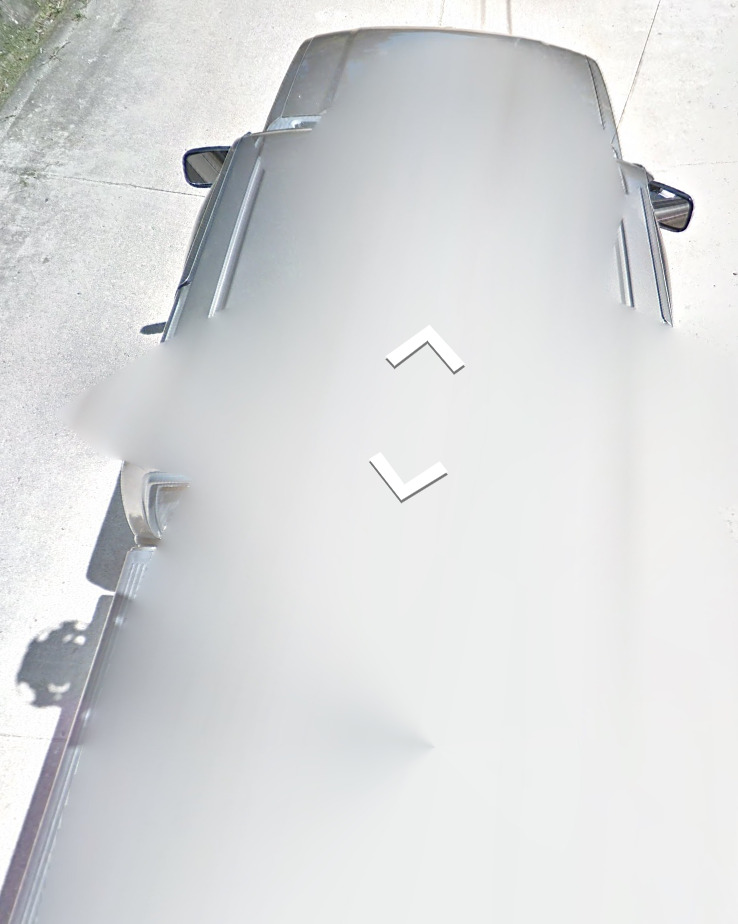
Providencia Island uses a grey / dark grey truck.
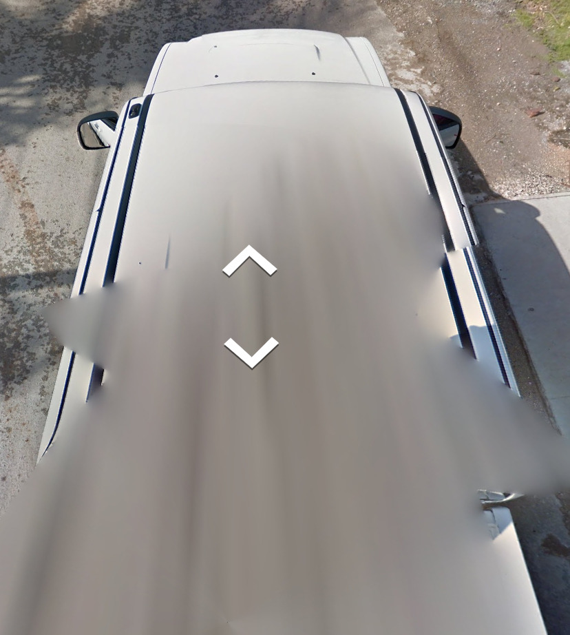
San Andrés Island uses a white truck, much like other white trucks in the Caribbean. The side of the road you are driving on matters here.
Each island has a different colored car. Knowing which car you have can be a difference maker, especially when considering where you want to guess.
Santa Catalina, off of the coast of Providencia Island, uses a Trekker. You can occasionally see the shadow, however it isn’t that common. It appears that the trekker rode a bicycle for the coverage.
Google Car:
Providencia Island uses a grey / dark grey truck.
San Andrés Island uses a white truck, much like other white trucks in the Caribbean. The side of the road you are driving on matters here.
Each island has a different colored car. Knowing which car you have can be a difference maker, especially when considering where you want to guess.
Santa Catalina, off of the coast of Providencia Island, uses a Trekker. You can occasionally see the shadow, however it isn’t that common. It appears that the trekker rode a bicycle for the coverage.
Google Coverage:
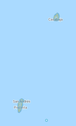
These islands are off the coast of Nicaragua. Each island has decent coverage, but like most countries, stick to the roads and towns and you should be fine.
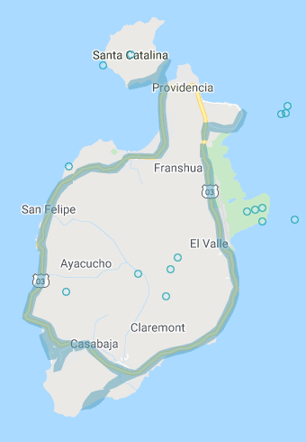
(Providencia Island)
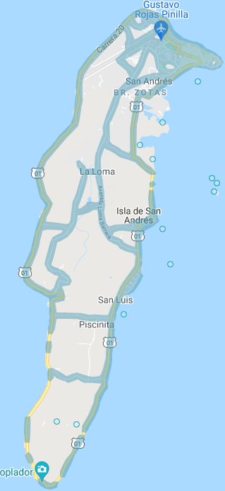
(San Andrés Island)
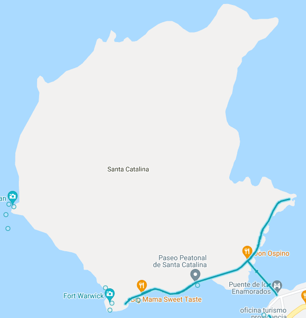
(Santa Catalina)
Unique Vehicle:
Unlike mainland Colombia, taxis in San Andrés don’t have license plates on the sides, roof or hood. They seem to be regular vehicles, owned by civilians. However, it is one of the most common forms of transportation on the island.
There are countless moped and motorcycles on the island. They come in every color you can think of, and are definitely a common sight while on these islands.
Camera Generation:
Gen 3
Road Lines:
You are more likely to find roads without any markings than with. The image above is from the capital, San Andrés. Most of the time, you will be on a cement road with nothing visible.
Santa Catalina, the Trekker island, has a unique pattern to the pathway that has coverage. It is a wavy pattern that is unique to this region.
Road Signs:
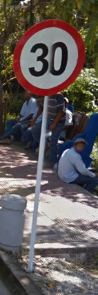
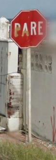
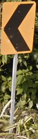
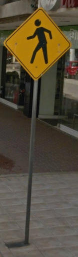
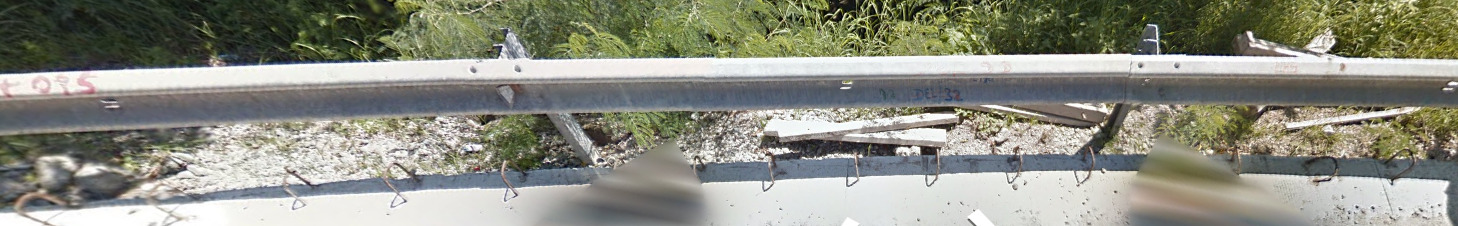
Guard rails in San Andrés are your traditional guard rail. They have a white reflector on the inside.
Electricity poles:
Each island uses a different pattern for their streetlights. You can tell which island is which based off of that information. San Andrés uses a simple light, while Providencia uses a more artistic design.
License plates:
Because these islands are Colombian, they use the typical yellow plate. The only difference will be the region name on the bottom.
Phone number:
The “B” for San Andrés and Providencia is 8. Therefore, all numbers will be 0A8-NXX-XXXX or 0Axy8-NXX-XXXX. It does share a number with other regions however.
Vegetation/Landscape:
Architecture:
General look:
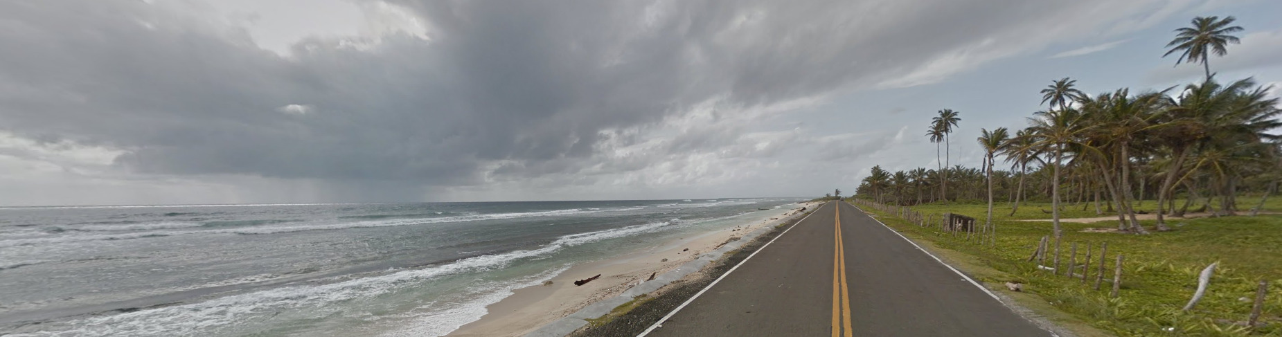
Alphabet / Script:
(Spanish)
(English)
Spanish, English and San Andrés–Providencia Creole are the three official Languages. San Andrés–Providencia Creole is only a spoken language.
Domain:
.co
Providencia & San Andrés share the domain with Colombia. They do not have a unique domain.