Brazil
- Country Flag
- Capital City
- Most Helpful
- Google Car
- Bollard
- Google Coverage
- Camera Generation
- Road Lines
- Road Signs
- Road Numbering System
- Electricity Poles
- License Plates
- Phone Numbers
- Vegetation/Landscape
- Specific Plants
- Architecture
- General Look
- Alphabet/Script
- Subdivisions
- Internet Domain
Country Flag:
Capital City:
Brasilia
Most Helpful:
Google car:
White car without or with a small chubby antenna:
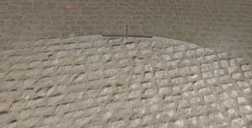
You will see the blue car in ALL gen 4 coverage. That doesn’t mean that all of Brazil will be covered by the blue car. In fact, the rest of the country should be covered by just a white car.
Bollard:
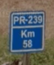
There are not any bollards, however you will find these signs along most of the larger roads. You will be able to see which region the road is located in, as well as which road you are listed on.
This image shows PR, which stands for the State of Parana, 239 which indicated Parana road 239, and the KM marker 58.
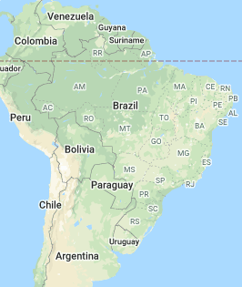
You can see the two letter codes if you zoom out in the Geoguessr map.
The only two letter code that won’t help will be BR. That’s because it indicates a country road, one that goes through multiple states.
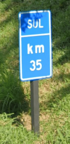
There are also these useless signs of the same type which only serve as kilometer markers and don’t show the road number:
Google Coverage:

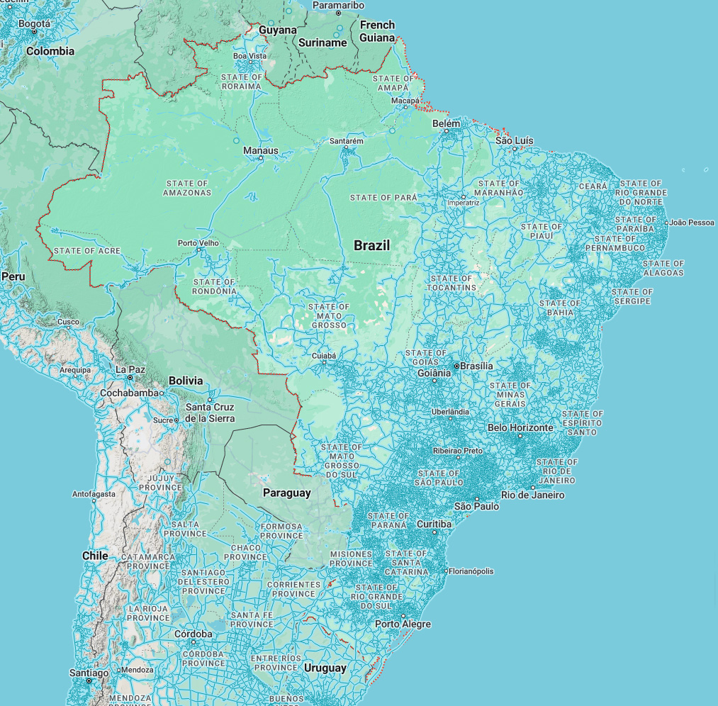
Most of Brazil’s coverage is along the eastern half. The western half is comprised mostly of the amazon rainforest. There are some trekkers scattered about, as well as some remote roads covered.
Camera Generation:
Gen 3 & 4 (negligible amount of Gen 2)
Road Lines:
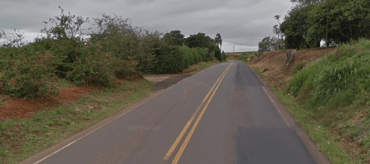
Brazil, like most of the Western Hemisphere, uses a yellow divider and white shoulder lines.
Road Signs:

The green signs seem to point to towns and villages.
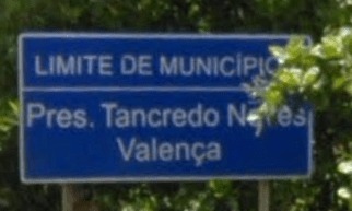
The blue signs seem to point to administrative regions, politicians, or other important information about the region or town. You’ll find the highway signs that point to a hotel or a restaurant in blue as well.
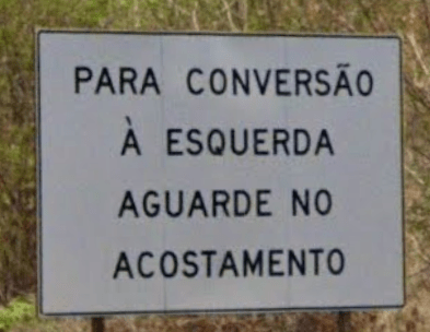
There are also white signs that just carry general information on them. They wont tell you anything about towns, but you will be able to tell that the language is Portuguese.
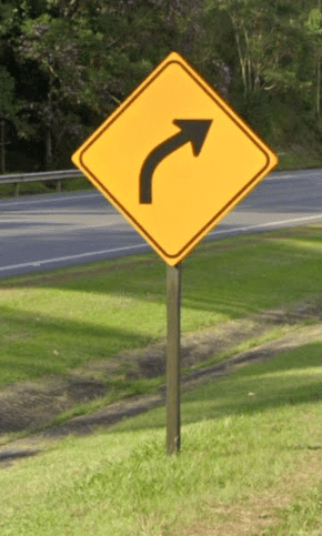
Warning signs in Brazil have the American yellow diamond-shaped style:
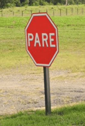
The stop signs in Brazil say PARE, just like in all other South American countries:
The roadside turn warning arrows are either yellow with a black background or black with a yellow background:
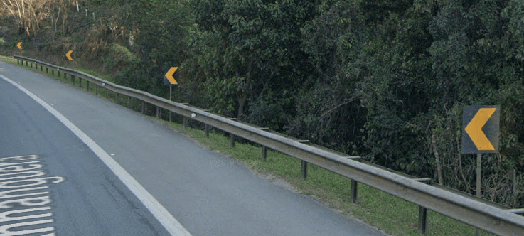
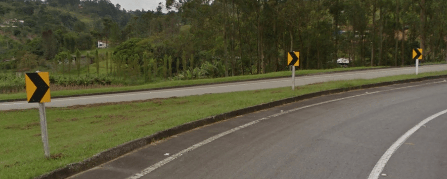
Road signs on Brazilian highways can often be magnified and bigger than the usual signs:
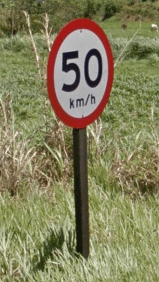
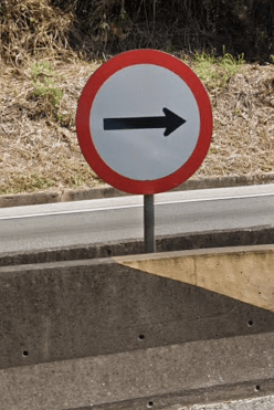
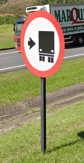
However, this is not the case in cities and towns.
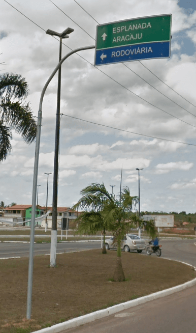
These overhanging signs with bent poles are very common in Brazil. They point the way either to the nearest cities and roads, or parts of cities if found in a city:
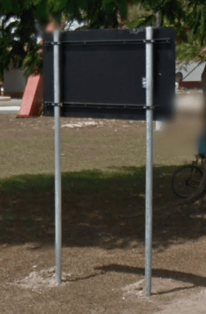
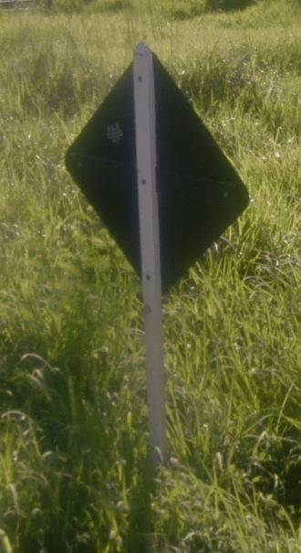
The backs of all types of official road signs in Brazil are black:
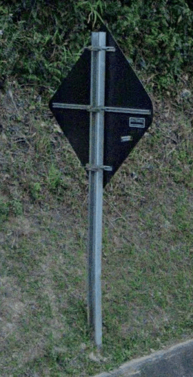
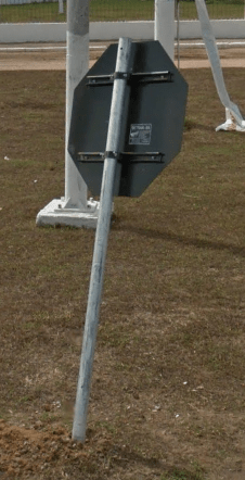
The road sign poles can be black, white, brown or metallic:



Road Numbering System:
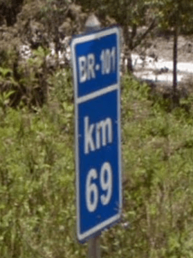
In addition to the state roads discussed above, there are also national roads, which have a prefix BR-###. These seemingly don’t follow any road numbering patterns for grouping the numbers together, but do follow some other patterns (see below). They can easily be found when zoomed out on the map, in contrast to the state roads for which you need to zoom in a lot. The most notable of these national roads must be the BR-101 which follows the east coast of the country in its full length from north to south.
More info about the Brazilian road numbering system (written by ed):
Radial Roads – Start with 0 These are the roads that leave Brasilia, in any direction. The lower numbers like BR-010 go North towards Pará and after that the numbers increase as you go clock wise. E.g. BR-020 for Fortaleza, BR-040 to Rio, BR-070 to Mato Grosso. If they are a state road they go from the state capital, like SP-021 (not many states use this method).
Longitudinal Roads – Start with 1. These go South to North, as the famous BR-116, BR-101, BR-153, etc.
Transversal Roads – Start with 2. These go East to West. Like BR-290 or SP-230.
Diagonal Roads – Start with 3. If they end with an even number they go Southeast-Northwest. If they end in an odd number they go Southwest-Northeast.
Connection Roads. Start with 4. Those roads are mainly used to connect two other roads and are not so common. There will probably be a national or state road junction not so far from your starting point.
Other stuff I noticed myself driving in Brazil: – Road names can often end at one point and have it start again hundreds of km from there. This is usually because the construction didn’t go as the initial planning. – Often signs and even google maps may display the road informal name and not their code. Bellow I made a list of the ones I know and see it often:
Transbrasiliana – BR 153 Regis Bittencourt, Dutra – BR 116 Translitoranea, Mario Covas, Rio-Santos, Litoral-Sul – BR 101 Fernão Dias – BR 381/SP 010
For any other info: Brazil Road Numbering System
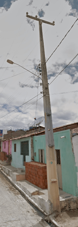
Electricity poles:
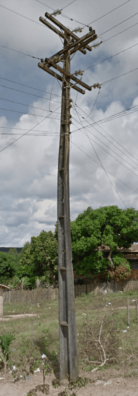
Common Brazilian electricity poles have these slim indentations or steps, and sometimes can even have circular holes inside them:

License plates:
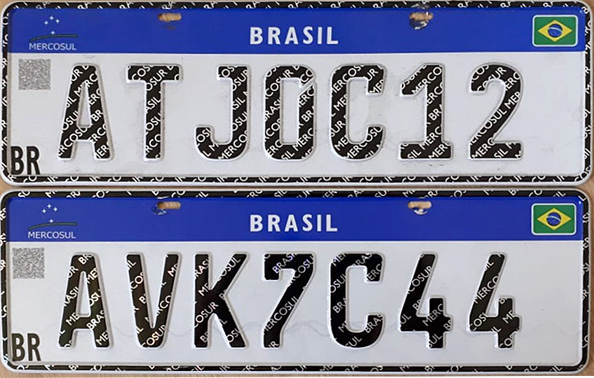
Brazil has a light grey plate that appears white when blurred:


However, from 2019 on, they changed the design to include this blue bar on the top (the Mercosul plate):
The service vehicle plates (buses, taxis, etc) in Brazil are red:

Phone Numbers:

It is super useful to learn phone numbers in Brazil. Each region has their own area code, and its very easy to find across the country. Even learning the general region of the numbers can change a score from 1000 to 4500+.
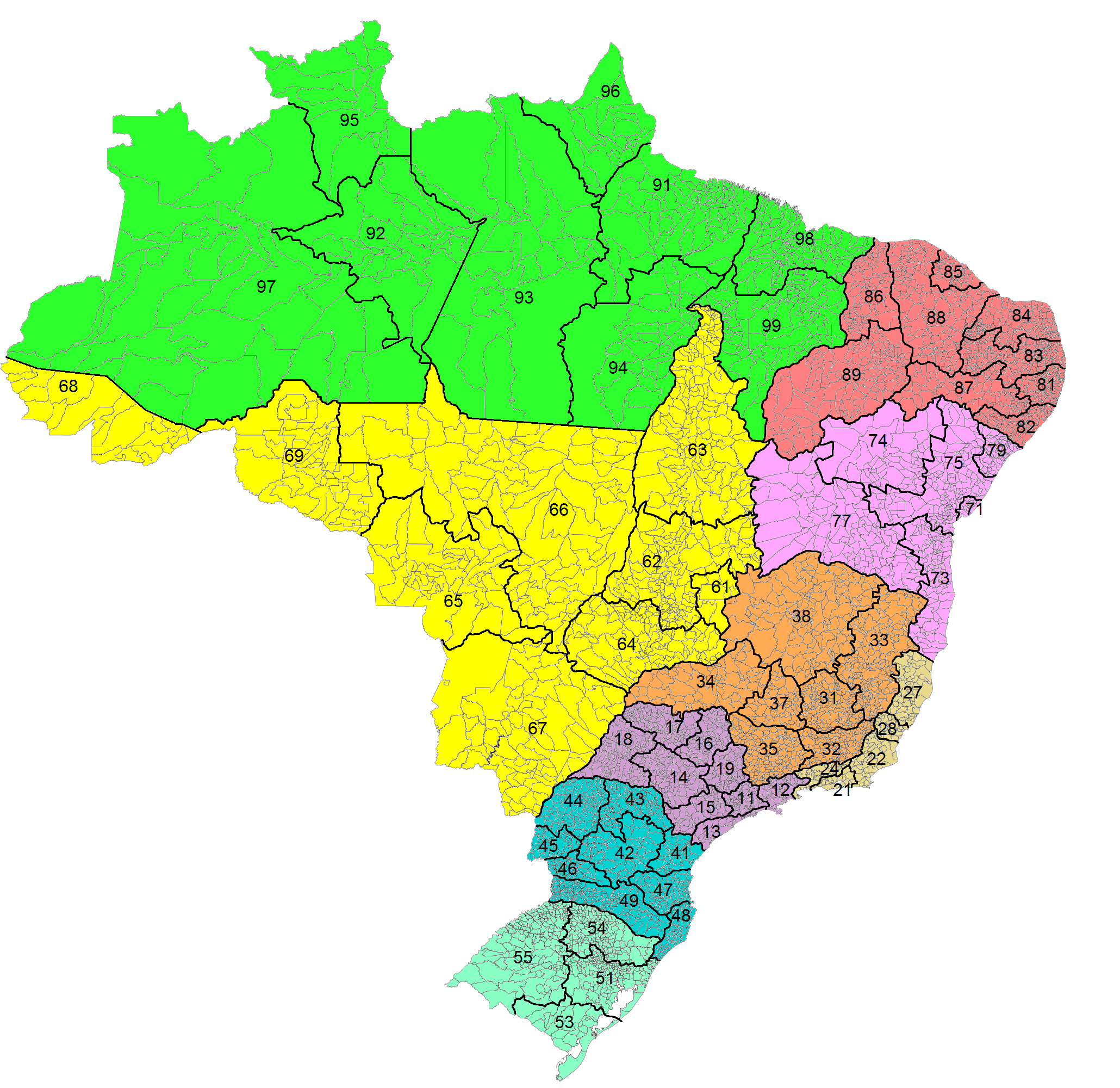
When you do find a number, the (xx) will be the region assigned to the map. In Brazil, Mobile numbers start with any 90 number (91, 92, 93 etc.) and are 9 numbers long. All land lines will be 8 numbers long. That one number can be the difference between guessing the correct area or using a mobile number.
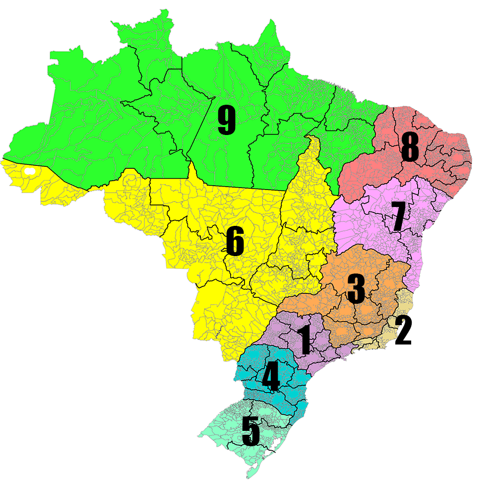
Its also important to notice that the second number in the first two is important. If it ends with a 1, it is the largest city in that state/region. If its a 2, its the second largest. 11 would be Sao Paulo as an example.
Vegetation/Landscape:
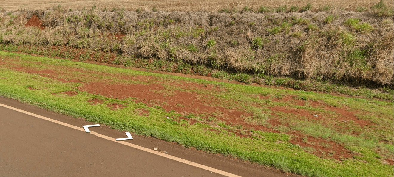
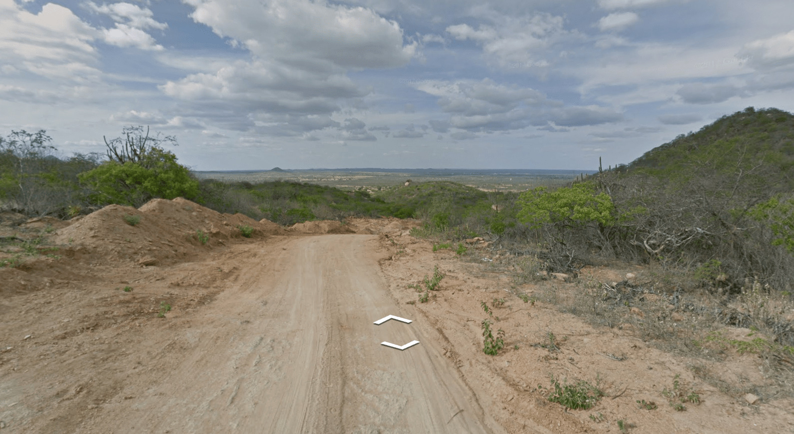
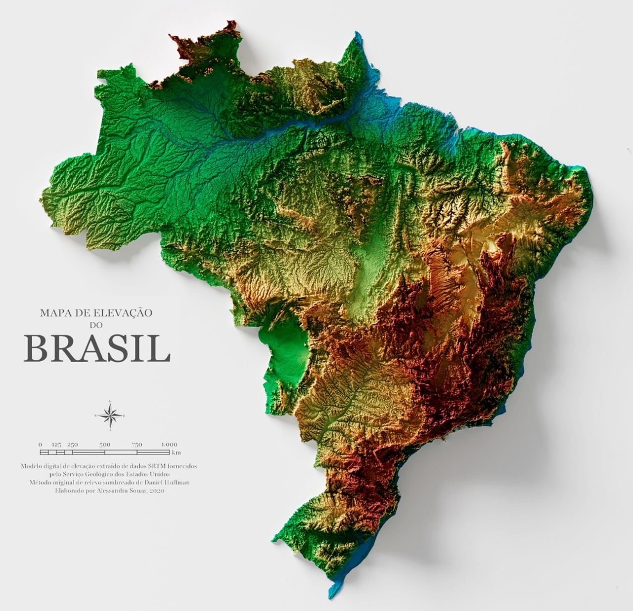
Brazil is very easy to recognize due to their reddish-orange soil.
The northeastern part of Brazil can be very dry and have a very light orange soil:


Specific Plants:
The Paraná pine is a very distinctive-looking tree which grows mostly in the Brazilian states of Paraná and Santa Catarina, but can also be found in Rio Grande do Sul and São Paulo, and thus is very useful for pinpointing your location within the country:


The Brazilian state of Espírito Santo and the neighboring mountainous regions can have a lot of these trees planted by the side of the road as artificial forests:
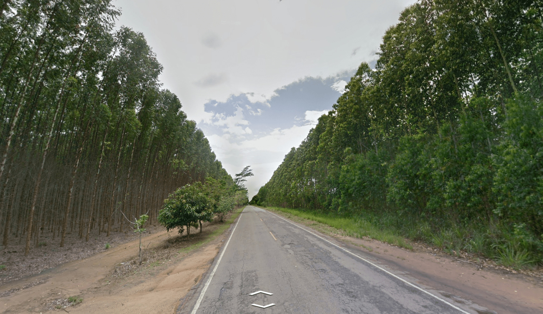
These forests can be found in other parts of Brazil too.
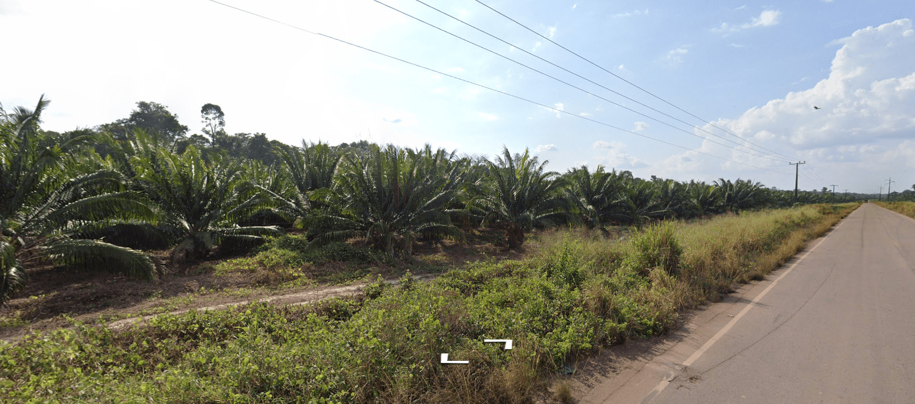
The area around Belém features oil palm plantations:
Regional Plants
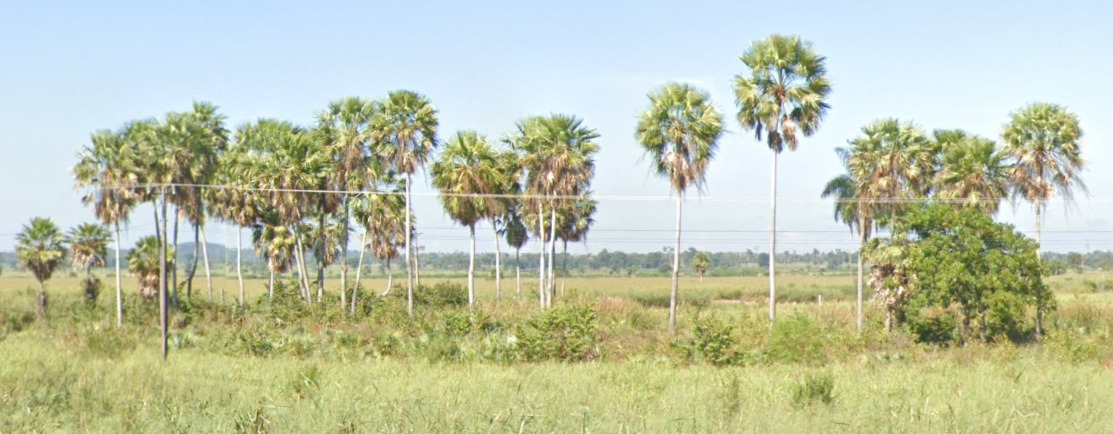
These palms are known as Caranday Palms. They are found mostly near the Paraguay border in the Mato Grosso Do Sul region. (as well as Argentina).
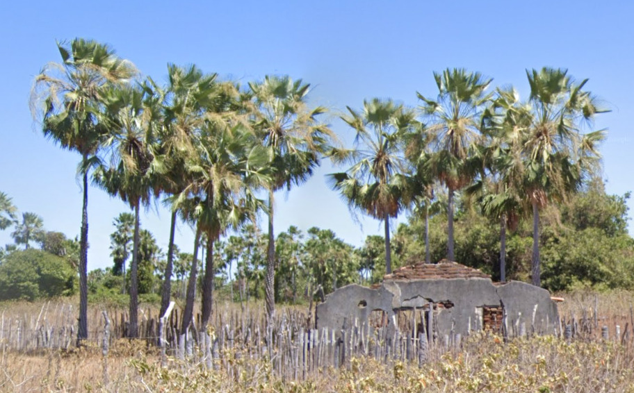
These palms, while they may look similar to the Caranday Palms, are called Carnauba Palms. They can be found in Ceara, Piaui and Rio Grande do Norte. The landscape should help you differentiate between the two types.

These are called Babassu Palms. They can be found throughout the country, however if you find large forests of them, aim for Maranhao.
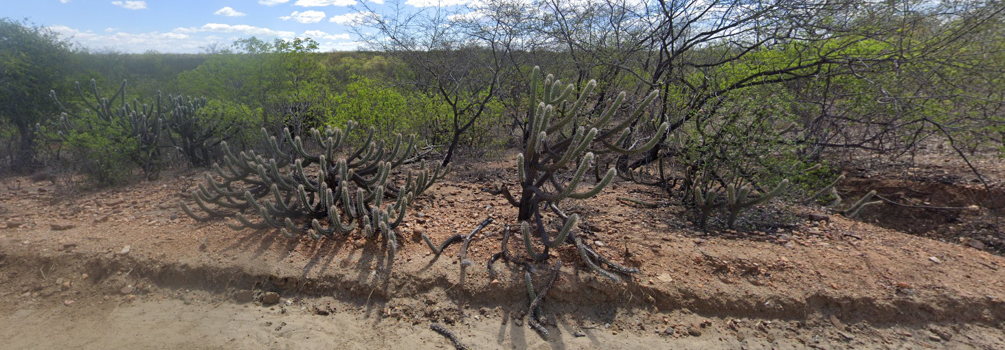
These low lying cacti are called Xiquexique and can be found in the northeast region of Brazil.


Sugar cane can be found in multiple places. If there is a whiteish soil with coconut palms, aim for the northeast coast between Sergipe and Pernambuco. If you find the typical red soil, saim for the central area around the Parana river. Aim for the Sao Paulo, Minas Gerais, Goias, Mato Grosso Do Sul and Parana.

Coffee Plantations are common in Minas Gerais and Espirito Santo.
Architecture:
Architecture in Brazil can most basically be split into three areas. The northeast, south, and west. Understand that this is a broad overview and sometimes you may find these types of architecture in the other regions of the country too.
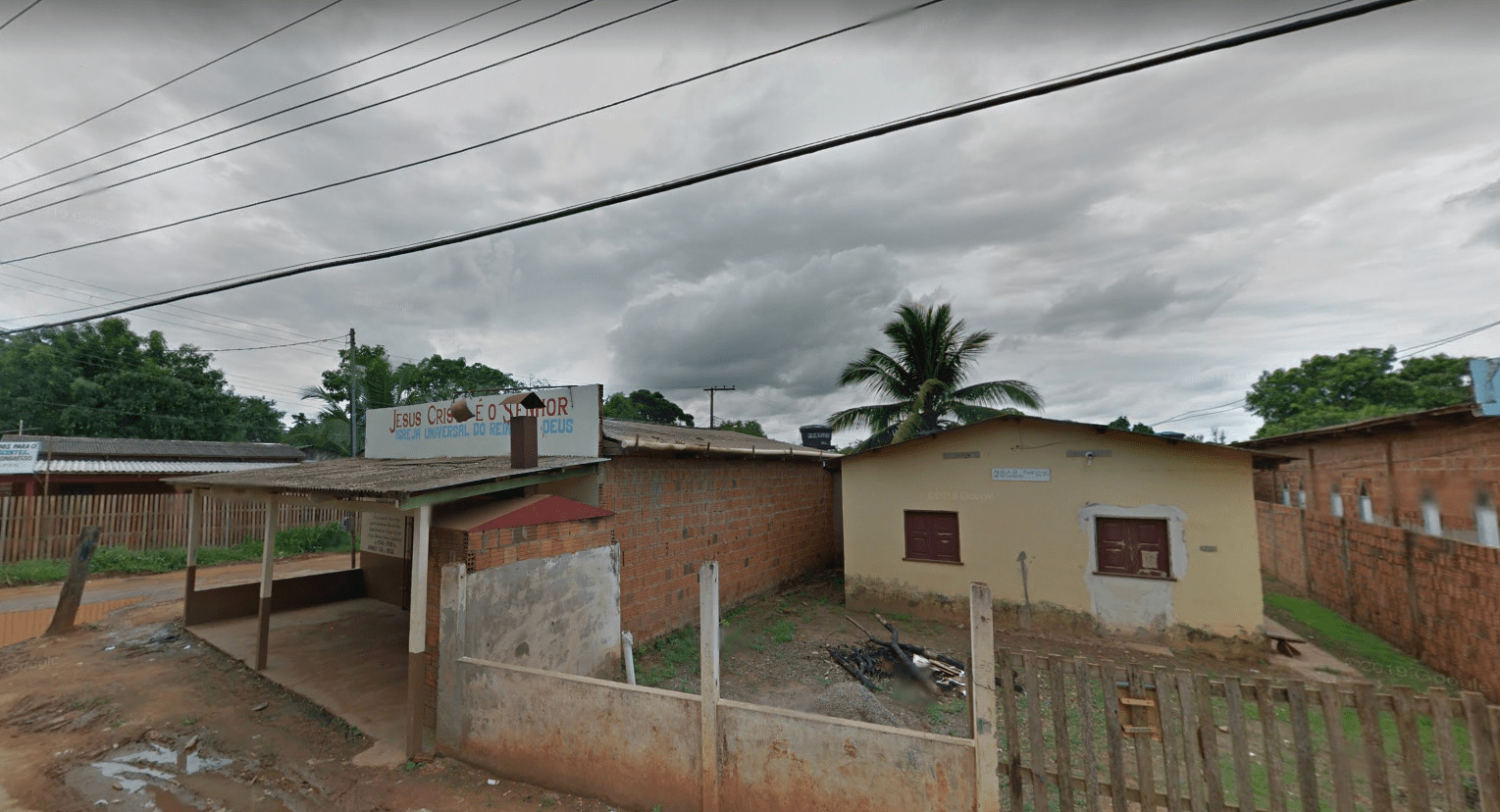
Western Brazil
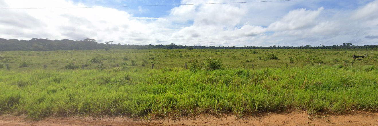
Here, a lot of the houses are made out of wood, and can sometimes be raised on stilts. Many of the roofs are metal sheets. There are also a lot red brick houses and some pastel colored houses.
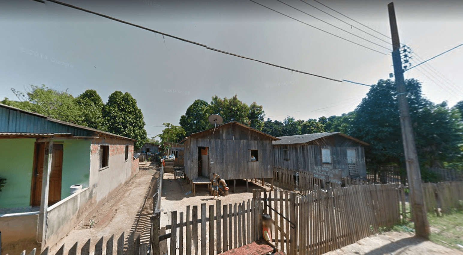
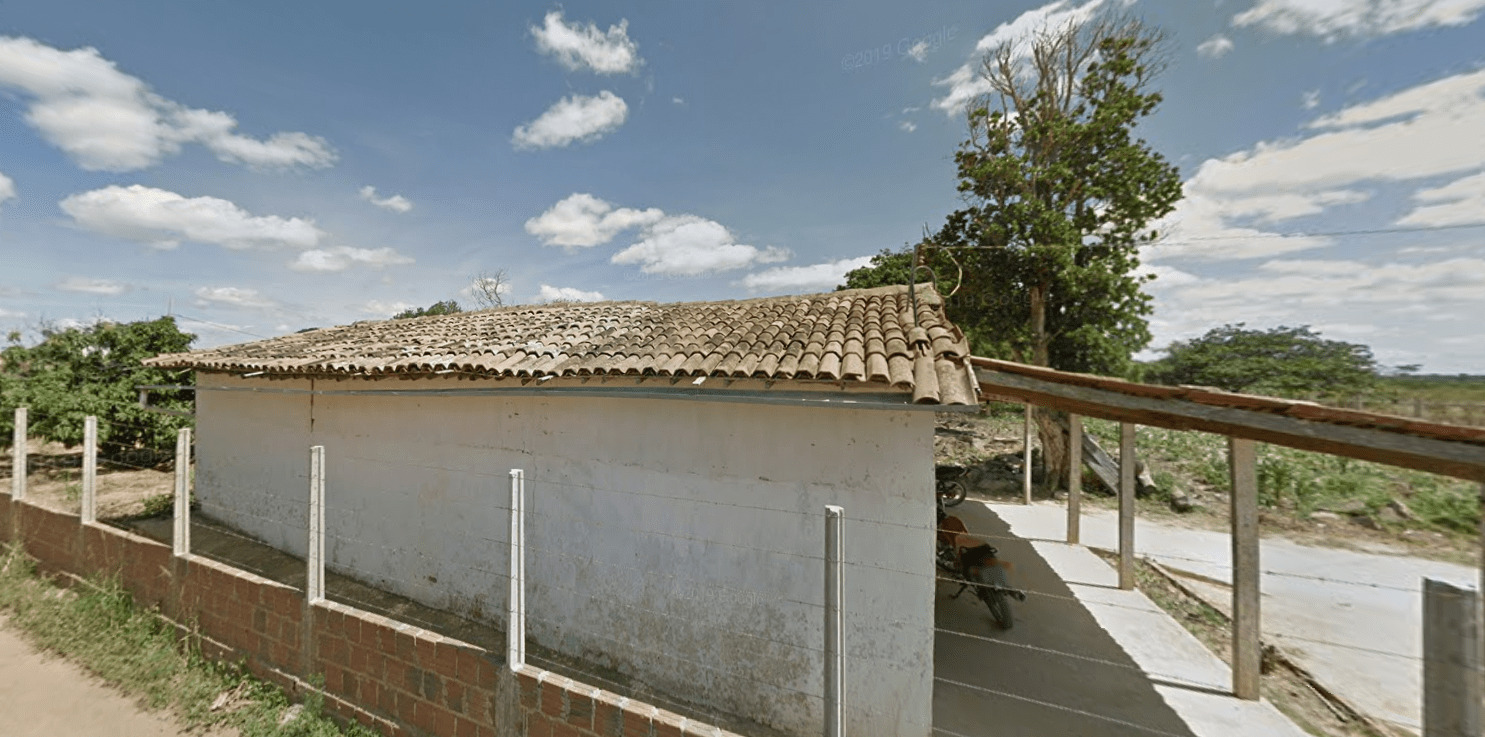
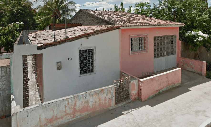
Northeast Brazil
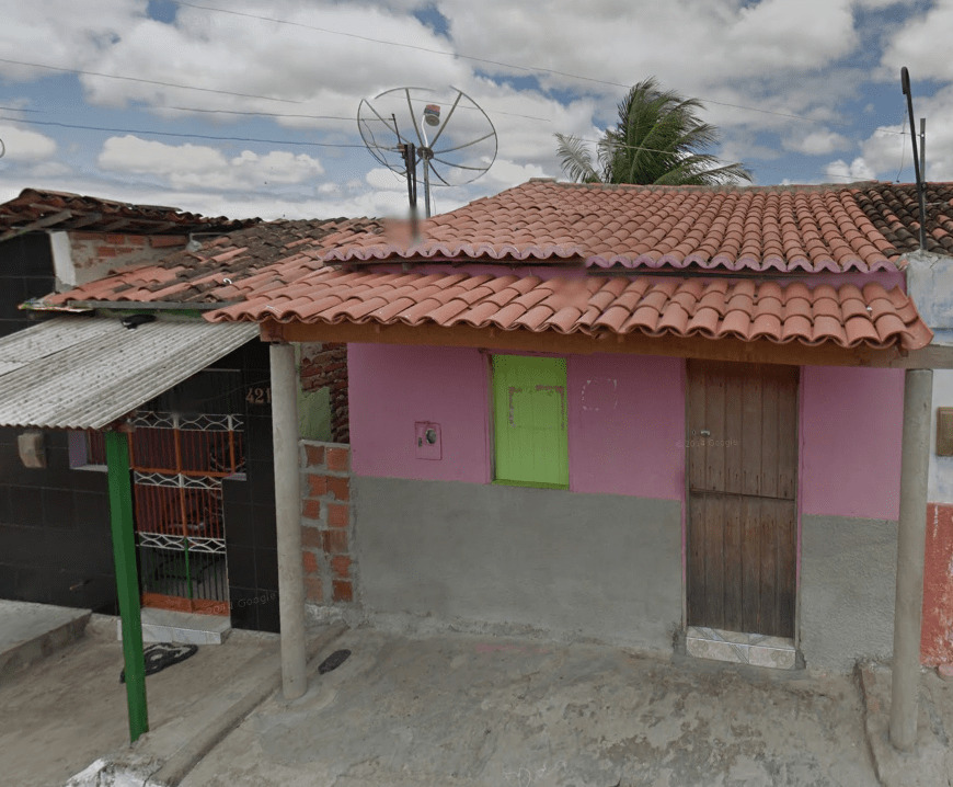
Houses typical of this area have white walls and orange/red tiled roofs which are often of a lower quality. There are some pastel colored houses with poor quality roofs as well, and occasionally some red brick buildings.
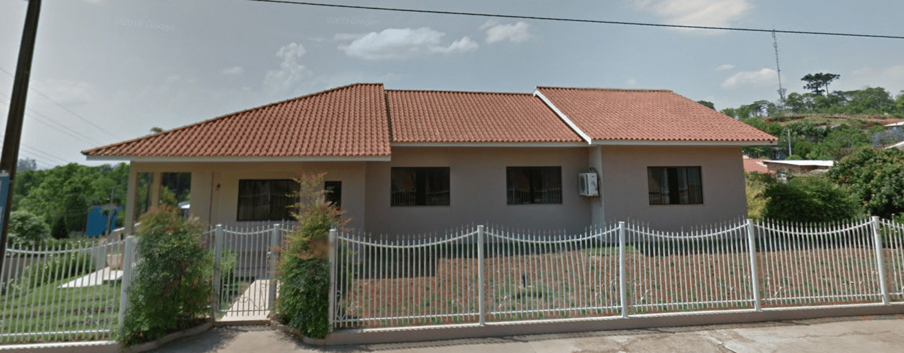
Southern Brazil
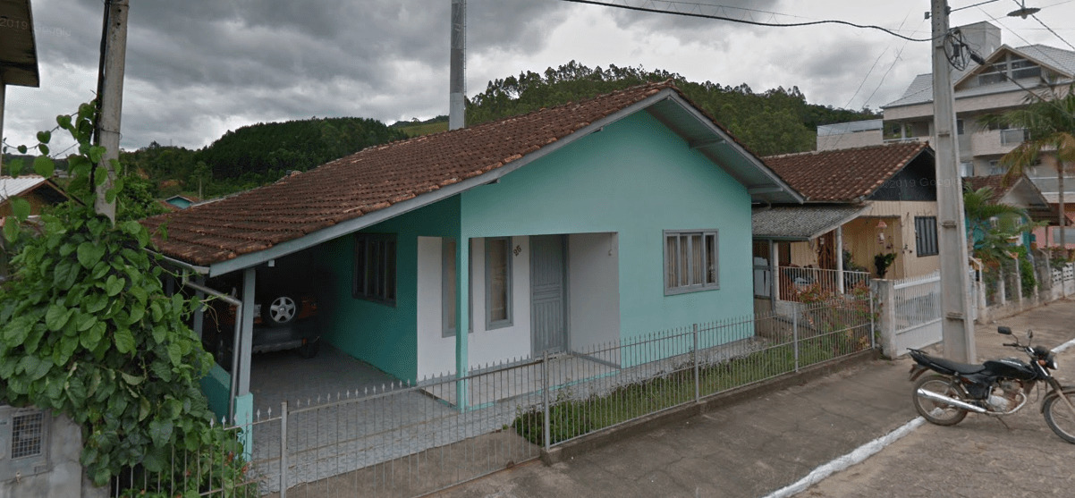
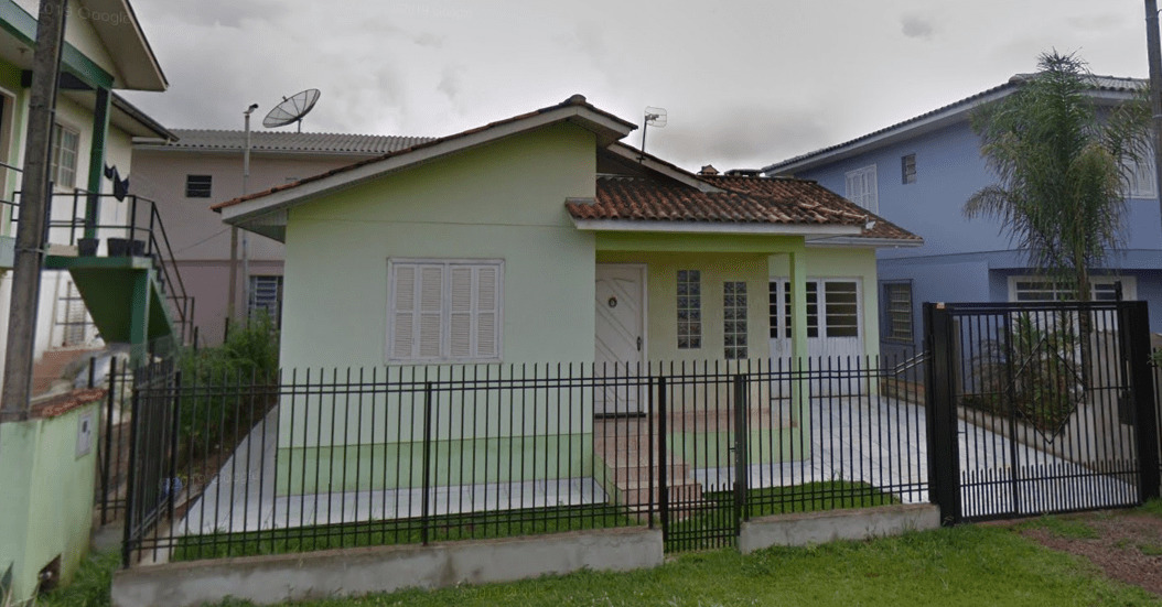
Southern Brazil has two main house styles. The first style is white or pastel concrete walls with red or cream colored tiled roofs of a higher quality/well-kept. These are common especially in the region between Sao Paulo state and Rio Grande do Sul state. The second style has solid colored concrete walls (usually blue or green) with dark brown tiled roofs.
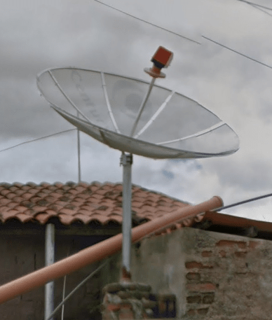
The common TV satellite dishes in Brazil are transparent, which can happen in Indonesia and Malaysia too:

General look:

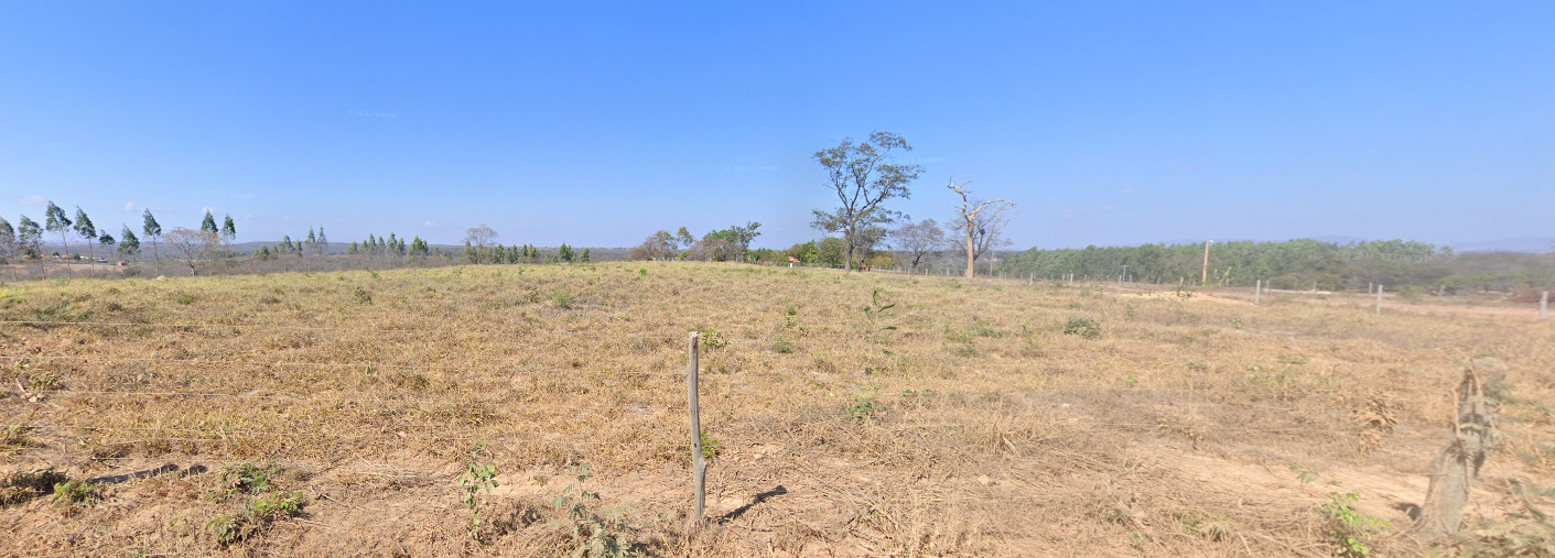
Alphabet/Script:
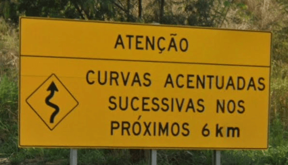
Brazil is the only country in South America that speaks Portuguese.

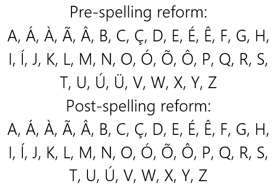
The best tips for distinguishing Portuguese from Spanish are that words in Portuguese often end in “ão”, the consonant pairs “lh” and “nh” which are “ll” and “ñ” in Spanish, and the vowels with a wave or “roof” above them – ã, õ, â, ê, ô and the consonant ç, none of which appear in Spanish.
Subdivisions:
Brazil is composed of 26 states and the federal district of Brasília:
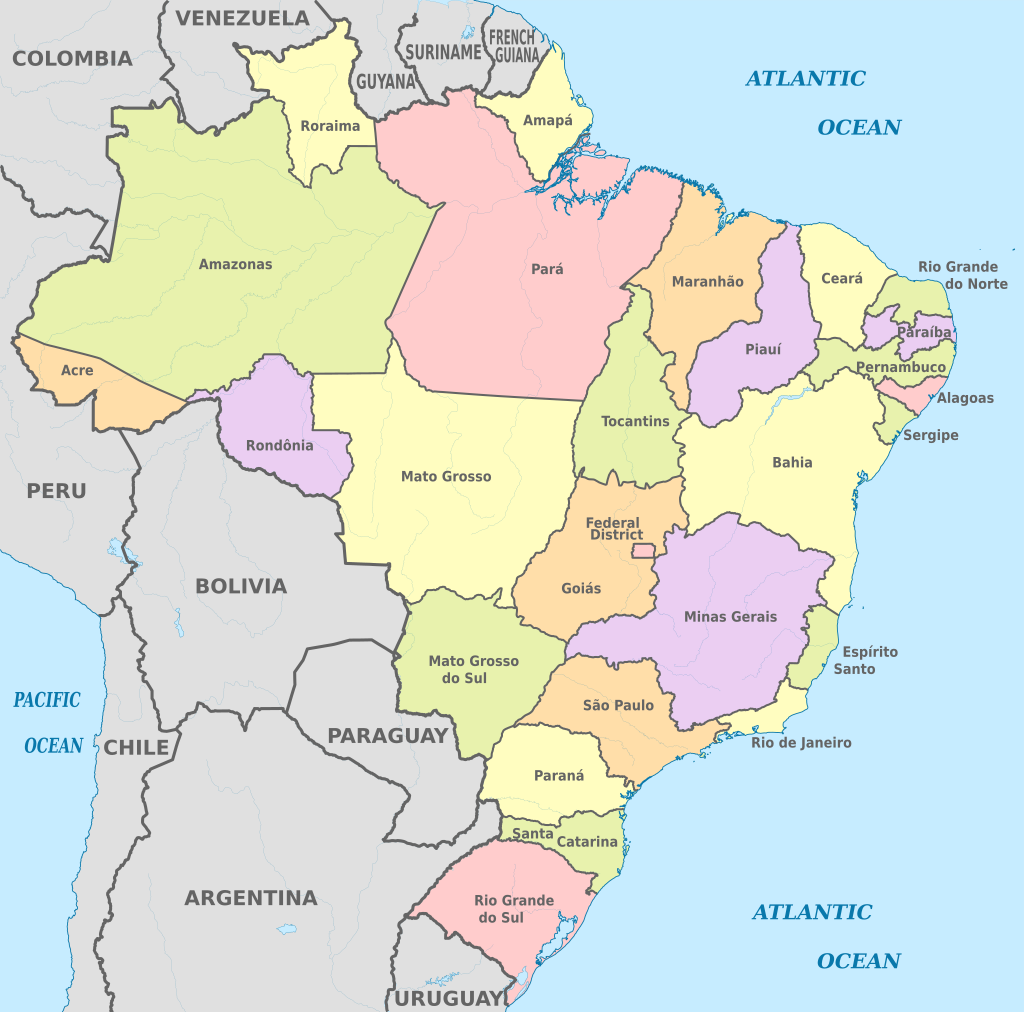
The state abbreviations appear when zoomed out on the map:

These appear on state highway signs, as well as on various other signs and billboards.
State flags can appear sometimes, but aren’t as useful as the other stuff listed here:

Internet domain:
.br
Argentina
- Country Flag
- Capital City
- Largest Cities
- Google Car
- Bollard
- Google Coverage
- Camera Generation
- Road Lines
- Road Signs
- Electricity Poles
- License Plates
- Phone Numbers
- Vegetation/Landscape
- Topography
- Climate
- Specific Plants
- Architecture
- Domain
Country Flag:

Capital City:
Buenos Aires
Largest Cities:
1. Buenos Aires – 13,588,171
2. Cordoba – 1,454,645
3. Rosario – 1,236,089
4. Mendoza – 937,154
5. La Plata – 794,327
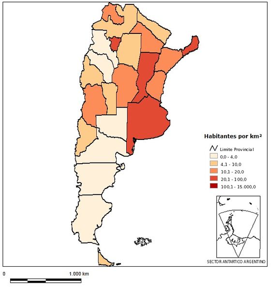
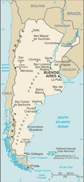
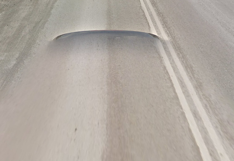
Google car:
Entire country is covered by black car:
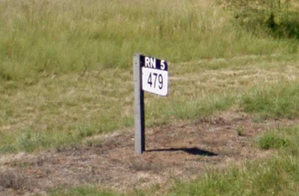
Bollard:
There are no specific bollards in Argentina, but national highways have identifiable kilometer markers:
Or you might see this one on Provincial Roads (RP = Ruta Provincial):
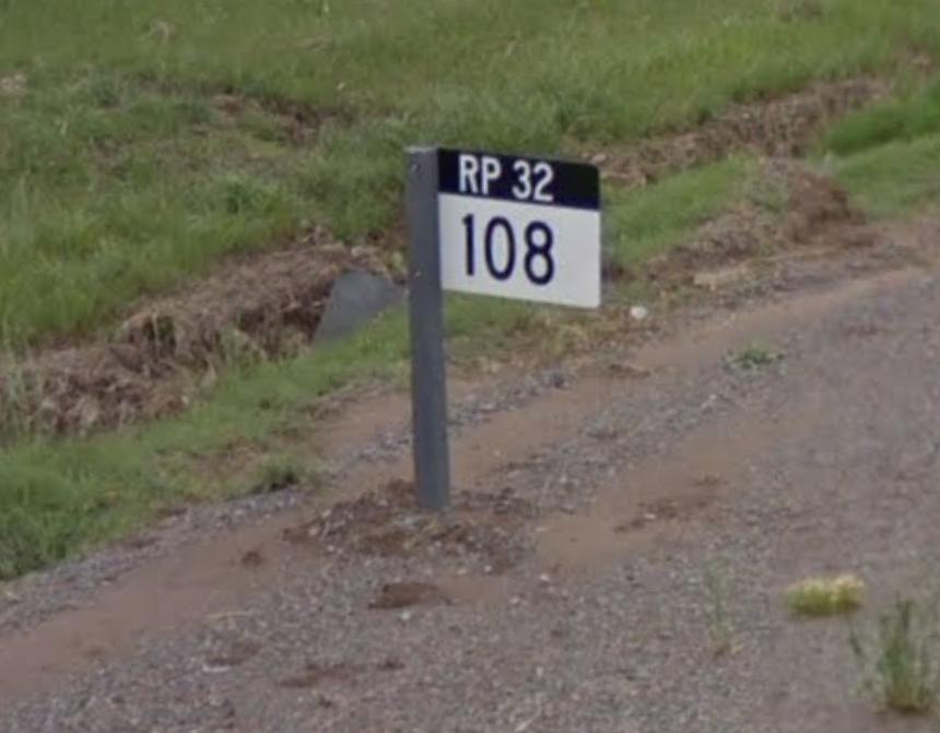
On the map RN = White symbol | RP = Green symbol
Google Coverage:
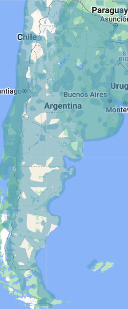
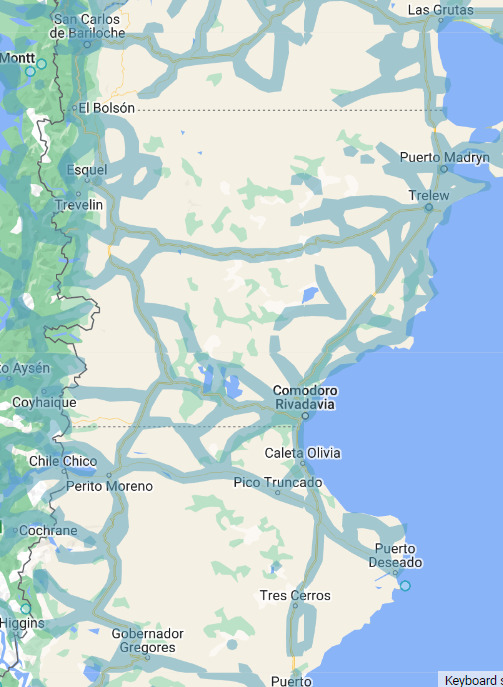
The vast majority of Argentina’s roads are covered, but you should still take note of the gaps in the northwest, the center and the middle of the south. If you’re guessing somewhere in the southern half of the country, it’s safest to guess closer to the border or coast.
Camera Generation:
Gen 3 & 4
Road Lines:
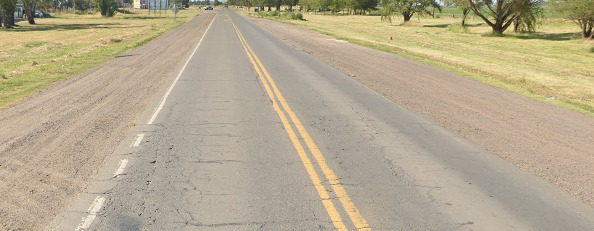
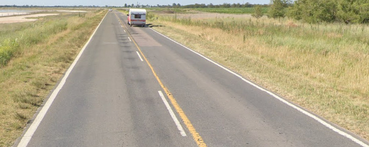
- Double yellow solid lines are used where neither side can overtake.
- One single yellow solid line together with white dashed lines are used when one side can overtake, while the other side is not allowed.

- White dashes only are used when both sides can overtake.
Road Signs:
Specific to Argentina are the street signs that you find in different cities. Those can be black, blue and green:
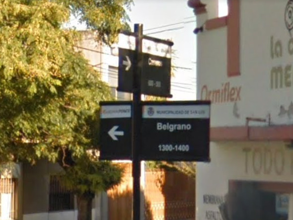
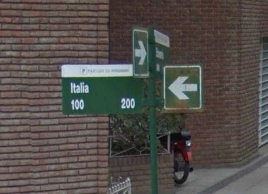
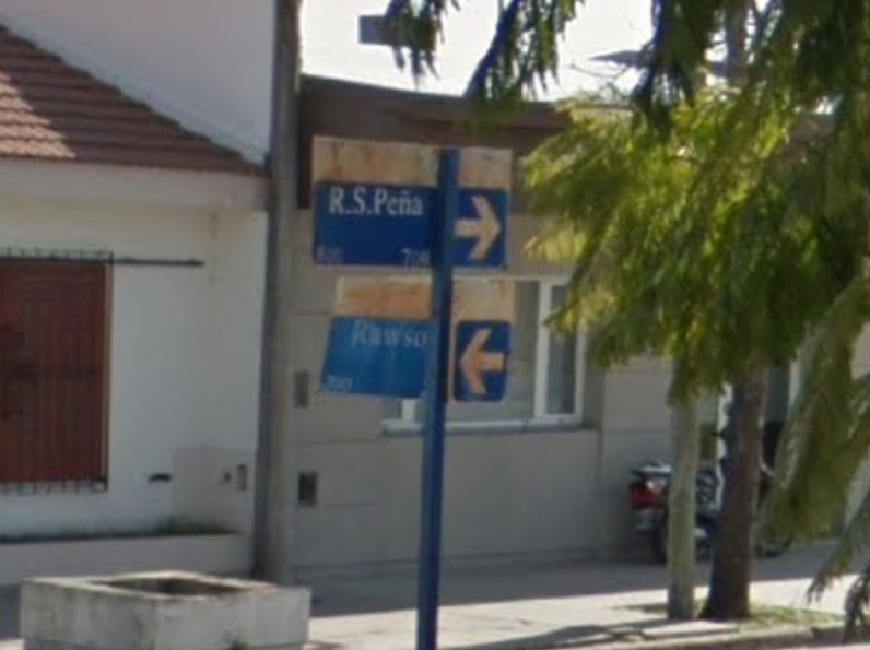
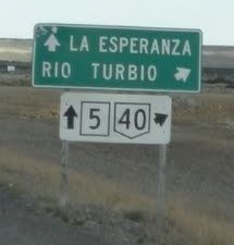
National routes will be in the five pointed pentagon, the provincial routes in the squares / rectangles. RN numbers generally increase the further south you go after you hit #51.
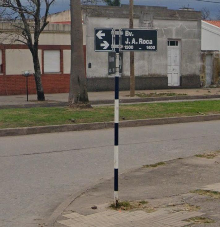
Do not confuse this type of street sign with Peru because of the black-white pattern:
Electricity poles:
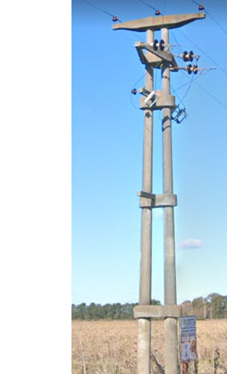
The typical Argentinian pole is made of concrete and split into two, forming an ‘A’ shape with horizontal segments connecting the two sides.
License plates:
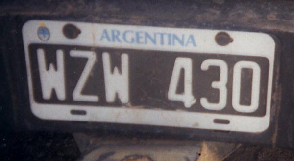
Since 1995+ Argentina has white on black license plates with 3 letters followed by 3 digits:
Phone number:
Mobile Numbers in Argentina start with 15, followed by 6, 7 or 8 digits:
Vegetation/Landscape:
Argentina has a lot of variation in landscape and vegetation due to its size. Here are some of the regions and their general looks.
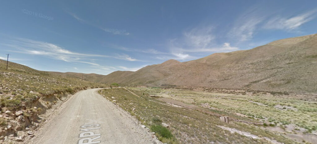
Beginning in the far northwest, specifically in Jujuy and Salta provinces, the landscape is very similar to that of Bolivia and Peru. Vegetation consists mostly of small shrubs and grasses, and the region is very rocky and mountainous.
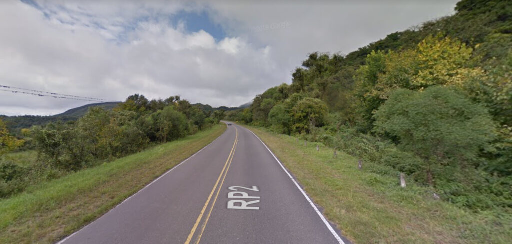
Argentina has a very drastic rain shadow effect. While the western halves of Jujuy and Salta provinces are very dry, the eastern halves, along with Tucuman province, are very green and lush. Depending on the altitude, the vegetation can range from tropical to temperate. This area is still very hilly and with lots of green valleys.
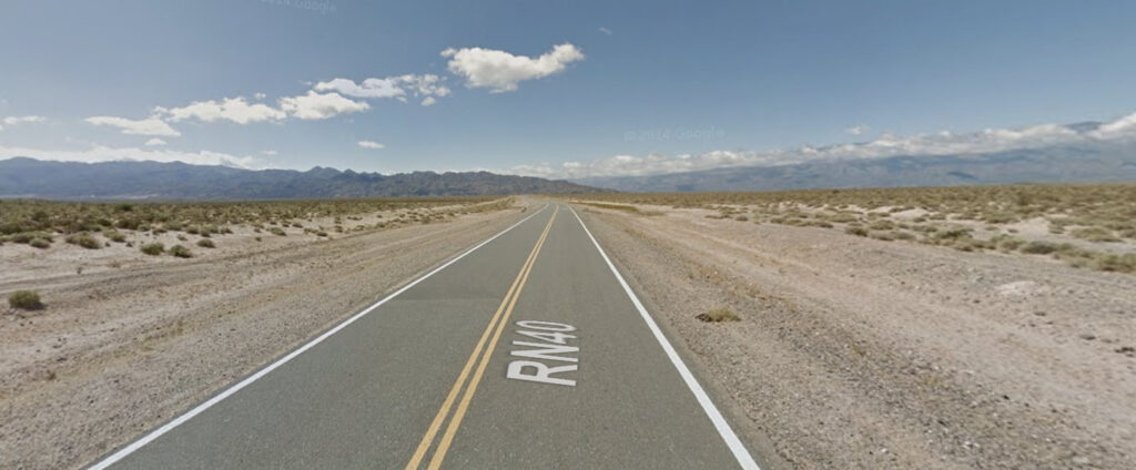
As you head south into Catamarca, La Rioja, and San Juan provinces, the climate becomes extremely arid. This area is characterized by massive mountain ridges that have no vegetation at all. The flat areas between ridges are very sandy and only have small shrubs.
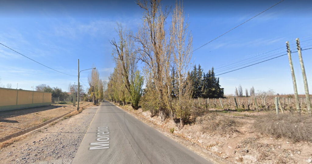
To the south in Mendoza province, the climate ranges from arid to Mediterranean. The area around the city of Mendoza is particularly pleasant – it is an area with lots of vineyards and farms. Poplar trees line the farm roads and big mountains can sometimes be seen in the far distance to the west. Google covered a lot of the rural farm roads around Mendoza recently, taking this coverage during the southern winter with gen 4 camera.
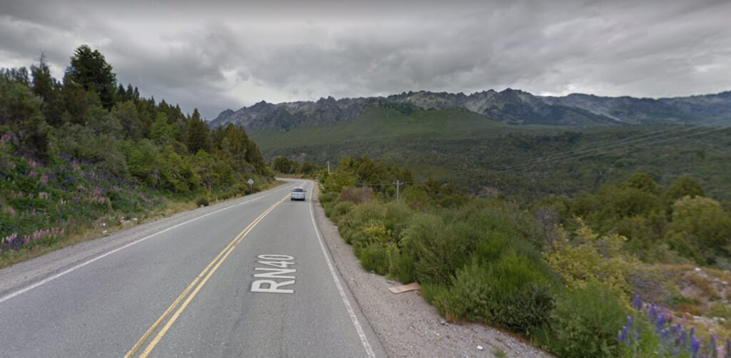
Finally, in the far west of Neuquén and Rio Negro provinces are the temperate forests and rising peaks of the Andes. This area has a lot of lakes and some alpine resort towns such as San Carlos de Bariloche and San Martin de los Andes.
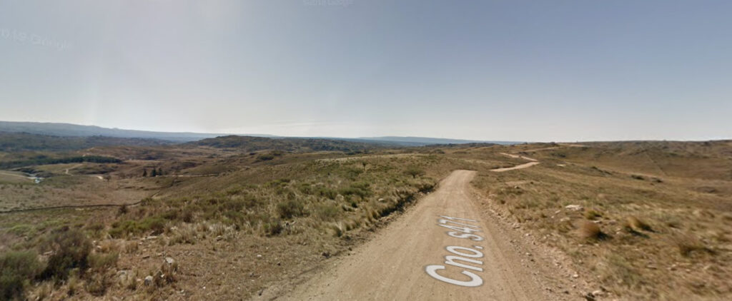
The provinces of San Luis and Cordoba contain another chain of mountains called the Sierras de Córdoba. This chain can be very closely compared to the Appalachians in North America – they are a much older range that has eroded over time, leaving less prominent and rugged mountains. Vegetation ranges from temperate forests in the foothills of the mountains, to sparse vegetation at higher altitudes.
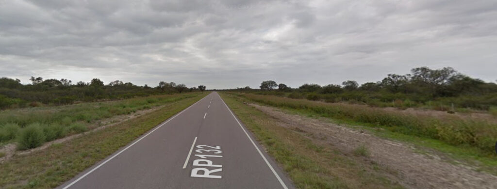
Santiago del Estero province marks the start of the “Grand Chaco,” a landscape region spanning eastern Bolivia, Paraguay, and northern Argentina, which is comprised of extremely flat scrub. The climate is both dry and tropical, but generally, the west is drier, similar to a Savanna, while the east (in Chaco and Formosa provinces) is very wet.
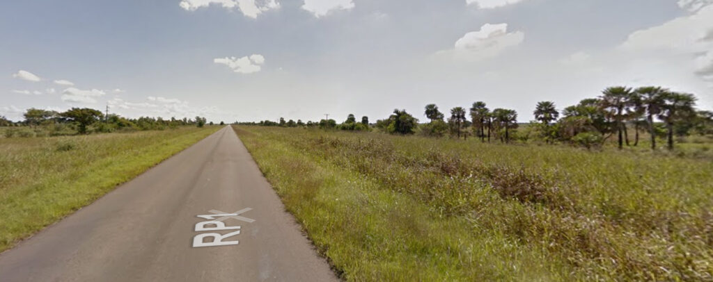
Here is the Grand Chaco of the Formosa and Chaco provinces, mentioned before. Here, a lot of the landscape is marshy, while the vegetation is tropical, including many natural palm trees.
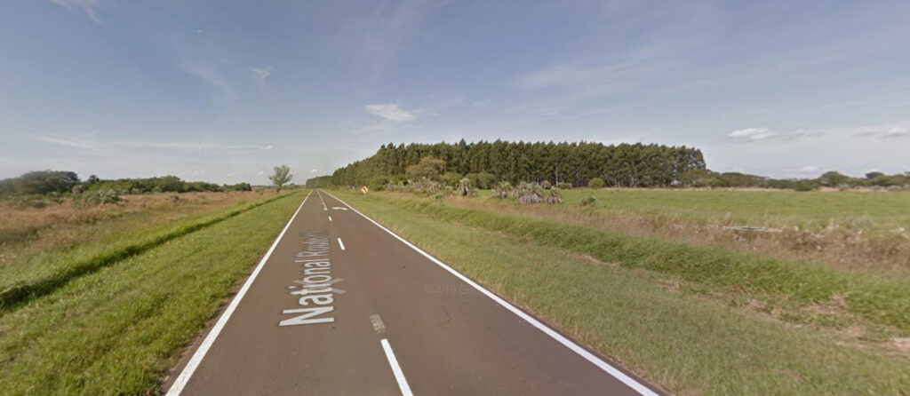
Corrientes province in the northeast is also extremely flat, sometimes marshy and sometimes grassland. The only clue to watch out for in this region is the large amount of planted pine or eucalyptus forests.
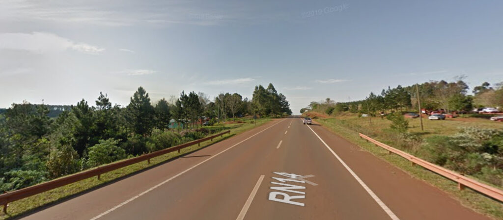
In the far northeast panhandle lies Misiones Province, a very unique and distinguishable region of Argentina. The landscape is mostly rolling hills, and the soil is a very recognizable dark red color. Pine trees are prevalent here, including the noteworthy Parana Pine (See: Specific Plants) .
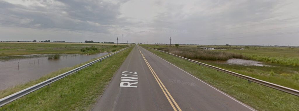
As the name implies, Entre Rios is a province between the Parana and Uruguay Rivers. As a result, this area is extremely flat and serves as a floodplain, since here is where the rivers’ deltas are. There is some grassland in this area and quite a bit of agriculture.
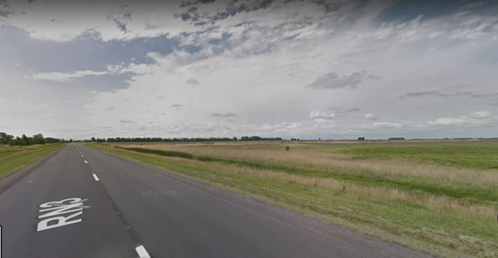
The Pampas is probably the region that most people think of when they think of Argentina. This area stretches the whole of Buenos Aires and Santa Fe provinces, and the eastern half of Cordoba and La Pampa provinces. It is flat and grassy as far as the eye can see, and is where the majority of Argentina’s farming and livestock occur.
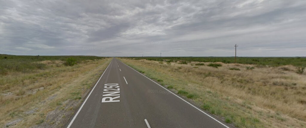
The transition zone between the Pampas and Patagonia is found in eastern Rio Negro province, as well as southern and western La Pampa province. Here, the primary vegetation changes from grasses to low shrubs and bushes, although grasses do still exist here.
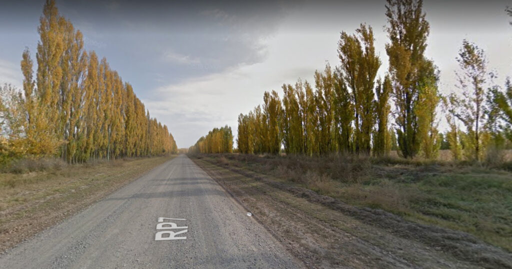
As in Mendoza province before, Google covered many of the rural roads in the Rio Negro Valley, near the towns of Villa Regina, General Roca, and Neuquén. Here, however, it was done in Gen 3 and the climate feels a bit colder, comparable to certain parts of southern Russia. Yellow poplar trees line the mostly gravel roads of this fertile valley.
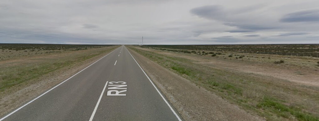
Continuing south into the coastal area of Patagonia, grasses are practically nonexistent, and only small shrubs remain. The coastal area is mostly flat except for near Comodoro Rivadavia, where rocky plateaus reach the ocean.
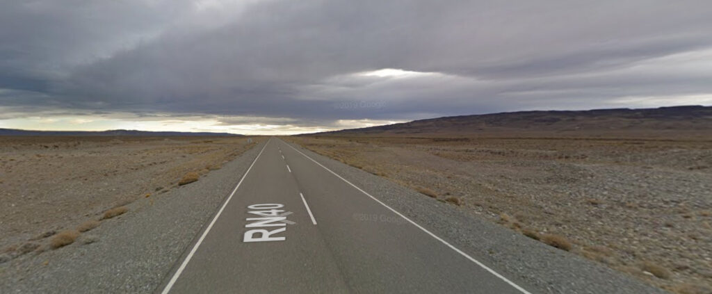
Inland in Patagonia, the landscape becomes a barren wasteland which looks as if it were an entirely different planet. Here, there are some ridges and plateaus, otherwise it is relatively flat until reaching the Andes near the border.
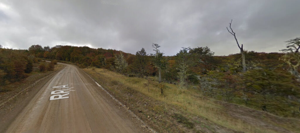
The furthest south province and its own island is Tierra del Fuego. Here the climate is very cold. Vegetation consists mostly of evergreens and dead-looking trees. The north of the island is flat, while the south is extremely mountainous.
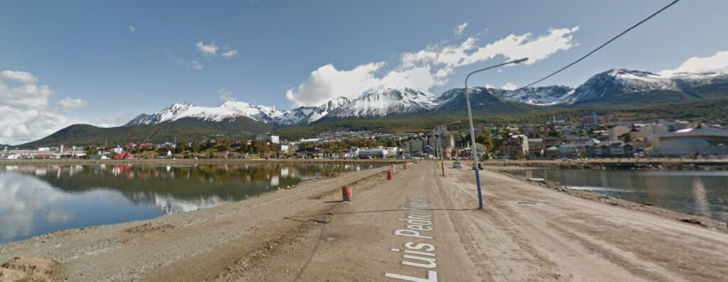
At the southern tip of Tierra del Fuego is Ushuaia, which in itself is recognizable in terms of landscape. Prominent snowcapped peaks with green foothills come straight down to the shores of the Beagle Channel, where the city lies on a slope.
Topography:
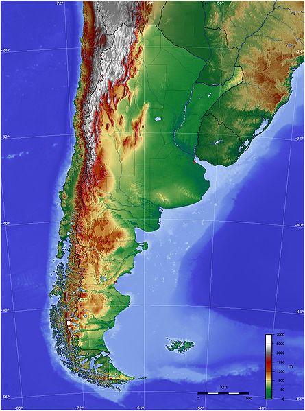
A general rule of thumb is as follows: Mountains are to the west, plains are to the east. The further north you go, the higher the mountains get.
Climate:
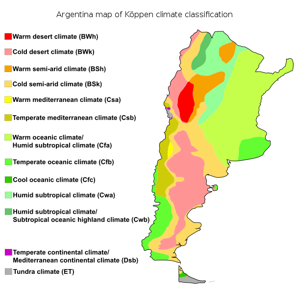
Generally, the further east you go, the wetter it gets.
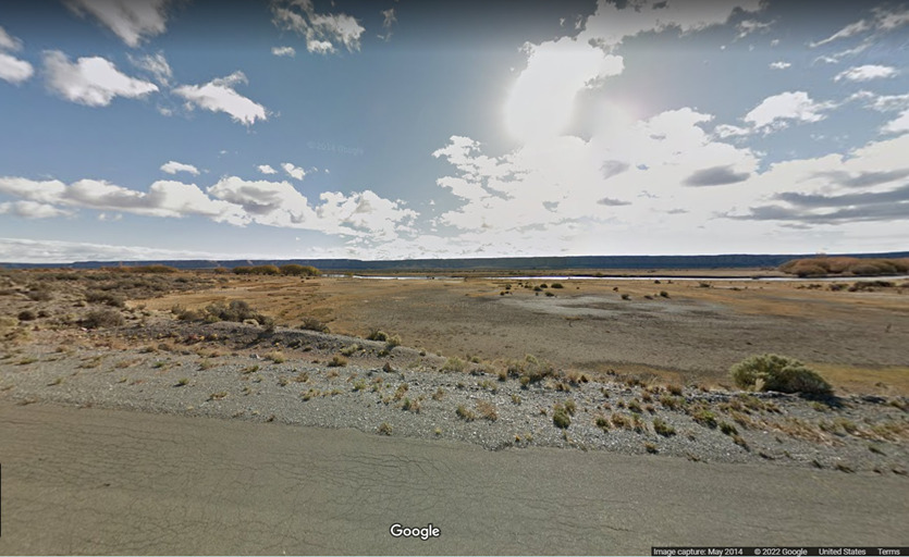
(Cold Desert)
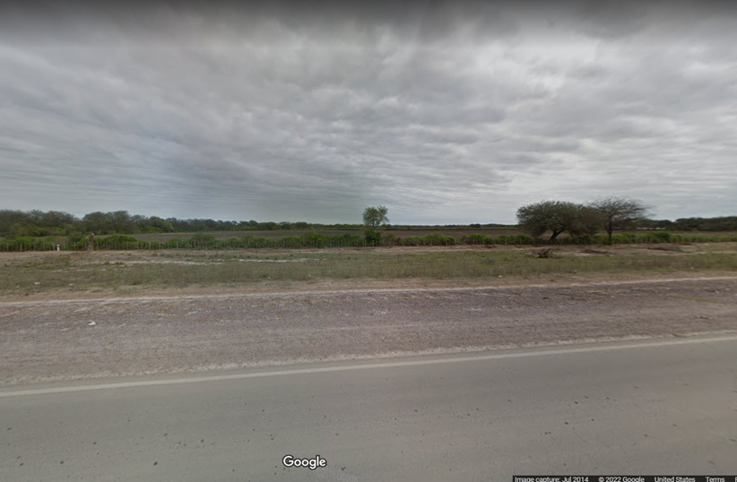
(Hot Steppe)
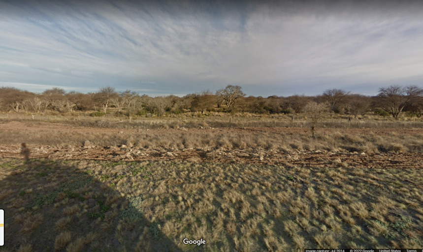
(Cold Steppe)
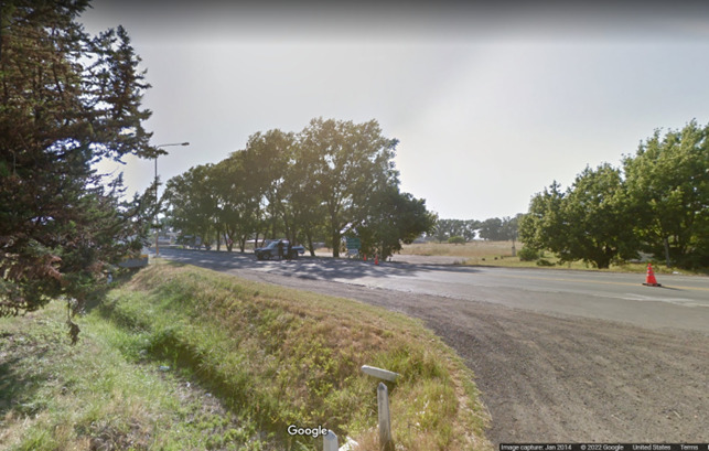
(Humid Subtropical)
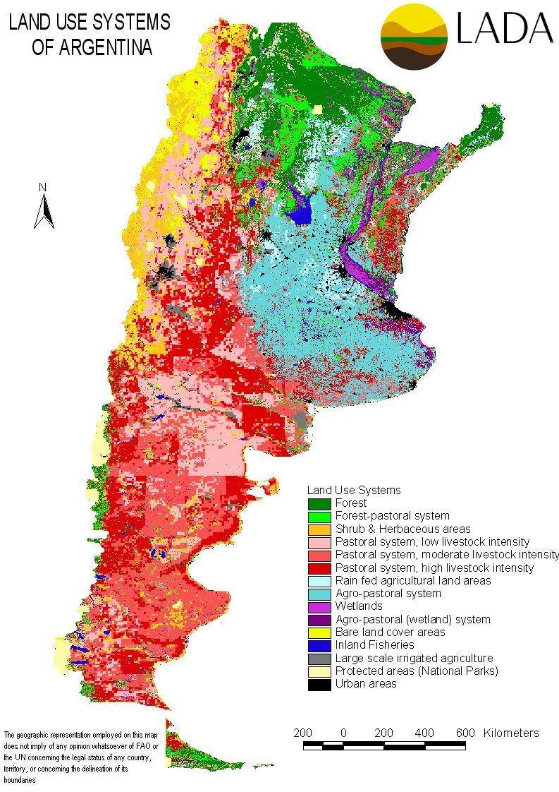
This map shows general land usage. Forests (in shades of green) are mainly found in the north. If you are placed near a pasture/grazing ground, you are probably in the center or south of the country (areas of red and pink). A field of crops is likely in the east (areas in light blue and gray). Black areas are small but important to keep in mind as they show urban areas. Notice how almost all of the black splotches are in the northern half of the country.
Specific Plants:
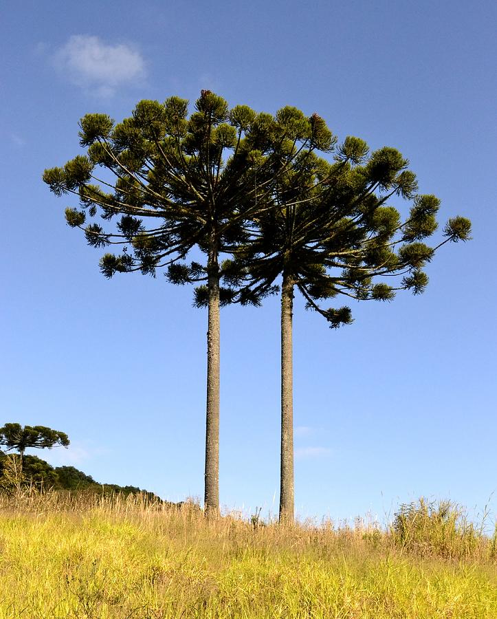
The Parana Pine is very recognizable for the shape of its branches that only extend at the very top of the tree, resembling an umbrella. This species is only found in the Misiones Province of Argentina, as well as across the border in southern Brazil.
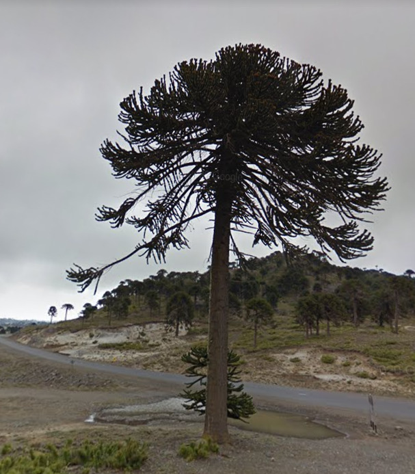
A close relative of the Parana plant is the Monkey Puzzle Tree (yes that’s its name…). However, this species is found in western Neuquen province, at relatively high altitudes in the Andes. These trees are also sometimes planted in town plazas in many countries in South America.
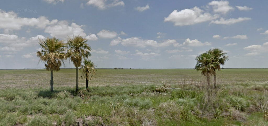
The palm trees found in the Grand Chaco region of northern Argentina are a type of Wax Palm (Copernicia alba).
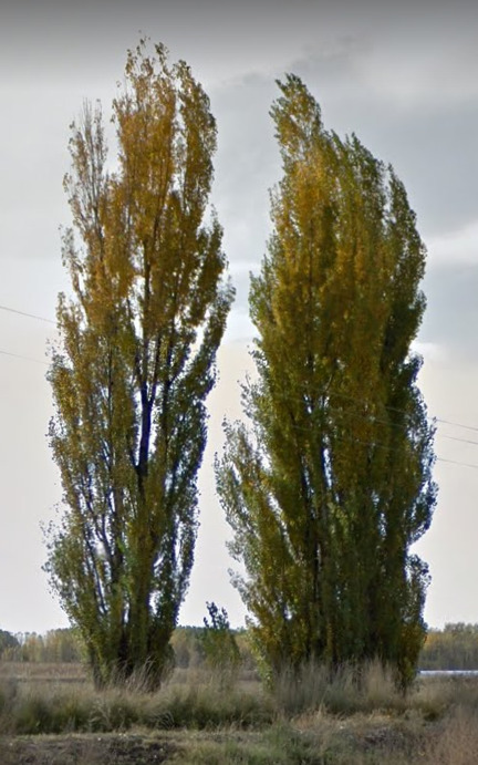
Poplar trees are recognizable for their slim and tall shape. They are found mostly in the Mendoza, La Pampa and Rio Negro provinces, and serve as planted trees which line the road for decoration and wind erosion protection.
Architecture:
Buildings in Argentina are generally rectangular in shape, made of stone or brick, with simple facades and minimal window decorations (except stonework on older buildings), and flat roofs.
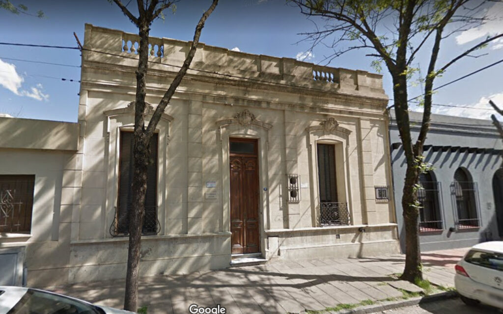
Above is a typical traditional Argentinian building. Here, the stonework around windows can be seen.
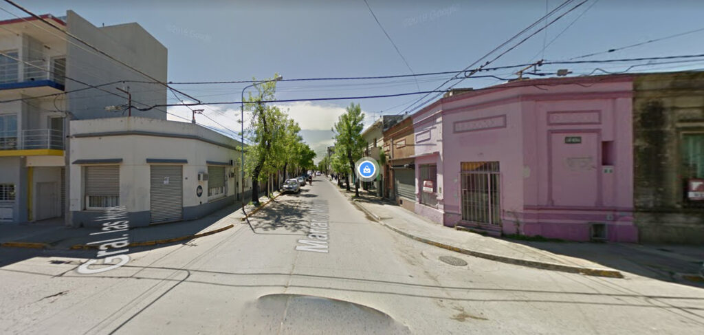
Almost every town in Argentina follows a grid pattern, so buildings at 4-way intersections have a “chipped corner.”
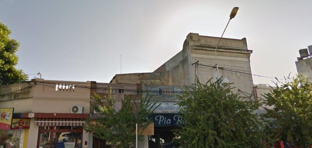
Since the majority of buildings have flat roofs, it is very common for them to have balconies. Other times, the façade is simply extended at the top to make the building seem appear taller (as can be seen on the building on the right).
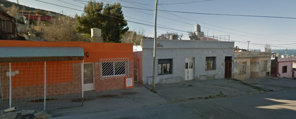
Poorer buildings such as the ones above follow the same general pattern, with a rectangular shape, simple facades and windows, and an extended façade at the top.
Variations:
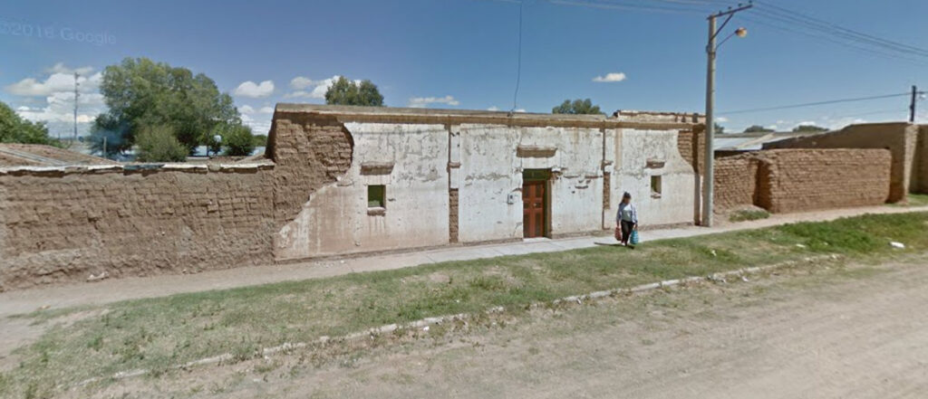
In the province of Jujuy, in the far northwest of Argentina, the use of adobe bricks (brown mud bricks) is common for buildings.
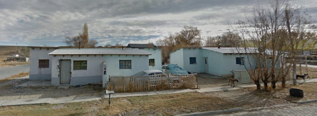
In the southern region of Patagonia, metal sheet roofs are used a lot.
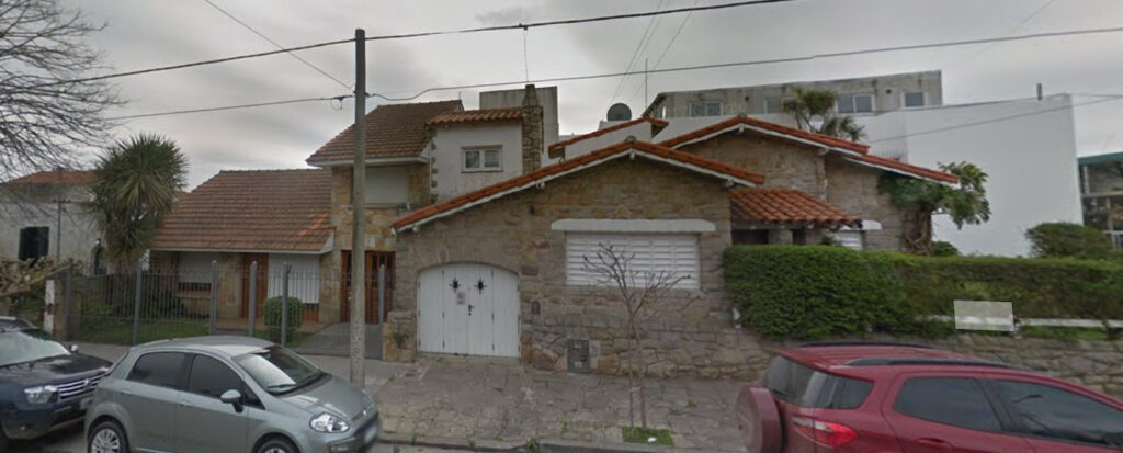
This specific type of house is called the Mar del Plata style, and is found mostly in the coastal areas of Buenos Aires province and Buenos Aires itself. It is characterized by tiled gable roofs and stone facades, and often incorporates dormers and chimneys.
Domain:
.ar
Peru
- Country Flag
- Capital City
- Most Helpful
- Google Car
- Bollard
- Google Coverage
- Rare Vehicles
- Road Lines
- Road Signs
- Electricity Poles
- License Plates
- Phone Numbers
- Commonly Found Things
- Vegetation/Landscape
- Specific Plants
- Architecture
- A Guide to Understanding Signs
- Language
- Domain
Country flag:

Capital City:
Lima
Most Helpful:
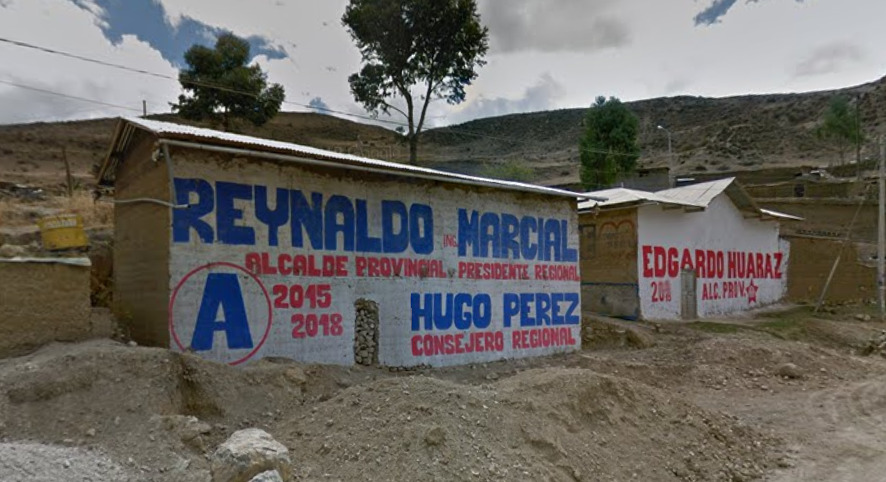
Political posters are extremely common in Peru, but not in the usual way other countries use them. In Peru, most political posters are painted on walls and buildings, with a white background and red or blue writing. These posters are rarely useful though. Most of them only say “Alcalde” which means mayor, and the name of the position and the candidate. In the example below, the province name, Huaraz, is actually mentioned.
Google car:
Gen 3 Peru is covered by both a white car and black car, neither have antenna. The black car is more common than the white car.
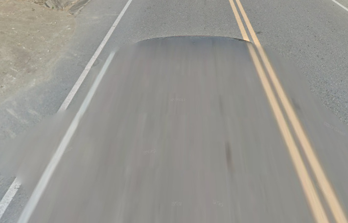
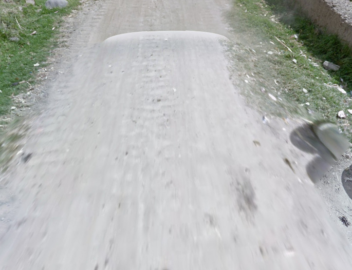

Gen 4 Peru is covered by a dark gray car. It sometimes will blend into the color of the pavement.
Bollard:
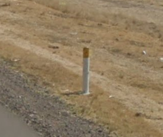
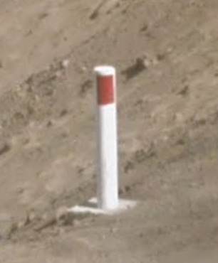
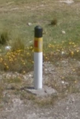
Peru has several different bollards which appear fairly often.
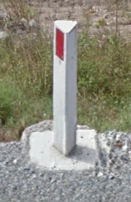
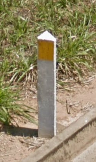
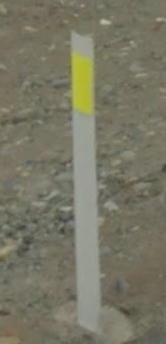
Camera Generation:
Gen 3 & 4 (with some Gen 2 Trekker)
Google Coverage:
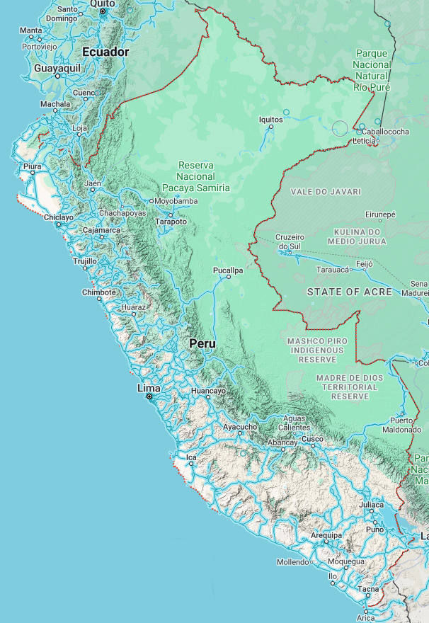
Most of the coverage is located in the western half of the country. There are a few scattered roads in the north east leading up to Iquitos.
Rare Vehicle:
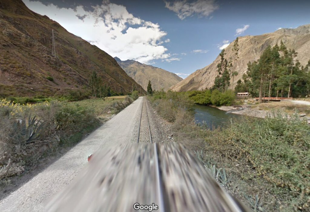
Railway coverage is found between Aguas Calientes (Machu Picchu) and Poroy (just west of Cusco). The vehicle is small and almost entirely blurred.
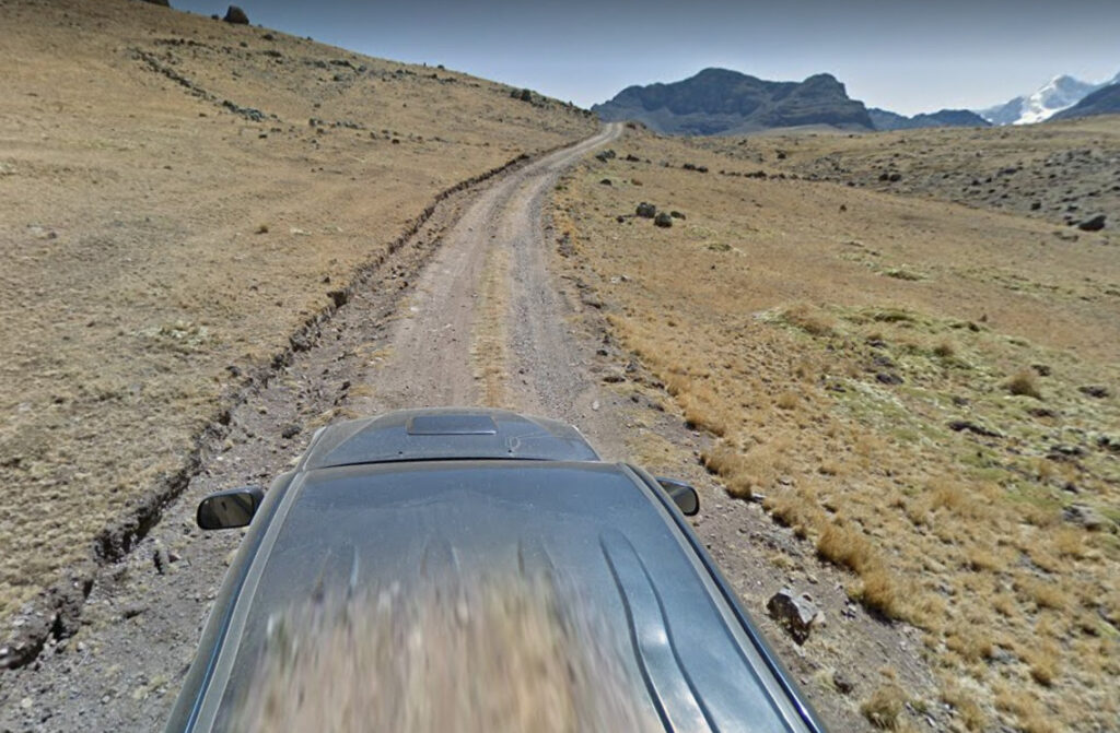
A black truck was used to cover part of the Highway 120, near and within the Yauyos-Cochas nature reserve, east of Lima.
Road Lines:
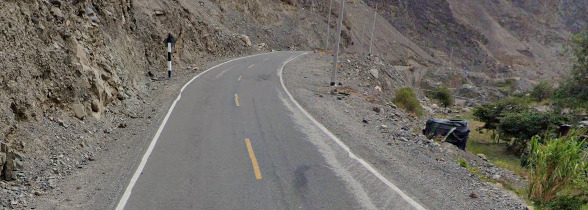

American style yellow center lines and white outside lines are used on single lane roads.
White center lines and outside lines are used on divided highways.
Road Signs:
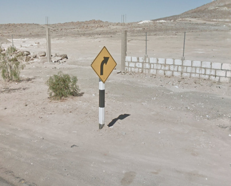
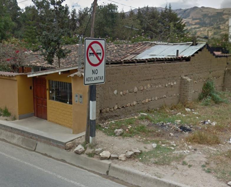
Road signs are usually painted in black white pattern:

Electricity poles:
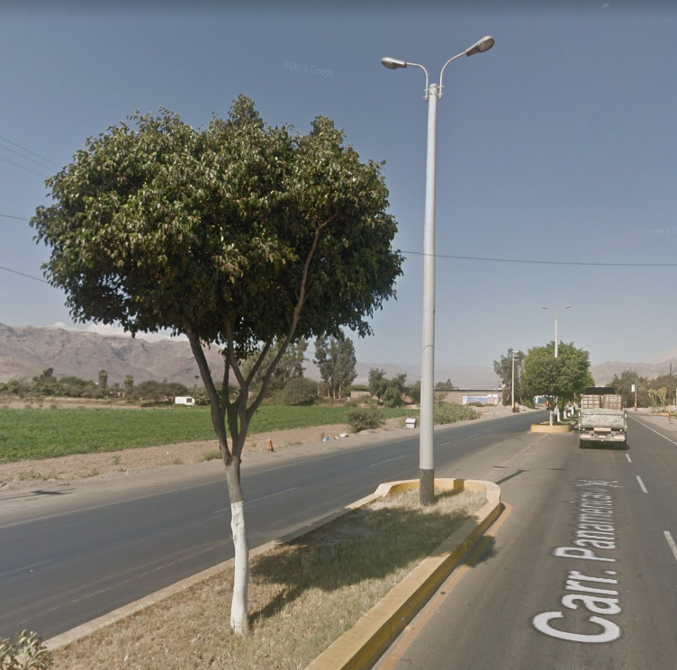
The majority of electricity poles are painted on the bottom, most common color being black
License plates:


Standard license plates are white. Commercial vehicles are often yellow.
Phone number:
Mobile Numbers: nine digits for mobile numbers across the country. The first digit is always the number nine: 9xx xxx xxx
Fixed (land) lines:
-seven digits in the Metropolitan Area of Lima and Callao
-six digits in the rest of the country
Commonly Found Things
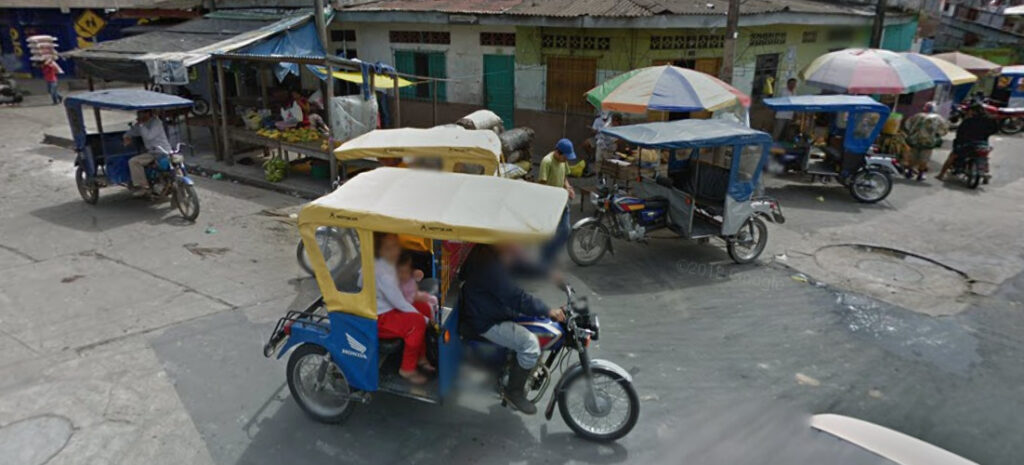
Tuk Tuks are extremely common in Peru, much more than any other country in Latin America.
Political posters are extremely common in Peru, but not in the usual way other countries use them. In Peru, most political posters are painted on walls and buildings, with a white background and red or blue writing. These posters are rarely useful though. Most of them only say “Alcalde” which means mayor, and the name of the position and the candidate. In the example below, the province name, Huaraz, is actually mentioned.

Vegetation/Landscape:
The variation in landscape in Peru is largely dictated by the Andes Mountains that run across the entire country, which results in drastic changes in climates due to altitude and the rain shadow effect.
Here is an elevation map of Peru, which shows the Andes running through the western portion of the country. Purple is the lowest elevation while white is the highest.

Now, a satellite image of Peru showing the clear rain shadow effect where the Andes begin.
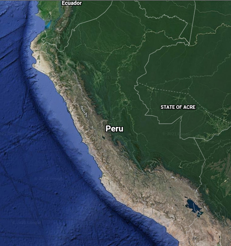
Knowing the rain shadow and elevation differences of Peru can help to tell apart different areas. However, Peru is a country that stretches far from north to south, so locations at similar altitudes but different latitudes can look extremely similar.
This guide will give general differences in landscape based on altitudes, as well as some specific recognizable areas.
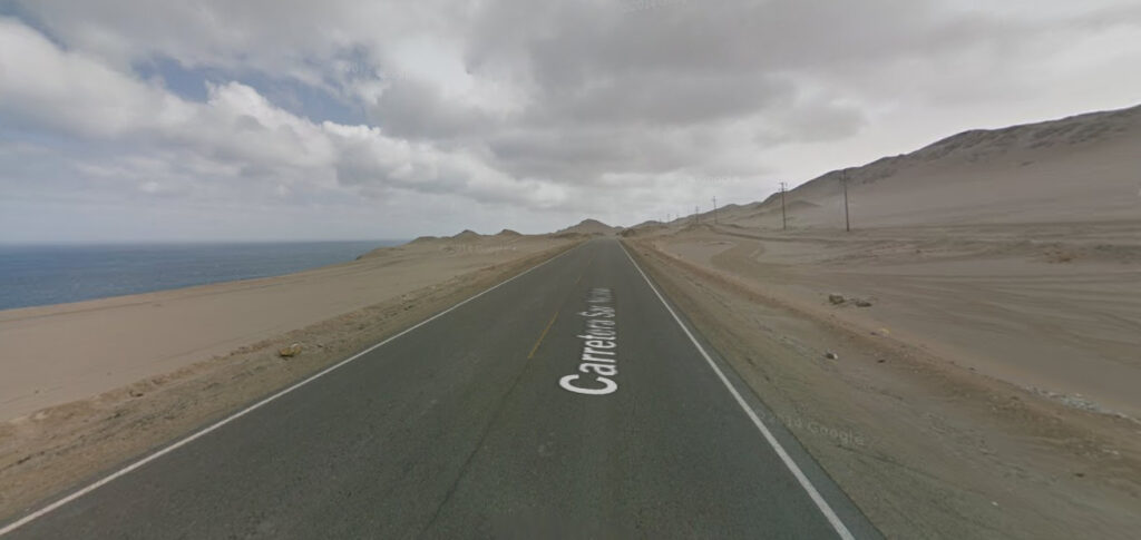
The coast of Peru is very dry and sandy, with practically no vegetation.
Peru has many rivers which come from high altitude areas, cut through the dry mountains and create fertile valleys. These valleys are used for agriculture such as grasses and corn.
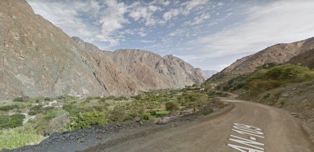
Between 2500 and 4000 meters elevation, the climate in these valleys is very habitable and temperate. This area has a lot of terrace farming and villages along the slopes.
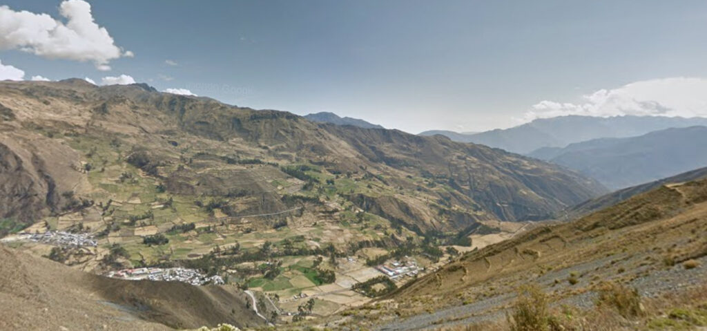
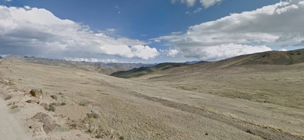
At 4000 meters and above, vegetation is limited to only small grasses and shrubs and the area is largely uninhabited.
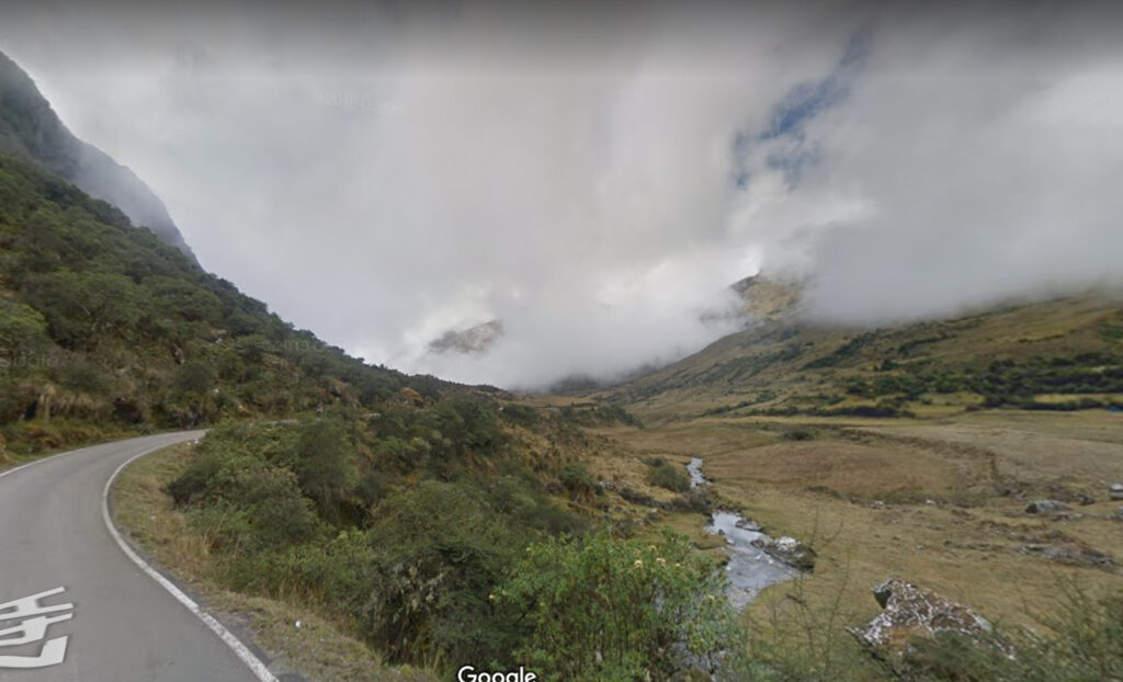
On the eastern side of the Andes, vegetation begins to appear as elevation descends. In this picture, we can also see a perfect example of the rain shadow effect, where clouds are too low to pass the mountains and are trapped on the other side.
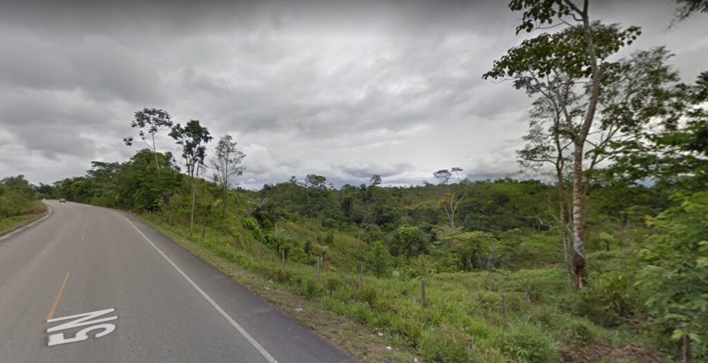
Finally, the eastern half of the country is flat or rolling hills, with tropical vegetation. The coverage in this area is limited to a few areas (See: Coverage of Peru)
Specific Areas:
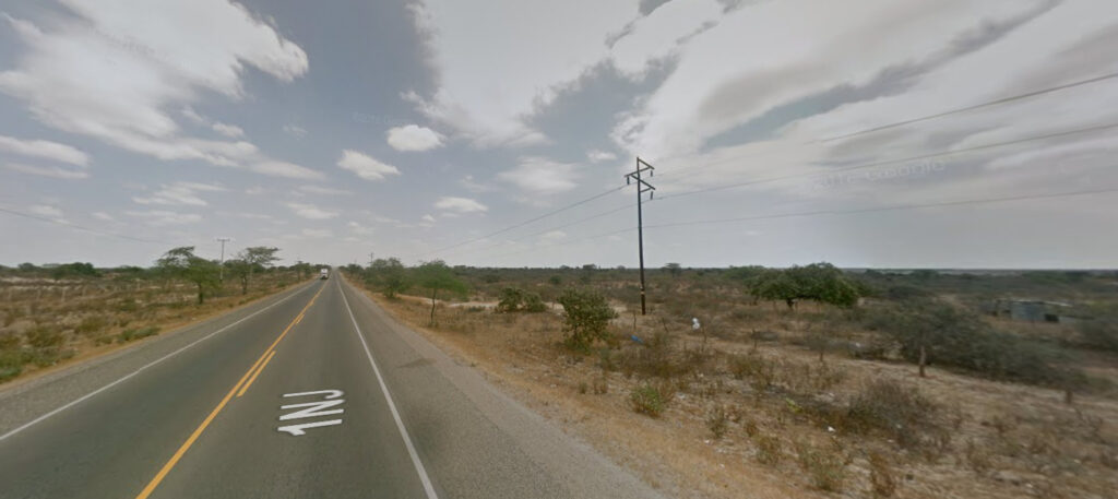
The far northwest (Piura and Tumbes regions) has a climate similar to a dry savanna. Lots of low trees and shrubs, but fairly arid.
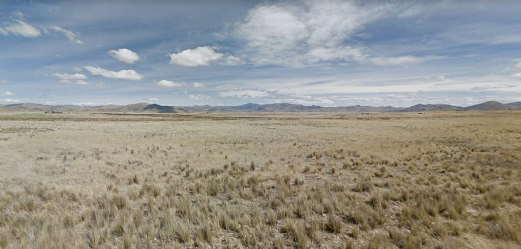
The area around Lake Titicaca is part of the Altiplano, which extends into Bolivia. The altiplano is a relatively flat, high-altitude region, and which mostly consists of grassland.
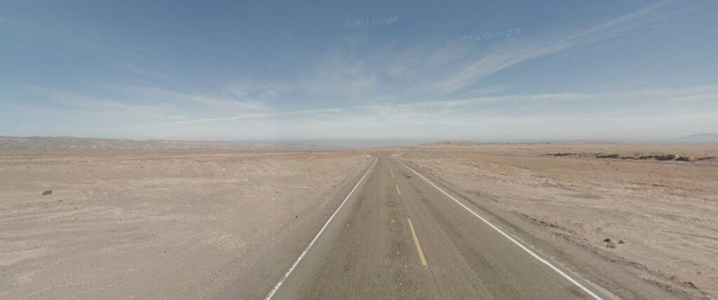
The Atacama Desert, known for being the world’s driest desert, is found in the far south of Peru (as well as northern Chile). Vegetation in this area is practically nonexistent. If all you see is desert and rocks as far as the eye can see, then you are probably in the Atacama.
Specific Plants:
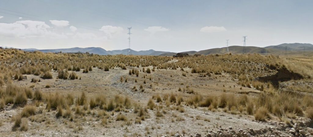
Ichu, or Peruvian Feathergrass, is a small poofy grass found in the Peruvian and Bolivian altiplano and occasionally in other parts of the Peruvian Andes around 4000 m altitude.
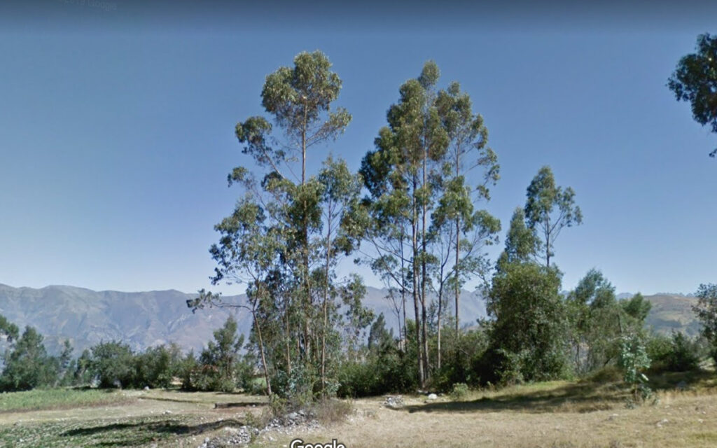
Although they are not native to South America, eucalyptus are extremely common in Peru because of planting. They are found throughout the country in the 2000 m – 3500 m elevation range.
Architecture:
Peru’s architecture is fairly identifiable compared to other Latin American countries. Its traditional style is pretty uniform around the country. Learning the typical general style can be simple.
A typical Peruvian building follows these general rules:
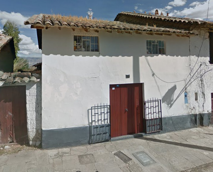
– Simple facades, one single color across the building. White is a very common choice for this color.
– A layer of a dark or contrasting color at the bottom of the building. This is usually black, brown, or red.
– Wooden doors, windows, and frames, usually painted brown or red.
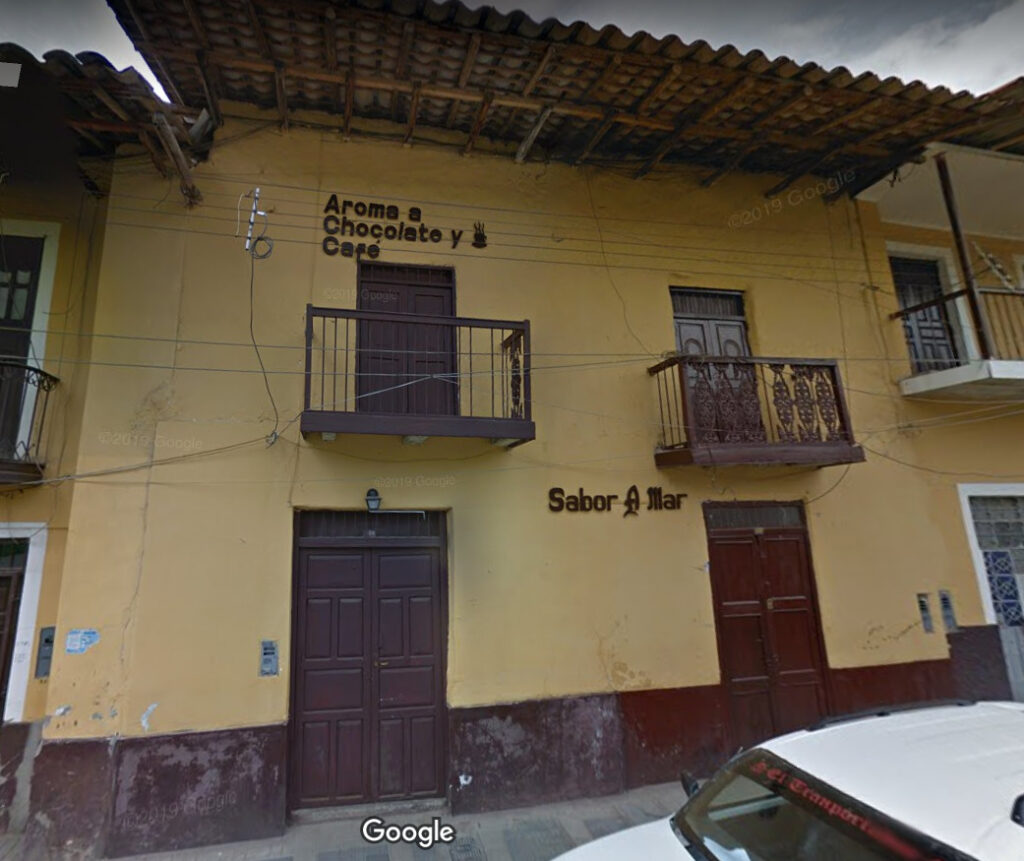
– In some cases, windows have wooden balconies, painted in the same color.
– Roofs are nearly always tiled, usually brown or occasionally red, and usually look weathered down. They tend to be overhanging.
Here is what a typical Peruvian house looks like in smaller towns and rural areas. Here, we can see the contrasting paint layer at the bottom, the wooden door, and brown tiled roof.
Here is a house in a medium-sized town, which has a balcony. Again, the brown bottom layer, painted windows and doors, and tiled overhanging roof.
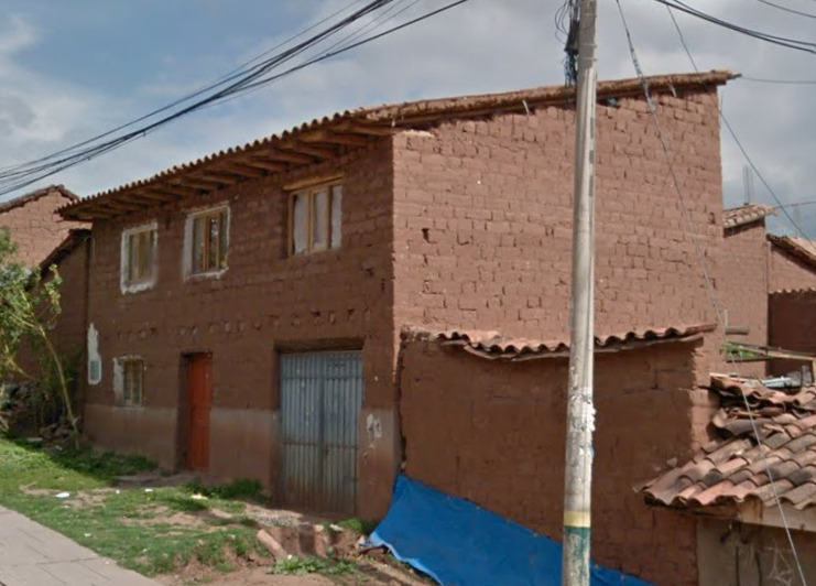
This example is of a poor building. However, a few of the same basic principles can still be seen. The building has a tiled roof, wooden door, and somewhat has a bottom painted layer. Another thing to mention here is the use of mud-brick, or adobe, for house construction. This is typical especially of Peru and Bolivia and is based on traditional indigenous building practices.
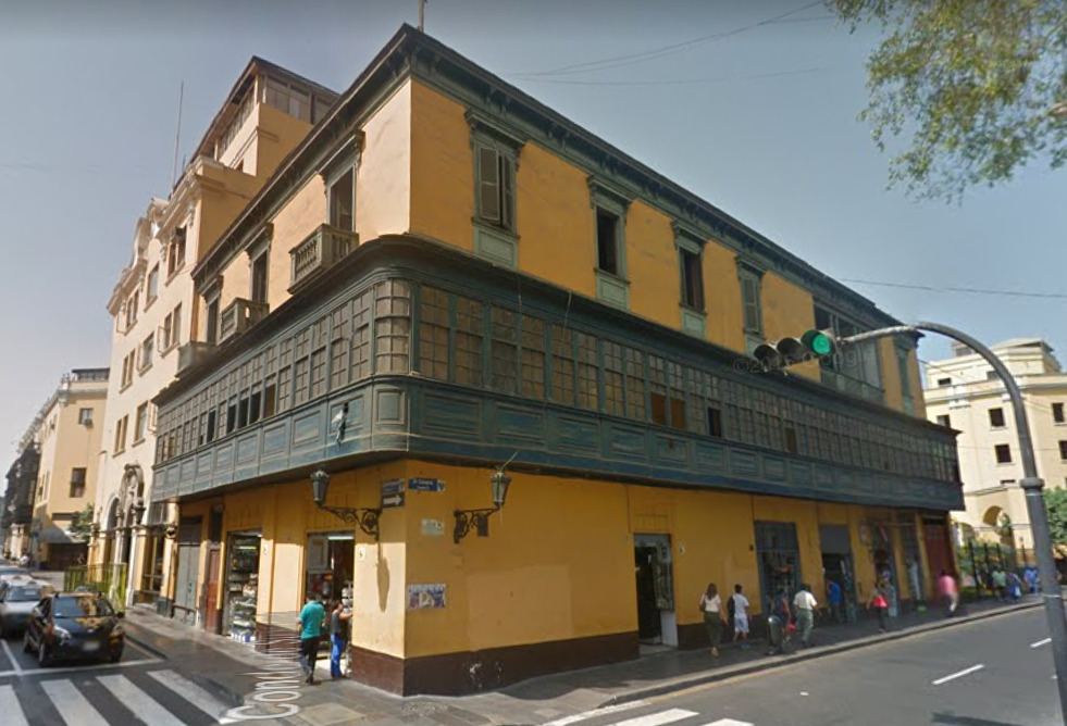
On the opposite end of the spectrum, here is a historic building in Lima. However, the same principles are followed. The building has a brown bottom layer and the windows and doors are painted. The balcony in this case extends across the entire building, but it is again the same color as the windows/window frames. The only difference is that the roof is not tiled. This is common for traditional Spanish buildings in Peru’s historic cities – they instead preferred to have flat roofs.
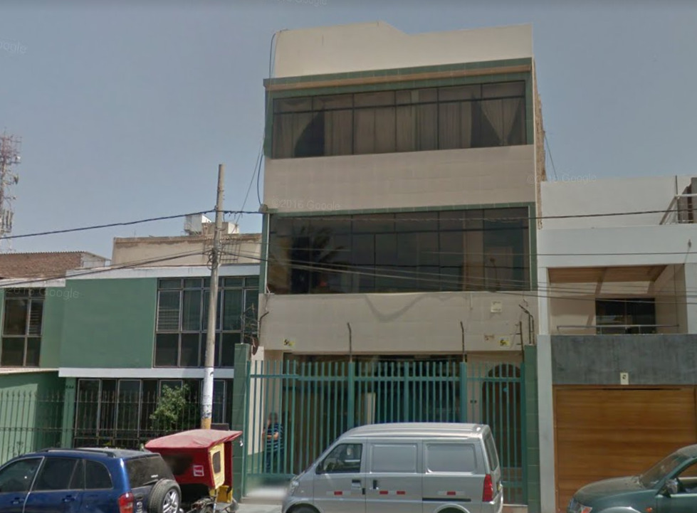
Moving on from Peru’s classic style, many recently constructed buildings prefer a more modern look, with very cubic building shapes and large windows. These types of buildings are common in cities along Peru’s coast and desert areas.
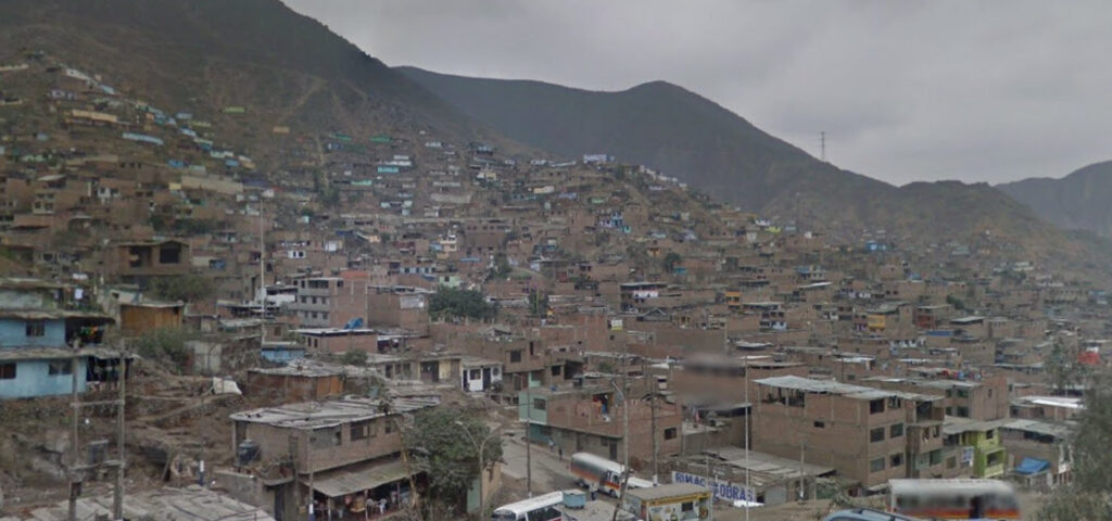
In poorer areas, especially the massive Lima urban area, houses are made of dark brown brick, most likely because of the pollution and sand in the environment. This color is pretty unique from other brick colors in Latin America.
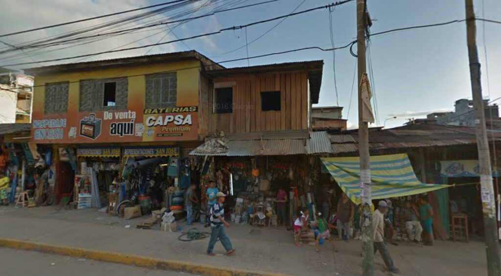
Finally, in the Amazonian region of Peru, roofs are usually made from metal sheets. It is also common to see wooden houses along with brick buildings.
A Guide to Understanding Signs in Peru:
Peruvian addresses on signs or posters usually include the names of administrative divisions.
Peru has 3 levels of Administrative Divisions:
Regions
- Regions are sometimes called Departments and are the largest political divisions of Peru. There are 25 regions:

Provinces
- Regions are subdivided into provinces. There are 196 provinces. These do not appear on google maps, but often times, the province name is that of a nearby larger town in the area.
Districts
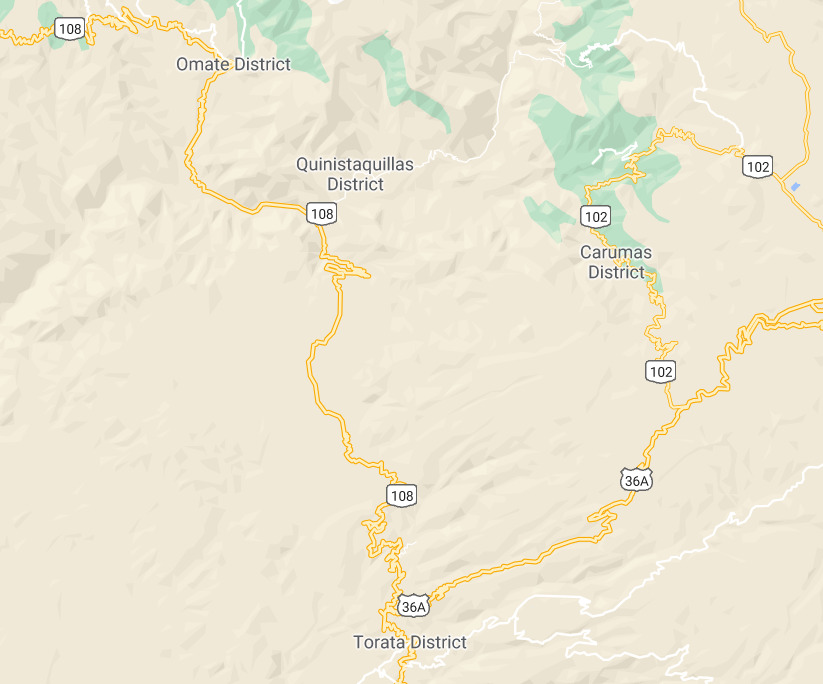
- Regions are subdivided into districts. There are 1838 districts. While politically not exactly the same as a town, districts appear on google maps as town names, often with “district” after the name:

Now, an example of a typical poster which has a helpful address:
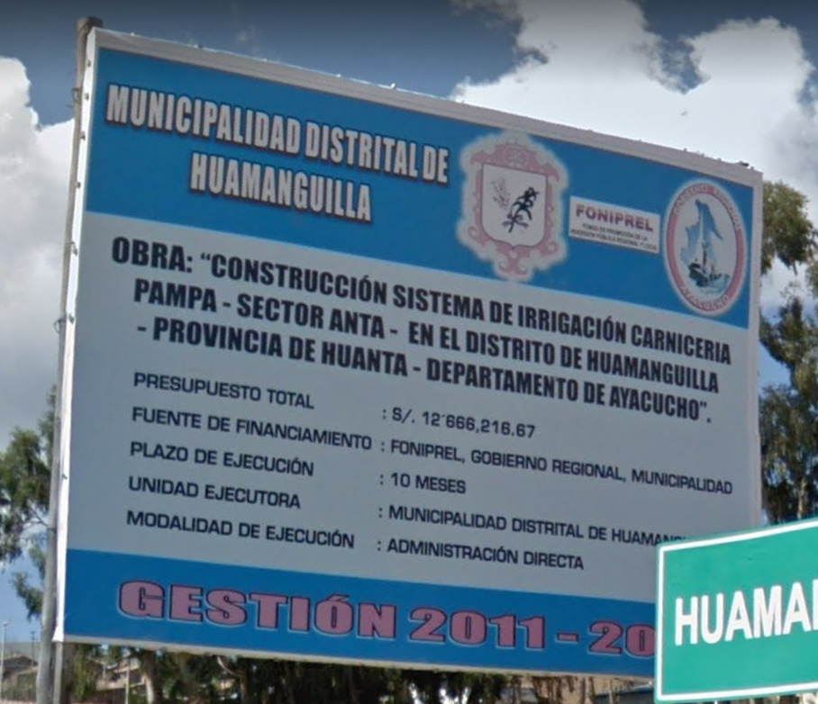
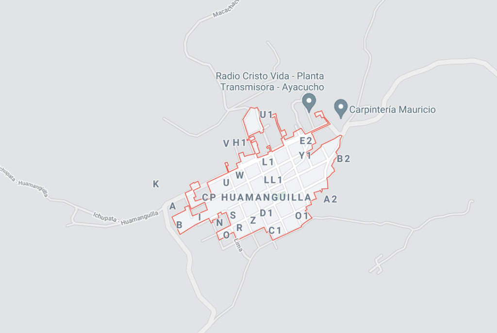
Here we have a ton of words, but we only need to focus on the words “distrito,” “provincia,” and “departamento.”
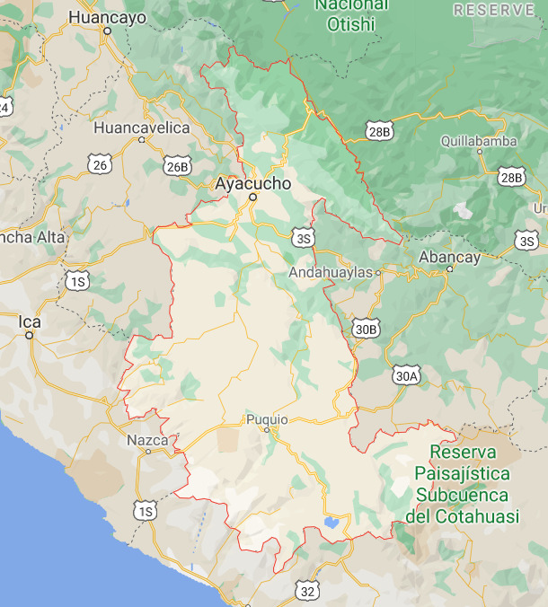
- The department, or region, is Ayacucho, which is also the name of a large city.

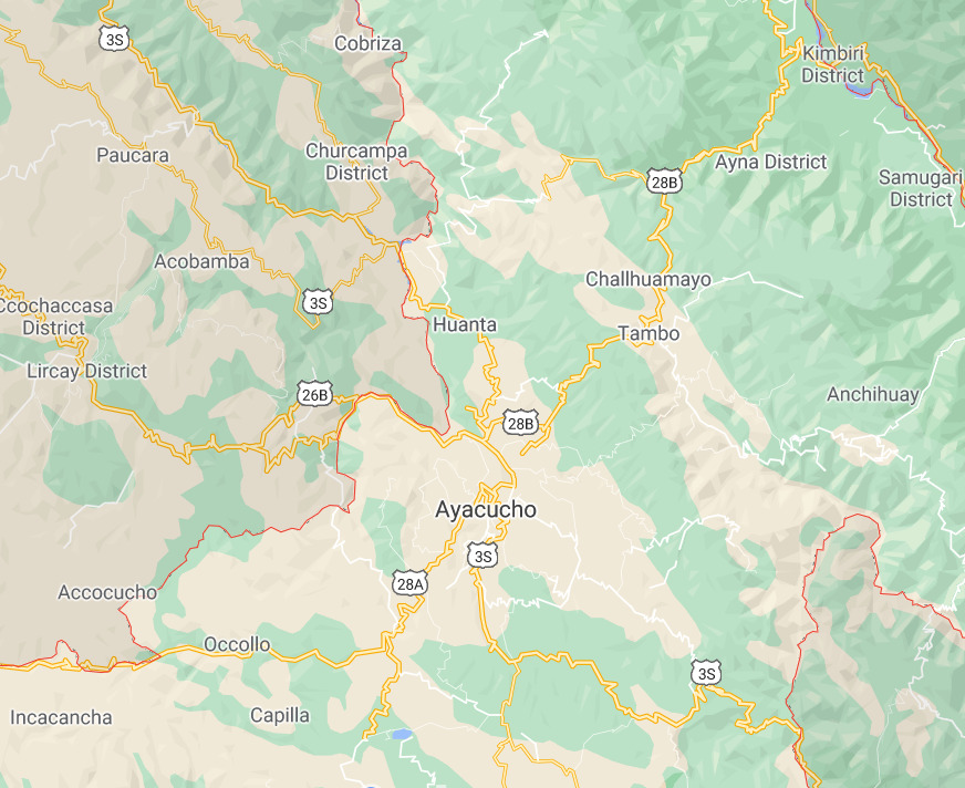
- The province is called Huanta. The town of Huanta is visible at a relatively zoomed-out level, near Ayacucho, which has narrowed down where to look for our district.

- Finally, finding the district of Huamanguilla was relatively difficult but not impossible, given that knowing the province narrowed down the area in which the district could be. Keep in mind that google maps often has issues in 2nd and 3rd world countries when it comes to map accuracy and detail. Therefore, sometimes district and town names do not immediately come up and take some more searching.

Alphabet/Script:
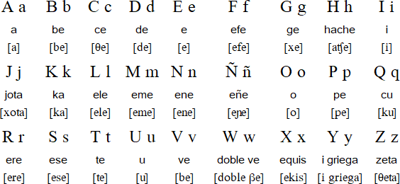
Peru uses the Spanish language.
Domain:
.Pe
Ecuador
- Country Flag
- Google Car
- Bollard
- Camera Generation
- Road Lines
- Road Numbering System
- Electricity Poles
- License Plates
- Vegetation/Landscape
- Specific Plants
- Architecture
- Alphabet/Script
- Subdivision
- Internet Domain
Country Flag:

Capital City:
Quito
Google car:
Only one type of car is available – white car with a stubby antenna:
Bollard:
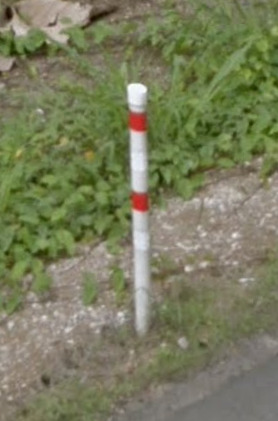
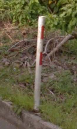
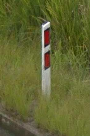
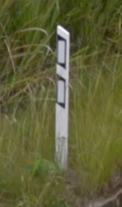
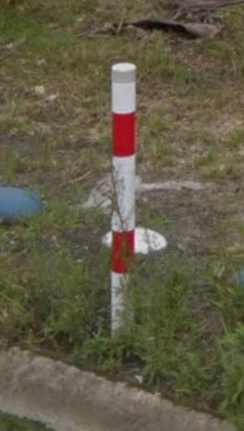
The most common small round bollard with 2 red rings:
Other types of bollards, which are also common:
Camera Generation:
Gen 3
Road Lines:
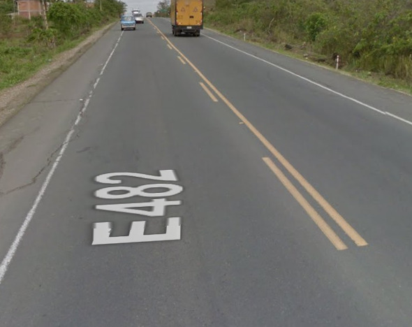
Ecuador uses the yellow centreline, also small shoulders are very representative of Ecuadorian roads:
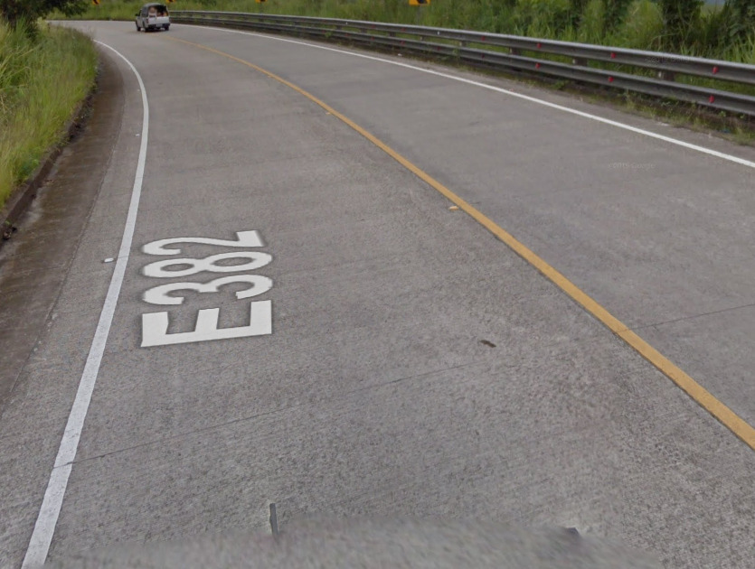
Concrete roads are also common in Ecuador, as well as the double guardrail:
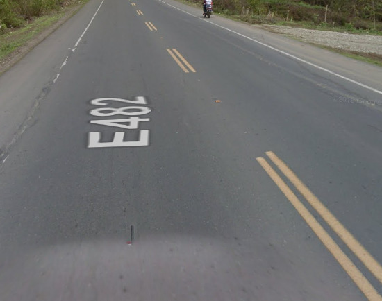
Weird double discontinuous line can also be found:
Road Signs:
Ecuador has green road signs with white text on them:
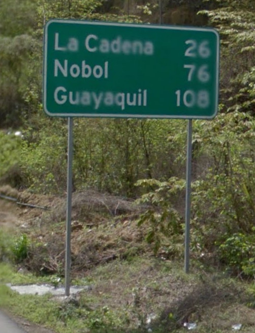
Highway sign:
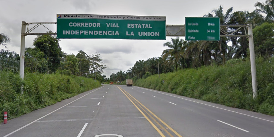
Other variations: Ecuadorian Road Sign Variations
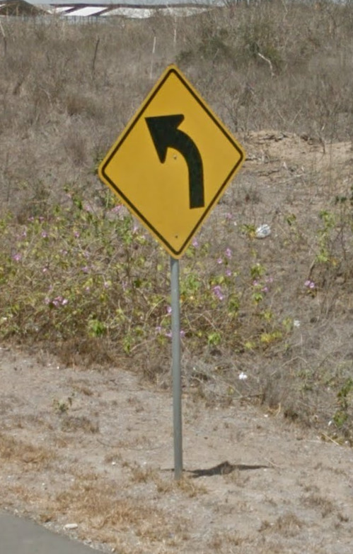
Ecuador uses American yellow diamond-shaped warning signs:
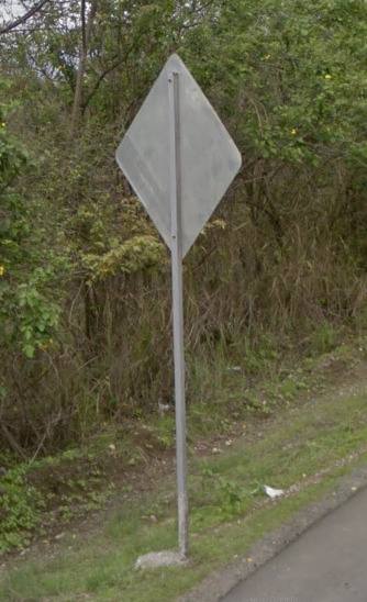
The backs of signs are quite plain, unlike Colombia which has a cross on them:
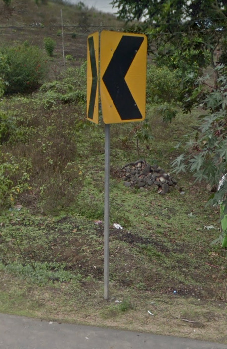
These yellow arrows are very common on curves, and they have 1 pole holding both plates, unlike in Colombia and Mexico which have 2:
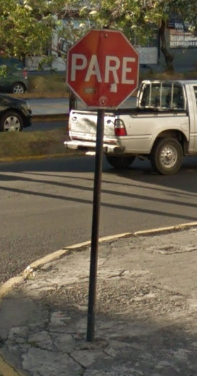
The stop signs in Ecuador say PARE, which is the same for all South American and Carribean countries:
Road numbering system:
Ecuador has national and provincial highways. The road numbers on the national highways increase from north to south and from east to west. There are primary and secondary national highways. All primary national highways are 2-digit and ending with 0 or 5 depending on whether they are going in an east-west direction or a north-south direction respectively. Their numbers go from E10 to E50. Secondary national highways occupy the other numbers in-between if they are 2-digit, and go from E18 to E69. 3-digit secondary highways’ first 2 digits represent the 2-digit secondary highway they feed into, so E582, for example, feeds into E58, etc. This means that all the road numbers are pretty grouped within different areas in Ecuador, and usually easy to find. More info about the Ecuadorian road numbering system: Ecuador Road Numbering System

Right click on the image, “View Image” for higher resolution.
The only 1-digit national highway, E5, is on the Galapagos Islands, but isn’t relevant to the game.
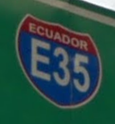
Primary national highways have blue highway shields:
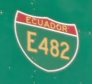
Secondary national highways have green ones:
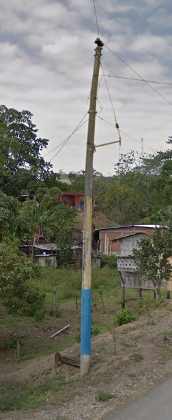
Electricity Poles:
Common Ecuadorian poles have these indentations or steps on them that are akin to the French poles’. They are less long than the ones on the Brazilian poles, and can thus be differentiated from them:
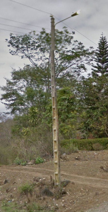
The poles can also be coloured sometimes on the bottom part:
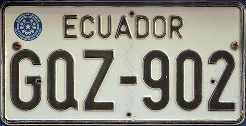
License plates:
Private or commercial plate:
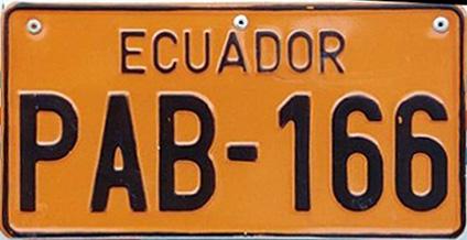
Service vehicle plate:
Phone number:
–
Vegetation/Landscape:
–
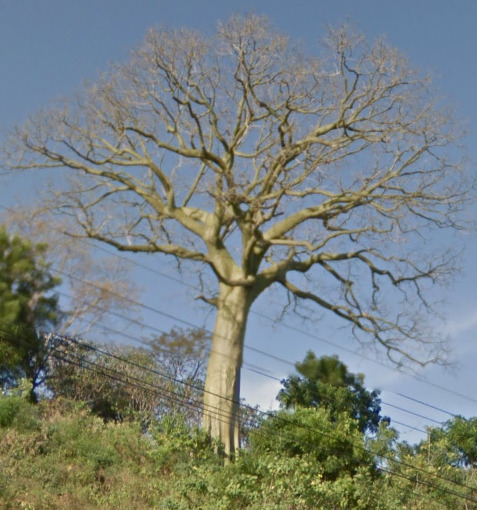
Specific Plants:
These smooth-barked green trees are very representative of Ecuador:
Architecture:
–
Alphabet/Script:
Regular Spanish alphabet:
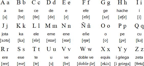
Subdivisions:
Ecuador is divided into 24 provinces, whose names can be often found on signs:

Internet domain:
.ec
Uruguay
- Country Flag
- Capital City
- Most Helpful
- Google Car
- Bollard
- Camera Generation
- Road Lines
- Road Signs
- Eletricity Poles
- License Plates
- Phone Numbers
- Vegetation/Landscape
- Architecture
- Alphabet/Script
- Internet Domain
Country Flag:

Capital City:
Montevideo
Most Helpful:
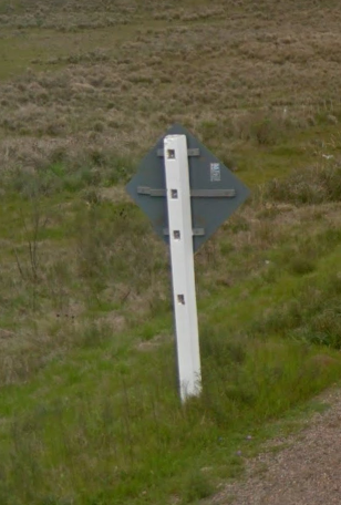
If you ever find a wooden pole that is painted white like the one above, you can safely guess Uruguay over Argentina.
Google car:

Uruguay uses the black reared google car.
Bollard:
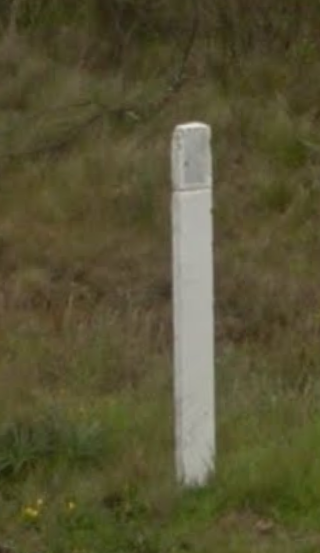

Uruguay has white/yellow bollards.
Camera Generation:
Gen 3
Road Lines:

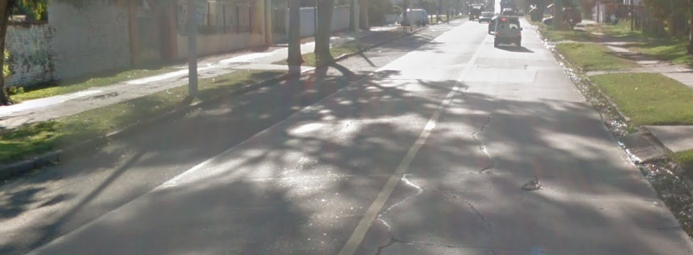
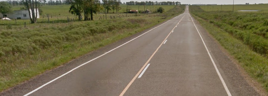
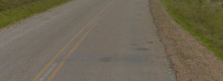
Uruguay uses white road lines often with a white center line encased with yellow. There are several other variants but the top image is unique to Uruguay.
Road Signs:
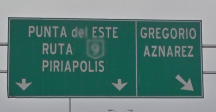
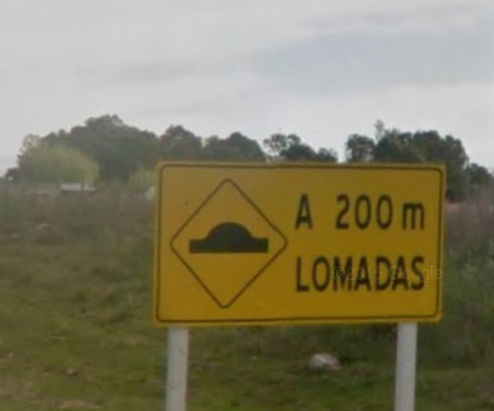
Uruguay uses Green signs for locations and yellow for information.

Uruguay often uses white wooden sign posts.
If you ever find a wooden pole that is painted white like the one above, you can safely guess Uruguay over Argentina. It has been a key meta down in this region.
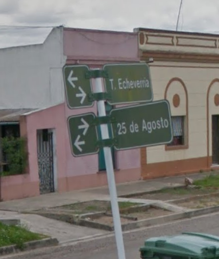
Uruguay uses a street sign style similar to Argentina in a variety of colours.
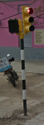
The Traffic lights in Uruguay are often painted in a white and black pattern.
Electricity poles:
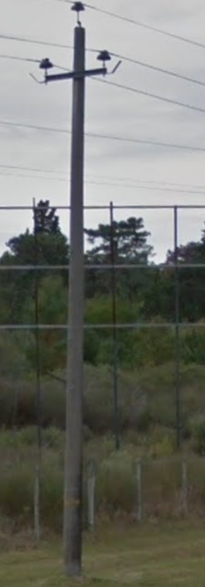


Uruguay uses concrete poles in a variety of patterns.
License plates:

The plate you will find currently on Geoguessr coverage for Uruguay is shown above.

However they have a new one which may come into the coverage in future updates.
Phone number:

Landline numbers are 8 digits long and begin with 2 for Montevideo, 4 for elsewhere in the country.
Mobile numbers most commonly begin with 099 followed by another six digits.
Vegetation/Landscape:


Uruguay is rather flat containing a lot of open grassland, interspersed with trees, rocks, and streams.
Architecture:
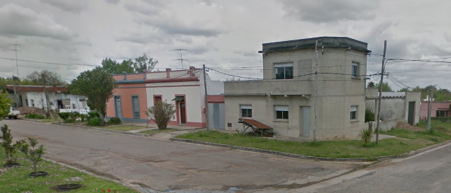

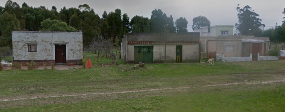
Alphabet/script:
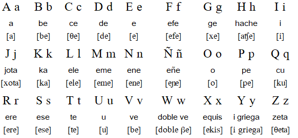
Uruguay uses the typical Spanish language/alphabet.
Internet Domain:
.Uy
Bolivia
- Country Flag
- Google Car
- Most Helpful
- Bollards
- Camera Generation
- Road Lines
- Road Signs
- License Plates
- Architecture
- Vegetation/Landscape
- Google Coverage
- Language
- Domain
Country Flag:
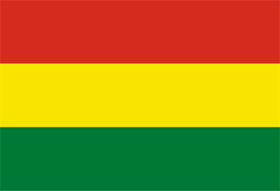
Capital City:
Sucre / La Paz
Most Helpful:
Google car:

The google car in Bolivia has a white back with no antenna.
Bollards:


You can sometimes find this bollard without the white reflector.


These poles are usually found on corners and are intended to work much in the same way as a chevron would. The rounded top pole is generally the same with different color and styles of reflectors being present on the poles.


With the wide range shown, it could be speculated that bollards are state / region specific. This may be updated later.
Camera Generation:
Gen 3
Road Lines:
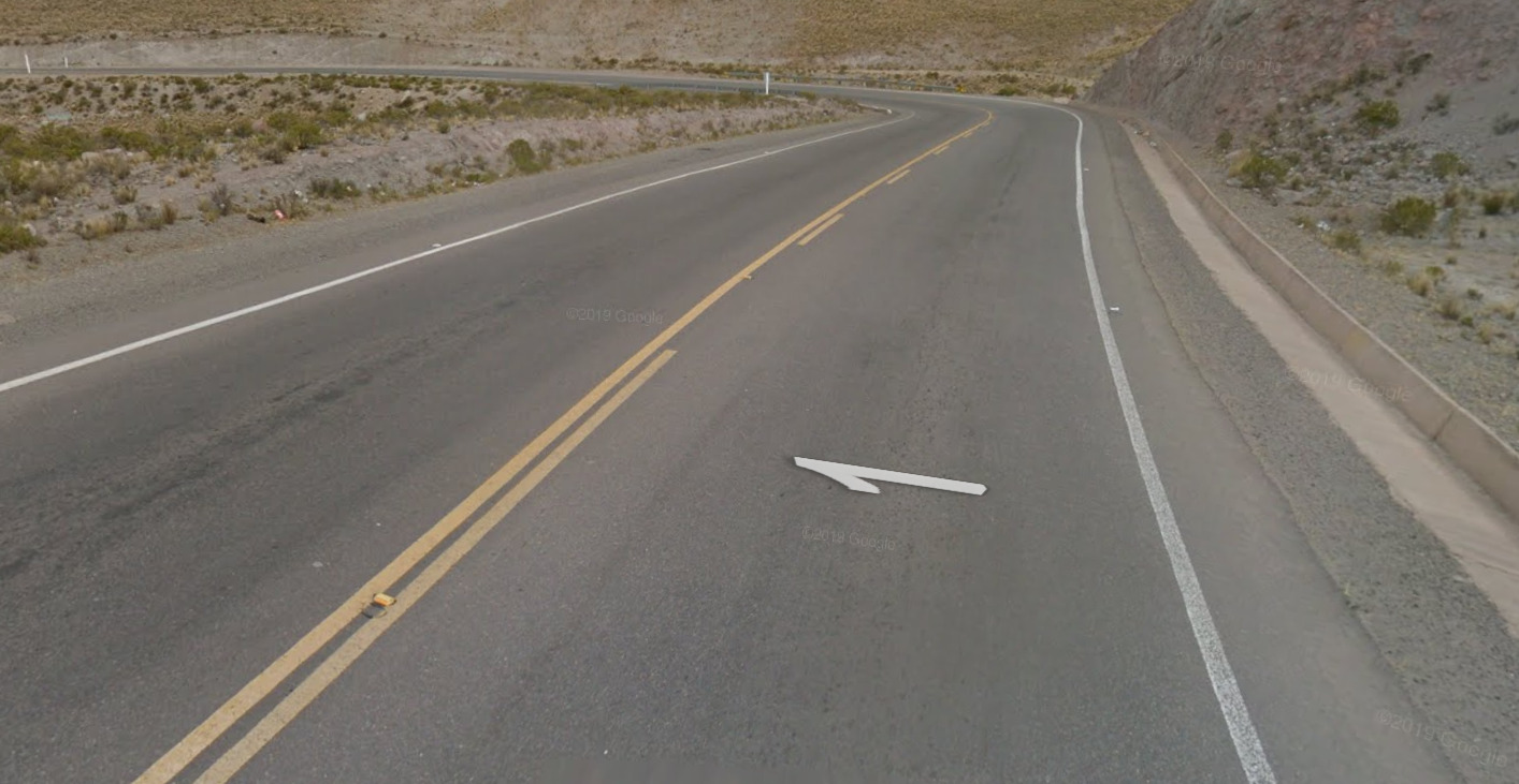
Like most of the rest of the western hemisphere, Bolivia uses yellow center lines and white outside lines. However, it is not uncommon that paved roads will have no painted lines at all.
Road Signs:
Like the rest of South America, Bolivian stop signs have “Pare” written on them.
Bolivia is very inconsistent in terms of sign color and format.
The most useful signs are signs indicating town directions, which can be either blue or green.
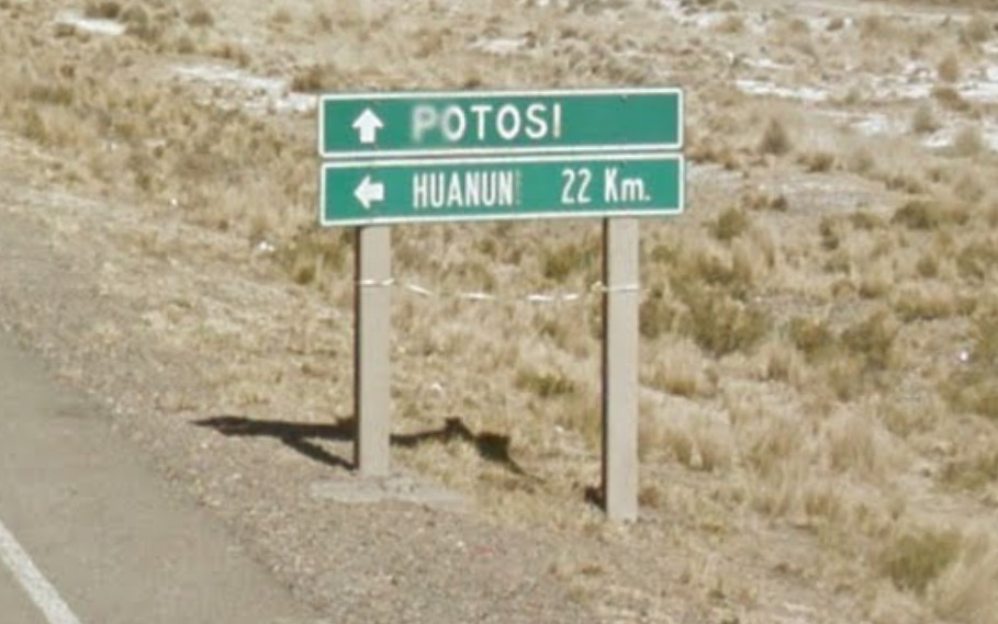
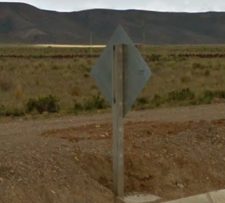
However, Bolivia can be distinguished through its use of wooden posts on all signs.
License plates:

License plates in Bolivia are white with blue text.
The plate number is 3 or 4 digits followed by 3 letters.
Architecture:
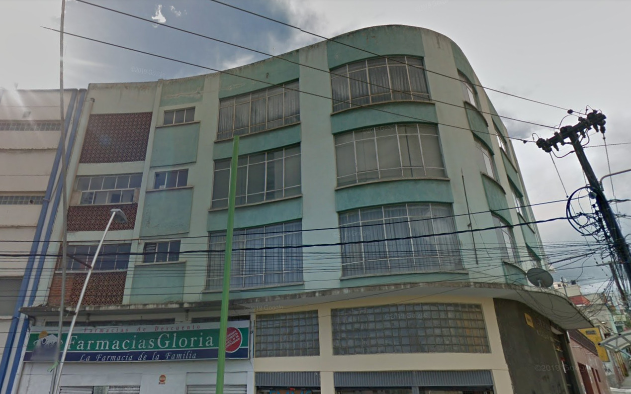
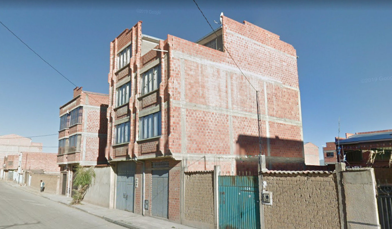
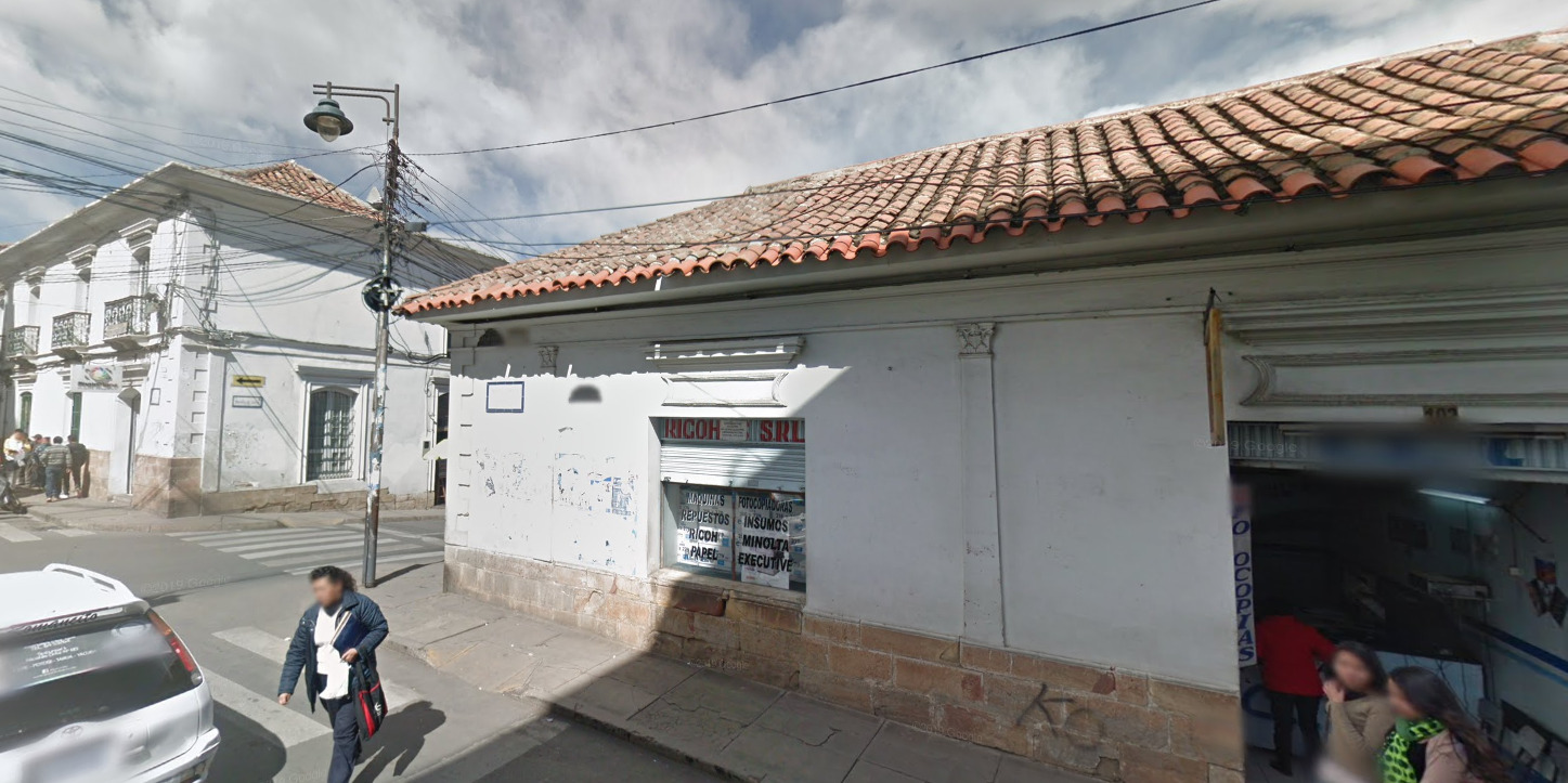
There are two types of architecture found in Bolivia: colonial and contemporary.
Typical contemporary urban buildings look like this.
Here is an example of typical urban/suburban contemporary housing.
Meanwhile, colonial architecture is mostly found in the form of white-washed walls with tiled roofs.
Vegetation/Landscape:
The single best way of telling apart regions of Bolivia is through landscape and climate.
Lake Titicaca-La Paz-Oruro area:
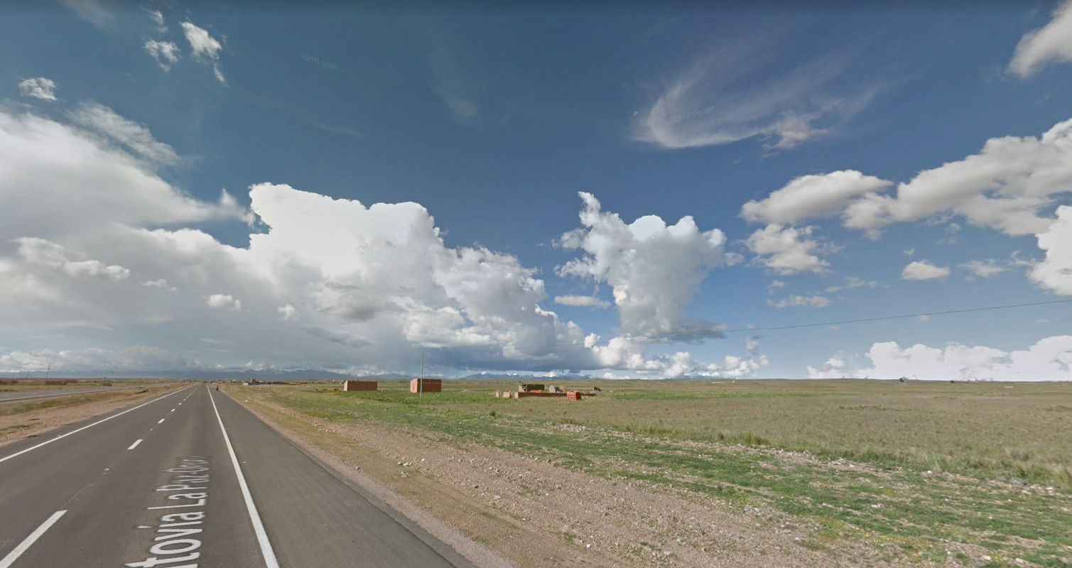
This area is known as the Altiplano, which is a high-altitude plateau. This area is mostly flat with occasional rolling hills and mountains which can be seen in the distance. It is relatively green, but treeless.
Oruro-Potosi-Chile Border area:
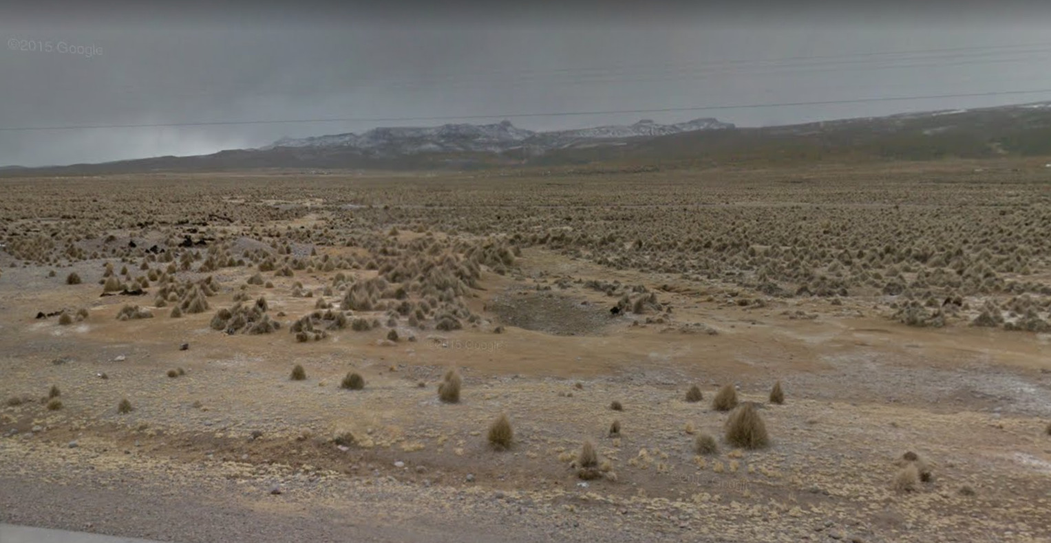
This area is extremely arid. It is barren except for yellow “poofy” grasses littering the landscape. This area can range from flat to mountainous. There are also a few large volcanoes.
Cochabamba-Sucre Area:
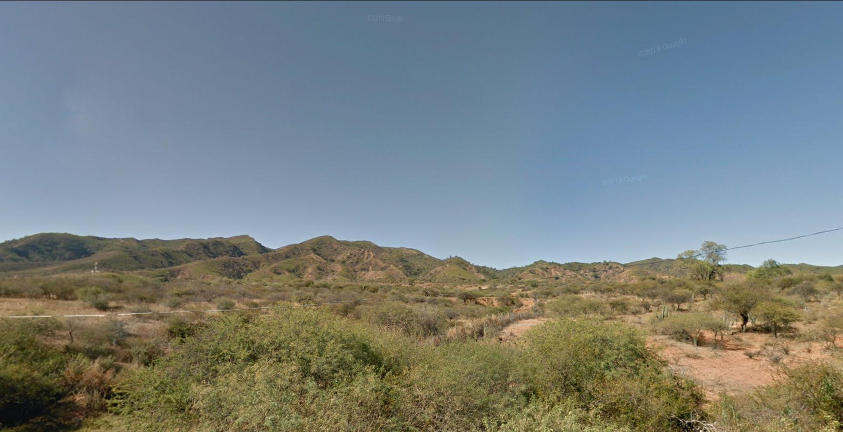
This area has a semi-arid or Mediterranean climate. It is mostly covered in bushes or shrubs, but there may be occasional trees. It is hilly or mountainous in terrain.
Vallegrande-Santa Cruz de La Sierra-Villamontes area:
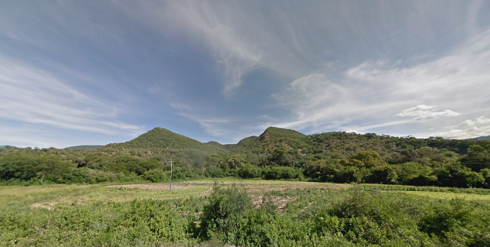
This area is a tropical or semi-tropical area that is hilly or sort of mountainous, with densely covered vegetation – mostly bushes and lowish trees.
The area north and east of Santa Cruz de La Sierra:
This area is extremely flat and tropical. It is mostly covered in open grassland with low trees and shrubs. It can also be swampy.
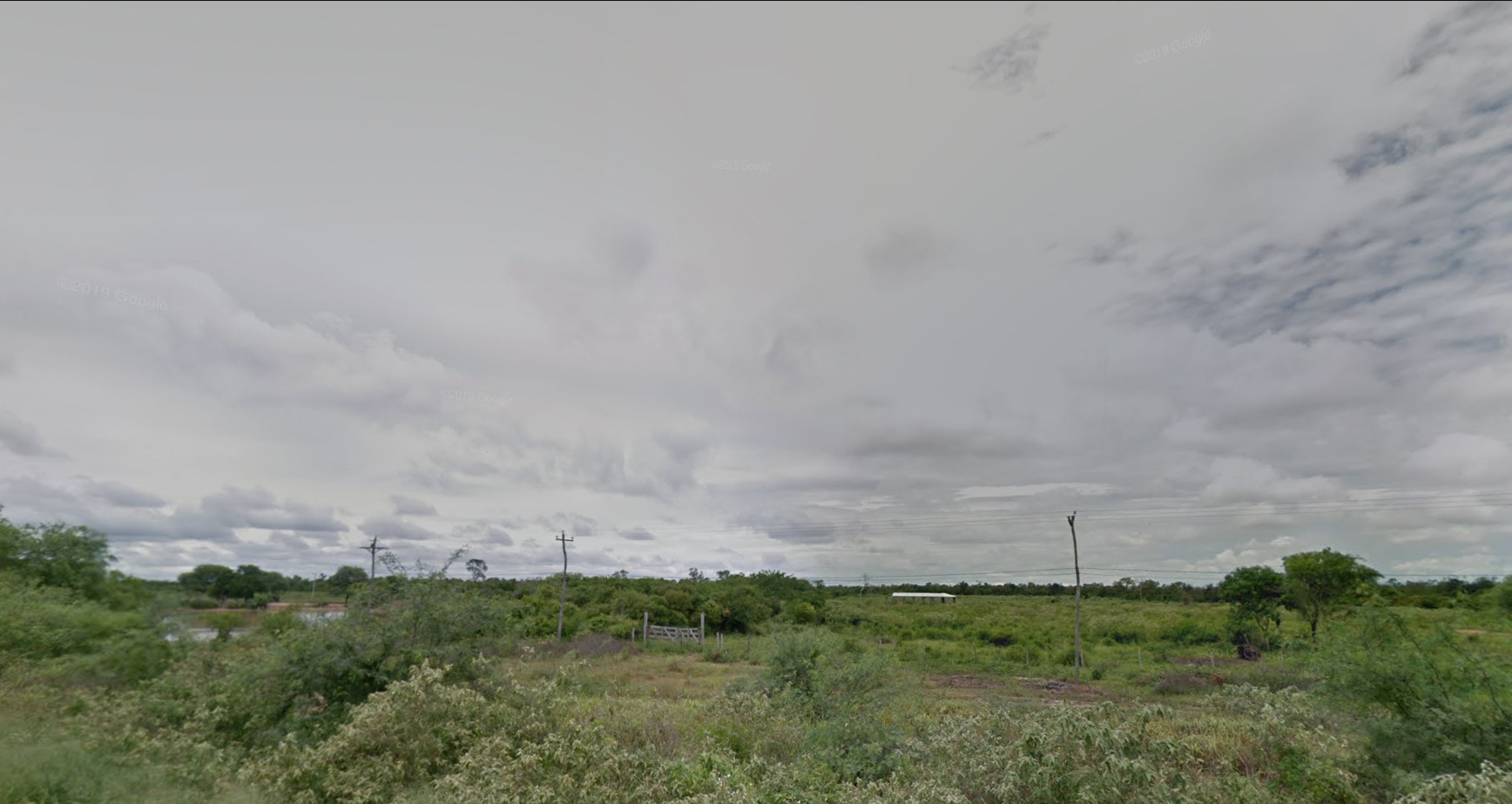
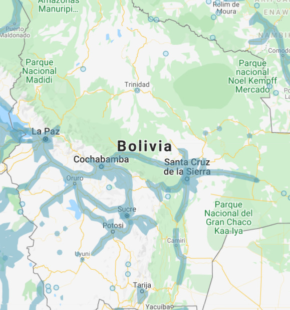
Google Coverage:
One crucial thing to mastering Bolivia is to understand where the coverage extends in the country. Bolivia’s coverage is pretty slim so it makes it much easier to figure out the right road or the general area. Here is a map of the coverage:

Language:

Bolivia’s official language is Spanish.
Domain:
.bo
Chile
- Country Flag
- Capital City
- Most Helpful
- Google Car
- Bollards
- Google Coverage
- Camera Generation
- Road Lines
- Road Signs
- Road Numbering System
- Electricity Poles
- License Plates
- Phone Number
- Vegetation / Landscape
- Architecture
- General Look
- Language
- Subdivisions
- Internet Domain
Country Flag:

Capital City:
Santiago
Most Helpful:

Google Car:

For the Gen 3 car, you can see the back of a white car. There is also a chance to see a Black/white car, although its still mostly white.
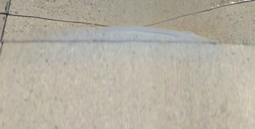
The Gen 4 Car is a blueish gray. Some shots may look more blue than others.Bollard:
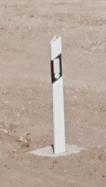
(Front)
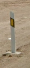
(Back)
The bollards are very similar to the type seen in Spain.Google Coverage:

Chile is very narrow but long. Using the road system, you should be able to generalize your guesses.Camera Generation:
Gen 3 & 4 (negligible amount of Gen 2 trekker coverage)
Road Lines:
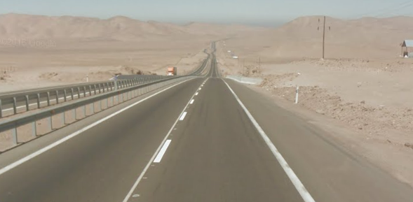
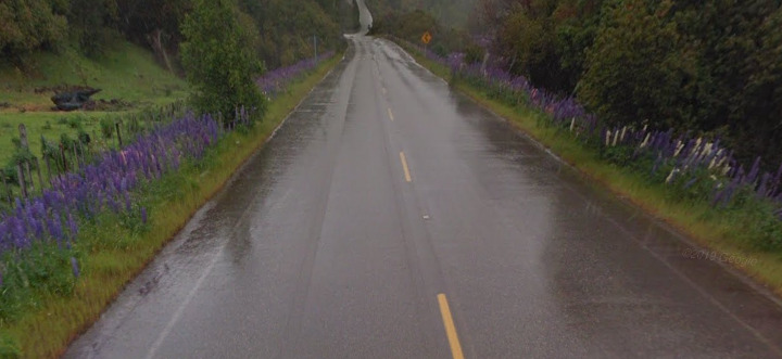
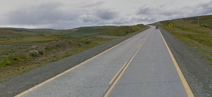
Chile is very unique. It’s the only country in South America that uses a white divider line. However, this changes in the south where the centerline is yellow and in Tierra del Fuego, where all lines are yellow (for visibility during snow).Road Signs:
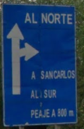
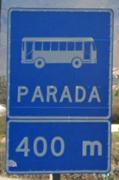
Most signs use a blue background with white text. Its also clearly in Spanish.
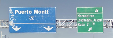
The other version of this is the Green sign with white text. These do exist and can be right next to some of the blue signs!


Road Numbering System:

Chile has national and local roads. The local road numbers follow a pattern – the letters in front of the number go alphabetically from A-Y from the north to the south of the country. More info: Chile Road Numbering SystemElectricity poles:

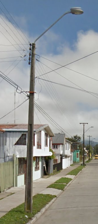
These poles are larger at the base and taper to a point at the top of the pole. It feels like the light itself is barely attached to the top of the pole.
Its important to note that these are not the only one, but this tapered pole is very common. Keep an eye out for it!License Plates:

Its clear that these plates are generally different from the surrounding countries.Phone Number:

Chile phone numbers are weird. There are no area codes or differences between a landline or mobile numbers. They all will be 8 or 9 digits long, like XXX-XXX-XX or XXX-XXX-XXX.Vegetation/Landscape:


The north is more of a desert and gradually becomes more lush the further south you go.Architecture:


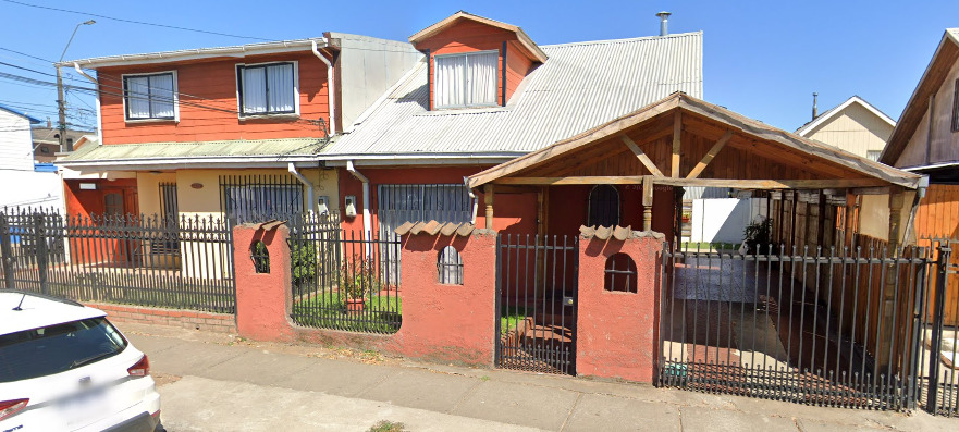
General Look:
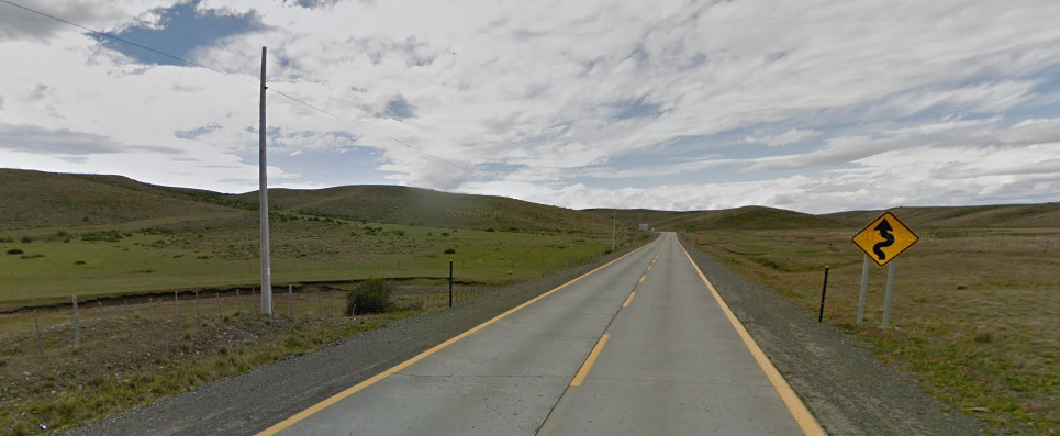
The general look above is from the Tierra del Fuego. Its pretty unique and easy to tell where you are.
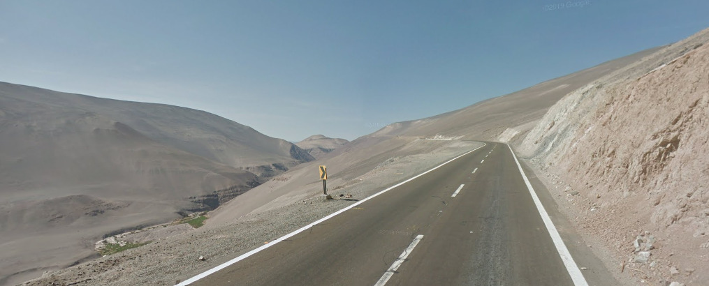
This general look is from the North of the Country. The Further north, the more of a desert feel. The further south you go, the greener the area becomes.
Also notice the line colors as this is really important!Language:
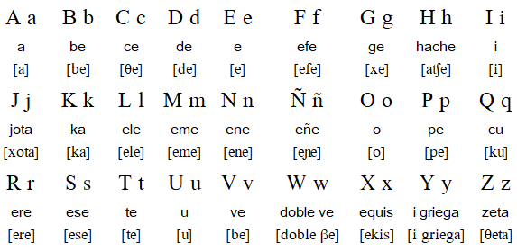
Chile uses the Spanish language.Subdivisions:
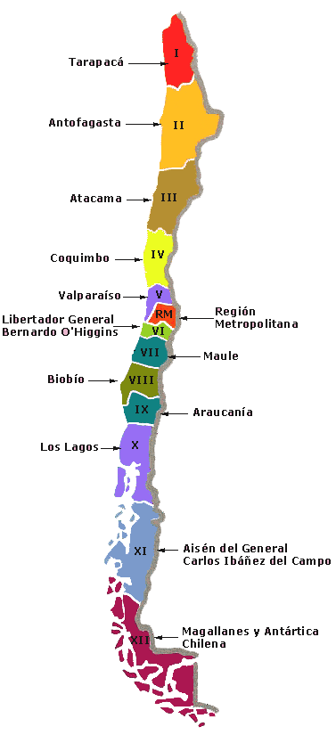
Chile is divided into 16 regions:Internet Domain:
.Cl
Colombia
- Country Flag
- Capital City
- Most Helpful
- Google Car
- Rare Car
- Bollard
- Google Coverage
- Camera Generation
- Road Lines
- Road Signs
- Electricity Poles
- License Plates
- Phone Numbers
- Vegetation/Landscape
- Architecture
- General Look
- Alphabet/Script
- Internet Domain
Country Flag:

Capital City:
Bogotá
Most Helpful:


Taxis and trucks in Colombia have a white side plate on them which is sometimes unblurred, giving away the region/city name.
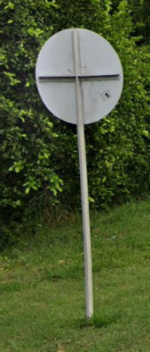
The “Colombia Cross” is a very good clue.

Google Car:


There are two cars that can be found in Colombia for their Gen 3 coverage- both are mostly blurred. One is black and the the other is white. Whether or not the stubby antenna can be seen is random.

As for the Gen 4 coverage, a dark gray car can be seen in varying degrees of blur.
Rare Car:
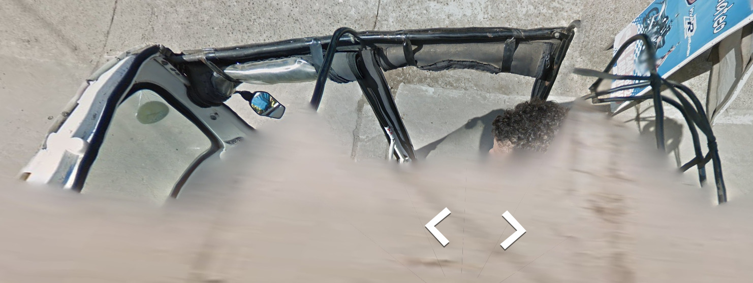
In the town of Leticia in the South East most corner of Colombia, you can find the car shown above.
Bollard:


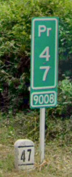
You can also find these two styles of KM markers around.
Google Coverage:
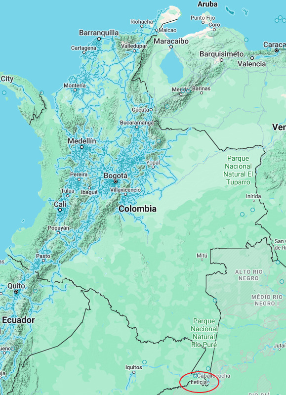
99% of the coverage in Colombia is shown here. There are about four roads and a park in Leticia that are covered with a special vehicle / trekker.
Camera Generation:
Gen 3 & 4
Road Lines:

Like most of the Western Hemisphere, the shoulder lines are white while the center divider is yellow.
Road Signs:


Colombia has several unique sign features. All sign posts are white and slim compared to other countries. Speed signs are round with a red outside and white inside (like Brazil). However all these signs also have a unique grey cross on the back of them.
Electricity Poles:


License Plates:

License plates in Colombia are yellow and have the municipality name at the bottom.


Taxis and trucks in Colombia have a white side plate on them which is sometimes unblurred, giving away the region/city name.
Phone Numbers:

Based on this, the (8) in 8716700 tells you that its the Boyacá, Tolima, Huila, San Andrés, Meta, Caquetá and the Amazon or the Orinoco departments. The (310) indicates that its a mobile number.

This map shows the first number of each local phone code is directly correlated to a region. Its worth knowing.
Vegetation/Landscape:


Architecture:

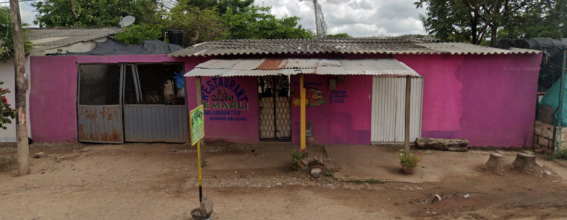
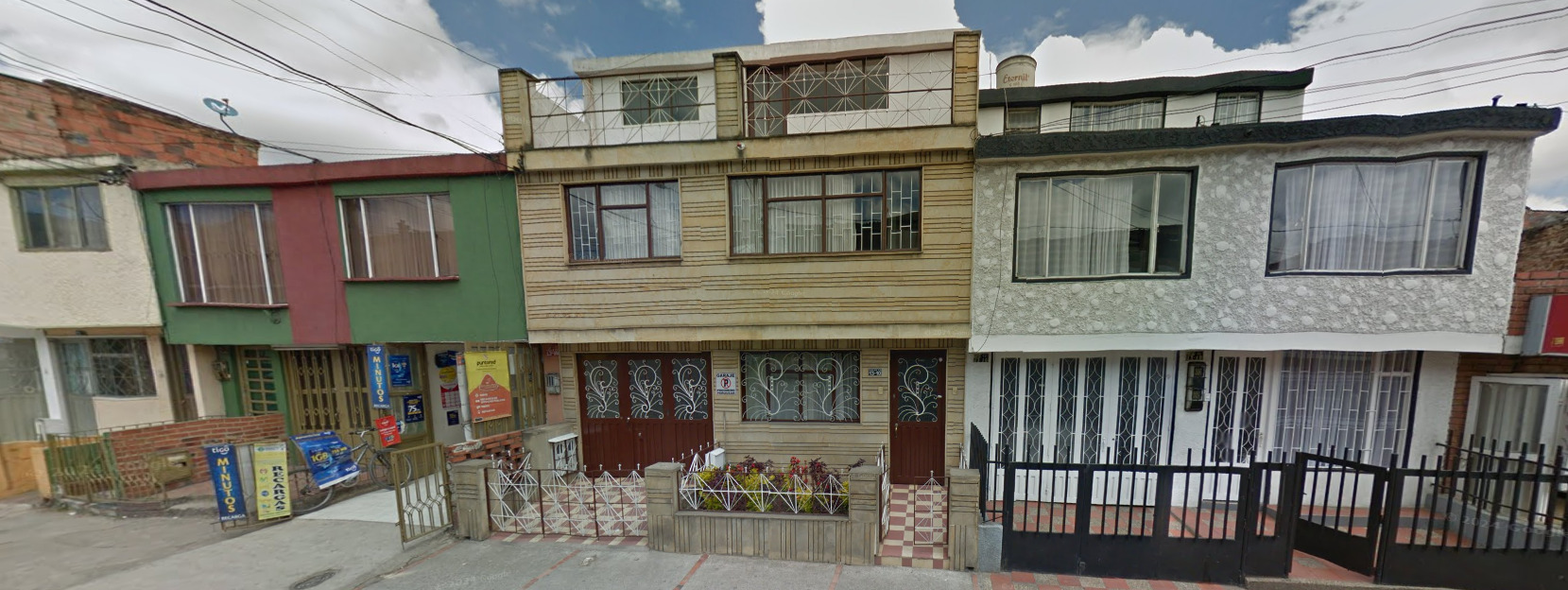
General Look:


Alphabet/Script:

Colombia uses the Spanish language.
Internet Domain:
.Co
The Falkland Islands
- Country Flag
- Capital City
- Most Helpful
- Controversy
- Google Car
- Google Coverage
- Camera Generation
- Research Boat
- Boat Coverage
- License Plates
- Vegetation / Landscape
- Architecture
- Fauna
- General Look
- Language
- Domain
Country Flag:
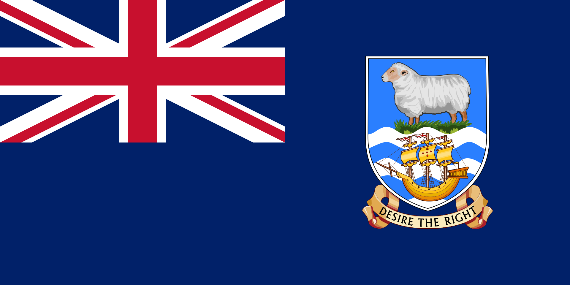
Technically, the Falkland Islands are a UK Territory. There is some controversy about whether they should remain apart of the UK.
You can see this flag in a few places.
Capital City:
Stanley
Most Helpful:
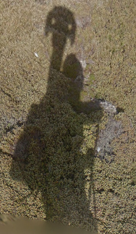
Controversy:
Due to the proximity of the Falkland Islands to Argentina, there was actually a war fought over who owned the rights to the island in the 80’s. It still is a part of the UK today, yet Argentina still maintains their claim to the island.
In March 2013, the Falkland Islands held a referendum on its political status: 99.8% of votes cast favored remaining a British overseas territory.
Google car:

There is no Google car here, but there is a Trekker and you can see them sometimes. There is also a few instances of Boat Coverage
Google Coverage:
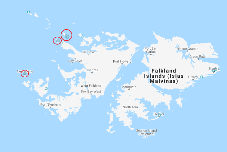
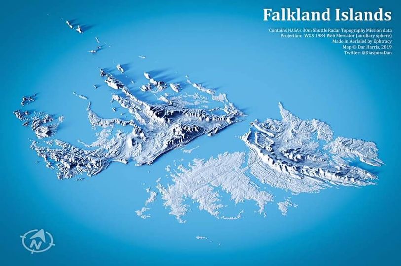
There is extremely limited coverage in The Falkland Islands, with all official coverage being on the western island.
The coverage contains 3 places.
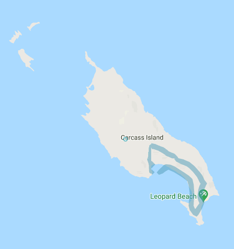
The Southern Tip of Carcass Island
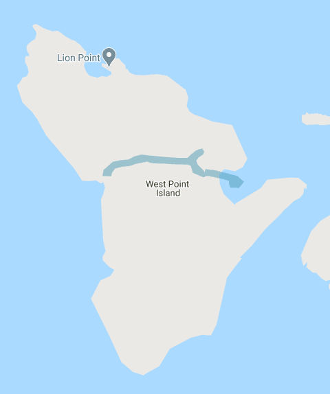
A line through the middle of West Point Island
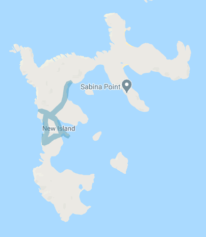
A Bit of Coverage in the middle of New Island
Camera Generation:
Gen 3 Trekker
Research Boat:

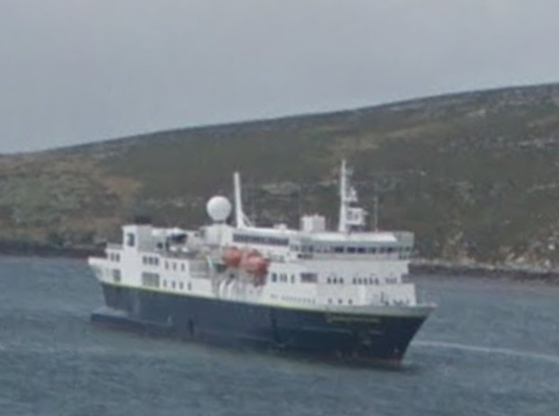
There is a research vessel that can be seen in the waters surrounding every island.
Boat Coverage:
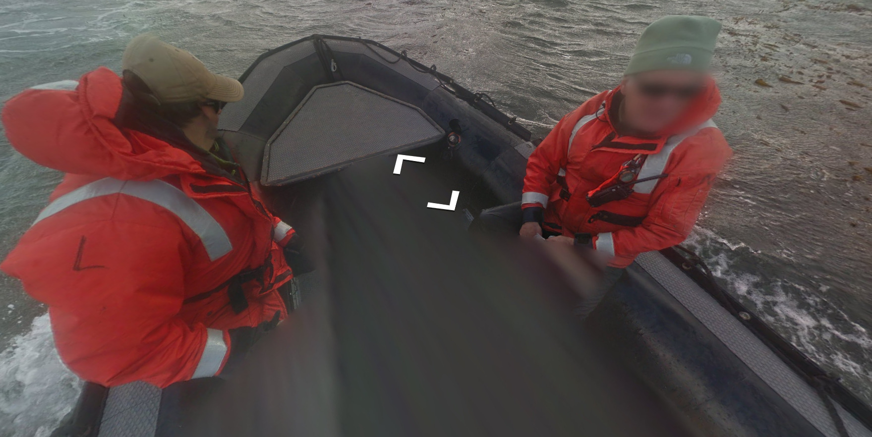
This is the front of the boat that covers points on the western end of Carcass island. Its heading towards the research boat.
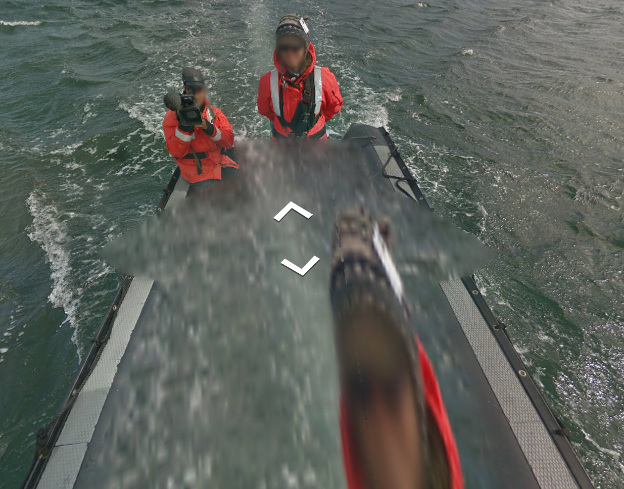
This boat is in the eastern enclave of West Point Island. There is a guy with a camera filming you on the back of the boat.
New Island does not have boat coverage.
License plates:
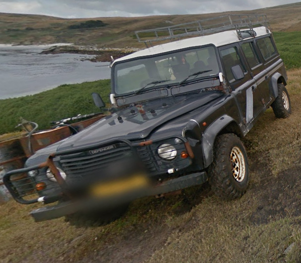
The Falklands use a similar setup to the UK, having a yellow plate in the back and a white plate in the front. There are a few cases where you can see a vehicle that does not follow this pattern.
Vegetation/Landscape:


Architecture:

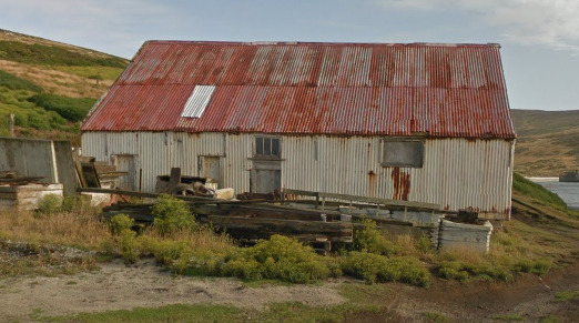

These houses are found on New Island, but the architecture is generally the same between all the islands.
Fauna:

There are instances where you can see Penguins. Seeing Penguins isnt a tell that you are in the Falklands, but if you recognize the grass and the penguins, its a good sign.
General look:

Carcass Island has these rocky outcrops. It almost reminds me of the Mediterranean with the rocks poking out of the grass.

West Point and New Island both feel like this. They have this dark, almost black soil. There are also plenty of these grasses scattered about.
Alphabet/script:
The Falklands use the English Language, yet there will not be any examples of this.
Internet Domain:
.fk
Paraguay
Disclaimer:
This area is technically Binational. It is a Hydro-electric dam that both countries use. We debating adding this country (as well as other “border spills”) and concluded that Paraguay should be added and discussed.
We chose the color orange to stand for Binational. We decided not to include any other “border spills”.
- Country Flag
- Capital City
- Google Car
- Google Coverage
- Camera Generation
- Road Lines
- Road Signs
- License Plates
- General Look
- Language
- Domain
Country Flag:
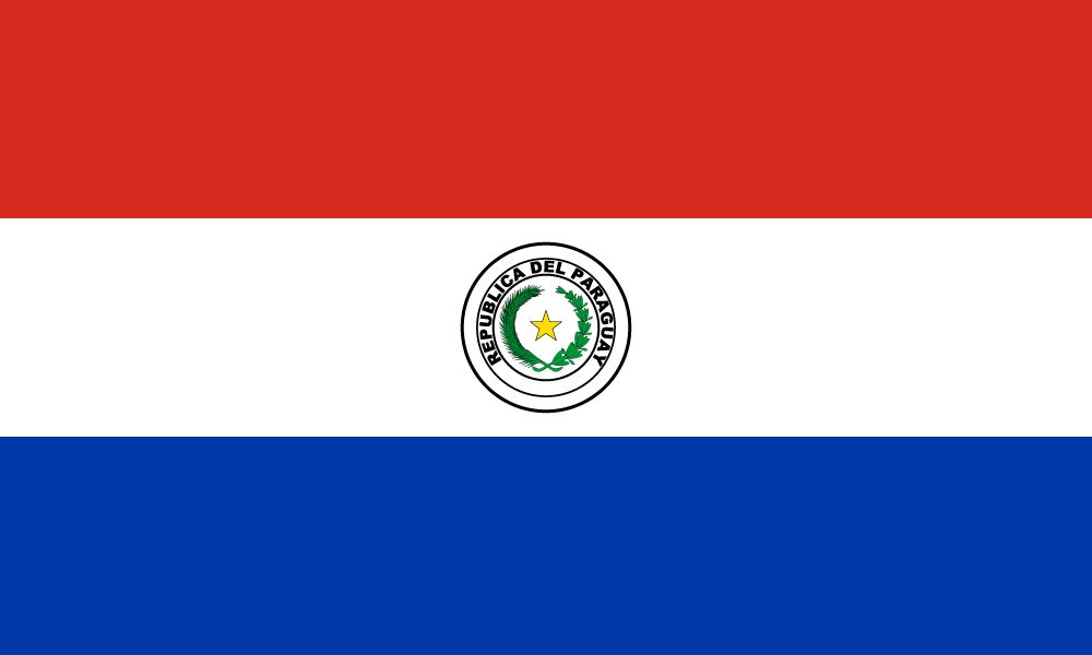
Capital City:
Asunción
Google car:
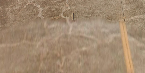
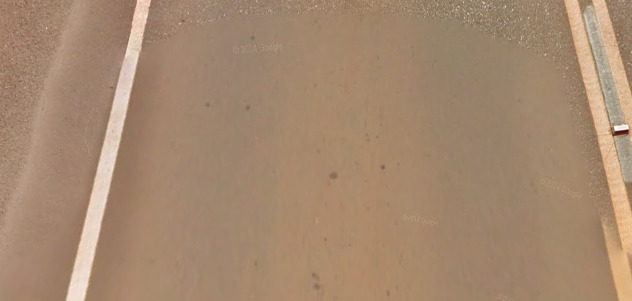
You can find both the short stubby antenna on a white car or no antenna at all.
Google Coverage:
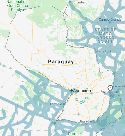
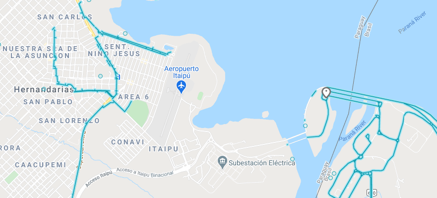
The side of the Dam with the firehouse is the Brazil side (East), while the side with the electric generators is Paraguay.
Camera Generation:
Gen 3
Road Lines:
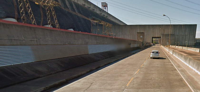
Paraguay uses a yellow divider and white shoulders. There did not appear to be a solid yellow line on the island.
Road Signs:
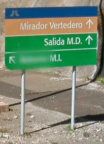
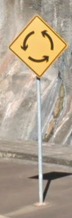
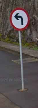
There are your typical Western Hemisphere warning signs, as well as what look like European influenced signs. The first sign appears to be related to the dam and the exits.
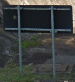

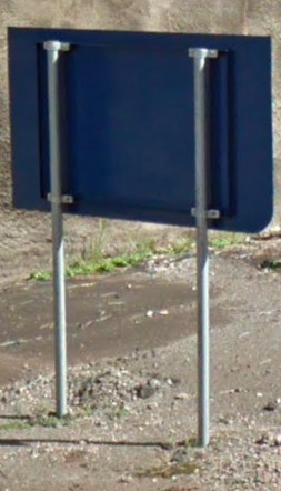
There are also different colors for the backs of the signs. The Black and Grey appear most commonly, while the blue seems to be saved for signs relating to the dam.
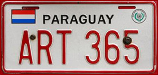
License plates:
General look:
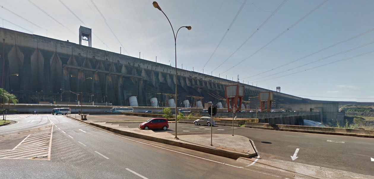
It is really hard to miss the dam. You can end up on top of the dam or on the ground below it. Either way, it is a large structure and cant be missed.
Alphabet/script:

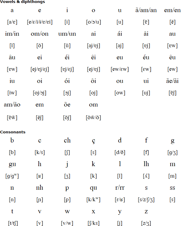
Paraguay uses Spanish, however you can also find Portuguese signs because of the birationality of the dam.
Domain:
.py
The Galápagos Islands
- Country Flag
- Capital City
- Most Helpful
- Google Car
- Google Coverage
- Camera Generation
- Vegetation / Landscape
- General Look
- Language
- Domain
Country Flag:
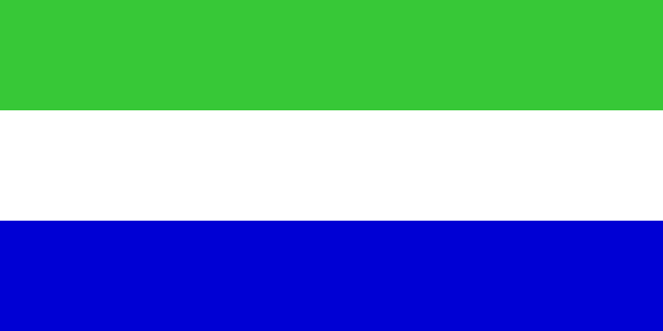
This is the official flag of the Galápagos islands. As it is a part of Ecuador, you may find that flag here as well.
Capital City:
Puerto Baquerizo Moreno
Most Helpful:
(Tan Hat Trekker) You can see a Tan hat in most of the images covered by this trekker. It can be found on most of Isla Isabela and Isla Espanola.
(Black Hat Trekker)This trekker has less coverage than the tan hat trekker, but they are both on two islands. It can be found South of the Volcano Alcedo as well as the Isla Seymour Norte.
DISCLAIMER: The islands of Isla Pinzon, The Southern section of Isla Isabela, Isla de San Cristóbal and Isla Floreana do not have any hat shown. You need to use the landscape to figure out where you are.
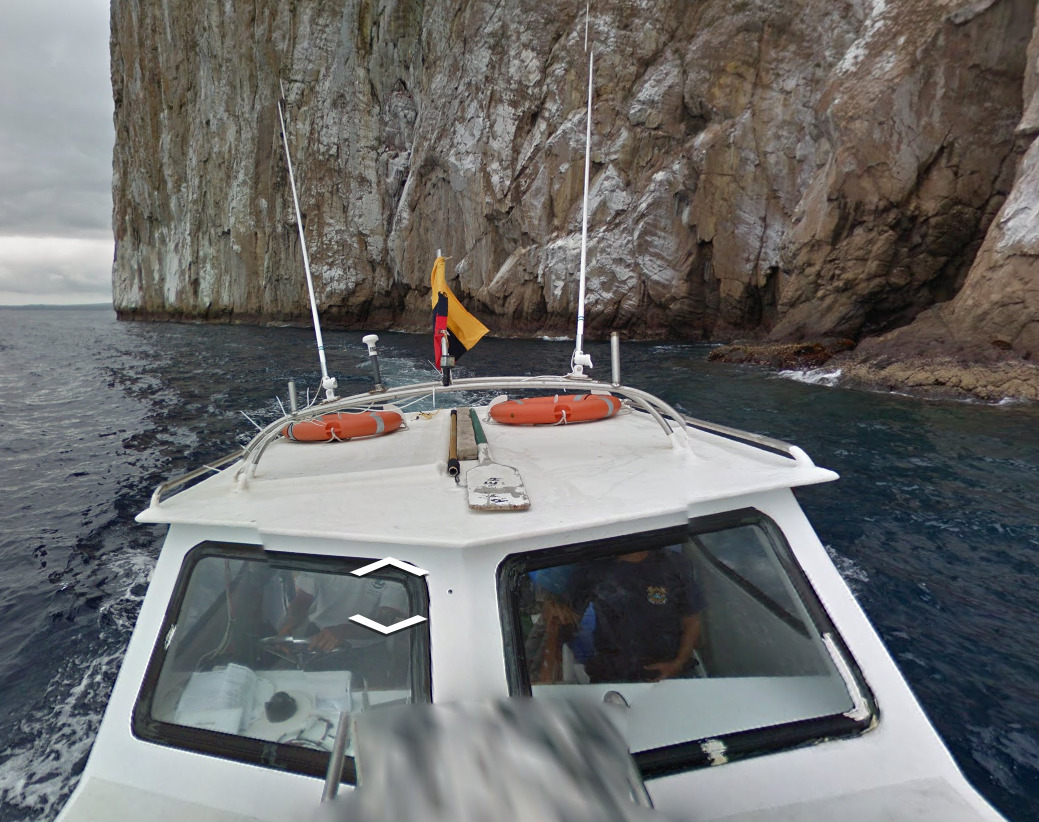
The most common boat is shown above. It can be found around several islands, and has made its appearance in Battle Royale more often than it hasn’t. Remember that the flag here is Ecuador, however the crest is missing. Some may think it looks like the Colombian flag.
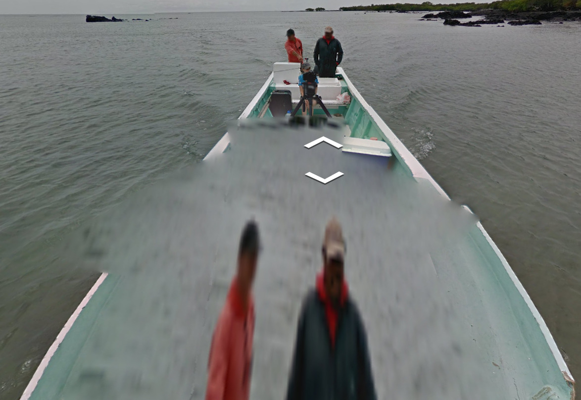
(Isla Isabela Boat) This boat is on the east coast of the Isla Isabela. It can be found north of Cabo Berrington on the east coast.
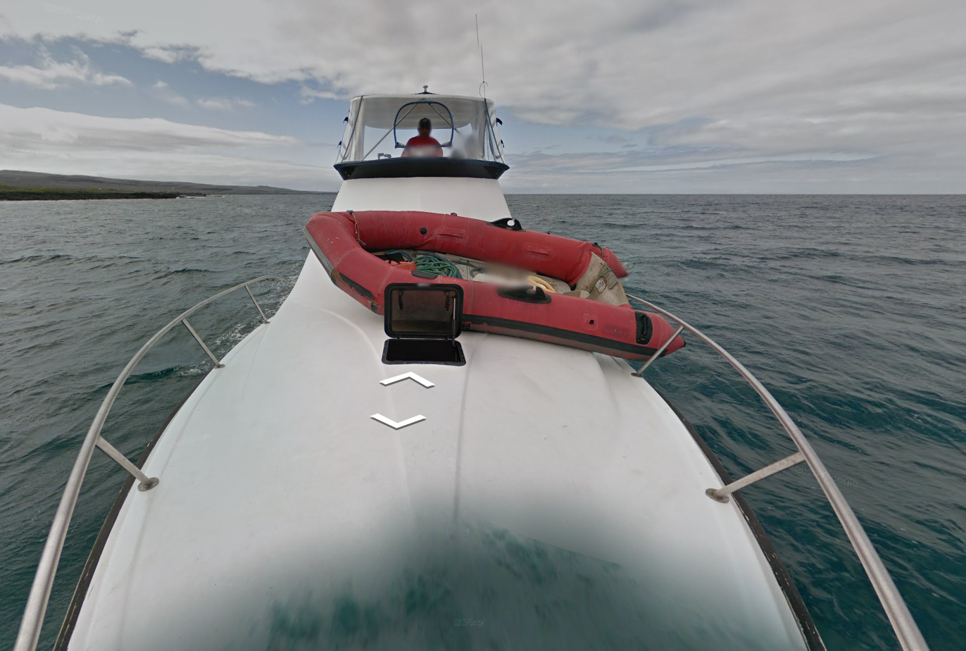
(Isla Floreana Boat) This boat can be found along the west and north coast of the Isla Floreana.
Google Car:

(Tan Hat Trekker) You can see a Tan hat in most of the images covered by this trekker. It can be found on most of Isla Isabela and Isla Espanola.

(Black Hat Trekker)This trekker has less coverage than the tan hat trekker, but they are both on two islands. It can be found South of the Volcano Alcedo as well as the Isla Seymour Norte.
DISCLAIMER: The islands of Isla Pinzon, The Southern section of Isla Isabela, Isla de San Cristóbal and Isla Floreana do not have any hat shown. You need to use the landscape to figure out where you are.

The most common boat is shown above. It can be found around several islands, and has made its appearance in Battle Royale more often than it hasn’t. Remember that the flag here is Ecuador, however the crest is missing. Some may think it looks like the Colombian flag.

(Isla Isabela Boat) This boat is on the east coast of the Isla Isabela. It can be found north of Cabo Berrington on the east coast.

(Isla Floreana Boat) This boat can be found along the west and north coast of the Isla Floreana.
Google Coverage:
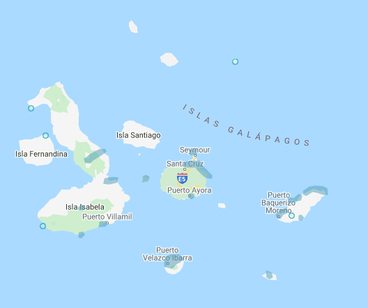
The Galápagos Islands have extremely limited coverage. Its a few places here and there, with the majority being boat coverage.
Camera Generation:
Gen 3
Vegetation/Landscape:


General look:


The Galápagos Islands are incredibly diverse, with some islands feeling completely different only a few hundred meters away. Each island has its own unique feel, and can be used if you decide to study each island.
Alphabet / Script:

The official language of the Galápagos islands is Spanish.
Domain:
.com.ec
South Georgia and the South Sandwich Islands
- Country Flag
- Capital City
- Most Helpful
- Google Trekker
- Google Coverage
- Unique Vehicle
- Camera Generation
- Vegetation / Landscape
- Architecture
- General Look
- Language
- Domain
Country Flag:
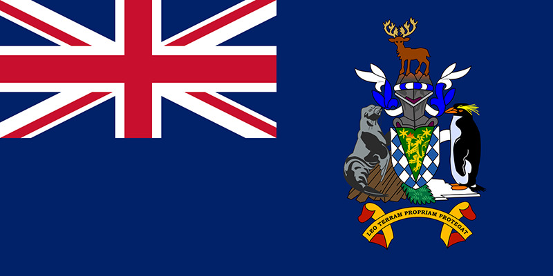
Capital City:
King Edward Point
Most Helpful:
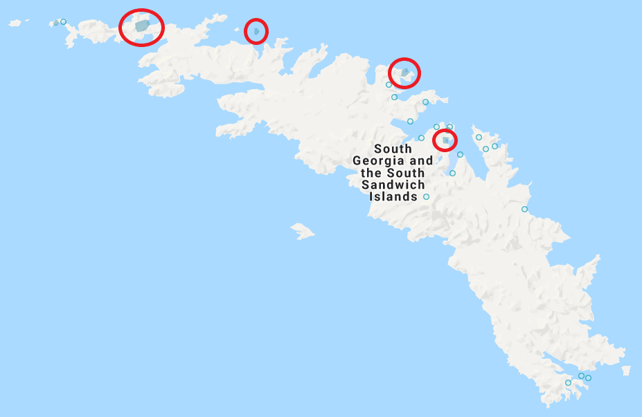

(South Georgia)

(Prion Island) Prion Island has a wooden walkway that cuts through the middle of the island. There are plenty of seals that will keep you company.

(King Edward Point)

(Hercules Bay) This bay is boat coverage only, but it is worth showing as it can look like Norway or other Fjords across the Earth
Google Trekker:
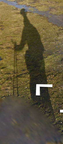
There is a chance to see the Trekker in the South Georgia Islands. The trekker has two ski poles that can be seen in the shadow.
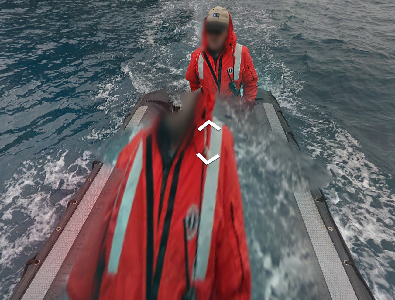
The third circle, starting from the top left, is strictly boat coverage. Its located in Hercules bay, but because a lot of map creators don’t like adding boat coverage, you are not very likely to come across it in game.
Google Coverage:
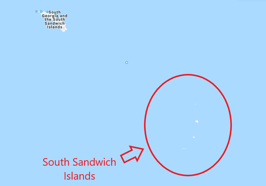

Technically, only the island of South Georgia has coverage. The South Sandwich islands are in the red circle of the first image, and none of them have official coverage.
Unique Vehicle:
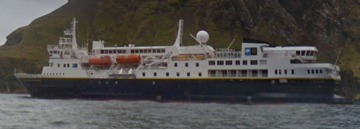
There is a boat in the water at all of the locations. It is a research vessel owned by National Geographic. Their logo can be found on the boat, as well as the peoples coat.
Camera Generation:
Gen 3
Vegetation/Landscape:

(South Georgia)

(Prion Island)

(King Edward Point)
Architecture:
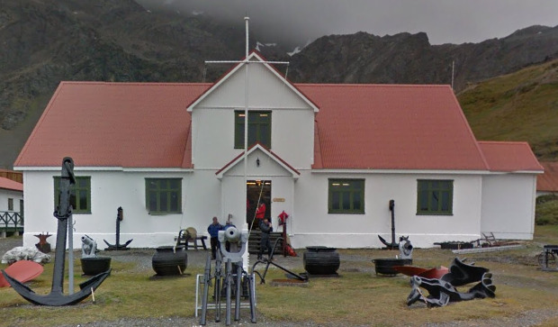
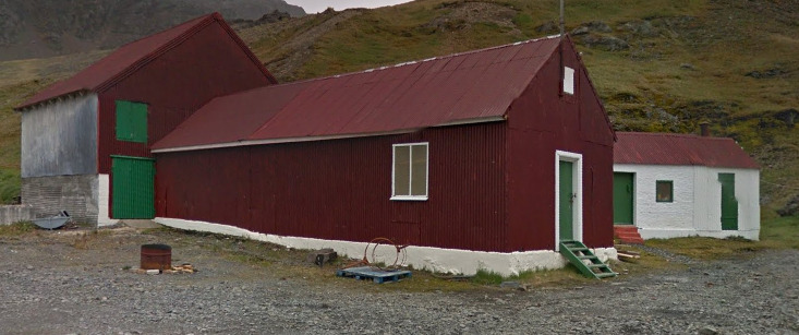
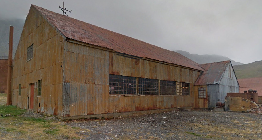
The only area with buildings is located in the capital of King Edward Point. You will not find structures anywhere else.
General look:

(South Georgia)

(Prion Island) Prion Island has a wooden walkway that cuts through the middle of the island. There are plenty of seals that will keep you company.

(King Edward Point)

(Hercules Bay) This bay is boat coverage only, but it is worth showing as it can look like Norway or other Fjords across the Earth
Alphabet/script:

South Georgia and the South Sandwich islands use English as their official language.
